After filtering for United States of America, 246 entries match your criteria. The first 100 are listed. ⊳
Historical Markers and War Memorials in Petersburg VA 23803
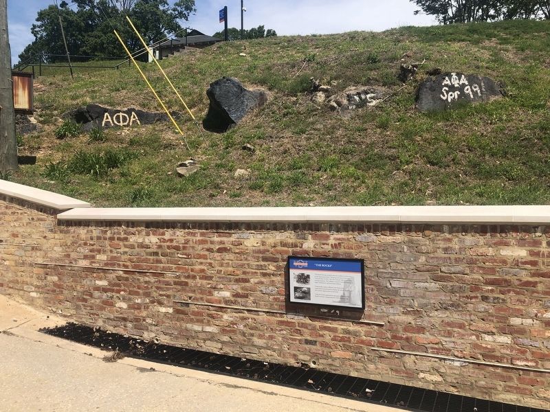
By Devry Becker Jones (CC0), May 8, 2020
"The Rocks" Marker
| 1 ► Virginia, Chesterfield County, Ettrick — "The Rocks" — Virginia State University — |
| On Chesterfield Avenue (Virginia Route 36), on the right when traveling west. | |||
| 2 ► Virginia, Chesterfield County, Ettrick — K-204 — Ettrick — |
| On Fleet Street (State Highway 36) at Chesterfield Avenue (State Highway 36), on the right when traveling north on Fleet Street. | |||
| 3 ► Virginia, Chesterfield County, Ettrick — Ettrick Veterans Memorial — |
| On Chesterfield Avenue (Virginia Route 36) south of Randolph Street, on the right when traveling south. | |||
| 4 ► Virginia, Chesterfield County, Ettrick — Local Workforce At The Mills — Virginia State University — |
| On Chesterfield Avenue (Virginia Route 36), on the right when traveling west. | |||
| 5 ► Virginia, Chesterfield County, Ettrick — Mr. Frederick Francoz Simms — Virginia State University — |
| On Chesterfield Avenue (Virginia Route 36), on the right when traveling west. | |||
| 6 ► Virginia, Chesterfield County, Ettrick — Railroad Crossing Over The Appomattox River — Virginia State University — |
| On Chesterfield Avenue (Virginia Route 36), on the right when traveling west. | |||
| 7 ► Virginia, Chesterfield County, Ettrick — Restoration of Storum Hall — Brought to you through the generous support of: — National Park Service's Historically Black Colleges and Universities Grant Program — |
| On College Avenue, 0.1 miles south of Hayden Street, on the right when traveling south. | |||
| 8 ► Virginia, Chesterfield County, Ettrick — Restoration of Vawter Hall — Brought to you through the generous support of: — National Park Service's Historically Black Colleges and Universities Grant Program — |
| On College Avenue at Hayden Street, on the right when traveling south on College Avenue. | |||
| 9 ► Virginia, Chesterfield County, Ettrick — Shaping Of The Town — Virginia State University — |
| On Chesterfield Avenue (Virginia Route 36), on the right when traveling west. | |||
| 10 ► Virginia, Chesterfield County, Ettrick — Silk Mill — Virginia State University — |
| On Chesterfield Avenue (Virginia Route 36), on the right when traveling west. | |||
| 11 ► Virginia, Chesterfield County, Ettrick — Simms Hall — |
| On Chesterfield Avenue (Virginia Route 36), on the right when traveling west. | |||
| 12 ► Virginia, Chesterfield County, Ettrick — The History of Virginia State University — Virginia State University — |
| On Chesterfield Avenue (Virginia Route 36), on the right when traveling west. | |||
| 13 ► Virginia, Chesterfield County, Ettrick — CH1 — Virginia State University — Ettrick, Virginia — Chesterfield County — |
| On Matthews Jefferson Drive at East River Road, on the right when traveling east on Matthews Jefferson Drive. | |||
| 14 ► Virginia, Chesterfield County, Matoaca — K-324-b — Matoaca Mill Site — |
| On Pickett Avenue (Virginia Route 600) at Ferndale Avenue, on the right when traveling south on Pickett Avenue. | |||
| 15 ► Virginia, Chesterfield County, Petersburg — S-77 — AKA Delta Omega — |
| On River Road (Virginia Route 36) at Winfred Avenue, on the right when traveling east on River Road. | |||
| 16 ► Virginia, Chesterfield County, Petersburg — O-26 — Mattoax — |
| On River Road (Virginia Route 36) west of Winfree Avenue, on the left when traveling west. | |||
| 17 ► Virginia, Dinwiddie County, Petersburg — “A Determination That Knew No Such Word as Fail” — The Breakthrough Trail — Pamplin Historical Park — |
| Near Duncan Road (Virginia Route 670), on the left when traveling south. | |||
| 18 ► Virginia, Dinwiddie County, Petersburg — “A Great Struggle is Now Impending” — The Breakthrough Trail — Pamplin Historical Park — |
| Near Duncan Road (Virginia Route 670), on the left when traveling south. | |||
| 19 ► Virginia, Dinwiddie County, Petersburg — “Our Line of Battle was so Thin” — The Breakthrough Trail — Pamplin Historical Park — |
| Near Duncan Road (Virginia Route 670), on the left when traveling south. | |||
| 20 ► Virginia, Dinwiddie County, Petersburg — “The Cannons’ Flashes Lit Up the Terrible Scene” — The Breakthrough Trail — Pamplin Historical Park — |
| Near Duncan Road (Virginia Route 670) 1 mile east of Boydton Plank Road (U.S. 1), on the left when traveling south. | |||
| 21 ► Virginia, Dinwiddie County, Petersburg — “The Strongest Line of Works Ever Constructed” — The Breakthrough Trail — Pamplin Historical Park — |
| Near Duncan Road (Virginia Route 670), on the left when traveling south. | |||
| 22 ► Virginia, Dinwiddie County, Petersburg — “We Fought Desperately” — The Breakthrough Trail — Pamplin Historical Park — |
| Near Duncan Road (Virginia Route 670), on the left when traveling south. | |||
| 23 ► Virginia, Dinwiddie County, Petersburg — 1st Lieutenant Evander McNair Robeson — The Breakthrough — Pamplin Historical Park — |
| Near Duncan Road (Virginia Route 670), on the left when traveling south. | |||
| 24 ► Virginia, Dinwiddie County, Petersburg — 1st Lieutenant Octavius Augustus Wiggins — The Breakthrough — Pamplin Historical Park — |
| Near Duncan Road (Virginia Route 670), on the left when traveling south. | |||
| 25 ► Virginia, Dinwiddie County, Petersburg — A Mysterious Historic Feature — The Breakthrough Trail — Pamplin Historical Park — |
| Near Duncan Road (Virginia Route 670), on the left when traveling south. | |||
| 26 ► Virginia, Dinwiddie County, Petersburg — A.P. Hill Death Site — |
| Near Sentry Hill Court. | |||
| 27 ► Virginia, Dinwiddie County, Petersburg — A.P. Hill Memorial — |
| On Boydton Plank Road (U.S. 1) at Duncan Road (County Route 670), on the left when traveling west on Boydton Plank Road. | |||
| 28 ► Virginia, Dinwiddie County, Petersburg — After the Breakthrough: April 2, 1865 — The Banks House — Pamplin Historical Park — |
| Near Hofheimer Way, on the left when traveling south. | |||
| 29 ► Virginia, Dinwiddie County, Petersburg — Battlefield Terrain — The Breakthrough Trail — Pamplin Historical Park — |
| Near Duncan Road (Virginia Route 670), on the left when traveling south. | |||
| 30 ► Virginia, Dinwiddie County, Petersburg — Brother vs. Brother — The Breakthrough Trail — Pamplin Historical Park — |
| Near Duncan Road (Virginia Route 670), on the left when traveling south. | |||
| 31 ► Virginia, Dinwiddie County, Petersburg — S-51 — Burgess Mill — |
| On Boydton Plank Road (U.S. 1) 0.3 miles north of White Oak Road, on the right when traveling north. | |||
| 32 ► Virginia, Dinwiddie County, Petersburg — S-48 — Cattle (Beefsteak) Raid — |
| On Boydton Plank Road (U.S. 1) at White Oak Road, on the right when traveling north on Boydton Plank Road. | |||
| 33 ► Virginia, Dinwiddie County, Petersburg — I-6 — Central State Hospital |
| On West Washington Street (U.S. 1) at 7th Avenue, on the right when traveling east on West Washington Street. Reported permanently removed. | |||
| 34 ► Virginia, Dinwiddie County, Petersburg — I-6 — Central State Hospital — |
| On West Washington Street (U.S. 1) at 7th Avenue, on the left when traveling west on West Washington Street. | |||
| 35 ► Virginia, Dinwiddie County, Petersburg — S-98 — Central State Hospital Cemetery — |
| On 7th Avenue, 0.1 miles south of Accomac Street, on the right when traveling south. | |||
| 36 ► Virginia, Dinwiddie County, Petersburg — Confederate Fort Gregg — |
| On Seventh Avenue, on the right when traveling north. | |||
| 37 ► Virginia, Dinwiddie County, Petersburg — S-82 — Confederate Fort Whitworth — |
| On Boydton Plank Road (U.S. 1) at Albemarle Street, on the right when traveling north on Boydton Plank Road. | |||
| 38 ► Virginia, Dinwiddie County, Petersburg — Confederate Winter Huts — The Breakthrough Trail — Pamplin Historical Park — |
| Near Duncan Road (Virginia Route 670), on the left when traveling south. | |||
| 39 ► Virginia, Dinwiddie County, Petersburg — Confederate Winter Quarters — The Breakthrough Trail — Pamplin Historical Park — |
| Near Duncan Road (Virginia Route 670), on the left when traveling south. | |||
| 40 ► Virginia, Dinwiddie County, Petersburg — S-47 — Edge Hill — |
| On West Washington Street (U.S. 1) at Boydton Plank Road (Business U.S. 460), on the right when traveling west on West Washington Street. | |||
| 41 ► Virginia, Dinwiddie County, Petersburg — Field Fortifications — The Military Encampment — Pamplin Historical Park — |
| Near Duncan Road (Virginia Route 670), on the left when traveling south. | |||
| 42 ► Virginia, Dinwiddie County, Petersburg — First Man Over the Works — The Breakthrough Trail — Pamplin Historical Park — |
| Near Duncan Road (Virginia Route 670), on the left when traveling south. | |||
| 43 ► Virginia, Dinwiddie County, Petersburg — Fort Conahey — |
| On Flank Road, on the right when traveling west. | |||
| 44 ► Virginia, Dinwiddie County, Petersburg — Fort Gregg — |
| On Seventh Avenue, on the right when traveling north. | |||
| 45 ► Virginia, Dinwiddie County, Petersburg — S-50 — Hatcher's Run — |
| On Boydton Plank Road (U.S. 1) 0.3 miles north of White Oak Road, on the right when traveling north. | |||
| 46 ► Virginia, Dinwiddie County, Petersburg — Hatcher's Run Battlefields — Boydton Plank Road & South Side Railroad — |
| On Duncan Road (Virginia Route 670) 0.6 miles south of Wheaton Road (Virginia Route 674), on the right when traveling south. | |||
| 47 ► Virginia, Dinwiddie County, Petersburg — Hatcher's Run Battlefields — The Federal Attack, October 27, 1864 — |
| Near Duncan Road (Virginia Route 670) 0.6 miles south of Wheaton Road (Virginia Route 674), on the right when traveling south. | |||
| 48 ► Virginia, Dinwiddie County, Petersburg — Hatcher's Run Battlefields — Using the Terrain — |
| Near Duncan Road (Virginia Route 670) 0.6 miles south of Wheaton Road (Virginia Route 674), on the right when traveling south. | |||
| 49 ► Virginia, Dinwiddie County, Petersburg — Hatcher's Run Battlefields — Confederate Fortifications — |
| Near Duncan Road (Virginia Route 670) 0.6 miles south of Wheaton Road (Virginia Route 674), on the right when traveling south. | |||
| 50 ► Virginia, Dinwiddie County, Petersburg — History of the Banks House — The Banks House — Pamplin Historical Park — |
| Near Hofheimer Way, on the left when traveling south. | |||
| 51 ► Virginia, Dinwiddie County, Petersburg — Kitchen and Servants Hall — Tudor Hall Plantation — |
| Near Duncan Road (Virginia Route 670), on the left when traveling south. | |||
| 52 ► Virginia, Dinwiddie County, Petersburg — Kitchen Garden — Tudor Hall Plantation — |
| Near Duncan Road (Virginia Route 670), on the left when traveling south. | |||
| 53 ► Virginia, Dinwiddie County, Petersburg — Lane’s North Carolina Brigade — |
| Near Duncan Road (Virginia Route 670) 0.5 miles south of Boydton Plank Road (U.S. 1), on the left when traveling south. | |||
| 54 ► Virginia, Dinwiddie County, Petersburg — Lieutenant Colonel George B. Damon — The Breakthrough — Pamplin Historical Park — |
| Near Duncan Road (Virginia Route 670), on the left when traveling south. | |||
| 55 ► Virginia, Dinwiddie County, Petersburg — Lieutenant Colonel Ronald A. Kennedy — The Breakthrough — Pamplin Historical Park — |
| Near Duncan Road (Virginia Route 670), on the left when traveling south. | |||
| 56 ► Virginia, Dinwiddie County, Petersburg — McGowan’s South Carolina Brigade — The Breakthrough Trail — Pamplin Historical Park — |
| Near Duncan Road (Virginia Route 670), on the left when traveling south. | |||
| 57 ► Virginia, Dinwiddie County, Petersburg — Obstructions — The Military Encampment — Pamplin Historical Park — |
| Near Boydton Plank Road (U.S. 1) 0.2 miles south of Duncan Road (Virginia Route 670), on the left when traveling south. | |||
| 58 ► Virginia, Dinwiddie County, Petersburg — Pamplin Historical Park — The Bivouac Monument — |
| Near Duncan Road. | |||
| 59 ► Virginia, Dinwiddie County, Petersburg — Pamplin Historical Park & The National Museum of the Civil War Soldier — Lee's Retreat — April 2, 1865 — |
| On Boydon Plank Road (U.S. 1) at Duncan Road (Virginia Route 670), on the left on Boydon Plank Road. | |||
| 60 ► Virginia, Dinwiddie County, Petersburg — Petersburg Battlefields — Life between the Picket Lines — |
| Near Church Road (Virginia Route 672) at Flank Road, on the left when traveling north. | |||
| 61 ► Virginia, Dinwiddie County, Petersburg — Petersburg Battlefields — Contested Ground — |
| Near Church Road (Virginia Route 627) at Flank Road, on the left when traveling north. | |||
| 62 ► Virginia, Dinwiddie County, Petersburg — Petersburg Battlefields — The Union Line — |
| Near Church Road (Virginia Route 672) at Flank Road, on the left when traveling north. | |||
| 63 ► Virginia, Dinwiddie County, Petersburg — Petersburg Battlefields — The Campaign for Petersburg — |
| Near Church Road (Virginia Route 672) at Flank Road, on the right when traveling south. | |||
| 64 ► Virginia, Dinwiddie County, Petersburg — Petersburg Battlefields — The Campaign for Petersburg — |
| Near Church Road (Virginia Route 672) at Flank Road, on the right when traveling south. | |||
| 65 ► Virginia, Dinwiddie County, Petersburg — Petersburg Battlefields — The Confederate Picket Line — |
| Near Church Road (Virginia Route 672) at Flank Road, on the right when traveling south. | |||
| 66 ► Virginia, Dinwiddie County, Petersburg — Petersburg Battlefields — Battle of Jones Farm, March 25, 1865 — |
| Near Church Road (Virginia Route 672) at Flank Road, on the right when traveling south. | |||
| 67 ► Virginia, Dinwiddie County, Petersburg — Petersburg Battlefields — The Sixth Corps Poised for Attack, April 2, 1865 — |
| Near Church Road (Virginia Route 672) at Flank Road, on the right when traveling south. | |||
| 68 ► Virginia, Dinwiddie County, Petersburg — Petersburg Battlefields — The Final Petersburg Offensive — |
| Near Church Road (Virginia Route 672) at Flank Road, on the right when traveling south. | |||
| 69 ► Virginia, Dinwiddie County, Petersburg — Petersburg Breakthrough Battlefield — |
| On Duncan Road (Virginia Route 670), on the left when traveling south. | |||
| 70 ► Virginia, Dinwiddie County, Petersburg — 15 — Petersburg State Colony for the Negro Insane — Petersburg, Virginia — Dinwiddie County |
| Near 7th Avenue, 0.5 miles north of Albermarle Street. Reported permanently removed. | |||
| 71 ► Virginia, Dinwiddie County, Petersburg — Sergeant John E. Buffington — The Breakthrough — Pamplin Historical Park — |
| Near Duncan Road (Route 670), on the left when traveling south. | |||
| 72 ► Virginia, Dinwiddie County, Petersburg — Siege of Petersburg—Grant's Eighth Offensive — April 2-3, 1865 Fall of Petersburg and Richmond — |
| On 7th Avenue, 0.1 miles north of Simpson Road (Virginia Route 142), on the right when traveling north. | |||
| 73 ► Virginia, Dinwiddie County, Petersburg — Siege of Petersburg—Grant's Fifth Offensive — September 29 - October 2, 1864 Battle of Peebles' Farm — |
| On Flank Road at Church Road (Virginia Route 672), on the right when traveling west on Flank Road. | |||
| 74 ► Virginia, Dinwiddie County, Petersburg — Sixth Maryland Infantry Monument — |
| Near Duncan Road (Virginia Route 670) 0.7 miles east of Boydton Plank Road (U.S. 1). | |||
| 75 ► Virginia, Dinwiddie County, Petersburg — DN1 — Southside Virginia Training Center — Petersburg, Virginia — Dinwiddie County — |
| On Bedford Street, 0.2 miles north of 7th Avenue, on the right when traveling north. | |||
| 76 ► Virginia, Dinwiddie County, Petersburg — The Attack Begins — The Breakthrough Trail — Pamplin Historical Park — |
| Near Duncan Road (Virginia Route 670), on the left when traveling south. | |||
| 77 ► Virginia, Dinwiddie County, Petersburg — The Banks House — Pamplin Historical Park — |
| On Hofheimer Way, on the left when traveling south. | |||
| 78 ► Virginia, Dinwiddie County, Petersburg — The Battle of Fort Whitworth — |
| On 7th Avenue at Accomack Street, on the right when traveling north on 7th Avenue. | |||
| 79 ► Virginia, Dinwiddie County, Petersburg — The Battle of Harmon Road — The Breakthrough Trail — Pamplin Historical Park — |
| Near Duncan Road (Virginia Route 670), on the left when traveling south. | |||
| 80 ► Virginia, Dinwiddie County, Petersburg — The Battle of White Oak Road — March 31, 1865 — |
| Near White Oak Road, on the left when traveling west. | |||
| 81 ► Virginia, Dinwiddie County, Petersburg — The Battle of White Oak Road — The Union Counterattack — |
| Near White Oak Road, on the left when traveling west. | |||
| 82 ► Virginia, Dinwiddie County, Petersburg — The Battle of White Oak Road — Breaking the Line — |
| Near White Oak Road, on the left when traveling west. | |||
| 83 ► Virginia, Dinwiddie County, Petersburg — The Battle of White Oak Road — The Walking Trail |
| Near White Oak Road at Clairborne Road, on the right when traveling west. Reported permanently removed. | |||
| 84 ► Virginia, Dinwiddie County, Petersburg — The Battle of White Oak Road — Four Years of War, Ten Months of Siege |
| Near White Oak Road, on the right when traveling west. Reported unreadable. | |||
| 85 ► Virginia, Dinwiddie County, Petersburg — The Battle of White Oak Road — The Battle of Lewis Farm |
| Near White Oak Road, on the right when traveling west. Reported unreadable. | |||
| 86 ► Virginia, Dinwiddie County, Petersburg — The Battle of White Oak Road — Moving into Position |
| Near White Oak Road, on the left when traveling west. Reported unreadable. | |||
| 87 ► Virginia, Dinwiddie County, Petersburg — The Big House — Tudor Hall Plantation — Pamplin Historical Park — |
| Near Duncan Road, on the left when traveling south. | |||
| 88 ► Virginia, Dinwiddie County, Petersburg — The Boisseau Family Cemetery — Tudor Hall Plantation — |
| Near Duncan Road (Virginia Route 670), on the left when traveling south. | |||
| 89 ► Virginia, Dinwiddie County, Petersburg — The Breakthrough — The Breakthrough Trail — Pamplin Historical Park — |
| Near Duncan Road (Virginia Route 670), on the left when traveling south. | |||
| 90 ► Virginia, Dinwiddie County, Petersburg — The Breakthrough — |
| Near Duncan Road (Virginia Route 670) 0.7 miles south of Boydton Plank Road (U.S. 1), on the left when traveling south. | |||
| 91 ► Virginia, Dinwiddie County, Petersburg — The Breakthrough at Hart Farm — The Breakthrough Trail — Pamplin Historical Park — |
| Near Duncan Road (Virginia Route 670), on the left when traveling south. | |||
| 92 ► Virginia, Dinwiddie County, Petersburg — The Breakthrough Trail — Pamplin Historical Park — |
| Near Duncan Road (Virginia Route 670). | |||
| 93 ► Virginia, Dinwiddie County, Petersburg — The Civil War Years — The Banks House — Pamplin Historical Park — |
| Near Hofheimer Way, on the left when traveling south. | |||
| 94 ► Virginia, Dinwiddie County, Petersburg — The Confederate Counterattack — The Breakthrough Trail — |
| On Duncan Road (Virginia Route 670) 0.7 miles south of Boydton Plank Road (U.S. 1), on the left when traveling south. | |||
| 95 ► Virginia, Dinwiddie County, Petersburg — The Confederate Fortifications — The Breakthrough Trail — Pamplin Historical Park — |
| Near Duncan Road (Virginia Route 670), on the left when traveling south. | |||
| 96 ► Virginia, Dinwiddie County, Petersburg — The Hart Farm — The Breakthrough Trail — Pamplin Historical Park — |
| Near Virginia Route 670, on the left when traveling south. | |||
| 97 ► Virginia, Dinwiddie County, Petersburg — The Hart House — The Breakthrough Trail — Pamplin Historical Park — |
| Near Duncan Road (Virginia Route 670), on the left when traveling south. | |||
| 98 ► Virginia, Dinwiddie County, Petersburg — The Kitchen Quarter — The Banks House — Pamplin Historical Park — |
| Near Hofheimer Way, on the left when traveling south. | |||
| 99 ► Virginia, Dinwiddie County, Petersburg — The Largest Fort — |
| 100 ► Virginia, Dinwiddie County, Petersburg — The Military Landscape — Pamplin Historical Park — |
| Near Boydton Plank Road (U.S. 1) 0.2 miles south of Duncan Road (Virginia Route 670). | |||
246 entries matched your criteria. The first 100 are listed above. Next 100 ⊳