Property was sold by Thomas Pockney in 1795
Structure built in 1796 by Joseph Olman
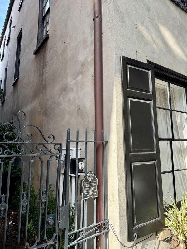
Purchased by John H. Dosher 1880s
Sold to famous cabinet maker
Edwin S. Smith in the 1960s and
functioned as Smitty’s cabinet shop
Awarded the . . . — — Map (db m242807) HM
Notable for its fine Georgian
paneling, this was home and
office to Dr. David Ramsay,
the distinguished patriot,
Revolutionary Historian and
physician. Dr. Ramsay
introduced the Small Pox
vaccine to Charleston
and helped found the . . . — — Map (db m27447) HM
The trustees of the College of Charleston laid the foundations of this building on the 21st day of December 1938 Erected by the City of Charleston with the aid of the income from the College Endowment it is dedicated to the physical well-being of . . . — — Map (db m135493) HM
(Front)
The man we honor and
here remembered served his
country in the time of war,
his state in time of peace.
In his beloved Charleston,
he was the preeminent Trial
Lawyer of the 20th Century, yet his
reach was broader . . . — — Map (db m49760) HM
Henry Hasslernyer opened his doors in 1932 and would be noted for being a world famous seafood restaurant for years to come. After Henry passed away in the mid 1970s, his daughter inherited the property and during her last years in business the . . . — — Map (db m242805) HM
Founded 1750
The Cradle of Reformed Judaism
In The United States, 1824
Jews who settled in Charleston as early as
1695 worshipped informally until the founding
of this congregation in 1750. First synagogue
on this site, 1780-1792, was a . . . — — Map (db m52396) HM
Has Been Designated A
National
Historic Landmark
This Site Possesses National Significance
in Commemorating the History of the
United States of America
1980
Heritage Conservation and Recreation Service . . . — — Map (db m52964) HM
This Georgian-era dwelling was constructed as the parsonage for St. Michael's Church by master builders Martin Miller & John Fullerton, one of the earliest known partnerships of house builders in colonial Charleston. Reverend Robert Cooper, the . . . — — Map (db m242804) HM
Board of Directors
Chaired by Nancy Hawk and Nancy Stevenson
Ethel Jane Bunting, Elizabeth M. Guerard, William Halsey, Raphael Jones, Charles J. Smith, Kathleen Summerall
In 1973, 4.5 acres of this Historic Commercial District were . . . — — Map (db m242806) HM
283 East Bay Street is located in the Ansonborough neighborhood on a lot that was originally part of Rhettsbury, named for early-18th century owner William Rhett. By 1773, William Hendrick owned the corner lot that became 283 East Bay. Maritime . . . — — Map (db m242580) HM
(front)
This was the south end of a large slave trading complex known as The Mart or Ryan's Mart. It was opened in 1856 by Thomas Ryan after the City banned auctions of enslaved people and other goods from streets near the Exchange . . . — — Map (db m242255) WM
From 1856 to 1863, this was the north end of a slave trading complex known as The Mart or Ryan's Mart. It was opened by Thomas Ryan and extended south to a lot on Chalmers St. that became its main sales room. Prior to auction, enslaved people . . . — — Map (db m242347) HM
The Roman Catholic Church
of
St. Mary's Charleston
Established 1789
Incorporated February 19, 1791
The first Roman Catholic Church in
South Carolina, North Carolina, and Georgia.
This is the third structure on this site.
The . . . — — Map (db m53004) HM
This corner building was constructed shortly after the end of the Civil War under the ownership of Ireland-native Mary Monaghan Molony, widow of John Molony, who purchased the property in 1854. Earlier structures on the site were destroyed in The . . . — — Map (db m242591) HM
Historical records indicate that this three-story single house was constructed between 1800 and 1802 for cabinet maker Philip Moore. Prior to the building's construction, the property served as part of brewer Daniel Bourget's large estate, which was . . . — — Map (db m242594) HM
1812-WAR of 1812-1814 between the United States and Great Britain. This Company was mustered into active service.
1836-SEMINOLE WAR-The Washington Light Infantry was sent to St. Augustine for the protection of women and children. . . . — — Map (db m152765) HM
This three-story, masonry residence set on a raised basement was begun circa 1796 by Mrs. Frances Motte Middleton, daughter of Jacob and Rebecca Motte. The house was completed by Mrs. Middleton and her second husband and former brother-in-law, . . . — — Map (db m51273) HM
Firefighting in Charleston Fires, earthquakes, tornados, hurricanes, and epidemics… although Charleston has faced many kinds of disasters over its long history, fire has had the greatest impact on the city.
In 1698 a great fire swept . . . — — Map (db m135500) HM
(side 1) This Charleston double house was built before 1789 by William Blake, a planter and descendant of former Proprietary Governor Joseph Blake. By 1803 Mary Smith Grimké, descendant of Landgrave Thomas Smith, and Judge John F. Grimké, a . . . — — Map (db m133687) HM
This residence was constructed by Col. William Rhett (1666-1722), a prominent Charleston merchant and colonial militia leader. In 1706 he led a small fleet of local ships that repulsed a combined French and Spanish invasion of the city. Rhett is . . . — — Map (db m31849) HM
This substantial three-story Greek Revival Period Charleston single house is constructed of stucco-covered brick and features a two-tiered piazza with Tuscan columns and turned balusters, piazza screen and entrance door complete with pilasters, . . . — — Map (db m51485) HM
Founded 1818 by the Reverend Morris Brown
Closed by State Law 1834. Reopened By The Reverend R.H. Cain 1865
Present Edifice Built By The Reverend L.R. Nichols 1891
Redecoration By The Reverend F.R. Veal 1949
The Right Reverend F.M. Reid, . . . — — Map (db m219129) HM
Bicentennal
Historical Marker
Emanuel African Methodist Episcopal Church
Charleston, South Carolina
Commemorating the unique ministry of South Carolina born bishops, elected in the first century of the
Connection- . . . — — Map (db m52010) HM
The oldest African Methodist Episcopal (A.M.E.) church in the south, Emanuel A.M.E. Church was organized as
Hampstead Free African church in 1818 by Rev. Morris Brown. After seceding from the Methodist Church,
Charlestonians organized three . . . — — Map (db m51900) HM
Salvaged from the waters of the tidal zone around Fort Sumter, these bricks were placed in this wall 140 years after the beginning of the Civil War. — — Map (db m67310) HM
Fort Sumter, visible in the far distance of Charleston Harbor, looks very different today. Built after the War of 1812, its tow two tiers are gone, destroyed during the Civil War. The fort's center is now dominated by Battery Huger, a huge, black, . . . — — Map (db m47521) HM
The land now known as Liberty Square was once a place of arrival for survivors of the largest forced migration in world history. Gadsden's Wharf was the primary wharf for slave ships arriving in Charleston for 25 years, up until the banning of slave . . . — — Map (db m134227) HM
The National Register
of Historic Places
South Carolina
Department of Archives
And History
Charleston
Old E. Historic District
Harleston Boags Funeral Home
(Lower Plaque)
Harleston - Boags Funeral Home . . . — — Map (db m51484) HM
Eliza Jones (1775-1846) purchased this lot in the aftermath of the Ansonborough fire of 1838. She was the granddaughter of Robert Gibson, a graduate of Oxford University, and a Grand Master Mason, who, according to family legend, played a role in . . . — — Map (db m135489) HM
Philip Simmons is the most distinguished of Charleston ironworkers. Born on Daniel Island, Simmons began his eighty year career as a blacksmith at the age of thirteen under the apprenticeship of formerly enslaved Peter Simmons (no relation). Over . . . — — Map (db m134229) HM
Since 1670 this well-protected harbor has persisted as a center for shipping and trade. By 1770 Charleston was America's third busiest port; Gadsden's Wharf, located here, became its largest pier. Along this waterfront ships loaded cargo and . . . — — Map (db m47522) HM
Rice, Rattlesnakes, and Rainwater is a sculptural collection that explores the connections between Charleston's natural environment and its rich African-American history. The project consists of tabby (oyster-shell and concrete) houses and barrels . . . — — Map (db m135492) HM
Septima Poinsette Clark was born in Charleston, South Carolina in 1898, the daughter of Victoria Anderson of Haiti and Peter Poinsette, who grew up enslaved on the plantation of Joel Roberts Poinsette. Clark earned a teacher's certificate from The . . . — — Map (db m134228) HM
Native Charlestonian and daughter of a former lowcountry slave, Mrs. Septima Clark was a leader of the Civil Rights Movement. A graduate of Avery Normal Institute, Clark's first job was teaching African-American children on Johns Island. Her . . . — — Map (db m64797) HM
November 18, 1866 Bishop Patrick N. Lynch purchased a Jewish synagogue at 34 Wentworth Street and its adjacent property to establish a church for African American Catholics and approximately two years later he dedicated St. Peter's Catholic Church. . . . — — Map (db m31846) HM
1822 Organized as a place of worship for those
could not afford to rent pews in existing churches.
1824 Church built on Guingard St. as the first "free"
Church of the Episcopal Church in the United States. . . . — — Map (db m170910) HM
C.- 1804
This significant single house was built by Benjamin DuPré, a French tailor, sometime after 1803. The entire area was known as “Gadsden’s Green” after Christopher Gadsden who divided this land into six wharf lots and 197 . . . — — Map (db m51826) HM
35 Calhoun Street was built in 1852 and occupied by Irish immigrants.
It was purchased by Willis Johnson, Sr. in 1939.
His sons, Frank and Henry built 35½ Calhoun with their own hands to complete
carpentry apprenticeships.
The houses . . . — — Map (db m53259) HM
35 Calhoun Street, was constructed in 1852
by Irish immigrants and purchased in 1939 by Willis
Johnson, Sr., who was born a free man at Drayton
Hall Plantation, West Ashley. 35 Calhoun Street and
35-1/2 are two-story wood framed . . . — — Map (db m171105) HM
Planters commonly maintained homes in the city and on their plantations. Joseph Manigault - planter,
buisnessman, slave-owner and legislator - built this elegant townhouse in 1803.
At that time this neighborhood (Wraggborough) was concidered . . . — — Map (db m50967) HM
An outstanding example of the Adam Style of
architecture in plan, interior detail, and decoration.
The house was designed by Gabriel Manigault,
Charleston's most famous amateur architect, for
his brother Joseph Manigault, who acquired the
lot . . . — — Map (db m50832) HM
Moses C. Levy, a Polish born King Street merchant, built this valuable Federal style single house between 1811 and 1816. The house is located on land originally owned by Henry Laurens, one of the wealthiest merchants in the United States and . . . — — Map (db m51808) HM
This three and one-half story Federal style single house set on a raised basement was built in 1807 by Ms. Abigail Noyer on land purchased from Mr. Christen Belser. The Federal style is evidenced by the hipped roof, a main entrance with fanlight . . . — — Map (db m135494) HM
Trinity Methodist Church Original Site
The first Trinity Church building was erected on this site in 1792. By 1813, Trinity had joined the S. C. Conference, and in 1874 it merged with Cumberland Church, the oldest Methodist church in . . . — — Map (db m31850) HM
Built c. 1847 by William C. McElheran, this Charleston "single house" became after 1860, part of the C.D. Franke Carriage Factory Complex. The factory, which made cannon carriages for the Confederate Army, remained at this location into the 1890's. . . . — — Map (db m31840) HM
(Front side)
This house, built ca. 1712, is believed to be one of the oldest houses in Charleston. It was built for William Rhett (1666-1723), a merchant, sea captain, militia officer, and speaker of the Commons House of Assembly famous . . . — — Map (db m31847) HM
This two-and-a-half story Charleston Single House is thought to be built by Frederick Wolfe after the fire of 1796, which destroyed much of the State Street area between Broad and Queen Streets. The house was moved back on its original lot at 21 . . . — — Map (db m50513) HM
Erected circa 1760 in the
old section of the city.
A rare surviving example
of its kind containing
4 finely paneled rooms
and other trim which
makes it exceptional
for a house of
its modest size.
Medallion:
Award 1967 . . . — — Map (db m51611) HM
On this site stood the
building in which the Supreme Council, 33°,
Mother Council of the World,
Ancient and Accepted Scottish Rite
of Freemasonry, was founded
May 31, 1801, A.D., corresponding to
Sivan 19, 5561, A.M. . . . — — Map (db m27535) HM
Originally two stories, built as a depository by the South Carolina Bible Society on land purchased from the City for that purpose in 1828.
In 1882 the South Carolina Art Association acquired the building and used it for an art school until . . . — — Map (db m47869) HM
[Masonic Emblem]
This tablet
erected by the members of
Orange Lodge No. 14, A.F.M.
marks the spot of Burger's
Tavern in which the lodge
was organized on May 28, 1789
It commemorates one hundred
and thirty eight years of . . . — — Map (db m39465) HM
This marble for thirty four years covered the tomb of Calhoun in the Western Churchyard. It has been placed here by the Vestry near the spot there he remains were interred during the siege of Charleston from which spot they were afterwards . . . — — Map (db m48142) HM
Erected by
The Grand Lodge
Free and Accepted Masons
of Michigan
To the memory of
Captain John Christie
--- of the ---
60th OR Royal American Regiment
Founder and First
Worshipful Master of Lodge No. 1
at Detroit, . . . — — Map (db m27504) HM
(front)
Carolina Art Association
In 1857, a group of civic-minded Charlestonians established the Carolina Art Association. The goal of the CAA was to promote fine arts in S.C. The CAA was awarded its official state charter in 1858. . . . — — Map (db m206021) HM
October 26, 1757 – October 29, 1824 He was a delegate to the Continental Congress, 1784-5, 1785-6, 1786-7 He was a delegate to the Federal Convention in 1787 and on May 29, 1787 submitted thereto a plan for a Constitution and at least . . . — — Map (db m67965) HM
On this site stands one of Charleston’s oldest public facilities in continuous use: the Charleston Market. Earlier markets, dating back to the city’s relocation to the peninsula, ca. 1680, offered meat, fish, and vegetables at different sites. . . . — — Map (db m67430) HM
On this site stands one of Charleston’s oldest public facilities in continuous use: the Charleston Market. Earlier markets, dating back to the city’s relocation to the peninsula, ca. 1680, offered meat, fish, and vegetables at different sites. After . . . — — Map (db m148911) HM
This Building, erected in 1878 by the Charleston Gas Light Company, A pioneer in Public Service, was Designed by Edward Brickell White Soldier-Engineer-Architect The South Carolina Power Company is the outgrowth of the Charleston gas Light Company, . . . — — Map (db m19218) HM
[Panel 1:] Seventeenth Century
Charles Town, named for Charles II, was settled in 1670, a
few miles north of this site, on the west bank of the Ashley River
It was the capital of the Colony of the Carolinas. In 1671, the
Lords . . . — — Map (db m30528) HM
This building, designed by
Gabriel Manigault
and built in 1801 for the
Charleston branch of
The First Bank of the United States,
Stands upon the site which was set
apart as a market place in 1672
and used for that purpose . . . — — Map (db m19539) HM
Here was erected between
1788 and 1804 a public market on
land ceded to City Council by
Charles Cotesworth Pinckney
Et Al...work of filling in low
ground and creek completed
in 1807; and six blocks of buildings
constucted extending . . . — — Map (db m19178) HM
Colonel William Rhett, born in London in 1666,
arrived at Charles Towne in 1694.
In 1712 he built and lived at 54 Hasell Street,
thought to be Charleston's oldest dwelling.
A capable military man and sea Captain,
he was commissioned a . . . — — Map (db m47931) HM
Originally built in 1753, the building was constructed as South Carolina's first and only colonial Statehouse. From 1756 to 1788, the Statehouse was the seat of the Royal British Governor, the Colonial Assembly and the central meeting place for . . . — — Map (db m47994) HM
Built in 1796 by
Daniel Ravenel,
the Second of
Wantoot Plantation,
as a summer home
replacing an earlier building
destroyed in the great fires of that year.
The property came to
his wife in 1749,
having been owned since 1710 . . . — — Map (db m27512) HM
In memory of
Elizabeth Hutchinson
Jackson
Mother of
Andrew Jackson
President of the U.S. 1829-1837
Who gave her life in the
cause of independence
while nursing Revolutionary
soldiers in Charles Town
and is buried in . . . — — Map (db m27509) HM
On or near this spot “on the bay, near Vendue Range”
Elizabeth Timothy
in 1738, became the first woman newspaper publisher in America when she took control over publication of the South Carolina Gazette upon the death of . . . — — Map (db m30019) HM
has been designated a
National Historic Landmark
This site possesses national significance in commemorating the history of the United States of America
1980
Heritage Conservation and Recreation Service
United States Department of the . . . — — Map (db m19673) HM
(side 1) Constructed 1822-26, the County Records Building, known as the Fireproof Building, was designed by Charleston-born architect Robert Mills. Mills eliminated combustible materials from the design. Stone steps, flagstone flooring, and . . . — — Map (db m133719) HM
Commemorating
Francis Salvador
1747-1776
First Jew in South Carolina to hold public office and to die for American Independence
He came to Charles Town from his native London in 1773 to develop extensive family landholdings in the . . . — — Map (db m27489) HM
George Washington was born in Virginia on February 22, 1732. As a boy, he excelled in field sports, and though
his formal education was limited, he exhibited skill in mathematics and surveying.
In the French and Indian War, though only 23, . . . — — Map (db m47791) HM
[South side]:
Born in Charleston, S.C.
December 8, 1829,
Died in Columbia, S.C.,
October 6, 1867.
[East side]:
This memorial has been erected with the proceeds of the recent sale of very large editions of the author's . . . — — Map (db m27511) HM
Hibernian Society
Founded March 17, 1801
Met in Corbett's Tavern until construction of this hall dedicated 1841. Long a civic life in disasters as in prosperity. Its presidents alternate Protestant and Catholic. — — Map (db m27475) HM
This site was the home of the Episcopal Church of the Redeemer. In 1745, Chief Justice of South Carolina Charles Pinckney purchased the property known as Collenton Square. In 1853 Miss Pinckney donated property for a chapel to be built where . . . — — Map (db m19177) HM
The
French Protestant Church
Huguenot
Organized about 1861
First church built in 1867
This building
the third on this site
was erected in 1845
[National Historic Landmark Plaque]:
Huguenot Church
has been . . . — — Map (db m27542) HM
Institute Hall
Institute Hall, built here in 1854, stood until 1861. An Italianate building, it was designed by Jones and Lee for the South Carolina Institute, a progressive organization promoting "art, ingenuity, mechanical skill, and . . . — — Map (db m39371) HM
Born March 18, 1782;
Died March 32, 1850.
Representative in the Legislature;
Member of Congress;
United States Senator.
Secretary of War;
Vice President;
Secretary of State.
Erected by the State of South Carolina
A.D. . . . — — Map (db m212242) HM
These notable stuccoed brick tenements were constructed as rental property in 1803 by the William Johnson family.
William Johnson, Sr., originally from New York, was a blacksmith and planter revered at his death as a patriot having served in the . . . — — Map (db m27544) HM
In this Churchyard is Buried Josiah Flagg
1763~1816
First native born American to make dentistry his life work and the first to carry to any foreign land evidence of American Dental Progress.
Soldier in the American Revolution, sailor in the War . . . — — Map (db m49764) HM
In Memory of
Lee Cohen Harby
1849 - 1918
Who by Her Patriotic and
Untiring Efforts Secured This Building for
The Daughters of the American Revolution
of South Carolina
As a Gift from the United States Government
May 9, 1917 . . . — — Map (db m50454) HM
(Left Panel)
South Carolinian
Born in
Berkley County
September 28 1905
Died at Birmingham
Alabama
December 28 1970
He spoke for
his neighbors
and strove to keep
his country strong
(Right Panel) . . . — — Map (db m47803) HM
Construction having begun in 1797, this building was occupied by the Bank of South Carolina on December 10, 1798, making it one of the oldest bank buildings in the U.S. It served as a bank until 1835. The Charleston Library Society used it . . . — — Map (db m27517) HM
This building
stands on the site formerly occupied by
S.C. Institute Hall
where, on December 20, 1860,
was signed and ratified the
Ordinance of Secession
which withdrew the state of South Carolina
from the Union and led to the . . . — — Map (db m19240) HM
P.G.T. Beauregard
General
Commanding Confederate forces Charleston South Carolina
Held this city and harbour inviolate against combined attacks by land and water 1863 1864 1865 — — Map (db m27490) HM
When the Powder Magazine was built in 1712, South Carolina was a proprietary colony owned by eight British aristocrats. Seven years later, the colonists peacefully overthrew the Lords Proprietor and South Carolina became a royal colony. The flags . . . — — Map (db m47962) HM
"Almighty God, our heavenly Father, we adore thy love and providence in the history of our country, and especially would we thank thee for our Confederate history
"We thank thee for its pure record of virtue, valor and for the inspiring . . . — — Map (db m27502) HM
The following people were buried at the Quaker meeting house graveyard on King Street and were reinterred at this site in 1974.
(Left Column)
John Allen - 1720
Bena Austin - 1735
John Cooper - 1715
Mary Fisher Bayly Crosse - . . . — — Map (db m47770) HM
It is believed that these two 12-pound British naval cannons were transported to Charles Town during the American Revolution (1775-1783). During the 19th century they stood vertically with their muzzles in the ground on Ann Street — near the . . . — — Map (db m70313) HM
Herein Lie the Remains of Richard Hutson 1747 - 1795 son of Rev. William and Mary Woodward Hutson
South Carolina Patriot, Statesman and Jurist Graduated Princeton 1765
Founding Body The College of Charleston 17-72 - 1794 Member S.C. general . . . — — Map (db m19238) HM
Early Barbadian supporter of the settlement of South Carolina Colonial Governor 1710-1712
Proprietor's Deputy Chief Justice of South Carolina
Member of 1st Assembly Colonel South Carolina Militia
Sent South Carolina Militia to aid North . . . — — Map (db m27505) HM
Robert Smalls was born into slavery on April 5, 1839, in Beaufort, South Carolina. In 1851, he was sent to work in Charleston to earn money for his owner. At the age of 23, he was a crewman on the steamer Planter, an armed transport in . . . — — Map (db m94744) HM
[South Side]:
On this site stood Shepheard's Tavern
The birthplace of the Ancient and Accepted Scottish
Rite of Freemasonry
The Mother Supreme Council of the World
May 31, 1801
[West Side]:
Founders of the Supreme . . . — — Map (db m27540) HM
Established in 1785 under the leadership
of Bishop Francis Asbury, the first Methodist
Society in Charleston purchased a lot in
Cumberland Street and erected a church
here in 1786. Long known as the Blue Meeting
House because of its color and . . . — — Map (db m47974) HM
Charleston was one of the largest slave trading cities in the U.S. In the 1800s, the area around the Old Exchange Building was one of the most common sites of downtown slave auctions. Along with real estate and other personal property, thousands of . . . — — Map (db m176650) HM
Here in the churchyard of
St. Philip's are buried
Charles Pinckney
(1757-1824)
Signer of the United
States Constitution
and author of the famous
"Pinckney Draught"
Governor of South Carolina
U.S. Senator & Congressman . . . — — Map (db m27541) HM
This handsome building, c. 1800 was constructed by Gilbert Chalmers. From 1810 to 1825 it was the home of Gov. John Geddes, who married the builder's daughter. During Gov. Geddes' term in office, Pres. James Monroe visited here. In 1867 Mary . . . — — Map (db m27514) HM
302 entries matched your criteria. The first 100 are listed above. Next 100 ⊳