178 entries match your criteria. The first 100 are listed. The final 78 ⊳
Trails West Inc. Historical Markers
Trails West marks the California, Applegate, Overland Trails as well as other related Western Trails with their notable "T" Rail markers. They have over 600 markers in place.
On California Route 88, on the left when traveling east.
"A part of the way the rocks cover the ground so large that it is with the greatest difficulty that we can find a place to drive our waggons [sic] through the trail is quite crooked" - Amasa Morgan, Jul 24, 1849 — — Map (db m211141) HM
On Crystal Springs Road, on the right when traveling west.
"The river here is…filled with large rocks. We crossed on a bridge but expect to ford the next times…We started through Mad Canyon which is rightly named…the hardest place for teams I ever saw" - Caroline L. Richardson, Sep 12, 1852 — — Map (db m211142) HM
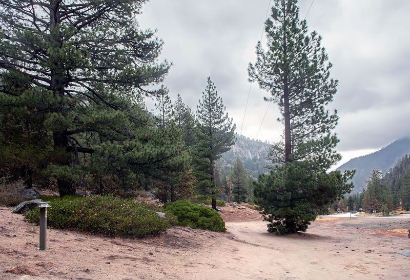
On Carson Pass Highway (California Route 88) at Emigrant Trail, on the left when traveling east on Carson Pass Highway.
"Thence over a high sloping stony hill (sloping to the river) and down a steep hill to a canon or pass creek, where comes the first tug of war! Through the first range of the Sierra Nevada mountains" - Giles S. Isham, Aug 5, 1850 — — Map (db m211139) HM
Near Carson Pass Scenic Byway (California Route 88).
Front of Marker
"After dinner we crossed the first mountain. The ascent is half a mile and much like going up the side of a house in steepness. With hughe stones in the road, aside the road and all around the road."- Henry Sheldon Anable, . . . — — Map (db m148705) HM
On Luther Pass Road (California Route 89) 4 miles north of California Route 88, on the left when traveling north.
"Passed over the summit of the first range and came to [Grass] lake situated nearly on the summit of the mountain....We began our decent [sic] down the mountain over as rough a road as we came up, into Lake Valley" - Luman A. Scott, Sep 8, 1859 — — Map (db m212025) HM
Near Luther Pass Road (California Route 89), on the left when traveling north.
"Then up hill [from Hope Valley] and away, steep and rugged and we at last gain the first summit of the Nevada Mountains [at Luther Pass] and down t'other side more rugged than ever" - John McTurk Gibson, Sep 3 1859... — — Map (db m212003) HM
On Burnside Road, on the right when traveling south.
"We immerged [sic] from the canon [sic] into a pretty valley in between two ranges of high mountains. Pretty pine trees were scattered over a small grass lawn, and a beautiful mountain stream passed through it." - Lorena L. Hayes, Sep . . . — — Map (db m211992) HM
On Burnside Road, on the right when traveling south.
"We crossed Carson River, for here we leave the Carson Route and take what is called the Johnson Route or 'Johnson's Cut-Off to Hangtown'." - J. Robert Brown, Sep 25, 1856 — — Map (db m211987) HM
On Mormon Emigrant Trail (NF-5), 1 mile west of 88 (California Route 88), on the right when traveling west.
Stop(p)ed & camped Leek Springs. A beautiful little valley surrounded by a large pine and fur trees. The most romantic spot we have camped upon. Mendall Jewett, July 19, 1850. — — Map (db m227886) HM
“We left here at half past four intending to go as far as Bidwell Bar. We passed on a bridge which crosses a pond made by damming a stream for the purpose of running (a) sawmill which is situated here” – James Woodworth, Aug. 19, . . . — — Map (db m61682) HM
"We decided to head for Placerville and cast out lot digging gold, and we expect to pass into this place to night....We passed...a good many cradling out gold, and we are all very enthusiastic to get started" - Albert G. Paschal, Aug 18, 1859 — — Map (db m211225) HM
On Cedar Ravine Road, on the right when traveling east.
"Entered Pleasant Valley in which are established several trading posts....We moved on and...descended into a valley in which is situated a few log huts & 1 tavern. This place is named Ring(g)old." James G. Shields, Aug 13, 1850 — — Map (db m211169) HM
On Pleasant Valley Road at Newtown Road, on the right when traveling east on Pleasant Valley Road.
"After descending from this ridge by a long hill...at twilight entered on as beautiful a valley as ever I laid eyes on called Pleasant Valley." - Peter Decker, Aug 7, 1849 — — Map (db m211152) HM
On Pleasant Valley Road, on the right when traveling east.
"We reached what in our guide book was called 'Pleasant Valley Gold Mines'; where we found two or three tents, and a few men with their gold-washing pans." - Sarah Royce. Oct 24, 1849 — — Map (db m210982) HM
On Pleasant Valley Road, on the left when traveling east.
"Came on the forks of the road - the left hand leading to Sutters Fort & the right hand to...Coloma...We here took the right hand fork and went...through Wevervill (and) came on...farther to Hang Town" - James A. Pritchard, Aug 11, 1849 — — Map (db m211151) HM
On Starkes Grade Road at Sly Park Road, on the right when traveling east on Starkes Grade Road.
Carson Trail - To Pleasant Valley
"Continued down the ridge upon which we traveled day before yesterday, occasionally descending deep valleys.... We reached what the Mormons call 'Pleasant Valley Gold Diggins.'" - P. C. Tiffany, Aug 24, 1849 — — Map (db m211067) HM
On South Upper Truckee Road, 0.3 miles north of Egret Way, on the right when traveling north.
"It took fifty men of us and all the oxen we could hitch to the wagons to take thirteen wagons up in two days. It takes all the men...and four yoke oxen to move an empty wagon...It is just like climbing a tree only worse." - William Gobin, Oct 1852 — — Map (db m212031) HM
On South Upper Truckee Road, 1 mile west of California Route 89, on the left when traveling west.
"After passing over this summit [Luther Pass] we enter Lake Valley [Lake Tahoe Basin]. Here we are camped, grass scarce. We had the roughest road down the mountain I ever saw." - John W. Powell, Sep 3, 1859 — — Map (db m212026) HM
On South Upper Truckee Road, 0.3 miles north of Egret Road, on the right when traveling north.
"We now prepared for the ascent of the mountain, we put all the oxen to one wagon, and started....The road is very steep in places, and runs up and along and around the side of the mountain" - J. Robert Brown, Sep 27, 1856 — — Map (db m212028) HM
On Scott Road, 2.3 miles south of California Route 70, on the left when traveling south.
"We descended in to the head of a beautiful valley here we found things requisite for camping ... our road led immediately down the valley from camp ... with a good level road all the way." - John C. Thorniley, Aug 16-17, 1852 — — Map (db m148331) HM
On Forest Road 32N21, 0.5 miles south of California Route 44, on the left when traveling south.
"Day pleasant. Road has been excellent ... Has led us through beautiful glades and plains ... Tonight we camped at 'Butte Creek' a fine little stream with abundance." Benjamin Franklin Ruggles, Aug 15, 1859 — — Map (db m148737) HM
Near California Route 44, 8.4 miles north of Mooney Road, on the left when traveling north.
"Thence northwest winding westward through some timber into a dry valley, some grass near the west end of the valley ... here we camped some grass wood plenty but no water, having water in our keg." J. D. Randall, Aug 24, 1852 — — Map (db m148185) HM
Near California Route 44, 4.9 miles north of California Route 36 when traveling north.
"10 ms. from the...head (of) Susan Valley you will find an excellent spring 150 yds. south of the road; but little grass here; grass is scarce on this ridge." J. D. Randall, Aug 23, 1852 — — Map (db m148177) HM
Near Bridge Creek Springs Road, 1 mile north of Merrill Flat Road.
"This is a fine valley and has the purest and coldest water a man ever drank ... I think this is the most pleasant camping place we have had, fine pine timbers ... Found the grave of Nancy Allen today." Gorham Gates Kimball, Jun 23, 1865 — — Map (db m148179) HM
On Bridge Creek Springs Road, 2 miles north of California Route 44, on the right when traveling north.
"We have risen to a considerable heighth [sic] today, though our road has been up and down. We are now crossing the Sierra Nevada Mountains by 'Nobles Pass' said to be the easiest pass of three" Benjamin Franklin Ruggles, Aug 13, 1859 — — Map (db m148178) HM
On Eagle Lake Road, 0.2 miles north of California Route 36, on the right when traveling north.
"We commenced the ascent directly on leaving the city...The greater portion of the company took the road to Marysville while the remaining portion & ourselves included have taken the Red Bluff Road." Mary C. Fish, Sep 12, 1860 — — Map (db m148037) HM
On North Weatherlow Street near Nevada Street, on the right when traveling north.
"This is a village of about 20 houses nearly all of which were built this summer. (It) is situated at the head of the valley... there is a hotel, store, blacksmith shop and... a saw-mill not far away." - Allen J. Tyrrell, Sep 8, 1860 . . . — — Map (db m87785) HM
“Striking the river this morning I noticed a cluster of
singular shaped rocks sticking up in spires of a conical
shape 20 to 30 feet high” - Andrew Lopp Murphy, Sep 26, 1849 — — Map (db m113025) HM
On S Main St (U.S. 395), on the left when traveling south.
“We crossed the creek here running between high banks,
and drove a short distance down the north west side
and encamped” — Elijah Preston Howell, Sep 6, 1849 — — Map (db m113037)
“My shoes are giving out and I have no others. Left one of
them and the other is barely on...At our noon camp I made
some moccasins of cloth” — Joseph Stuart, Sep. 28, 1849 — — Map (db m113024) HM
On Pit River Road (County Route 84) near Turner Creek Road, on the right when traveling west.
"We were obliged to cross the stream quite a number of times, in consequence of the canons of rock which confine it to a narrow bed." - Amos Batchelder, Sep 29, 1849
Guidebook available
Trails West Inc., P.O. Box 12045, Reno, NV 89510 . . . — — Map (db m113659) HM
On County Route 54 at County Route 70, on the left when traveling east on County Route 54.
"A few hundred yards N. W. of our camp, a tall, symetrical [sic] butte, or isolated mountain, rises from the level plain, like a tent." - J. Goldsborough Bruff, Oct 6, 1849 — — Map (db m147884) HM
On U.S. 395 at milepost 50.6, on the right when traveling south.
"Traveled ... to Goose Lake. The descent ... is sidling and dangers. While we were nooning here 2 wagons of other trains were upset and mashed to atoms" - Simon Doyle, Sep 19 1849
Guidebook available
Trails West Inc., P.O. Box 12045, . . . — — Map (db m87849) HM
On County Route 133C, 0.3 miles south of South Willow Ranch Road (County Route 47), on the left when traveling south.
"Four miles to a beautiful little stream of pure cold water coming from the mountains to our left and emptying into Goose Lake ... Camped there ...Found plenty of ripe plums on the neighboring mountain sides." - Andrew Murphy, Sep 23, 1849 — — Map (db m147338) HM
On Westside Road (County Route 48) near U.S. 395, on the left when traveling west.
"We leave the old Lawson Road for the new road to Shasta Valley (Yreka) to day It seems as if the road is one stone pile We have to goe a foot in such places for fear of getting our heads nocked off" Sophroni Helen Stone, Sep 13 1852 . . . — — Map (db m87850) HM
On Fandango Pass Road (County Route 9) 2.5 miles north of Surprise Valley Road, on the right when traveling north.
"We arrived at the foot of the summit ridge, the top of which lay one mile distant ... Up we ascended, slowly but surely, by the toilsome climbing of the teams and by lifting of the members. ... at the wheels." - William Swain, Oct 11, 1849 — — Map (db m147406) HM
On Fandango Pass Road, 3.8 miles north of Surprise Valley Road, on the left when traveling north.
"Passing over the summit, which is a very narrow ridge, a broad,deep valley ... presented itself to our view, far below us ... We immediately descended the mountain, which on this side, is fearfully steep" - Amos Batchelder, Sep 25, 1849 — — Map (db m147407) HM
On Forest Road 30, 2 miles south of County Route 133C, on the left when traveling south.
"Trees hundreds of feet high and 4-5-6 feet in diameter ... We can drive anywhere among the trees. Only the ground is covered with cobble stones" - E. W. Brooks, Sep 1, 1849 — — Map (db m147888) HM
On Old Alturas Highway (County Route 114) 1.1 miles north of County Route 101, on the left when traveling north.
"Over divide to Tule Lake, on Lost River, passed in sight of Bloody Point where a train of emigrants were cut off last year. This afternoon Geo. W. Ebey killed a brant on the lake. Oh, so good to eat." - James Henry Bascomb Royal, Oct 19, 1853. — — Map (db m147563) HM
"Camped at a magnificent spring of fresh cold water,
which we called Goff's Spring, in honor of the
newly elected lieutenant of the company."
-Levi Scott, South Road Exploring Party, 1846 — — Map (db m151903) HM
On Old Alturas Highway (County Route 114) 1.1 miles north of County Route 101, on the left when traveling north.
"We followed the Applegate Route to Klamath Lake [Tule Lake], where we left that road and took a southern direction. Thomas McKay, myself, and five others ... Went on in advance of the wagons to discover the best route" - Peter Burnett, Oct 1848 — — Map (db m147564) HM
On Route 46N23, 0.1 miles east of California Route 139, on the left when traveling east.
"The water [at Copic Bay] being so bad, we drank very little, and left early next morning [over a prairie]." - Peter Burnett, Oct 1848 — — Map (db m147841) HM
Near Clear Lake Road, on the right when traveling west.
Burnett's Road - Hunters skirted the lava fields to the west as they headed southerly. They crossed dry lake, which had only scattered ponds of water, and entered an area of scattered brush and rocky ridges. — — Map (db m147844) HM
On Old Alturas Highway (County Route 140) at California Route 139, on the right when traveling north on Old Alturas Highway.
"We passed over ... smooth prairie for some distance. One evening we encamped at what was then called Goose Lake (at Copic Bay). It being late in the season, the water in the lake was very low, muddy, and almost putrid." Peter Burnett, Oct 1848 . . . — — Map (db m87851) HM
On Taylor Crossing Road at Dog Bar Road, on the left when traveling east on Taylor Crossing Road.
"The country here is all hill & ravine the soil red or yellow mixed with small stones & gravel - Timber mostly pine some oak & cov[ere]d with dried up weeds no grass except in some ravines" - William Edwin Chamberlain, Aug 16, 1849 — — Map (db m149137) HM
On Dog Bar Road at Owl Hill Court, on the left when traveling north on Dog Bar Road.
"Now that we are among the foot hills the pines have disappeared and in their place beautiful evergreen oak is scattered here and there giving the appearance of old apple orchards." - A, J. McCall, Sep 14, 1849 — — Map (db m149156) HM
On Colfax Highway (California Route 174) at Lower Colfax Road, on the left when traveling north on Colfax Highway.
"[From Greenhorn Creek] we past [sic] up a steep ascent (doubled teamed) & came to the forks of the road. The right goes by the way of Yuba & left straight on by Johnsons [Ranch] We taken [sic] the left." - Augustus Ripley Burbank, Sep . . . — — Map (db m149130) HM
"Traveled six miles down Eubah then took to the left over the mountain passed a lake on our left on top of the mountain [Crystal Lake] drove ... to a valley on our left [Six Mile Valley] and encamp" - William P. Thompson, Aug 28, 1850 — — Map (db m149761) HM
On Garden Bar Road at Troy Road, on the left when traveling south on Garden Bar Road.
"We are evidently approaching the plains [of Sacramento Valley]. The hills are decreasing in magnitude & every thing indicates that we have gotten through the most difficult part of the mountains." - Jacob R. Snyder, Sep 25, 1845 — — Map (db m149139) HM
On Wolf Road at Duggans Road, on the left when traveling north on Wolf Road.
"Our road led through the last of the foothills of the Sierra Nevada. The road was still not overly good, yet the worst was behind us. ...By afternoon we had the last woodlands behind us" - Heinrich Lienhard, Oct, 1846 — — Map (db m149138) HM
On Conservation Road, 0.5 miles north of California Route 20, on the right when traveling north.
"We dared not lets them browse among the trees lest, by feeding on the poison oak, it might prove...fatal to them.... We therefore sought a place of greater safety,...through a forest of pine and cedar." - John Steele, Sep 22, 1850 — — Map (db m148909) HM
On California Route 20 at Ridgewood Road, on the left when traveling east on State Route 20.
"We camped in the woods and chained our oxen to a tree and fed them a little hay that we got in [Bear] Valley for the purpose; we had no water for them, but got a little for ourselves by going a mile for it." William B. Baker, Aug 31, 1852 — — Map (db m149129) HM
On State Highway 20, on the left when traveling east.
"Climbing the steep mountain road [from Bear Valley] to the summit, we struck off in a westerly course, along a heavily timbered ridge" John Steele, Sep 21, 1850 — — Map (db m148898) HM
On Skillman Road, 0.1 miles east of California Route 20, on the left when traveling east.
"Traveled 16 miles of pretty good road except [from] Bear Valey [sic]. Hilly which was very steep. Camped in mountain opposite Washington [Diggings] on the Yuba River, No feed or water, but plenty of timber." - John Shin, Sep 30, 1850 — — Map (db m148908) HM
On Soda Springs Road, 0.8 miles south of Donner Pass Road, on the left when traveling south.
About one mile from our camp and we left the valley to our right and went up a ravine on the left; 4 miles more brought us to a group of lakes (6 in number) the water in them was cool and beautifully clear - John Markle, August 22, 1849 — — Map (db m149586) HM
On Kidd Lakes Road, 2 miles west of Soda Springs Road, on the right when traveling west.
You take off to the left of the valey [sic] (Summit Valley) Travel over much bad road The rock is all through the wood looking like waggons [sic] white cows and sheep
Micajah Littleton, Sep 28, 1850 — — Map (db m95644) HM
On Old Donner Summit Road, 0.9 miles south of Sugar Bowl Road, on the left when traveling east.
Dcinded abut 5 miles (from Roller Pass) throug lovly pine fur & ceder groves some of wich ... measured upwards of 33 feet and look as though they were 300 feet high. Came to a butifull little valley & campt - M. A. Violette, Sep 1, 1849 — — Map (db m149497) HM
"The road now continues down the valley ... thirteen miles. Here is a spring of water near the road, on the left. Also a small stream, the head waters of Feather River. ...Passed several [mountains] called buttes." - Henry T. Baldy, Sep 8, 1852 — — Map (db m148732) HM
Near Feather River Highway (Route 70), on the left when traveling west.
“Beckwiths House (is) the first house that I have seen since I left (Ft.) Laramie... at Beckwiths House the roads fork, the left hand goes to 76 & Maryesville, the right hand is called Beckwiths rout to Maryesville.” – John F. . . . — — Map (db m66177) HM
On Chilcoot Avenue, 0.3 miles south of California Route 70, on the left when traveling west.
"Trow informed us we were in California, when father gave three loud cheers, which echoed from the rocks and hills about us. Willie said that he would not like to spend his life in California if this was it." - Harriet S. Ward, Oct 1, 1853 — — Map (db m148728) HM
“Crossed a brook with high banks, where Squire Stephens upset the wagon he was driving in which was Philip Linthicum and he was hurt very badly” – John Dalton, Sep. 2, 1852 — — Map (db m56549) HM
“... camped in order to cut some grass to feed along the road ahead, and also on account of P. Linthicum who was still very sick; not expected to live.” – John Dalton, Sep. 3, 1852 — — Map (db m56548) HM
On Bucks Lake Road, on the right when traveling west.
Now under water, Rich Valley and Bucks Ranch (1850) made a superb stopping place for emigrants of 1851 and later. “Good grass, wood and water” – John Dalton, Sep. 1, 1852 — — Map (db m56536) HM
On Jackson Street at Coburn Street on Jackson Street.
This marker stands on part of the American Ranch of 1850. A way stop for emigrants of 1851 and later. “Here were obtained some fine vegetables...” Joshua Variel. Sept. 17, 1852 — — Map (db m56403) HM
Trail route, 1851 and later. “Drove... through the canyon crossing the creek five times, two miles over the roughest road I ever saw” – Joshua Variel, Sep 16, 1852. — — Map (db m56500) HM
On Quincy Junction Road at Chandler Road, on the right when traveling north on Quincy Junction Road.
“Had a hard road, crooked & rocky. Had to cross (Greenhorn) creek 8 times in going 5 miles. Got down to the New England Ranch at noon, camped here for today.” - Chester Smith, Sep. 27, 1852. — — Map (db m66159) HM
On California Route 70 at Cow Camp Road, on the right when traveling west on State Route 70.
"We beheld a large valley spread out before us, surrounded by majestic mountains covered with pine and snow. Six miles down the valley brought us into camp on the banks of a branch of Feather River." - Jacob S Hayden, Aug 19, 1853 — — Map (db m148730) HM
On Dersch Road, 0.3 miles west of Hyrax Road, on the right when traveling west.
"Rolled on to Bear Creek a distance of about 14 miles and encamped on a small island near the creek... many grapes nearly ripe along the banks and grizzly bears are said to be plenty." - Joseph R. Bradway, Sep 12, 1853 — — Map (db m149411) HM
On Forest Road 32N21, 4.7 miles south of California Route 44, on the right when traveling south.
"We finally reached Black Butte Creek and followed it to Black Butte Lake. The lake was three miles long and on its left shore was a volcano which had been active a few years before." Tosten Kittelsen Stabek, 1852 — — Map (db m148275) HM
Near Volcanic Legacy Scenic Byway (California Route 44), on the left when traveling west.
"Then some miles of very rocky road amongst which is the piece called the 'Devils Half Acre', then tolerable road for rest of the day" - Benjamin Franklin Ruggles, Aug 16, 1859 — — Map (db m149314) HM
Near Volcanic Legacy Scenic Byway (California Route 44) 1.3 miles north of Forest Route 32N32, on the right when traveling west.
"Day pleasant. First part of afternoon had down hill road and good, then had a long and very rocky hill to go down road very winding." - Benjamin Franklin Ruggles, Aug 16, 1859 — — Map (db m149214) HM
Near California Route 44/89, on the left when traveling north.
“Drove 5 miles to Hat Creek Station (Old Station). Wild looking place. Signs of Indians. They have been here of late fishing.”
Gorman Gates Kimball, Jun 19, 1865 — — Map (db m58127) HM
On California Route 44, 0.1 miles east of McElroy Road, on the left when traveling east.
"Drove to Little Hat Creek (Hill) 6 miles, a beautiful little mountain valley with Hat Creek running through it. - Very good road today." Gorman Gates Kimball, Jun 19, 1865 — — Map (db m148336) HM
Near Volcanic Legacy Scenic Byway (California Route 44), on the right when traveling east.
"Tonight we are camped at 'Lost Camp Station' which is 8 miles below Hat Creek Station. Good water here but grass is enclosed...Have seen some very high mountains today" - Benjamin Franklin Ruggles, Aug 16, 1859 — — Map (db m149158) HM
"Drove up Hat Creek Crost [sic] it (Went) over a rockey [sic] ridge up a level flat & over some small bluffs to a creek (Lost Creek) Drove up it to a ranch and camped" A. L. Covel, Sep 5, 1859 — — Map (db m148738) HM
On California Route 44 at Pittville Road, on the left when traveling west on State Route 44.
"Very cold froze hard in camp last night ... We rolled on over a rough stony road ... and put up near a small pond fine feed and good water ... ducks & geese plenty ... This evening our camp presents a cheerful scene." J. R. Bradway, Sep 7, 1853 — — Map (db m148273) HM
Near Volcanic Legacy Scenic Byway (California Route 44) 1.2 miles north of Forest Route 32N56, on the right when traveling north.
"There has been snow capped mountains in sight for the last week: this evening Shasta Peak, Lawsons Butte are in plain view & they resemble large banks of snow." - Mary C. Fish, Sep 14, 1860" — — Map (db m149213) HM
On California Route 44/89, on the left when traveling north.
“We had at starting 5 miles up-hill travel mostly of a gradual ascent. This brought us to the summit of the hill from which Sacramento Valley may be seen.”
Allen J. Tyrell, Sep 14, 1860 — — Map (db m58129) HM
"Started and travailed [sic] some sixteen milles [sic] and camped within forty rodds [sic] (220 yards) of the Canon House for the night" - Ransom Josiah Arnold, Sep 11, 1860 — — Map (db m149413) HM
On 15432 Eureka Way (California Route 299) at 2nd Street, on the right when traveling west on 15432 Eureka Way.
"We was [sic] informed that the citizens of Shasta had prepared a dinner at the St. Charles Hotel for the emegrants [sic]...We was [sic] the first train of waggons [sic] that ever come [sic] into Shasta on the . . . — — Map (db m148328) HM
Near California Highway 44 south of Ogburn Road, on the left when traveling west.
“Traveled 15 miles to Charley’s Ranch and camped there. Good water, drove the stock 2 miles to grass, here we heard the first chicken crow, and saw the first hog.”
- John S.L. Taylor, Sep. 2, 1854 — — Map (db m70349) HM
Near Dersch Road, 2.6 miles south of California Route 44, on the right when traveling south.
This site was an early stopping place for emigrants using the Nobles Trail and became a stage and freighting station established by William W. L. Smith in 1858. Site of Foot of the Mountain Station is one mile north of Dersch Road. — — Map (db m149410) HM
Near California Route 44 west of Emigrant Trail/Wilson Hill Road, on the right when traveling west.
The two branches of the Nobles Trail rejoined near Shingletown and continued westward to Shasta City. Shingletown was named after the numerous shingle mills in the area. — — Map (db m149326) HM
On Forest Route 17, 0.1 miles south of California Route 44, on the left when traveling south.
"Traveld 7 miles. Road very hard to brake on account of stone & chaperal brush. Encamped on Rassberry (Manzanita) Creek. Grass rather (poor) but abundenc(e) of Mt Rassberrys." -
Solomon Kingery, Aug 17, 1852 — — Map (db m149161) HM
On Forest Service Road 32N13F, on the right when traveling south.
"Drove up a hill (at the trail junction we took) the left hand road past peek [sic] (Table Mountain) on our left)" - A. L. Covel, Sep 6, 1859 — — Map (db m149160) HM
Near Deer Flat Road, 0.1 miles west of Manzanita Creek Drive, on the right when traveling west.
"Our road still runs a westerly direction pretty level road but very thick large timber to Battle Creek... Steep banks; ford good. Swift current 25 ft. wide 2 ft. deep; very clear good water." - J. D. Randall, Aug. 28, 1852 — — Map (db m149324) HM
On Deer Flat Road, 0.9 miles north of California Route 44, on the right when traveling north.
"Deer Flat is quite a little valley. Here were two ranches or farms. Emigrants stop here to rest and recruit their stock...We lay over eights day [sic]" - John Murray Mickey, Aug 12, 1854 — — Map (db m149319) HM
Near California Route 44, 3.3 miles west of Mineral Road (County Route 17), on the left when traveling west.
"Six miles farther (from Lost Creek) over a very rough road and some very large hills to another creek (Manzanita Creek). Previous to reaching this stream passed over an extensive plain of Manzanita" - J. R. Bradway, Sep 10, 1853 — — Map (db m149316) HM
On Ridge Road, 0.5 miles east of Tippe Canoe Mine Road, on the right when traveling east.
Beginning in 1854, John Bope's Ranch and Inn was a major stopping place on the Ridge Road. "3-1/2 miles to Tavern in Plum Valley, here we campt,...gold diggings all around here." - Loring S. Comstock, Aug 28, 1855 — — Map (db m99648) HM
On Ridge Road at Mountain House Road, on the left when traveling east on Ridge Road.
"On again (along ridge), 2 miles to Gallaway's Rancho, then 4 miles to Forest City, to right of road and Orleans Flat (and Alleghany) to left of road. - Loring Samuel Comstock, Aug 28, 1855. — — Map (db m99646) HM
On Main Street at Nevada Street, on the right when traveling east on Main Street.
"Went to Downieville, called one of the smartest mining towns in the country, containing some 4, or 5,000 inhabitants, buildings in the business part of town are very well built a great deal of business is done" - Winslow Blake, Aug 25, 1852 — — Map (db m99645) HM
On Henness Pass Road west of Sunrise Creek Road, on the right when traveling west.
"We took up the mountain side through a rough and rocky, but not very steep, ravine. Large pines, firs and cedars abound,...some of which are fully six feet through." - Isaac J. Wistar, Aug 17, 1849 — — Map (db m148733) HM
On Dorris Brownell Road, on the left when traveling west.
(front plaque)
South Road - Forks Of The Yreka Trail
“All in need of provisions were supplied by a government
agent at this camp. Near this point the road forks-one
leading to Jacksonville, in Oregon, and the other to . . . — — Map (db m151605) HM
178 entries matched your criteria. The first 100 are listed above. The final 78 ⊳