Created by the Legislature
This cemetery was created by an act of
Alabama's Legislature on January 31,
1852. Cahaba's town council selected
this spot, but the Legislature had to
confirm their choice because all public
land within . . . — — Map (db m150864) HM
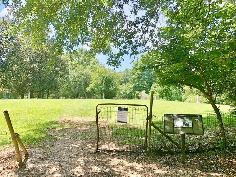
Three hundred feet ahead of you is the
entrance to one of Cahawba's oldest
cemeteries. On an 1883 map, it is
labeled "Negro burial ground." It also
appears, unlabeled, on the earliest Map
of the Town of Cahawba (circa 1819),
suggesting that . . . — — Map (db m274727) HM
These are not graves.
These are markers to memoralize
the Federal soldiers who died in the
Cahawba Military Prison during the
Civil War. The men within the prison
called it "Castle Morgan."
No one knows where in Cahawba these . . . — — Map (db m112409) HM
Burials in this cemetery, which served Cahaba from 1848 to 1900, tell a story of the town in which many deaths resulted from diseases of infancy, childhood and early adult life, Yellow Fever being a large factor because of proximity to Gulf of . . . — — Map (db m23322) HM
This site was set aside by the 1820 General Assembly, burials here date from 1818 to 1847. Interred are some of the state's earliest figures. There is no record of names, many handsome tombs have been destroyed, seven marked ones remaining, six are . . . — — Map (db m23355) HM
Prosperity Associate Reformed Presbyterian
Church Cemetery is the resting place of many
members of the church from 1846 until 1961. The
Church was organized in 1822 by Isaac Grier. A
church building stood on this site from 1844 until
1891, . . . — — Map (db m112357) HM
A Cumberland Presbyterian church named Mt. Pleasant was organized here about 1821 by Rev. William James Moor, a missionary from the Elk Presbytery of Tennessee. Renamed Mount Carmel in 1827, this church provided early leadership for the Ala. . . . — — Map (db m75777) HM
East portion reserved for graveyard, 1829; west part purchased City of Selma, 1877.
Here are buried:
William Rufus King, 1786-1853, Vice President of U.S. 1853.
John Tyler Morgan, 1824-1907, U.S. Senator, Brig. Gen. C.S.A.
Edmund . . . — — Map (db m37653) HM
Established in 1816 by eight families from Rocky River Presbyterian Church in Mecklenburg County, North Carolina.
In 1859 this two-story brick building replaced original wooden structure.
Sanctuary and former slave gallery are on second . . . — — Map (db m83683) HM
Native Sampson County, North Carolina.
Admitted to bar, 1806.
North Carolina House of Commons 1807-1809.
U.S. Congressman 1811-16.
Secretary U.S. Legation Naples and St. Petersburg 1816-1818.
Moved to Dallas County, Alabama, 1818.
. . . — — Map (db m37654) HM
Established circa 1819 as Childers Meeting House on land given by George Childers. Patent for the land was issued to George Childers March 16, 1819. This Methodist Church was later known as Childers Chapel. Church burned in 1842. Congregation . . . — — Map (db m37646) HM
In 1820, Elisha Milton Cain founded Cain's Chapel, one of the oldest continuous church congregations in the River Region. Cain moved from Orange County, South Carolina to the Pine Flat area in 1817. In 1820, he moved to this area and constructed . . . — — Map (db m263960) HM
The Alexander McKeithen family for which it is named, played a significant role in the history of Old Autauga County. Alexander's father, Archibald McKeithen settled in an area that became part of the village that became Robinson Springs. A . . . — — Map (db m292773) HM
Franklin Cemetery was established in the mid-nineteenth
century and was originally located on land where the existing
Georgia-Pacific Brewton LLC containerboard mill stands off of
Highway 31 in Brewton. The cemetery served as the primary
burial . . . — — Map (db m94163) HM
This cemetery was established in 1854 when Pilgrims' Rest Baptist Church was founded across the road on September 17 in that same year. The cemetery remained prominent in Alco even though the original congregation moved and Alco Methodist Church . . . — — Map (db m130672) HM
Union Cemetery has been an
important resting place for
Brewton's loved ones since
at least 1879. State
officials acknowledged
the historical significance
of Union Cemetery for our
area by adding it to the
Alabama Historic Cemetery
Register . . . — — Map (db m94162) HM
Established in 1826 as "The Colored Cemetery," this site is
the first and largest African-American cemetery in Gadsden.
In 1918, the Mosaic Templars of America, a fraternal
organization who provided African Americans with death and
burial . . . — — Map (db m167227) HM
This cemetery is listed in
the Alabama Historic Cemetery
Register by the Alabama
Historical Commission. Whites
Chapel Cemetery Association
is honored to have Veterans
of the Civil War. WWI, WWII,
Korean War, and others who
served our . . . — — Map (db m301821) HM WM
In 1853 Joseph Clayton bought
farmland where this cemetery
is now located. Around 1871 a
wagon train was headed west
when a young child became ill
and died. Mr. Clayton allowed
the child to be buried on top
of the hill. Clayton . . . — — Map (db m301814) HM
Oldest church in Etowah County. Organized Saturday, April 2, 1831, at Harmony Meeting
House, which was built in 1821, by Edmond Jones at this location.
It was here that the Wills Creek Baptist Association was organized in 1836, Harmony
being . . . — — Map (db m205239) HM
In the summer of 1784 William Jones and his two young sons were among a group of families from Georgia making their way through this area following the Old High Town Path. They camped here near a large spring and planned to continue their journey . . . — — Map (db m156371) HM
The lone survivor being Edmond Jones, 5 year old son of William and Hannah Humphries Jones, who later gave the land for the cemetery. — — Map (db m156398) HM
Located along the Byler Road, the earliest known
burial in New Liberty Cemetery is that of William
Smith in 1874. Established in 1901, charter members
for New Liberty Church were Thomas "Bud" Fowler,
Columbus Lonzo Fowler, William . . . — — Map (db m310077) HM
Zion Church was organized in the 1830s, not long
after the Byler Road was built. Samuel Blankenship
deeded three acres to 7 trustees of the church on
March 1, 1861. Formed in 1941, the Zion Church and
Cemetery Association constructed a . . . — — Map (db m310070) HM
According to the inscriptions on the cemetery's
headstones, the first burial in Tidwell Cemetery,
located beside the Byler Road, was Sarah Tidwell,
born and died in 1862. The home of Sarah's family,
including her brother, Peter Tidwell, born in . . . — — Map (db m310105) HM
Established along the Byler Road, the Dobbs community
dates to the early 20th century. Thomas Lafayette
"Bud" Fowler served as the only postmaster for the
Dobbs Post Office, established on May 27, 1901. The
community founders almost named the . . . — — Map (db m310074) HM
Founded in 1889 by Mathew Freeman, who was born into slavery in 1854 and died in 1930. Shady Grove Missionary Baptist Church and Cemetery played an important role in Newtonville, Fayette County, and surrounding communities. He was a trailblazer and . . . — — Map (db m289192) HM
Organized on June 30, 1888 by thirteen charter members as Dundee Missionary Baptist Church. The congregation originally worshipped in a brush arbor on this present site. The first church building was erected from pine slabs in the summer of 1886. . . . — — Map (db m39125) HM
The Countyline Missionary Baptist Church and adjoining cemetery were established in November 1882, on land donated by Shade Adams, Originally donated by way of a gentleman's agreement with the founding members, the land was deeded to the 'Countyline . . . — — Map (db m199425) HM
Pleasant Hill Baptist Church Cemetery is the final resting place to more than 1500 members of the community, with the earliest dating from 1887. The cemetery also contains about 100 unmarked graves. The cemetery is home to veterans from WWI, . . . — — Map (db m302928) HM
Zion Hill Missionary Baptist Church erected a church structure in 1879 on land owned by James Allen Peebles, who then donated the property to the church. Scottish-born brothers Albert and Lemuel Peebles were free Black people who immigrated to . . . — — Map (db m297061) HM
The First Baptist Church of Abbeville
This church was founded in 1834 as a mission of the Lawrenceville Baptist Church. Reverend Jeremiah Campbell was one of the early pastors. Later meetings were held in the lower story of the old wooden . . . — — Map (db m71807) HM
Constituted to the Glory of God, circa 1871, by former slaves in the area that later became Halesburg (now Haleburg), Alabama in 1885. Mt. Zion Church is one of the oldest African-American wooden frame churches in service in Alabama's Wiregrass . . . — — Map (db m165975) HM
Side 1
An arm of the Shilo Primitive Baptist Church located near the Abby Creek, began meeting near the Three Cornered Pond just south of here in 1848. A new church called Piney Grove was constituted on April 21, 1849, by the hands of . . . — — Map (db m71815) HM
Side 1
Newville Baptist Church
A small Baptist congregation met under a brush arbor in 1876, near what later became the village of Wells which grew into the town of Newville, Alabama. A log church called Center was erected in . . . — — Map (db m71814) HM
Old Center Methodist Church
The church was organized in 1859. The first building was a log structure located just NW of the present building. In the 1870's it was part of the Newton Circuit and was served by a minister who lived in the . . . — — Map (db m71831) HM
Union Springs Missionary Baptist Church was
dedicated to the Glory of God on September 19,
1896. Founders of the church included the Rev.
Zack Deese, George Murray, Nathan Jones, Alec
Cutchen, George Stokes, Marion Holland and Jasper
Roney. The . . . — — Map (db m174720) HM
Front
The Columbia Cemetery was started in the 1830s on land given
by Rev. Edmund Talbot. It postdates the abandoned Omussee
Creek Church Cemetery located a mile SW of here. A "public
Meeting house," which served as the Columbia . . . — — Map (db m115031) HM
(side 1)
Gordon Cemetery
Mr. William Wood (b. 22 Mar. 1826, d. 15 Oct. 1885), a prominent Gordon businessman, donated one acre of land located north of the town center adjacent to the old river road, now U.S. Highway 95, from . . . — — Map (db m73371) HM
Constituted to the glory of God by early
settlers in 1859, in then Henry County, Ala.
Originally with the West Florida Baptist Association, joined Columbia Baptist Association in
1887. First church built of logs. First members
were Nathan . . . — — Map (db m280517) HM
(side 1)
Big Creek United Methodist Church
One of the oldest churches in southeast Alabama and reportedly the oldest church in Houston County. The first church structure was a log building constructed about 20 yards north of the . . . — — Map (db m73356) HM
Bettle V. Adams deeded this plot of land
on September 2, 1926 to K.D. Bostic, Walter
Conyers, L.H. Dill, Thomas Douglas, Jeff
Gilbreath, Lucy Griffin, Americus Harrison,
Braden McCrary, and Willie Ross who served
as the Clay Cemetery Committee. . . . — — Map (db m285182) HM
Bellefonte Cemetery
Before the courthouse was completed, the community selected a location for a cemetery. The highest elevation in Bellefonte's corporate limits was chosen as the town's burial place. The earliest inscribed marker in . . . — — Map (db m83790) HM
A historically significant 19th century burial site, the Old Baptist Cemetery is located in Hollywood, Alabama, in the area formerly known as the Mud Creek Primitive Baptist Church. The cemetery is named for the oldest documented Baptist church in . . . — — Map (db m166946) HM
Established in 1892, this cemetery contains the remains of Russell William
Clay (March 6, 1804 - December 7, 1885) and Mahala Jones Clay
(February 2, 1817 - June 10, 1892). Married between 1836-1837, the Clays
had a son, Martin Alexander (M.A.), . . . — — Map (db m294032) HM
In November 1868, after the official records of Jackson County were relocated from Bellefonte to the new seat of government in Scottsboro, a campaign was begun for a new municipal cemetery here. Around 1876, Charlotte Scott Skelton. daughter of . . . — — Map (db m290807) HM
Prior to the Civil War, the remains of almost all deceased soldiers were buried in whatever land was available near the battlefields. The remains of those from wealthy families were often returned to their homes for burial.
The very large . . . — — Map (db m268443) HM WM
Robert T. Scott, born in 1800 into a prominent North Carolina family who originally settled in Maryland, founded the Alabama town that bears his name. Between 1848 and 1858, he acquired 1,240 acres of choice land in the heart of Jackson County. . . . — — Map (db m166957) HM
In 1840 he published his study, History of Rise and Progress of the Baptists in Alabama.
Also an evangelist and missionary.
In 1818 moved to Alabama from Carolinas, organizing five churches in vicinity.
President of Alabama Baptist . . . — — Map (db m27025) HM
Union Baptist Church was organized in 1834 by 18 or 20 members from Canaan Church. The Libscomb area was then known as East End. Members of the Rockett and Ware families donated the original two acreas of this site and a log cabin, which served as . . . — — Map (db m24352) HM
(front): United Confederate Veterans Camp Hardee No. 39 Camp Hardee No. 39 was organized as a camp of the United Confederate Veterans on August 7, 1891. This cemetery plot was acquired by the camp to provide a final resting place for the men . . . — — Map (db m12487) HM
Son of a Swedish ironmaster, Linn built Birmingham's first industry, Birmingham Car & Foundry Company (Linn Iron Works); the first bank, The National Bank of Birmingham; and the City's first park, called Linn Park.
When the population was less . . . — — Map (db m216140) HM
In memory of the
Pioneers
many of whom sleep in this saved spot and whose vision, courage, and arduous labor have been abundantly rewarded by the wonderful development of this great city and district
This Chapel is erected by . . . — — Map (db m206426) HM
In 1822 William Pullen, Revolutionary War veteran, acquired this land from the Federal Government for farming. In 1889 his heirs sold the land to the City of Birmingham for use as the New Southside Cemetery which operated from 1889 to 1909 with . . . — — Map (db m27096) HM
Wilson Chapel was built in 1916 as a memorial to James and Frances Wilson by their daughters, Rosa Wilson Eubanks and Minerva Wilson Constantine. At the time of its construction the area was developing into a community of country homes known as . . . — — Map (db m26681) HM
This cemetery is the final resting place of three of the four young girls killed in the September 15, 1963 church bombing of the 16th Street Baptist Church. Addie Mae Collins, Cynthia Wesley and Carol Robertson are buried here. The fourth victim, . . . — — Map (db m61197) HM
Mt. Zion Baptist Church began burying here in the mid-1800s. On June 2, 1970, New Grace Hill Cemetery, Inc., a subsidiary of the Booker T. Washington Insurance Company in Birmingham, purchased this cemetery and officially named it Zion Memorial . . . — — Map (db m35602) HM
Local Methodist connections for Clay Methodist Church were Cedar Mountain Church and Shiloh Methodist Church. Samuel, a Revolutionary War soldier, was a notable member of these early churches. Many of his descendants are buried here. James Self . . . — — Map (db m117209) HM
The oldest marked grave is that of Nancy Paerson, daughter of William S. Turner who was born September 23, 1813 and died September 19, 1830. Jesse Taylor deeded land for this church and graveyard on February 15, 1856.
Listed in the Alabama . . . — — Map (db m25134) HM
Samuel Massey and his brother - in - law, Duke William Glenn, first came to this Territory in February 1814 with Lt. Col Reuben Nash's Regt. South Carolina Volunteer Militia to help defeat the Creek Indians in the War of 1812. Samuel Massey returned . . . — — Map (db m25088) HM
Established about 1850, Wear Cemetery is located off Old Springville Road to the northeast at Countryside Circle. In the 1800's the Wear family was among the first settlers of the community later known as Clay. Twenty-three remaining graves were . . . — — Map (db m25113) HM
Union Hill Cemetery is the burial ground of many pioneers and early settlers of the Shades Valley area. It was established in the 1870s, but includes gravestones dating back to the early 1850s due to the relocation of two earlier, smaller cemeteries . . . — — Map (db m83873) HM
This cemetery is the final resting place of many of Shades Valley's pioneer residents. A few of the earliest headstones date from the mid-1850s. Descendants of these settlers helped mold the cities of Mountain Brook and Homewood. Located on property . . . — — Map (db m26294) HM
Just after the War Between the States Robert Berry Patton gave seven acres of land, logs from his sawmill to build a church, school and cemetery. He served as the first pastor. Fire destroyed the church in 1908 and 1938. The school served the area . . . — — Map (db m83915) HM
The original founders and charter members of Bethlehem Methodist Church are buried in this cemetery, consisting of benefactors, constructors, architects, soldiers, preachers and evangelists. Included are Ebenezer Hearn (1794-1862), James Rutledge . . . — — Map (db m215907) HM
New Hope Baptist Church and Cemetery were established here on land with a log house donated by Mr. & Mrs. Andrew Jackson Glass on August 21, 1884, for religious and educational purposes. The five-member church began with trustee Manson Glass. On . . . — — Map (db m83832) HM
In April 1836, William White donated land for a church and cemetery. In December 1904, William T. Simmons and his wife R. A. sold adjoining land to the church adding to the cemetery. The oldest marked grave is for Hepsey Herring who died October 8, . . . — — Map (db m83917) HM
Shiloh Cemetery is the first recorded Cumberland Presbyterian Cemetery in middle Alabama. Burial at Shiloh began in 1820, a year before the Shiloh Cumberland Presbyterian Church organized in 1821 at Oakridge, now Leeds. The cemetery stood back from . . . — — Map (db m49350) HM
The Graham Cemetery contains approximately 155 marked burials, with the earliest dating back to 1880. Buried in the cemetery are members of the Graham family, some of the first settlers of the area. Thomas Graham purchased 40 acres of land
in the . . . — — Map (db m173408) HM
This cemetery is owned by St. John Baptist Church in Edgewater and operated by Scott-McPherson Funeral Home, Inc. US Steel Corporation previously owned the area and it is historically associated with the Edgewater Mining Camp community established . . . — — Map (db m37221) HM
This cemetery is named for the nearby Montneba Presbyterian Church, or Mt. Nebo, which was originally established on October 2, 1867, as the Presbytery of Springville Synod. On October 25, 1958, this church was renamed First Presbyterian Church of . . . — — Map (db m217759) HM
Warren Truss, a wealthy farmer from Pitt County, North Carolina, was the first settler in the area known today as Trussville. In August 1821, Truss purchased 1000 acres of land near the banks of the Cahawba River. The cemetery is located on what is . . . — — Map (db m254923) HM
Daniel White, native of North Carolina, purchased land here in 1818, a year before Alabama became a state. His home and stagecoach stop, "Wayside Inn" was a large two~ story log house located on the North side of the highway from this site. In 1834 . . . — — Map (db m29170) HM
The notorious outlaw gang leader who boasted that no one would ever run over Tom Clark lies buried near the center of Tennessee Street where now all who pass by do run over him. In 1872, Clark, who terrorized helpless citizens during the Civil War, . . . — — Map (db m80320) HM
When the city was surveyed this land described as "outside the city limits" was designated as the burying grounds for the new town. It contains the graves of early settlers, including a son and brother of Ferdinand Sannoner, Surveyor of Florence, . . . — — Map (db m83968) HM
McVay (1766~1851), South Carolina native, built a three room log house at head of Cox's Creek about 1818. Community later called Mars Hill. He was a member of Mississippi Territorial Legislature, delegate to convention of 1819 which framed . . . — — Map (db m35260) HM
To the south of this marker is the Hickory Hill Plantation Slave Cemetery which contains the remains of approximately 140 African-Americans. These individuals labored in the bonds of slavery during the period 1818 to 1865 and many as tenant . . . — — Map (db m138778) HM
John Coffee was born in Prince Edward County, VA, in 1772, the son of Joshua and Elizabeth Graves Coffee. The family moved to NC in 1777. After his father died in 1798, Coffee and other family members moved to Davidson County, TN where he . . . — — Map (db m100248) HM WM
In 1824, settlers from the Carolinas built Old Pleasant Grove Primitive Baptist Church, the first church in the Cowpen Creek area and one of the earliest churches in Lauderdale County. Although the cemetery was likely established before the church . . . — — Map (db m236490) HM
Side 1 Following an outbreak of the dreaded plague, smallpox (Variola), at Florence during the winter of 1865-66, the Board of Alderman adopted a resolution on January 2, 1866, that a Pesthouse be “erected at the vineyard as soon as . . . — — Map (db m84043) HM
The first marked grave here is that of David Reeder who died November 14, 1843. An earlier unmarked burial was a Mrs. McClure from Ireland. The original log church and school stood just north of the cemetery. In 1884, a new church was erected north . . . — — Map (db m156987) HM
This area is the military cemetery for Confederate Soldiers. After an 1862 skirmish in the streets of Florence, it was used to bury casualties until the end of the Civil War. Many unknown Confederates and a few unknown Union soldiers rest here. . . . — — Map (db m28402) HM
Church organized in 1819; First Cemetery Burial in 1819. One of the earliest Methodist Congregations in the area, this church was organized by local preacher, Rev. Alexander Faires, in a log school built in 1816. Land donated in 1818 for church and . . . — — Map (db m56354) HM
Wilson Family Cemetery. In 1818 three Wilson brothers John, Matthew and Samuel, came from Virginia to purchase large farms in this area. The plantations of John and Matthew joined near this cemetery. All three brothers and their families are . . . — — Map (db m28160) HM
This is one of the earliest community burial grounds in Lauderdale County. The oldest dated gravestone is for Catherine Hill, first wife of Green Berry Hill, for whom the community is named. She died on June 8, 1825. George Kennedy deeded five acres . . . — — Map (db m154332) HM
Gabriel Butler was one of earliest settlers of Lauderdale
County (shown in 1809 Chief Doublehead Reserve Tenant
List.) Born 1779 in South Carolina. Died 1856, and buried
with 11 descendants within these rock walls hewn from
nearby clifts by . . . — — Map (db m310819) HM
Established in 1894 as New Salem Presbyterian Church. Originally affiliated with the Cumberland Presbyterian Church, the first recorded meeting was held 1897, William White, Pastor.
The Church became affiliated with Presbyterian U.S.A. in 1907. . . . — — Map (db m86305) HM
The Mt. Pleasant Baptist Church was established November 30, 1854,
at a newly constructed residence on Highway 101 in Lexington.
Murrell Askew assisted with the establishment of this church and
is the first recorded pastor. There were 31 charter . . . — — Map (db m309428) HM
The home-place of Bettie Anne Springer-Thornton lies 1.6 miles north on the east side of Lauderdale County Road 51. This home was originally a one-room log cabin, built between 1892 and 1894 by Levi Patrick Thornton. Two rooms and a dog-trot were . . . — — Map (db m141966) HM
Gabriel Butler “Ole Gabe” was born in the Carolinas in 1779, about the time of the Revolutionary War. His name is on records in Kentucky in the 1800s. He married his first wife, Sarah Whitesides, in Warren County, KY, on December 26, 1803. Gabe . . . — — Map (db m216372) HM
Liberty Church. At this location, just west of present-day downtown Rogersville, was the area's first place set aside for Christian worship, circa 1818. Ideally situated alongside the major east-west thoroughfare, this was the closest . . . — — Map (db m266763) HM
Side A
One of Alabama's oldest and most picturesque town cemeteries, this site was set aside as a burying ground by the Courtland Land Company in its original survey made prior to the incorporation of the town in 1819. Many of the area's . . . — — Map (db m84304) HM
McDaniel Cemetery #1
This cemetery is one of the oldest in the county. In the 1980s, the cemetery had all but disappeared except for four headstones and cemetery rocks found stacked under a tree. In March 2021, Marisa McDaniel Keenum oversaw . . . — — Map (db m286618) HM
13900 entries matched your criteria. Entries 101 through 200 are listed above. ⊲ Previous 100 — Next 100 ⊳