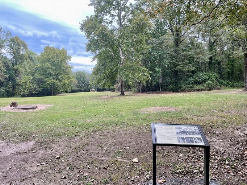
Near County Road 63, 0.2 miles south of County Road 530, on the right when traveling south.
Erected on this site in 1904 by the
State of Alabama, the Hospital was
constructed to meet what was
described as the "pressing need" for
medical care of the veterans at the
Confederate Soldiers' Home. This
25-bed facility was said to . . . — — Map (db m206691) HM
On School Street east of Engram Street, on the right when traveling east.
T.V. McCoo High School
In 1957, Eufaula citizens supported a bond issue that included, among other education projects, construction funds to relocate and build a new Van Buren High School facility. Completed in the same year, the campus was . . . — — Map (db m197392) HM
On East 10th Street, on the right when traveling east.
When seven injured "Freedom Riders" arrived at the Hospital on
this date, the mob that had attacked them earlier in the day
followed. The Riders were testing desegregation of public
transportation in the South by riding buses. The bus they . . . — — Map (db m106647) HM
On Gurnee Avenue south of 12th Street, on the right when traveling south.
In the early 1940s, all of the buildings
on Block 148 were demolished to make
way for two new buildings, the USO
Recreation Center and a public health
building. Paul W. Hofferbert designed the
USO building for the Army. Hofferbert
was a local . . . — — Map (db m217677) HM
On Clinton Street Southeast, on the right when traveling west.
This Church was used for a
Confederate Hospital
During the War
Between The States
Erected by
General John H. Forney
Chapter U.D.C. Sept 27, 1937 — — Map (db m36539) HM
On Gayle Avenue SW at Clinton Street SW, on the left when traveling north on Gayle Avenue SW.
This general practitioner's office is the only remaining structure of its type in northeast Alabama. It was built on the court-house square about 1850 by Dr. J. C. Francis, a beloved family doctor who served Jacksonville for more than 50 years. He . . . — — Map (db m23350) HM
On West Main Street at Watson Drive, on the right when traveling west on West Main Street.
Mose Hampton bought his freedom prior to the Civil War. He was a builder, assisted in laying out and surveying the town of Centre, a minister in the Episcopal Methodist North, and an inventor. Mr. Hampton owned land in the vicinity of this marker on . . . — — Map (db m120046) HM
On County Road 63, 0.7 miles north of State Route 143, on the left when traveling north.
Two cedar trees were planted and dedicated at the Alabama Confederate Soldiers' Home on February 12, 1928 in memory of Mrs. Sarah H. Bellinger and 1st Lt. Robert C. Norris.
Mrs. Bellinger and her husband, Dr. Carnot Bellinger, established the . . . — — Map (db m129412) HM
Dedicated to Civilian defense workers in critical industry for the war. US Army directed construction and production via Air Nitrate Corp. Army Projects here in 1917-1918 required 20,000 workers recruited from across the USA. The great flu-pandemic . . . — — Map (db m138776) HM WM
On West 20th Avenue west of Treatment Plant Road, on the right when traveling west.
An Experimental Plant
During World War 1, construction of the first ammonia synthesis plant in the U.S. began on this location in October 1917. With plans acquired by American and British espionage, construction of U.S. Nitrate Plant No. 1 . . . — — Map (db m183927) HM
One of the framers of the
constitution of the State
of Ala, represented Monroe
Co. in the first legislature
of the new state in 1819, rep-
resented Butler, Conecuh &
Monroe Cos. in the State Sen-
ate 1820-1842-1845. He was the . . . — — Map (db m81321) HM
On County Road 5, 1.2 miles north of County Road 30, on the right when traveling north.
This two and a half story structure with unusual lower front extension was the home of Dr. John Watkins. Dr. Watkins was one of the first and few physicians in this part of the Mississippi Territory. Before coming to Burnt Corn, he lived in . . . — — Map (db m81297) HM
On West Front Street (U.S. 84) 0.1 miles east of Cooper Street (State Route 83).
This pioneer surgeon, teacher and medical statesman was born May 12, 1922 in Evergreen. He worked at Conecuh Drug Company as a youngster and graduated from Evergreen High School (1940). His undergraduate degree was received from the University of . . . — — Map (db m81289) HM
On 1st Avenue Southeast at 4th Street Southeast, on the right when traveling south on 1st Avenue Southeast.
Preservation of this Weiss Cottage was initiated by the Cullman County Historical Society and implemented by the Cullman County Federation of Women’s Clubs, City of Cullman Bicentennial Commission and the City of Cullman Community Development . . . — — Map (db m33836) HM
On New Hope Road (County Road 1809) 0.2 miles south of County Road 1816, on the right when traveling south.
Thomas Monroe Corbin and his wife, Ella, settled here in 1894 on 80 acres and built a home. As pioneers, they cleared the ground with crosscut saws, draft horses, double-bit axes, and shovels. Rocks from the field, removed with a horse-drawn slide, . . . — — Map (db m160656) HM
On Hinton Waters Avenue west of 4th Street, on the right when traveling west.
The Howell House was built in 1907 by Dr. Samuel Matthew Crawford Howell, Midland City's first doctor. City Hall was established here December 17.1992.
Mayor
Joe Bob Parker
Councilmen
Clarence Shirrah · Paul Davis · Wiley Gibson · . . . — — Map (db m191351) HM
On East Broad Street (Alabama Route 27) 0.2 miles east of Union Street (Alabama Route 123), on the right when traveling east.
Constructed in c. 1900 by G. P. Dowling, the Dowling-Steagall House is a Classical Revival dwelling featuring a full-height portico with Ionic columns and an elaborate door surround. A judge and prominent businessman, G. P. Dowling organized Ozark's . . . — — Map (db m36510) HM
On East Andrews Avenue at Hull Street, on the right when traveling west on East Andrews Avenue.
This Marker is placed here as a memorial to
Dr. Eratus Byron Ard
and his wife
Zenada Byrd Ard
and to their family who occupied this property from 1895 to 1971.
Their children were:
Ligon Briggs Ard
Toxey Ard Sorrell . . . — — Map (db m184073) HM
On Vine Street near 2nd Street North, on the right when traveling north. Reported permanently removed.
The Cahaba Drug Store once covered this cellar hole. It was operated by Herbert Hudson and J. D. Craig.
On the same lot were T. L. Craig's large family grocery, Coleman's dry goods store, and Fellows' Jewelry.
All these men were related . . . — — Map (db m23008) HM
On Vine Street south of 2nd Street North, on the right when traveling north.
The Drug Store
This hole was once the cellar beneath a
drug store operated by Herbert Hudson
& James D. Craig. They sold medicines,
chemicals, paints, perfumes, and cigars.
On the same lot was Thomas L. Craig's
large family . . . — — Map (db m150849) HM
On Tremont Street at McLeod Avenue, on the right when traveling south on Tremont Street.
This Greek Revival dwelling was built c. 1850 by Dr. Albert Gallatin Mabry, a prominent physician and member of the Alabama Legislature. Dr. Mabry was a leader in organizing the Alabama State Medical Association and instrumental in passing . . . — — Map (db m83580) HM
On West Fort Toulouse Road, 0.1 miles west of U.S. 231, on the right when traveling west.
William Bartram, America’s first native born artist-naturalist, passed through Elmore County during the Revolutionary era, making the first scientific notations of its flora, fauna and inhabitants. In 1776 the appointed botanist of Britain’s King . . . — — Map (db m69431) HM
On Alco Drive, 0.2 miles south of Blacksher Lane, on the right when traveling south.
This cemetery was established in 1854 when Pilgrims' Rest Baptist Church was founded across the road on September 17 in that same year. The cemetery remained prominent in Alco even though the original congregation moved and Alco Methodist Church . . . — — Map (db m130672) HM
On South 1st Street at South 3rd Street, on the right when traveling north on South 1st Street.
On January 25, 1925 the Sisters acquired the 25 - bed Gadsden General Hospital on Chestnut Street and renamed it Holy Name of Jesus Hospital. The Hospital grew under the leadership of the Founders, Father Thomas A. Judge, C. M. and Mother Mary . . . — — Map (db m39141) HM
On Forrest Avenue east of North 10 Street, on the right when traveling east.
This is the site of the family home of Gadsden native General William Luther Sibert who played a major role in the construction of the Panama Canal. While serving in the U.S. Army Corps of Engineers, he was appointed chief engineer for the Atlantic . . . — — Map (db m39253) HM
On Main Street at Ward Street, on the right when traveling east on Main Street.
Built in 1828-29 by John Gayle,
sixth governor of Alabama.
Birthplace of
Amelia Gayle Gorgas,
wife of Gen. Josiah Gorgas,
Chief of Ordnance, CSA,
mother of Wm. Crawford Gorgas,
US Surgeon General who freed
Canal Zone of yellow fever. . . . — — Map (db m83754) HM
On County Road 12 west of State Route 69, on the right when traveling west. Reported damaged.
Discover of the antibiotic, Aureomycin
Son of a beloved country doctor, he carried a dedicated spirit to the frontiers of science
Having won degrees at Alabama, Auburn, Missouri, Harvard and Cornell, he taught at Cornell, . . . — — Map (db m38191) HM
On Omussee Creek Road, 0.5 miles north of Picnic Road, on the right when traveling north.
The original builders of the Omussee Creek mound
had abandoned the site by around 1550, but the
area continued to be occupied by Native American
groups well into the early nineteenth century. As early as
the 1630s, Spanish missionaries from . . . — — Map (db m115037) HM
Built 1940, 1420 7th Ave. N.
The Ballard House honors a time when thriving
neighborhoods; businesses, churches, social, cultural,
and civic organizations; made up a dynamic
African-American community during the first half of
the 20th . . . — — Map (db m187886) HM
On Highland Avenue South, on the right when traveling west.
Dr. Mortimer Harvie Jordan and his wife, Florence E. Mudd, constructed their home between 1906 and 1908. After service in the Confederate army, Jordan studied medicine in Cincinnati and New York (under Alabama's famous gynecologist, Dr. J. Marion . . . — — Map (db m26743) HM
On 5th Avenue North at 16th Street North, on the left when traveling east on 5th Avenue North.
In Tribute to
Pauline Bray Fletcher
1878 - 1970
The First Black Registered Nurse of Alabama
Through self-sacrifice, perseverance founded in 1926 Camp Pauline Bray Fletcher.
Renewing the faith and the good health of all black . . . — — Map (db m27393) HM
On 7th Avenue South at 19th Street., on the right when traveling south on 7th Avenue South.
Front of Marker:
Opened as Alabama Medical College in 1859 in Mobile by Josiah C. Nott and other physicians as part of the University of Alabama. Closed by the Civil War in 1861 it reopened in 1868. Reorganized in 1897, it became the . . . — — Map (db m83838) HM
On St. Vincents Drive at University Blvd South, in the median on St. Vincents Drive.
Named for St. Vincent de Paul, founder of the Daughters of Charity in France in 1633, the hospital opened December 20, 1898 in the temporarily rented Henry F. DeBardelaben mansion at 206 15th Street South. Father Patrick A. O’Reilly founded the . . . — — Map (db m27523) HM
On Montgomery Highway (U.S. 31) at Braddock Drive, on the right when traveling south on Montgomery Highway.
The City of Hoover has grown rapidly since its incorporation in 1967 from a small four block area west of this site. A metal shed behind Employers Ins. Co. became the first fire station and “city hall.” A bank, grocery, hardware, drug . . . — — Map (db m28448) HM
On Fairway Drive east of Cahaba Road, on the right when traveling east.
1,000 feet East a small group of tents erected May, 1910 by the
Anti Tuberculosis Association of Jefferson County
constituted the first effort to aid victims of tuberculosis in North Alabama. — — Map (db m26964) HM
On E Dr Hicks Blvd at S. Wood Ave. on E Dr Hicks Blvd.
This boulevard was named in honor of Dr. Leonard Jerry Hicks by the City of Florence in 1981. Dr. Hicks was a prominent Black leader of the community and was recognized for his skills as a physician across the State of Alabama. He was born September . . . — — Map (db m35257) HM
Near Hightower Place, 0.3 miles south of Veterans Drive (Alabama Route 133).
Dr. Ellen D. Hoffleit, celebrated worldwide for her many contributions to astronomy, discovered more than 1,200 variable stars. She authored Yale Bright Star Catalogue which is used in almost every astronomical observatory in the world. . . . — — Map (db m219302) HM
On this site Nicholas Marcellus Hentz conducted a girls' school. Native of Metz, France, Hentz was a painter, entomologist, author, and was once a professor at University of North Alabama. Experimenting with silkworms, he planted groves of mulberry . . . — — Map (db m84029) HM
On Wildwood Park Road at Waterloo Road on Wildwood Park Road.
Side 1 Following an outbreak of the dreaded plague, smallpox (Variola), at Florence during the winter of 1865-66, the Board of Alderman adopted a resolution on January 2, 1866, that a Pesthouse be “erected at the vineyard as soon as . . . — — Map (db m84043) HM
On Hermitage Drive just north of North Seminary Street, on the right when traveling south.
Constructed by 1830 by Leroy Pope as a Stagecoach Stop, Tavern and Inn and named Pope's Tavern.
The building was used as a Hospital by both Union and Confederate Soldiers during the War between the States.
In 1874 it as purchased for a . . . — — Map (db m212435) HM
As an accomplished scientist, Jesse C. James did groundbreaking studies of Venus, Mars, and the Sun; and he managed the Harvard Astronomy Station in Texas. He garnered 12 patents and authored 22 papers in scientific journals.
Inducted 2019
City . . . — — Map (db m219180) HM
On Clinton Avenue, on the right when traveling west.
Side A
This circa 1820 house is thought to be one of the oldest houses in Courtland. Occupying a lot platted by the Courtland Land Company in 1818, the house faces North toward what was once the main Tuscumbia Road. Dr. Jack Shackelford . . . — — Map (db m84306) HM
On Market Street (Alabama Route 33) at College Street, on the right when traveling south on Market Street.
A scientist of national fame, Peters (1810-1888) lived for many years in Moulton with his wife Naomi (Leetch), a relative of President James K. Polk, who possibly visited here. A man of many talents, Peters was a noted linguist, early civil rights . . . — — Map (db m69670) HM
On West Thach Concourse, 0.1 miles west of Miller Drive, on the right when traveling west.
(Side 1)
Dr. Charles Cary, a native of Iowa and graduate of Iowa State in 1887, came to Auburn in 1892 and taught the first class of veterinary medicine at Alabama Polytechnic Institute. He has been called the Father of Veterinary . . . — — Map (db m74436) HM
Near South College Street north of West Thach Avenue, on the right when traveling south.
The East Alabama Methodist College occupying this site was used as a Confederate hospital
1864 • 1865
1888
Alabama Polytechnic Institute
Agricultural & Mechanical College
Burned June 24, 1887. — — Map (db m183920) HM
On Long Street at Auburn Street, on the left when traveling north on Long Street.
Side 1
On February 9, 1876, the City of Opelika paid D.B. Preston $80 for two acres of land to establish an African-American section of Rosemere Cemetery. This rectangular area of the cemetery contains 176 blocks, with 16 being partial . . . — — Map (db m75139) HM
On Auburn Street, 0.1 miles north of Kilgore Avenue, on the right when traveling north.
Dr. John Wesley Darden, was the first African American physician to treat patients within a 30-mile radius of Opelika. He built the Darden House in 1904, and later married Maude Jean Logan of Montgomery. Dr. and Mrs. Darden shaped many lives through . . . — — Map (db m75131) HM
On Upper Fort Hampton Road (County Route 49) east of Railroad Street, on the left when traveling east.
01: Looking south on Railroad Street.
02: McWilliams Store, June 1913.
03: Drugstore interior, 1940s.
04: Citizens' Bank, early 1900s.
05: Elkmont Post Office, circa 1900s.
06: Telephone switchboard, early 1900s.
07: Elkmont Post . . . — — Map (db m93856) HM
On Pettusville Road (County Road 55) 0.2 miles north of Dunnavant Road, on the left when traveling north.
Pettusville was named for Dr. Thomas Coleman Pettus (1816-1890) who came from Lunenburg Co., Virginia and purchased land that encompassed Bailes Hollow in the late 1840s. Dr. Pettus discovered seven "medicinal springs” deep in the hollow. The . . . — — Map (db m154186) HM
On Union Camp Road, 0.2 miles north of Cooper Lane, on the right when traveling north.
The camp on this site served as a military hospital, a camp of conscription and instruction, a supply depot, and a cemetery during the War Between the States. At one time, there were hundreds of headstones and rocks marking the final resting place . . . — — Map (db m73529) HM
Near Tuskegee Street (Alabama Route 81) at Shiloh Street, on the right when traveling north.
It was under this tree that participants in the U.S. Public Health Study of Untreated Syphilis in Negro Males in Macon County, Alabama, met to wait for Nurse Rivers, the Shiloh School nurse, to come and either administer treatment, update health . . . — — Map (db m95113) HM
On Alabama Route 81 south of Pistol Range Road, on the right.
Oldest Identified Grave Site: 1881.
Grave sites include participants of the
U.S. Public Health Study of Syphilis in
Untreated Black Males, 1930-1972.
Designated State of Alabama Historic Site: 2006 — — Map (db m151227) HM
On Tuskegee Street (Alabama Route 81) at Shiloh Road, on the right when traveling north on Tuskegee Street.
Shiloh-Rosenwald School
The Shiloh-Rosenwald School, located in Notasulga, was a collaboration between educator Booker T. Washington and Julius Rosenwald, CEO of Sears. Rosenwald schools are landmarks in the history of African-American . . . — — Map (db m95109) HM
On Forest Road 949, 0.2 miles north of State Route 186, on the left when traveling north.
William Bartram, America's first native born artist - naturalist, passed through Macon County during the Revolutionary era, making the first scientific notations of its flora, fauna and inhabitants. As the appointed botanist of Britain's King George . . . — — Map (db m99676) HM
On Hospital Road, 1.4 miles north of East Water Street (Route 81), on the right when traveling north. Reported missing.
The Tuskegee Veterans Administration Hospital (VA), established in 1923, is significant as the first VA hospital in the nation to be administered by an all African American medical staff.
After WWI, African American veterans found it difficult . . . — — Map (db m101900) HM
On University Avenue at Lewis Adams Street, on the right when traveling east on University Avenue.
On February 10, 1940 George Washington Carver signed the deed of gift establishing the Carver Foundation with a $33,000 contribution from his personal savings. According to Carver, the foundation was established "for the purpose of combining . . . — — Map (db m101912) HM
On University Avenue at North Water Street, on the right when traveling west on University Avenue.
The primary idea in all of my work was to help the farmer and fill the poor man's empty dinner pail . . .
—George Washington Carver
George Washington Carver taught classes and developed new products from peanuts, . . . — — Map (db m101938) HM
On Booker T. Washington Boulevard at Benjamin F Payton Drive on Booker T. Washington Boulevard.
Let our societies spend less money in taking care of the sick, and much more money in promoting the health of the race . . . . Let us make health contagious in every community rather than disease. —Booker T. Washington, Address . . . — — Map (db m101940) HM
A life that stood out as a gospel of self-forgetting service. He could have added fortune to fame but caring for neither he found happiness and honor in being helpful to the world.
The centre of his world was the South where he was born in . . . — — Map (db m100165) HM
On Monte Sano Boulevard Southeast at Burrit Drive Southeast, on the left when traveling north on Monte Sano Boulevard Southeast.
Situated on 167 acres of some of the most scenic land in North Alabama, the museum and its grounds contain items of local and national interest.
This property was willed to the City of Huntsville in 1955 by Dr. William Henry Burritt . . . — — Map (db m27876) HM
On Panorama Drive Southeast at Monte Sano Boulevard Southeast, on the right when traveling west on Panorama Drive Southeast.
Over 200 soldiers were sent from Fort Barancas, Fl. each summer 1888 to 1898 to recuperate from yellow fever and malaria. Approximately 20 acres with a hospital. Joseph Boan, son of Mary and Sgt. Joseph Boan was born at Camp Monte Sano July 1888. . . . — — Map (db m154274) HM
On Monte Sano Boulevard Southeast at Old Chimney Road Southeast, on the left when traveling north on Monte Sano Boulevard Southeast.
(Front):Historic Viduta
"Viduta"-derived from Spanish "vida" meaning "life"
In a time when yellow fever, malaria, and cholera threatened, Dr. Thomas Fearn and his brothers Robert and George were drawn by the cool air and medicinal . . . — — Map (db m27795) HM
Near Tranquiltiy Base, 0.5 miles Madison Pike, on the left when traveling west.
The Mobile Geological Laboratory (MOLAB) was built as part of the development of NASA's Lunar Roving Vehicle(LRV) program. NASA engineers and scientists studied a number of different concepts for vehicles to use on the lunar surface. This rover . . . — — Map (db m98200) HM
Near Tranquility Base, 0.5 miles west of Old Madison Pike NW, on the left when traveling west.
Used during the Apollo Lunar Landing Program of the 1960's and 1970's, the Saturn V rocket remains the largest, most powerful rocket ever built.
This full scale mock up was completed in July 1999 to serve as the focal point for the 30th . . . — — Map (db m85601) HM
Near Ben Graves Drive NW north of Holmes Avenue NW, on the right when traveling north.
A graduate student from The University of Alabama in Huntsville achieved a major advance in science at this site on January 29, 1987. He discovered that a material composed of Yttrium, Barium, Copper, and Oxygen would superconduct—show no electrical . . . — — Map (db m94963) HM
Near Government Street (U.S. 90) just east of South Cedar Street, on the left when traveling east.
The first public school in Alabama built in 1835-36, used continuously since that time for the purpose of education except for a brief period during the Civil War when it was a hospital. Named for State Rep. Willoughby Barton of Mobile who was the . . . — — Map (db m143517) HM
On Dauphin Street, 0.1 miles South Warren Street, on the right when traveling east.
Dr. Williams opened one of the early African-American drugstores- Live and Let Live on this site in 1901. Born on a sugar plantation in Louisiana, he graduated from Meharry Medical School in 1900 and was the second black physician to practice . . . — — Map (db m86393) HM
On North Ann Street north of Basil Street, on the left when traveling north.
This was the residence of Dr. Franklin, who served the medical needs of Mobile for fifty-three years. He never turned an indigent patient away. Franklin was the only African-American to graduate from the University of Michigan in 1911. He opened his . . . — — Map (db m111350) HM
On St Francis Street at North Warren Street, on the left when traveling west on St Francis Street.
Dr. Harris, born April 6, 1868, in Montgomery, Alabama was one of the earliest black physicians to practice medicine in Mobile. He graduated in 1899 from Meharry Medical College in Nashville, Tennessee with dual degrees in dentistry and medicine. To . . . — — Map (db m86400) HM
On Saint Stephens Road (U.S. 45) at Rosemont Avenue, on the right when traveling south on Saint Stephens Road.
On this site stood the Gov. John Gayle home, birthplace of William Crawford Gorgas, world famous sanitarian, Panama Canal Zone, 1902-14; Surgeon Gen. & Maj. General; conqueror of dread plagues of yellow fever and malaria. — — Map (db m98590) HM
On North Claiborne Street at Dauphin Street, on the left when traveling south on North Claiborne Street.
(front side)
Mobile’s Hidden Figures initiative originated from the Mobile United Leadership Mobile’s Class of 2017 inaugural Diversity and Inclusion team. The objective is to raise awareness of diverse community members . . . — — Map (db m117243) HM
On St Anthony Street at North Jefferson Street, on the right when traveling west on St Anthony Street.
Built in 1830 by Thomas S. James, Mobile's third hospital has been preserved in its original design except for additions at each end, serving without interruption through disastrous fires, yellow fever epidemics, and war. For 83 years between . . . — — Map (db m86404) HM
On Government Street east of South Conception Street, on the right when traveling east.
Mobile Physician, 1829-1864. Son of Dr. Claudeus LeVert, who came to Virginia as fleet surgeon under General Rochambeau. This Italianate style building served as a doctor's office for one hundred years, 1858-1954.
Preserved by the action of the . . . — — Map (db m40667) HM
On South Washington Avenue north of Virginia Street, on the right when traveling north.
Established in 1947 by the Catholic Archdiocese of Mobile for the black community because segregation prevented black doctors from admitting patients to the City Hospital. Present building erected in 1950 and named for St. Martin de Porres, who was . . . — — Map (db m111355) HM
On Superintendents Drive at Coy Smith Highway (Alabama Route 96), on the right when traveling west on Superintendents Drive.
The cannon in front of you, buried muzzle-down during an
1873 land survey to mark a corner of the Mount Vernon
Military Reservation, is just one of many reminders that Mount
Vernon hosted important U.S. Army posts throughout the 19th
century. . . . — — Map (db m149304) HM
On East Coy Smith Highway (County Road 96) at Superintendents Drive, on the left when traveling west on East Coy Smith Highway.
(obverse)
Mt. Vernon Arsenal and Barracks
Established 1828 by Congress to store arms and munitions for U. S. Army. Original structures completed 1830's.
Arsenal appropriated by Confederacy 1861; equipment moved to Selma . . . — — Map (db m70593) HM
On West Fairview Avenue at Oak Street, on the right when traveling west on West Fairview Avenue.
The City of St Jude, always a refuge for African Americans, hosted the marchers on the last night of their journey. This religious complex—named for the patron saint of impossible situations—housed a school church and hospital and had a 36-acre . . . — — Map (db m91481) HM
On West Fairview Avenue, 0.1 miles west of Oak Street, on the right when traveling west.
(side 1)
City of St. Jude
Founded by Father Harold Purcell in the 1930s, the City of St. Jude included church, school, medical facilities, social center and rectory. Its mission was to provide spiritual, educational, social and . . . — — Map (db m86070) HM
On South Perry Street south of Dexter Avenue, on the left when traveling south.
This tablet marks the site of the office and infirmary of DR. J. MARION SIMS Here, in 1845, he performed the first closure of a vesico-vaginal fistula with wire suture, using a pewter spoon as speculum. This operation made him famous throughout the . . . — — Map (db m36576) HM
On Lake Street west of Hall Street, on the right when traveling west.
Hale Infirmary
On this site for nearly seven decades stood Hale Infirmary. It was
among 25 hospitals in Alabama, and the first in Montgomery, established during the Black Hospital Movement, an effort to overcome
healthcare inequities for . . . — — Map (db m240686) HM
Near South Bainbridge Street at Dexter Avenue, on the left when traveling south.
Montgomery 1848-1849 Operations he devised cured a then considered hopeless malady—gaining him fame as a benefactor of women.
Founded—Women's Hospital—City of New York—-1855. Decorated by Emperor of France—Kings . . . — — Map (db m87208) HM
On South Perry Street south of Dexter Avenue, on the left when traveling south.
(Side A):Office of Dr. Luther Leonidas HillThis early 20th-century building was office of Dr. L.L. Hill who, in 1902, performed first open heart surgery in the Western Hemisphere when he sutured stab wound in young boy's heart. A . . . — — Map (db m86413) HM
On South Holt Street at Bullock Street, on the right when traveling south on South Holt Street. Reported missing.
Born on the west side of Holt Street, April 11, 1899, Percy Lavon Julian entered Depauw University in 1916; graduated in chemistry with Phi Beta Kappa honors. Earned master's from Harvard, Ph.D. at the University of Vienna. His studies led to a . . . — — Map (db m86418) HM
On Forest Avenue at Park Place, on the right when traveling south on Forest Avenue.
Side A
Forest Avenue's Medical Facilities
With the growth of the Highland Park suburb in the 1890s, a medical community developed along Forest Avenue. In 1895, Dr. Isaac Watkins opened Highland Park Sanatorium in three frame . . . — — Map (db m71264) HM
On State Highway 36 east of Thomas Road, on the right when traveling east.
The restorative qualities of the mineral springs here attracted settlement in the early 1800s. Variously known as Chunn Springs (after Lancelot Chunn) and Manning Springs (after Robert Manning), the spot was named for early developers of the resort . . . — — Map (db m37208) HM
On Phoenix Avenue (County Road 35) at Elliott Street, on the left when traveling north on Phoenix Avenue.
Former home of John Herbert Kelly, brigadier general, C.S. Army, born in Carrollton, March 31, 1840. Appointed to West Point at age 17, resigned a few months before graduation. Fought at Shiloh, Perryville, Murfreesboro and Chickamauga. Mortally . . . — — Map (db m37447) HM
Born in Henderson, Alabama in 1850, Fletcher Jackson Cowart began his working career as a public school teacher. He later served superintendencies for both the Pike County and the Troy City schools. He was editor of the Troy Messenger and a . . . — — Map (db m38934) HM
On State Road 25 at County Road 23, on the right when traveling east on State Road 25.
Side 1
James Hardy and his twin brother, Julian, were born and reared in Newala, Alabama, 3 miles east of Montevallo. He attended the consolidated grammar school nearby which had 3 rooms for the 6 grades, then attended high school in . . . — — Map (db m76244) HM
On Alabama Route 25 north of Lake View Circle, on the right when traveling north.
Founder of Buffalo Rock Company (1901) in Birmingham and creator of Buffalo Rock Ginger Ale, a medicinal tonic first used in the Civil War. Lee's vision and influential support inspired the construction of this road across Double Oak Mountain . . . — — Map (db m52693) HM
On Washington Street South at Franklin Street, on the right when traveling north on Washington Street South.
Side 1
Livingston, Alabama
Prior to the signing of the Treaty of Dancing Rabbit Creek on September 27, 1830, this site belonged to the Choctaw Nation. Early settlers to the area came from the Carolinas, Georgia, Tennessee, and . . . — — Map (db m92665) HM
On North Broadnax Street at West Lafayett Street, on the right when traveling south on North Broadnax Street.
Alabama’s first medical school.
Trained physicians who
rendered great service to
the State and Confederacy.
Closed by war
and death of its founder,
Philip M. Shepard, M.D. — — Map (db m28741) HM
Daughter of John Gayle, Governor of Alabama.
Wife of Josiah Gorgas, Brigadier General, C. S. A.
Mother of William Crawford Gorgas, Surgeon General, U. S. A.
Untiring nurse in Confederate Hospitals, 1861-1865.
First Historian Alabama Division, . . . — — Map (db m33653) HM
On Campus Drive East at Bryce Drive, on the right when traveling west on Campus Drive East.
Alabama state hospitals inspired by Dorothea Dix in 1849. Opened 1861. Peter Bryce, J. T. Searcy and W. D. Partlow were the superintendents during the next 87 years. — — Map (db m40480) HM
On Kirkbride Lane at Harper Court, on the right when traveling west on Kirkbride Lane.
One of four historic cemeteries located on the campus of Bryce Hospital, Alabama's oldest mental health facility, this cemetery features at least thirty-seven marked graves, the earliest of which dates to 1892. There are an undetermined number of . . . — — Map (db m235525) HM
On Jack Warner Parkway Northeast north of 8th Avenue Northeast, on the right when traveling north.
One of four historic cemeteries located on the campus of Bryce Hospital, Alabama's oldest mental health facility, this cemetery was established in 1922 and was closed for burials in 1953. It contains approximately 1550 burials mostly marked with . . . — — Map (db m40449) HM
5684 entries matched your criteria. The first 100 are listed above. Next 100 ⊳