975 entries match your criteria. Entries 401 through 500 are listed.⊲ Previous 100 — Next 100 ⊳
Historical Markers and War Memorials in New Hampshire
By Conrad Ward, March 10, 2024
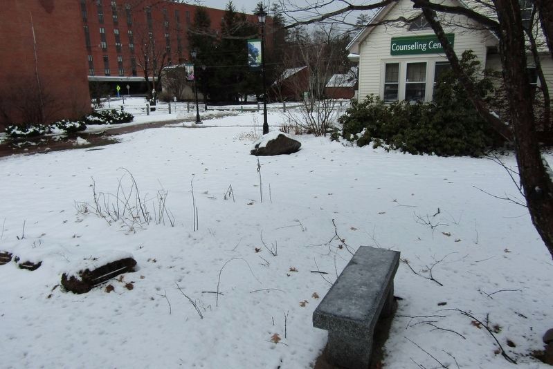
Marker on the boulder next to the Counseling Center
401 ► New Hampshire, Grafton County, Plymouth — PSU Counseling and Human Relations Center Site —  |
| Near Merrill Street east of Langdon Street, on the right when traveling east. | |||
| 402 ► New Hampshire, Grafton County, Plymouth — Restoring The American Chestnut Tree — |
| On Daniel Webster Highway (New Hampshire Route 3) at Railroad Square Road, on the right when traveling south on Daniel Webster Highway. | |||
| 403 ► New Hampshire, Grafton County, Plymouth — Revolutionary War Cannon — |
| On Main Street (U.S. 3) at Court Street, on the right when traveling south on Main Street. | |||
| 404 ► New Hampshire, Grafton County, Plymouth — Robert L Frost — |
| On Highland Avenue at School Street, on the left when traveling north on Highland Avenue. | |||
| 405 ► New Hampshire, Grafton County, Plymouth — 179 — Smith Bridge — |
| On Smith Bridge Road. | |||
| 406 ► New Hampshire, Grafton County, Plymouth — The Frost House — |
| On School Street at Highland Avenue, on the right when traveling east on School Street. | |||
| 407 ► New Hampshire, Grafton County, Plymouth — Rotary Amphitheater — Plymouth Riverfront Park — |
| On Green Street. | |||
| 408 ► New Hampshire, Grafton County, Plymouth — 189 — Stream Gaging in New Hampshire — |
| On Green Street. | |||
| 409 ► New Hampshire, Grafton County, Plymouth — The Common — |
| On Main Street (US 3). | |||
| 410 ► New Hampshire, Grafton County, Rumney — 55 — Baker River — |
| On Mount Moosilauke Highway (New Hampshire Route 25) 1 mile west of Halls Brook Road, on the right when traveling west. | |||
| 411 ► New Hampshire, Grafton County, Rumney — Geological History of the Polar Caves — |
| Near Mount Moosilauke Highway (New Hampshire Route 25). | |||
| 412 ► New Hampshire, Grafton County, Rumney — Park History — |
| Near Mount Moosilauke Highway (New Hampshire Route 25). | |||
| 413 ► New Hampshire, Grafton County, Rumney — The Granite State — |
| Near Mount Moosilaukee Highway (New Hampshire Route 25). | |||
| 414 ► New Hampshire, Grafton County, Sugar Hill — Carolina Crapo Memorial — Dedicated July 19, 1949 — |
| On Sugar Hill Road (New Hampshire Route 117), on the right when traveling east. | |||
| 415 ► New Hampshire, Grafton County, Sugar Hill — 073 — First Ski School in America — |
| On Sugar Hill Road (New Hampshire Route 117) at Lovers Lane, on the right when traveling south on Sugar Hill Road. | |||
| 416 ► New Hampshire, Grafton County, Sugar Hill — Sugar Hill Veterans Memorial — |
| On Sugar Hill Road (New Hampshire Route 117), on the right when traveling east. | |||
| 417 ► New Hampshire, Grafton County, Warren — 231 — Norris Cotton — Statesman — 1900 - 1989 — |
| On School Street at Mount Moosilauke Highway ( Route 25), on the right when traveling south on School Street. | |||
| 418 ► New Hampshire, Grafton County, Warren — 275 — Sarah Whitcher and the Bear — |
| On New Hampshire 25 at Swain Hill Road, on the right when traveling south on New Hampshire 25. | |||
| 419 ► New Hampshire, Grafton County, Waterville Valley, North Sandwich — By Foot and Horseback, Stagecoach and Car — |
| Near Kancamagus Highway (State Highway 112) 20 miles east of Daniel Webster Highway (U.S. 3), on the right when traveling east. | |||
| 420 ► New Hampshire, Grafton County, Waterville Valley, North Sandwich — How Sabbaday Falls Got Its Name — |
| Near Kancamagus Highway (State Highway 112) 20 miles east of Daniel Webster Highway (U.S. 3), on the right when traveling east. | |||
| 421 ► New Hampshire, Grafton County, Woodsville — Haverhill World War II Honor Roll — |
| On Central Street (U.S. 302) at Chapel Street, on the right when traveling west on Central Street. | |||
| 422 ► New Hampshire, Grafton County, Woodsville — Town Clock — |
| On Central Street (U.S. 302) at Court Street ( Route 135), on the left when traveling west on Central Street. | |||
| 423 ► New Hampshire, Grafton County, Woodsville — Veterans Memorial — |
| On Central Street (U.S. 302) at Chapel Street, on the right when traveling west on Central Street. | |||
| 424 ► New Hampshire, Hillsborough County, Amherst — Birthplace of Horace Greeley — |
| On State Route 101 at Horace Greeley Road, on the left when traveling north on State Route 101. | |||
| 425 ► New Hampshire, Hillsborough County, Amherst — The Old Court House — |
| On Foundry Street west of Boston Post Road, on the right when traveling west. | |||
| 426 ► New Hampshire, Hillsborough County, Bedford — 102 — Colonel John Goffe — (1701 - 1786) — |
| On South River Road (U.S. 3) 0.1 miles south of Kilton Road, on the right when traveling south. | |||
| 427 ► New Hampshire, Hillsborough County, Deering — Deering Veterans — |
| On Deering Center Road (New Hampshire Route 149) at Gregg Hill Road/Reservoir Road, on the left when traveling south on Deering Center Road. | |||
| 428 ► New Hampshire, Hillsborough County, Deering — War Memorial — |
| On Deering Center Road (New Hampshire Route 149) at Gregg Hill Road/Reservoir Road, on the left when traveling south on Deering Center Road. | |||
| 429 ► New Hampshire, Hillsborough County, Deering — World War Memorial — 1917 - 1918 — |
| On Deering Center Road (New Hampshire Route 149) at Gregg Hill Road/Reservoir Road, on the left when traveling south on Deering Center Road. | |||
| 430 ► New Hampshire, Hillsborough County, Francestown — 0043 — Levi Woodbury 1789 - 1851 — |
| On Route 136 at Route 47 on Route 136. | |||
| 431 ► New Hampshire, Hillsborough County, Goffstown — B&M Railroad Covered Bridge — Goffstown Covered Bridge — |
| On Main Street at Mill Street, on the right when traveling north on Main Street. | |||
| 432 ► New Hampshire, Hillsborough County, Goffstown — Congregational Church — Goffstown Historical Marker — Town of Goffstown, Inc. June 17, 1761 — |
| On Main Street (New Hampshire Route 3/114) at Church Street, on the right when traveling south on Main Street. | |||
| 433 ► New Hampshire, Hillsborough County, Goffstown — Goffstown Town Hall — |
| On Main Street (New Hampshire Route 13/114) south of School Street, on the right when traveling south. | |||
| 434 ► New Hampshire, Hillsborough County, Goffstown — Grasmere Town Hall — Goffstown Historical Marker — |
| On Center Street east of Henry Bridge Road, on the left when traveling east. | |||
| 435 ► New Hampshire, Hillsborough County, Goffstown — In Memory of Michael J. Kos — |
| On Center Street east of Henry Bridge Road, on the right when traveling east. | |||
| 436 ► New Hampshire, Hillsborough County, Goffstown — Popcorn Stand — Goffstown Historical Marker — Town of Goffstown, Inc. June 17, 1761 — |
| On Mast Street (New Hampshire Route 114) at High Street ( Route 13), on the left when traveling south on Mast Street. | |||
| 437 ► New Hampshire, Hillsborough County, Goffstown — Public Library — Goffstown Historical Marker — Town of Goffstown, Inc. June 17, 1761 — |
| On High Street (New Hampshire Route 13) at Mast Street ( Route 114), on the left when traveling south on High Street. | |||
| 438 ► New Hampshire, Hillsborough County, Goffstown — St. Matthew's Episcopal Church — |
| On North Mast Street (New Hampshire Route 14) at High Street ( Route 13), on the right when traveling east on North Mast Street. | |||
| 439 ► New Hampshire, Hillsborough County, Goffstown — War Memorial — |
| On Main Street (New Hampshire Route 114) at Elm Street, on the left when traveling south on Main Street. | |||
| 440 ► New Hampshire, Hillsborough County, Goffstown, Pinardville — Hillsborough County Pauper Cemetery — Goffstown Rail Trail — |
| Near Mast Road (New Hampshire Route 14) 0.6 miles west of Danis Park Road, on the right when traveling west. | |||
| 441 ► New Hampshire, Hillsborough County, Hillsboro — Birthplace of Franklin Pierce — |
| On 2nd New Hampshire Turnpike (New Hampshire Route 31) north of Franklin Pierce Highway ( Route 9), on the right when traveling north. | |||
| 442 ► New Hampshire, Hillsborough County, Hillsboro — Butler Park — |
| On Main Street (New Hampshire Route 149) at Center Street, on the left when traveling east on Main Street. | |||
| 443 ► New Hampshire, Hillsborough County, Hillsboro — War Memorial — |
| On Main Street (New Hampshire Route 149) at Central Street, on the left when traveling east on Main Street. | |||
| 444 ► New Hampshire, Hillsborough County, Hillsborough — Colonial Grant — |
| On East Washington Road north of Center Road, on the right when traveling north. | |||
| 445 ► New Hampshire, Hillsborough County, Hillsborough — Hillsborough War Memorial — |
| On School Street north of Myrtle Street, on the right when traveling north. | |||
| 446 ► New Hampshire, Hillsborough County, Hillsborough — Memorial Day Order — |
| Near School Street north of Myrtle Street, on the right when traveling north. | |||
| 447 ► New Hampshire, Hillsborough County, Hillsborough — 065 — Pierce Homestead — |
| On Second New Hampshire Turnpike (New Hampshire Route 31) 0.1 miles north of West Main Street, on the right when traveling north. | |||
| 448 ► New Hampshire, Hillsborough County, Hillsborough — 203 — Stone Arch Bridges — |
| On West Main Street (New Hampshire Route 149) at U.S. 202, on the right when traveling east on West Main Street. | |||
| 449 ► New Hampshire, Hillsborough County, Manchester — National Colonnade — |
| Near River Road 0.1 miles north of Park Ave, on the left when traveling north. | |||
| 450 ► New Hampshire, Hillsborough County, Manchester, Corey Square — Ash Street School — |
| On Bridge Street at Ash Street, on the left when traveling east on Bridge Street. | |||
| 451 ► New Hampshire, Hillsborough County, Manchester, Corey Square — Manchester Spanish-American War Memorial — |
| On Amherst Street. | |||
| 452 ► New Hampshire, Hillsborough County, Manchester, Currier — The Historic Currier Neighborhood — |
| On Ash Street at Myrtle Street, on the right when traveling south on Ash Street. | |||
| 453 ► New Hampshire, Hillsborough County, Manchester, Downtown — 124 — Amoskeag Mills — |
| On Canal Street at West Pentacook Street, on the right when traveling north on Canal Street. | |||
| 454 ► New Hampshire, Hillsborough County, Manchester, Downtown — Battlefield Crosses — |
| On Elm Street (U.S. 3) at Pleasant Street, on the right when traveling north on Elm Street. | |||
| 455 ► New Hampshire, Hillsborough County, Manchester, Downtown — Brigadier General John Stark — 1728 - 1822 — Victor of the Battle of Bennington 1777 — |
| On Market Street east of Franklin Street, on the left when traveling east. | |||
| 456 ► New Hampshire, Hillsborough County, Manchester, Downtown — City Hall — 1844-1845 — |
| On Elm Street (U.S. 3) at Hanover Street, on the right when traveling south on Elm Street. | |||
| 457 ► New Hampshire, Hillsborough County, Manchester, Downtown — Gulf Conflicts Memorial — |
| On Central Street 0.1 miles east of Elm Street (U.S. 3), on the right when traveling west. | |||
| 458 ► New Hampshire, Hillsborough County, Manchester, Downtown — Manchester NH Civil War Memorial — |
| On Elm Street, on the right. | |||
| 459 ► New Hampshire, Hillsborough County, Manchester, Downtown — Manchester NH General Pulaski Monument — |
| On Bridge Street at Union Street, on the right on Bridge Street. | |||
| 460 ► New Hampshire, Hillsborough County, Manchester, Downtown — Manchester NH Iwo Jima/Rene Gagnon Memorial — |
| On Chestnut Street at Amherst Street, on the right on Chestnut Street. | |||
| 461 ► New Hampshire, Hillsborough County, Manchester, Downtown — Manchester NH Victory Park War Memorial — |
| On Chestnut Street at Amherst Street, on the right on Chestnut Street. | |||
| 462 ► New Hampshire, Hillsborough County, Manchester, Downtown — Manchester NH War Memorial — |
| On Elm Street, on the right. | |||
| 463 ► New Hampshire, Hillsborough County, Manchester, Downtown — Manchester NH World War II Memorial — |
| On Elm Street, on the right. | |||
| 464 ► New Hampshire, Hillsborough County, Manchester, Downtown — Manchester Picker House — Black Heritage Trail NH — |
| On Bedford Street north of Pleasant Street, on the left when traveling north. | |||
| 465 ► New Hampshire, Hillsborough County, Manchester, Downtown — Manchester's First Green Roof — |
| On Market Street east of Franklin Street, on the left when traveling east. | |||
| 466 ► New Hampshire, Hillsborough County, Manchester, Downtown — Ralph Baer — The Father of Video Games #Baersquare — Baer Square — |
| On Stark Street at Mungall Street, on the right when traveling west on Stark Street. | |||
| 467 ► New Hampshire, Hillsborough County, Manchester, Downtown — The Mill Girl — |
| On Commercial Street at Stark Street, on the right when traveling north on Commercial Street. | |||
| 468 ► New Hampshire, Hillsborough County, Manchester, Downtown — The New England Gold Star Mothers Statue — |
| On Elm Street (U.S. 3) at Pleasant St, on the left when traveling north on Elm Street. | |||
| 469 ► New Hampshire, Hillsborough County, Manchester, Kalivas Union — Christos Kalivas — |
| On Lake Street at Chestnut Street, on the right when traveling east on Lake Street. | |||
| 470 ► New Hampshire, Hillsborough County, Manchester, Kalivas Union — Governor Moody Currier Gateway Entrance — |
| On Auburn Street at Chestnut Street, on the right when traveling east on Auburn Street. | |||
| 471 ► New Hampshire, Hillsborough County, Manchester, Kalivas Union — Mary E. Elliot — |
| Near Pine Street. | |||
| 472 ► New Hampshire, Hillsborough County, Manchester, Kalivas Union — Valley Cemetery — Welcome — |
| Near Auburn Street. | |||
| 473 ► New Hampshire, Hillsborough County, Manchester, North End — John Stark —Revolutionary War Hero — |
| Near River Road 0.1 miles Park Road, on the left. | |||
| 474 ► New Hampshire, Hillsborough County, Manchester, North End — Revolutionary War Patriots — |
| On Elm Street at Waldo Street, on the right when traveling south on Elm Street. | |||
| 475 ► New Hampshire, Hillsborough County, Manchester, North End — Stark Park — |
| On River Road (Route 715) north of Park Ave, on the left when traveling north. | |||
| 476 ► New Hampshire, Hillsborough County, Manchester, Notre Dame — Notre Dame Bridge — 1937 - 1989 — |
| On Amory Street/Bridge Street at McGregor Street, on the right when traveling east on Amory Street/Bridge Street. | |||
| 477 ► New Hampshire, Hillsborough County, Manchester, Rimmon Heights — Merci Box Car — |
| On Reed Street at Reed Street just off Bremer Street when traveling south on Reed Street. | |||
| 478 ► New Hampshire, Hillsborough County, Manchester, Rimmon Heights — 208 — St. Mary's Bank Credit Union / La Caisse Populaire Saint-Marie — |
| On Notre Dame Avenue near Armory Street, on the right when traveling north. | |||
| 479 ► New Hampshire, Hillsborough County, Mason — 035 — Uncle Sam’s House — |
| On Valley Road (New Hampshire Route 123) near Cascade Road, on the right when traveling south. | |||
| 480 ► New Hampshire, Hillsborough County, Merrimack — Lowell Memorial Library — |
| On Daniel Webster Highway (U.S. 3) at Baboosic Lake Road, on the right when traveling south on Daniel Webster Highway. | |||
| 481 ► New Hampshire, Hillsborough County, Merrimack — 079 — Matthew Thornton — 1714 - 1803 — |
| On Daniel Webster Highway north of Continental Blvd, on the right when traveling north. | |||
| 482 ► New Hampshire, Hillsborough County, Merrimack — 029 — Old Dunstable — |
| On Daniel Webster Highway (U.S. 3) north of Woodbury Street, on the right when traveling north. | |||
| 483 ► New Hampshire, Hillsborough County, Merrimack — Veterans and War Memorial — |
| On Baboosic Lake Road, on the right when traveling west. | |||
| 484 ► New Hampshire, Hillsborough County, Merrimack — War Memorial — 1861-65 — |
| On Baboosic Lake Road west of Daniel Webster Highway (U.S. 3), on the right when traveling west. | |||
| 485 ► New Hampshire, Hillsborough County, Milford — Captain Josiah Crosby / Lieutenant Thompson Maxwell — |
| On Emmerson Road east of Route 13, on the left when traveling east. | |||
| 486 ► New Hampshire, Hillsborough County, Nashua — 1939 City Hall — |
| On Main Street north of Hollis Street, on the left when traveling north. | |||
| 487 ► New Hampshire, Hillsborough County, Nashua — Abbot-Spalding House — |
| On Amherst Street (New Hampshire Route 101A) at Abbott Street, on the right when traveling north on Amherst Street. | |||
| 488 ► New Hampshire, Hillsborough County, Nashua — City Fire Alarm Bell — |
| On Main Street north of Hollis Street, on the left when traveling north. | |||
| 489 ► New Hampshire, Hillsborough County, Nashua — Hellenic Circle — |
| On Chestnut Street at W Pearl Street, on the left when traveling south on Chestnut Street. | |||
| 490 ► New Hampshire, Hillsborough County, Nashua — Historic Homes — |
| On Amherst Street (New Hampshire Route 101A) at Townsend, on the left when traveling west on Amherst Street. | |||
| 491 ► New Hampshire, Hillsborough County, Nashua — Joseph Greeley II House — |
| Near Front Street south of Franklin Street, on the left when traveling south. | |||
| 492 ► New Hampshire, Hillsborough County, Nashua — Korean War Memorial — Duty to God and Country — |
| On Main Street north of Hollis Street, on the left when traveling north. | |||
| 493 ► New Hampshire, Hillsborough County, Nashua — La Parc De Notre Renaissance Française — |
| Near Water Street at Mechanic Street, on the right when traveling west. | |||
| 494 ► New Hampshire, Hillsborough County, Nashua — Masonic Temple — |
| On Main Street at Pearl Street, on the right when traveling north on Main Street. | |||
| 495 ► New Hampshire, Hillsborough County, Nashua — Nashua Manufacturing Co. — |
| On Water Street at Factory Street, on the right when traveling south on Water Street. | |||
| 496 ► New Hampshire, Hillsborough County, Nashua — Nashua Public Library — |
| Near Hartshorn Avenue at Park Street, on the right when traveling south. | |||
| 497 ► New Hampshire, Hillsborough County, Nashua — Nashua River - Jackson Falls Dam — |
| Near Pearson Avenue 0.1 miles east of Main Street, on the left when traveling east. | |||
| 498 ► New Hampshire, Hillsborough County, Nashua — Nashua Soldiers and Sailors Monument — |
| On Concord Street at Amherst Street, on the right when traveling south on Concord Street. | |||
| 499 ► New Hampshire, Hillsborough County, Nashua — No. 1 Mill Bell — |
| On Clocktower Place, on the left when traveling west. | |||
| 500 ► New Hampshire, Hillsborough County, Nashua — President John Fitzgerald Kennedy — In Memoriam — |
| On Main Street north of Hollis Street, on the left when traveling north. | |||
975 entries matched your criteria. Entries 401 through 500 are listed above. ⊲ Previous 100 — Next 100 ⊳