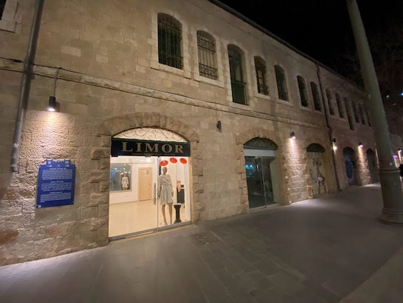
On Jaffa Street, on the right when traveling east.
A courtyard neighborhood built In 1911 by the Bukharan Jew Yitzhak Saidoff, in 1911. In the common style at the time of a two-story building and a backyard with two water pits. Shops housed the first floor while flats in the second floor with an . . . — — Map (db m220099) HM
On Jaffa Street, on the right when traveling east.
Shaare Zedek Hospital was named after its founder Dr. Moshe Wallach, who was born in 1866 in Germany and immigrated to the land of Israel in 1891. The hospital was built thanks to his initiative, am perseverance, and the donations of German and' . . . — — Map (db m220100) HM
On Nitrate Al Ali, on the left when traveling west.
Mameluke mosque, formerly a place of prayer and residence for Sufi Dervishes, named after its founder, Salah al-Din (Saladin). During 1099-1187 the Patriarch's palace was in this site. — — Map (db m219019) HM
On Christian Quarter Road, on the right when traveling north.
An arch decorated with "pillows" which demarcated the opening of the Western entrance into the Church of the Holy Sepulchre in the Crusaders period.
(Hebrew and Arabic not transcribed) — — Map (db m222064) HM
On Al Batriarkeya Al Armaneya, on the right when traveling west.
One of the most beautiful and important gates within the Ottoman City walls, dating from the 16th century. The Gate led to Jaffa and to Hebron, and hence the origin of its name (in Arabic Bab al-Khalil-Hebron Gate).
(Hebrew and Arabic text . . . — — Map (db m219032) HM
The paving stones in this section are part of the street pavement dating from the end of the Roman Period, 3rd-4th century C.E.
The street paved with these stones was discovered underneath the existing level in the course of development works . . . — — Map (db m222065) HM
A public water fountain built in the 16th century, also named in Arabic: "Sebil Sit Mariam", due to its proximity to the place where Virgin Mary was born according to Christian tradition.
(Hebrew and Arabic texts not transcribed) — — Map (db m220236) HM
On Via Dolorosa Street, on the right when traveling west.
A Catholic Convent whose construction was completed in 1860. The site contains the remains of a water cistern (Struthion Pool) and the pavement (Lithostrotos) from the Antonio Fortress dating from the second Temple period.
(Hebrew and Arabic . . . — — Map (db m220146) HM
On Beit HaBad Street near Khan Az-Zait St., on the right when traveling south.
In Memory of Yig'al Shahaf (Masrufi) Hy''d who was murdered at this very spot on 18 (Yud Het) Tishre 5748 11 October, 1987 in a shooting attack
(Hebrew text not transcribed) — — Map (db m219013) HM
On Jaffa Street, on the left when traveling south.
The Russian Compound housed the offices of the Palestine Police and the British Criminal Investigation Department (CID). On March 23, 1944, Etzel attacked and blew up the CID section. In the course of the attack, fighter Asher Benziman was killed. . . . — — Map (db m220087) HM
On Heleni ha-Malka Street, on the left when traveling west.
Around the compound was a perimeter wall with two formal gates at north and south. This is one of the two gate houses, built in 1890. The other was pulled down in the 70s. On the facade is the emblem of the "Imperial Russian Orthodox Palestine . . . — — Map (db m220003) HM
On Jaffa Street, on the left when traveling south.
On the morning of May 14th 1948, units of the Haganah and the Irgun Zvai Leumi began an operation to take over the positions held by the British, including the central "Russian Compound". The Haganah succeeded in gaining control of all of the . . . — — Map (db m220088) HM
On Shivtei Israel Street, on the right when traveling south.
The Roman Catholic Salesian Congregation built in 1928-1938 this two-story tile-roof school. Half of the pupils were of Jewish families who preferred high quality European education for their children. Houses currently the Ministry of Education . . . — — Map (db m219969) HM
On Monbaz Street, on the right when traveling south.
Built in 1886-1890, the Sergei compound was named after Prince Sergei, brother of Tsar Alexander III, as a hotel for noble Russian pilgrims. Designed by architect George Franghia as a two-story building of mixed styles. The centered entrance . . . — — Map (db m219993) HM
On Shivtei Israel Street, on the right when traveling south.
The Evangelical Lutheran Church of Finland educational and cultural center was until 1968 a boarding school for Jewish children. Serves today mainly as a pilgrim hostel. Built in 1875 with an English-colonial facade, with a red-and-white arcade on . . . — — Map (db m219971) HM
Among the collapsed stones was one (its replica displayed here), which bore a Hebrew inscription: "to the place of trumpeting to...". In the Second Temple days this stone probably marked the place - at the top of the southwest corner of the Temple . . . — — Map (db m219238) HM
On Ha-Yehudim Street, on the left when traveling south.
During the Roman and Byzantine periods alongside the continued use of local limestone the use of marble in construction became widespread, particularly in public buildings. The display contains architectural elements that decorated public buildings . . . — — Map (db m219114) HM
On Ha-Yehudim Street, on the left when traveling south.
Sons of the 'Old Yishuv' in Jerusalem typically studied Torah from a young age. Following many years of study, as adult men, they would train to become either a scholar or a professional.
Daughters were destined to be wives and mothers, and . . . — — Map (db m219121) HM
"And Eternal Life He has implanted within us" (blessing on reading the Torah).
This is the original site of Old Jerusalem's largest yeshiva. All age groups - from young children to the elderly - have studied here since 1876.
The yeshiva . . . — — Map (db m220117) HM
On Ha-Yehudim Street, on the left when traveling south.
On November 29, 1947, the War of Independence broke out and the battle for the Old City of Jerusalem lasted 180 days. The early stages of the war were characterized by localized Arab attacks in full view of the unresponsive British Army. When the . . . — — Map (db m219151) HM
This was one of the most important Sephardic yeshivot in Jerusalem. The cornerstone was laid in 1914. Its grand inauguration took place in 1923.
During the War of Independence (1948), the building served as a frontline position for the besieged . . . — — Map (db m219155) HM
Remains of Jerusalem's main street, running the length of the Western Wall along about one kilometer, in the late Second Temple period. The street was paved with flagstones and edged with curbstones. It had two large drainage channels running . . . — — Map (db m219237) HM
On Misgav Ladakh Street, on the left when traveling south.
The Order of the Teutonic Knights settled here during the Crusader Period (12th-13th centuries CE). The Order built the Church of St. Mary and a hospital, which were destroyed; and St. Mary's Hospice of the German Knights, whose ruins you see before . . . — — Map (db m220119) HM
On Ha-Yehudim Street, on the left when traveling south.
Until the sixteenth century, the "Ramban" was the main synagogue, where members of all denominations prayed together. Its closure at the end of that century is probably the point at which the various streams dispersed. The Sephardi Jews organized in . . . — — Map (db m219150) HM
On Misgav Ladakh Street, on the right when traveling south.
The Crusaders built a roofed market on the remnants of the Byzantine Cardo. In the ensuing years, the vaulted ceilings became the cellars of buildings above. The market was renovated after the Six Day War (1967).
Photo caption: Capital of a . . . — — Map (db m220120) HM
On Ha-Yehudim Street, on the left when traveling south.
In the mid-19th century, the waves of Jewish immigration increased, and the Ashkenazi community grew rapidly. On September 25, 1864, the great Hurva synagogue was inaugurated in an inspiring ceremony Just in time for the High Holidays. Ceremony . . . — — Map (db m219118) HM
You are facing the remains of a lower aqueduct originally built in the Hasmonean period. During the second temple period the need to bring water to Jerusalem increased. This serpentine aqueduct was 21 km (13.5 miles) long; it began, at Solomon's . . . — — Map (db m219171) HM
On Ha-Yehudim Street, on the right when traveling south.
Remains of a magnificent main road from the Roman-Byzantine period serving throughout time until today as a major thoroughfare for shopping.
(Arabic and Hebrew text not transcribed) — — Map (db m219069) HM
David Daniel Marcus, the son of a Romanian Jewish family, was born in 1902 in New York. In 1924 he graduated from the West Point Military Academy and after three years of military service, he retired and started a legal career. In the 1940's, he . . . — — Map (db m225688) HM WM
Ancient Azeka, an important fortified city in the geographical jurisdiction of the Tribe of Judah, dominated one of the routes from the lowlands to the Judean Mountains. It is mentioned in the scriptures in relation to Joshua's wars against the . . . — — Map (db m135460) HM
Near National Route 90, 31.5 kilometers south of National Route 1, on the right when traveling south.
Displayed here is Ahava's original filling instrument. Since Ahava factory opened in 1988, this tool has been utilized to fill 284,770 salt bags, 339 25 kilogram salt sacks and 729 5 kilogram salt buckets. In 1992 it officially retired and was . . . — — Map (db m132155) HM
Near Sha’ul HaMelech Street (Northern District Route 6667) just west of National Route 90, on the right when traveling west.
English Text:
The summer months pulsate with heat in the Bet-She'an Valley. At its heart, in the ancient city of Bet-She'an, were discovered the remains of bathhouses, fountains, and ornamental pools - echoes of a past rich in water . . . — — Map (db m141501) HM
Near Sha’ul HaMelech Street (Northern District Route 6667) just west of Route 90, on the right when traveling west.
English Text:
Monument
The purpose of this lavish structure is uncertain; it may have served as a central monument. Together with the surrounding buildings, it collapsed in the earthquake of 749 C.E.
Nymphaeum
Splendid . . . — — Map (db m141528) HM
Near Sha’ul HaMelech Street (Northern District Route 6667) just west of National Route 90, on the right when traveling west.
English Text:
Roman Bet-She'an, known as Nyssa Scythopolis, became Christian, reaching its golden age in the 6th century C.E. In the 7th century, Muslims settled in the city, once again changing its character. One day in the year 749, an . . . — — Map (db m141502) HM
Near Sha’ul HaMelech Street (Northern District Route 6667) just west of National Route 90, on the right when traveling west.
English Text:
In the Roman period, during the 2nd century C.E., the monumental center of Bet-She'an was built into the valley at the foot of the tell. Roman style and workmanship were applied in constructing public buildings, which were . . . — — Map (db m141513) HM
Near Northern District Route 90 just east of Northern District Route 807, on the right when traveling north.
English Text:
The Magdala stone: A three-dimensional model of the Temple on which the holy scrolls were placed, was found inside the synagogue.
Four miqva'ot: Purification baths fed by underground water sources are unique compared . . . — — Map (db m140979) HM
Near Northern District Route 90 just east of Northern District Route 807, on the right when traveling north.
The architecture of this area allows us to distinguish two streets that separate three structures following the same symmetric layout as the rooms located west. They are constructed from local materials: the walls are made of roughly hewn basalt . . . — — Map (db m140515) HM
Near Northern District Route 90 just east of Northern District Route 807, on the right when traveling north.
English Text:
c. 200 BC
Magdala is established, likely through Hasmonean influence (Jewish families), during the Hellenistic period.
c. 20-60 AD
Magdala develops from a small village into a prosperous city known for fish . . . — — Map (db m140983) HM
Near Northern District Route 90 just east of Northern District Route 807, on the right when traveling north.
English Text:
c. 1500 AD
Between the earthquake of 363 and the crusader period, the southern part of Magdala witnesses a progressive decrease and multiple variations. It eventually becomes a small Arab village during Mamluk and . . . — — Map (db m141302) HM
Near Northern District Route 90 just east of Northern District Route 807, on the right when traveling north.
The building has peculiar architectural elements, and the existence of groundwater was key for locating the miqwa'ot. The analysis of the architectural plan and the building system suggests that this ritual space on the outside had similar . . . — — Map (db m140867) HM
Near Northern District Route 90 just east of Northern District Route 807, on the right when traveling north.
The Jewish communities of Israel in the Second Temple period used unique water installations called miqwa'ot, which enabled them to maintain ritual purity. According to the Halakhah (Jewish law), religious people should immerse into . . . — — Map (db m140973) HM
On Northern District Route 90, 0.05 kilometers east of Northern District Route 807, on the right when traveling north. Reported missing.
The main axis of this complex is a north-south street that divides two buildings. There are two types of contexts here: housing units in the southern area are constructed simply with blocks of basalt stone and limestone walls. To the east ands west . . . — — Map (db m220391) HM
Near Northern District Route 90 just east of Route 807, on the right when traveling north. Reported missing.
This ritual space stands out due to its mosaic floor that is made of thousands of colored tesserae. A white background, framed by a black meander pattern surrounded by an orange rectangle, emphasizes the image of a rosette in the central panel, . . . — — Map (db m220392) HM
Near Northern District Route 90 just east of Northern District Route 807, on the right when traveling north.
English Texts:
Magdala was the hometown of Mary Magdalene - one of Jesus' most faithful followers.
Luke 4:15, Matthew 4:23; 9:35; Mark 1:39 "Jesus went throughout all Galilee, teaching in their synagogues and proclaiming the good . . . — — Map (db m140982) HM
Near Northern District Route 90 just east of Northern District Route 807, on the right when traveling north.
The architectural features of this area denote a public building identified with commercial activities. A North - South street leads to the synagogue and provides the only access to spaces with an additional eastern access to another structures. . . . — — Map (db m141363) HM
Near Al-Bishara Street just north of Paulus ha-Shishi Street, on the right when traveling north.
The stones exhumed form the fill beneath the mosaic floors of the Byzantine building (IV-V century) can be classified: (1) bases, more or less preserved, often having traces of plaster; (2) imposts of a double-arch with a beautifully worked cornice; . . . — — Map (db m139218) HM
Near Paulus Ha Shishi, 0.3 kilometers north of Iksal.
“And the Word became flesh”
Historians tell that the Grotto and its surroundings, being the site of the Annunciation were turned into a worship place in the 1st and 2nd Century.
-Early sources referred to the place as being . . . — — Map (db m44298) HM
Near Al-Bishara Street just north of Paulus ha-Shishi Street, on the right when traveling north.
The most important mosaic floors are found inside the Basilica in the area in front of the Holy Grotto. Those shown here come from the monastery on the south side of the Byzantine Church. They had the value of "sealed levels" having preserved some . . . — — Map (db m139256) HM
Near National Route 60 just south of National Route 75, on the right when traveling south.
Rising above the southern part of the
Nazareth Mountain Mt. of Precipice (397 meters)
Look out over Nazareth, Mt. Tabor and
The Yizrael Valley at its foot.
Mt. of Precipice is also known as "The
Leaping Mountain" - according to old . . . — — Map (db m65395) HM
Near Al-Bishara Street, 0.3 kilometers north of Paulus ha-Shishi Street, on the right when traveling north.
What is left of the ancient village consist of a network of grottoes and bits of walls form various historical periods. Going backwards in time we found first the remains of the XVII century Franciscan monastery, then the palace of the crusader . . . — — Map (db m65462) HM
Near Paulus Ha Shishi, 0.4 kilometers north of Iksal.
[Text in Hebrew …]
[Text in Arabic…]
This church was built in 1914 on the site of an earlier 12th century church.
-The caves, granaries and wells in the lower level were used by the early dwellers of Nazareth. Later, . . . — — Map (db m44353) HM
On HaBanim (National Route 90) just north of HaGalil, on the right when traveling north.
Tiberias the capital of the Galilee, one of the four Holy Cities of Israel Which was built by Antipas in the year 17-20, C.E. Antipas named the city Tiberias in honor of the Roman Ceasar, Tiberius. The institution of Jewish Leadership, the Sanhedrin . . . — — Map (db m65327) HM
Near HaBanim (National Route 90) just north of HaGalil, on the right when traveling north.
This building was part of Tiberias' northern quarter between the 6th and 11th centuries CE. The quarter occupied by Jews and the synagogue stood in its center. This building has three rooms and a courtyard with a well. — — Map (db m65359) HM
On HaBanim (National Route 90) close to HaGalil, on the right when traveling north.
Doors of Burial Caves
Burial caves were frequently sealed by stone doors in order to prevent bad smells and looting. In 2nd-3rd centuries CE Tiberias, basalt doors were used in mausolea and decorated with relief of panels and iron nails that . . . — — Map (db m65341) HM
Near HaBanim (National Route 90) just north of HaGalil, on the right when traveling north.
The Architecture of Tiberias
The columns, bases, cornices and capitals attest to the superb architecture of the public buildings in Tiberias. These were built according to the 2nd-3rd centuries CE Roman Imperial tradition. The . . . — — Map (db m65352) HM
Near HaBanim (National Route 90) just north of HaGalil, on the right when traveling north.
[Text at the top of the marker]: The Crusader-Ottoman Building
This was built in the 12th century CE and remained in use until the Ottoman period. The hall has typical pointed vaults and embrasures in the walls, with remains of . . . — — Map (db m65331) HM
On HaBanim (National Route 90) close to HaGalil, on the right when traveling north.
The wall was erected by the Beduin Governor of the Tiberias Region, Daher El-Omer, in the 18th century on the basis of the ruins of an earlier wall built by the Crusaders.
The wall was destroyed in the 1837 earthquake and since then only . . . — — Map (db m65326) HM
Near HaBanim (National Route 90) just north of HaGalil, on the right when traveling north.
This is one of the thirteen synagogues existed in Tiberias according to the Talmud. It was a square building divided by two rows of columns. One of the mosaics bears a dedication inscription decorated with Jewish symbols: Lulav and Etrog. The . . . — — Map (db m65333) HM
Near National Route 7926 just north of National Route 79, on the right when traveling north.
The Citadel (perhaps a watch tower) was built during the crusader period on foundations from an earlier period. Some of the cornerstones are rubble-filled Roman sarcophagi.
In the 18th Century the building was renovated by Dahr El-Omar, the . . . — — Map (db m65412) HM
Near National Route 7926 just north of National Route 79, on the right when traveling north.
The Roman theater was built in the late first or early second century C.E. Carved into the bedrock on the steep northern slope of the hill. It's diameter is 72 m., and it seated 4000.
The rows of seats constructed on the hewn bedrock were robbed . . . — — Map (db m65405) HM
Near Northern District Route 888 just north of Northern District Route 87, on the left when traveling north.
English Text:
This spacious palace faced a paved
courtyard that led to the city gate.
Its wide entrance opened into a vestibule
and it had a throne hall surrounded by
eight service chambers.
This palace is of Neo-Hittite . . . — — Map (db m139345) HM
Near Northern District Route 888 just north of Northern District Route 87, on the left when traveling north.
English Text:
This is the ancient road leading to the city gate. The road was paved during the 10th century B.C.E. and was in use until the 3rd century C.E. It was paved on a series of terraces seen in the slope. Farther ahead the road . . . — — Map (db m139308) HM
Near Northern District Route 888 north of Northern District Route 87, on the left when traveling north.
English Text:
The inner city gate includes
four chambers, two on each side.
In this chamber vessels
for offerings at the high places were kept.
The other three chambers served as granaries.
The city gate was destroyed by the . . . — — Map (db m139336) HM
Near Northern District Route 888 just north of Northern District Route 87, on the left when traveling north.
English Text:
The outer city gate was part of the heavy
fortification that protected the city.
It included an inner city gate and four solid towers.
Between the two gates was a spacious paved courtyard.
The gate of Bethsaida . . . — — Map (db m139317) HM
On Route 888 just north of Northern District Route 87, on the left when traveling north.
English Text:
The inhabitants of the kingdom of Geshur were
Aramaens and the high places and ritual
objects reflect their religion.
On the sacrificial high place were found
fragments of basins, horned altars, and an
incised . . . — — Map (db m139343) HM
Near Route 888 just north of Route 87, on the left when traveling north.
Whenever he went, to village or town or farm,
they laid the sick in the streets and begged him
to let them simply touch the edge of his cloak;
and all who touched him were healed.
Mark 6:56 — — Map (db m139383) HM
Near Northern District Route 888 north of Northern District Route 87, on the left when traveling north.
Jesus was walking by the Sea of Galilee when
he saw Simon and his brother Andrew
at work with casting-nets in the lake;
for they were fishermen. Jesus said to them,
'Come follow me, and I will make you fishers of men.'
At once they left . . . — — Map (db m139366) HM
Near Route 888 just north of Route 87, on the left when traveling north.
English Text:
Wine is like life to men, if you drink it
in moderation. What is life to a man who
is without wine?
It has been created to make men glad.
Sirach 31:27 — — Map (db m139374) HM
Near Northern District Route 92, 0.08 kilometers south of Northern District Route 789, on the left when traveling south.
English Text:
In the time of the most God - beloved Stephanos the priest and abbot was made the mosaic of the Photisterion in the month of December fourth indiction in the time of the pious and Christ - beloved our King Mauricius . . . — — Map (db m139423) HM
Near Northern District Route 92 at Route 789 when traveling south.
Kursi, east of the Sea of Galilee, is identified with Gergessa, or with "the Land of the Gardarenes," of the New testament, where the miracle of the swine took place. (Luke 8:26-39)
There were three main periods of settlement at Kursi: . . . — — Map (db m139392) HM
Near Northern District Route 888 north of Northern District Route 87, on the left when traveling north.
English Text:
This is the heart of the ancient town.
Here the public activities of the city took
place. It was the center of commercial,
juridicial, and religious life.
"Now David was sitting between the two gates,
and . . . — — Map (db m139327) HM
According to the Gospel of John, scripture indicates that Jesus was baptized very close to this part of the “Jordan River”. Of the four Gospel writers, John was the only one present when Jesus was baptised by John the Baptist.
In . . . — — Map (db m44228) HM
Capharnaum the town of Jesus
He left Nazareth and went to live in Capharnaum by the sea (Gospel of Matthew 4:13). He entered a boat, made a crossing, and came into his own town (Gospel of Matthew 9:1).
The House of Simon Peter
On . . . — — Map (db m44108) HM
The synagogue is made up of four units, namely the prayer hall, the eastern courtyard, the southern porch, and a side-room near the northwestern corner of the prayer hall.
The prayer hall, with the façade toward Jerusalem, is rectangular in . . . — — Map (db m44055) HM
History
28–350 AD
The Judeo-Christians of Capharnaum venerated a large rock upon which Jesus is said to have laid the bread and fish before he fed the five thousand (Mk 6:30-44)
ca. 350 AD
Used as an altar, the rock . . . — — Map (db m44034) HM
Capharnaum is located on the northwest shore of the Sea of Galilee, 16 kilometers northeast of modern Tiberias, 3 kilometers northeast of ancient Heptapegon (modern Tabgha), and 5 kilometers southwest of the upper Jordan River. The original Semitic . . . — — Map (db m221192) HM
• (Blue icon)-1905 First excavations in the 5th c. Synagogue by Heinrich Kohl and Carl Watzinger of the Deutsche Orient- Gesellschaft, on behalf of the Custody of the Holy Land.
• (Green icon)-1915 First excavations in the old village, as . . . — — Map (db m221198) HM
The Sea of Galilee (named after the surrounding area, the Galil) is where several pivotal events in the earthly life of Jesus took place, including:
•Fishermen Simon (Peter) and his brother Andrew were called by Jesus on these shores; they . . . — — Map (db m221195) HM
THE FIFTH CENTURY OCTAGONAL CHURCH
In the second half of the fifth century an octagonal church was erected on a raised level within the perimeter of the previous enclosure wall. The plan consisted of a small central octagon, of a larger . . . — — Map (db m222077) HM
THE Eight Pillars
•1 The Crucifixion
•2 Jesus teaches "become like this little child" to enter the Kingdom of Heaven
•3 Jesus heals the paralytic man lowered through the roof of St. Peter's House Et Ferentes Paralyticum...Nudaverunt . . . — — Map (db m221184) HM
This is a rectangular building where spaces are arranged around a courtyard that allows communication, lighting and ventilation into the rooms. It has two clear entrances: one that leads to the courtyard without interfering with domestic activities . . . — — Map (db m220401) HM
In this area, some walls and materials were found below the level of the first century period, which were dated to the Hellenistic period. Thus, we may infer that the first settlement of the town was between 332-63 BCE.
Due to the distribution . . . — — Map (db m220402) HM
This synagogue is dated to the first century CE, before the destruction of the Second Temple. It is the first synagogue discovered in Galilee and one of seven known from this period in the Land of Israel. The impressive structure was established by . . . — — Map (db m220390) HM
In blessed memory of John Paul II
pilgrim to Tabgha on March 24, 2000
this bronze door was blessed
by Cardinal Stanisław Dziwisz
Metropolitan Archbishop of Krakow,
November 16, 2006 — — Map (db m221201) HM
On HaAtsmaut Street, on the left when traveling south.
LIBERATION OF TIBERIAS MEMORIAL
At the end of March 1948, the Arabs of Tiberias succeeded, with the assistance of armed gangs from the outside, to cut off the Jewish Quarter in the old city from the new one. At the same time, they cut off the . . . — — Map (db m222079) HM WM
Rabbi Ammi was among the greatest Talmudic sages and scholars of the third generation (of rabbis) in the Land of Israel (beginning of the 4th c. CE). Rabbi Ammi was head of the Yeshiva in Tiberias following the death of his rabbi, Rabbi Yochanan. . . . — — Map (db m221220) HM
The son of Avraham, son of the Rambam, David served as Nagid (head) of the Jewish community in Egypt, Syria and the Land of Israel in the 13th century CE. When rabbis demanded that the Rambam's "Guide for the Perplexed" be banned, he fought for his . . . — — Map (db m221396) HM
Rabbi Eliezer ben Hyrkanos was among Rabban Yochanan ben Zakkai's most prominent pupils. He was raised in a wealthy home but gave up a life of abundance, choosing to dedicate himself to Torah learning. His rabbi said that he was like a "cemented pit . . . — — Map (db m221218) HM
Rabbi Maimon ben Yosef was a student of Rabbi Yosef Halevi Ibn Magash and lived in the 12th century CE. Escaping anti-Semitic rioters, Rabbi Maimon took his family on a long and difficult road to safety from Cordoba in Spain to Morocco and from . . . — — Map (db m221400) HM
Rabbi Yochanan ben Zakkai was one of the students of Hillel and Shammai. He escaped the besieged city of Jerusalem immediately before its destruction (in the year 70 CE) and asked Vespasian, the commander of Roman forces in Judea, to "Give me Yavneh . . . — — Map (db m221206) HM
On Ha-Banim Street, on the left when traveling north.
This portion of the Old City wall was preserved intact. It is the remains of the wall built during the 18th century by the Beduin Ruler of the region Daher El-Omar. It is easy to notice the shooting posts on the wall.
On the west side, in . . . — — Map (db m221402) HM
Rabbi Yeshayahu Halevi Horwitz, the "Shlah", a rabbi and kabbalist, one of the greatest Ashkenazi (Western European) scholars, lived in the 15th century. He held religious positions in various Jewish communities across Europe, the main one being in . . . — — Map (db m221223) HM
The Rambam, "The Great Eagle", was among the greatest of Jewish sages of the Middle Ages and a symbol of Jewish wisdom. He was born in the year 4898 (1138) in Cordoba, Andalusia to the judge Rabbi Maimon and his wife. He was forced to wander with . . . — — Map (db m221398) HM
The synagogue was discovered in 1905 by H. Kohl and C. Waltzinger.
It is a square building belonging to the Galilean type of synagogue with a number of special components:
• The main entrance in the eastern wall.
• The niche for holy ark in . . . — — Map (db m126103) HM
Qarne Hittin is the crater of an ancient volcano that was active 4.3 million years ago. On the north and the south sides of the crater are the mountain's two "horns", which gave rise to the Hebrew name Qarne Hittin meaning "horns of wheat."
On . . . — — Map (db m137054) HM
Near Northern District Route 87, 16.7 kilometers east of Northern District Route 90, on the right when traveling east.
Capharnaum is located on the northwest shore of the Sea of Galilee, 16 kilometers northeast of modern Tiberias, 3 kilometers northeast of ancient Heptapegon (modern Tabgha), and 5 kilometers southwest of the upper Jordan River. The original Semitic . . . — — Map (db m139434) HM