On Trafalgar Road at Sumner Street, on the right when traveling north on Trafalgar Road.
Trafalgar Township settlers lived in isolation during the early years. Travel was difficult, and there was no newspaper or postal service. But transportation and communication links were not long in coming.
The first stage-coach service began . . . — — Map (db m242234) HM
On Lakeshore Road East at George Street, on the right when traveling east on Lakeshore Road East.
The oldest commercial buildings date mostly from the 1846-57 period, when Oakville grew from a village of 500 to a newly-incorporated town of 2,000.
Development of Old Oakville's commercial district started at Sixteen Mile Creek and grew east . . . — — Map (db m238571) HM
On Trafalgar Road at Sumner Avenue, on the right when traveling north on Trafalgar Road.
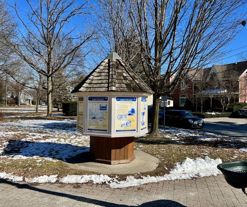
Oakvilles churches, schools and taverns knit the community together and created a social support network.
Taverns and inns were usually the first public buildings in Upper Canadian towns. They doubled as town halls, churches and courthouses. . . . — — Map (db m238672) HM
On Navy Street, 0.1 kilometers south of King Street, on the left when traveling south.
The founder of Oakville was born in Nova Scotia of
Loyalist parents who moved to Burlington Bay in 1793.
William served with distinction in the militia during the
War of 1812. He settled in Nelson Township in 1816 and
became a successful . . . — — Map (db m237075) HM
On Navy Street at William Street, on the right when traveling south on Navy Street.
William Chisholm’s first priorities for Oakville’s economic development were developing the harbour, building a grist and sawmill, and setting up a shipyard.
This activity, along with the declaration of the harbour as a Port of Entry for . . . — — Map (db m238303) HM
On Randall Street at Thomas Street, on the right when traveling west on Randall Street.
Europeans first arrived in what is now southern
Ontario during the second decade of the 17th century. At the time, the area was populated by three major groups of Iroquoian-speaking people: Huron, Petun and Neutral.
By 1650 these aboriginal . . . — — Map (db m241925) HM
On Navy Street at William Street, on the right when traveling south on Navy Street.
Oakville Heritage Trails
Old Oakville Loop
Early Leaders
In addition to the founder William Chisholm, strong
leadership from other citizens was important in developing
Oakville into a town by 1857. One such person was Merrick . . . — — Map (db m237951) HM
On Cornwall Road, 0.2 kilometers west of Trafalgar Road, on the right when traveling east.
This region’s first farmers. mainly of British descent, established themselves on lots of 200
acres after the Mississauga purchase of 1805. As they cleared their land, their first products for sale were timber and potash (from the burning of trees . . . — — Map (db m242254) HM
On Trafalgar Road at Sumner Avenue, on the right when traveling north on Trafalgar Road.
As Oakville’s population and
prosperity increased, stately homes were built near George's Square. These houses represent different architectural styles and designs from various periods in the town's development.
19th Century Heritage Homes . . . — — Map (db m238721) HM
On Walker Street, 0.2 kilometers east of Chisholm Street, on the right when traveling east.
History
The Battle of the Atlantic (September 1939 - May 1945)
The Second World War began when Nazi Germany invaded Poland. Britain, France, and Canada were quick to declare war, but the enemy was strong and well equipped. By the fall of . . . — — Map (db m237096) HM
On Randall Street at Thomas Street, on the right when traveling west on Randall Street.
After the ice melted away from southern Ontario, Paleo-Indians moved into the
region. Southern Ontario was a treeless tundra then, like today's Arctic.
The Paleo-Indians travelled widely, hunting caribou with spear points made of chert, a type . . . — — Map (db m241978) HM
On Cornwall Road, 0.2 kilometers west of Trafalgar Road, on the right when traveling east.
Water power from the Sixteen enabled the first industries to be established in Oakville.
The first sawmill on the Sixteen was built near Upper Middle Road around 1810. William Chisholm built the first gristmill near the Speers Road bridge in 1833. . . . — — Map (db m242238) HM
On Lakeshore Road East near George Street, on the right when traveling east.
In Oakville, as in most of the area villages, the first public building to be erected was the tavern. Necessary way-stations in a land of arduous travel, taverns also provided meeting places for the new settlers to conduct business and enjoy . . . — — Map (db m241808) HM
On Front Street at Thomas Street, on the right when traveling east on Front Street.
Lakeside Park Bandstand
- Original structure circa 1908 -
The Lakeside Park Bandstand was originally located
in Trafalgar Park (then known as Oakville Fair
Grounds). The Bandstand was moved to Lakeside
Park in the early 1950's. It . . . — — Map (db m237087) HM
On Lakeshore Road East near George Street, on the right when traveling east.
Oakville’s early businessmen realized their success depended on the prosperity and attractiveness of the larger community. Many of them made civic affairs their business. Parks, sidewalks, road improvements, street lighting, public health and safety . . . — — Map (db m241701) HM
On Walker Street, 0.1 kilometers east of Chisholm Street, on the left when traveling west.
Tannery Park
Life "Over the Creek"
West Harbors history as a working class neighborhood began in the 1830s with William Chisholm's need to raise money for his ill-fated Oakville Hydraulic Company, which was to construct a dam on the . . . — — Map (db m237434) HM
On Trafalgar Road at Sumner Avenue, on the right when traveling north on Trafalgar Road.
The area that is present day Oakville was first settled by Europeans in 1806, after the land was purchased from the Mississauga tribe and Trafalgar Township was surveyed.
Twenty-one years later, in 1827, William Chisholm bought 960 acres at . . . — — Map (db m238670) HM
On Cornwall Road, 0.2 kilometers west of Trafalgar Road, on the right when traveling east.
Industry prospered in Oakville during the 1840s to 1860s, with the establishment of foundries, tanneries and carriage works.
In 1851 machinists John Doty and Ashley Hibberd built a foundry to manufacture sawmill equipment and steam engines. . . . — — Map (db m242252) HM
On Navy Street at Church Street, on the left when traveling north on Navy Street.
On this site in 1827 Oakville's meeting hall was built,
which also was used as a church on Sundays and a
school on weekdays. Oakville's first library was
established here when William Tassie, the town's first
schoolmaster, opened a reading room. . . . — — Map (db m237948) HM
On Navy Street at William Street, on the right when traveling south on Navy Street.
The early settlers of Oakville, while full of optimism lacked formal training- there were few master builders or architects at the time. In fact, the shipbuilders who came to work for Chisholm in the shipyard also built many of the first houses . . . — — Map (db m238338) HM
On Navy Street at William Street, on the right when traveling south on Navy Street.
Period Homes
For the greater part of the nineteenth century, the centre hall Georgian plan remained popular. In the early homes, this basic form was embellished with door and window surrounds and cornice treatments. The degree of decorative . . . — — Map (db m238341) HM
On Randall Street near Thomas Street, on the right when traveling west.
In the Late Woodland period (AD 500-1000) people of the Princess Point Complex introduced corn into southern Ontario. Evidence of their culture has been found at Cootes Paradise in Hamilton and along the Credit River.
The Princess Point . . . — — Map (db m242013) HM
On Navy Street at William Street, on the right when traveling south on Navy Street.
An Act to incorporate the Town of Oakville was assented to on May 27th, 1857. The first council members were:
Mayor G.K. Chisholm Farmer & Landowner
Ward 1 R.K. Chisholm Customs Agent & Postmaster
W.E. Hagaman General Merchant
Ward . . . — — Map (db m238339) HM
On Reynolds Street at Palmer Avenue, on the left when traveling north on Reynolds Street.
Dedicated to the soldiers of
The Lorne Scots
(Peel, Dufferin and Halton Regiment)
In honour of their 150th anniversary
1866-2016
And for their continuing service
to our community and country
Defence of Canada, 1812-1815 . . . — — Map (db m238723) HM WM
On Cornwall Road, 0.2 kilometers west of Trafalgar Road, on the right when traveling east.
The manufacture of baskets, Oakville's longest lived industry, grew out of the area's flourishing fruit industry.
Pioneer strawberry grower John Cross manufactured the first wooden berry baskets of his own design in the 1860s. John A. . . . — — Map (db m242253) HM
On Trafalgar Road at Sumner Avenue, on the right when traveling north on Trafalgar Road.
During the 1830s, Oakville entered a prosperous era. Shipments of wheat and lumber made the harbour a busy focus of commercial activity. Steamships and stagecoaches carried passengers, mail and freight to and from Hamilton and York.
William . . . — — Map (db m238668) HM
On Walker Street, 0.1 kilometers east of Chisholm Street, on the left when traveling west.
Oakville Heritage Trails
Tannery Park
Few enterprises influenced the lives of ordinary Oakville
residents like the Marlatt & Armstrong Leather Co. did at the turn of the 20th Century. If you didn't work for the tannery, you smelled its . . . — — Map (db m237297) HM
On Walker Street, 0.1 kilometers east of Chisholm Street, on the right when traveling east.
Oakville Heritage Trails
Tannery Park
The Temperance Movement
Oakville was a hotbed of temperance activity in the 1800s. In 1889, West Harbour found itself at the centre of it as the site of what was to that point the largest temperance . . . — — Map (db m237726) HM
On Randall Street at Thomas Street, on the right when traveling west on Randall Street.
Under the Royal Proclamation of 1763, European settlement could not proceed without a formal treaty with the aboriginal proprietors of the land. In 1806 the Mississauga signed the treaty surrendering all the lands from Etobicoke River to Burlington . . . — — Map (db m241812) HM
On Trafalgar Road at Sumner Avenue, on the right when traveling north on Trafalgar Road.
The Underground Railroad secretly transported fugitive slaves from the
southern United States across the border to freedom in Canada. From 1820 to 1865 thousands of black slaves escaped into Canada.
Although Oakville was a small terminus . . . — — Map (db m238720) HM
On Lakeshore Road East at George Street, on the right on Lakeshore Road East.
Once, everyone from farmers to dowagers met and mingled on "Main Street." People knew all the merchants by their first names. Today, the friendliness remains, as well as much of the small-town charm, as Downtown Oakville develops its own blend of . . . — — Map (db m242154) HM
On Navy Street at William Street, on the right when traveling south on Navy Street.
The first town survey was completed in 1833, enclosing an area bounded on the west by Brock Street, on the north by Rebecca and Randall Streets, and on the east by Allan Street.
Road allowances were laid out in the standard grid pattern . . . — — Map (db m238336) HM
On Walker Street, 0.1 kilometers east of Chisholm Street, on the right when traveling east.
Oakville Heritage Trails
Tannery Park
Oakville founder William Chisholm's 1827 grant of land included about 300 acres of land west of Sixteen Mile Creek. By buying a parcel owned by James and Susannah Brock, he was able to extend the . . . — — Map (db m237941) HM
On Bronte Road, 0.1 kilometers north of Ontario Street, on the right when traveling south.
For nearly a century, commercial fishing was a way of life for the village of Bronte. In 1850, the mouth of Twelve Mile Creek resembled an Atlantic Coast outport. Fishing shanties lined the creek, nets hung on reels drying in the sun, and fish boats . . . — — Map (db m247113) HM
On Bronte Road, 0.1 kilometers north of Ontario Street, on the right when traveling east.
During the 1850s, a dramatic increase in international wheat prices made Bronte prosperous as a grain handling port. By the end of the decade, over 300,000 bushels were being exported annually from the harbour.
The boom ended when the Grand . . . — — Map (db m247150) HM
Sovereign House (circa 1825)
Officially opened September 23, 1995
by Her Worship Mayor Ann Mulvale
The Sovereign House was the residence of Charles Sovereign; a founding father of Bronte Village. From 1911-1914, the home became the . . . — — Map (db m243012) HM
On Bronte Road, 0.1 kilometers north of Ontario Street, on the right when traveling east.
From the 1830s until after World War I, the Lake Ontario waterfront was busy with men mining the shallow waters for shale. Pried from the lake bottom, the blocks of shale were gathered on barges and then loaded onto stonehooking schooners for . . . — — Map (db m247158) HM
On Bronte Road, 0.1 kilometers north of Ontario Street, on the right when traveling east.
Between 1960 and 2000 yacht building flourished in Bronte and Oakville. In the 1970s as many as twenty major yachts a year were launched at Bronte Harbour.
Yacht manufacturers C&C, Ontario Yachts, Grampian and Bruckmann worked together with . . . — — Map (db m247157) HM