2926 entries match your criteria. Entries 101 through 200 are listed.⊲ Previous 100 — Next 100 ⊳
Notable Events Topic
By Bill Kirchner, August 6, 2013
US 60 History Trail Marker
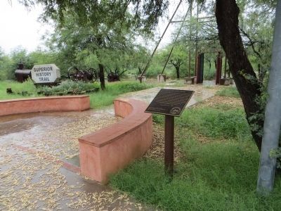
| 101 ► Arizona, Pinal County, Superior — US 60 History Trail — |
| On U.S. 60 at milepost 226.3, on the left when traveling east. | |||
| 102 ► Arizona, Santa Cruz County, Madera Canyon — Boy Scout Memorial — |
| Near Madera Canyon Road. | |||
| 103 ► Arizona, Yavapai County, Prescott — The Fire of 1900 — |
| On South Montezuma Street (Arizona Route 89) at West Goodwin Street, on the right when traveling south on South Montezuma Street. | |||
| 104 ► Arizona, Yuma County, Dateland — Boeing B-50A The "Long Ranger" — |
| On Ave 64E near Interstate 8, on the left when traveling south. | |||
| 105 ► Arkansas, Arkansas County, Arkansas Post National Memorial — 38,000 Reasons to Fight — Arkansas Post National Monument — National Park Service, U.S. Department of the Interior — |
| Near Old Post Road, 0.4 miles south of State Route 169. | |||
| 106 ► Arkansas, Benton County, Bella Vista — The Years Between — |
| 107 ► Arkansas, Benton County, Bentonville — Peoples Bank — |
| On West Central Avenue, on the left when traveling north. | |||
| 108 ► Arkansas, Benton County, Bentonville, Downtown Bentonville — Famous Outlaws that Robbed Bentonville — |
| Near South Main Street. | |||
| 109 ► Arkansas, Benton County, Garfield — Pea Ridge and the Trail of Tears — Trail of Tears National Historic Trail — National Trails System — |
| On Military Park Road (County Road 65), on the left when traveling south. | |||
| 110 ► Arkansas, Benton County, Rogers — War Eagle Mills Farm — |
| On War Eagle Road, on the right when traveling east. | |||
| 111 ► Arkansas, Cleveland County, New Edinburg — The Battle of Marks' Mill — |
| On Arkansas Route 8 at Arkansas Route 97, on the left when traveling south on State Route 8. | |||
| 112 ► Arkansas, Crawford County, Van Buren — First Three U.S. Deaths in WWI — |
| Near Main Street at South 4th Street. | |||
| 113 ► Arkansas, Crittenden County, Marion — Rhodes Storefronts — Circa 1925 — Courthouse Square Walking Trail — |
| On Court Street north of East Military Road, on the left when traveling north. | |||
| 114 ► Arkansas, Crittenden County, Marion — The Loss of the Sultana — |
| Near Arkansas Route 77 north of Military Road, on the right when traveling south. | |||
| 115 ► Arkansas, Faulkner County, Conway — "Trail of Tears" — |
| Near State Highway 319, 0.1 miles west of Cadron Settlement Lane. | |||
| 116 ► Arkansas, Garland County, Hot Springs — “Rebirth of the American Spa” — Hot Springs Central Avenue Historic District — |
| Near Central Avenue (Arkansas Route 7) at Mountain Street, on the right when traveling south. | |||
| 117 ► Arkansas, Garland County, Hot Springs — Hot Springs Utility Improvements — Hot Springs Central Avenue Historic District — |
| Near Central Avenue (Arkansas Route 7), on the right when traveling south. | |||
| 118 ► Arkansas, Garland County, Hot Springs — The Flynn-Doran Battle — Hot Springs Central Avenue Historic District — |
| Near Central Avenue (Arkansas Route 7) at Bath, on the right when traveling south. | |||
| 119 ► Arkansas, Garland County, Hot Springs — The Roosevelts in Hot Springs — Hot Springs Central Avenue Historic District — |
| Near Central Avenue at Court Street, on the right when traveling south. | |||
| 120 ► Arkansas, Jefferson County, Wabbaseka — Miss Willie K. Hocker — |
| On North Main Street (U.S. 63/79) near Garnett Road, on the right when traveling south. | |||
| 121 ► Arkansas, Jefferson County, Wabbaseka — Willie Kavanaugh Hocker — 1862-1944 — |
| On North First Street (U.S. 63/79) south of Myrtle Street, on the left when traveling south. | |||
| 122 ► Arkansas, Johnson County, Clarksville — 103 — Clarksville in the Civil War / Depredations — |
| On West Main Street (U.S. 64) at South Fulton Street, on the right when traveling east on West Main Street. | |||
| 123 ► Arkansas, Mississippi County, Osceola — Flag Poles Erected — |
| On W. Hale Avenue at N. Popular Street, on the right when traveling west on W. Hale Avenue. | |||
| 124 ► Arkansas, Phillips County, Helena — A Short Lived Confederate Victory — |
| Near Yorkshire Drive, 0.1 miles east of Audubon Drive when traveling east. | |||
| 125 ► Arkansas, Phillips County, Helena — A Terrific Fire From Graveyard Hill — |
| Near Yorkshire Drive, 0.1 miles east of Audubon Drive when traveling east. | |||
| 126 ► Arkansas, Phillips County, Helena — Freedom in Helena! — |
| Near Biscoe Street at Little Rock Road. | |||
| 127 ► Arkansas, Phillips County, Helena — Phillips County, Arkansas — |
| On Cherry Street. | |||
| 128 ► Arkansas, Pope County, Russellville — 101 — Pope County in the Civil War / Pope County Militia War — |
| Near Lake Front Drive, 0.2 miles west of River Lane. | |||
| 129 ► Arkansas, Pulaski County, Jacksonville — 118 — Marmaduke-Walker Duel — |
| On South First Street (Arkansas Route 161) at Lakeshore Drive, on the right when traveling south on South First Street. | |||
| 130 ► Arkansas, Pulaski County, Jacksonville — The Trail of Tears through Jacksonville — Trail of Tears National Historic Trail — National Trails System — |
| Near East Trickey Lane at Military Road. | |||
| 131 ► Arkansas, Pulaski County, Jacksonville — They Passed This Way — Trail of Tears National Historic Trail — National Trails System — |
| Near East Trickey Lane at Military Road. | |||
| 132 ► Arkansas, Pulaski County, Little Rock, Downtown — Dedicated to You, A Free Citizen in a Free Land — Arkansas Liberty Bell Replica — |
| On State Capitol north of West 4th Street / Capitol Mall, on the left when traveling north. | |||
| 133 ► Arkansas, Pulaski County, Little Rock, Macarthur Park — The First Human Dissection in Arkansas — |
| On McMath Avenue at East 11th Street, on the right when traveling south on McMath Avenue. | |||
| 134 ► Arkansas, Sebastian County, Fort Smith — Executions at Fort Smith — Fort Smith National Historic Site, Arkansas — |
| On Parker Avenue, on the left when traveling north. | |||
| 135 ► Arkansas, Sebastian County, Fort Smith — First Butterfield Overland Mail Coach — |
| On Rogers Avenue at South 4th Street, on the right when traveling south on Rogers Avenue. | |||
| 136 ► Arkansas, Sebastian County, Fort Smith — W.J. Murphy - Eads Brothers Building in 1903 — |
| On Garrison Avenue (U.S. 64), on the left when traveling west. | |||
| 137 ► Arkansas, Union County, El Dorado — Oil in Arkansas — The Discovery — |
| Near South Jefferson Avenue at East Cedar Street, on the right when traveling south. | |||
| 138 ► Arkansas, Union County, El Dorado — The Gunfight on El Dorado's Courthouse Square, Oct. 9, 1902 — |
| On North Jefferson Avenue north of East Main Street, on the right when traveling north. | |||
| 139 ► Arkansas, Union County, El Dorado — The Gunfight on the Square — Historic Union Square — October 9, 1902 4:30 p.m. — |
| On North Jefferson Avenue north of East Main Street, on the right when traveling north. | |||
| 140 ► Arkansas, Yell County, Dardanelle — Council Oak — |
| Near North Front Street. | |||
| 141 ► California, Alameda County, Alameda — 968 — Pan Am China Clipper — |
| On West Mall Square. | |||
| 142 ► California, Alameda County, Albany — 7 — Site of Garbage Wars — |
| On Buchanan Street at San Pablo Avenue, on the left when traveling west on Buchanan Street. | |||
| 143 ► California, Alameda County, Berkeley — John Fitzgerald Kennedy Charter Day Speech — |
| Near Piedmont Avenue. | |||
| 144 ► California, Alameda County, Berkeley, Southside — “A People’s History of Telegraph Avenue” — |
| On Haste Street at Telegraph Avenue on Haste Street. | |||
| 145 ► California, Alameda County, Hayward — Juan Bautista de Anza Expedition Campsite #98 — |
| On Foothill Boulevard (U.S. 238) at City Center Drive, on the right when traveling north on Foothill Boulevard. | |||
| 146 ► California, Alameda County, Livermore — Livermore Flagpole — |
| On South Livermore Avenue at First Street, on the right when traveling south on South Livermore Avenue. | |||
| 147 ► California, Alameda County, Livermore — Tolliver Airship — |
| On Terminal Circle, on the left when traveling west. | |||
| 148 ► California, Alameda County, Oakland, Lakeside Park — Children's Memorial Statue — |
| On Bellevue Avenue south of Grand Avenue, on the right when traveling east. | |||
| 149 ► California, Alameda County, Oakland, Produce and Waterfront — Pony Express Ferry “Oakland” — Jack London Square — |
| Near Water Street at Broadway Street. | |||
| 150 ► California, Alameda County, Pleasanton — Gold Creek — The Great Gold Discovery of 1871 — |
| Near Pleasant Hill Road at Chestnut Way. | |||
| 151 ► California, Alameda County, San Leandro, Old San Leandro — San Leandro – Cherry Festivals — |
| On West Estudillo Avenue at Clarke Street, on the right when traveling west on West Estudillo Avenue. | |||
| 152 ► California, Alameda County, Union City — 768 — Site of the Nation’s First Successful Beet Sugar Factory — |
| On Dyer Street at Ratekin Drive, on the right when traveling west on Dyer Street. | |||
| 153 ► California, Amador County, Jackson — - Jackson - — The Jumping Seat of Calaveras County — |
| Near Main Street near Court Street, on the right when traveling south. | |||
| 154 ► California, Amador County, Jackson — In Memoriam: The '49ers — |
| On Court Street at Summit Street on Court Street. | |||
| 155 ► California, Amador County, Jackson — Labor Day Celebration — |
| On Main Street at California Highway 49, on the right when traveling east on Main Street. | |||
| 156 ► California, Amador County, Jackson — 34 — Pioneer Hall — |
| On Main Street near Court Street, on the right when traveling south. | |||
| 157 ► California, Amador County, Martell — To The Memory of Mike Tovey — Wells Fargo Messenger — |
| On State Highway 88/104, 1.6 miles west of Ridge Road (State Highway 104), on the left when traveling west. | |||
| 158 ► California, Amador County, Sutter Creek — 1854 · Amador County · 1954 — |
| On Sutter Hill Road at Eureka Road, on the right when traveling west on Sutter Hill Road. | |||
| 159 ► California, Amador County, Sutter Creek — Mahoney Mine — On top of the Hill — |
| Near Gopher Flat Road. | |||
| 160 ► California, Amador County, Sutter Creek — Wildman Mine — Powder House — |
| Near Gopher Flat Road. | |||
| 161 ► California, Amador County, Volcano — Soldier Gulch — |
| On Main Street at Consolation Street, on the left when traveling north on Main Street. | |||
| 162 ► California, Amador County, Volcano — Volcano — |
| On Main Street at Consolation Street, on the left when traveling north on Main Street. | |||
| 163 ► California, Butte County, Magalia — 771 — The Dogtown Nugget — |
| On Old Skyway Road, 0.3 miles north of Pentz-Magalia Road, on the right when traveling east. | |||
| 164 ► California, Calaveras County, Copperopolis — Black Bart at Funk Hill — Copperopolis — |
| Near Main Street, on the left when traveling south. | |||
| 165 ► California, Calaveras County, Copperopolis — 296 — Copperopolis — State Registered Landmark No.296 — |
| On Main Street, on the left when traveling south. | |||
| 166 ► California, Calaveras County, Mokelumne Hill — 265 — Chili Gulch — |
| On State Highway 49, on the right when traveling north. | |||
| 167 ► California, Calaveras County, San Andreas — Attempted Stage Robbery — |
| On Mountain Ranch Road at Rocky Road, on the right when traveling east on Mountain Ranch Road. | |||
| 168 ► California, Calaveras County, Valley Springs — 295 — Paloma (Fosteria) — |
| On Paloma Road at Edster Street, on the right when traveling south on Paloma Road. | |||
| 169 ► California, Calaveras County, West Point — HOSTAGE: A most painful experience of human suffering — 444 Days - "Free at Last" — |
| On Winton Road near California Route 26, on the right when traveling east. | |||
| 170 ► California, Colusa County, Grimes — COL-001 — Grand Island Shrine — |
| On California Route 45, 0.3 miles south of Buster Road, on the right when traveling south. | |||
| 171 ► California, Contra Costa County, Concord — In Commemoration — |
| Near Parkside Drive near Salvio Street. | |||
| 172 ► California, Contra Costa County, Martinez — Birthplace of The Martini — |
| On Alhambra Avenue at Masonic Street, on the right when traveling north on Alhambra Avenue. | |||
| 173 ► California, Contra Costa County, Martinez — Morgan House — |
| On Main Street at Ferry Street, on the right when traveling east on Main Street. | |||
| 174 ► California, Contra Costa County, Martinez — Pony Express Ferry "Carquinez" — |
| On Ferry Street near Marina Vista Avenue, on the left when traveling north. | |||
| 175 ► California, Contra Costa County, Walnut Creek — 103 — Liberty Bell Replica — Liberty Bell Plaza 1976 — |
| On Mt. Diablo Boulevard at North Broadway Street on Mt. Diablo Boulevard. | |||
| 176 ► California, El Dorado County, Coloma — Chance Discovery Leads To Change — |
| On Bridge Street at Back Street, on the right when traveling west on Bridge Street. | |||
| 177 ► California, El Dorado County, Coloma — Coloma Greys |
| On Highway 49 (Main Street) at Bridge Street, on the left when traveling north on Highway 49 (Main Street). Reported permanently removed. | |||
| 178 ► California, El Dorado County, Coloma — 143 — James W. Marshall — 1810 - 1885 — |
| Near Marshall Park Way (State Highway 153). | |||
| 179 ► California, El Dorado County, Coloma — Marshall Gold Discovery State Historic Park — Welcome — |
| On Coloma Road (California Route 49) north of Mt Murphy Road, on the right when traveling north. | |||
| 180 ► California, El Dorado County, Coloma — 748 — The Coloma Road — |
| Near State Highway 49. | |||
| 181 ► California, El Dorado County, Coloma — The Moment of Discovery — |
| Near Coloma Road (California Route 49) north of Mt Murphy Road. | |||
| 182 ► California, El Dorado County, Coloma — The World Rushed In — |
| Near Back Street west of Bridge Street. | |||
| 183 ► California, El Dorado County, Coloma — Where the Gold Rush Started — |
| Near Coloma Road (California Route 49) north of Mt Murphy Road when traveling east. | |||
| 184 ► California, El Dorado County, El Dorado — 486 — El Dorado — |
| On Main Street (Pleasant Valley Road) at Church Street, on the right when traveling west on Main Street (Pleasant Valley Road). | |||
| 185 ► California, El Dorado County, El Dorado Hills — Sterlingshire — Historical Site — |
| On Green Valley Road, 0.1 miles east of Salmon Falls Road/El Dorado Hills Boulevard, on the right when traveling east. | |||
| 186 ► California, El Dorado County, Georgetown — Jonathan Davis — |
| On Main Street, on the left when traveling east. | |||
| 187 ► California, El Dorado County, Placerville — Placerville — |
| On Coloma Street (State Hwy 49) at Bee Street, on the left when traveling north on Coloma Street (State Hwy 49). | |||
| 188 ► California, El Dorado County, Pollock Pines — Bullion Bend Robbery — |
| On Pony Express Trail (Lincoln Highway) at Forebay Road, on the right when traveling east on Pony Express Trail (Lincoln Highway). | |||
| 189 ► California, El Dorado County, Pollock Pines — The California Gold Rush — |
| On Pony Express Trail (Lincoln Highway) at Forebay Road, on the right when traveling east on Pony Express Trail (Lincoln Highway). | |||
| 190 ► California, El Dorado County, Pollock Pines — The Pony Express |
| On Pony Express Trail (Lincoln Highway) at Forebay Road, on the right when traveling east on Pony Express Trail (Lincoln Highway). Reported missing. | |||
| 191 ► California, El Dorado County, Rescue — Old Coloma Road — |
| On Green Valley Road at Deer Valley Road, on the left when traveling east on Green Valley Road. | |||
| 192 ► California, El Dorado County, Shingle Springs — 456 — Camp Site of Boston-Newton Party — |
| 193 ► California, El Dorado County, Skinners — 703 — Pleasant Grove House — |
| On Green Valley Road, on the left when traveling east. | |||
| 194 ► California, Fresno County, Fresno — Christmas Tree Lane — |
| On North Van Ness Boulevard, 0.2 miles east of Palm Avenue, on the right when traveling west. | |||
| 195 ► California, Fresno County, Reedley — 29 — Poole's Ferry — Smith's Ferry — |
| On Reed Avenue at Olson Avenue, on the right when traveling south on Reed Avenue. | |||
| 196 ► California, Fresno County, Selma — 30 — Groundwater Irrigation Beginnings — |
| Near Art Gonzales Parkway, 0.2 miles Highland Avenue. | |||
| 197 ► California, Humboldt County, Myers Flat — Redwood Time-ring — |
| Near Avenue of the Giants near Pensula Road, on the right when traveling north. | |||
| 198 ► California, Humboldt County, Trinidad — Spain Claims Northern California — |
| Near Lighthouse Road. | |||
| 199 ► California, Inyo County, Bishop — History of "Dangerous Arrest" — Inyo Register — Thursday, March 10, 1887 — |
| On West Line Street, on the right when traveling west. | |||
| 200 ► California, Inyo County, Bishop — Lynching of the Convicts — |
| On U.S. 395, on the right when traveling north. | |||
2926 entries matched your criteria. Entries 101 through 200 are listed above. ⊲ Previous 100 — Next 100 ⊳