After filtering for Maryland, 454 entries match your criteria. Entries 101 through 200 are listed.⊲ Previous 100 — Next 100 ⊳
War of 1812 Topic
By Bill Coughlin, April 22, 2023
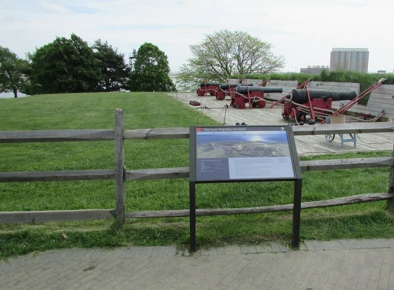
The Guns that Won the Battle Marker
| 101 ► Maryland, Baltimore, Locust Point Industrial Area — The Guns that Won the Battle — |
| Near East Fort Avenue. | |||
| 102 ► Maryland, Baltimore, Locust Point Industrial Area — The Guns That Won the Battle |
| Near East Fort Avenue. Reported permanently removed. | |||
| 103 ► Maryland, Baltimore, Locust Point Industrial Area — The Ravelin |
| Reported permanently removed. | |||
| 104 ► Maryland, Baltimore, Locust Point Industrial Area — This Tree Dedicated to Captain M.S. Bunbury — |
| Near Constellation Plaza, 0.1 miles east of Wallace Street, on the right when traveling east. | |||
| 105 ► Maryland, Baltimore, Locust Point Industrial Area — This Tree Dedicated to Captain William H. Addison — |
| Near Constellation Plaza, 0.1 miles east of Wallace Street, on the right when traveling east. | |||
| 106 ► Maryland, Baltimore, Locust Point Industrial Area — This Tree Dedicated to Charles Messenger — |
| Near Constellation Plaza, 0.1 miles east of Wallace Street, on the right when traveling east. | |||
| 107 ► Maryland, Baltimore, Locust Point Industrial Area — This Tree Dedicated to Colonel George Armistead — |
| Near Constellation Plaza, 0.1 miles east of Wallace Street, on the right when traveling east. | |||
| 108 ► Maryland, Baltimore, Locust Point Industrial Area — This Tree Dedicated to Colonel Joseph Sterett — |
| Near Constellation Plaza, 0.1 miles east of Wallace Street, on the right when traveling east. | |||
| 109 ► Maryland, Baltimore, Locust Point Industrial Area — This Tree Dedicated to Colonel Samuel Lane — |
| Near Constellation Plaza, 0.1 miles east of Wallace Street, on the right when traveling east. | |||
| 110 ► Maryland, Baltimore, Locust Point Industrial Area — This Tree Dedicated to Colonel William Steuart — 58th Inf. U. S. A. — |
| Near Constellation Plaza, 0.1 miles east of Wallace Street, on the right when traveling east. | |||
| 111 ► Maryland, Baltimore, Locust Point Industrial Area — This Tree Dedicated to Commodore John Rogers — U.S.N. — |
| Near Constellation Plaza, 0.1 miles east of Wallace Street, on the right when traveling east. | |||
| 112 ► Maryland, Baltimore, Locust Point Industrial Area — This Tree Dedicated to Commodore Joshua Barney, U.S.N. — |
| Near Constellation Plaza, 0.1 miles east of Wallace Street, on the right when traveling east. | |||
| 113 ► Maryland, Baltimore, Locust Point Industrial Area — This Tree Dedicated to Edward Johnson — |
| Near Constellation Plaza, 0.1 miles east of Wallace Street, on the right when traveling east. | |||
| 114 ► Maryland, Baltimore, Locust Point Industrial Area — This Tree Dedicated to General John Stricker — |
| Near Constellation Plaza, 0.1 miles east of Wallace Street, on the right when traveling east. | |||
| 115 ► Maryland, Baltimore, Locust Point Industrial Area — This Tree Dedicated to Major General Samuel Smith — |
| Near Constellation Plaza, 0.1 miles east of Wallace Street, on the right when traveling east. | |||
| 116 ► Maryland, Baltimore, Locust Point Industrial Area — This Tree Dedicated to Major Richard Heath — |
| Near Constellation Plaza, 0.1 miles east of Wallace Street, on the right when traveling east. | |||
| 117 ► Maryland, Baltimore, Locust Point Industrial Area — Welcome! You Are Now "On Post" — |
| Near East Fort Avenue, 0.3 miles east of Wallace Street, on the right when traveling east. | |||
| 118 ► Maryland, Baltimore, Madison Park — Francis Scott Key — |
| On Eutaw Place at West Lanvale Street, on the left when traveling north on Eutaw Place. | |||
| 119 ► Maryland, Baltimore, Middle Branch Park — On Guard — Star-Spangled Banner National Historic Trail — National Park Service, U.S. Department of the Interior — |
| On Waterview Avenue. | |||
| 120 ► Maryland, Baltimore, Mount Vernon — Francis Scott Key — |
| On East Mt. Vernon Place at North Charles Street, on the right when traveling west on East Mt. Vernon Place. | |||
| 121 ► Maryland, Baltimore, Mount Vernon — In Full Glory — Star-Spangled Banner National Historic Trail — National Park Service, U.S. Department of the Interior — |
| On West Monument Street. | |||
| 122 ► Maryland, Baltimore, Oldtown — Young Martyrs — Star-Spangled Banner National Historic Trail — National Park Service, U.S. Department of the Interior — |
| On Monument Street at Asquith Street on Monument Street. | |||
| 123 ► Maryland, Baltimore, Parkside — Furley Hall — |
| On Parkside Drive at Boehms Lane on Parkside Drive. | |||
| 124 ► Maryland, Baltimore, Patterson Park — Patterson Park — Civil War Camp and Hospital — |
| On Patterson Park Avenue. | |||
| 125 ► Maryland, Baltimore, Patterson Park — Prelude to War — Star-Spangled Banner National Historic Trail — War of 1812 — |
| On South Patterson Park Avenue. | |||
| 126 ► Maryland, Baltimore, Patterson Park — Show of Strength — Star-Spangled Banner National Historic Trail — War of 1812 — |
| On South Patterson Park Avenue. | |||
| 127 ► Maryland, Baltimore, Patterson Park — The Star-Spangled Banner Centennial Monument — |
| Near Patterson Park Avenue. | |||
| 128 ► Maryland, Baltimore, Patterson Park — This Cannon Marks Rodgers Bastion — 1814-1914 — |
| On Patterson Park Avenue. | |||
| 129 ► Maryland, Baltimore, Riverside — Fort Look-Out — |
| On East Randall Street at Riverside Avenue, on the right when traveling east on East Randall Street. | |||
| 130 ► Maryland, Baltimore, Riverside — Leone Riverside Park — |
| On Covington Street at Covington Street, on the left when traveling west on Covington Street. | |||
| 131 ► Maryland, Baltimore, Riverside — Strategic Post — Star-Spangled Banner National Historic Trail — National Park Service, U.S. Department of the Interior — |
| On East Randall Street. | |||
| 132 ► Maryland, Baltimore, Rosebank — First Invasion: The War of 1812 — [Senator Theatre] — |
| On York Road (Maryland Route 45) just south of Mix Court, on the right when traveling south. | |||
| 133 ► Maryland, Baltimore, University of Maryland — A Beloved General — |
| Near West Fayette Street at North Greene Street. | |||
| 134 ► Maryland, Baltimore, University of Maryland — Among the Illustrious Men — |
| Near North Greene Street near West Fayette Street. | |||
| 135 ► Maryland, Baltimore, University of Maryland — Final Rest — Star-Spangled Banner National Historic Trail — National Park Service, U.S. Department of the Interior — |
| On West Fayette Street. | |||
| 136 ► Maryland, Baltimore, University of Maryland — Local Hero, National Leader — |
| Near West Fayette Street near North Greene Street. | |||
| 137 ► Maryland, Baltimore, University of Maryland — National Independence in the Revolution and War of 1812 — |
| On West Redwood Street, on the right when traveling east. | |||
| 138 ► Maryland, Baltimore County, Dundalk — Home of the Brave — |
| On North Point Road at Kimberly Road, on the left when traveling west on North Point Road. | |||
| 139 ► Maryland, Baltimore County, Dundalk — Aquila Randall Monument — |
| On Old North Point Road, 0.1 miles south of Eleanor Terrace, on the left when traveling south. | |||
| 140 ► Maryland, Baltimore County, Dundalk — At Patapsco Neck — Star-Spangled Banner National Historic Trail — National Park Service, U.S. Department of the Interior — |
| On North Point Road. | |||
| 141 ► Maryland, Baltimore County, Dundalk — Battle Acre — September 12, 1814 — |
| On North Point Road (Maryland Route 20) at Kimberly Road, on the right when traveling south on North Point Road. | |||
| 142 ► Maryland, Baltimore County, Dundalk — Battle Ground Methodist Episcopal Church — |
| On North Point Road at Robinson Avenue, on the right when traveling west on North Point Road. | |||
| 143 ► Maryland, Baltimore County, Dundalk — Commodore Joshua Barney — 1759–1818 — |
| On Wise Avenue at Inverness Ave., on the left when traveling south on Wise Avenue. | |||
| 144 ► Maryland, Baltimore County, Dundalk — Defenders Honored — Star-Spangled Banner National Historic Trail — National Park Service, U.S. Department of the Interior — |
| On North Point Road. | |||
| 145 ► Maryland, Baltimore County, Dundalk — Delay Tactic — Star Spangled Banner National Historic Trail — National Park Service, U.S. Department of the Interior — |
| On North Point Road. | |||
| 146 ► Maryland, Baltimore County, Dundalk — Francis Scott Key Memorial Bridge — |
| On the Baltimore Beltway (Interstate 695), on the right when traveling west. | |||
| 147 ► Maryland, Baltimore County, Dundalk — General Robert Ross — |
| On North Point Blvd, on the right when traveling south. | |||
| 148 ► Maryland, Baltimore County, Dundalk — Hitting Home — Star Spangled Banner National Historic Trail — National Park Service, U.S. Department of the Interior — |
| On North Point Road. | |||
| 149 ► Maryland, Baltimore County, Dundalk — North Point Battlefield — |
| On Old North Point Road, 0.1 miles south of Eleanor Terrace, on the left when traveling south. | |||
| 150 ► Maryland, Baltimore County, Dundalk — North Point State Park - Sept. 12, 1814 Battlefield — Battle of North Point — |
| On North Point Boulevard (Maryland Route 151), on the right when traveling east. | |||
| 151 ► Maryland, Baltimore County, Dundalk — Proud of Our Stand — Star-Spangled Banner National Historic Trail — |
| On North Point Road, 0.1 miles east of Trappe Road, on the left when traveling east. | |||
| 152 ► Maryland, Baltimore County, Dundalk — Proud of Our Stand — Star-Spangled Banner National Historic Trail — War of 1812 — |
| On North Point Road. | |||
| 153 ► Maryland, Baltimore County, Dundalk — Squeeze Tactic — Star Spangled Banner National Historic Trail — War of 1812 — |
| On North Point Road. | |||
| 154 ► Maryland, Baltimore County, Dundalk — The Conflict upon this Battle Field — War of 1812 — |
| On North Point Road. | |||
| 155 ► Maryland, Baltimore County, Dundalk — To Honor the Heroes — Star Spangled Banner National Historic Trail — National Park Service, U.S. Department of the Interior — |
| On North Point Road. | |||
| 156 ► Maryland, Baltimore County, Dundalk — Witness to Battle — Star Spangled Banner National Historic Trail — National Park Service, U.S. Department of the Interior — |
| On North Point Road. | |||
| 157 ► Maryland, Baltimore County, Edgemere — Dreaded Alarm — Star-Spangled Banner National Historic Trail — National Park Service, U.S. Department of the Interior — |
| Near Old Bay Shore Road, 1.7 miles south of North Point Road, on the right when traveling south. | |||
| 158 ► Maryland, Baltimore County, Edgemere — North Point — September 12, 1814 — |
| On North Point Road (Maryland Route 20) at Lodge Farm Road, on the left when traveling south on North Point Road. | |||
| 159 ► Maryland, Baltimore County, Edgemere — Shaw Family Cemetery — |
| On Foulkes Farm Road at North Point Spur, on the left when traveling south on Foulkes Farm Road. | |||
| 160 ► Maryland, Baltimore County, Edgemere — Unexpected Resistance — Star-Spangled Banner National Historic Trail — |
| On North Point Spur at Bay Shore Road, on the right when traveling south on North Point Spur. | |||
| 161 ► Maryland, Baltimore County, Edgemere — War in the Chesapeake — Star-Spangled Banner National Historic Trail — |
| On North Point Spur at Bay Shore Road, on the right when traveling south on North Point Spur. | |||
| 162 ► Maryland, Baltimore County, Fort Howard — Battery Nicholson — |
| Near Fort Howard Park Road, 0.6 miles south of North Point Road (Old Maryland Route 20). | |||
| 163 ► Maryland, Baltimore County, Fort Howard — Fort Howard — |
| On Gettysburg Avenue, 0.3 miles south of North Point Road (Maryland Route 20), on the right when traveling south. | |||
| 164 ► Maryland, Baltimore County, Fort Howard — North Point Beachhead — |
| On Gettysburg Avenue, 0.1 miles North Point Road, on the right when traveling south. | |||
| 165 ► Maryland, Baltimore County, Fort Howard — The Landing — Star-Spangled Banner National Historic Trail — War of 1812 — |
| On North Point Road. | |||
| 166 ► Maryland, Baltimore County, Fort Howard — Todd’s Inheritance — (National Register of Historic Places) — |
| On North Point Road (Maryland Route 20) 0.3 miles south of McComas Road, on the left when traveling south. | |||
| 167 ► Maryland, Baltimore County, Fort Howard — Todd’s Inheritance — Citizens in Harm’s Way |
| On North Point Road (Maryland Route 20) 0.3 miles south of McComas Road, on the left when traveling south. Reported missing. | |||
| 168 ► Maryland, Baltimore County, Pikesville — The Old United States Arsenal — |
| On Reisterstown Road (Maryland Route 140) at Sudbrook Lane, on the right when traveling north on Reisterstown Road. | |||
| 169 ► Maryland, Baltimore County, Sparrows Point — A Heavy Price — Star-Spangled Banner National Historic Trail — War of 1812 — |
| On North Point Road. | |||
| 170 ► Maryland, Baltimore County, Towson — Hometown Hero — Star-Spangled Banner National Historic Trail — War of 1812 — |
| On Washington Avenue. | |||
| 171 ► Maryland, Baltimore County, Towson — Nicholas Ruxton Moore — 1736–1816 — |
| On Bellona Avenue at Malvern Avenue, on the left when traveling south on Bellona Avenue. | |||
| 172 ► Maryland, Baltimore County, Towson — War of 1812 Cannon — |
| Near Delaney Valley Road. | |||
| 173 ► Maryland, Baltimore County, Towson — Wartime Support — Star Spangled Banner National Historic Trail — War of 1812 — |
| On Hampton Lane. | |||
| 174 ► Maryland, Baltimore County, Woodbrook — Fire Power — Star-Spangled Banner National Historic Trail — |
| Near Lakeside Drive. | |||
| 175 ► Maryland, Calvert County, Huntingtown — Warships and Raids — |
| Near Kings Landing Road, 2.5 miles west of Huntingtown Road. | |||
| 176 ► Maryland, Calvert County, Lower Marlboro — Lower Marlboro — Calvert County — Port town to “front porch” town in 300 years |
| On Lower Marlboro Rd. (Maryland Route 262) west of Southern Maryland Blvd. (Maryland Route 4). Reported missing. | |||
| 177 ► Maryland, Calvert County, Lower Marlboro — Town Ravaged — Star-Spangled Banner National Historic Trail — War of 1812 — |
| On Lower Marlboro Road. | |||
| 178 ► Maryland, Calvert County, Lusby — Morgan Hill Farm — |
| On Sollers Wharf Road at Wohlgemuth Road, on the right when traveling south on Sollers Wharf Road. | |||
| 179 ► Maryland, Calvert County, Owings — A County in Ruin — Star-Spangled Banner National Historic Trail — War of 1812 — |
| On Southern Maryland Blvd (SR 4). | |||
| 180 ► Maryland, Calvert County, Prince Frederick — British Vengeance — Star-Spangled Banner National Historic Trail — War of 1812 — |
| On Hollowing Point Road. | |||
| 181 ► Maryland, Calvert County, Prince Frederick — Joseph & James Wilkinson — Two revolutionary leaders who grew up on farm south of Hunting Creek |
| Near Stoakley Road at Solomons Island Road (Maryland Route 2/4), on the right when traveling west. Reported missing. | |||
| 182 ► Maryland, Calvert County, Prince Frederick — Panic in Prince Frederick — |
| On Main Street (Maryland Route 765) at Duke Steet, on the right when traveling south on Main Street. | |||
| 183 ► Maryland, Calvert County, Solomons — Apt Anchorage — Star-Spangled Banner National Historic Trail — War of 1812 — |
| On Thomas Johnson Road. | |||
| 184 ► Maryland, Calvert County, Solomons — Enemy Blockade — Star-Spangled Banner National Historic Trail — National Park Service, U.S. Department of the Interior — |
| On Farren Avenue. | |||
| 185 ► Maryland, Calvert County, Solomons — Menace on the Horizon — Star-Spangled Banner National Historical Trail — National Park Service, U.S. Department of the Interior — |
| Near Solomons Island Road South (Route 2) just south of Thomas Johnson Road, on the left when traveling south. | |||
| 186 ► Maryland, Calvert County, Solomons — Perils along the Patuxent — Star-Spangled Banner National Historic Trail — War of 1812 — |
| On Solomons Island Road. | |||
| 187 ► Maryland, Calvert County, Solomons — Solomon's Island — |
| On Solomons Island Road South. | |||
| 188 ► Maryland, Calvert County, St. Leonard — “The Commodore Can Beat Any…Barges…Sent Against Him” — Maryland Republican, June 18, 1814 — Second Battle of St. Leonard Creek — |
| On Jefferson Patterson Park Road. | |||
| 189 ► Maryland, Calvert County, St. Leonard — “We Must Have Done Them Considerable Damage” — Captain Joshua Barney June 11, 1814 — First Battle of St. Leonard Creek — |
| On Jefferson Patterson Park Road. | |||
| 190 ► Maryland, Calvert County, St. Leonard — A Place in Chesapeake History — |
| 191 ► Maryland, Calvert County, St. Leonard — Early Settlements — |
| On Parran Road at Solomons Island Road (Maryland Route 2/4), on the right when traveling west on Parran Road. | |||
| 192 ► Maryland, Calvert County, St. Leonard — Fate of the Flotilla — Star-Spangled Banner National Historic Trail — War of 1812 — |
| On Jefferson Patterson Park Road. | |||
| 193 ► Maryland, Calvert County, St. Leonard — John Stuart Skinner — Witness to Fort’s Bombardment — |
| On Jefferson Patterson Park Road. | |||
| 194 ► Maryland, Calvert County, St. Leonard — June 1814 — War Visits the Patuxent — Battle At The Mouth of St. Leonard Creek — |
| Near Mackall Road. | |||
| 195 ► Maryland, Calvert County, St. Leonard — Land Battle Evidence — Artifacts Key to Battlefield — Possible Site of American Cannon Battery — |
| On Jefferson Patterson Park Road. | |||
| 196 ► Maryland, Calvert County, St. Leonard — Naval Warfare — Barges, Boats, & Frigates — The Opposing Forces — |
| On Jefferson Patterson Park Road. | |||
| 197 ► Maryland, Calvert County, St. Leonard — St. Leonard Creek — Scene of naval battles during War of 1812 — |
| On Parran Road at Solomons Island Road (Maryland Route 2/4), on the right when traveling west on Parran Road. | |||
| 198 ► Maryland, Calvert County, St. Leonard — The Search for the Chesapeake Flotilla — High Technology Locates Ships — |
| On Jefferson Patterson Park Road. | |||
| 199 ► Maryland, Calvert County, St. Leonard — The War of 1812 Living History — A Living Legacy — |
| On Jefferson Patterson Park Road. | |||
| 200 ► Maryland, Calvert County, St. Leonard — Turning Point — Star-Spangled Banner National Historic Trail — War of 1812 |
| On St. Leonard Road. Reported unreadable. | |||
454 entries matched your criteria. Entries 101 through 200 are listed above. ⊲ Previous 100 — Next 100 ⊳