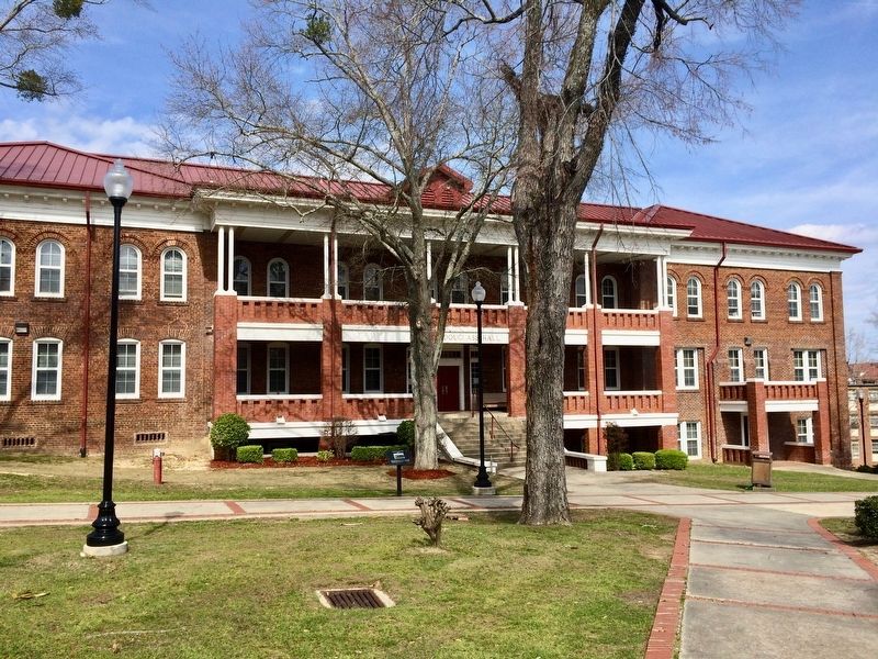
Named for Frederick Douglass, famed runaway slave, abolitionist and statesman. Douglass came to Tuskegee in 1892 and delivered the 11th Annual Commencement address in which he "urged economy, thrift and common sense." Those words of Douglass . . . — — Map (db m101908) HM
Family and Early Political Life
William Henry Seward was born in Florida, New York, on May 16, 1801. His father, a wealthy landowner, was a slaveholder prior to New York abolishing slavery in 1827. Seward would later become instrumental in . . . — — Map (db m181752) HM
Mother of Civil Rights in California.
She supported the western terminus of the underground railway for fugitive slaves, 1850-1865. This legendary pioneer once lived on this site and planted these six trees.
Placed by the San . . . — — Map (db m85557) HM
The significance of 1514 Blake St. lies in its connection to the remarkable life of black pioneer Barney Ford. Ford was born a slave on January 22, 1822 in Stafford, Virginia, but escaped to Chicago, where he worked with the underground railroad . . . — — Map (db m118597) HM
Known in the 1800’s as “the hub” of Connecticut’s Underground Railroad, Farmington was home to an active group of prominent and outspoken abolitionists, several of whom were involved in state, national and international anti-slavery . . . — — Map (db m95984) HM
First speech in Hartford on the grounds of this Church May 18, 1843
"[We found several towns in which people closed their doors and refused to entertain the subject. Notably among those were Hartford, Conn., and Grafton, Mass. . . . — — Map (db m151933) HM
Tales from the City
Walter Camp “Father of American Football”
Walter Camp, known as the “Father of American Football”, was born in New Britain on April 7, 1859. Camp played football at Yale University between 1876 and 1882, and then served . . . — — Map (db m259592) HM
The Underground Railroad
Led by George Read, Founder of the Town’s Ivory Industry, Deep River Became Known in the Nineteenth Century as "All Abolitionist" and a Refuge for Runaway Slaves on the Underground Railroad. In 1828, Daniel Fisher, a . . . — — Map (db m100312) HM
On this site, on a spring evening in 1834, a violent mob descended on a small group of Middletown residents who had come together to work towards abolishing slavery. The abolitionists, both black and white citizens, were members of the newly . . . — — Map (db m71118) HM
Across Lyme Street
Enslaved
by Dr. John Noyes
Willed 1733
to Mary Hudson Noyes
Freed by Mary Noyes Ely 1743
"to be his own man" — — Map (db m268184) HM
John Brown, the abolitionist, was born at this site on May 9, 1800. He dedicated his life to ending slavery in the United States. Brown became a spokesperson for those abolitionists who believed that slavery could only be eliminated by force. He is . . . — — Map (db m30187) HM
This house was built facing the Green in 1770 and was drawn here by 70 oxen in 1829. It was owned by Dr. Lyman Beecher father of Henry Ward Beecher and Harriet Beecher Stowe who wrote Uncle Tom's Cabin — — Map (db m299369) HM
Rev. Aron Dutton and 123 members of the First Congregational Church, passionate abolitionists, were granted dismissal from that congregation. They built this structure, which served as the Third Congregational Church until 1920. In the 1930s and . . . — — Map (db m264831) HM
[ south side ]
“Make Us Free”
This monument is a memorial to the 1839 Amistad Revolt and its leader, Sengbe Pieh, also known as Joseph Cinque. Sengbe Pieh was one of the millions of Africans kidnapped from their homes and . . . — — Map (db m48428) HM
Roger Sherman Baldwin was born in 1793
in New Haven. He attended Hopkins
School, and later graduated from Yale
College with high honors in 1811. After
leaving Yale he studied law in his father's
office in New Haven, and was admitted to
the . . . — — Map (db m270020) HM
A 19th century abolitionist and social activist
born in New Haven. He is known for his attempt
to establish an African American college in
New Haven and for
his role in the
Amistad affair.
An intensely
debated issue,
Jocelyn's . . . — — Map (db m269664) HM
Simeon S. Jocelyn (1799-1879) founded the African Ecclesiastical Society for [indecipherable] slaves in New Haven, CT, in 1820.
They acquired a church building in 1824, the Temple Street Congregational Church, now the Dixwell Avenue . . . — — Map (db m294333) HM
On this site, September 30, 1858, Police Court Judge Augustus H. Brandegee and Customs Collector John Perkings Mather freed a stowaway slave known as “Joe” by applying Connecticut’s Personal Liberty Law against the federal Fugitive Slave Act. Judge . . . — — Map (db m66445) HM
On this site, August 29. 1839, federal investigative inquiry indicted 38 enslaved Mende Africans accused of revolt on the high seas and murder of the Captain and cook of the Spanish slave ship Amistad which was captured and brought into New . . . — — Map (db m66444) HM
This has been a racially mixed neighborhood since at least 1850. In part this is due to the efforts of a passionate white abolitionist, Avillion Haley (1805-1866). In 1842 Haley purchased a tract of land occupying about half the block between . . . — — Map (db m227221) HM
Free African Americans have lived and worked in this neighborhood since colonial times. In the 1840s both blacks and whites bought home (some still standing) through the efforts of abolitionist and developer, Savillion Haley. Travelers on the . . . — — Map (db m48364) HM
In the spring of 1761, the schooner Speedwell left the west coast of Africa with ninety-five captive Africans crowded beneath her deck. By the time it arrived in New London, Connecticut on July 17, only seventy-four were still alive. The . . . — — Map (db m216604) HM
In the summer of 1839, the Amistad, a Spanish coastal schooner with 39 kidnapped Africans aboard, was found in Long Island Sound and brought to New London. The captives, who had been sold into slavery in Cuba, had taken over the ship and . . . — — Map (db m48324) HM
On June 28, 1839, the schooner Amistad set sail from Havana with fifty-three captive Africans: forty-nine adult males and four children, three of them girls. Four days later, in a life and death struggle for freedom, the Africans killed the . . . — — Map (db m216607) HM
Paul Cuffe was the son of Ruth Moses, a Wampanoag woman, and Kofi Slocum* a man from West Africa brought to Massachusetts as an enslaved person. Kori gained his freedom, but died when Paul was young. Paul began a career at sea at the age of 14 on . . . — — Map (db m227102) HM
This house was built in 1839 for George and Abigail Greenman. He was the oldest of the three brothers who founded the George Greenman & Co. Shipyard. The three brothers lived here until Clark Greenman built his house next door on your right in . . . — — Map (db m114829) HM
Located in Pequot territory and used for millennia by Indigenous people, it was later colonized by Europeans who displaced local Indigenous peoples. Mystic is also the notorious site of one the most brutal massacres of Indigenous people in . . . — — Map (db m227055) HM
During the era of slavery, African Americans played a major role in oystering. Thomas Downing, a notable abolitionist who was the "Oyster King" of New York City, built an empire out of an oyster bar. He made his fortune in oysters as an . . . — — Map (db m226979) HM
Travel aboard a ship was often a much safer route to freedom than attempting an escape from enslavement on land. Some of the Underground Railroad's bravest conductors were sea captains. Escape by sea required much ingenuity. In 1854, . . . — — Map (db m226993) HM
It was a harrowing undertaking, requiring courage and determination, on the part of those who followed the Underground Railroad north to freedom in Antebellum America for both the escaping slaves and those who offered sanctuary. New Milford . . . — — Map (db m230244) HM
This plaque is dedicated to the memory of slaves.
In the middle of the 1800's, the Underground Railroad was organized with a true commitment to freedom.
New Milford, Connecticut was a road to freedom used to escape into Canada.
In . . . — — Map (db m230242) HM
Chief engineer of the Underground Rail Road in the State of Del. and the richest man in Del. He was convicted and fined in 1846 by the U.S. Dist. Court, later he was fined twice for $10,000.00 each by Del. but was advised the fines wouldn't be . . . — — Map (db m294630) HM
Brinkley Hill was a free black community that acted as a stop on the Underground Railroad. Brothers William and Nathaniel Brinkley aided Harriet Tubman on numerous occasions, including her documented "Tilly Escape." William guided many . . . — — Map (db m286297) HM
Founded 1783 on the tract “Brecknock” by Daniel Mifflin and settled largely by Quakers. Once called Piccadilly and Mifflins Cross Roads. Incorporated 1852, it was a center of anti-slavery sentiment. Several homes were by tradition stops on the . . . — — Map (db m168332) HM
This house of worship, built in 1805, was first a Preparative Meeting under the care of Motherkiln (Murderkill) Monthly Meeting of the Religious Society of Friends (Quakers). In 1830, Camden Monthly Meeting was formed by uniting with Motherkiln and . . . — — Map (db m39513) HM
Zion African Methodist Episcopal Church-The roots of this congregation can be traced to 1845, when a group of local residents met to formally organize Zion African Methodist Episcopal Church. With several churches established in the area by free . . . — — Map (db m141317) HM
These two words say a great deal about Dover. It is a modern and growing city entering the 21st century on a foundation of achievement built over more than 300 years of American history.
And a rich history it is. Founded by William Penn in . . . — — Map (db m142501) HM
The Georgian Architecture of Poplar Hall, John Dickinson's Delaware home, suited his orderly mind and refined tastes. Built by his parents, Samuel Dickinson and Mary Cadwalader in 1740, enlarged in the 1750s, the house dominated a 5,000 acre . . . — — Map (db m284904) HM
A native of Virginia's Eastern Shore, Mifflin came to Delaware as a young man. Born into a slaveholding Quaker family, he manumitted his own slaves in 1774-75 and later became one of America's foremost abolitionists of the 18th century. As an elder . . . — — Map (db m39456) HM
Born into a slaveholding Quaker family in Virginia and later becoming an abolitionist. Warner Mifflin came to Delaware as a young man. An elder of the Religious Society of Friends, he traveled extensively to convince others to free their slaves, . . . — — Map (db m282793) HM
Samuel D. Burris, a free African-American conductor on the Underground Railroad resided in the Willow Grove area during the 1840s. He helped enslaved people find their pathway to freedom in Philadelphia. Caught for aiding and abetting runaway slaves . . . — — Map (db m142503) HM
Near this location were the farms of John Alston (1794-1872) and John Hunn (1818-1894), cousins who shared the Quaker faith and were well documented operatives on Delaware's Underground Railroad. John Alston sometimes employed fugitives as laborers . . . — — Map (db m88341) HM
The civil war officially began on April 12, 1861 when Confederate forces bombarded the Union controlled Fort Sumter.
Delaware was a Border . . . — — Map (db m238413) HM
Believed to be one of the smallest Quaker Meeting Houses in the nation, the Appoquinimink Friends Meeting House was built in 1785 by David Wilson and presented to the Friends as a gift. Local tradition identifies this structure as a stop on the . . . — — Map (db m269792) HM
Built in the mid-eighteenth century by Captain David Clark, Clearfield Farm was the home of his grandson John Clark (1761 -1821), Governor of Delaware from 1817 -1820. John Clark served as Colonel in the Delaware Militia and as Justice of the Peace . . . — — Map (db m69112) HM
"The Rocks," a natural landing on the Christina River, was critical to Wilmington's Underground Railroad network. Captain James Watson Fountain outfitted a schooner to secretly carry freedom-seekers north from North Carolina and Virginia. Black . . . — — Map (db m226518) HM
Abraham Doras Shadd (1801-1882) was the grandson
of Hans and Elizabeth Schad, a Hessian soldier and
free Black woman who settled in Delaware in the
1770s. Abraham was a shoemaker and a well-known
abolitionist in Wilmington who aided freedom . . . — — Map (db m191564) HM
The Rocks by Moonlight - Freedom's Landing
The Rocks were used by abolitionist sea captains and freedom-seeking fugitive slaves as a landing site in Wilmington's Underground Railroad network. Located in today's Fort Christina Park, a . . . — — Map (db m287071) HM
Grew from New-Wark Meeting established 1682. Present house is third in this vicinity. Friends School begun here in 1748 has operated continuously. Among 3,000 buried in yard are founders of Wilmington, John Dickinson, "Penman of the Revolution," and . . . — — Map (db m10943) HM
Born August 21, 1789, in Upper Darby, Pennsylvania, Garrett came to Wilmington in 1822. A prominent merchant, his home and business were located nearby on Shipley Street. Garrett was committed to the anti-slavery efforts of his Quaker faith. He is . . . — — Map (db m67356) HM
The first Meeting House on this site was built in 1738. It was replaced in 1748 when a larger building was constructed. The old Meeting House was then converted into a school. Known as Wilmington Friends School, it was relocated to a new facility in . . . — — Map (db m10941) HM
By the late 1700s the institution of slavery was declining in Delaware. A changing economy and the active efforts of Quakers and Methodists had led to the manumission of many slaves and dramatic growth of the state’s free black population. Though . . . — — Map (db m168333) HM
By the late 1700s the institution of slavery was declining in Delaware and there was a dramatic growth in the state's free black population. Demand for slave labor in the Deep South continued to grow and large numbers of free blacks were . . . — — Map (db m215946) HM
On March 10, 1999, this site was officially proclaimed as the Tubman-Garrett Riverfront Park by the Riverfront Development Corporation of Delaware
The Underground Railroad Memorial Plaque was originally erected in 1976 at Spencer Plaza by . . . — — Map (db m184944) HM
Thomas Garrett, John Hunn, Ezekial Jenkins, Samual D. Burris, and many other Delawareans were prominent abolitionists of pre-Civil War days. Their activities with Harriet Tubman, an escaped slave from Dorchester County, Maryland, frequently referred . . . — — Map (db m184942) HM
This monument sheds light on the facts that citizens here felt so strongly during the Civil War that they left their state, farms, businesses and families to head south to enlist. Delaware men served in units from Virginia to Texas. The journey . . . — — Map (db m199250) HM
This monument sheds light on the facts that citizens here felt so strongly during the Civil War that they left their state, farms, businesses and families to head south to enlist. Delaware men served in units from Virginia to Texas. The journey . . . — — Map (db m258114) HM
In October 1856, famed Underground Railroad conductor Harriet Tubman organized what is considered by Tubman scholars to be "one of her most complicated and clever escape attempts." Working at the request of a fiancé who had escaped to Canada, Tubman . . . — — Map (db m138271) HM
Orator - Publisher - Statesman
Precursor of the Civil Rights Movement
An ex-slave who rose to world renown as an abolitionist and who served in high government posts under presidents Grant through Cleveland, Frederick Douglass resided in this . . . — — Map (db m69264) HM
In grateful memory of Abraham Lincoln. This monument was erected by the Western Sanitary Commission of Saint Louis, Mo., with funds contributed solely by emancipated Citizens of the United States declared free by his Proclamation, January 1st . . . — — Map (db m41617) HM
Today's Walter Pierce Park was once the site of two cemeteries—the Friends (Quaker) Burying Ground, in use from 1807 to 1890, and Mt. Pleasant Plains Cemetery, where more than 8,400 African Americans were buried between 1870 and 1890. . . . — — Map (db m236776) HM
Mt. Pleasant Plains Cemetery was the final resting place for some of the passengers and conductors of the largest Underground Railroad operation in history: the escape on the sailing ship Pearl. In April 1848, after months of planning, . . . — — Map (db m236777) HM
The Civil War changed Washington, as Union troops poured into the city to secure it, and thousands of refugees from slavery arrived here seeking freedom. More than 40 African American soldiers and sailors were later buried at Mt. . . . — — Map (db m236779) HM
Organized 1832.
2nd Church Built 1833.
Admitted to Philadelphia-Baltimore Conference, 1837.
3rd Church Built 1888.
Relocated present site, 1956.
Bishop Raymond Luthe Jones, Presiding Bishop, 4th Episcopal District.
Dr. William B. . . . — — Map (db m11042) HM
"...watch yourselves closely
so that you do not forget the things
your eyes have seen...
...teach them
to your children
and to their children
and to their children after them."
Deuteronomy 4:9
Stories . . . — — Map (db m70316) HM
"…watch yourselves closely
so that you do not forget the things
your eyes have seen…
…teach them
to your children
and to their children
and to their children
after them."
Deuteronomy 4:19
"The churches are needed as never before for divine services.
So said President Lincoln from his pew in New York Avenue Presbyterian Church. While other churches were occupied by the federal government and . . . — — Map (db m211822) HM
The Thaddeus Stevens Elementary School was one of the first publicly funded schools for African-American children in Washington, DC after the abolition of slavery in 1865. Built in 1868, the school is named after abolitionist and U.S. congressman . . . — — Map (db m283661) HM
Billions for the war
and a bunker
for the president
The grand, pillared United States Treasury building that stands before you was the financial command center for the Union during the Civil War. It was here between 1861 and 1865 . . . — — Map (db m130491) HM
Origins
Franklin Park was never supposed to exist. Unlike many other parks in Washington, DC, this land was not set aside for any special purpose. However, the natural springs that emerged from the ground here created a gathering place for . . . — — Map (db m240159) HM
Fire Fact, November 28, 1911
DC's first motorized fire engine was placed in service at Engine Company 24. Its engine house was the first to be built without a stable and manure pit.
Caption: Fire Department information and images . . . — — Map (db m112658) HM
Images Courtesy Of: Library of Congress, Prints and Photographs Division • DC Public Library, Washingtoniana Division • Heurich House Museum • Women's National Democratic Club Archives • Michael Cianciosi Private Collection, Potomac Bottle . . . — — Map (db m110851) HM
From 1890 to 1910, some of the nation’s finest architects built mansions at or near Dupont Circle in Queen Anne, Richardsonian Romanesque, Italian Renaissance or Colonial Revival style.
Wealthy couples living elsewhere built most of the . . . — — Map (db m89393) HM
Leonard A. Grimes, a Black man born free in Leesburg, Virginia, owned a residence on this corner from 1836 to 1846.
In the 1830s, he owned a successful coach business transporting passengers in and around Washington. He also carried slaves . . . — — Map (db m46970) HM
What is seen, and sometimes not seen, on the landscape informs the process of understanding history and historic preservation. If you look up and around, what do you see?
In 1804, Dumbarton House sat on an urban farm owned by Joseph Nourse . . . — — Map (db m189266) HM
You are standing in the heart of a once thriving African American community. At the time of the American Revolution in 1776, one third of Georgetown's population was African American. By the time of the Civil War in the 1860s, many former slaves . . . — — Map (db m110018) HM
Mt. Zion Cemetery
(Old Methodist Burial Ground)
1809 - 1950s
Female Union Band Society
Cemetery
1842 - 1950s
have been listed in the
National Register of Historic Places
by the
United States Department of the . . . — — Map (db m189267) HM
The house at #4 Logan Circle, built in 1878, was the 1880's home of Senator John A. Logan. In the Civil War, Logan's military valor helped to save the Union. In the postwar era, Logan lived here as a political leader deeply committed to achieving . . . — — Map (db m153985) HM
The house at #4 Logan Circle, built in 1878, was the 1880's home of Senator John A. Logan. In the Civil War, Logan's military valor helped to save the Union. In the postwar era, Logan lived here as a political leader deeply committed to achieving . . . — — Map (db m195513) HM
The wooden chapel here was completed in 1857 as a mission of the McKendree Methodist Church. Known as Fletcher Chapel, it may have been a stop on the Underground Railroad.
Washington's Anti-Saloon League began meeting at Fletcher Chapel . . . — — Map (db m130898) HM
Second Baptist Church was organized in 1848 by seven members of the Nineteenth Street Baptist Church. Under the leadership of the Reverend Sandy Alexander — eventually one of the country's best-known black Baptist ministers — the church purchased . . . — — Map (db m152617) HM
Designated a D.C. Landmark in 1960, the Rest (pictured here) is Tenleytown's oldest residence (built around 1800) and is located at the corner of Windom Place and 39th Street. Local legend maintains that the bricks for the house were brought over . . . — — Map (db m112187) HM
President Lincoln and his family lived in this country home for over a quarter of his presidency. Escorted by his cavalry guard, Lincoln rode to the White House every morning either on horseback or by carriage, and returned here each evening to . . . — — Map (db m52838) HM
To your right at the end of Indiana Avenue is Washington's first City Hall/Courthouse. Across Sixth Street is the H. Carl Moultrie I Courthouse, a successor to the original courthouse. The Old City Hall/Courthouse opened in 1822, with . . . — — Map (db m56124) HM
A Famed orator and writer Frederick Douglass was also a key architect of the movement that ended slavery, the very institution into which he was born. Even after his goal to abolish slavery was achieved, Douglass persisted in his struggle for . . . — — Map (db m92084) HM
Harriet Tubman escaped a life of slavery only to return south, at her own peril, time and again, to lead more than 300 fugitive slaves through the Underground Railroad to safety and freedom. After the Civil War, Tubman raised money to clothe and . . . — — Map (db m91877) HM
Julia Ward Howe (1819-1910) was a poet, author, composer, abolitionist, suffragist and more—but she is most remembered for writing the lyrics to The Battle Hymn of the Republic. According to the story, she and her husband were asleep at the . . . — — Map (db m141266) HM