After filtering for Maryland, 836 entries match your criteria. The first 100 are listed. ⊳
African Americans Topic
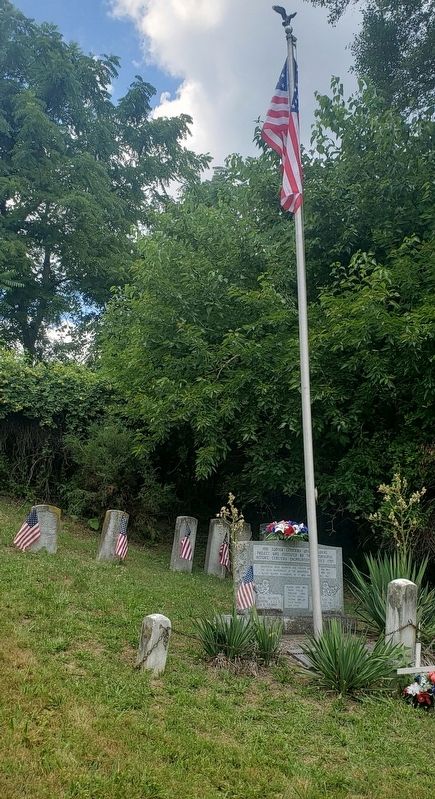
By Bradley Owen, June 30, 2021
30th Regiment Infantry U.S.C.T. Marker
| 1 ► Maryland, Allegany County, Cumberland — 30th Regiment Infantry U.S.C.T. — |
| On Yale Street, 0.2 miles north of Baltimore Avenue (County Route 743), on the left when traveling north. | |||
| 2 ► Maryland, Allegany County, Cumberland — Crossroads of America Mural — |
| On Canal Street, 0.1 miles north of West Harrison Street, on the left when traveling north. | |||
| 3 ► Maryland, Allegany County, Cumberland — Lynching in America / Lynching in Allegany County — Community Remembrance Project — |
| On Prospect Square just south of Washington Street, on the left when traveling south. | |||
| 4 ► Maryland, Allegany County, Cumberland — Metropolitan A.M.E. Church — Decatur Street — 309 Frederick Street — |
| On Decatur Street just east of Frederick Street, on the right when traveling west. | |||
| 5 ► Maryland, Allegany County, Frostburg — Honoring Brownsville / Park Avenue — |
| Near East College Avenue at Wood Street, on the right when traveling east. | |||
| 6 ► Maryland, Allegany County, Frostburg — Public Safety Building — |
| On University Drive south of Planetarium Drive, on the right when traveling south. | |||
| 7 ► Maryland, Anne Arundel County, Annapolis — A Community Legacy — West Street — The Banneker-Douglass Museum — |
| On West Street (Maryland Route 450) west of Church Circle, on the right when traveling west. | |||
| 8 ► Maryland, Anne Arundel County, Annapolis — Annapolis During The Civil War — Annapolis Charter 300 1708-2008 — Commemorating the 1708 Royal Charter under Queen Anne to the City of Annapolis — |
| On Taylor Avenue (Maryland Route 435) at Westgate Circle, on the right when traveling north on Taylor Avenue. | |||
| 9 ► Maryland, Anne Arundel County, Annapolis — Asbury United Methodist Church — |
| On West Street (Maryland Route 450) at West Washington Street, on the right when traveling east on West Street. | |||
| 10 ► Maryland, Anne Arundel County, Annapolis — Bates: The Center of Community Life — 1931 - 1966 — |
| On Smithville Street, 0.1 miles east of South Villa Street, on the left when traveling west. | |||
| 11 ► Maryland, Anne Arundel County, Annapolis — Bates: The Community Commitment — 1966 - 2006 — |
| On Smithville Street, 0.1 miles east of South Villa Avenue, on the left when traveling west. | |||
| 12 ► Maryland, Anne Arundel County, Annapolis — Brown-Leanos Memorial Park — |
| On West Street (Maryland Route 450) at Spa Road (Maryland Route 387), in the median on West Street. | |||
| 13 ► Maryland, Anne Arundel County, Annapolis — Charles Carroll House North Porch — |
| Near Duke of Gloucester Street. | |||
| 14 ► Maryland, Anne Arundel County, Annapolis — Clay Street Community Montage — Annapolis Charter 300 1708-2008 — |
| On Clay Street west of Calvert Street. | |||
| 15 ► Maryland, Anne Arundel County, Annapolis — Dred Scott, 1799 - 1858 — Freedom Denied by the United States Supreme Court — |
| On State Circle. | |||
| 16 ► Maryland, Anne Arundel County, Annapolis — Gateway to Discovery — Annapolis — |
| Near Dock Street, 0.1 miles Market Space when traveling east. | |||
| 17 ► Maryland, Anne Arundel County, Annapolis — George H. Phelps, Jr. — Visionaries of the 1960s — August 5, 1926 — |
| On West Street (Maryland Route 450) at Brewer Avenue, on the right when traveling west on West Street. | |||
| 18 ► Maryland, Anne Arundel County, Annapolis — Governor Sir Francis Nicholson and Bloomsbury Square — |
| On College Avenue (Maryland Route 450) at Bladen Street, on the left when traveling east on College Avenue. | |||
| 19 ► Maryland, Anne Arundel County, Annapolis — John Snowden Memorial — |
| Near West Street (Maryland Route 450) at Brewer Avenue. | |||
| 20 ► Maryland, Anne Arundel County, Annapolis — Kunte Kinte-Alex Haley Memorial — |
| On Main Street at Compromise Street, on the left when traveling south on Main Street. | |||
| 21 ► Maryland, Anne Arundel County, Annapolis — Kunte Kinte-Alex Haley Memorial — |
| On Memorial Circle. | |||
| 22 ► Maryland, Anne Arundel County, Annapolis — Leonard A. Blackshear Walk — A pathway to reconciliation and healing — 1943 - 2006 — |
| On Main Street at Compromise Street, on the left when traveling south on Main Street. | |||
| 23 ► Maryland, Anne Arundel County, Annapolis — Matthew Alexander Henson — Co-discoverer of the North Pole — |
| Near State Circle. | |||
| 24 ► Maryland, Anne Arundel County, Annapolis — Maynard-Burgess House — Rehabilitation and Adaptive Use Project — Together! We're Building a Strong Annapolis Future. — |
| On Duke of Gloucester Street just west of Market Street, on the right when traveling east. | |||
| 25 ► Maryland, Anne Arundel County, Annapolis — On this site on November 25, 1960 — |
| On West Street (Maryland Route 450) at Lafayette Avenue, on the left when traveling east on West Street. | |||
| 26 ► Maryland, Anne Arundel County, Annapolis — Original Bates Flagpole — |
| On Smithville Street, 0.1 miles east of South Villa Avenue, on the right when traveling east. | |||
| 27 ► Maryland, Anne Arundel County, Annapolis — Remembering the Foot Soldiers of the March on Washington — Civil Rights Foot Soldiers Memorial — |
| On Calvert Street at Clay Street on Calvert Street. | |||
| 28 ► Maryland, Anne Arundel County, Annapolis — Roger Brooke Taney, 1777 - 1864 — Chief Justice of the United States Supreme Court — |
| On State Circle. | |||
| 29 ► Maryland, Anne Arundel County, Annapolis — 3 — Sally Wern Comport's "Shaping a City" — Annapolis Charter 300 1708-2008 — |
| On Compromise Street north of Newman Street, on the left when traveling north. | |||
| 30 ► Maryland, Anne Arundel County, Annapolis — Sharpening Our Governing Teeth: The 1708 Charter of Annapolis — Annapolis Charter 300 1708-2008 — Commemorating the 1708 Royal Charter under Queen Anne to the City of Annapolis — |
| On West Street (Maryland Route 450) at Westgate Circle, in the median on West Street. | |||
| 31 ► Maryland, Anne Arundel County, Annapolis — State House Square — |
| On College Avenue (Maryland Route 450) near Bladen Street. | |||
| 32 ► Maryland, Anne Arundel County, Annapolis — The Old Fourth Ward — 1941 - 1951 — |
| On West Street (Maryland Route 450) at West Washington Street, on the right when traveling west on West Street. | |||
| 33 ► Maryland, Anne Arundel County, Annapolis — Thurgood Marshall — 1908-1993 — Equal Justice Under Law — |
| Near State Circle. | |||
| 34 ► Maryland, Anne Arundel County, Annapolis — Weeping Cherry Tree — |
| On Smithville Street just east of South Villa Avenue, on the right when traveling east. | |||
| 35 ► Maryland, Anne Arundel County, Annapolis — Welcome to the Wiley H. Bates Memorial Courtyard — |
| On Smithville Street, 0.1 miles east of South Villa Avenue, on the right when traveling east. | |||
| 36 ► Maryland, Anne Arundel County, Annapolis — Who was Henry Davis? — Maryland Lynchings — |
| Near West Street (Maryland Route 450) at Brewer Avenue. | |||
| 37 ► Maryland, Anne Arundel County, Annapolis — Wiley H. Bates — August 1, 1859 - April 1, 1935 — |
| On Smithville Street, 0.1 miles east of South Villa Avenue, on the left when traveling west. | |||
| 38 ► Maryland, Anne Arundel County, Annapolis — Wiley H. Bates: His Educational Legacy — |
| On Smithville Street, 0.1 miles east of South Villa Avenue, on the left when traveling west. | |||
| 39 ► Maryland, Anne Arundel County, Annapolis — Wiley H. Bates: The Man — |
| On Smithville Street, 0.1 miles east of South Villa Avenue, on the left when traveling west. | |||
| 40 ► Maryland, Anne Arundel County, Annapolis, Parole — Aris T. Allen, M.D. — Dec. 27, 1910 - Feb 8, 1991 — |
| On Forest Drive at Fairfax Road, on the right when traveling south on Forest Drive. | |||
| 41 ► Maryland, Anne Arundel County, Annapolis, Parole — 6b — Building Pride into a Community — Parole Heritage Tour — |
| Near West Street (Route 450) just west of Chinquapin Round Road, on the right when traveling east. | |||
| 42 ► Maryland, Anne Arundel County, Annapolis, Parole — 4 — Cecil Memorial United Methodist Church — Parole Heritage Tour — |
| On Parole Street south of West Street (Maryland Route 450), on the right when traveling north. | |||
| 43 ► Maryland, Anne Arundel County, Annapolis, Parole — 6c — How Parole Named Its Streets — Parole Heritage Tour — |
| Near West Street (Maryland Route 450) west of Chinquapin Round Road, on the right when traveling east. | |||
| 44 ► Maryland, Anne Arundel County, Annapolis, Parole — 2 — Mount Olive African Methodist Episcopal Church — Parole Heritage Tour |
| On Hicks Avenue south of West Street (Maryland Route 450), on the right when traveling south. Reported unreadable. | |||
| 45 ► Maryland, Anne Arundel County, Annapolis, Parole — 3 — Parole Health Center — Parole Heritage Tour — |
| On Drew Street just east of Parole Street, on the left when traveling east. | |||
| 46 ► Maryland, Anne Arundel County, Annapolis, Parole — 5 — Parole's Public Schools — Parole Heritage Tour — |
| On George and Marion Phelps Lane at Vincent Street, on the right when traveling north on George and Marion Phelps Lane. | |||
| 47 ► Maryland, Anne Arundel County, Annapolis, Parole — 8 — Political Representation in Ward Three, Parole — African American Aldermen — Parole Heritage Tour |
| Near Hicks Avenue south of West Street (Maryland Route 450), on the right when traveling south. Reported damaged. | |||
| 48 ► Maryland, Anne Arundel County, Annapolis, Parole — 7 — Second Baptist Church — Parole Heritage Tour |
| On Poplar Avenue just east of Bowie Avenue, on the right when traveling west. Reported damaged. | |||
| 49 ► Maryland, Anne Arundel County, Annapolis, Parole — 6a — The Origin of the Parole Community — Parole Heritage Tour — |
| Near West Street (Maryland Route 450) just west of Chinquapin Round Road, on the right when traveling east. | |||
| 50 ► Maryland, Anne Arundel County, Annapolis, Parole — 1 — You Are Here — Parole Heritage Tour — |
| Near Hicks Avenue south of West Street (Maryland Route 450), on the right when traveling south. | |||
| 51 ► Maryland, Anne Arundel County, Annapolis, Sandy Point State Park — The Fight for Freedom — Sandy Point and the Evolution of Civil Rights — |
| On South Beach Road. | |||
| 52 ► Maryland, Anne Arundel County, Arnold — The Dr. Martin Luther King, Jr. Memorial — |
| Near College Parkway. | |||
| 53 ► Maryland, Anne Arundel County, Davidsonville — Watkins Slave Cemetery — |
| On Old Davidsonville Road (Maryland Route 424) 0.5 miles south of John Hanson Highway (U.S. 50), on the right when traveling south. | |||
| 54 ► Maryland, Anne Arundel County, Eastport — Eastport's Soul — |
| On Third Street at Chester Avenue, on the right when traveling north on Third Street. | |||
| 55 ► Maryland, Anne Arundel County, Eastport — The Watermen of Back Creek — |
| On Chester Avenue at Fourth Street, on the right when traveling south on Chester Avenue. | |||
| 56 ► Maryland, Anne Arundel County, Eastport — Welcome to Eastport — |
| On 6th Street, 0.1 miles north of Severn Avenue, on the right when traveling north. | |||
| 57 ► Maryland, Anne Arundel County, Eastport — Welcome to Eastport — |
| On Second Street at Bay Shore Avenue, on the left when traveling south on Second Street. | |||
| 58 ► Maryland, Anne Arundel County, Edgewater — Java Plantation Life — Life on the Quarter — |
| On Dock Road. | |||
| 59 ► Maryland, Anne Arundel County, Edgewater — Java Plantation Life — The Songs of Sorrow — |
| On Dock Road. | |||
| 60 ► Maryland, Anne Arundel County, Fort Meade — World War I Cantonment Area — Fort George G. Meade - United States Army |
| On Taylor Avenue just north of Mapes Road, on the right when traveling north. Reported missing. | |||
| 61 ► Maryland, Anne Arundel County, Galesville — Welcome to Galesville — |
| On Main Street. | |||
| 62 ► Maryland, Anne Arundel County, Glen Burnie — Freetown — A Safe Haven for Freedom — |
| On Freetown Road, on the right when traveling east. | |||
| 63 ► Maryland, Anne Arundel County, Glen Burnie — Marley Neck School — |
| On Solley Road, 1.6 miles south of Fort Smallwood Road (Maryland Route 173), on the right when traveling south. | |||
| 64 ► Maryland, Anne Arundel County, Hanover, Harmans — Harmans — |
| On Dorsey Road (State Road 176) 0.1 miles west of Arundel Mills Blvd / New Ridge Road (State Road 713), on the right when traveling west. | |||
| 65 ► Maryland, Anne Arundel County, Highland Beach — Twin Oaks — Frederick Douglass Summer Home — |
| On Wayman Avenue, on the right when traveling south. | |||
| 66 ► Maryland, Anne Arundel County, Pasadena — Freetown — |
| On Mountain Road (Maryland Route 177/648) 0.1 miles east of Freetown Road, on the right when traveling west. | |||
| 67 ► Maryland, Anne Arundel County, Pasadena — The History of Ft Smallwood Park — |
| Near Fort Smallwood Road (Maryland Route 173) 0.1 miles north of Parkside Drive. | |||
| 68 ► Maryland, Anne Arundel County, Pumphrey — 5 — Pumphrey — "We Are Our History, and Our History Is Us" — |
| On Berlin Avenue at School Road, on the right when traveling north on Berlin Avenue. | |||
| 69 ► Maryland, Anne Arundel County, Pumphrey — Pumphrey Elementary School — |
| On Belle Grove Road (Maryland Route 170), on the right when traveling east. | |||
| 70 ► Maryland, Anne Arundel County, Severn, South Gate — Queenstown Rosenwald School — National Historic Place — |
| On Queenstown Road, 0.1 miles south of Kearneys Lane, on the right when traveling north. | |||
| 71 ► Maryland, Anne Arundel County, Severna Park — Lynching in America / Lynching in Anne Arundel County — Community Remembrance Project — |
| On West McKinsey Road, 0.1 miles east of Baltimore Annapolis Boulevard (Maryland Route 648), on the right when traveling east. | |||
| 72 ► Maryland, Anne Arundel County, Shady Side — Crabbing — |
| On East West Shady Side Road west of Bast Avenue, on the right when traveling north. | |||
| 73 ► Maryland, Anne Arundel County, Shady Side — Seasons of the Waterman — |
| On East West Shady Side Road west of Bast Avenue, on the right when traveling north. | |||
| 74 ► Maryland, Anne Arundel County, Skidmore — Sandy Point Farm — William Evans, Soldier and Sailor |
| Near South Beach Road, 0.8 miles south of Oceanic Drive when traveling south. Reported permanently removed. | |||
| 75 ► Maryland, Baltimore, Abell — "Old" Oriole Park — |
| On 30th Street at Barclay Street on 30th Street. | |||
| 76 ► Maryland, Baltimore, Bolton Hill — Neighbors and Natives — |
| On Dolphin Street at Bolton Street, on the right when traveling west on Dolphin Street. | |||
| 77 ► Maryland, Baltimore, Bolton Hill — The Md. Prince Hall Masons — |
| On Eutaw Place at West Lanvale Street, on the right when traveling north on Eutaw Place. | |||
| 78 ► Maryland, Baltimore, Bromo Arts District — Black slavery in and around Lexington Market — |
| On West Lexington Street just west of North Eutaw Street, on the left when traveling west. | |||
| 79 ► Maryland, Baltimore, Bromo Arts District — Holy Women of Paca Street — St. Mary's Park — Dedicated 1977 — |
| On North Paca Street (Maryland Route 129) south of Druid Hill Avenue, on the left when traveling north. | |||
| 80 ► Maryland, Baltimore, Bromo Arts District — Ring, ring! Hear that? It's time to open up shop! — |
| On West Lexington Street east of North Paca Street, on the right when traveling east. | |||
| 81 ► Maryland, Baltimore, Bromo Arts District — Robert & Rosetta — Oletha Devane and Christopher Kojzar — 2022 — |
| On West Lexington Street at North Eutaw Street, in the median on West Lexington Street. | |||
| 82 ► Maryland, Baltimore, Canton — Frederick Douglass' Escape from Slavery — |
| On Boston Street just east of South Kenwood Avenue, on the right when traveling east. | |||
| 83 ► Maryland, Baltimore, Canton — The Railroad to Freedom — |
| On Boston Street just east of South Kenwood Street, on the right when traveling east. | |||
| 84 ► Maryland, Baltimore, Carroll Park — Carroll Park — |
| Near Washington Boulevard at Monroe Street. | |||
| 85 ► Maryland, Baltimore, Carroll Park — Carroll Park at the Golf Course — Gwynns Falls Trail — |
| On Gwynns Falls Trail (Trailhead 6) west of Washington Blvd., on the left when traveling west. | |||
| 86 ► Maryland, Baltimore, Carroll Park — Carroll Park Golf Course — |
| Near Washington Boulevard (Alternate U.S. 1) south of Western Avenue, on the right when traveling south. | |||
| 87 ► Maryland, Baltimore, Carroll Park — Mount Clare — Freedom Seekers at Georgia Plantation — National Underground Railroad-Network to Freedom — |
| On Washington Blvd.. | |||
| 88 ► Maryland, Baltimore, Downtown — Building Atop the Burying Ground — |
| On West Fayette Street at Greene Street, on the left when traveling west on West Fayette Street. | |||
| 89 ► Maryland, Baltimore, Downtown — Charles H. Dorsey, Jr. — (1930-1995) — |
| On East Lexington Street at North Gay Street on East Lexington Street. | |||
| 90 ► Maryland, Baltimore, Downtown — Discover Baltimore: The Monumental City — Heritage Walk — |
| Near North Calvert Street (Maryland Route 2) north of East Fayette Street, in the median. | |||
| 91 ► Maryland, Baltimore, Downtown — Discover Holliday Street: A Stage for Culture, Politics, and Worship — Heritage Walk — |
| On E. Lexington Street at Holliday Street on E. Lexington Street. | |||
| 92 ► Maryland, Baltimore, Downtown — Harry Sythe Cummings — (1866 - 1917) — |
| On East Fayette Street at Holliday Street, on the right when traveling east on East Fayette Street. | |||
| 93 ► Maryland, Baltimore, Downtown — Joshua Johnson |
| Near West Baltimore Street at North Hanover Street, on the right when traveling east. Reported missing. | |||
| 94 ► Maryland, Baltimore, Downtown — The Negro Heroes of the United States — |
| Near Holliday Street. | |||
| 95 ► Maryland, Baltimore, Downtown — The Peale Museum — |
| On North Holliday Street, on the left when traveling south. | |||
| 96 ► Maryland, Baltimore, Downtown West — Frances Ellen Watkins Harper — (1825 - 1911) — |
| On South Sharp Street north of West Conway Street, on the right when traveling north. | |||
| 97 ► Maryland, Baltimore, Druid Hill Park — "…And Oh, We Had Fun" — Great Memories under Difficult Times — Druid Hill Park — |
| On Shop Road just south of Commissary Road, on the left when traveling north. | |||
| 98 ► Maryland, Baltimore, Druid Hill Park — A Sense of Sanctuary — A Safe Place for Friendly Competition and Open Discussion for Social Change — |
| Near Grove Road. | |||
| 99 ► Maryland, Baltimore, Druid Hill Park — Breaking the Back of Segregation — |
| On Pimlico Drive, on the left when traveling south. | |||
| 100 ► Maryland, Baltimore, Druid Hill Park — Druid Hill — Strategic Union Encampment |
| On Swann Drive at Druid Park Lake Drive, on the right when traveling north on Swann Drive. Reported missing. | |||
836 entries matched your criteria. The first 100 are listed above. Next 100 ⊳