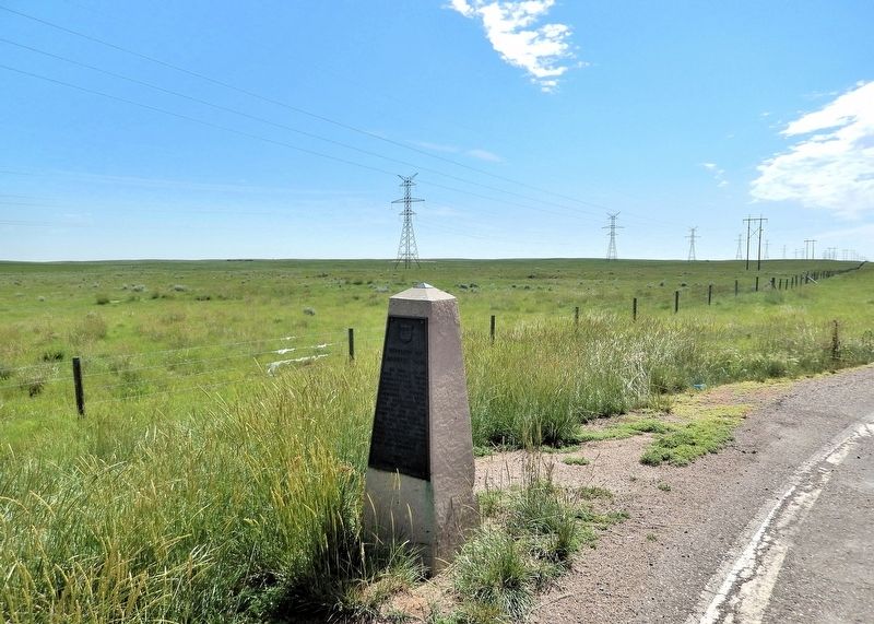
On Trans-Canada Highway (Provincial Highway 1) 2.2 kilometers west of Range Road 105, on the right when traveling west.
In 1882, part of the North West Territories was divided into the Districts of Alberta, Assiniboia, Athabasca and Saskatchewan. The old District of Alberta lies to the west of this cairn. In 1905, the provinces of Alberta and Saskatchewan were . . . — — Map (db m303393) HM
On Trans-Canada Highway (Provincial Highway 1) 2.2 kilometers west of Range Road 105, on the right when traveling west.
To the east of this cairn lies the old District of Assiniboia of the North West Territories. When, in 1905, Alberta and Saskatchewan became provinces in the growing Dominion of Canada, the District of Assiniboia was absorbed in the main by . . . — — Map (db m303200) HM
On Trans-Canada Highway (Provincial Highway 1) 2.2 kilometers west of Range Road 105, on the right when traveling west.
You have just entered the Eastern Irrigation District (EID), located within the Palliser Triangle (the semi-arid area of the western prairies). The Triangle, named after the Palliser Expedition of 1857-60, was thought to be of insignificant . . . — — Map (db m303398) HM
On Trans-Canada Highway (Buffalo Trail) (Provincial Highway 1/41) 0.5 kilometers east of Range Road 34, on the right when traveling east.
On 17 November 1879, Constable Marmaduke Graburn of the North-West Mounted Police (NWMP) was shot and killed approximately 55 kilometres southeast of here. A member of the Kainai Nation, Star Child, was arrested and tried for the murder in 1881. . . . — — Map (db m201753) HM
On 1 Street Southeast (Provincial Highway 41A) 0.1 kilometers west of 6 Avenue Southeast, on the right when traveling west.
The A. P. Burns house and the Gas City Planing Mill originally stood where the courthouse extension and part of City Hall are now located.
Arthur P. Burns arrived in Medicine Hat in 1901. He is best remembered as a local entrepreneur, real . . . — — Map (db m206637) HM
On First Street (National Highway 41) at 6th Ave. SE, on the left when traveling east on First Street.
Presented to the citizens of Medicine Hat by Canadian Pacific this sixth day of July, 1985 A.D.
The two Canadian Pacific locomotives (Units 1418 and 1424) are typical of the locomotives put in service by Canadian Pacific in the 1950’s. These . . . — — Map (db m205307) HM
On 6th Street at First Street (National Highway 41), on the left when traveling north on 6th Street.
On this site facing Sixth Avenue, now occupied by the City Hall, once stood three buildings.
A two-story brick and tile structure situated adjacent to the river was erected in 1914. The Medicine Hat News, which had previously operated from the . . . — — Map (db m205357) HM
On 1 Street Southeast (Provincial Highway 41A) just west of 5 Avenue Southeast, on the right when traveling west.
Until 1892, when Medicine Hat became a separate judicial seat for the territorial District of Assiniboia, court officials travelled from the judicial headquarters in Fort Macleod to hear cases. The first local courthouse, a small and inexpensive . . . — — Map (db m206559) HM
On First Street (National Highway 41) at 6th Ave. SE, on the left when traveling east on First Street.
Dutch Canadian Society of Medicine Hat and District
This monument was placed with everlasting gratitude to honor the men and women of the Canadian Forces who were involved in the liberation of the Netherlands during World War II on the occasion . . . — — Map (db m205303) WM
On 1 Street Southeast (Provincial Highway 41A) just east of 4 Avenue Southeast (Provincial Highway 41A), on the right when traveling east.
This distinctive 1½ storey Victorian style red brick home was originally constructed in 1887 by H. C. Yuill on behalf of John Ewart and his wife to be, Jessie Herald, daughter of prominent pioneer Rev. James Herald. Mr. Ewart was a local . . . — — Map (db m206564) HM
On 4 Street Southeast just west of 5 Avenue Southeast, on the right when traveling west.
A downtown landmark, Fifth Avenue Methodist Church was designed in the Arts and Crafts style by Medicine Hat architect William T. Williams and built by Lussier Construction Company. Opened in 1913, it featured large stained glass windows, red . . . — — Map (db m206986) HM
On 6th Avenue SE 0.1 kilometers north of 1st Street SE (Provincial Route 41A), on the left when traveling north.
Finlay Bridge is a vehicle and foot bridge that crosses the South Saskatchewan River, connecting the north (Riverside) and south sides (downtown) of Medicine Hat. It officially opened in May 14, 1908/
Finlay Bridge is named for William T. Finlay: . . . — — Map (db m196935) HM
On 1 Street Southeast just west of 4 Avenue Southeast (Provincial Highway 41A), on the right when traveling west.
The First Street South Municipal Historic Area is recognized as one of the oldest residential districts in Medicine Hat. The boundaries include the road right-of-way with views of the homes on both sides of First Street, from Fourth Avenue SE to . . . — — Map (db m206914) HM
On 2 Street Southeast just west of South Railway Street, on the left when traveling west.
The Hargrave Sissons Block is a two-storey brick structure designed in the Edwardian Commercial style. The Grocery Warehouse, a single-storey brick structure also in the same style, was added in 1910. The combined structure stands at a major . . . — — Map (db m206783) HM
Near 1 Street Southeast (Provincial Highway 41A) just east of 6 Avenue Southeast, on the left when traveling east.
The Indian people, living in close harmony with the land for thousands of years, referred to this beautiful river valley as "the place where the river comes closest to the mountains." The eagles that lived on the cliffs near Police Point provided . . . — — Map (db m206688) HM
On 3rd Street Southeast at 6 Avenue Southeast, on the right when traveling east on 3rd Street Southeast.
The Hull Block is a three storey, load-bearing brick structure designed in the Edwardian Commercial style. It features engaged brick pilasters, symmetrically placed upper level windows and pressed metal entablature. The ground floor brickwork has . . . — — Map (db m206785) HM
On First Street (National Highway 41) at 6th Ave. SE, on the left when traveling east on First Street.
On June 9, 1995 at 9:00 P.M., the south Saskatchewan River overflowed its banks and peaked at 9.8 meters (32 feet). Hundreds of people were affected by the "100 year" flood. Several families lost their homes. This wall is to commemorate that tragic . . . — — Map (db m205301) HM
On First Street (National Highway 41) at 6th Ave. SE, on the left when traveling east on First Street.
This Sherman tank is presented by the South Alberta Light Horse to the City of Medicine Hat in Canada's Centennial Year and is a memorial to the Men of the South Alberta Regiment who used them during the 1939 - 1945 War. — — Map (db m205308) WM
On 1st Street SE (National Highway 41) at 6th Ave. SE, on the left when traveling east on 1st Street SE.
Dedicated
To the Sons and Daughters
of Medicine Hat and
District Who Served With
Their Majesties Forces to
Preserve the Freedom
Which We and Others Enjoy
Originated by the Royal Canadian Legion Robertson Memorial Branch 12
Donated . . . — — Map (db m205310) WM
On 1st Street SE (National Highway 41) at 6th Ave. SE, on the left when traveling east on 1st Street SE.
This monument is erected by their grateful fellow citizens, to the everlasting memory of those men and women of Medicine Hat and district who laid down their lives for their country on active service in the Great War
Lest We Forget
Middle . . . — — Map (db m205323) WM
On 2 Street Southeast just west of South Railway Street, on the left when traveling west.
The Merchants Bank of Canada is a two-storey brick structure with a cottage roof configuration and rectangular floor plan; hallmarks of the Georgian style. The façade features: a symmetrical storefront with large display windows and central . . . — — Map (db m206902) HM
On 2nd Street Southeast just east of 6th Avenue Southeast, on the left when traveling west.
An icon of Medicine Hat’s entertainment history, the Monarch Theatre is a two-storey Streamline Moderne-style building. Connected to buildings of similar scale and vintage, it is distinctive for its boxed massing, smooth stucco surfaces, and . . . — — Map (db m206913) HM
On River Road Southeast 0.3 kilometers east of 4 Avenue Southeast, on the left when traveling east.
River Road was the brainchild of Allan Gunter City Engineer. Before his plan received approval, those in opposition to it dubbed it "Gunter's Folly," predicting that it would wash away and be a waste of taxpayers money. However, the plan was . . . — — Map (db m206575) HM
On 1 Street Southeast (Provincial Highway 41A) 0.1 kilometers west of 6 Avenue Southeast, on the right when traveling west.
This is the original site of Medicine Hat’s first radio station “1270 CHAT AM.” CHAT AM signed on-air November 1, 1946 and continues to serve Medicine Hat and surrounding area. For the past fifty years CHAT AM has been broadcasting on a frequency . . . — — Map (db m206682) HM
On 2 Street Southeast at 5 Avenue Southeast, on the right when traveling west on 2 Street Southeast.
St. John’s Presbyterian Church is a brick and sandstone structure executed in Gothic Revival style with a prominent corner square tower and octagonal pinnacle which frame the main façade with its gothic arch windows. The front façade is largely . . . — — Map (db m206995) HM
On 2 Street Northeast just west of 2 Avenue Northeast, on the right when traveling west.
[English] Built in 1912-1914, this church is a fine example of the Gothic Revival style, long favoured for ecclesiastical design in Canada. Gothic Revival churches were inspired by those of medieval Europe in plan, composition, and . . . — — Map (db m206552) HM
Near Southridge Drive Southeast just south of Trans-Canada Highway (Provincial Highway 1), on the right when traveling south.
Between 1912 and 1989 over a dozen different pottery companies operated in Medicine Hat and Redcliff. The availability of natural gas, suitable clay deposits nearby, and a location on the CPR mainline, were major factors in locating pottery . . . — — Map (db m205412) HM
On 3rd Street Southeast just east of 4th Avenue Southeast (Macleod Trail Southeast) (Provincial Highway 41A), on the left when traveling east.
Central School was built in June of 1887 to accommodate the nearly 100 children of Medicine Hat. Built over six lots on Toronto Street at cost of $3,000, the school opened in 1889, with only the bottom portion of the building occupied. The school . . . — — Map (db m206574) HM
On Crowsnest Highway (Provincial Highway 3) at Main Street, on the right when traveling west on Crowsnest Highway.
This pivot point and two towers are part of the first two water drive pivot systems introduced to Canada by Donald and Wyman Campbell. They arrived in the Burdett area on May 11, 1962 from the Valley Manufacturing Co., Valley, Nebraska, USA. The . . . — — Map (db m201765) HM
On 2 Avenue just west of 3 Street East, on the right when traveling west.
This building is dedicated to the efforts of Bros. A. C. Hockett and the late John A. Jeffery, Grand Organizers, who instituted Bassano Lodge No. 487 September 21, 1964 — — Map (db m301619) HM
On Range Road 142 1.2 kilometers south of Township Road 184 (Provincial Highway 1A), on the right when traveling south.
This earth aqueduct was built under an agreement between the governments of Canada and Alberta. It replaces the original concrete flume, constructed in 1912-14 to carry irrigation water across the valley to the Patricia and Tilley areas. The new . . . — — Map (db m301889) HM
On Range Road 142 1.2 kilometers south of Township Road 184 (Provincial Highway 1A), on the right when traveling south.
[English] A monument to the achievements of those civil engineers who developed irrigation in southern Alberta. [Français] Un monument en hommage aux ingénieurs civils qui ont . . . — — Map (db m301974) HM
On Range Road 142 0.4 kilometers south of Township Road 183A Road, on the right when traveling south.
Water flowed through the Brooks Aqueduct every year from 1915 until it was replaced in 1979. The engineers who built the Aqueduct planned a delivery rate of about 900 cubic feet (25 cu. m) of water per second. The Aqueduct never managed it. From the . . . — — Map (db m196947) HM
On Range Road 142 0.4 kilometers south of Township Road 183A Road, on the right when traveling south.
Getting the water in and out of the Aqueduct wasn't the only challenge. As it marched across the valley it would run smack into the CPR tracks. The Aqueduct as planned was not high enough for trains to go under it. And the construction required to . . . — — Map (db m196952) HM
On Brooks Aqueduct trail 1.4 kilometers west of Range Road 142.
Many settlers in the Eastern Irrigation Section had a hard time in the 1920s and 1930s. Low grain prices, deteriorating soils from alkali seepage into fields, and inexperience with irrigation farming techniques were some of the problems. Even though . . . — — Map (db m196954) HM
On Brooks Aqueduct trail 1.4 kilometers west of Range Road 142.
1916 “On April 6 … a camp … was located at the aqueduct for the purpose of tightening and repacking the metal bands at six expansion joints, and also of putting on additional bands … Total cost $160.00.”
1917 “Work was started on . . . — — Map (db m196955) HM
Near Range Road 142 0.4 kilometers south of Township Road 183A Road, on the right when traveling south.
[English] The CPR built this reinforced concrete aqueduct between 1912 and 1914. It was part of a large irrigation scheme using water diverted from the Bow River to transform 55,000 hectares east of Brooks from semi-arid rangeland to farmland . . . — — Map (db m196937) HM
On Range Road 142 0.4 kilometers south of Township Road 183A Road, on the right when traveling south.
“So he grabbed hold of a pick, he just kind of lifted it up a bit and then drove it right through, right through the bowl. Well, as the pick went through the bowl his hair stood straight up on end, I can assure . . . — — Map (db m196950) HM
Near Range Road 142 0.4 kilometers Township Road 183A Road, on the right when traveling south.
In the early 1900s the Canadian Pacific Railroad began construction of a huge irrigation project in Alberta comprising over a million hectares (3 million acres). Part of this original block land grant to the railway is now known as the Eastern . . . — — Map (db m196941) HM
Near Railway Avenue South at 2nd Street, on the right when traveling north.
The turntable was one means of turning steam locomotives and an essential component of the roundhouse complex. It consisted of a revolving bridge, balanced on a centre bearing, in a circular pit. After dumping their fires at the ash pit, locomotives . . . — — Map (db m197013) HM
Near Railway Avenue South at 2nd Street, on the right when traveling north.
Every divisional point had an engine house or “shop” as it was commonly referred to. It was in these structures that after each run, steam locomotives were checked, cleaned, and miscellaneous light repairs performed. The “roundhouse,” known as such . . . — — Map (db m197014) HM
On 50 Street just north of Veterans Memorial Highway (Provincial Highway 3/36), on the left when traveling north.
The Alberta Company of the Daughters of the Utah Pioneers dedicate this site in the memory of the early Mormon Pioneers who came to Canada in 1903 and settled here. They had the foresight to see that this barren stretch of prairie land, with a lone . . . — — Map (db m202487) HM
On 5 Avenue just north of Main Street, on the right when traveling north.
According to legend, when the first CPR train pulled in at the 12th siding west of Medicine Hat in 1883, a group of VIP passengers got off the train to see the Blackfoot Reserve. One of these men was Count Gleichen (pronounced Glaiken), an investor . . . — — Map (db m202492) HM