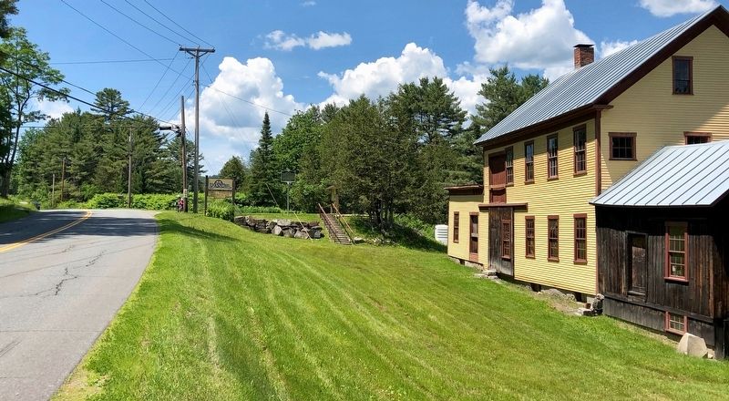
This water-powered mill on the Stevens River was built in 1872 by Alexander Jack. It originally housed a patented woolen print and dye works. In 1893, James Judkins retooled it as a wagon and woodworking shop. Judkins’ Shop was later run by sons . . . — — Map (db m136055) HM
Henry Stevens
Born in Barnet on December 13, 1791, and educated at Peacham Academy, Henry Stevens was at various times a farmer, innkeeper, mill owner, legislator, postmaster, temperance leader, stage line proprietor, and operator of the . . . — — Map (db m77691) HM
On Vermont Route 5, on the left when traveling south.
Local builder Fred “Silo” Quimby built this round barn, considered a great curiosity, in 1900 for farmer James R. Moore. Popularized by Midwest agricultural colleges in the 1890s, round barns were considered more economical to build and . . . — — Map (db m136060) HM
On Interstate 91 at milepost 121.8, on the right when traveling north.
The Connecticut River, starting at the International Boundary, flows 380 miles to the Atlantic Ocean. In its course the river falls 1640 feet. In 1928, the New England Power Association started a two-year project to build one of the largest . . . — — Map (db m74467) HM
In honor of the brave men of Danville who victoriously defended the Union during the War of the Rebellion
1861 - 1865
Commissioned Officers
Colonel Addison W. Preston •
Captain James M. Ayer •
Captain Charles D. Brainerd • . . . — — Map (db m140332) WM
On Greenbanks Hollow Road at Brook Road, on the right when traveling south on Greenbanks Hollow Road.
On this site, in 1849, Benjamin Greenbank converted an existing small mill into a 5-story woolen factory. As many as 45 people worked here to produce up to 700 yards of cloth a day. Greenbank's Hollow, as it became known, included a company store, . . . — — Map (db m61392) HM
On Theodore Roosevelt Hwy (U.S. 2) at Peacham Road, on the right when traveling east on Theodore Roosevelt Hwy.
Born crippled and poor in Danville in 1792, Stevens was schooled by his mother, Sally Morrill Stevens, and at nearby Caledonia County Grammar School, graduating from Dartmouth College in 1814. He became a brilliant lawyer, committed to racial . . . — — Map (db m20664) HM
On Darling Hill Road at East Darling Hill Road, on the right when traveling south on Darling Hill Road.
This farm was established in 1883 by Elmer A. Darling (1848-1931), a native of East Burke who became part owner/manager of the world famous Fifth Avenue Hotel in New York City. After the hotel closed in 1908, Mr. Darling retired to the life of a . . . — — Map (db m75981) HM
On Scott Highway (U.S. 302) at Mill Street, on the right when traveling west on Scott Highway.
In Memory
Of
The Brave Soldiers
Of The
Town Of Groton
Who Served During
The Civil War
1861 – 1865
Left Face:
Groton's Roll Of Honor
In The Civil War
Vermont Infantry Co. Regt.
Sergeant . . . — — Map (db m157719) WM
On Scott Highway (U.S. 302) 1.2 miles west of Seyon Pond Road (County Route 24), on the left when traveling west.
In memory of William Scott the sleeping sentinel pardoned by Abraham Lincoln Sept. 9th, 1861. Born on this farm Apr. 9th, 1839. Enl. in Co. K, 3rd Vt. Vol. July 10th, 1861. Died of wounds at Lees Mills Apr. 16th, 1862. — — Map (db m155867) HM WM
Dr. Merle Frampton established Camp Wapanacki here in 1938. It was the first camp in the country dedicated to children with blindness and visual impairments. Dr. Frampton and his wife, Iris, managed Wapanacki until 1942, when operations were . . . — — Map (db m136061) HM
Founded in 1780, the Town of Lyndon was home to 59 residents at the time of the 1790 census. In June 1791 the inhabitants and freeholders were invited to the first town meeting, held here at the home of Daniel Reniff.
On July 4, Elder Philemon . . . — — Map (db m177610) HM
Near Cemetery Circle west of Center Street, on the right when traveling west.
The children of Lyndon Center attended school in this wooden building for 43 years. It then served as a cemetery storage garage until its restoration by the Lyndon Historical Society during 2002-2004. Now it is home to an exhibit depicting life in a . . . — — Map (db m136692) HM
On Institute Circle just north of College Road, on the left when traveling north.
Born in Lyndon, Vermont, in a log house, February 21, 1821. Daughter of Samuel Rowell, a farmer and Mary Atwood. Being one of twelve children and brought up under hardships and privations, Elizabeth had little schooling. At age nine she went out to . . . — — Map (db m152259) HM
Near Center Street at Cemetery Circle, on the left when traveling north.
Built by the Town of Lyndon in the summer of 1809 as a meeting house for the religious services of four congregations – Baptist, Congregational, Methodist, and Universalist – and for town meetings. The “Town House” was . . . — — Map (db m136690) HM
On Center Street (Vermont Route 122) at College Road, on the right when traveling north on Center Street.
Dedicated to the memory of Theodore Newton Vail (1848–1920), president of the American Telephone and Telegraph Company, a most generous benefactor of Lyndon Institute and Vail Agricultural School – one who had faith in the young people . . . — — Map (db m87926) HM
On College Road 1 mile Center Street ( Route 122), on the left when traveling south.
bought a farmhouse on this site in 1883. Continually enlarged by Vail, it became his permanent residence and office. Conferences held here culminated in the creation of the American Telephone and Telegraph Company with Vail its president, who . . . — — Map (db m75108) HM
On Bridge Street at U.S. 5, in the median on Bridge Street.
Dedicated to all Veterans
of the armed forces of the
United States of America
WW II
F. C. Converse
That others may live
( reverse side )
WW II
★R. F. Kipp · P. E. Kipp · R. W. Irwin · E. G. Hall · I. A. Foran · . . . — — Map (db m157294) HM
On Bayley-Hazen Road 0.1 miles south of Church Street, on the right when traveling south.
Caledonia County was set out from Orange County in 1792. Peacham chose to provide a County grammar school rather than a courthouse. The Caledonia County Grammar School (Peacham Academy) was chartered in 1795, the third County grammar school in . . . — — Map (db m77694) HM
On Peacham Road at Stonehouse Road, on the right when traveling south on Peacham Road.
In the style of a Scottish stone croft (farmhouse), this house was erected by James Whitehill, a prosperous farmer and one of a large number of immigrants from Inchinnan Parish, Scotland, who settled Ryegate under the sponsorship of the Scotch . . . — — Map (db m77692) HM
On Vermont Route 18 just east of Slate Ledge Road.
Opened on July 18, 1959 as Vermont’s first organized auto racing track under the guidance of the Northeastern Racing Association, the State’s first motor sports sanctioning body. By instituting formal point and purse structures and focusing on . . . — — Map (db m65865) HM
On Main Street (U.S. 2) south of Eastern Avenue (U.S. 2), on the right when traveling north.
On June 28, 1790, Jonathan Arnold donated the land now occupied by the courthouse and park to the "South Parish" of the Village of St. Johnsbury for use as a "Buryal Ground."
By 1855 the burial ground had fallen into disrepair.
Families . . . — — Map (db m116650) HM
On Main Street near Eastern Avenue, on the right when traveling south.
Line of Duty Death
Eugene “Geno” McDonough
December 6, 1943 – September 5, 1998
19 Years of Service
On September 5th, 1998 Firefighter Eugene McDonough responded on Engine Company 3 to a mutual aid call for a multiple alarm warehouse fire at . . . — — Map (db m180782) HM
On Portland Street (U.S. 2) at Spaulding Road, on the right when traveling east on Portland Street. Reported permanently removed.
After experimenting with new types of farm equipment, plows, and stoves, Thaddeus Fairbanks invented the platform scale here in 1830. With his brothers Erastus and Joseph, he founded the company which still bears their name. Many St. Johnsbury . . . — — Map (db m74468) HM
On Western Avenue (U.S. 2) at Mount Vernon Street, on the right when traveling east on Western Avenue.
After experimenting with new types of farm equipment, plows and stoves, Thaddeus Fairbanks invented the platform scale here in 1830. With his brothers Erastus and Joseph, he founded the company which still bears their name. Many St. Johnsbury . . . — — Map (db m77603) HM
On Railroad Street north of Eastern Avenue, on the left when traveling north.
On this site in 1852 the former Cottage Hotel opened for business owned by a Mr. Flint. Later, being part of the Calderwood Family holdings it was sold to Dominico and Maria Costa in 1920. —— By 1935 William T. Costa, Sr. and Joseph Caplan had . . . — — Map (db m180717) HM
On Main Street (U.S. 2) near Eastern Avenue, on the right when traveling north.
Parrot Gun No. 126
Presented To
Chamberlin Post No. 1 G.A.R.
August 1899
By Sec. of Navy on request of
Hon. W.W. Grout.
This gun was in service during
Civil War on U.S.S. Kanawha — — Map (db m180787) WM
On Main Street (U.S. 2) at Eastern Avenue, on the right when traveling north on Main Street.
Parrot Gun No. 126
Presented To
Chamberlin Post No. 1 G.A.R.
August 1899
By Sec. of Navy on request of
Hon. W.W. Grout.
This gun was in service during
Civil War on U.S.S. Magnolia — — Map (db m180785) WM
On Main Street (U.S. 2) at Eastern Avenue, on the right when traveling north on Main Street.
In Honor of
The St. Johnsbury Volunteers
Who Sacrificed Their Lives
In Defence of The Union.
Fredricksburgh. · Gettysburg. · Winchester. · Spotsylvania. · Wilderness. · Port Hudson. · Williamsburg. · Cold Harbor. · Petersburg. · Lees Mills. . . . — — Map (db m180784) WM
On Main Street (U.S. 2) at Eastern Avenue, on the right when traveling north on Main Street.
To the Honor and Glory
of the
Men and Women
of St. Johnsbury
Who Served Their Country in the
1914 World War 1919
and in Memory of
These Noble Dead
Audette Albert A · Bartlett Lowell Arthur · Batchelder Raymond · Birch Arthur B · . . . — — Map (db m180789) HM
On Main Street (U.S. 2) near Eastern Avenue, on the right when traveling north.
This Memorial Erected In
Grateful Memory of Those
Who Died to Preserve Our
Way of Life in World War II
Graydon L. Adams · Glenn C. Badger · Stanley R. Bailey · Kenneth R. Bailey · William W. Balch · Arnold L. Bartlett · Donald R. Bean · . . . — — Map (db m180791) WM
On Main Street (U.S. 2) at Eastern Avenue (U.S. 2), on the left when traveling north on Main Street.
(National Register of Historic Places Plaque)
St. Johnsbury Athenaeum
Has been designated a
National Historic Landmark
This building possesses National Significance
in commemorating the history of the
. . . — — Map (db m116649) HM
On Western Avenue (U.S. 2) 0.3 miles west of Main Street, on the left when traveling west.
Vermont's first and for many years only four year vocational school opened on Western Avenue on September 3, 1918. Needing skilled workers during World War I, Fairbanks, Morse & Co. started an all-day co-operative school where young men could learn . . . — — Map (db m77584) HM
On Vermont Route 122 at Sutton Road, on the right when traveling north on Vermont Route 122.
When Eleazer Wheelock founded Dartmouth in 1769, he sought land grants to support the new college. In 1785 the Vermont legislature chartered and named a town of 23,000 acres for Wheelock. In the early 1800's substantial support for financially . . . — — Map (db m87807) HM
Near River Road (U.S. 3) 1.3 miles north of West Road, on the left when traveling north.
Northeast corner of Vermont is a point at low water mark on the West side of the Connecticut River in Lat. 45 00’ 49.20” Long.
71 27’ 57.48” N 89 40’ E. 314 feet from center of this marker. — — Map (db m288421) HM
On East Brighton Road (Vermont Route 105) at Cross Street ( Route 114), on the left when traveling west on East Brighton Road.
The town of Brighton, VT., dedicates this plaque to the memory of one of its prominent public officials, Charles F. Maw, who was born in Nettleham, Lincolnshire, England in 1883.
With only an 8th grade education, Charles F. Maw emigrated to . . . — — Map (db m221718) HM
On East Brighton Road (Vermont Route 105) at Cross Street ( Route 114), on the left when traveling west on East Brighton Road.
In Recognition of
Generations of Railroaders
from
Island Pond
Montreal 149mi. Portland 147mi.
"Great Halfway Point"
on the
Atlantic & St. Lawrence/
St. Lawrence & Atlantic RRS.
Grand Trunk Railway of Canada
Canadian . . . — — Map (db m221720) HM
On East Brighton Road at Cross Street, on the left when traveling east on East Brighton Road.
1366 feet west of this marker on railway right of way the Atlantic St. Lawrence RY
from Portland, Maine was linked to the St. Lawrence & Atlanta RY from Montreal, Quebec in July of 1853. This linking formed the first International Railway in . . . — — Map (db m198518) HM
On Vermont Route 114 at Route 102, on the right when traveling east on Vermont Route 114.
1861 Civil War 1865
Canaan, Vermont
3rd Vermont Volunteers
Francis Baker,
Chauncey Barnett,
Hiram Bowen,
Samuel Cable,
Thomas Colby,
Charles M Elliott,
Thomas Farrow,
George Gamsby,
James Gamsby,
William H. Gault,
David . . . — — Map (db m140268) WM
On Vermont Route 115 near Route 102, on the right when traveling east.
Canaan Remembers
1917 - World War-1919
Canaan Honor Rolls
1950 - Korean War -1954
Jean C. Lanctot, Albert Leonard
denoted as having died in service
1965 - Vietnam Conflicit - 1973
1941 - World War II - 1945
no . . . — — Map (db m140467) WM
On Main Street at Shadow Lake Road on Main Street.
The first recognized school for the purpose of training teachers was conducted near here by the Rev. Samuel Read Hall, 1823-25. Practice teaching was employed, with lectures on Schoolkeeping, which became in 1829, the first professional book for . . . — — Map (db m74469) HM
On Oregon Road 3 miles south of West Lunenberg Road (U.S. 2), on the left when traveling south.
Called from his Gilman parish to serve as a Chaplain in World War II, First Lieutenant Fox died when the Dorchester was torpedoed in the North Atlantic. Giving his life jacket to a soldier, he perished with three other chaplains, in one of the most . . . — — Map (db m77604) HM
On Vermont Route 105 at McConnell Pond Road, on the right when traveling west on Vermont Route 105.
Stewart Holbrook was a logger, a nationally recognized author, and self-taught historian whose topics included Ethan Allen, railroads, and the timber industry. Holbrook, believed to have coined the term “tree farm,” was renowned for . . . — — Map (db m104491) HM
On Porrell Road 0.7 miles north of Granby Road, on the left when traveling north.
This stone cairn marks the graves of two Rogers' Rangers who died during the French and Indian War. Their gruesome deaths were recorded in the diary of Lieutenant George Campbell: "(Sergeant) Lewis had told me that his party had shot a Moose near a . . . — — Map (db m75587) HM
On Vermont Route 102 at Bridge Street, on the right when traveling east on Vermont Route 102.
Only Town in the World so Named Chartered 1761 • Settled 1764 Capt. Peter Powers discovered Guildhall Falls in 1754 Frontier during French & Indian War Col. Ward Bailey built first blockhouse First wing dam built on Connecticut River Seat of . . . — — Map (db m151899) HM
On State Highway 102 at Bridge Street Fork (Guildhall Road), on the right when traveling north on State Highway 102.
Dedicated to our youth of Guildhall and Maidstone who served their country 1917 World War I 1919 Allen, Ray L. • Beattie, John G. • Blackburn, William J. • Canfield, Frank M. • Currier, Amos C. • Currier, Nathan B. . . . — — Map (db m236292) WM
On Vermont Route 102 just south of Courthouse Drive, on the right when traveling north.
This property been placed on the
National Register
of Historic Places
by the United States
Department of the Interior The Benton Cottage Built 1915 — — Map (db m151900) HM
U.S. 2 is the major highway between the Atlantic and Lake Champlain. It leads through St. Johnsbury, the maple sugar center, down the Winooski River to Montpelier, through the tallest mountains at Bolton Gorge to Lake Champlain at Burlington, . . . — — Map (db m77605) HM
On East Brighton Road (Vermont Route 105) at Railroad Street ( Route 114), on the right when traveling east on East Brighton Road.
Pioneer Railroad Planner John A. Poor’s dream of an International Railway connecting Montreal, Canada with the Ice-free harbor of Portland, Maine became a reality on July 18, 1853, when the first through trains met at this great halfway point on . . . — — Map (db m75118) HM
On Lancaster Road (U.S. 2) 1.4 miles west of Route 102, on the left when traveling west.
U.S.2 is the major highway between the Atlantic and Lake Champlain. It leads through St. Johnsbury, the maple sugar center, down the Winooski River to Montpelier, through the tallest mountains at Bolton Gorge to Lake Champlain at Burlington, . . . — — Map (db m155739) HM
On West Main Street (U.S. 2) at Park Avenue, on the right when traveling west on West Main Street.
In memory of
our comrades in
the Rebellion
1861 to 1865
Captains
John S. Clark
Elben J. Hartshorn
Lieuts.
Geo. P. French
Nathan C. Cheney
George W. Hill
Sergeants
Marshall W. Wright
Solo L. Simonds
Levi H. . . . — — Map (db m140149) WM
On Church Street (Vermont Route 16) 0.1 miles south of Main Street (U.S. 5), on the right when traveling south.
Born in Barton on February 16, 1843 to a hard working farm family, Henry Leland carried into his life the strength and quality of his family’s work ethic adding to it his gift and love for precision. By 1890, Leland was in Detroit where he had . . . — — Map (db m75107) HM
On Church Street at Main Street, on the right when traveling north on Church Street.
Proudly we salute our
veterans & pledge eternal
gratitude for their sacrifices
& gallant preservation of
freedom for all.
[Armed Services Emblems]
Dedicated May 30, 1989 — — Map (db m122627) HM
On Old Stone House Road east of Hinman Settler Road, on the left when traveling east.
Alexander Lucius Twilight taught here in Brownington at the Orleans County Grammar school for 20 years of his career. He was an open minded and forward thinking educator, beloved by his students. Mr. Twilight emphasized the study of the natural . . . — — Map (db m221756) HM
Near Hinman Settler Road at Old Stone House Road, on the left when traveling north.
The Brownington Congregational Church was completed in 1841. For eighteen years prior to that the congregation met on the second floor of the Orleans County Grammar School. In 1899, William Barstow Strong, a Brownington native and former student at . . . — — Map (db m221726) HM
On Hinman Settler Road at Old Stone House Road, on the left when traveling north on Hinman Settler Road.
The Brownington Village Historic District was added to the United States National Register of Historic Places on June 9, 1973. The district consists of seven buildings within the Old Stone House Museum complex as well as the Brownington . . . — — Map (db m221753) HM
On Hinman Settler Road at Old Stone House Road, on the right when traveling north on Hinman Settler Road.
In 1836, Rev. Alexander Twilight, the schoolmaster of the Orleans County Grammar School, on a main stage route to Canada, built this structure, Athenian Hall, as a dormitory for his pupils. It now holds the interesting collection of the County . . . — — Map (db m85871) HM
On Hinman Settler Road north of Old Stone House Road, on the left when traveling north.
The Orleans County Grammar School was built at the foot of Prospect Hill in 1823 by William Baxter, a prominent citizen of Brownington. He asked that worship services for the Congregational Church be held on the second floor until a permanent . . . — — Map (db m221755) HM
On Main Street at Covered Bridge Road, in the median on Main Street.
North Face
Names of the soldiers from
the Town of Coventry, Vermont
who served in the Civil War of
1861-1865.
Co. A 2d VT Inf. Vol.
Abby, Daniel
Co. B 3d VT Inf. Vol.
Allen, Levi C.
Bartlett, Enoch K. . . . — — Map (db m155240) WM
On Main Street at Covered Bridge Road on Main Street.
1917 World War 1919
Coventry
Remembers
Robert Bickford • Carroll W. Brooks • Walter E. Cleveland • George P. Corrow • Will E. Corrow • Quincy W. Goss • Lewis S. Kahlstrom • Clyde W. Kiern • Wallace W. Kiern • Raymond E. Kneeland • Richard C. . . . — — Map (db m155697) WM
On Sterling Drive, on the right when traveling south.
Sterling College was among the first colleges and universities in the United States to offer a liberal arts curriculum focused on the environment. It was founded here in Craftsbury Common in 1958 as a boys’ preparatory school known as Sterling . . . — — Map (db m136063) HM
1799 First worship service held in home of Timothy Hitman
1807 Congregational Society of Derby formed by settlers
1816 Members form Stanstead QC Congregational Church
1820 First Derby Congregational Church building erected
1823 Members . . . — — Map (db m208173) HM
On Main Street (Vermont Route 105) 0.3 miles south of U.S. 5, on the right when traveling north.
On this site the Derby Literary and Theological Institute - a private boarding school - was founded by the Danville Baptist Association on one acre of land given by Lemuel Richmond and Benjamin Hinman. Colonel Chester Carpenter led a campaign for . . . — — Map (db m75586) HM
On Main Street (Vermont Route 105) at Junior High Drive, on the right when traveling north on Main Street.
Presented June 2001
By The Derby Academy Alumni
Derby Academy Bell
Cast by George H. Holbrook in Midway Mass
in 1841. Moved from the old boarding house
about 1869, it hung in the Academy building until
the building was replaced by the . . . — — Map (db m198515) HM
On Derby Line Road (U.S. 5) at Palin Farm Road, on the left when traveling south on Derby Line Road.
In memory of the volunteers from Derby, who lost their lives in the Great Rebellion of 1861-5.
1861 Derby's tribute to her sons who fought in the Civil War 1865
+Spaulding, S.F., 1st Lt.• *Chase, G.W. 1st Lt.• *Hopkins, M. 2nd Lt.• . . . — — Map (db m221723) WM
Lieutenant Colonel:
Nelson, George E.
Captain:
Aldrich, Fred N.•
Corley, Richard T.•
Foster, Stephen M.
1st Lieutenant:
Foster, Austin T.•
Nelson, Asa B.•
Somers, Henry E.
2nd Lieutenant:
Powell, Wellman H. . . . — — Map (db m207871) WM
A captain in the American Revolution. Born in Southbury, Conn. and came to Vermont in 1790. On this lot overlooking Hinman Pond he built the first house in town in 1794. A log house, rough but solid, thatched with hemlock bark over plank floors. . . . — — Map (db m207861) HM
Willie Johnston was the youngest recipient of The Medal of Honor at the age of 13. In 1861, at age 11, he enlisted as a drummer boy for Company D of the 3rd Vermont Infantry. He was the only drummer in his division to come away with his drum during . . . — — Map (db m207862) HM
On Caswell Avenue at Church Street, on the right when traveling west on Caswell Avenue.
This structure is doubly unusual: it not only straddles the Canada-United States boundary but also contains the rare combination of a library and a theatre. Built between 1901 and 1904 as the gift of the Haskell family of Vermont, it testifies to . . . — — Map (db m75167) HM
On Main Street (U.S. 5) 0.1 miles north of Baxter Avenue, on the right when traveling south.
Derby Line demonstrates the goodwill between Canada & the United States with its International Rotary Club, and Haskell Library and Opera House built astride the boundary line. Southward in Orleans County lie two of New England’s most beautiful . . . — — Map (db m75259) HM
On 10 Mile Square Road at Route 105, on the left when traveling east on 10 Mile Square Road.
The Clyde River and its wetlands are one or the most diverse ecosystems in the Northeast. The bog sedge-dominated landscape is classified as an intermediate fen, a globally rare natural community.
The Clyde River was a major Native American . . . — — Map (db m221722) HM
On Dry Pond Road (Vermont Route 16) 1.9 miles north of Quarry Road, on the right when traveling north.
On this site, on June 6, 1810 settlers dug an outlet to the north from what was then known as Long Pond. The retaining bank collapsed, causing all water from the 1.5-mile long pond to be discharged toward Barton River, and on to Lake Memphremagog, . . . — — Map (db m75120) HM
On Center Road at Lake Shore Road, on the left when traveling north on Center Road.
Hinman Settler Road begins here at Greensboro’s Four Corners, passes through Glover, Barton, Brownington, and ends at the Quebec border in Derby. The road was named after Timothy Hinman, born 1761 in Woodbury, CT. Hinman, one of many Revolutionary . . . — — Map (db m199458) HM
Newport was first organized as a town on October 25, 1781, though its charter was not issued until October 30, 1802, when it was granted to Nathan Fish and George Duncan under the name Duncansboro. It was not until November 16, 1816 when a small . . . — — Map (db m122741) HM
On Main Street (U.S. 5) at Field Avenue, on the right when traveling west on Main Street.
Newport had reached its pinnacle of success at the dawn of the 20th century, when three of Newport's most impressive civic buildings were constructed[;] the Goodrich Memorial Library, the Orleans County Courthouse and the Federal Building. These . . . — — Map (db m122745) HM
On Main Street at Bayview Street, on the right when traveling east on Main Street.
First Reparative Probation Case in the United States
In February 1995 the first documented reparative probation case in the U.S. was adjudicated at the Orleans County Courthouse in Newport. Reparative probation applies restorative justice to . . . — — Map (db m151265) HM
On Gardner Park Road east of Causeway Street (U.S. 5), on the right when traveling east.
In memory of the Eighteen Charter Members of Baxter Post No 51 G.A.R.
Ina L. Rocque, Dept. President W.R.C.
In memory of Our Fathers
Vermont Dep't. D. of U.V. of the Civil War
In memory of Sarah . . . — — Map (db m122865) HM WM
On Seymour Lane at Main Street ( Route 105), on the right when traveling north on Seymour Lane.
The Emery A. Hebard State Office Building, located on Lane Avenue and Main Street, was constructed on the site of some of Newport's earliest establishments. The east end of Main Street, the first street built in Newport, was home to many of the . . . — — Map (db m261801) HM
On Crawford Farm Road south of Clyde Street, on the left when traveling south.
When Calvin Arnold of Randolph, Vermont, arrived in the Vermont-Quebec border region in about 1800, it was a vast land of big forests, big lakes, and free running streams. Native Americans, many of them Abenaki, called it their home. They hunted, . . . — — Map (db m198876) HM
On Field Avenue north of Seymour Lane, on the left when traveling north.
The Memphremagog Hose Company, organized in 1885, was the first fire station of the Newport Village Fire Department. Two separate fire departments, the Memphremagog Hose Company (which included the former Batesville Company) and the West Derby . . . — — Map (db m122834) HM
On Main Street (U.S. 5) west of Railroad Square, on the right when traveling west.
The grand Memphremagog House, c. 1838-1907, the core of which was one of the original buildings constructed on Main Street, dominated the hotel business in Newport, though a few other smaller hotels were also built downtown, near the railroad . . . — — Map (db m122666) HM
On Main Street (U.S. 5) at Central Street, on the right when traveling east on Main Street.
From the mid-1800's until around 1930, Newport experienced what can only be called its “Splendid Years”. Profitable businesses, a bustling Main Street and a continuing tourist industry all pointed towards continued growth. The streets were newly-lit . . . — — Map (db m261803) HM
[Front]
For thousands of years, the waterways of the Northeast Kingdom provided the best travel routes across the rugged landscape. Lake Memphremagog is a hub which connects the northeast's major waterways: Lake Champlain to the west, the St. . . . — — Map (db m122629) HM
On Main Street (U.S. 5) west of Railroad Square, on the right when traveling west.
This property is a heartfelt gift
from Antonio Pomerleau and Family.
A native son of Newport, Tony wishes to
ensure an enjoyable space for present
and future generations. — — Map (db m122680) HM
On Causeway Street (U.S. 5) near Main Street (U.S. 5), on the right when traveling south.
The City of Newport's development was dramatically altered by the arrival of the railroad in the mid-nineteenth century. From the south, in 1863, the Connecticut and Passumpsic Railroad arrived in Newport. In 1873, a second line, the Missisquoi . . . — — Map (db m122671) HM
104 entries matched your criteria. The first 100 are listed above. The final 4 ⊳