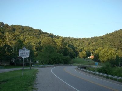
On U.S. 33 at Arnoldsburg-Rocksdale Road, on the left when traveling east on U.S. 33.
Site of Camp McDonald, set up, 1862, occupied by the 11th W. Va. Inf., U.S.V. Scene of engagement, May 6, 1862, when Federals under Maj. George C. Trimble beat off an attack by Confederate Moccasin Rangers under Capt. Geo. Downs. — — Map (db m14153) HM
On Arnoldsburg Road (U.S. 33/119) at County Route 33/119, on the right when traveling west on Arnoldsburg Road.
Early in 1862, the 11th West Virginia Infantry in Spencer established an outpost here in Arnoldsburg to suppress Confederate guerilla activity. Union Maj. George C. Trimble commanded four companies here at Camp McDonald, named for former county . . . — — Map (db m73440) HM
Gilmer CountyFormed, 1845, from Kanawha and Lewis. Named for Thomas Walker Gilmer, Secretary of the Navy in President Tyler's Cabinet, who was killed by the explosion of a gun on board the United States battleship, Princeton, February 28, 1844. . . . — — Map (db m73437) HM
On U.S. 33 west of Arnoldsburg-Rocksdale Road (Local Route 18).
One of several partisan groups in western VA during the Civil War, the Moccasin Rangers were Southern sympathizers who operated in the central counties of present-day West Virginia, conducting raids and terrorizing local Unionists. After they looted . . . — — Map (db m137948) HM
On U.S. 33 west of Arnoldsburg-Rocksdale Road (Local Route 18), on the right when traveling west.
Perry Hays & George Silcott. Peregrine Hays and George Silcott were prominent businessmen before the Civil War. Hays was sheriff of Calhoun County and Silcott county clerk. In 1861, they helped form the Moccasin Rangers. After truce they . . . — — Map (db m137949) HM
On Little Kanawha Parkway (West Virginia Route 5) 1.3 miles west of the Big Bend Post Office, on the right when traveling east.
Site of first Calhoun Co. Court which met at home of Joseph Burson, April 14, 1856. Justices were Wm. Brannon, Dan. Duskey, H.R. Ferrell, Geo. Lynch, Joshua Knight, Absalom Knotts and Hiram Ferrell. — — Map (db m73462) HM
On Main Street (West Virginia Route 5) at Market Street ( Route 5) when traveling west on Main Street.
Dedicated to all veterans of Calhoun County, to the honor and glory of those who bravely served to keep our country a land of freedom. — — Map (db m174390) WM
On Main Street (West Virginia Route 5) at Court Street, on the left when traveling west on Main Street.
Town was laid out in 1866
on farm of Simon P. Stump
and named for Gen. Grant.
Became permanent county
seat of Calhoun in 1869,
after 13 years of moving
county seat from place to
place. Incorporated 1896. — — Map (db m174389) HM
On Main Street, on the right when traveling north.
In Memoriam
CSM Clovis Drexell Ice
1933 - 1991
United States Army
1950 thru 1977
Military Intelligence Hall of Fame
Airborne - Special Forces
Distinguished Soldier and Citizen
Duty, Honor, and Country
Erected by . . . — — Map (db m190015) WM
On Main Street (West Virginia Route 5) at Jarvis Street, on the left when traveling north on Main Street.
• In 1883, A. H. "Dick" Stump (who would later become Grantsville's first Mayor)
and his wife, Druscilla Ball Stump, built a house, a block from the Courthouse,
on Main Street.
• The Stumps tuned their home into a hotel by 1885, and in . . . — — Map (db m190017) HM
On Calhoun Highway (West Virginia Route 16) at Milo Road (Local Route 13), on the right when traveling south on Calhoun Highway.
One mile west in the low gap are the graves of Mike Fink and an Indian, slain in 1780, and buried where they fell. While hunting, Fink and Adam O’Brien were fired on by two Indians; Fink shot one and was killed by the other. — — Map (db m137950) HM
On Country Farm Road (Route 33/18) south of Ripley Road ( Route 62).
Michael Coleman, member of a hunting party from frontier fort at Belleville, was killed and scalped by the Indians at this point about 1793. Near by at Mill Creek Falls, Benjamin Wright build an early power flour mill. — — Map (db m124884) HM
Post Office established here July 1, 1880, with Grandville P. Morrison as first postmaster. Named in honor of John Edward Kenna (1848-1893), member of the U.S. House of Representatives (1879-1883), and later elected to the U.S. Senate (1883-93). . . . — — Map (db m73672) HM
On West Virginia Route 2 east of Jackson Lane, on the left when traveling east.
Jackson County
Formed in 1831 from Mason, Kanawha and Wood. Named
for General Andrew Jackson,
the seventh President of the
United States. Jesse Hughes,
noted Indian fighter, spent
declining years in this county where he is buried.
. . . — — Map (db m189747) HM
On Ravenswood Road (Route 68) 0.2 miles south of County Road 4/8, on the right when traveling north.
Erected in 1860 on land donated by Thomas Coleman, who donated half of building cost. Family and community members donated the balance. Service June 22, 1860. Deeded to Methodist Episcopal Church South. During the Civil War, Union Home Guard . . . — — Map (db m189754) HM
On Ravenswood Road (Route 68) at Lock House Road, on the right when traveling south on Ravenswood Road.
Born in 1819, Frost was editor of Jackson County’s first newspaper, The Virginia Chronicle, which was burned in 1862 during Jenkins Raid for its pro-Union stance. He served as Speaker of the House for the Restored Government of Virginia, . . . — — Map (db m124351) HM
On Walnut Street at Ann Street, on the right when traveling west on Walnut Street.
This tablet marks the military grant of land 2448 acres made by King George II of England in the year 1772 to George Washington for his services in the French and Indian War. General Washington bequeathed 1425 acres of this tract to his niece . . . — — Map (db m228080) HM
On Lock House Road, on the right when traveling north.
Used in WV, late 1800's to early 1900's
Quote
Plow tills soil to grow vegetation.
Education tills the mind to grow knowledge.
God's Word tills your faith in Christ unto salvation.
By: Don C. Sayre . . . — — Map (db m189753) HM
On West Virginia Route 68 0.2 miles north of U.S. 33, on the right when traveling south.
(Preface): Confederate Gen. Albert G. Jenkins led 550 cavalrymen on a 500-mile raid from Salt Sulphur Springs, Aug. 22-Sept. 12, 1862, attacking Federal forces and destroying military stores. He captured and paroled 300 Union . . . — — Map (db m39627) HM
On West Virginia Route 68 0.2 miles east of U.S. 33, on the left when traveling north.
Ravenswood. These lands were surveyed, 1771, for George Washington by Colonel William Crawford, who later was taken captive by the Indians and burned at the stake. Washington camped here in 1770. Here is grave of Jesse Hughes, noted scout. . . . — — Map (db m39625) HM
On West Virginia Route 2 south of U.S. 33, on the right when traveling south.
Westward lies the Millwood Tract of 4,395 acres patented by George Washington on December 15, 1772, based on a survey made in June 1771. It bordered on the Ohio River above the Great Bend for “file miles and 700 poles.” — — Map (db m124517) HM
On Court Street North at North Street West, on the left when traveling north on Court Street North.
Brother Harry Ripley was a circuit-riding minister for the Methodist church. According to legend, he had planned to wed a local girl and build the first church in the community. Tragedy struck, however, when he drowned in Mill Creek with their . . . — — Map (db m10915) HM
On West Main Street (U.S. 33) at North Court Street, on the right when traveling west on West Main Street.
In honor of
veterans
World War I
April 6, 1917
Nov. 11, 1918
In honor of
veterans
Panama
Dec. 17, 1989
Jan. 3, 1990
In honor of
veterans
peace time
Mar. 1, 1908
present . . . — — Map (db m256877) WM
On Court Street North at West Main Street (U.S. 33), on the left when traveling north on Court Street North.
During the Civil War, both Union and Confederate supporters formed guerrilla bands. Each government denounced the other side’s partisans as bushwhackers or common thieves but gave those on their own side an official military designation as cover. . . . — — Map (db m73647) HM
On North Court Street north of Main Street (U.S. 33), on the right when traveling north.
Pfost-Greene Murders. On November 3, 1897, John Morgan murdered Chloe Greene and two of her three children, James Greene and Matilda Pfost. Daughter Alice Pfost managed to escape despite being wounded during the attack. G.W. Shamblen captured . . . — — Map (db m124858) HM
On North Church Street (County Road 21) at West N Street on North Church Street.
At around 9 p.m. on December 19, 1861, a party of armed Confederate guerillas known as the Moccasin Rangers captured Ripley and broke into the post office, seizing its contents. The Rangers also robbed a store, stole private possessions, and took . . . — — Map (db m178585) HM
On Main Street (U.S. 33) at North C Street, on the right when traveling west on Main Street.
In honor of Revolutionary War Soldiers & Patriots
Patrick Board •
Joel Buffington •
Jesse Hughes •
James McCown •
James McDade •
Constantine O'Neal •
Charles Parsons •
Joseph Parsons •
Michael Rader •
Charles Smith •
Bazel Wright . . . — — Map (db m267089) WM
On Court Street north of Main Street (U.S. 33), on the right when traveling north. Reported permanently removed.
In 1824 Jacob Sturdier built the first grist mill in Ripley along Mill Creek. In 1853, Jacob Sayre sold the mill to John McGrew who came to Jackson County in 1844.
The McGrew mill building was a structure of about 40 ft. by 30 ft. and was . . . — — Map (db m11426) HM
On Court Street north of Main Street (U.S. 33), on the right when traveling north. Reported permanently removed.
Jackson County was created by an act of the Virginia Assembly on March 1, 1831, and named in honor of President Andrew Jackson.
The first courthouse on this site was a brick structure. The land for the courthouse square was donated by Jacob . . . — — Map (db m11439) HM
Established in 1832 on land which was settled by William John and Lewis Rogers in 1768 and later acquired by Jacob and Ann (Staats) Starcher. Near here lived Capt. William Parsons who was active in the early life of Jackson County. — — Map (db m73650) HM
On North Court Street just north of West Main Street (U.S. 33), on the left when traveling north.
Jackson County was created by an act of the Virginia Assembly on March 1, 1831 and named for President Andrew Jackson.
The first courthouse was a brick structure. The land for the courthouse square was donated by Jacob Starcher, one of the . . . — — Map (db m178574) HM
On North Court Street just north of West Main Street (U.S. 33), on the left when traveling north.
In 1824, Jacob Starcher built the first grist mill in Ripley, along Mill Creek. In 1853, Jacob Sayre sold the mill to John McGrew, who came to Jackson County in 1844.
The McGrew Mill building was a structure of about 40 ft. by 30 ft. and was . . . — — Map (db m178575) HM
On FFA Drive east of Cedar Creek Drive (County Route 25), on the left when traveling east.
Built in 1887 over Tug Fork of Mill Creek and named for Enoch Statts' mill. Jackson Co. Court paid local builder H.T. Hartley $904 to erect "Long" truss wooden superstructure. Total cost of original 97 ft. bridge with stone abutments and approaches . . . — — Map (db m73652) HM
On FFA Drive east of Cedar Creek Drive (County Route 25), on the left when traveling east.
Although western Virginia eventually separated from the original state to form West Virginia and join the Union, many residents of the new state supported the Confederacy. Many others served the Union, while still others wished to avoid contact with . . . — — Map (db m73651) HM
On West Virginia Route 68 south of Little Sandy-Median Road (County Route 8), on the left when traveling south. Reported missing.
As General John H. Morgan’s raid into Indiana and Ohio came to a close, he tried to cross the Ohio River into WV. Reaching the Buffington Island ford late on July 18, 1863, he waited until the 19th to cross. Union troops and gunboats blocked his . . . — — Map (db m279338) HM
On Staats Mill Road (County Route 36) east of Tug and Bear Fork, on the left when traveling east.
Raised in 1887 by order of Jackson County Court under presidency of George W. Shinn. Local builder H.T. Hartley erected the wooden superstructure at a cost of $904. Stone abutments were built by Quincy and Grim, local masons, at a cost of $710. . . . — — Map (db m73653) HM
On West Virginia Route 2 south of Woodland and Graysville Road (County Route 27), on the left when traveling south.
Site of blockhouse built by Captain John Baker in 1784. Rendezvous of scouts along Indian war path from Muskingum Valley into Virginia. Near by are buried Captain Baker, John Wetzel, and others killed by Indians in 1787. — — Map (db m54808) HM
On Energy Highway (West Virginia Route 2) just north of Dry Run Road, on the right when traveling north.
Made famous as line between free and slave states before War Between the States. The survey establishing Maryland-Pennsylvania boundary began, 1763; halted by Indian wars, 1767; continued to southwest corner, 1782; marked, 1784. — — Map (db m296722) HM
On West Virginia Route 2 south of Woodland and Graysville Road, on the left when traveling south.
General Zachary Taylor, on his way to Washington to be inaugurated as the 12th President of the U.S., found his steamer blocked by ice here. He left his boat and completed his trip over the National Pike. — — Map (db m54810) HM
On Huntington Road (West Virginia Route 2) south of Hereford Lane.
Mercer’s Bottom. This is part of the 16,000 acre tract surveyed by order of Washington for General Hugh Mercer. Nearby are the graves of Adjutant John Hereford and Ensign John Wilson. They were officers in the Revolutionary Army.
Captain . . . — — Map (db m125578) HM
On Mason Street (West Virginia Route 62) at Columbia Street, on the left when traveling west on Mason Street.
Born 1825 in Wales, he emigrated to U.S. as a child and was working in iron industry when war erupted Commissioned captain of 2nd (West) Virginia Cavalry at Ironton, OH, and won Medal of Honor for actions at Sinking Creek Valley in 1862. Wounded, . . . — — Map (db m124893) HM
On Huntington Road (West Virginia Route 2) south of Crab Creek Road (County Route 29), on the right when traveling south.
This is one of the larger burial mounds in the State. It has never been properly excavated, but was probably built by the Adena people between 500 B.C. and A.D. 1. Several smaller mounds can also be seen in this area. — — Map (db m125577) HM
Near Ohio River Road (West Virginia Route 2) at Homestead Road, on the right when traveling south.
This was the childhood home of Albert Gallatin Jenkins. He was born in 1830 and was educated at Marshall Academy, Jefferson College, and Harvard Law School. Jenkins practiced law and served in the U.S. House of Representatives (1857-1861).
When . . . — — Map (db m73694) HM
Clover Archeological Site has been designated a National Historic Landmark. This site possesses national significance in commemorating the history of the United States of America. — — Map (db m73695) HM
On Huntington Road (West Virginia Route 2) west of Old River Road (County Route 21), on the left when traveling west.
Born 1755, died 1835. Soldier in
the Revolution and the first white
settler in Cabell County. Blazed
trace from Saint Albans to Chilicothe
which bears his name. This
was the first road that came into
Cabell and Mason Counties. Hannan
owned . . . — — Map (db m125580) HM
On Ohio River Road (West Virginia Route 62) at State Farm Road (Local Route 8), on the right when traveling west on Ohio River Road.
Samuel and Pamela Clemens,
grandparents of “Mark Twain,”
settled here in 1803. Samuel
was accidentally killed in 1805 at
a “house-raising.” Their eldest
son, John Marshall, the father
of “Mark Twain,” lived here
until he moved West. — — Map (db m124904) HM
On South 2nd Street (West Virginia Route 62) at East Brown Street, on the right when traveling west on South 2nd Street.
Educator and historian born near West
Columbia, July 6, 1848; died in Mason
City, December 5, 1912; was buried in
Point Pleasant. He founded the Southern
Historical Magazine in 1892; was State
Superintendent of Schools, 1893-97; . . . — — Map (db m124886) HM
On Kanawha Valley Road (U.S. 35) south of Local Road 78.
Home of General John McCausland, 1836–1927, one of the last officers of the general staff of the Confederate Army. He served in Pennsylvania, the Virginias, and Maryland. He led Lomax’s cavalry against Sheridan in Valley Campaign. — — Map (db m92555) HM
Organized at Barboursville Sept. 18, 1862, with Captain William Gunn as commander. Served with the Guyandotte Battalion until Jan. 1863, then was assigned as Company D 8th Virginia Cavalry, CSA under Col. Albert G. Jenkins. — — Map (db m124164) HM
On a chilly, fall night in November 1966, two young couples
drove into the TNT area north of Point Pleasant, West Virginia,
when they realized they were not alone.
What they saw that night has evolved into one of the great
mysteries of . . . — — Map (db m124131) HM
On Main Street just north of 10th Street, on the right when traveling north.
John McCulloch, the son of Alexander and Mary Steenbergen McCulloch, and his wife Adelia A. Byres built their family home in 1874 he was a director of the Merchants National Bank and in 1878 was elected president of the bank. Mrs. McCulloch was a . . . — — Map (db m189717) HM
On Main Street just north of 10th Street, on the left when traveling north.
This is the former home of J. M. H. Beale and his wife, Julia D. Lewis Beale. Mr. Beale was the owner of a farm eight miles south of town and was one of the most progressive farmers in the county. Mrs. Beale was a great-granddaughter of Colonel . . . — — Map (db m189718) HM
On Main Street just north of 10th Street, on the left when traveling north.
This home is believed to have been built for James Menager around 1882. Taliaferro and Margaret Stribling purchased the home in 1903 and lived here for many years. Mr. Stribling had a life-long banking career and Mrs. Stribling was a teacher in . . . — — Map (db m189719) HM
On 3rd Street just west of Main Street, on the right when traveling west.
This brick home was built between 1890 and 1900 for A.F. Kisar, an accomplished jeweler. The house has beautiful, hand-carved woodworks and an abundance of very ornate tile. The tile was imported from England. The basement houses a brick wine cellar . . . — — Map (db m178661) HM
On Main Street just south of 1st Street, on the right when traveling north.
This two-story, frame house was built around 1885 for J. H. and Margaret Stone. Mr. Stone was born and raised across the street in the "Mansion House". J. H. Stone was a ferryman who, along with his family operated ferries on both the Ohio and . . . — — Map (db m189708) HM
On Main Street north of 2nd Street, on the right when traveling north.
This building was built between 1886-89 for the St. Paul Methodist Episcopal Church, South. In 1942 it was sold to the Church of Christ in Christian Union. An earlier building, built in 1834 on this site was the First Methodist Church, which was the . . . — — Map (db m189709) HM
On 6th Street (County Road 62/29) just east of Main Street, on the left when traveling east.
This building was built between 1883 and 1886. It was the Mercy Hospital, operated by Dr. E.J. Mossman, who came to this town in 1876. Mercy Hospital served K and M Railroad employees as well as local residents. For a while the Mossmans lived on the . . . — — Map (db m178676) HM
On Main Street south of 4th Street, on the left when traveling south.
G.W.M. Hoff built a frame opera house in 1884. In 1886 he erected a brick opera house which three years later was destroyed by fire. In 1889 he rebuilt the brick structure containing an up to date opera house with a seating capacity of 800. It also . . . — — Map (db m125576) HM
On Main Street at 4th Street, on the left when traveling south on Main Street.
R. S. Bickel had this building constructed around 1875. The Merchants National Bank occupied this structure, along with Point Club rooms, until it moved across the street to the newly constructed Spencer Hotel building. The Odd Fellows acquired the . . . — — Map (db m125463) HM
On Viand Street north of 5th Street, on the right when traveling north.
This church was built in 1884 and was known as the
First Baptist Church. Although not the first church
built in town, it is the oldest church building now
standing. — — Map (db m189746) HM
On Main Street south of 6th Street, on the right when traveling south.
The splendid three-story, brick building was built by Captain Joseph Hein, a native of Germany. Hein (b. 1825) came to America when he was a young man and arrived in Point Pleasant in 1877. He served with the Federal troops in the American Civil . . . — — Map (db m189712) HM
On Main Street 0.1 miles north of 6th Street (County Road 62/29), on the left when traveling north.
This home was built in 1917 for Dr. Hugh Barbee and his wife, Mary Ester. The house formerly had a side door opening for easy access to the doctor's horse and buggy. During its construction the Barbees lived in the house now located at 100 9th . . . — — Map (db m178663) HM
On Viand Street north of 6th Street, on the left when traveling north.
The Methodist Episcopal Church had this building
erected in 1887. In 1889, the name was changed to
Trinity Methodist Episcopal Church. In 1939, St.
Paul's Methodist Episcopal Church, South, united
with this congregation to form Trinity . . . — — Map (db m189745) HM
On Viand Street at 7th Street, on the left when traveling north on Viand Street.
Judge Daniel W. Polsley and family moved here in
1865. Polsley was the only person to hold the office
of Lieutenant Governor of the Reorganized State of
Virginia (1861-1863) prior to the actual formation
of West Virginia in 1863. Polsley served . . . — — Map (db m189743) HM
On Main Street 0.1 miles south of 8th Street, on the right when traveling north.
Carpenters Building the Lowe Hotel built this home for Captain John T. Stone and his wife, Ida in 1901. It was the first house built in the Dutch Colonial style in Point Pleasant. — — Map (db m178675) HM
On Main Street just south of 8th Street, on the left when traveling north.
This home was built by John Hale in 1836, in the Jenny Lynn style. Later a second floor was added and lap siding was applied. Some time after 1873 the north and south gables were added. John Hall, pres. of the First Constitutional Congress of West . . . — — Map (db m178670) HM
On Main Street just south of 8th Street, on the right when traveling north.
James and Elizabeth Bryan had this home built between 1876 and 1879. Everett Donham purchased the home in 1932 and did extensive renovation inside after retirement in 1959. He named the house "Eastmor", after his childhood home in Louisiana. — — Map (db m178674) HM
On Main Street just south of 8th Street, on the left when traveling north.
This home was about 1880 for Virginia A. Risk. the house remained in the Risk family until 1945. In 1967 the façade was changed and a large addition was added to the home. — — Map (db m178671) HM
On Main Street just north of 8th Street, on the left when traveling north.
This was the home of G.P. Gardner. Mr. Gardner served during the Civil War as a member of the First West Virginia Artillery. He was the owner of a local dock and sawmill. Gardner held the offices of Road Supervisor, School Commissioner, County . . . — — Map (db m178672) HM
On Main Street just north of 9th Street, on the right when traveling north.
The home of Judge John Warth English and Mrs. Fanny Lewis English was built in 1863. Judge English served on the West Virginia Supreme Court for 12 years. His former law office was located in rear of the house. Mrs. English was a descendant of . . . — — Map (db m189714) HM
On Main Street just north of 9th Street, on the left when traveling north.
The home of John Daniel and Sarah Lewis McCulloch was built in 1887. Direct descendants lived here until the death of Mrs. Jean Steenbergen Johnson in 1992, at which time Robert and Lesa Doeffinger purchased the property. Mrs. McCulloch was a . . . — — Map (db m189715) HM
On Main Street just north of 9th Street, on the right when traveling north.
This home was built in 1897 for Dr. Gutherie in 1913 it became the home of J. W. C. Heslop and Family. Mr. Heslop was the owner of the Point Pleasant Machine Works. This machine shop specialized in steamboat repair and the manufacture of all types . . . — — Map (db m189716) HM
On Viand Street at 10th Street, on the left when traveling north on Viand Street.
This is the former home of Judge George and Livia
Simpson Poffenbarger, Mrs. Poffenbarger organized
the Colonel Charles Lewis Chapter of the D.A.R. The
chapter first met in this home in February 1901. Mrs.
Poffenbarger is credited with getting . . . — — Map (db m189738) HM
On 2nd Street at Point Pleasant Biking & Walking Trail, on the left when traveling west on 2nd Street.
[The mural features 3 panels:]
The USS West Virginia SSBN - 736
American Legion
For God and Country
All gave some - Some gave all
U.S. Navy
U.S. Coast Guard
United States Marine Corps
U.S. Air Force
U.S. . . . — — Map (db m178660) WM
On Krodel Park Road at Route 62, on the left when traveling north on Krodel Park Road.
The nearby highway is part of route traversing W. Va. from Lewisburg to Point Pleasant memorialized by the state to commemorate the march of the American Colonial army of 1,200 men led by Andrew & Charles Lewis. After a month’s march this army . . . — — Map (db m124127) HM
Here lies “Mad Ann” Bailey, heroine of the Virginia frontier. Ann Hennis came to Virginia at age 19. She married Richard Trotter who was killed at the Battle of Point Pleasant on October 10, 1774. “Mad Ann” dressed in buckskins and galloped off . . . — — Map (db m23878) HM
On West Virginia Route 62 at Krodel Park campground entrance, on the left when traveling east on West Virginia Route 62.
Daniel Boone, noted scout and Indian fighter, operated trading post here, 1790. He was scout for General Lewis enroute to Point Pleasant, 1774. Named County Lieutenant for Kanawha and served in the Virginia General Assembly. — — Map (db m124124) HM
On Point Pleasant Biking & Walking Trail just north of 4th Street, on the right when traveling north.
Carolin Harris was the owner and proprietor of Harris Steak House, which later became know as the "Mothman Diner." She was like a mother to all, always smiling when she greeted her patrons. The highlight for many was when she took time from . . . — — Map (db m178629) HM
On Main Street 0 miles west of 1st Street, on the right when traveling south.
In this monument rests the remains of Keigh-tugh-qua, better known as Cornstalk to the early settlers and frontiersman. Chief Cornstalk was well known and respected by the white settlers and Indian tribes of the Ohio Valley. As chief of the . . . — — Map (db m20790) HM
Near 1st Street just west of Main Street, on the left when traveling west. Reported permanently removed.
In this monument rests the remains of Keigh-tugh-qua, better known as Cornstalk to the early settlers and frontiersman. Chief Cornstalk was well known and respected by the white settlers and Indian tribes of the Ohio Valley. As chief of . . . — — Map (db m189569) HM
On Main Street 0 miles west of 1st Street, on the right when traveling south.
Born October 9, 1720, in County Donegal, Ireland. The second son of John and Margaret Lynn Lewis. He served in the early campaigns on the American frontier. Wounded at Fort Necessity in 1754. Commanded the Big Sandy Expedition in 1756. With Forbes . . . — — Map (db m20791) HM
On Main Street just north of 6th Street (County Road 62/29), on the right when traveling south.
This three-story, brick structure was built in 1901 for Drs. Andrew and Hugh Barbee, father and son. The first floor housed the post office, the second the doctors' offices and the third, the masonic hall. Dr. Andrew came to Pt. Pleasant in 1868 to . . . — — Map (db m178662) HM
On Viand Street (West Virginia Route 2 Spur) at 6th Street ( Route 62), on the right when traveling north on Viand Street.
This site was at one time the muster ground for the state militia and the soldiers of the Civil War. On January 26, 1891, the doors of Central School opened to all white children living in town. Due to increased enrollment, a cement block building . . . — — Map (db m178683) HM
On Viand St (West Virginia Route 62) at 7th Street, on the left when traveling north on Viand St.
Born 1803 in Palatine, Polsley was
a noted lawyer and publisher of the
Western Transcript in Wellsburg
until he moved to Mason County in
1845. A delegate to the Wheeling
conventions, Polsley served in the
Restored Government of Virginia . . . — — Map (db m125301) HM
On Viand Street (West Virginia Route 62) north of 9th Street, on the right when traveling north.
Grave and home (½ mile W.) of Dr. Jesse Bennett, whose Caesarean operation on his wife, 1794, was the first in America. Bennett, colonel of Virginia Militia, 1804–1814, refused to aid Blennerhassett, Burr in their ambitious plan. — — Map (db m231758) HM
On Viand Street (West Virginia Route 62) at 9th Street, on the right when traveling north on Viand Street.
In Point Pleasant Cemetery are graves of John Roush and John Roseberry, Revolutionary War soldiers, Major Andres Waggener, hero of Craney Island in the War of 1812, and others who were prominent in early history. — — Map (db m125047) HM
On Lighthouse Lane just west of Krodel Park Road, on the right when traveling west.
Protecting the Frontier
In 1754, Colonel George Washington ordered the Virginia regiment to construct a line of forts from the Potomac River to North Carolina along the Appalachian Mountains. Settlers hoped these forts would protect them . . . — — Map (db m178694) HM
On Ohio River Road (West Virginia Route 62) just west of Airport Road (Local Road 62/4), on the right when traveling west.
Near here stood the blockhouse
built by Captain Isaac Robinson
in 1794. Indians attacked the
fort soon after its erection but
the little garrison drove them
away. Robinson spent 12 years
as an Indian captive and was a
noted border scout. — — Map (db m125014) HM
Original French Version: Lan 1749 du règne de Louis XV Roy de France
nous Céloron commandant d’un détachement
envoie par monsieur le Mis de la Galissoniere
commandant général de la Nouvelle France
pour rétablir la tranquillité dans . . . — — Map (db m42653) HM
On Main Street 0.1 miles south of 1st Street, on the left when traveling north.
Citizens of France sent the "Merci Train" to America in 1949, in appreciation for the supplies and helpt they received during and after World War II. A boxcar of gifts was sent to every state. Among the gifts sent to West Virginia were oak . . . — — Map (db m178633) HM
On Viand Street (West Virginia Route 62) at 6th Street, on the right when traveling south on Viand Street.
From the Kanawha’s mouth in May, 1778, George Rogers Clark set out to attack the British at Vicennes and Kaskaskia. The conquest of the Northwest by his little army of 175 men is ranked among the greatest exploits of all history — — Map (db m124201) HM
On Viand Street (West Virginia Route 2 Spur) just south of 6th Street ( Route 62), on the right when traveling north.
In honor of West Virginia Gold Star mothers who suffered the loss of a son or daughter while serving in our Armed Forces for the enduring freedom of these United States of America from the American Revolutionary War to present day
May God, . . . — — Map (db m178685) WM
On Main Street just south of 7th Street, on the right when traveling south.
Gordon and Mildred Jackson were responsible for the creation of a foundation that benefits charitable, scientific and educational pursuits in Mason County. The Jacksons became residents of 615 Main in early 1960. Mr. Jackson died in 1986 and Mrs. . . . — — Map (db m178667) HM
386 entries matched your criteria. The first 100 are listed above. Next 100 ⊳