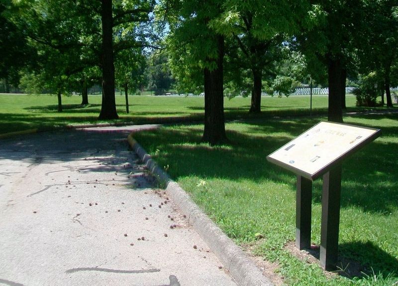
On Sheridan Road 0.3 miles east of Telegraph Road (Missouri Route 231), on the left when traveling east. Reported missing.
The Jefferson Barracks National Cemetery was established by joint resolution of Congress in 1866, among the first burial grounds officially designated in the wake of the Civil War. Under the care of the Veterans Administration, the facility is . . . — — Map (db m124986) HM
On University Drive north of Arnold B Grobman Drive, on the right when traveling north.
Dedicated to the founders of UMSL the residents of the Normandy area, whose generosity and foresight in acquiring the old Bellerive Country Club made this campus possible.
The clubhouse, which stood on this site, was the University's first . . . — — Map (db m151671) HM
On Worth Road south of Hancock Avenue, on the left when traveling north.
Ulysses Grant's arrival at Jefferson Barracks in September, 1843, as a new officer out of West Point, commenced a long relationship with St. Louis. In 1848, he married the former Julia Dent of St. Louis County, at the Dents' city home at Fourth . . . — — Map (db m163566) HM
Near Marine Avenue south of Crystal Springs Quarry Drive.
Water Trail
Saint Louis County Department of Parks is partnering with Great Rivers Greenway to bring you the Creve Coeur Water Trail. Whether by canoe, kayak or paddleboard, we invite you to come on this 6 mile journey across the lake and . . . — — Map (db m150906) HM
On Morgan Street near Main Street (U.S. 40), on the left when traveling east.
Born in slavery in St. Louis County, Mo.
Freed 1843
Founder, Elias Buckner African-American School in Boonville 1869 Established 32 Missouri schools for African-Americans in 1870
Secured state funding for Lincoln Institute (later Lincoln . . . — — Map (db m46016) HM
On North Broadway at Convention Plaza, on the right when traveling north on North Broadway.
May - In response to enabling legislation passed during the 1989 Missouri General Assembly session, the project's governmental sponsors (State of Missouri, St. Louis County, and The City of St. Louis) appointed 11 Commissioners, formally . . . — — Map (db m142042) HM
On St. Francois Street east of North St. Charles Street, on the right when traveling west.
A United States Navy veteran, Dave served on the Florissant City Council from 1976 - 1994 and was Council President in 1979. He served as President of the St. Louis County Municipal League in 1988 and was elected to four terms as a Missouri State . . . — — Map (db m145370) HM
On West Drive at Lucas Road, on the right when traveling south on West Drive.
Great Rivers Greenway is the public organization leading the development of a region-wide system of interconnected greenways, parks and trails, known as the River Ring. The River Ring will join two states and cover an area of 1,216 square miles. . . . — — Map (db m218973) HM
On Grant's Trail just west of Sappington Road, on the right when traveling west.
Sappington House
• The Sappington House is the historic home of Thomas Sappington. Thomas was one of the seventeen children of John and Jemima Sappington, early pioneers of the area. John and Jemima Sappington moved to this area in 1804 . . . — — Map (db m140976) HM
On Vincent Avenue at South Broadway Street (State Road 231), on the right when traveling west on Vincent Avenue.
Belles of St. Louis
In the 1820s , Jefferson Barracks was the largest military installation in the western United States, Consequently, many young men were stationed there fresh out of West Point,. Not surprisingly, many who would become . . . — — Map (db m192914) HM WM
Sandy Creek Covered Bridge is one of three historic Howe-truss bridges in Missouri. The bridge is 74 feet, 6 inches long and 18 feet, 10 inches wide with an entrance height of 13 feet. The original bridge was built in 1872 by John Hathaway Morse and . . . — — Map (db m211581) HM
The 1860 census shows 15,000 people living in Saline county, 5,000 of whom were enslaved African Americans. The collapse of the hemp market and emancipation in 1865 resulted in many African Americans leaving farms and plantations. Many "freedmen" . . . — — Map (db m247019) HM
On North Broadway at Convention Plaza, on the left when traveling south on North Broadway.
January - Site preparation and final design were completed.
March - Construction began of the foundation, anchored by 585 piers drilled into bedrock to provide maximum structural stability.
May-July - Bids were received and contracts were . . . — — Map (db m141887) HM
On Hancock Avenue at Center Road, on the right when traveling west on Hancock Avenue.
In 1826, the year of Thomas Jefferson's death, Jefferson Barracks, named after him, was established ten miles south of St. Louis. Now a Missouri Air National Guard installation, it is the oldest continuously operating U.S. military post west of the . . . — — Map (db m163572) HM
On Main Street (Missouri Route 87) east of High Street, on the left when traveling east.
The domed octagonal cupola, domed semicircular portico supported by curved brick columns of Corinthian order, 24-paned windows and fanlighted front door lend architectural interest to this classic revival-styled building completed in 1868. What . . . — — Map (db m62427) HM
Near Greens Bottom Road 1.3 miles west of Jungs Station Road, on the right when traveling west.
The distance from Greens Bottom to St. Charles is 6.20 miles. Traveling east toward St. Charles, the elevation remains almost constant. Greens Bottom (milepost 45.7) is named for the American Revolutionary War (1775-1783) veteran James Green, . . . — — Map (db m169568) HM
On Gateway Arch Trail, on the left when traveling north.
In 1854 Dred Scott, his wife Harriet, and a group of lawyers stood before the federal court here in St. Louis. The court rejected their claim for freedom. Four years earlier, Dred and Harriet sued for their freedom at the Old Courthouse and won, . . . — — Map (db m295571) HM
On Forsyth Boulevard at South Meramec Avenue, on the right when traveling east on Forsyth Boulevard. Reported missing.
The county was first visited by white colonists when missionary priests, Illinois French, and Kaskaskia and Tamaroa Indians settled the temporary village of Des Peres, 1700-03. The village site, laid out 18 years after La Salle claimed the . . . — — Map (db m213198) HM
Near Barrett Station Road east of Old Dougherty Ferry Road, on the right when traveling east.
"As one intrusted with your interests, I felt that your rights had been disregarded, and I did not fail to express my convictions in pretty strong language, to which Mr. Garrison and his associates took great exceptions and have . . . — — Map (db m303880) HM
On Natural Bridge Road (State Highway 115) at West Drive, on the right when traveling east on Natural Bridge Road. Reported unreadable.
Natural Bridge Road, the UMSL Campus and Surrounding Communities
This section of Natural Bridge Road began in St. Louis County in about 1837 as Owens Station Road, when it led from Normandy to Owens Station, a community that was . . . — — Map (db m151682) HM
On Delmar Boulevard west of Melville Avenue, on the right when traveling east.
A native son of Affton in St. Louis County, John Goodman studied drama at Southwest Missouri State and later made his mark with distinctive, often hilarious character performances in films such as "True Stories" and "Raising Arizona." Drawing on his . . . — — Map (db m124671) HM
On Rue de la Chapelle at Rue de Luxembourg, on the right when traveling east on Rue de la Chapelle.
In honor of the valiant 5th U.S. Armored Division who
liberated our country on September 10th 1944,
and in memory of Sgt Joseph L. Passet and
Sgt Jesse Mittiga, the first U.S. soldiers killed
on the soil of Sandweiler. — — Map (db m266124) HM WM
On East Main Street east of East State Street, on the right when traveling west.
The City of Union was founded in 1825. It was the second county seat of Franklin County, replacing New Port, which served the county from the time it separated from St. Louis County in 1818. In 1859, John T. Vitt constructed the brick building . . . — — Map (db m124309) HM
Near Missouri Route 94 0.6 miles east of Berg Crossing Drive, on the right when traveling east.
The Missouri River you see before you is not the same river that Lewis and Clark experienced on
their journey. For Lewis and Clark, the river was filled with islands, side channels flowing around the islands, quiet backwaters and marshes, as well . . . — — Map (db m254201) HM
Father Dickson Cemetery was founded in 1903. The cemetery is named for Moses Dickson, a prominent African American abolitionist who passed away in 1901 and was re-interred here. This was one of the first public cemeteries in St. Louis available . . . — — Map (db m163583) HM
Near Rue St. Francois 0.1 miles west of North St. Charles Street, on the right when traveling west. Reported unreadable.
A Fertile Valley
You are standing in one of Missouri's oldest settlements. In the last half of the 18th century, French trappers following the Riviere le Biche (Cold Water Creek) came upon this rich, fertile valley and settled here. Spanish . . . — — Map (db m288772) HM
Near Hancock Avenue west of Grant Road, on the right when traveling west.
Brief Historic Timeline
1826 Major Stephen Watts Kearny arrives and construction begins. New post named in honor of Thomas Jefferson.
1828 Jefferson Barracks troops involved in Native American insurrection and protecting traders . . . — — Map (db m254972) HM
On Mississippi River Greenway, on the left when traveling east.
Reception Center
World War II military posts were tents and simple wood frame buildings that tell a fascinating story of American ingenuity and the nation's ability to create and produce quickly, under pressure.
Beginning in 1940, the . . . — — Map (db m151569) HM
On Krumm Road 0.2 miles south of Meramec Bottom Road.
Welcome
Welcome to the Meramec Greenway Trail at the I-55 Trailhead. The next trailhead is located 2.0 miles upstream at the Lower Meramec Trailhead. This multi-use asphalt trail is a joint effort between Great Rivers Greenway and the Saint . . . — — Map (db m157252) HM
On Loop Road north of North Outer 40 Road, on the left when traveling east.
The Monarch-Chesterfield Levee System
The Monarch-Chesterfield Levee was constructed to protect the City of Chesterfield and adjacent communities from flooding caused by the Missouri River or one of its tributaries.
·The Great . . . — — Map (db m241167) HM
(left panel:)
History of the Quarry
Meramec Highlands Quarry in Dee Koestering Park served as a cornerstone of the Meramec Highlands Resort development, established circa 1890. The quarry may have started as a "local diggings" . . . — — Map (db m298984) HM
On North Leonor K Sullivan Boulevard at Biddle Street, on the right when traveling north on North Leonor K Sullivan Boulevard.
Jefferson National Expansion Memorial
Gateway Arch
• The Gateway Arch is a 630 feet tall stainless steel structure designed by famous architect Eero Saarinen. It symbolizes St. Louis's role as the gateway to the west.
• A tram takes . . . — — Map (db m144261) HM
Near East Grand Avenue. Reported permanently removed.
Industry on the River
• The St. Louis riverfront is a working industrial and shipping center for the only area in the country that produces six basic metals: iron, lead, zinc, copper, aluminum and magnesium.
• The City of St. Louis . . . — — Map (db m165761) HM
On Riverview Drive south of Scranton Avenue. Reported permanently removed.
Wildlife in Urban Environments
Wildlife Area
• While urban and industrial areas seem harsh and forbidding to wildlife, nature endures with a wide array of flora and fauna.
• Many wild creatures
• The area is home to many wild . . . — — Map (db m145730) HM
Near Delmar Boulevard near DeBaliviere Avenue, on the right when traveling west. Reported permanently removed.
The Ruth C. Porter Mall commemorates the life and legacy of Ruth C. Porter, a tireless activist who left an indelible mark on St. Louis and her home, the West End neighborhood.
At great personal sacrifice, she dedicated her life to eradicating . . . — — Map (db m141906) HM
On Fee Fee Road 0.3 miles south of Natural Bridge Road (State Highway B), on the right when traveling south.
Born May 30, 1869 daughter of Elbridge G. and Mary E. Long Payne. She lived here most of her life. She taught the one-room Fee Fee School in Pattonville, 1893-1896. She married William R. Gentry, of Columbia, Missouri, who moved here and became a . . . — — Map (db m169162) HM
On 2nd Street west of Club Road, on the right when traveling east.
Park History
• This area was originally named Meramec Bend for the "big bend" the Meramec River makes to the south.
• Nearby salt springs attracted early Native Americans and the valley's first European settlers. Numerous tribes . . . — — Map (db m194343) HM
On Grant Road west of Gravois Road ( Route 30), on the right when traveling west.
Ulysses S. Grant National Historic Site, a unit of the National Park Service, was established in 1990. Its 9.65 acres were the core of the 19th century farm called White Haven, where Ulysses S. Grant first met his wife, Julia Dent, raised a family, . . . — — Map (db m268913) HM
On Mississippi River Greenway, on the right when traveling east. Reported permanently removed.
The Might in the Middle
Welcome to Jefferson Barracks, a now decommissioned military post that has influenced almost two centuries of American history. Established in 1826 at the cost of a $5 gold piece, Jefferson Barracks began as a . . . — — Map (db m151570) HM
On Laclede Station Road at Bennett Avenue, on the right when traveling south on Laclede Station Road.
Arthur Ashe lived at 1221 Laclede Station Road in 1961-62 as the guest of owner Richard A. Hudlin. This side yard tennis court is where Mr. Hudlin helped Arthur improve his game.
This memorial recognizes two African-American men . . . — — Map (db m145182) HM
On Marshall Road east of Simpson Park Road, on the right when traveling east.
A Rocky History
• The area known as Simpson Park once belonged to the Simpson Sand and Gravel Company.
• The building of a dam to hold water from Grand Glaize Creek and a sand and gravel dredging operation helped create the existing . . . — — Map (db m194470) HM
On Bald Hill Road 0.1 miles north of Weber Drive, on the right when traveling north.
Located just south of downtown Eureka, Lions Park is named for the Eureka Lions Club and honors its community service and fundraising efforts for the Eureka area. Lions Club's generous donation helped established the athletic fields within the . . . — — Map (db m157385) HM
On Deer Lodge Road 0.4 miles north of Allen Road, on the left when traveling north.
Park History
• In April 1969, St. Louis County accepted a gift of 37.4 acres of land from Winter Brothers Material Company and a lease of 13.12 additional acres for $1.00 per year. This was the beginning of George Winter County Park. . . . — — Map (db m156709) HM
Near Barrett Station Road 0.5 miles south of Dougherty Ferry Rd, on the right when traveling east.
In 1944, St. Louis physician Dr. John Payne Roberts took action after learning a local transit company was sending a streetcar to a war-effort scrap drive. Fearing a piece of history would be lost, Roberts connected with other like-minded . . . — — Map (db m306102) HM
Near Bellefontaine Road 0.4 miles north of Fountainhead Lane, on the left when traveling north.
Why is this Park Important?
•St. Louis was a center of military activity for the trans-Mississippi West for 181 years (1765-1946)
•Cantonment Belle Fontaine - First Indian factory (trading post) built west of the Mississippi (1805) . . . — — Map (db m142539) HM
Forty acres of land were acquired by the Catholic church in the early 1830's from land in the Military Tract, which had been set aside for the veteran survivors of the War of 1812. Title to this land on the Southeast Quarter of the Northeast . . . — — Map (db m181443) HM
Near South Riverside Drive at Madison Street, on the right when traveling north.
The distance from St. Charles to Greens Bottoms is 6.20 miles. Traveling west toward Greens Bottom, the elevation remains almost constant. In St. Charles, the route of Katy Trail State Park runs beside the Missouri River bluffs. The . . . — — Map (db m169210) HM
For centuries, humans have used the land that is now Castlewood State Park in many ways. Water, the Meramec River to be specific, has drawn people to the area for a variety of reasons. Castlewood has seen human occupation over thousands of years, . . . — — Map (db m314827) HM
On Thornill Estate 0.2 miles Faust Park Drive, on the right when traveling north.
Built between the years 1815-1820
The residence of Frederick Bates
1777 - 1825
Secretary of the Louisiana Territory 1807 - 1820
Second Governor of Missouri
1824-1825
Thornhill was donated to St. Louis County by Mr. and Mrs. . . . — — Map (db m178571) HM
On Lindbergh Boulevard (U.S. 61/67) 0.2 miles west of Roxanna Drive, on the right when traveling north.
First city of the Trans-Mississippi West and second permanent settlement in Missouri. Founded, 1764, by the New Orleans Frenchman Laclede as a trading post to tap the rich fur resources of the Missouri Valley. Named for canonized Louis IX, French . . . — — Map (db m140858) HM
On Grant Road north of Gravois Road ( Route 30), on the right when traveling west.
Ulysses S. Grant National Historic Site, a unit of the National Park Service, was established in 1990. Its 9.65 acres were the core of the 19th century farm called White Haven, where Ulysses S. Grant first met his wife, Julia Dent, raised a . . . — — Map (db m297123) HM
Near East Waymire Avenue north of East Thornton Avenue.
Community Identity
The first African-American people came to the area of North Webster in the early 1800s as enslaved people farming the woodlands. Many freed African-American people stayed in North Webster after slavery was abolished, and . . . — — Map (db m218209) HM
Old Ordnance Room
The Old Ordnance Room was the first of two limestone buildings built in Jefferson Barracks for the purpose of storing gunpowder. It was constructed in 1851 by Master Builder Francis Quinette of St. Louis. The cost, just . . . — — Map (db m151466) HM
On Cliff Cave Road south of Bluff Road, on the left when traveling south.
Great River
As the last ice glaciers in the area melted nearly 12,000 years ago, Native Americans began occupying the Mississippi River and its valleys. They fished, hunted, gathered plants, grew crops, swam and traveled all along the . . . — — Map (db m202792) HM
On South McKnight Road north of Manchester Road ( Highway 100), on the right when traveling north.
[Plaque to the left of the door]
Faifax House
This house, built circa 1841, by James Collier Marshall an early resident of the Rock Hill area, is one of the oldest homes along Manchester Road, in St. Louis County, Missouri . . . — — Map (db m124919) HM
Thin black lines indicate changes in relevance. Between each pair of lines entries are ordered geographically but all have the same relevance.
* Inflectional forms of words are their plurals, singulars, and possessives as well as gramatical tenses and similar variations.