Near Old Post Road at Beach Road, on the right when traveling north.
Fairfield's prominence brought many important visitors to town, including President George Washington, who recorded his October 16, 1789 visit in his journal. The newly inaugurated president of the United States likely spent the night at Samuel . . . — — Map (db m203404) HM
On Ridgebury Road at George Washington Highway, on the right when traveling south on Ridgebury Road.
Ridgebury, "The New Patent," was one of the last land purchases made by the Proprietors. Tradition says that the First Congregational Church in Ridgebury had its beginnings in the "New Patent Meeting House" as early as 1738. In 1768 the . . . — — Map (db m32052) HM
On Ridgebury Road at George Washington Hwy., on the right when traveling south on Ridgebury Road.
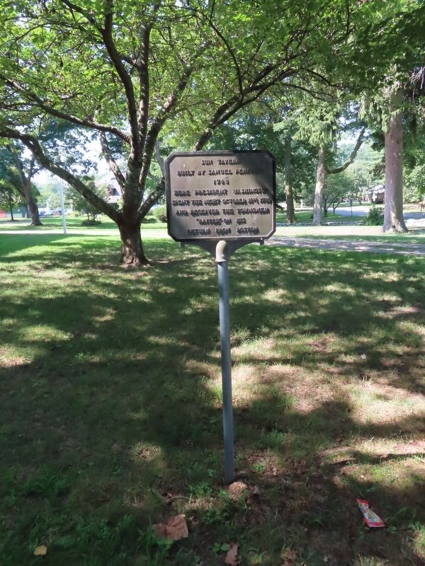
Gathered Built 1760 1851 This property is listed in the National Register of Historic Places by the United States Department of the Interior < Second Plaque: > Connecticut Washington – Rochambeau Revolutionary . . . — — Map (db m23423) HM
On Main Street at Gold Street, on the right when traveling north on Main Street.
George Washington
was entertained by
Colonel Jeremiah Wadsworth in his home on this site on June 30, 1775 when on his way to Cambridge to assume command of the Army.
On September 21, 22, 23, 1780 with Lafayette, General Knox and Governor . . . — — Map (db m151930) HM
On South Carolina Avenue Southeast just east of 6th Street Southeast, on the right when traveling east.
Since 1936 Friendship House, across the street, has operated an array of social service programs from this grand Federal style house, also known as "The Maples." Friendship House is the city's oldest such agency. It was founded in 1904 by . . . — — Map (db m166999) HM
On South Liberty Street (U.S. 25) 0 miles south of West 6th Street (Georgia Route 80), on the right when traveling south.
The game is yet in our own hands; to play it well is all we have to do – nothing but harmony, honesty, industry and frugality are necessary to make us a great and happy people.
George Washington — — Map (db m59851) HM
On North Liberty Street (U.S. 25) near Sixth / Peace Street (Georgia Route 56).
Traveling from Savannah to Augusta on his Southern tour of 1791, President George Washington stopped in Waynesboro on May 17. Departing from Savannah two days earlier, Washington lodged at "one Spencers " in Effingham County, fifteen miles north of . . . — — Map (db m7800) HM
On E. 6th Street at N. Liberty Street, on the right when traveling west on E. 6th Street.
On July 31, 1783, an Act was passed by the General Assembly meeting in Augusta to lay out a town, Waynesborough, on reserved or private land. Commissioners named (Thomas Lewis, Sr., Thomas Lewis, Jr., John Duhart, Edward Telfair, John Jones) were . . . — — Map (db m7868) HM
On Augusta Road (State Highway 21/30) north of Drakie Road, on the right when traveling north.
Near here stood Mulberry Grove, plantation home of General Nathanael Greene and Catherine Littlefield Greene. President George Washington twice visited the widowed Mrs. Greene at Mulberry Grove during the Southern tour of 1791. Traveling downriver . . . — — Map (db m18640) HM
On W State Street at Barnard Street, on the right when traveling west on W State Street.
During his visit to Savannah May 12-15 1791 was a guest at the Inn which stood on the northwest corner of Barnard and State Streets. This tablet is placed in commemoration of the bi-centenary of his birth by the Daughters of the American Revolution . . . — — Map (db m241960) HM
On Abercorn Street at E.St Julian Street, on the right when traveling north on Abercorn Street.
Where colony's production of silk was reeled until 1771. Building then used for public purposes. President Washington attended a ball here in 1791.
Building destroyed by fire in 1859. — — Map (db m9391) HM
Near Bull Street near East Congress Street, on the left when traveling north.
During his Southern tour of 1791, President George Washington attended services at the original Christ Church on Sunday, May 15. While in Savannah from May 12-15, Washington lodged at a house on the corner of Barnard and State streets on St. James . . . — — Map (db m5696) HM
On Ebenezer Road (State Highway 275) at Rincon-Stillwell Rd, on the right on Ebenezer Road. Reported missing.
Five miles South on this road, George Washington spent Sunday night, May 15, 1791, at the house of "one Spencer." The occasion was Washington's Southern tour, and he was traveling in his carriage over this road from Savannah to Augusta.
Four . . . — — Map (db m7688) HM
On 13th Street (U.S. 1) near Independence Drive, on the left when traveling north.
400 feet west of here is Meadow Garden, home of George Walton, Revolutionary Patriot and soldier, Governor, Congressman, Senator, Jurist. With Button Gwinnett and Lyman Hall, he signed the Declaration of Independence, July 4, 1776, for the State of . . . — — Map (db m33358) HM
During his Southern tour of 1791, President George Washington visited Augusta--at that time Georgia's capital--from May 18-21. Washington met with Governor Edward Telfair and other "principal gentlemen of the place," including George Walton and . . . — — Map (db m9708) HM
On Newington Highway (State Highway 24), on the right when traveling south.
"Monday, May 16th, 1791" wrote President George Washington in his diary as he recorded the date of his lodging in the Inn of Stephen Calfrey Pearce, 200 yards [from] this marker. Being forewarned, the Pearces had made lavish preparation for the . . . — — Map (db m16434) HM
On Burton's Ferry Highway (U.S. 301) at Waynsboro Highway (State Highway 24), in the median on Burton's Ferry Highway.
President Washington passed here early on the morning of Tuesday, May 17th, 1791, enroute to the home of William Skinner with whom he had breakfast. The Skinner home, still standing (1953), is about 5 miles northwest. President Washington spent the . . . — — Map (db m7795) HM
On Greene Street at Bridge Street on Greene Street.
Our founding father spent much time in this vicinity when a young man as surveyor, ambassador, aide-de-camp to General Braddock, and commander of Virginia military forces. This cabin served as his headquarters during part of this time.
Young . . . — — Map (db m167057) HM
As colonel under General Braddock at Fort Cumberland during the French and Indian War 1755 - 1758 and as Commander-in-Chief of the American Army in 1794Presented to the City of Cumberland by James Walter Thomas, L.L.D.; Litt.D. dedicated April . . . — — Map (db m17724) HM
On Oldtown Road (Maryland Route 51) at Opessa Street, on the right when traveling east on Oldtown Road.
Fording place for “Great Warriors Path” from New York to the South. Thomas Cresap built stockade fort here in 1741 used as a refuge during French and Indian War after Braddock’s defeat.
George Washington
was here on his first . . . — — Map (db m447) HM
On Conduit Street near Gorman Street, on the left when traveling south.
Just north of this building, facing Main Street, stood Mann’s Tavern where twelve delegates from five states met in 1786 to discuss commercial problems of the new nation. Their call for another convention in Philadelphia to render the government . . . — — Map (db m130220) HM
On Muddy Creek Road, 0.1 miles east of Galesville Road, on the right when traveling east.
Cedar Park
Patented to Richard Ewen in 1666 as “Ewen upon Ewenton.” Brick house built c.1697 by Richard Galloway II around earlier frame structure possibly dating back to 1656. Known as “West River Farm” in 18th Century. . . . — — Map (db m65889) HM
On Solomons Island Road (Maryland Route 2) at Harwood Road, on the left when traveling south on Solomons Island Road.
Jonathan Rawlings given a license to keep an “ordinary” (tavern) in 1771.
George Washington
dined here September 26, 1773, on his way to the Annapolis races. — — Map (db m3141) HM
1754–1914.
This oldest colonial structure of Baltimore was built in 1754 upon the estate known as “Georgia Plantation”
by
Charles Carroll, Barrister
1723–1783
One of the foremost patriots of . . . — — Map (db m41351) HM
On Market Street at Bladen Street, on the right when traveling east on Market Street.
Laid out and erected as a town by Act of Assembly in 1742 “there being as yet no such place settled at, or near the head of Chesapeake Bay".
George Washington
records many visits to Charlestown in his diary. He lodged here Aug. 10, . . . — — Map (db m144413) HM
On Hermitage Drive, 0.2 miles north of East Main Street, on the right.
Part of Friendship Tract and home of Robert Alexander, delegate to the Provincial Convention of 1774 and to the Continental Convention of 1776. On August 25, 1777, he was host to Washington here and three days later offered allegiance to British . . . — — Map (db m154176) HM
On Broad Street, 0.1 miles west of River Road, on the right when traveling west.
Old Post Road
Established 1666
Lower Susquehanna Ferry
established 1695
Rodgers’ Tavern
where
George Washington
frequently stopped
between
1781–1798 — — Map (db m145429) HM
On Cecilton-Warwick Road (Maryland Route 282) at Worsell Manor Road on Cecilton-Warwick Road.
Patented 5th June, 1685, to Major Peter Sayer, a prominent Catholic. Later acquired by the Heath Family. On 14th May, 1773, George Washington “din’d and lodg’d at Mr. DL. Heath’s” taking his stepson Jackie Custis to King’s College, N.Y. . . . — — Map (db m65392) HM
On Cecilton-Warwick Road (Maryland Route 282) 0.1 miles west of Church Road, on the left when traveling east.
Visited Warwick Feby. 1756, March 1756. “Din’d and lodg’d at Mr. D’L Heath’s May 1773. Passed through Sept. 9 and Oct. 28, 1774. Breakfasted March 23, 1791 and again in September 1793. — — Map (db m152183) HM
On Liverpool Point Road at Beaverdam Road, on the right when traveling east on Liverpool Point Road.
Two miles southwest Washington owned 600 acres of land bought in 1775 and retained until his death. In 1786 he visited this property accompanied by Gen. Smallwood. — — Map (db m6231) HM
The Indian village of Potobac, visited in 1608 by Capt. John Smith, occupied this site. County Seat of Charles County, 1658 - 1895. Washington visited here frequently. Site of St. Columba Lodge No. 11 A. F.& A. M., chartered April 18, 1793. — — Map (db m128824) HM
On Port Tobacco Road (Maryland Route 6) at Poorhouse Road, on the right when traveling west on Port Tobacco Road.
Daniel St. Thomas Jenifer’s home.
First President of the Maryland
Senate 1777-81. Close friend of
George Washington
who visited here June 3rd, 1763. — — Map (db m1235) HM
On Chicamuxen Road (Maryland Route 224) at Sweden Point Road, on the right when traveling south on Chicamuxen Road.
One mile from here lived Gen. Wm. Smallwood, commander of the Maryland troops which saved Washington’s Army at Long Island. Governor of Maryland from 1785 to 1788. Washington visited here in 1786. — — Map (db m6081) HM
On Catoctin Mountain Highway (U.S. 15) at Willow Road, on the right when traveling north on Catoctin Mountain Highway.
On August 5 and 6, 1785, and again June 30 and July 1, 1791, was the guest of Thomas Johnson at the latter's manorial residence which stood on the site of the present farm house, about 150 yards east of this point. Thomas Johnson, a member of the . . . — — Map (db m1538) HM
On Hutton Road (Maryland Route 39) west of Old Crellin Road, on the right when traveling west.
George Washington stopped here Sept. 26, 1784 on his trip to determine a feasible passage between the Potomac and the Ohio for a canal or easy portage between these rivers as a passage to the Western Territory. — — Map (db m479) HM
On National Pike (U.S. 40) 0.8 miles east of the Pennsylvania state line, on the right when traveling west.
General Braddock's 6th camp on the march to Fort Duquesne Saturday and Sunday June 20th and 21st, 1755. Washington was forced to remain behind with a guard on account of "violent fevers" until cured by "Dr. James's Powders (one of the most excellent . . . — — Map (db m135626) HM
On National Pike (Alternate U.S. 40) east of Chestnut Ridge Road (U.S. 219), on the right when traveling east.
General Braddock's 4th camp on the march to Fort Duquesne June 17, 1755. Washington arrived here after Braddock's defeat July 15th, 1755. Washington also stopped here May 9th, 1754, July 7th or 8th, 1754, October 1st, 1770, November 26th, 1770 and . . . — — Map (db m361) HM
On Garrett Highway (U.S. 219) at Paul Friend Road, on the left when traveling south on Garrett Highway. Reported damaged.
The first trail through The Glades passed near this point. George Washington on his visit here in September 1784, wrote of it: “McCulloch’s Path which owes its origin to buffaloes, being no other than their tracks from one lick to . . . — — Map (db m457) HM
The flat land beside the little Youghiogheny River on the western edge of Oakland has two items of historic interest. First, it contains a spring, and according to tradition, George Washington stopped at the spring on the morning of September 26, . . . — — Map (db m68806) HM
On Norrisville Road (Maryland Route 23) at Troyer Road, on the left on Norrisville Road.
George Washington stayed here the night of June 5, 1773 on his way back to Mt. Vernon from Columbia College, New York, where he had left his step-son Jackie Custis. — — Map (db m1408) HM
On Old Washington Road, 0.1 miles south of Washington Boulevard (U.S. 1), on the right when traveling south.
An important colonial port for shipment of Tobacco. Here in 1765 Zachariah Hood, Maryland’s “Stamp Act” agent, was hanged in effigy. Lafayette’s troops camped here April 17-18, 1781 on the way to engage Cornwallis in Virginia. George . . . — — Map (db m3144) HM
On Washington Boulevard (U.S. 1) 0.2 miles south of South Street, on the right when traveling south.
An important colonial port for shipment of Tobacco. Here in 1765 Zachariah Hood, Maryland’s “Stamp Act” agent, was hanged in effigy. Lafayette’s troops camped here April 17-18, 1781 on the way to engage Cornwallis in Virginia. George . . . — — Map (db m3145) HM
On Washington Road (U.S. 1) 0.2 miles north of Waterloo Road (Maryland Route 175), on the right when traveling north. Reported missing.
Thomas Spurrier's stood at nearby crossroads connecting two important overland routes in colonial days (now U.S. 1 and MD. 175.) George Washington stopped here at least 25 times between 1789 and 1798. His diary noted July 18, 1795: "Dined and lodged . . . — — Map (db m3236) HM
On Waterloo Road (Maryland Route 175) 0.1 miles west of Washington Boulevard (U.S. 1), on the right when traveling east.
George Washington
stopped here at least twenty five times between 1789 and 1798. On July 18, 1795, his diary says:
"Dined and lodged at Spurrier's where my sick horse died." — — Map (db m3238) HM
On High Street at Cross Street (Maryland Route 289), on the left when traveling south on High Street.
County seat of Kent County. Established in 1706. Situated on the most traveled highway between south and north during the revolutionary period. George Washington made eight known visits here between 1756 and 1793. Rich in Colonial History. — — Map (db m3059) HM
On South Main Street (Maryland Route 313/290) at W. Cross Street (Maryland Route 213), on the left when traveling north on South Main Street.
On this site stood the tavern erected by William Downs in 1763. Burned in 1893. George Washington stopped here in 1774 en route to and from the first Continental Congress. He traveled this road on his eight visits to Kent County. — — Map (db m155488) HM
On Maryland Route 213 at Queen Street, on the right when traveling south on State Route 213.
Erected by act of Assembly of Maryland, May 1736, on a tract called Tolchester. A base of Continental supplies, 1775 to 1783. Port of Entry and ferry landing. George Washington stopped here enroute to points north and south.
Burned by British . . . — — Map (db m155498) HM
On Sharp Street at Main Street (Maryland Route 445), on the right when traveling east on Sharp Street.
Formerly known as Rock Hall Cross Roads. Main Street is part of first road cut in Kent County in 1675. George Washington passed here eight known times. Tench Tilghman used this route from Yorktown to Philadelphia in October 1781. — — Map (db m3075) HM
On Darnestown Road (State Highway 28) 3 miles south of Martinsburg Road.
Thomas Sprigg, Jr., patented in 1725 as "Woodstock" 1,102 acres here, inherited in 1782 by Sprigg's three granddaughters, Sophia, Rebecca, and Elizabeth. Sophia married John Francis Mercer (later Governor of Maryland, 1801-1803.) in 1794. Nearly . . . — — Map (db m151719) HM
On Fort Washington Road, 0.8 miles west of Old Fort Road, in the median.
Home of the Digges Family
(descendants of Edward Digges,
governor of Virginia, 1652–1668)
The most intimate friend of
George and Martha Washington
in Prince George’s County,
where they visited many times. . . . — — Map (db m3663) HM
On Broad Creek Church Road, 0.1 miles south of Oxon Hill Road, on the right when traveling south.
(King George's Parish Established 1692)
Credible evidence and honest
tradition record that
Washington
attended services here on
numerous occasions. — — Map (db m3662) HM
On Largo Road (Route 202) 0.1 miles south of Kettering Drive, on the right when traveling south.
Known as “Castle Magruder” where lived Rev. Jonathan Boucher, tutor to “Jackie” Custis.
George and Martha Washington,
Nelly and John Parke Custis, Benedict Calvert, and Robert Eden, last royal governor of . . . — — Map (db m3631) HM
On Old Marlboro Pike (Maryland Route 725) 0.5 miles east of Woodyard Road (Maryland Route 223), on the left when traveling east.
The home of Ignatius Digges whose daughter Mary, married Thomas Sim Lee, twice Governor of Maryland. Lee died here, 1819. General George Washington visited here four times and Martha Washington once. In the War of 1812 British officers stopped here . . . — — Map (db m62919) HM
On Old Marlboro Pike (Maryland Route 725) at Main Street (Maryland Route 725), on the left when traveling east on Old Marlboro Pike.
George Washington
"lodged" here August 31, 1774, going to
First Continental Congress
May 4, 1775, on his way to
Second Continental Congress
where, on Jun 15, 1775, he was elected "General and Commander-in-Chief of the Army of the . . . — — Map (db m34330) HM
On South Potomac Street at West Memorial Boulevard, on the right when traveling south on South Potomac Street.
1774
On July 2, 800 citizens meet in Elizabeth Town and pledge to boycott British goods, especially tea. This is done to support the citizens of Boston because their port had been closed by Parliament.
1775
In August, a colonial . . . — — Map (db m146011) HM
On Western Pike (Maryland Route 144), on the right when traveling west.
George Washington’s diary (while he visited Berkley Springs in 1769) states: “Aug. 30 Old Mr. Flint dined with us” and on Sept. 4: “Rid to the Potomac where my horses were. From thence to Mr. Flint’s and to the Pennsylvania Line, . . . — — Map (db m61485) HM
On E. Potomac Street (U.S. 11) at Springfield Lane, on the right when traveling east on E. Potomac Street.
Home of Brig. Gen. Otho Holland Williams, Revolutionary War hero and founder, 1786, of Williamsport, and of Col. Elie Williams, president of commission to lay out National Road and chief surveyor Chesapeake and Ohio Canal. President George . . . — — Map (db m3909) HM
On Brattle Street, on the right when traveling west.
Built in 1759 Headquarters for George Washington 1775 – 1776 . Home of Henry Wadsworth Longfellow Family & Descendants 1837 1950 — — Map (db m19085) HM
On Tremont Street south of Court Street, on the left when traveling south.
In 1789 President George Washington stayed at Joseph Ingersoll's inn at this site while visiting Boston. Massachusetts Governor John Hancock's visit to meet Washington here is regarded as an early acceptance of Federal sovereignty over that of . . . — — Map (db m215167) HM
On Hunking Street west of Mechanic Street, on the right when traveling west.
Colonel Tobias Lear
was born in this house in 1760.
He was George Washington’s Secretary
from 1783 to 1799.
Washington visited here in 1789.
This tablet is placed by the Society
of the Sons of the Revolution
of the State of New . . . — — Map (db m115969) HM
On Palisade Avenue, on the left when traveling south.
General Washington was in Fort Lee many times during the Battle of New York. His main headquarters was in Hackensack, but had a temporary headquarters in Fort Lee near Anderson Avenue and Elizabeth Street. His main objective in Fort Lee was to . . . — — Map (db m7647) HM
Hackensack was a small village centered around The Green which served as a strategic point during the American Revolution.
Washington headquartered here in November 1776 while he surveyed the local roads and bridges. — — Map (db m6867) HM
On Franklin Avenue at Ramapo Valley Road (U.S. 202), on the right when traveling west on Franklin Avenue.
This Dutch Colonial house was built by Hendrick Van Allen before the Revolutionary War on a farm that consisted of over two-hundred acres. General George Washington used this house as his Headquarters on July 14-15, 1777, when he moved his troops . . . — — Map (db m12336) HM
On Franklin Avenue at Ramapo Valley Road (U.S. 202), on the right when traveling west on Franklin Avenue.
Located on Ramapo Valley Road key military highway for troops and supply units during the Revolutionary War this building served as General George Washington's headquarters on July 14, 1777 and as the Bergen County Court House in 1778 – 1779. — — Map (db m12335) HM
On Forest Avenue, on the left when traveling north.
The Continental Army is reported to have utilized the old spring at the base of these slopes during the September encampment west of the Hackensack River. Reports indicate that General Washington visited here and drank water from the spring. — — Map (db m8413) HM
On Forest Avenue, on the left when traveling north.
Howland Avenue divided the farms of miller Cornelius Van Saun to the south and Christian Dederer to the north. Hendrick Banta lived west of Mill Creek. The Continental Army moved into Bergen County in August 1780 to forage for food and to await the . . . — — Map (db m8412) HM
On E Glen Avenue, on the right when traveling east.
Organized in 1725 by pioneer Dutch settlers, the congregation of this church has worshipped here over 240 years. First church, built 1735 on this land given by Peter Fauconier, a French Huguenot, was a headquarters of Gen. George Washington in . . . — — Map (db m24983) HM
On Valley Road (County Route 621) at Claremont Avenue (County Route 654), on the right when traveling south on Valley Road.
This boulder which lay from time immemorial on this site near the turn of the old road marks the location of a house used by General George Washington as temporary headquarters on October 26, 1780 while on march from Totowa now Paterson to . . . — — Map (db m7572) HM
On George Street (County Route 672), on the left when traveling west.
Built about 1735 and occupied until 1774 by Anthony White whose wife was Elizabeth, daughter of Lewis Morris, and whose son was General Anthony White.
Owned and occupied from 1774 by General William Burton of the British Army.
Owned by the . . . — — Map (db m8979) HM
On Albany Street (New Jersey Route 27) at Neilson Street, on the left when traveling west on Albany Street.
Under the rooftree of the Inn which occupied this site General Washington tarried when in New Brunswick ----- On the adjoining square upon the arrival of the express rider the Declaration of Independence was acclaimed by all loyal citizens on July . . . — — Map (db m8954) HM
On S James Street, on the right when traveling west.
This tavern, operated at the time by John Manning, hosted the overnight stay of George Washington April 22, 1789 on route to his inauguration on April 30, 1789. Washington was accompanied on the part of the journey from New Brunswick to Rahway by . . . — — Map (db m8987) HM
Built in the early half of the 18th century, Cross Keys Tavern took its name from the Continental term “Cross Keys” denoting an important intersection. The two most important roads in colonial Woodbridge met at the present-day . . . — — Map (db m125888) HM
On S James Street, on the right when traveling west.
On April 22, 1789, George Washington stayed the night at this Tavern on his way from Mount Vernon, Virginia, to New York City for his inauguration as the first President of the United States.
1896 — — Map (db m194317) HM
On North Park Place at West Park Place, on the right when traveling south on North Park Place.
Site of Col. Jacob Arnold's Tavern. It was used as Washington's Headquarters January - May, 1777. Troops were in Lowantica Valley. — — Map (db m5949) HM
Near N Park Place, on the left when traveling west.
On January 6, 1777 General George Washington established his winter headquarters at Jacob Arnold’s Tavern, then located at what is now 20 Park Place. He occupied rooms on the second floor. His officers and men were quartered in every house and barn . . . — — Map (db m32723) HM
Near Chestnut Street, on the left when traveling west.
Morristown was a village of about 70 buildings in 1777.
General George Washington, Commander in Chief of the Continental Army, brought his tired troops to Morristown for rest and reorganization in January 1777. They had just completed . . . — — Map (db m7471) HM
On Washington Place at Morris Avenue, on the right when traveling east on Washington Place. Reported missing.
Washington made his winter headquarters at the Arnold Tavern, January 6, 1777, now a part of All Souls Hospital. December, 1779, he established quarters at the Ford Mansion, now maintained as a museum. — — Map (db m5946) HM
On Main Street (U.S. 202) at Heritage Ct., on the left when traveling north on Main Street.
Circa 1760 Dutch Stone House where George Washington and Alexander Hamilton stayed June 25-27, 1780, following the Battle of Springfield. French forces under Gen. Rochambeau rested in the orchard August 27, 1781, en route to Yorktown.
. . . — — Map (db m165838) HM
Washington’s Headquarters Nov. 21, 1776 was situated about one hundred feet west of this tablet. The entrance to the old Revolutionary Bridge was nearly opposite this spot.
Reset by the Acquackanock Landing Chapter D.A.R. 1930 — — Map (db m7045) HM
The Mansion of Colonel Theunis Dey The Headquarters of General Washington July ~ Oct ~ Nov ~ 1780 Acquired and restored 1930-1934 by The Passaic County Park Commission Marked by Capt. Abraham Godwin Chapter New Jersey Society S.A.R. . . . — — Map (db m39733) HM
On Totowa Road, on the left when traveling east. Reported missing.
This brick Georgian mansion was built by Colonel Theunis Dey in 1742. It was used as headquarters by General George Washington from July 1 to July 29, 1780 and again from October 8 to November 27, 1780 because of its strategic position and . . . — — Map (db m7701) HM
On Hamburg Turnpike (U.S. 202), on the right when traveling east.
This house, which is Wayne’s oldest, was built in 1695 by Ardent Schuyler, one of the leaders of the original settlement. William Colfax, who married Hester Schuyler in 1783, gave the house the Colfax name. — — Map (db m7704) HM
228 entries matched your criteria. The first 100 are listed above. Next 100 ⊳