THE HISTORICAL
MARKER DATABASE
“Bite-Size Bits of Local, National, and Global History”


899 entries match your criteria. The first 100 are listed.                                               Next 100 ⊳


Texas 1936 Centennial Markers and Monuments Historical Markers

In 1935/1936 the State of Texas Legislature created a commission to celebrate the 100th anniversary of Texas independence from Mexico. Part of this consisted of placing about 1,100 statues, and granite and bronze markers and monuments around Texas. See more at the Texas Historical Commission website 1936 Texas Centennial Markers.
 
By J. J. Prats, May 19, 2025
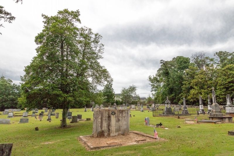
John Rusk / Mary Sterritt Monument
1 ► South Carolina, Pickens County, Clemson — John Rusk / Mary Sterritt — Builder of Old Stone Church, 1797 / Wife of John Rusk — Mother and Father of Thomas Jefferson Rusk —
Near Stone Circle at Old Stone Church Road.
2 ► Texas, Anderson County, Elkhart — 8795 — Dickinson Parker —
On Farm to Market Road 861 0.2 miles north of County Road 103, on the left when traveling north.
3 ► Texas, Anderson County, Elkhart — 8736 — Miles Bennett —
On Farm to Market Road 861 0.2 miles north of County Road 103, on the left when traveling north.
4 ► Texas, Anderson County, Elkhart — 8798 — Pilgrim Predestinarian Regular Baptist Church —
On Farm to Market Road 861 0.2 miles north of County Road 103, on the left when traveling north.
5 ► Texas, Anderson County, Elkhart — 8799 — Pilgrim Predestinarian Regular Baptist Church —
On State Highway 294 at Farm to Market Road 319, on the right when traveling east on State Highway 294.
6 ► Texas, Anderson County, Elkhart — 8794 — Rev. Daniel Parker —
On Farm to Market Road 861 0.2 miles north of County Road 103, on the left when traveling north.
7 ► Texas, Anderson County, Frankston — 8770 — Site of the Kickapoo Battlefield —
On Farm to Market Road 19 at Road 320, on the right when traveling south on Road 19.
8 ► Texas, Anderson County, Palestine — 8731 — Anderson County —
On North Mallard Street (State Highway 19) at East Poplar Street, on the right when traveling south on North Mallard Street.
9 ► Texas, Anderson County, Palestine — 8771 — Captain William Kimbro —
On East Market Street east of N Dechard St, on the right when traveling east.
10 ► Texas, Anderson County, Palestine — 8753 — Fort Houston —
On West Reagan Street at Knox Street, on the right when traveling east on West Reagan Street.
11 ► Texas, Anderson County, Palestine — 8746 — Henry Fields —
Near State Road 294 at County Road 2119.
12 ► Texas, Anderson County, Palestine — 8778 — Site of the McClean Massacre —
On County Road 185 0.3 miles east of County Road 190, on the right when traveling east.
13 ► Texas, Andrews County, Andrews — 167 — Andrews County —
On Eunice Highway (State Highway 176) 0.3 miles east of County Road 7001, on the right when traveling west.
14 ► Texas, Angelina County, Huntington — 7008 — Site of the Town of Jonesville —
On U.S. 69, on the left when traveling south.
15 ► Texas, Angelina County, Lufkin — 6981 — Angelina County —
On Charlton St. east of Third Street, on the right when traveling east.
Paid Advertisement
16 ► Texas, Angelina County, Lufkin — 7004 — Site of the town of Homer —
On Farm to Market Road 326, on the left when traveling west.
17 ► Texas, Aransas County, Fulton — 2537 — Home of George W. Fulton —
Near Henderson Street at Fulton Beach Road, on the left when traveling east.
18 ► Texas, Aransas County, Fulton — 2733 — Site of One of the Homes of James Power —
On State Highway 35 at Farm to Market Road 1781, on the left when traveling north on State Highway 35.
19 ► Texas, Aransas County, Lamar — 3018 — Site of the Town of Lamar —
On Bois D’Arc Street at Main Street, on the right when traveling north on Bois D’Arc Street.
20 ► Texas, Aransas County, Rockport — 180 — Aransas County —
On Broadway Street (State Highway 35) at East Orleans Street, in the median on Broadway Street.
21 ► Texas, Archer County, Archer City — 189 — Archer County —
On State Highway 79 0.3 miles north of Sam Cowan Road, on the right when traveling south.
22 ► Texas, Armstrong County, Goodnight — 4850 — Site of Old Goodnight Ranch —
Near County Road 25 0.2 miles south of U.S. 287, on the right when traveling south.
23 ► Texas, Armstrong County, Goodnight — 5528 — Town of Goodnight —
On Farm to Market Road 294 0.2 miles north of U.S. 287, on the left when traveling north.
24 ► Texas, Atascosa County, Jourdanton — 223 — Atascosa County —
On Campbell Avenue at Circle Drive, on the left when traveling north on Campbell Avenue.
25 ► Texas, Austin County, Bellville — 243 — Austin County —
On West Main Street (State Highway 36) at Nelsonville Road (State Highway 159), in the median on West Main Street.
26 ► Texas, Austin County, Bellville — 4018 — Michael Robert Pilley —
Near Amthor Street 0.1 miles south of East Main Street (Farm to Market Road 529).
27 ► Texas, Austin County, Buckhorn — 4213 — Sherwood Y. Reamos —
Near Ham Kendrick Road 0.2 miles south of Farm to Market Road 1456, on the left when traveling south.
28 ► Texas, Austin County, Cat Spring — 759 — Town of Cat Springs —
Near Hall Road at Farm to Market Road 1094.
29 ► Texas, Austin County, Industry — 2644 — Industry — Site of the first Permanent Settlement in Texas — 1831 —
On Schroeder Road 0.2 miles west of Ernst Parkway (Farm to Market Road 109), on the left when traveling west.
30 ► Texas, Austin County, New Ulm — 3586 — Site of the Town of New Ulm —
On Ernst Parkway (Farm to Market Road 109) at Missouri Street, on the right when traveling south on Ernst Parkway.
31 ► Texas, Austin County, San Felipe — 5514 — A Town Hall —
Near Farm to Market 1458 0.2 miles 2nd Street, on the left when traveling north.
Paid Advertisement
32 ► Texas, Bailey County, Muleshoe — 276 — Bailey County —
On South 1st Street (State Highway 214) south of West Avenue C, on the right when traveling south.
33 ► Texas, Bandera County, Bandera — 290 — Bandera County —
On State Highway 16 at Old San Antonio Road, on the right when traveling south on State Highway 16.
34 ► Texas, Bandera County, Bandera — 293 — Bandera Pass —
On Hwy 173 10.6 miles north of SR 16, on the left when traveling north.
35 ► Texas, Bastrop County, Bastrop — 9152 — Bastrop County —
On State Highway 21 at Loop State Highway 150, on the right when traveling east on State Highway 21.
36 ► Texas, Bastrop County, Bastrop — 9163 — Captain James Burleson —
On Pecan Street north of Walnut Street, on the right when traveling south.
37 ► Texas, Bastrop County, Bastrop — 9185 — Felipe Entrique Neri, Baron De Bastrop — 1770 - 1829 —
On Park Road 1-A 0.6 miles east of Loop Texas Highway 150 when traveling east.
38 ► Texas, Bastrop County, Bastrop — 16095 — Josiah Pugh Wilbarger — In Memoriam —
Near State Hwy 95.
39 ► Texas, Bastrop County, Bastrop — 9220 — Robert Love Reding —
Near State Highway 95 0.1 miles north of Farm Street.
40 ► Texas, Bastrop County, Bastrop — 9156 — Site of Bastrop Military Institute —
On Church Street at Buttonwood Street, on the right when traveling south on Church Street.
41 ► Texas, Bastrop County, Bastrop — 9176 — William Dunbar —
Near State Highway 95 0.1 miles north of Farm Street.
42 ► Texas, Bastrop County, Elgin — 9171 — Site of the Home of Col. Robert M. Coleman — (1799 -1837) —
On Farm to Market Road 969 0.2 miles west of Upper Elgin River Road (County Route 127), on the right when traveling east.
43 ► Texas, Bastrop County, Jeddo — Rev. Benjamin F. Fry —
Near Jeddo Road (County Highway 297) 0.2 miles north of Farm to Market Road 713.
44 ► Texas, Bastrop County, Smithville — 9199 — Captain John Campbell Hunt —
Near Powell Cemetery Road 0.1 miles north of Texas Highway 71.
45 ► Texas, Baylor County, Seymour — 340 — Baylor County —
On South Washington Street at McLain Street, on the left when traveling south on South Washington Street.
46 ► Texas, Bee County, Pettus — 351 — Bee County
On U.S. 181 at Main Street (Farm to Market Road 623), on the right when traveling north on U.S. 181. Reported missing.
47 ► Texas, Bell County, Belton — 357 — Bell County —
Near I-35 Frontage Rd.
Paid Advertisement
48 ► Texas, Bell County, Belton — 2723 — James H. Isbell —
On South Penelope Street at E Ave East on South Penelope Street.
49 ► Texas, Bell County, Belton — 3516 — Mrs. Sarah Ann Hardin-Kelton —
On East Avenue E east of South Penelope Street, on the left when traveling west.
50 ► Texas, Bell County, Belton — 23609 — Peter Hansbrough Bell — 1812 - 1898 —
On South Main Street at Water Street on South Main Street.
51 ► Texas, Bell County, Little River-Academy — 1986 — Fort Griffin —
On W Main Street (Farm to Market Road 436) at Wilson Valley Road, on the right when traveling west on W Main Street.
52 ► Texas, Bell County, Salado — 2535 — Home of Elijah Sterling Clack Robertson —
Near Interstate 35 Frontage Road.
53 ► Texas, Bell County, Salado — 5586 — Home of Orville Thomas Tyler — 1810 - 1856 —
On South Main Street, on the right when traveling south.
54 ► Texas, Bell County, Salado — 1179 — The Davis Mill —
On South Main Street at Pace Park Road, on the right when traveling north on South Main Street.
55 ► Texas, Bell County, Temple — 410 — Bird Creek Indian Battle — May 26, 1839 —
On West Nugent Avenue east of Merritt Street, on the right when traveling west.
56 ► Texas, Bexar County, San Antonio, Alamo Plaza — Gonzales Men at the Alamo —
Near Alamo Plaza.
57 ► Texas, Bexar County, San Antonio, Alamo Plaza — 95 — The Alamo Cenotaph — "The Spirit of Sacrifice" —
On Alamo Plaza at Houston Street, on the right when traveling north on Alamo Plaza.
58 ► Texas, Bexar County, San Antonio, Downtown — 3370 — Benjamin Rush Milam —
On West Commerce Street at North San Saba, on the right when traveling west on West Commerce Street.
59 ► Texas, Bexar County, San Antonio, East Side — 329 — In this Vicinity the Battle of Rosillo —
On Southeast Military Drive 0.1 miles west of Republic Pkwy.
60 ► Texas, Bexar County, San Antonio, East Side — 245 — Site of the Camp of Stephen F. Austin — October 20-26, 1835 —
On Rigsby Avenue 0.2 miles west of Shrader Street, on the right when traveling east.
61 ► Texas, Bexar County, San Antonio, East Side — 13356 — Young Perry Alsbury —
On Noblewood Drive west of Salado Creek Greenway.
62 ► Texas, Bexar County, San Antonio, Eastside Promise Neighborhood — 2943 — Charles Frederick King —
Near Paso Hondo at North Monumental Street.
63 ► Texas, Bexar County, San Antonio, Eastside Promise Neighborhood — 13333 — Colonel George Wythe Baylor —
On Paso Hondo Street, on the right when traveling east.
Paid Advertisement
64 ► Texas, Bexar County, San Antonio, Eastside Promise Neighborhood — 1903 — James Nathaniel Fisk —
Near East Commerence Street at North Monumental Street.
65 ► Texas, Bexar County, San Antonio, Eastside Promise Neighborhood — 1904 — Mrs. Simona Smith Fisk —
Near East Commerce Street.
66 ► Texas, Bexar County, San Antonio, Eastside Promise Neighborhood — 4963 — Samuel S. Smith —
Near Paso Hondo at North Monumental Street.
67 ► Texas, Bexar County, San Antonio, Inner West Side — 3329 — Capt. José Antonio Menchaca —
Near South Colorado Street at Vera Cruz.
68 ► Texas, Bexar County, San Antonio, Inner West Side — 4385 — Col. José Francisco Ruiz —
Near South Colorado Street at Vera Cruz.
69 ► Texas, Bexar County, San Antonio, Inner West Side — 3557 — José Antonio Navarro —
Near South Colorado Street at Vera Cruz.
70 ► Texas, Bexar County, San Antonio, Inner West Side — 3021 — Moses Lapham — Near Here on October 20, 1838 —
On U.S. 90 Access Road 1 mile east of Pinn Road, on the right when traveling west.
71 ► Texas, Bexar County, San Antonio, Inner West Side — 3848 — Placido Olivarri —
Near South Colorado Street at Vera Cruz.
72 ► Texas, Bexar County, San Antonio, Main/Military Plaza — 246 — Moses Austin —
On Plaza de Armas south of West Commerce Street, on the left when traveling south.
73 ► Texas, Bexar County, San Antonio, Near East Side — 335 — The Battle of the Salado —
On Holbrook Road, on the left when traveling south.
74 ► Texas, Bexar County, San Antonio, Near East Side — 1182 — The Dawson Massacre —
On Austin Highway (State Highway 368) at Corrine Drive, on the right when traveling south on Austin Highway.
75 ► Texas, Bexar County, San Antonio, South Side — 3380 — Mill on the Pajalache Acequia —
On Mission Road north of Yellowstone Street.
76 ► Texas, Bexar County, San Antonio, Southside — 12646 — The Battle of the Medina
On Martinez Losoya Road at U.S. 281, on the right when traveling east on Martinez Losoya Road. Reported damaged.
77 ► Texas, Bexar County, San Antonio, Thelka — 3414 — Mission San Francisco Xavier de Nájera — Approximate Location of —
On Mission Road 0.1 miles south of Hansford street, on the left when traveling south.
78 ► Texas, Blanco County, Round Mountain — 4121 — Robert Price —
On Round Mountain Cemetery Road 0.1 miles north of Ranch to Market Road 962.
79 ► Texas, Borden County, Gail — 456 — Borden County —
On U.S. 180 at North Elm Street, on the right when traveling east on U.S. 180.
Paid Advertisement
80 ► Texas, Bosque County, Meridian — 463 — Bosque County —
On State Highway 22 at State Highway 6, on the right when traveling east on State Highway 22.
81 ► Texas, Bowie County, Maud — 9478 — Site of Epperson's Ferry —
On U.S. 67 near Broadway, on the left when traveling east.
82 ► Texas, Bowie County, New Boston — 9469 — Bowie County —
On James Bowie Drive 0.1 miles east of North McCoy Boulevard (Texas Highway 8), on the right when traveling east.
83 ► Texas, Bowie County, Texarkana — James Bowie —
On North State Line Avenue at Hazel Street, on the left when traveling north on North State Line Avenue.
84 ► Texas, Bowie County, Woodstock — 9476 — Site of the Texas Home of Richard Ellis —
On State Highway 8 0.3 miles south of Woodstock Road, on the left when traveling south.
85 ► Texas, Brazoria County, Brazoria — 9525 — Don Carlos Barrett —
On China Street south of Camp Street, on the left when traveling south.
86 ► Texas, Brazoria County, Brazoria — Henry Smith —
On N. Brooks Street (State Highway 36) at W. Smith Street, on the right when traveling south on N. Brooks Street.
87 ► Texas, Brazoria County, Brazoria — 9522 — Site of the Home of John Austin —
On West Velasco Street at Marion Street, on the right when traveling north on West Velasco Street.
88 ► Texas, Brazoria County, Clute — 9521 — Dr. Branch Tanner Archer —
Near West Lake Jackson Road north of West Plantation Drive, on the right when traveling west.
89 ► Texas, Brazoria County, Clute — 9557 — Eagle Island Plantation —
On Plantation Drive at Dixie Drive, on the right when traveling west on Plantation Drive.
90 ► Texas, Brazoria County, Clute — 9614 — William Harris Wharton —
Near West Lake Jackson Road north of West Plantation Drive, on the right when traveling west.
91 ► Texas, Brazoria County, Damon — 9554 — Abraham Darst —
Near County Highway 8 0.1 miles south of Boone 6th Street.
92 ► Texas, Brazoria County, Damon — 9555 — Edmund Calloway Darst —
Near County Highway 8 0.1 miles south of Boone 6th Street.
93 ► Texas, Brazoria County, Freeport — 9606 — Four Miles Southeast to the Original Town of Velasco —
On Skinner Street at North Avenue B, on the left when traveling north on Skinner Street.
94 ► Texas, Brazoria County, Jones Creek — 9581 — Peach Point —
On State Highway 36 at Gulf Prairie Road, on the right when traveling east on State Highway 36.
95 ► Texas, Brazoria County, Liverpool — 9542 — Thomas Jefferson Callihan —
On Highway 272A at Cemetery Road, on the right when traveling east on Highway 272A.
Paid Advertisement
96 ► Texas, Brazoria County, Surfside Beach — 9616 — The Lively —
On Monument Drive west of Jettyview Road, on the right when traveling west.
97 ► Texas, Brazoria County, Sweeny — 9597 — Thomas Jefferson Sweeny —
Near Main Street (Farm to Market Road 524) 0.2 miles east of Old Main Street.
98 ► Texas, Brazoria County, West Columbia — 9575 — Home of George B. McKinstry — 1802 - 1837 —
Near Oil Field Road (County Route 467) 0.5 miles east of Texas Highway 36W, on the right when traveling east.
99 ► Texas, Brazoria County, West Columbia — 9540 — John S. D. Byrom —
Near East Jackson Street east of South 16th Street, on the right when traveling east.
100 ► Texas, Brazoria County, West Columbia — 9566 — Nathaniel C. Hazen —
Near East Jackson Street east of South 16th Street, on the right when traveling east.

899 entries matched your criteria. The first 100 are listed above. Next 100 ⊳
 
 
CeraNet Cloud Computing sponsors the Historical Marker Database.
This website earns income from purchases you make after using our links to Amazon.com. We appreciate your support.
Paid Advertisement
Oct. 19, 2026
