82 entries match your criteria.
Historical Markers and War Memorials
in Northeast Iowa — the Driftless Area Region
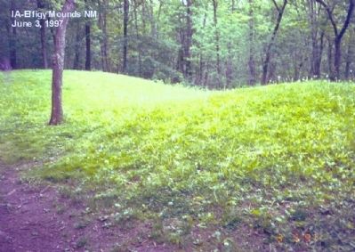
By Don Morfe, November 9, 2007
The Mystery of the Mounds Marker
| 1 ► Iowa, Allamakee County, Harper Ferry — The Mystery of the Mounds — Effigy Mounds National Monument — National Park Service, U.S. Department of the Interior |
| On State Highway 76. Reported permanently removed. | |||
2 ► Iowa, Allamakee County, Waukon — Allamakee County Court House Museum —  |
| On Allamakee Street, on the right when traveling north. | |||
| 3 ► Iowa, Allamakee County, Waukon — Gjefle Log Cabin — |
| On Allamakee Street Northwest (Iowa Route 9) 0.1 miles north of 1st Avenue Northwest, on the right when traveling north. | |||
| 4 ► Iowa, Allamakee County, Waukon — Waukon Freedom Rock Veterans Memorial — Honoring Allamakee County Veterans — Ray "Bubba" Sorensen II — |
| Near Rossville Road (State Highway 9) just north of 13th Avenue Southeast (Park Road), on the left when traveling north. | |||
| 5 ► Iowa, Clayton County, Farmersburg — National, Iowa Veterans Memorial — National Cemetery — |
| On River Bluffs Scenic Highway/Hiawatha Pioneer Trail (U.S. 52) at Ivory Rd (County Highway B60), on the right when traveling north on River Bluffs Scenic Highway/Hiawatha Pioneer Trail. | |||
| 6 ► Iowa, Clayton County, Guttenberg — 43 — Mississippi Valley Overlook — |
| On Great River Road Hiawatha Pioneer Trail (U.S. 52), on the right when traveling north. | |||
| 7 ► Iowa, Clayton County, Marquette — Old Military Trail — |
| Near Great River Road (State Highway 76) 2 miles north of U.S. 18, on the right when traveling north. | |||
| 8 ► Iowa, Clayton County, McGregor — Bat Caves — |
| Near River Street (Business U.S. 18) 0.4 miles north of Front Street, on the left when traveling north. | |||
| 9 ► Iowa, Clayton County, McGregor — Blacksmith Shop — |
| On Froelich Rd, on the left when traveling east. | |||
| 10 ► Iowa, Clayton County, McGregor — John Froelich — |
| On Froelich Road, on the left when traveling east. | |||
| 11 ► Iowa, Clayton County, McGregor — McGregor / Ringling Brothers — |
| On A Street / Dr. Clifford Smith Street west of Main Street ( Highway 76), on the right when traveling west. | |||
| 12 ► Iowa, Clayton County, McGregor — Pikes Peak Overlook Landscape Interpretation — |
| On Pikes Peak Road 0.5 miles east of County Highway X56. | |||
| 13 ► Iowa, Clayton County, McGregor — Point of Discovery — |
| Near Pikes Peak Road 0.5 miles east of Highway X56. | |||
| 14 ► Iowa, Clayton County, McGregor — The Froelich Train Depot — |
| On Froelich Road, on the right when traveling south. | |||
| 15 ► Iowa, Clayton County, McGregor — The Iron Clad Store & Post Office — Burlingame’s General Merchandise — |
| On Froelich Road, on the left when traveling east. | |||
| 16 ► Iowa, Fayette County, Clermont — Abraham Lincoln Statue and Park — Soldiers & Sailors of the Civil War — |
| Near Mill Street (U.S. 18) at Stone Street (County Road B60), on the right when traveling north. | |||
| 17 ► Iowa, Fayette County, West Union — Fayette County Historical Center — National Register of Historic Places — |
| On North Walnut Street just north of East Elm Street, on the right when traveling north. | |||
| 18 ► Iowa, Fayette County, West Union — William Wells — 1811-1877 — Founder of West Union — |
| Near North Vine Street north of East Elm Street, on the right when traveling north. | |||
| 19 ► Iowa, Howard County, Cresco — 101-A Train - EMD Model FP7 — |
| On 2nd Avenue SW at South Elm Street on 2nd Avenue SW. | |||
| 20 ► Iowa, Howard County, Cresco — Cresco Freedom Rock Veterans Memorial — Howard County Freedom Rock — — -- Ray “Bubba” Sorensen II -- — — |
| On 2nd Avenue SW at 3rd Street SW on 2nd Avenue SW. | |||
| 21 ► Iowa, Howard County, Cresco — Cresco Opera House — Iowa Historic Site — 1914-1915 — |
| On 2nd Avenue West west of North Elm Street, on the left when traveling west. | |||
| 22 ► Iowa, Howard County, Cresco — Dr. Norman E. Borlaug - March 25, 1914 - September 12, 2009 — |
| On 2nd Avenue SW at South Elm Street on 2nd Avenue SW. | |||
| 23 ► Iowa, Howard County, Cresco — Howard County Historical Society-1854 Log Cabin-Beadle Park — |
| On 2nd Avenue SW at South Elm Street on 2nd Avenue SW. | |||
| 24 ► Iowa, Howard County, Cresco — Space Tree — |
| On 2nd Avenue SW at South Elm Street on 2nd Avenue SW. | |||
| 25 ► Iowa, Howard County, Cresco — World War I Mine — |
| On 2nd Avenue SW at South Elm Street on 2nd Avenue SW. | |||
| 26 ► Iowa, Winneshiek County, Calmar — Winneshiek County Freedom Rock — Honoring Winneshiek County Veterans — Ray "Bubba" Sorensen II — |
| On Henry Street at Webster Street, on the left when traveling west on Henry Street. | |||
| 27 ► Iowa, Winneshiek County, Castalia — Old Homestead Farm — |
| On River Bluffs Scenic Highway /Hiawatha Pioneer Trai (U.S. 52), on the right when traveling west. | |||
| 28 ► Iowa, Winneshiek County, Decorah — "The Biggest Day in the History of the County" — Decorah: A Walk into the Past — Historic District Trail — |
| On West Main Street just west of Winnebago Street, on the left when traveling west. | |||
| 29 ► Iowa, Winneshiek County, Decorah — Bethania Church — Heritage Park, Vesterheim Norwegian-American Museum — |
| On North Mill Street just north of West Water Street, on the left when traveling north. | |||
| 30 ► Iowa, Winneshiek County, Decorah — Blacksmith Shop — Heritage Park, Vesterheim Norwegian-American Museum — |
| Near North Mill Street just north of West Water Street, on the right when traveling north. | |||
| 31 ► Iowa, Winneshiek County, Decorah — Conservation — Heritage Park, Vesterheim Norwegian-American Museum — |
| On North Mill Street just south of Heivly Street, on the left when traveling south. | |||
| 32 ► Iowa, Winneshiek County, Decorah — Decorah, Northeast Iowa, & the Neutral Ground — |
| On Court Street just south of West Main Street, on the left when traveling south. | |||
| 33 ► Iowa, Winneshiek County, Decorah — Decorah: A Walk into the Past — Water Street Trail — |
| On College Drive (County Highway W38) just north of West Water Street, on the right when traveling north. | |||
| 34 ► Iowa, Winneshiek County, Decorah — Decorah: A Walk into the Past — Water Street Trail — |
| On West Water Street at North Mill Street, on the right when traveling west on West Water Street. | |||
| 35 ► Iowa, Winneshiek County, Decorah — Decorah: A Walk into the Past — Water Street Trail — |
| On West Water Street just east of Mill Street, on the right when traveling east. | |||
| 36 ► Iowa, Winneshiek County, Decorah — Decorah: A Walk into the Past — Water Street Trail — |
| On West Water Street at River Street, on the right when traveling west on West Water Street. | |||
| 37 ► Iowa, Winneshiek County, Decorah — Decorah: A Walk into the Past — Water Street Trail — |
| On East Water Street at Riverside Avenue (Day Street), on the right when traveling west on East Water Street. | |||
| 38 ► Iowa, Winneshiek County, Decorah — Decorah: A Walk into the Past — Water Street Trail — |
| On West Water Street just east of River Street, on the right when traveling west. | |||
| 39 ► Iowa, Winneshiek County, Decorah — Decorah: A Walk into the Past — Water Street Trail — |
| On West Water Street at River Street, on the left when traveling west on West Water Street. | |||
| 40 ► Iowa, Winneshiek County, Decorah — Decorah: A Walk into the Past — Water Street Trail — |
| On West Water Street at Court Street, on the left when traveling west on West Water Street. | |||
| 41 ► Iowa, Winneshiek County, Decorah — Decorah: A Walk into the Past — Water Street Trail — |
| On West Water Street at Winnebago Street, on the left when traveling west on West Water Street. | |||
| 42 ► Iowa, Winneshiek County, Decorah — Decorah: A Walk into the Past — Water Street Trail — |
| On East Water Street at State Street, on the left when traveling west on East Water Street. | |||
| 43 ► Iowa, Winneshiek County, Decorah — Decorah: A Walk into the Past — Water Street Trail — |
| On North State Street at East Day Spring Lane, on the right when traveling north on North State Street. | |||
| 44 ► Iowa, Winneshiek County, Decorah — Decorah: A Walk into the Past — Water Street Trail — |
| On East Water Street at Washington Street, on the left when traveling west on East Water Street. | |||
| 45 ► Iowa, Winneshiek County, Decorah — Decorah: A Walk into the Past — Water Street Trail — |
| On West Main Street at Winnebago Street, on the right when traveling east on West Main Street. | |||
| 46 ► Iowa, Winneshiek County, Decorah — Decorah: A Walk into the Past — Historic District Trail — |
| On West Broadway Street at River Street, on the right when traveling east on West Broadway Street. | |||
| 47 ► Iowa, Winneshiek County, Decorah — Decorah: A Walk into the Past — Historic District Trail — |
| On West Broadway Street just west of River Street, on the left when traveling west. | |||
| 48 ► Iowa, Winneshiek County, Decorah — Decorah: A Walk into the Past — Historic District Trail — |
| On West Broadway Street at Court Street, on the right when traveling west on West Broadway Street. | |||
| 49 ► Iowa, Winneshiek County, Decorah — Egge-Koren House — Heritage Park, Vesterheim Norwegian-American Museum — |
| Near North Mill Street just north of West Water Street, on the right when traveling north. | |||
| 50 ► Iowa, Winneshiek County, Decorah — Haugan House — Heritage Park, Vesterheim Norwegian-American Museum — |
| Near North Mill Street just north of West Water Street, on the right when traveling north. | |||
| 51 ► Iowa, Winneshiek County, Decorah — Locust School — |
| On Big Canoe Road when traveling west. | |||
| 52 ► Iowa, Winneshiek County, Decorah — Norsvin Mill — Heritage Park, Vesterheim Norwegian-American Museum — |
| Near North Mill Street just north of West Water Street, on the right when traveling north. | |||
| 53 ► Iowa, Winneshiek County, Decorah — Painter-Bernatz Mill — Heritage Park, Vesterheim Norwegian-American Museum — |
| Near North Mill Street just south of Heivly Street, on the right when traveling north. | |||
| 54 ► Iowa, Winneshiek County, Decorah — Replica of the Statue of Liberty — |
| On West Main Street at Court Street, on the left when traveling west on West Main Street. | |||
| 55 ► Iowa, Winneshiek County, Decorah — Rovang Schoolhouse — Heritage Park, Vesterheim Norwegian-American Museum — |
| On North Mill Street just north of West Water Street, on the right when traveling north. | |||
| 56 ► Iowa, Winneshiek County, Decorah — Stabbur — Heritage Park, Vesterheim Norwegian-American Museum — |
| Near North Mill Street just north of West Water Street, on the right when traveling north. | |||
| 57 ► Iowa, Winneshiek County, Decorah — Stovewood House — Heritage Park, Vesterheim Norwegian-American Museum — |
| Near North Mill Street just north of West Water Street, on the right when traveling north. | |||
| 58 ► Iowa, Winneshiek County, Decorah — Tasa Drying Shed — Heritage Park, Vesterheim Norwegian-American Museum — |
| Near North Mechanic Street at West Day Spring Lane, on the left when traveling north. | |||
| 59 ► Iowa, Winneshiek County, Decorah — Timber Framing — Heritage Park, Vesterheim Norwegian-American Museum — |
| On North Mill Street just south of Heivly Street, on the left when traveling south. | |||
| 60 ► Iowa, Winneshiek County, Decorah — To Build, or Not To Build — Decorah: A Walk into the Past — Historic District Trail — |
| On Court Street just south of West Main Street, on the left when traveling south. | |||
| 61 ► Iowa, Winneshiek County, Decorah — Valders House — Heritage Park, Vesterheim Norwegian-American Museum — |
| Near North Mill Street just north of West Water Street, on the right when traveling north. | |||
| 62 ► Iowa, Winneshiek County, Decorah — Vesterheim — Heritage Park, Vesterheim Norwegian-American Museum — |
| Near West Water Street just east of North Mill Street, on the left when traveling east. | |||
| 63 ► Iowa, Winneshiek County, Decorah — Welcome to Vesterheim — The National Norwegian-American Musuem and Folk Art School — |
| On West Water Street just east of North Mill Street, on the left when traveling east. | |||
| 64 ► Iowa, Winneshiek County, Decorah — Wickney House — Heritage Park, Vesterheim Norwegian-American Museum — |
| Near North Mechanic Street just north of West Day Spring Lane, on the left when traveling north. | |||
| 65 ► Iowa, Winneshiek County, Decorah — Winnebago Street — Decorah: A Walk into the Past — Water Street Trail — |
| On Winnebago Street just south of West Main Street, on the left when traveling south. | |||
| 66 ► Iowa, Winneshiek County, Fort Atkinson — Constructing Fort Atkinson — The Story — Fort Atkinson State Preserve — |
| Near 2nd Street at 8th Avenue, on the right when traveling east. | |||
| 67 ► Iowa, Winneshiek County, Fort Atkinson — East Officers' Quarters — Family Life on the Frontier — Fort Atkinson State Preserve — |
| Near 2nd Street east of 8th Avenue, on the right when traveling south. | |||
| 68 ► Iowa, Winneshiek County, Fort Atkinson — Fort Atkinson — |
| On 2nd St. at 8th Ave. on 2nd St.. | |||
| 69 ► Iowa, Winneshiek County, Fort Atkinson — Guard House — Discipline When Needed — Fort Atkinson State Preserve — |
| Near 2nd Street at 8th Avenue, on the right when traveling east. | |||
| 70 ► Iowa, Winneshiek County, Fort Atkinson — North Barracks — A Soldier's Life — Fort Atkinson State Preserve — |
| Near 2nd Street at 8th Avenue, on the right when traveling east. | |||
| 71 ► Iowa, Winneshiek County, Fort Atkinson — Powder House — Precious Cargo — Fort Atkinson State Preserve — |
| Near 2nd Street east of 8th Avenue, on the right when traveling east. | |||
| 72 ► Iowa, Winneshiek County, Fort Atkinson — Root House & Ice House — Provisions for the Troops — Fort Atkinson State Preserve — |
| Near 2nd Street east of 8th Avenue, on the right when traveling south. | |||
| 73 ► Iowa, Winneshiek County, Fort Atkinson — South Barracks — Educational Teaching — Fort Atkinson State Preserve — |
| Near 2nd Street at 8th Avenue when traveling south. | |||
| 74 ► Iowa, Winneshiek County, Fort Atkinson — Stockade & Main Gate — Protecting the Troops — Fort Atkinson State Preserve — |
| Near 2nd Street east of 8th Avenue, on the right when traveling east. | |||
| 75 ► Iowa, Winneshiek County, Fort Atkinson — Sutler's Store and Post Commissary — Fort Atkinson State Preserve — |
| Near 2nd Street west of 8th Avenue, on the left when traveling west. | |||
| 76 ► Iowa, Winneshiek County, Fort Atkinson — The Block House — Strong Defense — Fort Atkinson State Preserve — |
| Near 2nd Street west of 8th Avenue, on the left when traveling west. | |||
| 77 ► Iowa, Winneshiek County, Hesper — Hesper Community — |
| On 380 Street (County Route 380) at 188th Ave (County Route 188), on the right on 380 Street. | |||
| 78 ► Iowa, Winneshiek County, Ridgeway — Lincoln Lutheran Congregation — |
| On County Road W14 just north of 225th Street, on the right when traveling north. | |||
| 79 ► Iowa, Winneshiek County, Spillville — Antonín Dvořák — |
| Near Bridge Street (Dvorak Memorial Highway) (County Highway B16) 0.2 miles east of South Main Street, on the right when traveling east. | |||
| 80 ► Iowa, Winneshiek County, Spillville — Clarence C. Haug Major General — |
| On South Main Street at Church Street (Dvorak Memorial Highway) (County Highway B16), on the left when traveling north on South Main Street. | |||
| 81 ► Iowa, Winneshiek County, Spillville — The Big Stone Mills — |
| On North Main Street just north of Mill Street, on the left when traveling north. | |||
| 82 ► Iowa, Winneshiek County, Spillville — Wenzil Taylor Building — Built 1871 — Iowa Historic Site — |
| On South Main Street just north of Bridge Street (Dvorak Memorial Highway) (County Highway B16), on the left when traveling north. | |||