56 entries match your criteria.
Entries Containing All of the Phrases «st louis county» AND «missouri»
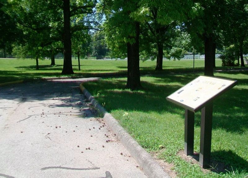
By William Fischer, Jr., July 10, 2016
Jefferson Barracks National Cemetery Marker
RANKED BY RELEVANCE
| 1 ► Missouri, St. Louis County, Lemay — Jefferson Barracks National Cemetery — Missouri's Civil War 1861 - 1865 |
| On Sheridan Road 0.3 miles east of Telegraph Road (Missouri Route 231), on the left when traveling east. Reported missing. | |||
2 ► Missouri, St. Louis County, Normandy, University of Missouri-St. Louis — UMSL Commons —  |
| On University Drive north of Arnold B Grobman Drive, on the right when traveling north. | |||
| 3 ► Missouri, St. Louis County, Lemay — U.S. Grant: The St. Louis Years — Missouri's Civil War — 1861-1865 — |
| On Worth Road south of Hancock Avenue, on the left when traveling north. | |||
| 4 ► Missouri, St. Louis County, Maryland Heights — Creve Coeur Lake Memorial Park - Water Trail — |
| Near Marine Avenue south of Crystal Springs Quarry Drive. | |||
| 5 ► Missouri, Cooper County, Boonville — James Milton Turner — (1839 - 1915) — |
| On Morgan Street near Main Street (U.S. 40), on the left when traveling east. | |||
| 6 ► Missouri, St. Louis, Downtown — 1990 — |
| On North Broadway at Convention Plaza, on the right when traveling north on North Broadway. | |||
| 7 ► Missouri, St. Louis County, Florissant — David L. Reynolds — 7 November 1936 - 9 January 2003 — |
| On St. Francois Street east of North St. Charles Street, on the right when traveling west. | |||
| 8 ► Missouri, St. Louis County, Normandy, University of Missouri-St. Louis — St. Vincent Greenway Trail - 3.5 Miles — |
| On West Drive at Lucas Road, on the right when traveling south on West Drive. | |||
| 9 ► Missouri, St. Louis County, Crestwood — Grant's Trail: Sappington House and Father Dickson Cemetery — |
| On Grant's Trail just west of Sappington Road, on the right when traveling west. | |||
| 10 ► Missouri, St. Louis County, Lemay — Longwood — The "Hancock Place" — Missouri's Civil War — |
| On Vincent Avenue at South Broadway Street (State Road 231), on the right when traveling west on Vincent Avenue. | |||
| 11 ► Missouri, Jefferson County, Hillsboro — History of Sandy Creek Covered Bridge — |
| Near Old Lemay Ferry Road. | |||
| 12 ► Missouri, Saline County, Nelson — Enslavement to Freedom — Sappington African American Cemetery State Historic Site — |
| Near Missouri Route AA north of County Route 216. | |||
| 13 ► Missouri, St. Louis, Downtown — 1993 — |
| On North Broadway at Convention Plaza, on the left when traveling south on North Broadway. | |||
| 14 ► Missouri, St. Louis County, Lemay — The Historic Parade Ground — Missouri's Civil War — 1861-1865 — |
| On Hancock Avenue at Center Road, on the right when traveling west on Hancock Avenue. | |||
| 15 ► Missouri, Moniteau County, California — Moniteau County Courthouse — |
| On Main Street (Missouri Route 87) east of High Street, on the left when traveling east. | |||
| 16 ► Missouri, St. Charles County, St. Charles — Greens Bottom to St. Charles — Points of Interest — |
| Near Greens Bottom Road 1.3 miles west of Jungs Station Road, on the right when traveling west. | |||
| 17 ► Missouri, St. Louis, Downtown — Freedom Denied, Freedom Gained — Jefferson National Expansion Memorial — National Park Service, U.S. Deparment of the Interior — |
| On Gateway Arch Trail, on the left when traveling north. | |||
| 18 ► Missouri, St. Louis County, Clayton, Downtown Clayton — Saint Louis County |
| On Forsyth Boulevard at South Meramec Avenue, on the right when traveling east on Forsyth Boulevard. Reported missing. | |||
| 19 ► Missouri, St. Louis County, Kirkwood, National Museum of Transportation — The Pacific Railroad Controversy — |
| Near Barrett Station Road east of Old Dougherty Ferry Road, on the right when traveling east. | |||
| 20 ► Missouri, St. Louis County, Normandy, University of Missouri-St. Louis — St. Vincent Greenway - University of Missouri - St. Louis |
| On Natural Bridge Road (State Highway 115) at West Drive, on the right when traveling east on Natural Bridge Road. Reported unreadable. | |||
| 21 ► Missouri, St. Louis County, University City, Delmar Loop — John Goodman — Born June 20, 1952 — |
| On Delmar Boulevard west of Melville Avenue, on the right when traveling east. | |||
| 22 ► Luxembourg, Lëtzebuerg, Sandweiler — U.S. Fifth Armored Division Memorial — |
| On Rue de la Chapelle at Rue de Luxembourg, on the right when traveling east on Rue de la Chapelle. | |||
| 23 ► Missouri, Franklin County, Union — Vitt's Mill — Missouri's Civil War — 1861-1865 — |
| On East Main Street east of East State Street, on the right when traveling west. | |||
| 24 ► Missouri, St. Charles County, Augusta — The Missouri River During The Lewis & Clark (Corps of Discovery) Expedition — |
| Near Missouri Route 94 0.6 miles east of Berg Crossing Drive, on the right when traveling east. | |||
| 25 ► Missouri, St. Louis County, Crestwood — Father Dickson Cemetery — Missouri's Civil War — 1861-1865 — |
| Near Sappington Road. | |||
| 26 ► Missouri, St. Louis County, Florissant — Sunset Greenway |
| Near Rue St. Francois 0.1 miles west of North St. Charles Street, on the right when traveling west. Reported unreadable. | |||
| 27 ► Missouri, St. Louis County, Lemay — Jefferson Barracks Historic Site — |
| Near Hancock Avenue west of Grant Road, on the right when traveling west. | |||
| 28 ► Missouri, St. Louis County, Lemay — Jefferson Barracks Historic Site - World War II Reception Center #1772 — |
| On Mississippi River Greenway, on the left when traveling east. | |||
| 29 ► Missouri, St. Louis County, Oakville — Meramec Greenway - Lower Meramec Park — |
| On Krumm Road 0.2 miles south of Meramec Bottom Road. | |||
| 30 ► Missouri, St. Louis County, Chesterfield — Missouri River Greenway - Monarch-Chesterfield Levee Trail — |
| On Loop Road north of North Outer 40 Road, on the left when traveling east. | |||
| 31 ► Missouri, St. Louis County, Kirkwood — The Meramec Highlands Quarry at Dee Koestering Park — |
| Near Marshall Road. | |||
| 32 ► Missouri, St. Louis, Near North Riverfront — Biddle Street Trailhead — |
| On North Leonor K Sullivan Boulevard at Biddle Street, on the right when traveling north on North Leonor K Sullivan Boulevard. | |||
| 33 ► Missouri, St. Louis, Near North Riverfront — Coast Guard Rest Stop |
| Near East Grand Avenue. Reported permanently removed. | |||
| 34 ► Missouri, St. Louis, Riverview — North Riverfront Park |
| On Riverview Drive south of Scranton Avenue. Reported permanently removed. | |||
| 35 ► Missouri, St. Louis, West End — Ruth Porter Mall Park |
| Near Delmar Boulevard near DeBaliviere Avenue, on the right when traveling west. Reported permanently removed. | |||
| 36 ► Missouri, St. Louis County, Bridgeton — Mary Lee Payne Gentry — |
| On Fee Fee Road 0.3 miles south of Natural Bridge Road (State Highway B), on the right when traveling south. | |||
| 37 ► Missouri, St. Louis County, Fenton — Meramec River Greenway - Unger Park — |
| On 2nd Street west of Club Road, on the right when traveling east. | |||
| 38 ► Missouri, St. Louis County, Grantwood Village — On "Grant's Trail" Through History — |
| On Grant Road west of Gravois Road ( Route 30), on the right when traveling west. | |||
| 39 ► Missouri, St. Louis County, Lemay — Jefferson Barracks - At the Confluence of American History |
| On Mississippi River Greenway, on the right when traveling east. Reported permanently removed. | |||
| 40 ► Missouri, St. Louis County, Richmond Heights — Richard A. Hudlin and Arthur R. Ashe, Jr. and the Bennett Avenue Historic District — |
| On Laclede Station Road at Bennett Avenue, on the right when traveling south on Laclede Station Road. | |||
| 41 ► Missouri, St. Louis County, Valley Park — Simpson Park and the Meramec River Greenway — |
| On Marshall Road east of Simpson Park Road, on the right when traveling east. | |||
| 42 ► Missouri, St. Louis County, Eureka — Meramec Greenway - Flat Creek Trail at Lions Park — |
| On Bald Hill Road 0.1 miles north of Weber Drive, on the right when traveling north. | |||
| 43 ► Missouri, St. Louis County, Fenton — Meramec River Greenway - Winter Park — |
| On Deer Lodge Road 0.4 miles north of Allen Road, on the left when traveling north. | |||
| 44 ► Missouri, St. Louis County, Kirkwood, National Museum of Transportation — The National Museum of Transportation: Our History — |
| Near Barrett Station Road 0.5 miles south of Dougherty Ferry Rd, on the right when traveling east. | |||
| 45 ► Missouri, St. Louis County, Spanish Lake — Welcome to Fort Belle Fontaine — |
| Near Bellefontaine Road 0.4 miles north of Fountainhead Lane, on the left when traveling north. | |||
| 46 ► Illinois, Hancock County, Fountain Green — St. Simon Cemetery — Looking for Lincoln — 1832 — |
| On East Co Road 1900 west of County Route 2900. | |||
| 47 ► Missouri, St. Charles County, Matson — Daniel Boone Judgment Tree Memorial — |
| On State Highway 94 north of Lucille Avenue, on the right when traveling north. | |||
| 48 ► Missouri, St. Charles County, St. Charles — St. Charles to Greens Bottom — Points of Interest — |
| Near South Riverside Drive at Madison Street, on the right when traveling north. | |||
| 49 ► Missouri, St. Louis County, Ballwin — 20th Century History of Castlewood — Castlewood State Park — |
| Near Kiefer Creek Road. | |||
| 50 ► Missouri, St. Louis County, Chesterfield — Thornhill — |
| On Thornill Estate 0.2 miles Faust Park Drive, on the right when traveling north. | |||
| 51 ► Missouri, St. Louis County, Sappington — Saint Louis — |
| On Lindbergh Boulevard (U.S. 61/67) 0.2 miles west of Roxanna Drive, on the right when traveling north. | |||
| 52 ► Missouri, St. Louis County, Affton — On "Grant's Trail" Through History — |
| On Grant Road north of Gravois Road ( Route 30), on the right when traveling west. | |||
| 53 ► Missouri, St. Louis County, Webster Groves — Stories That Shape Our Culture — Get to Know North Webster Groves — Deer Creek Greenway — |
| Near East Waymire Avenue north of East Thornton Avenue. | |||
| 54 ► Missouri, St. Louis County, Lemay — Jefferson Barracks Historic Site - Old Ordnance Room — |
| Near Bagby Road south of Gark Road. | |||
| 55 ► Missouri, St. Louis County, Oakville — History of the Area — How We Got Where We Are Today — Mississippi Greenway — |
| On Cliff Cave Road south of Bluff Road, on the left when traveling south. | |||
| 56 ► Missouri, St. Louis County, Rock Hill — Fairfax House — |
| On South McKnight Road north of Manchester Road ( Highway 100), on the right when traveling north. | |||
Thin black lines indicate changes in relevance. Between each pair of lines entries are ordered geographically but all have the same relevance.
* Inflectional forms of words are their plurals, singulars, and possessives as well as gramatical tenses and similar variations.
Nov. 13, 2026