84 entries match your criteria.
Utah Pioneer Trails and Landmarks Association Historical Markers
Organized in 1937, the association erected more than a hundred historic monuments and markers from Nauvoo, IL to Utah and throughout the West.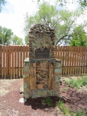
By Bill Kirchner, May 17, 2016
Pipe Springs National Monument Marker
| 1 ► Arizona, Coconino County, Fredonia — 29 — Pipe Springs National Monument — |
| On U.S. 89A at milepost 609, on the left when traveling north. | |||
| 2 ► Arizona, Mohave County, Kaibab — 5 — Pipe Springs National Monument — |
| Near North Pipe Springs Road. | |||
| 3 ► Arizona, Navajo County, Winslow — 46 — Brigham City Cemetery |
| Near North Park Drive. Reported missing. | |||
| 4 ► Arizona, Pinal County, Picacho — 71 — Mormon Battalion Trail — |
| Near Interstate 10. | |||
| 5 ► Idaho, Bannock County, Downey — 119 — Captain Jefferson Hunt, Soldier, Pioneer, Churchman — Born January 20, 1804 in Kentucky - Died May 11, 1879 in Idaho — |
| On State Highway 91, on the right when traveling north. | |||
| 6 ► Idaho, Bear Lake County, Paris — 73 — Charles Coulson Rich — |
| On South Main Street (U.S. 89) near East 1st South Street, on the right when traveling south. | |||
| 7 ► Idaho, Bingham County, Fort Hall — 11 — Fort Hall — An Indian Trading Post — |
| On U.S. 91 near Agency Drive, on the right when traveling north. | |||
| 8 ► Idaho, Bonneville County, Idaho Falls — 15 — Eagle Rock Crossing — |
| Near West Broadway Street near River Parkway, on the left when traveling west. | |||
| 9 ► Idaho, Franklin County, Preston — 16 — The Battle of Bear River — |
| On Highway 91 (State Highway 91) just south of Hot Spring Road, on the right when traveling north. | |||
| 10 ► Idaho, Fremont County, St. Anthony — 40 — Fort Henry — |
| On South Bridge Street near East 3rd Street, on the right when traveling north. | |||
| 11 ► Idaho, Lemhi County, Tendoy — 116 — The Salmon River Mission — Fort Lemhi — |
| On Back Road (County Highway 28) near Mule Shoe Road, on the right when traveling north. | |||
| 12 ► Idaho, Madison County, Rexburg — 54 — In Honor of the Rexburg Stake Pioneers — |
| On North Center Street. | |||
| 13 ► Idaho, Madison County, Rexburg — 70 — North Fork Ferry — |
| On State Highway 33 at Plano Road, on the right when traveling east on State Highway 33. | |||
| 14 ► Nebraska, Dodge County, Fremont — 117 — Mormon Pioneer Trail — |
| On Military Avenue, on the right when traveling east. | |||
| 15 ► Nebraska, Douglas County, Florence, North Omaha — 130 — Mormon Pioneer Memorial Bridge |
| On 30th Street at Willit Street, on the left when traveling north on 30th Street. Reported missing. | |||
| 16 ► Nebraska, Lincoln County, North Platte — 80 — Mormon Pioneer Camp — |
| Near North Buffalo Bill Avenue, 0.8 miles north of Lincoln Highway (U.S. 30), on the right when traveling north. | |||
| 17 ► Nebraska, Morrill County, Bridgeport — 79 — Mormon Pioneer Camp — |
| On Main Street (Route 26/385) near Brown's Creek Road (underpass), on the left when traveling north. | |||
| 18 ► New Mexico, Sandoval County, Santo Domingo Pueblo — 99 — The Mormon Battalion — |
| On West Frontage Road (U.S. 85), on the left when traveling north. | |||
| 19 ► Utah, Beaver County, Beaver — 67 — Fort Cameron — (Located 2 miles east) — |
| On North Main Street at 200 North Street, on the right when traveling north on North Main Street. | |||
| 20 ► Utah, Beaver County, Beaver — 68 — Lee’s Ranch Indian Raid — |
| On Main Street (U.S. 91), on the left when traveling south. | |||
| 21 ► Utah, Box Elder County, Brigham City — 22 — Call's Fort — |
| On Highway 69, on the right when traveling south. | |||
| 22 ► Utah, Box Elder County, Brigham City — 69 — Erected in Honor of Brigham Young — |
| On Forest St, on the left when traveling east. | |||
| 23 ► Utah, Box Elder County, Honeyville — 10 — In Honor of James Bridger — 1804 - 1881 — Early Western Fur Trapper, Frontiersman, Scout and Guide — |
| On 5200 West, on the right when traveling north. | |||
| 24 ► Utah, Cache County, Hyrum — 55 — The Great Fur Cache — |
| On West Main Street (Utah Route 101) west of South Center Street, on the left when traveling west. | |||
| 25 ► Utah, Cache County, Logan — 2 — Cache Valley — |
| On Main Street. | |||
| 26 ► Utah, Cache County, Logan — 63 — Logan Community Center — |
| On 400 East, on the right when traveling north. | |||
| 27 ► Utah, Cache County, Logan — 9 — The First Settlers of Logan — |
| On Main St., on the right when traveling north. | |||
| 28 ► Utah, Cache County, Providence — 110 — Providence Pioneers — |
| On 10 S Main, on the right when traveling south. | |||
| 29 ► Utah, Davis County, Layton — 251 — Stage Coach Station — |
| On South Main Street, on the right when traveling south. | |||
| 30 ► Utah, Iron County, Cedar City — 60 — Old Irontown — |
| Near Iron Town Road, on the right when traveling east. | |||
| 31 ► Utah, Iron County, Paragonah — 61 — Paragonah Fort — |
| On North Main Street, on the right when traveling south. | |||
| 32 ► Utah, Iron County, Parowan — 62 — Pioneer Sundial — |
| On Main Street at 100 South, on the right when traveling north on Main Street. | |||
| 33 ► Utah, Kane County, Kanab — 115 — Fort Kanab — |
| 34 ► Utah, Kane County, Kanab — 21 — Jacob Hamblin — Born April 2, 1819 Died August 21, 1886 — |
| 35 ► Utah, Rich County, Garden City — 74 — Fur Traders Rendezvous — |
| Near Utah Route 30, 0.2 miles south of N. Meadowville Drive. | |||
| 36 ► Utah, Salt Lake County, Bluffdale, Independence at the Point — 48 — Rockwell Station — |
| On West 14600 South (Utah Route 140) at Portern Rockwell Boulevard, on the right when traveling east on West 14600 South. | |||
| 37 ► Utah, Salt Lake County, Brighton, Holladay Cottonwood — 14 — The First Statewide Pioneer Day Celebration — Was held in this Basin July 23-24, 1857 — |
| Near Nordic Trail Lane east of South Brighton Loop Road, on the left when traveling north. | |||
| 38 ► Utah, Salt Lake County, Copperton, Bingham Canyon — 114 — Bingham Canyon — |
| Near Kennecott Access Road, 4.5 miles west of Bacchus Highway (Utah Highway 111). | |||
| 39 ► Utah, Salt Lake County, East Milcreek — 64 — Pioneer Flour-Mill Site — |
| On East 3435 South Street at South 2700 East Street, on the right when traveling east on East 3435 South Street. | |||
| 40 ► Utah, Salt Lake County, Herriman — 32 — Fort Herriman — |
| On North Pioneer Street (6000 W), 0.1 miles south of Un Road, on the right when traveling north. | |||
| 41 ► Utah, Salt Lake County, Midvale — 109 — Union Fort — |
| Near Union Park Avenue, on the right when traveling south. | |||
| 42 ► Utah, Salt Lake County, Millcreek — 57 — Gardner's Saw Mill — |
| On Highland Drive south of East Millcreek Way, on the right when traveling south. | |||
| 43 ► Utah, Salt Lake County, Salt Lake City — Site #3 — Big Mountain — |
| On Big Mountain Pass (Utah Route 65), on the right when traveling east. | |||
| 44 ► Utah, Salt Lake County, Salt Lake City, Capitol Hill — 52 — Brigham Young’s Office — |
| Near South Temple Street. | |||
| 45 ► Utah, Salt Lake County, Salt Lake City, Capitol Hill — 43 — Ensign Peak — |
| Near Ensign Vista Drive west of East Greenstroke Drive. | |||
| 46 ► Utah, Salt Lake County, Salt Lake City, Capitol Hill — 12 — Great Salt Lake Base and Meridian — |
| On South Temple Street at Main Street, on the right when traveling west on South Temple Street. | |||
| 47 ► Utah, Salt Lake County, Salt Lake City, Capitol Hill — 65 — Honor Thy Father and Thy Mother — |
| Near SouthTemple Street at Main Street. | |||
| 48 ► Utah, Salt Lake County, Salt Lake City, Capitol Hill — 50 — The Bee-Hive House — |
| Near South Temple Street. | |||
| 49 ► Utah, Salt Lake County, Salt Lake City, Capitol Hill — 51 — The Lion House — |
| On East South Temple Street, on the right when traveling west. | |||
| 50 ► Utah, Salt Lake County, Salt Lake City, East Central — 18 — Sisters of the Holy Cross — Catholic Pioneers in the Cause of Christian Education and Charity in Utah — |
| On 100 South at 1100 East, on the right when traveling west on 100 South. | |||
| 51 ► Utah, Salt Lake County, Salt Lake City, Fairpark — 7 — Donner Trail 1846 — |
| On North Temple Street, on the right when traveling west. | |||
| 52 ► Utah, Salt Lake County, Salt Lake City, Rio Grande — 8 — Great Salt Lake City Station — |
| On Main Street north of 200 S, on the right when traveling north. | |||
| 53 ► Utah, Salt Lake County, Salt Lake City, Rio Grande — 23 — Pioneer Square — |
| On 300 West, on the right when traveling south. | |||
| 54 ► Utah, Salt Lake County, Salt Lake City, Rio Grande — 20 — Social Hall — |
| On State Street, on the right when traveling north. | |||
| 55 ► Utah, Salt Lake County, Salt Lake City, The Avenues — 35 — A Private School House — |
| On State Street at South Temple, on the right when traveling north on State Street. | |||
| 56 ► Utah, Salt Lake County, Salt Lake City, The Avenues — 78 — Grave of Brigham Young — Prophet - Pioneer - Statesman — |
| Near East First Avenue east of North State Street. | |||
| 57 ► Utah, Salt Lake County, Sandy — 49 — Temple Granite Quarry — |
| Near East Little Cottonwood Road (Utah Route 209) at South Watsatch Boulevard (Utah Route 210). | |||
| 58 ► Utah, Sevier County, Richfield — 6 — Peace Treaty with Fish Lake Indians — |
| On Utah Route 25, 0.1 miles north of Lakeside Resort, on the right when traveling north. | |||
| 59 ► Utah, Summit County, Henefer — 4 — "Mormon" Pioneer Trail — |
| On North Main Street (Utah Route 65) just south of 100 North, on the right when traveling south. | |||
| 60 ► Utah, Tooele County, Dugway — 95 — Burial Plot — |
| On Pony Express Road, 1.5 miles south of South Davis Ranch Road, on the right when traveling south. | |||
| 61 ► Utah, Tooele County, Dugway — 86 — Lookout Station — Pony Express 1860 - 61 — |
| On Pony Express Road, on the right when traveling east. | |||
| 62 ► Utah, Tooele County, Faust — 53 — Faust Station — Pony Express — |
| On Utah Route 36 north of Pony Express Highway, on the right when traveling south. | |||
| 63 ► Utah, Tooele County, Rush Valley — 98 — Rush Valley Station — Pony Express 1860-61 — |
| On Pony Express Trail Road, on the left when traveling east. | |||
| 64 ► Utah, Tooele County, Stockton — 97 — Steptoe's Military Camp — Godbe's Chicago Smelter — (At Spring 700 feet S.W.) — |
| On Utah Route 36 north of Utah Route 73, on the right when traveling south. | |||
| 65 ► Utah, Utah County, Fairfield — 82 — Fairfield-Camp Floyd-Fort Crittenden / The Pony Express — |
| On West 1540 North at 18040 West, on the right when traveling east on West 1540 North. | |||
| 66 ► Utah, Utah County, Lehi — 118 — Pioneers of Lehi — |
| On West 7750 North at South 2185 West, on the left when traveling west on West 7750 North. | |||
| 67 ► Utah, Utah County, Pleasant Grove — 133 — Old Pleasant Grove Fort — |
| On South 300 East at East 300 South, on the right when traveling south on South 300 East. | |||
| 68 ► Utah, Utah County, Pleasant Grove — 56 — Utah’s First Indian Battle — In Commemoration of — |
| On South Main Street north of East 200 South, on the right when traveling north. | |||
| 69 ► Utah, Utah County, Provo, Maeser — 1 — Escalante Trail — |
| Near South University Avenue (U.S. 189) at 100 South, on the right when traveling north. | |||
| 70 ► Utah, Wasatch County, Wallsburg — 66 — Wallsburg Fort — |
| Near Center Street North, on the left when traveling south. | |||
| 71 ► Utah, Washington County, Central — 17 — Mountain Meadows Massacre Grave Site Memorial — |
| Near Utah Route 18 at milepost 30.5. | |||
| 72 ► Utah, Washington County, New Harmony — 59 — Fort Harmony — |
| Near 2900 East Street, 0.2 miles south of Utah Route 144. | |||
| 73 ► Utah, Weber County, Ogden — 112 — Captain James Brown — |
| Near Washington Boulevard. | |||
| 74 ► Utah, Weber County, Ogden — 3 — Jedediah Strong Smith — |
| Near Washington Boulevard south of 25th Street when traveling west. | |||
| 75 ► Utah, Weber County, Ogden — 113 — Lorin Farr — |
| Near Washington Boulevard. | |||
| 76 ► Utah, Weber County, Ogden — 44 — Ogden Canyon Toll Gate — |
| Near Valley Drive west of Canyon Road (Utah Route 39), on the left when traveling west. | |||
| 77 ► Utah, Weber County, Ogden — 416 — Ogden City Wall — |
| On Wall Avenue near 25th Street, on the right when traveling south. | |||
| 78 ► Utah, Weber County, Ogden — 72 — Pierre-Jean De Smet — Priest of the Society of Jesus 1801-1873 — Courageous Missionary to the American Indians 1838-1868 — |
| On 24th Street at Jefferson Avenue, on the right when traveling east on 24th Street. | |||
| 79 ► Wyoming, Big Horn County, Lovell — 58 — The Mormon Colonists — |
| On West Main Street (U.S. 310) near Alternate U.S. 14A, on the right when traveling east. | |||
| 80 ► Wyoming, Fremont County, South Pass City — 27 — Willie’s Handcart Company — |
| Near Lewiston Road near Oregon Trail, on the left when traveling east. | |||
| 81 ► Wyoming, Natrona County, Alcova — 28 — Martin's Cove — |
| On Oregon Trail Road near Martin Cove Road, on the right when traveling west. | |||
| 82 ► Wyoming, Natrona County, Mills — 13 — The “Mormon” Ferry — |
| On 9th Street near Southwest Wyoming Boulevard, on the left. | |||
| 83 ► Wyoming, Sweetwater County, Farson — 26 — Little Sandy Crossing — |
| On State Highway 28, 0.1 miles west of U.S. 191, on the right when traveling west. | |||
| 84 ► Wyoming, Uinta County, Fort Bridger — 25 — The Mormon Wall — |
| On Business U.S. 80 near Main Street. | |||