58 entries match your criteria.
National Oceanic and Atmospheric Administration (NOAA) Historical Markers
NOAA's mission is to understand and predict our changing environment, from the deep sea to outer space, and to manage and conserve America's coastal and marine ecosystems and resources.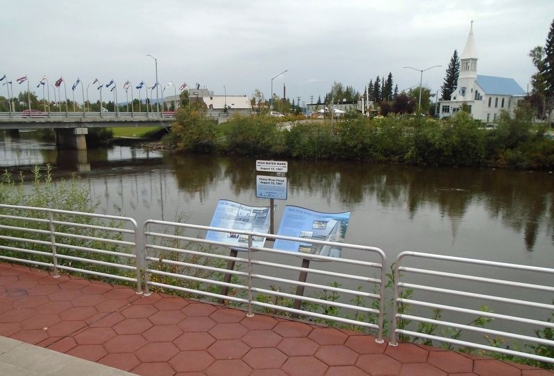
By William Fischer, Jr., August 17, 2024
Chena River Flood Control Marker
1 ► Alaska, Fairbanks North Star Borough, Fairbanks, Downtown — Chena River Flood Control —  |
| On 1st Avenue west of Lacey Street, on the right when traveling west. | |||
| 2 ► Alaska, Fairbanks North Star Borough, Fairbanks, Downtown — The 1967 Chena River Flood — |
| On 1st Avenue west of Lacey Street, on the right when traveling west. | |||
| 3 ► Alaska, Juneau Borough, Juneau, Downtown Juneau — Protecting Alaska's Glacial Harbor Seals — Approach Guidelines For Tidewater Glacial Fjords — For All Vessel Types and Sizes — |
| Near Marine Way (Alaska Route 7) south of Ferry Way, on the right when traveling south. | |||
| 4 ► Delaware, New Castle County, Wilmington — USS Monitor – America's First National Marine Sanctuary — |
| Near East 7th Street east of Swedes Landing Road, on the right when traveling east. | |||
| 5 ► Delaware, New Castle County, Wilmington — Wilmington's Civil War Ironclads — |
| Near East 7th Street east of Swedes Landing Road, on the right when traveling east. | |||
| 6 ► Florida, Wakulla County, St. Marks — The City of St. Marks — 1828 — |
| On Port Leon Drive (Florida Route 363) at West Pine Street, on the right when traveling south on Port Leon Drive. | |||
| 7 ► Louisiana, East Baton Rouge Parish, Baton Rouge, Highlands/Perkins — Land Grant College / Sea Grant College — |
| On Tower Drive 0.1 miles Dalrymple Drive, on the right when traveling south. | |||
| 8 ► Louisiana, Natchitoches Parish, Natchitoches — Great Red River Flood of 1945 — |
| Near Front Street north of Church Street, on the right. | |||
| 9 ► Maryland, Anne Arundel County, Annapolis, Eastport — Oysters: Vital to Commerce. Vital to Culture. — |
| Near 2nd Street south of Bay Shore Avenue, on the right when traveling north. | |||
| 10 ► Maryland, Anne Arundel County, Annapolis, Eastport — Oysters: Vital to Nature. Vital to Our Future. — |
| Near 2nd Street south of Bay Shore Avenue. | |||
| 11 ► Maryland, Anne Arundel County, Annapolis, Eastport — Oysters: Vital to the Lifeline of the Chesapeake — |
| Near 2nd Street south of Bay Shore Avenue. | |||
| 12 ► Maryland, Dorchester County, Vienna — Discover: Restoration — |
| On Water Street just south of Race Street, on the left when traveling south. | |||
| 13 ► Maryland, Kent County, Chestertown — Wilmer Park Living Shoreline — Chestertown, Maryland • Founded in 1706 — |
| On South Cross Street (Maryland Route 289) south of Cannon Street, on the right when traveling north. | |||
| 14 ► Maryland, Montgomery County, Silver Spring, Downtown Silver Spring — Geodetic Marker — & Time Capsule — |
| Near Georgia Avenue, on the right when traveling north. | |||
| 15 ► Maryland, Prince George's County, Croom — Climate Change and Jug Bay — |
| Near Park Entrance Road 1.8 miles north of Croom Airport Road, on the right when traveling east. | |||
| 16 ► Maryland, Wicomico County, Sharptown — Chesapeake Bay Restoration in Progress — Sharptown Living Shoreline — |
| Near Railway Street 0.1 miles north of Little Water Street. | |||
| 17 ► Michigan, Alcona County, Harrisville, Haynes Township — Get Into Your Sanctuary / Thunder Bay National Marine Sanctuary — Great Lakes Maritime Heritage Trail — |
| On Point Road east of Spruce Trailways Road, on the left when traveling east. | |||
| 18 ► Michigan, Alpena County, Alpena, North Riverfront Park — Welcome to the Alpena Water Level Station — Great Lakes Maritime Heritage Trail — |
| On East Fletcher Street at Ford Avenue, on the right when traveling east on East Fletcher Street. | |||
| 19 ► Michigan, Grand Traverse County, Old Mission Point, Peninsula Township — A Light at Old Mission — |
| Near Michigan Route 37. | |||
| 20 ► Michigan, Muskegon County, Muskegon, Laketon Township — Restoration on the South Branch — |
| On the North Causeway Street southbound ramp (Michigan Route 120) at Business U.S. 31, on the right when traveling south on the North Causeway Street southbound ramp. | |||
| 21 ► Michigan, Presque Isle County, Millersburg, Bearinger Township — Thunder Bay National Marine Sanctuary — |
| On U.S. 23 0.7 miles north of Moss Point Road, on the right. | |||
| 22 ► Michigan, Presque Isle County, Presque Isle — Get Into Your Sanctuary — |
| On East Grand Lake Road 0.7 miles north of Range Light Lane, on the right when traveling north. | |||
| 23 ► Michigan, Presque Isle County, Rogers City, Rogers Township — Schooners — Great Lakes Maritime Heritage Trail — |
| On North Lake Street at East Michigan Avenue, on the right when traveling north on North Lake Street. | |||
| 24 ► Michigan, Presque Isle County, Rogers City, Rogers Township — Thunder Bay National Marine Sanctuary — Great Lakes Maritime Heritage Trail — |
| Near North Lake Street at East Michigan Avenue, on the right when traveling north. | |||
| 25 ► Michigan, St. Clair County, Port Huron — Fort Gratiot Light — |
| Near Omar Street. | |||
| 26 ► Michigan, St. Clair County, Port Huron — Keepers Duties — |
| Near Omar Street. | |||
| 27 ► Michigan, St. Clair County, Port Huron — Learning from Lake Huron — |
| Near Omar Street. | |||
| 28 ► Michigan, St. Clair County, Port Huron — Seeing the Light — |
| Near Omar Street. | |||
| 29 ► Michigan, St. Clair County, Port Huron — Sending a Signal — |
| Near Omar Street. | |||
| 30 ► Michigan, St. Clair County, Port Huron — The Storm — |
| Near Omar Street. | |||
| 31 ► Michigan, St. Clair County, Port Huron — U.S. Coast Guard — |
| Near Omar Street near Garfield Street, on the right when traveling north. | |||
| 32 ► Minnesota, Cook County, Grand Marais — Cascade River Overlook — |
| On North Shore Scenic Drive (State Highway 61) 0.8 miles east of Cascade Beach Road (County Road 97), on the right when traveling east. | |||
| 33 ► Montana, Lewis and Clark County, Lincoln — Coldest Temperature in Contiguous United States — -70ºF on January 20, 1954 — |
| Near State Highway 200 at milepost 90 near Little Wold Creek Road, on the right when traveling east. | |||
| 34 ► North Carolina, Carteret County, Beaufort — USS Monitor: America's First Ironclad — Monitor National Marine Sanctuary — USS Monitor Trail — |
| On Front Street west of Turner Street, on the right when traveling west. | |||
| 35 ► Ohio, Ashland County, Loudonville, Hanover Township — High Water Mark — July 10, 2006 — |
| On Ohio Route 3. | |||
| 36 ► Pennsylvania, Philadelphia County, Philadelphia, Pennsport — Legacy of an Urban Waterfront: a Changing River Shoreline — Washington Avenue Green — |
| On Delaware River Trail south of South Christopher Columbus Boulevard, on the right when traveling north. | |||
| 37 ► Virginia, Accomack County, Saxis — While Visiting — |
| On Starling Creek Road. | |||
| 38 ► Virginia, Chesterfield County, Bellwood — The USS Monitor — |
| Near Fort Darling Road 0.5 miles north of Bellwood Road. | |||
| 39 ► Virginia, Norfolk, West Freemason — NOAA Charts Its Beginnings to 1807 — Established to map seafloors & create nautical charts — |
| On West York Street 0.1 miles west of Botetourt Street, on the right when traveling west. | |||
| 40 ► Virginia, Richmond, Shockoe Bottom — Here Stood the Trigg Shipyard — |
| Near Dock Street at Pear Street, on the right when traveling east. | |||
| 41 ► Virginia, Richmond, Shockoe Bottom — The Tidal James — |
| Near Dock Street at Pear Street, on the right when traveling east. | |||
| 42 ► Virginia, Richmond, Shockoe Bottom — Water Quality in the James — |
| Near Dock Street at Pear Street, on the right when traveling east. | |||
| 43 ► Virginia, Virginia Beach, North Virginia Beach — Beaches on the Move — Shifting Sand, Sinking Land, & Rising Seas — Brainwaves at the Beach — |
| On Virginia Beach Boardwalk at 16th Street, on the right when traveling north on Virginia Beach Boardwalk. | |||
| 44 ► Washington, Clallam County, Neah Bay — 9 — Snow Creek — Welcome to the Whale Trail — |
| On Straight of Juan de Fuca Highway (State Highway 112) just east of Snow Creek Resort, on the right when traveling west. | |||
| 45 ► Washington, Clallam County, Sekiu — 10 — Shipwreck Point — |
| On Straight of Juan de Fuca Highway (State Highway 112) 8.7 miles west of Sekiu, on the right when traveling west. | |||
| 46 ► Wisconsin, Bayfield County, Bayfield — Schooner Pretoria — Historic Shipwreck — Wisconsin’s Maritime Trails — |
| On South 1st Street at Wilson Street, on the right when traveling south on South 1st Street. | |||
| 47 ► Wisconsin, Door County, Liberty Grove — The Niagara Escarpment — |
| Near North Port Des Morts Drive. | |||
| 48 ► Wisconsin, La Crosse County, La Crosse — Sidewheel Riverboat War Eagle — Historic Shipwreck — Wisconsin’s Maritime Trails — |
| On East Veterans Memorial Dr. 0.2 miles north of State Street, on the right when traveling west. | |||
| 49 ► Wisconsin, Milwaukee County, Milwaukee, Historic Third Ward — Milwaukee's Changing Lakefront — |
| Near North Harbor Drive. | |||
| 50 ► Wisconsin, Milwaukee County, Milwaukee, Menomonee Valley — A Changing Landscape — Hank Aaron State Trail — |
| Near Frederick Miller Way west of Selig Drive. | |||
| 51 ► Wisconsin, Milwaukee County, Milwaukee, Menomonee Valley — American Indians in the Menomonee Valley — Hank Aaron State Trail — |
| Near Menomonee Valley Passage. | |||
| 52 ► Wisconsin, Milwaukee County, Milwaukee, Menomonee Valley — Immigrants and Silver City — |
| Near Hank Aaron State Trail. | |||
| 53 ► Wisconsin, Milwaukee County, Milwaukee, Menomonee Valley — Menomonee Valley Native Plants — |
| On Hank Aaron State Trail, on the right when traveling east. | |||
| 54 ► Wisconsin, Milwaukee County, Milwaukee, Menomonee Valley — Milwaukee Road Shops — |
| On West Canal Street near West Milwaukee Road, on the right. | |||
| 55 ► Wisconsin, Milwaukee County, Milwaukee, Menomonee Valley — The Machine Shop of the World — |
| On Canal Street 0.1 miles east of Selig Drive, on the left when traveling west. | |||
| 56 ► Wisconsin, Milwaukee County, Milwaukee, Walker's Point — Floating Freight on Liquid Highways — |
| On South 6th Street 0.1 miles south of West Canal Street, on the right when traveling south. | |||
| 57 ► Wisconsin, Sheboygan County, Sheboygan — Schooner Gallinipper — Historic Shipwreck — Wisconsin’s Maritime Trails — |
| On Broughton Drive. | |||
| 58 ► Wisconsin, Winnebago County, Menasha — Menasha Lock — Builders and Owners of the Fox River Locks — Wisconsin’s Maritime Trails — |
| Near Broad Street 0.2 miles west of Tayco Street (Wisconsin Highway 114). | |||