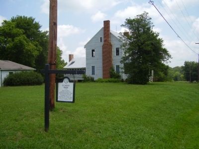
One of the finest surviving federal style houses in Gaston County. Built as the seat of a 356 acre plantation. Part of the Ancestral Hoyle Family Lands. Listed on the local & National Register of Historic Places. — — Map (db m44380) HM
On This square was located the Courthouse of Gaston County from 1847 until the County seat was moved to Gastonia in 1911. The first structure, built of logs, was replaced by a brick building in 1848. The interior of this latter building, together . . . — — Map (db m18582) HM
This Greek Revival structure
served as the county courthouse
from 1848 to 1911, when the county
seat moved to Gastonia. It marks
the center of the Dallas Historic
District, a Federal Register site. — — Map (db m18577) HM
On this site c.1874 structures existed to provide for the upkeep of the less fortunate, an imposing structure for its time and purpose, it gives physical and concrete evidence of the caring qualities of the people of Gaston County. — — Map (db m18616) HM
Hotel provided lodging for visitors to town and court sessions, and for male students of the original Gaston College. Jury was sequestered on the third floor "Bull Pen."
Daniel Hoffman was the builder, Jonas Hoffman, Second proprietor, . . . — — Map (db m18610) HM
On Dallas Stanley Highway (North Carolina Route 275) east of Jacob Martin Road, on the right when traveling east.
Possibly the oldest remaining structure in Gaston County, the house is on the site where Peiter Heyl was granted a land patent in May 1754. It features a rare corner post log construction.
Site Of Hoylesville, first Federal post office in present . . . — — Map (db m267904) HM
This building with the West addition served as the Gaston County Jail until 1911 when the County seat was moved to Gastonia. The Sheriff and his family had living quarters on the first floor. The second floor still contains the main cell block. — — Map (db m18614) HM
On North Gaston Street 0.1 miles south of West Trade Steet, on the right.
June 25, 1950 - July 27, 1953
This monument is given by the citizens of the
Town of Dallas in dedication to the memory of the brave men and women who served and sacrificed
their lives in the
Korean War Conflict — — Map (db m235947) WM
Built as a General Store with living quarters upstairs by cotton manufacturing industry pioneer Moses H. Rhyne this structure also served as a Post Office and as a site of County Court during rebuilding of the Court House damaged by fire in 1874. — — Map (db m18609) HM
Built by Dr. J.F. Smyre
This building was sold in 1851 to Ely Pasour, State Legislator, Postmaster and First Mayor of Dallas. The northern addition was used as a classroom for privately tutoring boys. The granite upping block near the street was . . . — — Map (db m18612) HM
This monument is given by
the town of Dallas and the Dallas Jaycees and
is dedicated to the memory of the brave young men of Dallas who sacrificed their lives in the Vietnam Conflict.
Jerry L. Addis, U.S. Army, Jun 24, 1969
Roy Neal Burris, . . . — — Map (db m18608) HM
On West Main Street west of North Gaston Street, on the right when traveling west.
As President of the University of North Carolina from 1956-86, he developed it into a 16 campus system and a national model. Respected nationwide for his compassion, vision, leadership and integrity. Born July 13, 1920 to Lathan and Beth Friday, . . . — — Map (db m235956) HM
King's Pinnacle is named for the unique formation at its summit resembling a king's crown. The pinnacle is the highest peak in the park at 1,705 feet in elevation. It towers more than 800 feet above the surrounding landscape.
It's elevation is . . . — — Map (db m252542) HM
On York Highway (U.S. 321) just north of Gateway Farm Road, on the right when traveling north.
North Carolina. Colonized, 1585-87, by first English settlers in America; permanently settled c.1650; first to vote readiness for independence, Apr. 12, 1776.
South Carolina. Formed in 1712 from part of Carolina, which was chartered . . . — — Map (db m129257) HM
On Andrew Jackson Highway (U.S. 74) at South South Street, on the right when traveling west on Andrew Jackson Highway.
Governor of North Carolina, 1945 - 1949. State legislator. Promoted good roads and rural electrification. Grave is 3 miles S.E. — — Map (db m108789) HM
Robert Benjamin Babington
August 24, 1869
November 28, 1935
The North Carolina Orthopedic Hospital is his monument.
Its need was revealed to him of God; whereupon, he was not disobedient to the heavenly vision - his zeal and perseverance . . . — — Map (db m266177) HM
On North Lincoln Street (State Highway 321) near Thompkins Street (State Highway 1812), on the right when traveling south.
Founder of High Shoals Iron Works about 1795. One of first producers of pig iron by charcoal process. Revolutionary patriot. Buried 20 yds. W. — — Map (db m18571) HM
On Lucia Riverbend Highway (State Highway 16) at Killian Road, on the right when traveling north on Lucia Riverbend Highway.
Built 1782. Home of James Johnston, officer in Revolution, member Provincial Congress,
legislature, convention of 1788. Is 2 mi. east. — — Map (db m156501) HM
On South Main Street at West Central Avenue, on the right when traveling south on South Main Street.
This property has been placed on the National Register of Historic Places by the United States Department of the Interior
Downtown Mount Holly Historic District — — Map (db m248613) HM
On South Main Street at West Central Avenue, on the right when traveling south on South Main Street.
This property has been placed on the National Register of Historic Places by the United States Department of the Interior
Downtown Mount Holly Historic District — — Map (db m248611) HM
On South Main Street near West Central Avenue, on the right when traveling south.
This property has been placed on the National Register of Historic Places by the United States Department of the Interior
Downtown Mount Holly Historic District — — Map (db m248609) HM
On North Main Street near East Charlotte Avenue ( Highway 27), on the right when traveling south.
This property has been placed on the National Register of Historic Places by the United States Department of the Interior
Downtown Mount Holly Historic District — — Map (db m248605) HM
On South Main Street near East Charlotte Avenue ( Highway 27), on the right when traveling north.
This property has been placed on the National Register of Historic Places by the United States Department of the Interior
Downtown Mount Holly Historic District — — Map (db m248608) HM
On 111 West Central Avenue near South Main Street, on the right when traveling east.
This property has been placed on the National Register of Historic Places by the United States Department of the Interior
Downtown Mount Holly Historic District — — Map (db m248624) HM
On West Central Avenue at South Main Street, on the left when traveling west on West Central Avenue.
This property has been placed on the National Register of Historic Places by the United States Department of the Interior
Downtown Mount Holly Historic District — — Map (db m248621) HM
On West Central Avenue near South Main Street, on the right when traveling east.
This property has been placed on the National Register of Historic Places by the United States Department of the Interior
Downtown Mount Holly Historic District — — Map (db m248622) HM
On North Main Street near East Charlotte Avenue ( Highway 27), on the right when traveling south.
This property has been placed on the National Register of Historic Places by the United States Department of the Interior
Downtown Mount Holly Historic District — — Map (db m248606) HM
On West Central Avenue near South Main Street, on the right when traveling east.
This property has been placed on the National Register of Historic Places by the United States Department of the Interior
Downtown Mount Holly Historic District — — Map (db m248623) HM
On South Main Street near West Central Avenue, on the right when traveling south.
This property has been placed on the National Register of Historic Places by the United States Department of the Interior
Downtown Mount Holly Historic District — — Map (db m248620) HM
On North Main Street near East Charlotte Avenue ( Highway 27), on the right when traveling south.
This property has been placed on the National Register of Historic Places by the United States Department of the Interior
Downtown Mount Holly Historic District — — Map (db m248607) HM
On South Main Street near East Central Avenue, on the right when traveling north.
This property has been placed on the National Register of Historic Places by the United States Department of the Interior
Downtown Mount Holly Historic District — — Map (db m248614) HM
On South Main Street near West Central Avenue, on the right when traveling south.
This property has been placed on the National Register of Historic Places by the United States Department of the Interior
Downtown Mount Holly Historic District — — Map (db m248619) HM
On South Main Street near West Central Avenue, on the right when traveling south.
This property has been placed on the National Register of Historic Places by the United States Department of the Interior
Downtown Mount Holly Historic District — — Map (db m248616) HM
On South Main Street near East Catawba Avenue (Local Road 2040), on the right when traveling north.
This property has been placed on the National Register of Historic Places by the United States Department of the Interior
Downtown Mount Holly Historic District — — Map (db m233185) HM
Near West Glendale Avenue at South Hawthorne Street, on the right when traveling east.
Ransom Hunter and his parents, Julia and Mike were born in North Carolina. According to the Ransom Hunter Foundation's genealogical research, they spent much of their time in towns and communities that straddled the North and South Carolina border. . . . — — Map (db m306988) HM
On West Glendale Avenue at South Hawthorne Street, on the right when traveling east on West Glendale Avenue.
Ransom Hunter sold vegetables and livestock at a market stand near the Mighty Oak Tree. Neighbors also brought goods to sell, creating a small local market. In the barn, the Hunter family kept horses and goats. Family members remember playing there . . . — — Map (db m306993) HM
Near West Glendale Avenue at South Hawthorne Street, on the right when traveling east.
After purchasing surrounding acreage, Hunter provided land at little to no cost for families and community services. Hunter is credited with helping 14 families become homeowners, and the neighborhood surrounding his home came to be known as the . . . — — Map (db m306995) HM
Near West Glendale Avenue at South Hawthorne Street, on the right when traveling east.
The Ransom Hunter house stayed in the family for several generations. The house was recorded as a historic structure by the North Carolina Historic Preservation Office in 1981. However,the house deteriorated and was demolished in 2002. The City of . . . — — Map (db m306996) HM
On East Charlotte Avenue (State Highway 27) 0.1 miles west of Highland Street (State Highway 273), on the right when traveling west.
Queen Ann Style constructed by R.F. Rankin for A.P. Rhyne as a wedding gift to his daughter and husband. Bought in 1918 by Mayor Paul E. Lentz and wife whose descendants are still owners. — — Map (db m156460) HM
Near West Glendale Avenue at South Hawthorne Street, on the right when traveling east.
Mortared stone and concrete walls mark the foundation of Ransom Hunter's family home.
Hunter first built a simple cabin and barn before constructing the house around 1875. The house was expanded and remodeled several times. In the 1940s and . . . — — Map (db m306983) HM
On Charles Raper Jonas Highway (State Highway 27) at Westland Farm Road (County Highway 1924), on the right when traveling south on Charles Raper Jonas Highway.
Colonel in Revolution, later brigadier general, member of legislatures of N.C. and Tenn., and of U.S. Congress. His home stands ¼ mile W. — — Map (db m156459) HM
Near North Main Street at Alsace Street, on the left when traveling south.
The fourth cotton mill built
in Gaston County and the
oldest remaining. The mill
used water power.
It was renovated after
the 1916 flood and
renamed Alsace Mfg. Co.
Saved from demolition in 1973
by Robert Friedl,
who began . . . — — Map (db m240779) HM
Near South Hawthorne Street at West Glendale Avenue, on the right when traveling north.
This park was once home to Ransom Hunter, a successful Black landowner, entrepreneur and founder of the Freedom Community. He lived here with his family from 1865 until his passing in 1918. While genealogical research cannot confirm how or when . . . — — Map (db m306967) HM
Near Mountain Island Highway (State Highway 273) at Sandy Ford Road (County Highway 1918), on the left when traveling north.
Dedicated in 1843 by Bishop I.A. Reynolds, D.D. of the Diocese of Charleston, South Carolina
St. Joseph's is the oldest standing Catholic Church in the state of North Carolina. — — Map (db m156457) HM
On West Glendale Avenue at South Hawthorne Street, on the right when traveling east on West Glendale Avenue.
In front of you once stood the Mighty Oak Tree, a witness tree which lived here at the same time as Ransom Hunter. For many years, the tree served as the site for annual Hunter family reunions. Unfortunately, the tree was in poor
condition and was . . . — — Map (db m306997) HM
On Alexis Lucia Road 0.8 miles west of Old Lowesville Road, on the right when traveling west.
Built as the plantation home of Andrew Carpenter and family. This structure also served as a stagecoach stop on the Charlotte Lincolnton Road. "Happy Home” plantation continued as a sharecropping farm after slavery was abolished. — — Map (db m181622) HM
On Mecklenburg Highway (State Highway 115) near Dunmurry Road, on the right when traveling south.
Formed northern half
of the colony of North
Carolina. Its southern
boundary was run to a
point three miles east
in the fall of 1746. — — Map (db m237320) HM
On South Main Street south of East Central Avenue, on the right when traveling south.
In memorial to our Marines and sailors of
the multi-national peacekeeping force
Lebanon – 1983 - 1984
North Carolina • Semper Fidelis
1st Sgt. D.L. Battle, Hubert • Sgt. Richard Blankenship, Fayetteville • LCpl. Bobby Buchannan, Midway Park . . . — — Map (db m237233) WM
On North Main Street north of East Center Avenue, on the right when traveling north.
(upper plaque)
This property has seen placed on the National Register of Historic Places by the United States Department of the Interior
Mooresville
(lower plaque)
D.E. Turner Co.
1899 - 1999 . . . — — Map (db m255021) HM
On River Highway (North Carolina Route 150) at Mariner Pointe Lane, on the right when traveling west on River Highway.
Among the original pioneers from Pennsylvania, New Jersey, and Maryland who settled on the east side of the Catawba River were George Davidson (1-home destroyed), Reverend John Thomson, Moses White, Hugh Lawson, John Oliphant, John Brevard, . . . — — Map (db m283194) HM
Near North Church Street near East Moore Avenue, on the right when traveling south.
This mural honors and celebrates the 150th anniversary of Mooresville's incorporation in 1873. The design was created to encourage passersby to slow down and reminisce on moments from the past that brought the town to where it is today, to . . . — — Map (db m254995) HM
On South Main Street south of West Center Avenue, on the right when traveling south.
Pioneer citizen. Donor of
land for civic use. Mooresville
was named in his honor.
Erected by
Battle of Bentonville Chapter
United Daughters of Confederacy - 1950. — — Map (db m237228) HM
On North Main Street at West Iredell Avenue ( Route 3), on the left when traveling north on North Main Street.
Mooresville's First Couple
Esther Jane "Jennie" Moore & John Robert McNeely
On March 3rd 1873, the small village known as "Moore's Siding" was incorporated into the Town of Mooresville. Much of the land for initial development & also . . . — — Map (db m255000) HM
On North Main Street south of West Iredell Avenue ( Route 3), on the right when traveling south.
D.K. McNeely & Son store, circa 1919
This building standing today at 134 Main St. is probably the oldest standing commercial structure in town. Originally Harris & Sherrill dry goods store, D. K. McNeely purchased the building in the early . . . — — Map (db m255015) HM
On North Maple Street south of East Iredell Avenue (State Route 3), on the right when traveling south.
Dedicated to the following employees of
– Mooresville Mills –
who left the company to served their country in
World War II
James F. Abernathy • Wm. R. Adamson • Felix Alexander • Jack T. Alexander • John L. Alexander • Louis W. Alexander . . . — — Map (db m237157) WM
On North Main Street south of West Iredell Avenue ( Route 3), on the left when traveling north.
The Mooresville Moors played in the Class D North Carolina State League from 1937-1942. The league ceased operations for two seasons due to World War II but was reorganized in 1945. That season's team was known as the Mooresville Braves, due to . . . — — Map (db m255005) HM
On North Main Street south of West Iredell Avenue ( Route 3), on the right when traveling south.
W.N. Johnston and Sons Co.
In the late 1800s and early 1900s W.N. Johnston and Sons Co. owned and operated seven stores on Broad St. just across from the train depot. Nat Johnston's grocery store was considered the "finest" grocery store in . . . — — Map (db m255007) HM
On Langtree Road (State Road 1102) at Mount Mourae Road, on the right when traveling west on Langtree Road.
where skirmish between British
and American soldiers occurred
February 1781.
Erected by
Mary Slocumb Chapter D.A.R.
1914.
Rededicated 2014 — — Map (db m237287) HM
On Centre Church Road (State Road 1245) 0.1 miles south of Fairview Road, on the right when traveling south.
The History of Centre Presbyterian Church Centre Church was organized in 1765 and held meetings at Osborne's Meeting House. This new congregation's mission was centrally located between five other missions: Sugar Creek, Hopewell, Fourth Creek . . . — — Map (db m237253) HM WM
On North Main Street south of West Iredell Avenue ( Route 3), on the left when traveling north.
The Mooresville Cotton Mills began operations in 1893. By 1914 the mill had 550 employees, and continued to grow into the largest employer in the county, with an annual payroll of $7 million. In 1916 the mill erected 40 houses for its employees . . . — — Map (db m255003) HM
On Mecklenburg Highway (State Road 115) at Langtree Road (State Road 1102), on the right when traveling south on Mecklenburg Highway.
British cavalry led by
Colonel Tarleton routed
a force of American
militia, Feb. 2, 1781,
at Torrence's Tavern,
which stood nearby. — — Map (db m237285) HM
On North Maple Street south of East Iredell Avenue ( Road 3), on the right when traveling south.
Dedicated to God and all those who died and served in all wars and
conflicts of the United States of America
Lest We Forget!
World War II Gold Star Boys
Jay Edgar Alley • Herbert Richard Baker • Herman Bostian Ballard • Charles . . . — — Map (db m237227) WM
Near McKendree Road at Fulton Farms Lane, on the right when traveling south.
The Library of Congress, Washington, D.C. records that His Excellency Governor Thomas Mayhew, born 1593 Tisbury, England, who was the English Crown Governor of the Elizabeth Island chain including Martha's Vineyard and Nantucket islands off the . . . — — Map (db m237235) HM
On Business North Carolina Route 16 north of Mundy Road, on the left when traveling north.
Built between 1850 and 1870 by descendants of Revolutionary War soldier and Methodist minister Jeremiah Mundy (1760-1835); One of the founding families of the Rock Springs Methodist Camp Meeting grounds in Denver; The R.O. Mundy family owned the . . . — — Map (db m256065) HM
On Old Plank Road at Brevard Place Road (County Highway 1360), on the left when traveling north on Old Plank Road.
Presbyterian, 1801. Graves include those of Alexander Brevard, Joseph & James Graham, and Robert Hall & Joseph Graham Morrison. — — Map (db m156520) HM
On State Highway 73 at Amity Church Road, on the right when traveling west on State Highway 73.
Governor, 1845-1849; Secretary of the Navy; United States Senator; Whig nominee for Vice President in 1852. His birthplace is 3 mi. E. — — Map (db m156518) HM
"Old White Church" Cemetery First Burying Ground in Lincolnton ca. 1787 Has been placed on the National Register of Historic Places by the United States Department of the Interior" Old White Church" Lincolnton's original house of worship . . . — — Map (db m44431) HM
On West Main Street (State Highway 27) east of North Government Street, on the right when traveling east.
French botanist, pioneer in studying flora of western North Carolina, passed through Lincolnton, July 24, Sept. 11, 1794, and April 29, 1795. — — Map (db m44390) HM
On Laboratory Road (County Highway 1252) at Southfork Road, on the right when traveling north on Laboratory Road.
(side 1)
Daniel E. Rhyne
Textile Pioneer and Philanthropist
(1852 ~ 1933)
Daniel E. Rhyne was a pioneer in the textile industry in North Carolina. He built the Laboratory Cotton Mill on this site in 1885 and eventually . . . — — Map (db m156692) HM
On Reepsville Road (County Route 1113) at Daniels Road (County Route 1204), on the right when traveling west on Reepsville Road.
Evangelical Lutheran. Organized in 1774. J.G. Arndt was first regular minister; Philip Henkel assistant. This building, 1888, is third on site. — — Map (db m231739) HM
On South Aspen Street at West Church Street, on the right when traveling south on South Aspen Street.
Organized ca. 1785
This building erected in 1920
has been placed on the
National Register of Historic Places
by the United States Department of the Interior — — Map (db m231908) HM
On East Main Street (North Carolina Route 27) east of South Poplar Street, on the right when traveling east.
First Federal Savings Bank of Lincolnton had its beginnings on February 6, 1940 when a group of local businessmen, led by
C.P.A. Chauncey Depew Stroup, held a meeting to form an local savings and loan association to serve the county. The Federal . . . — — Map (db m261574) HM
On East Main Street (State Highway 27) at Lancrest Lane, on the right when traveling west on East Main Street. Reported missing.
Eleventh Chief of Staff, U.S. Air Force, 1982~1986
Graduated Lincolnton High School, 1944
Attended Catawba College, 1944~1946
Graduated U.S. Military Academy, West Point, 1950
Interred Arlington National Cemetery
Site of . . . — — Map (db m231843) HM
On South Aspen Street south of Church Street, on the right when traveling north.
Native German, pioneer teacher and minister, ordained 1775, first president of the N.C. Lutheran Synod, 1803. Grave a few yds. east. — — Map (db m44402) HM