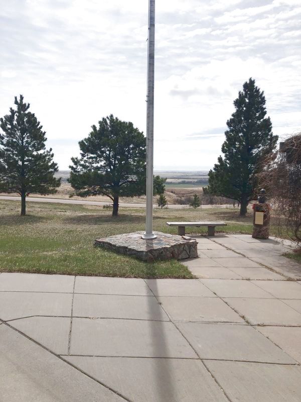
With a military expedition
camped in the vicinity
July 10, & 11th, 1859.
He conducted on Sunday
the first Christian services
on Meade County soil. — — Map (db m172481) HM
This youthful pony mail carrier on the Sidney-Deadwood Gold Trail was ambushed, killed, and scalped in what is now south Sturgis on August 19, 1876. He was buried, next morning, by passing pioneers. On June 7, 1889, local citizens re-interred him . . . — — Map (db m183999) HM
Charles "Red" Nolin, pony mail carrier on the Sidney-Deadwood trail, was ambushed, killed, and scalped here by Indians on August 19, 1876.
On this evening, Nolin stopped by Alkali Creek, where the National Cemetery is now located. Here a party . . . — — Map (db m184002) HM
Camps D-Army-1 & SCS-6 (Fechner): 1/2 mile S on W edge of Ft. Meade D-Army-1 company: 2758--7/20/34-10/31/35. SCS-6 companies: 2765--10/15/36-5/27/42; 4725V--5/28/42-7/27/42. The Civilian Conservation Corps was a federal work-relief program during . . . — — Map (db m184004) HM
Noavosse (cheyenne) "The good Mountain"
Mato Paha (Sioux) "Bear Mountain"
Here through the centuries plains Indians received spiritual guidance
from their creator.
Here the Cheyenne Prophet, Sweet Medicine, received the 4 . . . — — Map (db m172490) HM
On this site, the evening of August 19, 1876, 24-year-old Charles "Red" Nolin, pony mail carrier was shot and scalped. He was asked by members of the Schofeld Freighting Outfit to stay with them for the night because of the presence of Indians in . . . — — Map (db m174075) HM
There had long been talk of the need for a military post in the region. As far back as 1857, First Lieutenant Warren recognized the strategic importance of the Black Hills. On Sept. 30, 1857, Lt Warren, while on a military survey of the region, . . . — — Map (db m174069) HM
Born in Ohio in 1876, he came to South Dakota in 1907. With scant education, he achieved college degrees, taught for 25 years, his last school at 86, to afford him time for summer research.
He wrote "Mato Paha", the story of Bear Butte, a . . . — — Map (db m180977) HM
As the United States grew and people moved west, they came in contact with the Native Americans. Out of these contacts conflicts arose. In response to these conflicts, the United States government enacted treaties with the Native Americans.
. . . — — Map (db m174081) HM
On this spot, where the eroded ruts of the Bismarck-Deadwood Trail are still plain to see took place on July 17, 1877 the massacre of the Wagnus family by Indians, who from Bear Butte watched with envy the passing of their lands to the whites. Two . . . — — Map (db m184171) HM
"Give us a blessing so that our words and actions be one in unity, and that we will be able to listen to each other. In doing so, we shall with good heart walk hand in hand to face the future."
Frank Fools Crow in prayer . . . — — Map (db m154913) HM
FOR HE OR SHE WHO SHEDS HIS OR HER BLOOD
WITH ME SHALL BE MY SISTER OR BROTHER
William Shakespeare
We honor these military members from South Dakota
who paid the ultimate price for freedom.
Killed in Action . . . — — Map (db m312797) WM
Ellsworth Air Force Base
Senior Enlisted Advisor[s]/Command CMSGTS
SEAS
Sept 73-Sept 75 CMSgt Robert Power
Sept 75-Jun 76 CMSgt Jones (no first name listed)
Jun 76-May 78 CMSgt Fred H. Quinn
May 78-Mar 79 CMSgt George H. . . . — — Map (db m312800) WM
The Harney Peak fire lookout, dam
and pumphouse were built by the
CCC in 1939 and are listed in the
National Register of Historic
Places. Harney Peak Elevation is
2207 meters (7242 ft). The peak is
the highest point east of the . . . — — Map (db m125087) HM
The B-1A was initially developed in the 1970s as a replacement for the B-52. Four prototypes of his long –range, high speed strategic bomber were developed and tested but the program was canceled in 1977 before going into production. The B-1B is an . . . — — Map (db m70966) HM WM
Painted black, Invaders flew night missions over North
Korea, searching for trucks and trains carrying supplies
to the battlefront. Angling down, the pilot fired the eight
guns in the nose. In some Invaders, a glass nose allowed . . . — — Map (db m313279) HM
It's small compared to the B-1 bomber in front of the
museum, but the Corsair II had a lot in common with that
big machine. The A-7D stayed up a long time without
refueling, carried a lot of bombs, dropped them with great
accuracy, and . . . — — Map (db m313310) HM
In March 2011, under blizzard conditions, the call came:
could the 28th Bomb Wing be ready for action in Libya,
in less than two days? Despite freezing metal and icy
pavement, Airmen began working around the clock. Experts in electronics, . . . — — Map (db m313211) HM
Designed and built to fight a Cold War enemy, the B-1
bomber and its crews adapted to the threat of international
terrorism. Features that made the B-1 effective against
the Soviet Union are now used to directly support ground
troops and to . . . — — Map (db m313147) HM
The Doolittle Raid was the most audacious bomber mission
in history. In April 1942, sixteen B-25s took off from an
aircraft carrier in the Pacific Ocean and bombed Tokyo and
other targets, with plans to land in China. Although seven
crew . . . — — Map (db m313150) HM
Theodore Roosevelt said, "Speak softly and carry a big stick."
In 1948, the Soviet Union stopped ground traffic to West
Berlin. Speaking softly—with unarmed transports—the U.S.
and its allies showed their resolve and ability to keep a . . . — — Map (db m313253) HM
A B-52's crew includes two navigators. They take
stations on the darkened lower deck, constantly
sharing information with the Aircraft Commander,
Co-pilot, and Electronic Warfare Officer on the upper
deck. The Navigator calculates the route . . . — — Map (db m313254) HM
When this plane was built in the 1950s, there was no such
thing as next-day shipping, and more passengers moved
by train than by airplane. To keep national defense moving,
many bases had their own transport planes. Today, it's
much cheaper . . . — — Map (db m313296) HM
Utility aircraft are just as essential to the Air Force
mission as fighters like the F-100 to your right.
Variants of the C-45 trained 90% of our Navigators
and Bombardiers in WWII, carried cameras, or—like
this Expeditor—hauled light . . . — — Map (db m313179) HM
During WWII, C-47s like this one flew over the Himalayas
to supply Americans and Chinese fighting the Japanese.
For three years, daily flights across the world's highest
mountain range were the only way to deliver fuel and
ammunition to . . . — — Map (db m313277) HM
At first, the drone of planes overhead during the Berlin
Airlift (1948-49) reminded Germans of Allied bombing
raids during the recent World War. Then U.S. crews on
approach over the city took to dropping tiny handkerchief
parachutes, . . . — — Map (db m313255) HM
During the Cold War, this plane pretended to be the
enemy. Its bomb bay held electronics that made it
appear on radar like a Soviet bomber trying to sneak
into U.S. airspace. An Electronic Warfare Officer in
the back seat jammed signals and . . . — — Map (db m313294) HM
Crammed with electronics, one of three ALCS from
Ellsworth sat ready for takeoff at all times between 1970
and 1991. If an attack on the United States disrupted
ground-based launch control sites, this plane's crew—from 30,000 feet in the . . . — — Map (db m313209) HM
Ellsworth is home to the 28th Bomb Wing.
Our mission is to provide combat airpower—
anytime, anywhere.
The base has played a vital role in our national
security since 1941. While its facilities and mission
have changed over time to meet . . . — — Map (db m313256) HM
In 1967, a group of F-100 pilots in Vietnam adopted
the call sign Misty and tried something new. They
became Forward Air Controllers (FACs). This job of
flying low to mark targets was usually done by much
slower planes, like our O-2 . . . — — Map (db m313156) HM
Jets like this one—and like the F-102 to your right—served as interceptors: they defended the nation's
borders against aerial attack. But although they were
designed for our Air Force, American aerospace
companies also supplied our allies. . . . — — Map (db m313258) HM
Interceptors like the F-102-and the F-101 to your left-
defended the nation's borders against aerial attack. The
Air Force Reserve and Air National Guard were vital to this
mission. Crews from 23 different Guard squadrons flew and
maintained . . . — — Map (db m313257) HM
When pilots took off in their F-105s to bomb targets
in North Vietnam in the 1960s, they faced some grim
statistics: more than half the Thunderchiefs built were lost
in combat in that war. Their missions—low altitude strikes
on . . . — — Map (db m313302) HM
The United States provided a lot of military aid to
European allies early in the Cold War, including
more than a thousand of these F-84Fs. This
Thunderstreak flew in the French Air Force for 13
years. U.S. military aid helped equip . . . — — Map (db m313299) HM
The F-86 was one of the Air Force's first jet fighters. In
high-performance fighters like the Sabre, acceleration
and turns exert g-forces that drain the blood from
pilots' heads, causing them to lose vision and then
consciousness. To . . . — — Map (db m313259) HM
The FB-111 had Terrain-Following Radar. It could scan
the ground ahead, feed its readings into the autopilot,
and then remain at a constant low altitude without
the pilot's control—at night, at hundreds of miles per
hour. This gave aircrews . . . — — Map (db m313312) HM
In the early 1960s, our leaders suspected the Soviets
had better long-range nuclear weapons. They decided
to install six squadrons of Titan I missiles across
the nation, even given the system's disadvantages.
These missiles stood . . . — — Map (db m313371) HM
Only 17 days after the Titan missiles in South Dakota were
declared operational in the fall of 1962, an Air Force pilot
photographed Soviet nuclear missiles in Cuba, 90 miles
from U.S. shores. Ten days after that, the missile force went
to . . . — — Map (db m313372) HM
Our museum building was originally an
alert hangar complex near the Ellsworth
Air Force Base runway. It held crews and
jet fighters of the 54th Fighter-Interceptor
Squadron. During the Cold War, Soviet
bombers probed American and . . . — — Map (db m313166) HM
During the Cold War, Ellsworth supported two legs of the
nation's nuclear deterrence triad: bombers and land-based
missiles (submarine-launched missiles are the third leg).
For 32 years, the 44th Missile Wing trained to launch and
maintained . . . — — Map (db m313186) HM
Q: When was the last time a nuclear weapon was used?
A: They're used every day, for deterrence.
For 34 years, Ellsworth Airmen kept fields of nuclear missiles
ready to launch. A single Minuteman II could arrive within
half a mile of . . . — — Map (db m313200) HM
Ten years into the Cold War, Ellsworth had hosted the
nation's most effective heavy bombers—the B-29 and the
B-36—and was readying for the B-52. For its protection, the
U.S. Army installed a shield of anti-aircraft missiles around
the base. . . . — — Map (db m313174) HM
This plane flew slow and low over Vietnam, directly
supporting ground troops. Called a Forward Air Controller,
the pilot kept track of friendly forces' locations and marked
enemy positions with smoke rockets, identifying targets
for . . . — — Map (db m313303) HM
With its straight wings and wing-tip fuel tanks, the T-33
was adapted from the very first American jet fighter.
A second seat accommodated the instructor behind
the front seat. Until the swept-wing T-38 Talon was
introduced in 1961, this . . . — — Map (db m313298) HM
At one time, small transport planes like these two
were a common sight on Air Force and Army airfields.
They quickly transported all kinds of passengers and
light cargo. Pilots flew them as an inexpensive way to
keep up their skills. . . . — — Map (db m313309) HM
Air Force UH-1F pilots put in their time rescuing
and evacuating troops in Vietnam in the 1960s. But
the rescue work didn't end when their squadrons
returned to stateside bases. In the summer of 1972,
floodwaters poured out of the Black . . . — — Map (db m313301) HM
This was General Dwight D. Eisenhower's personal
transport in 1944 and 1945, when he led the Allied
Expeditionary Force in retaking northwest Europe
from the Nazis. Eisenhower traveled frequently to
meet with other leaders or to visit troops . . . — — Map (db m313155) HM
This is a beloved plane among Air Force pilots. For over
50 years, Air Force fighter and bomber pilots-tens of
thousands of Airmen-have trained in the Talon. In this jet
they power above the speed of sound for the first time, with
an . . . — — Map (db m313311) HM
This memorial dedicated to
the young men of the
Civilian Conservation Corps
1933-1942
Made possible by a grant from
”Sarge”
Melvin B. Hermanson
2008 — — Map (db m120159) HM
Engine #7 turned 100 in 2019. This engine was in service at the 1880 Train until 2012, when it was retired and placed here for all to enjoy and photograph.
Built by the Baldwin Locomotive Works in 1919, this historic 2-6-2 (wheel arrangement) . . . — — Map (db m202718) HM
This signal was retired from service on the Burlington Northern Santa Fe Railway, Powder River Division, Butte Subdivision, Milepost 400 in Marsland, Nebraska on August 10, 2011. The Butte Subdivision is part of BNSF Railway's coal loop which . . . — — Map (db m202702) HM
Camp F-2 (DF-2) Horse Creek: Located 2 miles W on Horse Creek. Companies: 791--5/22/33-4/30/34 2752--7/30/34-10/21/35 2761--10/25/35-01/36 2748--01/36-5/25/36
The Civilian Conservation Corps was a federal relief program during 1933-1942 that . . . — — Map (db m184419) HM
Camp F-15 Tigerville: Located 1/4 mile S of here.
Companies: 765--10/26/33-Spring 1934 757--4/21/34-10/20/34
2748--10/21/34-1/36 793--5/25/36-6/13/39
The Civilian Conservation Corps was a federal relief program during 1933-1942 that . . . — — Map (db m184461) HM
When Burlington Northern abandoned their railroad right of way between Deadwood and Custer in 1983, a group of citizens recognized the historic value of the rail line and saw the opportunity to create a recreational trail. They formed an . . . — — Map (db m309699) HM
First laid out as a gold camp in February 1876 by Thomas Harvey, John Miller and Hugh McCullough, the rich strikes in the Northern Hills made it a deserted village by May 1876. Its deserted cabins had many transient occupants and the cabin that . . . — — Map (db m177389) HM
The Hill City Depot was built in 1889 by the Burlington and Missouri River Railroad (B&M.R.) an early subsidiary of the Chicago Burlington and Quincy Railroad (C.B &Q). This depot was originally two stories with living quarters for the station agent . . . — — Map (db m202705) HM
The George S. Mickelson trail follows the old railroad of the abandoned Edgemont to Deadwood line of the Chicago, Burlington, and Quincy Railroad (CB&Q). The railroad was converted to the Mickelson Trail in the Fall of 1998 as part of the Rails to . . . — — Map (db m162782) HM
This young Ponderosa Pine forest was thinned by the Civilian Conservation Corps in 1935 to improve the growth of the remaining trees[.] The first commercial harvest was made in 1959 when the area was thinned again for posts and poles. From now on a . . . — — Map (db m37116) HM
This F-9 Hill City Civilian Conservation Corps CCC) Camp was established in March 1933. Congress began the program to address severe unemployment and poverty during the Great Depression and later terminated it in 1942, during World War II. The CCC . . . — — Map (db m155899) HM
The George S. Mickelson trail follows a raised railroad right-of-way that is the abandoned Chicago, Burlington, and Quincy Railroad (CB&Q). In 1849, construction of the CB&Q began in Aurora, Illinois and by 1864, the CB&Q spanned the 400 miles . . . — — Map (db m155900) HM
It was an exciting time in the late nineteenth century, as people in eastern states became fascinated with business and recreational opportunities in the West. Railroads expanded into vast, new areas and opened them for unprecedented development. . . . — — Map (db m309698) HM
Samuel Finley Breese Morse, an American, developed the telegraph system, which consisted of one wire. A further development called the Highton Signal System, introduced in 1837, employed the Morse code, transmitted from a device know as a . . . — — Map (db m202698) HM
Sheridan, located 1/2 mile NE, now 30 feet under water, was named for General Philip Sheridan and founded in 1875 on Cheyenne-Deadwood Trail, as Golden, in the belief that fabulous placer gold existed here. Still Indian Country and everybody a . . . — — Map (db m184420) HM
The Black Hills Central Railroad
has been placed on the
National Register of
Historic Places
by the United States
Department of the Interior — — Map (db m70976) HM
The Little White Church was built in 1889 of lumber sawed at the mill of the Harney Peak Mining Company which was located four miles east of Hill City on County Road 323. The sawyer was Charlie Clifford; the Chief Carpenter, Joe Hare with three . . . — — Map (db m234793) HM
The strength of the steam engine is its ability to convert raw heat into mechanical work. The first Steam Locomotive Engine was designed by George Stephenson in 1814 at the age of 20. The diagram shows major components of a piston steam engine, . . . — — Map (db m202710) HM
This building is listed on the National Register as the oldest commercial hand-hewn log building in continuous use in South Dakota.
Built in 1885 by the German immigrant Camillo Von Woehrman as a saloon and sleeping quarters; in 1890 he began . . . — — Map (db m119999) HM
This water tank has a capacity of 3000 gallons. The water tank has been reconstructed, but it is on the original footings. Water tanks were placed along railroad lines to fill steam engines with water. Steam engines were the first engines widely . . . — — Map (db m288427) HM
Journey to Wounded Knee-December 24, 1890 a bitter Christmas Eve wind rattled the wagon in which Minneconjou Chief Big Foot lay waiting while his people cleared a pass down the Badlands Wall. Several hours of hard work with axes and spades made the . . . — — Map (db m62104) HM
Camp F-4: Pactola Campsite inundated by Lake Pactola. Companies: 1789--6/8/33-10/35 2748--5/25/36-1940
The Civilian Conservation Corps was a federal relief program during 1933-1942 that gave jobless men work renovating abused lands. The Army . . . — — Map (db m184423) HM
Construction of Pactola Dam began in 1952 and was completed in 1956. At times nearly 200 men worked on the dam. Unskilled workers earned $1.25 an hour and skilled workers $2.75 an hour. The men placed 2,163,251 cubic yards of impervious earthfill . . . — — Map (db m37064) HM
By the mid-20th century, water in the West did more than irrigate 160 acre patches of alfalfa. Water flowed as the life blood of cities, private industries, and military bases. Droughts during the 1930s illustrated that Rapid City could not depend . . . — — Map (db m37070) HM
The westward encroachment of settlers to the Plains radically impacted Tribal Nations as part of a series of events
that would forever change their traditional lifestyles, culture, and access to homelands. Among these changes was the . . . — — Map (db m277226) HM
1923 • Colossal sculpture in the Black Hills first suggested by Doane Robinson.
1924 • Gutzon Borglum's first visit to the Black Hills.
1927 • Address by President Calvin Coolidge at Mount Rushmore and first actual drilling.
1929 • Senator . . . — — Map (db m89492) HM
Heavy thunderstorms on the afternoon and evening of June 9th, 1972, caused Battle Creek to flood this area. The water reached the elevation of this flood benchmark. — — Map (db m312931) HM
On June 9, 1972 the towns of Rapid City and Keystone were decimated by a flash flood which claimed a total of 238 lives. Rain began in late afternoon and continued through the night, increasing in intensity, with sky-splitting lightning. Within . . . — — Map (db m312512) HM
On June 9, 1972 the towns of Rapid City and Keystone were decimated by a flash flood which claimed a total of 238 lives. Rain began in late afternoon and continued through the night, increasing in intensity, with sky-splitting lightning. Within . . . — — Map (db m312956) HM
Born: February 12, 1809, in a log cabin in Harden (now Larue) County, Kentucky
Married: Mary Todd (1818-1882), November 4, 1842
Children: Robert Todd, Edward Baker, William Wallace, and Thomas "Tad"
Died: April 15, 1865, Washington, D.C., . . . — — Map (db m89398) HM
The Galena Fire consumed 16,788 acres, mostly within the borders of Custer State Park. More than $2.1 million was spent fighting the fire, and about $4.4 million worth of timber burned. None of Custer State Park's buildings were damaged, no people . . . — — Map (db m45351) HM
Ancient stone circles can be found across the landscapes of North America. Often the "spokes" are aligned with the cardinal directions, significant locations, or constellations. These structures act as astronomical clocks, denoting significant . . . — — Map (db m277206) HM
In 1893 exploration for gold began at the Gold Hill Lode claim, the present location of the Big Thunder Gold Mine. The exploration tunnel, known as the Krupp Tunnel, was "driven" by two German miners, Fred Sierth and August Engel. The Big . . . — — Map (db m312480) HM
Looking across the highway to the left, you have a view of the Black Elk Wilderness and Harney Peak. This 13,424-acre wilderness was designated by Congress in 1980. The wilderness was named for Black Elk, a Holy Man of the Oglala Sioux. Harney . . . — — Map (db m312668) HM
Carrie Ingalls Swanzey, sister of Laura Ingalls Wilder, lived in Keystone for thirty-five years. Coming
here from De Smet, SD Carrie ran the local newspaper until 1912 when she married David Swanzey,
a widower with two young children, Mary and . . . — — Map (db m312929) HM
For Native Peoples in the Black Hills region, celestial and earthly locations are inextricably intertwined. Every year, from the Vernal Equinox to the Summer Solstice, spiritual leaders follow a map of the Black Hills located amongst the stars, . . . — — Map (db m277245) HM
Charles Upham from Hermosa, SD owned and operated the Upham Saloon. Like many mining camps, there were many saloons in Keystone. The disgruntled wife of one of its regular customers allegedly torched the Upham Saloon in 1908. The fire not only . . . — — Map (db m312811) HM
The Congregational Church was organized in the Willis Bower home in August 1895. In March of 1896, a motion was adopted "to proceed at once with the erection of a church building, the probable cost of said building, duly furnished, being . . . — — Map (db m312915) HM
has been recognized as a
historic building by the
Keystone Area Historical Society
—————————————————
This is the original hand-hewn schoolhouse built in the early 1890s which "housed forty students in eight grades, one teacher and few . . . — — Map (db m312516) HM
Born: February 22, 1732, Westmoreland County, Virginia
Married: Martha Danbridge Curtis, (1732-1802), January 6, 1759
Children: John and Martha Curtis (adopted)
Died: December 14, 1799, at Mount Vernon, Virginia
Education: No formal . . . — — Map (db m89399) HM
His birthplace was Idaho. California first taught him art. Then France, who first gave him fame. England welcomed him. America called him home. His genius for the exquisite as for the colossal, gave permanence on canvas, in bronze, in marble, to . . . — — Map (db m49105) HM
His birthplace was Idaho. California first taught him art. Then France, who first gave him fame. England welcomed him. America called him home. His genius for the exquisite as for the colossal gave permanence on canvas, in bronze, in marble, to . . . — — Map (db m134568) HM
This is the second icehouse for Halley's Store in Keystone, built in the 1930s by James Halley III. He built a small dam on Battle Creek, about a mile west of Keystone, and transported the ice to the store by truck. In earlier years ice was cut . . . — — Map (db m312652) HM
John M. Hayes and his brother Patrick F. Hayes were millwrights. After completing the
construction of the mill for the Harney Peak Tin Mining, Milling, and Manufacturing Company
(Harney Peak Tin Company for short) at the top of Tin Mill Hill . . . — — Map (db m312808) HM
334 entries matched your criteria. Entries 101 through 200 are listed above. ⊲ Previous 100 — Next 100 ⊳