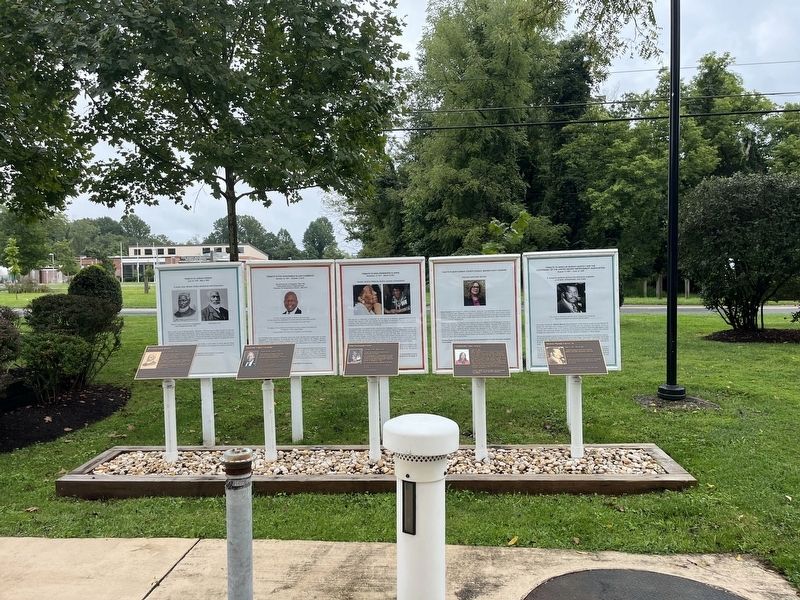
Nancy Navarro was born in Caracas, Venezuela. She is the first Latina county council member in Montgomery County. Navarro served District 4, the largest and most diverse district in the county. She is the recipient of the Hispanic Hero Award . . . — — Map (db m197810) HM
Mysteries of the Hopkins House
Set back from the main road at the end of a gravel driveway, stands the Hopkins House at 18465 Brooke Road. The oldest part of this house, of log construction, is a two-story, gable-roofed structure that runs . . . — — Map (db m188281) HM
Nina Honemond Clarke Was a Master Teacher at the Sandy Spring Elementary School
She was born in Poolesville on November 13, 1917, grew up in Dickerson, graduated from Rockville Colored High School in 1934, and received her first . . . — — Map (db m188207) HM
Warrick Hill: Author and Superstar Math Teacher from Holly Grove
Warrick Hill was born in Baltimore in 1926. As a child he lived with his parents at Alloway and walked two and a half miles twice a day to and from Spencerville . . . — — Map (db m188214) HM
Recording the Past
In 1936, John Brostup came to Colesville to take photographs for the Historic American Buildings Survey (HABS), a New Deal federal works project established to capture pre-1860s structures on film before they disappeared. . . . — — Map (db m115372) HM
Sgt. Luther James Dorsey, born around 1852 under slavery in Maryland, was a veteran of Company E of the 10th Cavalry of the United States Army. He served from November 1873 to November of 1878. The 9th and 10th Cavalry regiments were created in . . . — — Map (db m301827) HM WM
Peirce Mill Dam was completed in 1906 to create a scenic waterfall on Rock Creek. Since its construction, the dam has prevented spawning herring and other migratory and resident fish from swimming further upstream. A Denil fishway was installed . . . — — Map (db m70670) HM
This may look like a natural arrangement of rocks but it is really a feat of engineering. Rocks are precisely placed to build a series of boulder step pools that raise the water level making it possible for fish to swim over an active sewer line. . . . — — Map (db m147381) HM
Has been designated a Registered Natural Landmark under the provisions of the Historic Sites Act of August 21, 1935. This site possesses exceptional value in illustrating the natural history of the United States. — — Map (db m55471) HM
Pioneering planner Caroline Freeland championed urban parks—like this one!
In 1963, Caroline Freeland (1918-2007) was appointed to the Montgomery County Planning Board, part of The Maryland-National Capital Park and Planning . . . — — Map (db m295692) HM
Rockville began when Owen's Ordinary, an inn and tavern, was established in this area around 1750. It functioned as the seat of lower Frederick County and in 1776 became the seat of Montgomery County when it was created. In 1784, William P. Williams . . . — — Map (db m117874) HM
One of the earliest businesses in this crossroads village was Owen's Ordinary, an inn and tavern, established in this area around 1750. The village functioned as the government center of lower Frederick County, and in 1776 became the seat of the . . . — — Map (db m174694) HM
In 1777, seven commissioners were appointed to purchase a plot of land, not exceeding 4 acres, to build a courthouse and jail for Montgomery County. Initially, both court and jail were located in the former Hungerford Tavern on South Washington . . . — — Map (db m174702) HM
In 1777, seven commissioners were appointed to purchase a plot of land not exceeding four acres, for building a court house and prison for Montgomery County. In 1777, both court and jail were located in the former Hungerford Tavern on South . . . — — Map (db m330) HM
Nancy Navarro (born August 15, 1965) in Caracas, Venezuela. She graduated from the University of Missouri-Columbia with a Bachelor of Science in Psychology. She is the first Latina County council member in Montgomery County. She is the first . . . — — Map (db m205948) HM
Silver Spring's heyday as a commercial center began in 1938 with the opening of the Silver Theatre and Shopping complex, designed by John Eberson. These streamlined buildings housed a wide variety of shops, as well as a 1,100 seat movie theatre, and . . . — — Map (db m76002) HM
Ms. Rachel Louise Carson was born on May 27, 1907 in Springdale, Pennsylvania, but spent most of her adult life in and around Montgomery County, Maryland. She was a renowned biologist and owed her love of nature to the encouragements of her mother, . . . — — Map (db m74150) HM
The boatsmen had a hard life. But the locktenders did too, because they couldn't go nowhere. They had to be on the job all the time. - Harvey Brant, Locktender, Lock 44.
The canal company supplied locktenders with . . . — — Map (db m95855) HM
Civil War-Barnes School
In April 1865, the Union Army command made this house its headquarters. Mrs. Pickett hid her silver on an inside ledge of the cupola. Later, former Confederate Generals Hood, Bragg, and Walker visited here. In 1906, . . . — — Map (db m86072) HM
The earliest inhabitants of the Rock Creek Valley crossed the creek at this and other natural low spots located along its banks. In the early 1900s several of these fording places were paved with concrete to accommodate automobile traffic. The . . . — — Map (db m210146) HM
Boulder step pools dot this stretch of creek for an important reason. They were created to provide an essential passageway for migratory fish. Many sewer lines crisscross Rock Creek. Once buried, the pipes have been exposed due to high volumes of . . . — — Map (db m147418) HM
The Germantown Bank was built in 1922 and was established by Augustus R. Selby, part-owner and manager of the Liberty Milling Company, and Andrew H. Baker, local entrepreneur and head of the A. H. Baker Insurance Company of Washington. Selby was . . . — — Map (db m126711) HM
During the Civil War, more soldiers passed through Poolesville than any other Montgomery County town. Union forces occupied this bustling village throughout most of the war, protecting the strategic road network, lines of communication and . . . — — Map (db m275874) HM
Dedicated to all those
who have served our
country and our
community
Town of Poolesville (Founded 1867)
Montgomery County, Maryland
May 26, 2003 — — Map (db m131598) WM
In April 1862, Congress abolished slavery in Washington, D.C. District slaveholders were eligible for monetary compensation when they manumitted (freed) their slaves. Because the Beall sisters held several slaves who worked in the District, they . . . — — Map (db m5416) HM
Carver was the first accredited two-year junior college conducted under the Montgomery County Board of Education for post-secondary education of Black students in the county.
At the time, Lincoln High School, located in a historically Black . . . — — Map (db m295699) HM
William B. Gibbs, Jr., teacher and principal of the Rockville Colored Elementary School, thought black educators should receive the same pay as white educators, but he had to take the issue to court.
African-American teachers had to meet the . . . — — Map (db m174772) HM
The red brick and sandstone courthouse on this site is believed to be the fourth location of courts since Rockville was selected as the county seat in 1776. Court was originally held at Hungerford Tavern. A frame courthouse existed in the late . . . — — Map (db m174765) HM
Teacher, activist, historian, author, lecturer, humanitarian, and model.
The granddaughter of enslaved people that reached the pinnacle for achievement in heritage education; chronicler of the history of black public schools and churches in . . . — — Map (db m197809) HM
In 1890, one of the 252 Civil War veterans still living in Montgomery County was Elias Price. The Department of Census interviewed Price and other Civil War veterans living in the county, recording critical details including which side of the war . . . — — Map (db m306009) HM
On June 24, 1863, Gen. J.E.B. Stuart, leaving 3,000 cavalrymen in Rectortown, Virginia, to monitor Federal activity, led three Confederate cavalry brigades to Haymarket. Encountering Union Gen. Winfield S. Hancock’s corps marching north, Stuart . . . — — Map (db m306043) HM
"Three ace promoters of Silver Spring in those days [1920s & 30s], they had a finger in almost every pie." So wrote editor Blair Lee III in August 29, 1947 Maryland News describing his father E. Brooke Lee, James H. Cissel and Frank L. . . . — — Map (db m75761) HM
This mural tells the stories of 3 refugees who live here in Maryland, who were interviewed for this project. Georges, a former mayor of his city in eastern Congo (DRC), fled with his family when the war came to his region. Mai, from Myanmar (aka . . . — — Map (db m114527) HM
Have you ever wondered?
In a city with nearly equal numbers of Black and white residents, why is Ward 3's population 70% white and 8% Black?
Since at least the 1700's, Black people have lived and thrived in the area, . . . — — Map (db m259716) HM
Each spring a miraculous journey begins in the Atlantic Ocean. Blueback herring, Alewife, and other migratory fish swim to Rock Creek by way of the Chesapeake Bay and Potomac River. Members of the herring family come to Rock Creek to spawn. Since . . . — — Map (db m40381) HM
A natural low area made this portion of Rock Creek a perfect place to ford the creek on foot, horseback or by carriage. Concrete paving was installed at Milkhouse Ford in the early 1900s to accommodate heavy carriages and automobiles. Unless the . . . — — Map (db m116079) HM
Born June 4, 1834, in Martinsburg, New York, this 1856 West Point graduate returned to his alma mater as an instructor following a tour of duty in the west and midwest. At the outbreak of the Civil War, Bailey organized the First New York Light . . . — — Map (db m17695) HM
Darnestown Road is one of the oldest roads in Montgomery County. Once an old trail, the route dates back to 1600 when it was used by the Seneca Indians. Native Americans established villages, planted maize, and fished along the Potomac Palisades. . . . — — Map (db m295915) HM
Restoring History
This circa 1800 stable was built either by the Young family or the Fisher family of Seneca sandstone most likely quarried nearby on the Potomac River. Seneca stone was prized for its ruddy variegated color, local abundance, . . . — — Map (db m86368) HM
In 1924, steps to construct a park on town-owned lots was initiated by the
Woman's Club of Kensington. Blanche Armstrong, chair of the Civic Committee, deemed this location ideal, since the park “would serve as an attractive introduction to our . . . — — Map (db m195211) HM
Local farmers attempted to maintain their agricultural operations despite disorder caused during the Civil War. Out of necessity, planters paid particular attention to weather and planting information provided by almanacs and newspapers. The . . . — — Map (db m305919) HM
Early on Sunday morning, June 28, 1863, 5,000 of Confederate Gen. J.E.B. Stuart's cavalrymen rode into Rockville as they trailed Gen. Robert E. Lee's army through Maryland into Pennsylvania. Here in Rockville they arrested Union supporters. They . . . — — Map (db m295696) HM
This was the office of Dr. Edward E. Stonestreet, who practiced medicine from 1852 to 1903. He began his career here as a country doctor serving Montgomery County. During the Federal draft of 1862, he examined an estimated 800 draftees and . . . — — Map (db m174801) HM
[The marker features a set of panels that are sections of a mural:]
European map of this geographic area, attributed to John Smith, 1608. People lived here for ten thousand years or more before the European . . . — — Map (db m174783) HM
Rockville started in the 1750s as a tiny Village Crossroads. It was called Owens Ordinary, Hungerford's Tavern, Montgomery Court House, Williamsburgh, and finally in 1803 Rockville. § Route 355 began as an Indian path that later became a . . . — — Map (db m102370) HM
General Edward Braddock and his troops camped in Rockville in 1755 on their way to Fort Duquesne during the French and Indian War. § In 1774, local residents passed the Hungerford Resolves in protest against British taxation policy in the . . . — — Map (db m102421) HM
Beginning about 1000 B.C., local American Indian tribes used these rock shelters as "prehistoric motels." Although the tribes had adopted agriculture by that time, they supplemented their diet with wild plants and animals. These shelters provided . . . — — Map (db m312325) HM
The home of Horace and Amanda Thomas built in 1884 was the first house to be completed in Takoma Park. It is a fine example of early residential development in Montgomery County. The house, carriage house, and spacious garden illustrate life as it . . . — — Map (db m110245) HM
Virginia Avenue Tunnel (1906-2015)
Virginia Avenue Tunnel
As automobile and streetcar use increased during the early 20th century, at-grade railroad crossings created safety hazards throughout the city. To address this issue, the newly . . . — — Map (db m136835) HM
Early Political Career
Born in 1775 in Montgomery County, Maryland, Ninian Edwards moved to Kentucky in 1794 and was elected to the Kentucky legislature in 1795. He was appointed to serve as Chief Justice in the Kentucky Court of Appeals . . . — — Map (db m263411) HM
Constructed in 1857, this building has served changing needs over time.
Restaurant History
1953: The White House restaurant opened and also offered overnight accommodations in the building. Later it was known as Bucher's Restaurant & . . . — — Map (db m262685) HM
After the Civil War, America's cities created new transportation systems that enabled them to prosper and grow. During this time, major rail lines were built to connect Washington, D.C. with other cities. Smaller electric streetcar or 'trolley' . . . — — Map (db m116775) HM
This area was named in honor of the large and loud frog population around Little Bennett Creek. Before Kingsley School was built, white children living on nearby farms were sent to neighboring community schools. With no bus transportation, . . . — — Map (db m295641) HM
By the summer of 1861, the Union recognized Darnestown as an ideal location for establishing a major division headquarters. The town was strategically situated at the intersection of roads leading to the Chesapeake and Ohio Canal and to . . . — — Map (db m295676) HM
Compared to areas further south, Maryland was welcoming to freed people who wished to purchase land. Such was the case for Albert and Mary Newman, who following their manumission left Virginia and settled "Newmantown" as a kinship-based . . . — — Map (db m197859) HM
The serenity of the Maryland countryside was
shattered on September 4-6, 1862, as 35,000 Confederate soldiers of the Army of Northern Virginia
waded across the Potomac River. Gen. Robert E. Lee, hoping to rally support in the divided
state, . . . — — Map (db m173131) HM
Family Farming
Dr. William Brewer acquired 583 acres in a land grant known as “Woodstock Manor,”
in 1838. Woodstock was two miles from Dr. Brewer's primary residence, Aix-La-Chappell where he provided medical treatment to the local . . . — — Map (db m86904) HM
“Feed the Liberty Way” was the slogan of Liberty Milling Company, mainstay of the little farming community of Germantown for many years. In its heyday, Liberty Mill put out 24,000 lbs. of flour each day and 9,000 lbs. of cornmeal each . . . — — Map (db m69289) HM
Beginning in 1940, a new Art Deco arcade was added to Glen Echo park. Designed by the firm of Edward Schoeppe of Philadelphia, also the chief architect of the Crystal Pool and Spanish Ballroom, the arcade was constructed in stages from 1940 to . . . — — Map (db m247736) HM
After the Civil War, America's cities created new transportation systems that enabled them to prosper and grow. During this time, major rail lines were built to connect Washington, D.C. with other cities. Smaller electric streetcar or 'trolley' . . . — — Map (db m219959) HM
Dawson Family History
Thomas Dawson (1708-1800) left his family home in Charles County, Maryland, in 1750 and established Dawsonville in what was Frederick County, but later became Montgomery County. The Dawsons were a prominent Montgomery . . . — — Map (db m201500) HM
After the Civil War, America's cities created new transportation systems that enabled them to prosper and grow. During this time, major rail lines were built to connect Washington, D.C. with other cities. Smaller electric streetcar or 'trolley' . . . — — Map (db m219962) HM
After the Civil War, America's cities created new transportation systems that enabled them to prosper and grow. During this time, major rail lines were built to connect Washington, D.C. with other cities. Smaller electric streetcar or 'trolley' . . . — — Map (db m219957) HM
County-funded elementary education for African American children did not exist until 1872. Until then, small black enclaves, like Mount Pleasant, pulled community resources to establish schools. A significant boost in financial . . . — — Map (db m151280) HM
Brookeville - Mt. Zion
In the 1880s, Mt. Zion was a well-established Black settlement in Montgomery County, having two dry goods stores, post office and grocery store owned by Thomas Brown and approximately 25 residences. . . . — — Map (db m188230) HM
The Mutual Memorial Cemetery, established in 1873, is the final resting place of more than 300 African American citizens who lived in and around Sandy Spring, MD. The inhabitants of this hallowed ground, collectively, experienced a history that . . . — — Map (db m206729) HM
The Powell-Matthews-Cook and Brooks Families in Sandy Spring: Focus on Lucy Matthews Cook
Margaret Ann Powell, born circa 1890s is the mother of Lucy Powell Matthews and great grandmother of Lucy Matthews Cook.
Gilbert Matthews [son of . . . — — Map (db m188277) HM
Woodlawn Manor Cultural Park
The Underground Railroad Experience Trail & The Josiah Henson Museum and Park
The Underground Railroad Experience Trail
Located in Sandy Spring, Woodlawn Manor Cultural Park offers a glimpse into the . . . — — Map (db m188240) HM
With only the Potomac River between Montgomery County and the Confederate South, Seneca Mills residents were always close to impending troop activity.
At the beginning of the war, the Seneca Mill community was worthy of consideration by the . . . — — Map (db m306050) HM
The 1938 Silver Theatre and Silver Spring Shopping Center complex is a landmark of early 20th-century commercial architecture. It profoundly affected the development of suburban Silver Spring as well as helped shape the growth of the region. It . . . — — Map (db m113018) HM
Just around the corner, on Colesville Road, is the American Film Institute (AFI) Silver Theatre and Cultural Center — an architectural treasure and state-of-the-art movie theater saved from the wrecker's ball by the citizens of Silver Spring and . . . — — Map (db m113010) HM
Mothers and fathers alike sought to ensure that their sons and daughters had continual access to education between 1861 and 1865. At the height of the Civil War, public primary schools in Montgomery County were closed due to deficient state . . . — — Map (db m306114) HM
Arthur Briggs Farquhar, American Industrialist
Arthur Briggs Farquhar was born on September 28, 1838, in Montgomery County, Maryland. Arthur, known as A.B., was an ambitious young man who apired to a career in business. He had an early . . . — — Map (db m305357) HM
North of this monument, Robert Ober, a wealthy merchant built his home. A long tree-lined approach adds prominence to this 1½ story brick Georgian-style residence. This Tidewater style of architecture is rarely found in Montgomery County. . . . — — Map (db m72538) HM
You are standing on the tract of land where Wootton's Mill once stood near Watts Branch stream. The gristmill was constructed and began operations in 1821. The saw and gristmill was powered by an overshot wheel, in which the weight of water . . . — — Map (db m108378) HM
Countee Cullen: Poet, Anthropologist, Novelist, Translator, Children's Author, and Playwright
Countee Cullen died in 1946; he was only 42 years. In the centuries of the 20s and 30s he along with his friends Arna Bontemps, . . . — — Map (db m188351) HM
The South Arch
This memorial honors Pennsylvania's military heroes of the Civil War (1861-1865). A pair of arches topped by tall pillars, the project involved 12 noted sculptors over a 15-year period. It is considered one of most ambitious . . . — — Map (db m191697) HM
179 entries matched your criteria. Entries 101 through 179 are listed above. ⊲ Previous 100
Thin black lines indicate changes in relevance. Between each pair of lines entries are ordered geographically but all have the same relevance.
* Inflectional forms of words are their plurals, singulars, and possessives as well as gramatical tenses and similar variations.