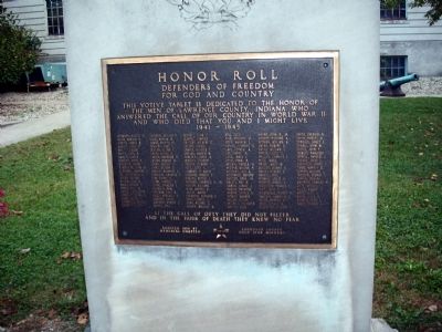
Honor Roll
Defenders of Freedom
for God and Country
This votive tablet is dedicated to the honor of the men of Lawrence County, Indiana who answered the call of our Country in World War II and who died that you and I might . . . — — Map (db m48423) WM
From 1851 to 1892 this was the location of the first railroad depot in Lawrence County. It was built by the New Albany and Salem R. R. And handled both passengers and freight. Starting in 1876 it was also the depot of the narrow gauge Bedford and . . . — — Map (db m243574) HM
A gift of newspaperman Fred B. Otis, May 13, 1937. The mansion was built circa 1865 by William A. Ragsdale. Pioneer stone worker, Nathan Hall purchased the property in 1875 and named it "Pine Hall." Later it was owned by industrialist Alvin T. Hert. . . . — — Map (db m74152) HM
Presented to the City of Bedford October 31, 1935 by Fred B. Otis, editor of the Bedford Daily Mail. An area of 145.81 acres of beautiful landscape, including the fine old mansion, Pine Hall. Dedicated to refined recreation and pleasure of all the . . . — — Map (db m74153) HM
Built 1865-7 by Wm. Ragsdale. Cost $25,000. Occupied by his family 11 years. Bought 1878 by Nathan Hall, pioneer quarryman. Occupied by his family 21 years. Bought and run as a dairy farm 1899 by Alvin Tobe Hert who named the estate Pine Hall. Owned . . . — — Map (db m74154) HM
Here on March 11, 1818, Ambrose Carlton, Thomas Beagley and James Scotts, commissioners, organized Lawrence County and its first five townships, appointed officers, fixed Palestine as county seat and ordered first elections. The first court convened . . . — — Map (db m74155) HM
Created by the Legislature on January 28, 1834, it was one of ten original branch banks. This institution served six counties and contributed greatly to Bedford’s growth.
First President was Col. William McLane, followed by John Vestal. . . . — — Map (db m48302) HM
Top Plaque
This Cornerstone of Freedom
presented June, 17, 1948
at Bedford, Indiana, U. S. A.
The Stone City of the World
On this spot June 17, 1948 as a
part of the Indiana Limestone
Centennial Cornerstones of . . . — — Map (db m48335) HM
Mercury 4 Virgil I. Grissom Liberty Bell 7 Gemini 3 Virgil I. Grissom • John W. Young The Molly Brown Apollo 1 Virgil I. Grissom • Ed White • Roger B. Chaffee — — Map (db m195330) HM
On June 19, 1928 the Lehigh Portland Cement Company donated the area known as Hamer Mill Land to the state of Indiana for its natural beauty and scenic characteristics, to be used for the preservation and use as a state park
This donated . . . — — Map (db m289922) HM
Founded April 6, 1880, a coeducational, non-sectarian institution of higher learning with schools of Law, Civil Engineering, Pedagogy, Liberal Arts, Commerce and Music. There were no entrance examinations or required courses. The college was . . . — — Map (db m307071) HM
STS-41D — Mercury Program This tree was grown from a seed which orbited the Earth with astronaut Charles Walker, native of Bedford, Indiana aboard Space Shuttle Discovery from 30 Aug. to 5 Sept. 1984. It was presented to the Grissom family by . . . — — Map (db m195329) HM
This marker is on the northern boundary of the Vincennes Tract, the first Indian cession obtained by Governor William Henry Harrison in the Indiana Territory.
The treaty was signed by chiefs of the Miami, Delaware, Shawnee, Potawatomi, Eel . . . — — Map (db m243588) HM
Largest building stone quarries in the world, in continuous operation since the 1830s. These quarries have produced stone for many of the world’s largest and finest memorials, buildings and bridges. — — Map (db m74165) HM
Although they never met, George Donaldson honored his countryman, Alexander Wilson, with this stone monument.
Alexander Wilson (1766-1813)
The Father of Ornithology
At the age of 13, Alexander Wilson began an apprenticeship as a . . . — — Map (db m185705) HM
"Created in early 1933, the CCC was an effort by President Franklin Roosevelt to combine the national need for employment with the preservation of natural and historical resources. From May, 1933 until 1942, CCC boys restored village cabins, built . . . — — Map (db m163025) HM
…our parks and preserves are not mere picnicking
places. They are rich storehouses of memories and
reveries. They are a solace to the aged and an
inspiration to the young.
Richard Lieber, Founder
Indiana State . . . — — Map (db m163028) HM
Honoring a century of conservation and outdoor recreation. Celebrating unique, cherished places where future generations can experience nature and history.
Spring Mill established 1927
Governor Michael R. Pence
Lt. Governor Eric J. . . . — — Map (db m285591) HM
The Hamer Cemetery represents the customs and beliefs of 1800s frontier Hoosiers.
The Hamer Cemetery began out of immediate need when a traveler died in the night near this location. Mill owner Hugh Hamer instructed his carpenters to build a . . . — — Map (db m163047) HM
You are standing on
the Stagecoach
Trail, an historic
stagecoach route.
From this point, the
trail curves to the
right into the woods.
Stagecoaches stopped here on their way between New Albany
and Terre Haute.
Stagecoaches had to stop . . . — — Map (db m163037) HM
First settled in 1818, Hindostan became county seat of Martin County, boasting a population of approximately 1,200. A “Great Sickness” struck in 1828 bringing death to the inhabitants. The town was never occupied again. — — Map (db m99002) HM
(Left Panel)
The Martin County Guards
Company C, 14th Regiment Indiana Volunteers
Shortly after the firing on Fort Sumter in Charleston, South Carolina, President Abraham Lincoln called for the states remaining in . . . — — Map (db m98961) HM
Bronze Plaque
This property
is listed in the
National Register
of Historic Places
by the United States
Department of the Interior
Engraved Stone
Martin County
Court House
Erected 1876 . . . — — Map (db m47420) HM
( Top - Center Panel )
In Memory of those who made the Supreme Sacrifice for their Country
( Left Panel )
* * * World War I * * *
(Row One) - - Clarence H. Corbin • Benjamin H. Abner • Isaac Alford • George B. Bridges • . . . — — Map (db m47482) WM
Shoals was the location of the connecting point of the main east-west railroad line, which was laid westward from Cincinnati, Ohio by the Ohio and Mississippi Railroad Company and eastward from St. Louis, Missouri by the Baltimore and Ohio Railroad . . . — — Map (db m180290) HM
Historic Hotels of America Nation Trust for Historic Preservation
second plaque:
This property has been placed on the National Register of Historic Places. — — Map (db m9917) HM
This hotel stands on the site of the French Lick Fort maintained as a Government Station - as a protection from Indians until about 1815. — — Map (db m243575) HM
Thomas Freeman surveyed the Vincennes Tract 1802-1803. The northeast corner of this tract is located 839 ft. N. and 48 ft. E.
Placed by Lost River Chapter D.A.R.
1935. — — Map (db m74118) HM
Dedicated to those who served
(Leftmost Panel of Brick Memorials)
First Column:
Grant C. Cornwell - (USAAC - S/SGT) - (2-1942 to 10-1945) -•- Lester R. Cornwell - (USN - GM3/C) - (8-1944 to 2-1946) -•- Leland W. Cornwell - (USA . . . — — Map (db m242018) HM
Side A:
Orleans was platted March 11, 1815. This town square, called Congress Square, was part of the plat. Orleans Academy was built here 1866, in operation by 1867. In 1870s, the Academy was purchased, and its building was made part . . . — — Map (db m22064) HM
This bell rung in the Orleans Academy building when built in 1864, remained in the enlarged public school building until it was razed in 1965. — — Map (db m22095) HM
(East Side)
Dedicated in honor
of those who gave
their lives in the
service of their
country that we
might live in freedom
(North Side)
World War I
Warren J. Brock •
Wesley Edwards •
Everett M. . . . — — Map (db m22315) WM
Commemorating our Native Indians, our forefathers who planned and put into effect our Public Land System, the U.S. Deputy Public land Surveyors and our early prominent land surveyors
( Center are the plotted Survey Plaques )
Contributing . . . — — Map (db m47662) HM
1903
Presented by the Government
to Williamson Post No. 364, G. A. R.,
and by the Post to Orange County,
in Memory of Her Soldiers of
1861 - - - 1865 — — Map (db m47424) HM
The Orange County Courthouse
circa 1850 has been placed on the National Register of Historic Places
by the United States Department of The Interior
1975 — — Map (db m47451) HM
( Across Top of Memorial )
Honor Roll of the Silent Ones
Who fought for God and Country
( Center Panel )
* * * 1917 - - World War I - - 1918 * * *
(Row One) - - Alvis Apple • William A. Beaty • Walter Benson • . . . — — Map (db m47489) WM
( Bronze Plaque )
Soldiers and Patriots of the American Revolution Buried in Orange County.
(Row One) - - Thomas Atkinson • Joseph Bolling • William Case • William Chandler • Ephraim Dailey • George Duncan • Robert Hall • George Henton • . . . — — Map (db m47409) WM
On November 13, 2010, a devastating fire destroyed almost all of the southwest section of historical downtown Paoli. This building, like a Phoenix rising from the ashes, was completed in the fall of 2012 and stands in memorial to those shops and . . . — — Map (db m195492) HM
600 yards west, intersection of the baseline and the second principal meridian, the lines fixed in 1805 by Ebenezer Buckingham, to govern land survey in Indiana under the Ordinance of 1785. — — Map (db m47345) HM
The mineral springs at West Baden Springs Hotel drew the people to the area and made it famous. During those early years, the springs were identified by numbers. Lee W. Sinclair had Spring No. 3 covered with a wooden structure, which housed the . . . — — Map (db m194997) HM
The entrance of West Baden Springs Hotel features a double archway and serves as a gateway to the magnificent hotel. The International Steel and Iron Company was awarded the contract for the construction in 1902. The archway was actually . . . — — Map (db m195090) HM
You are standing on the original brick street to West Baden Springs Hotel, installed when the hotel was built in 1902. In the early 1900s, over half of the streets in the towns of French Lick and West Baden were made of bricks, numbering in the . . . — — Map (db m194999) HM
Golfing at the hotel was used as a form of relaxation for the guests. It provided a calm and peaceful environment for getting away from the troubles of everyday life. Luckily for the guests at West Baden Springs Hotel, they had two golf courses . . . — — Map (db m194998) HM
Located to your left is the bridge named in honor of boxing legend Joe Louis. The "Brown Bomber" was the World heavyweight Champion from 1937 to 1949 who trained in West Baden. Although he trained at West Baden Springs Hotel, he was not allowed to . . . — — Map (db m195099) HM
The Seal Fountain was named for the hand-carved seal that was perched on a mound of stones in the center of the fountain. Originally, the fountain was located in the center of the atrium when the hotel was built. Ferdinand Cross, a famous local . . . — — Map (db m195097) HM
Built 1917 • Restored 1987 Board of Directors Mr. Arnold F. Habig, Chairman Mr. Everett Land, President Mr. Thomas L. Habig, Secretary Miss Harriett Brown Mr. John B. Habig Mr. Ronald J. Sermersheim Mr. James M. Tucker Mr. Douglas A. . . . — — Map (db m195100) HM
Spring No. 7 (later re-named Sprudel to honor the hotel's mascot) was the strongest, pumping out 12 gallons a minute with a production capacity of two thousand barrels of water a day. A lucrative bottling business from Spring No. 7 soon . . . — — Map (db m194996) HM
Several of the Jesuits who studied at the West Baden Monastery are buried here. Mr. Sinclair constructed two churches on the property, one Methodist and one Catholic, on each side of the cemetery located on the hill overlooking the brick street. . . . — — Map (db m195098) HM
The walkway was designed to guide the hotel guests as they strolled through the sunken garden. Originally the paths to the various buildings in this area were covered with sawdust. However, in 1912 a disastrous fire destroyed the buildings that . . . — — Map (db m194995) HM
From its construction in 1902 to its closure as a resort hotel casino after the stock market crash of 1929, West Baden Springs Hotel's 200' free-span atrium dome was known as the Eighth Wonder of the World. After 1929 it housed a multitude . . . — — Map (db m195000) HM
West Baden Springs Hotel had four springs on its property; they were numbered in the order they were discovered. Only odd numbers were used to offset the practice at French Lick using even numbers. Spring No. 1 was renamed Hygeia Spring, based . . . — — Map (db m195095) HM
The remote southern Indiana location of the West Baden Springs and French Lick resort area made access by railroad essential to their prosperity in the late 1880’s. The resorts signed a deal with the Monon Railroad that granted direct access to the . . . — — Map (db m195001) HM
West Baden has had many different uses through the years. During WWI, the hotel became Army Hospital #35. By the Fall of 1918, troops needing medical aid were returning from war. The U.S. Army aggressively sought out potential sites for hospitals . . . — — Map (db m195094) HM
The first rails into the Valley of Springs were built in 1887. Just outside the entrance arches at West Baden Springs Hotel are remnants of the rails and the foundation of the West Baden Depot. The Monon Line would stop at this depot before . . . — — Map (db m195091) HM
264 entries matched your criteria. Entries 201 through 264 are listed above. ⊲ Previous 100