270 entries match your criteria. Entries 201 through 270 are listed.⊲ Previous 100
Erie Canal Historical Markers
Markers related to the water route that connected the Hudson River to Lake Erie, creating the first significant commercial route to the American Midwest.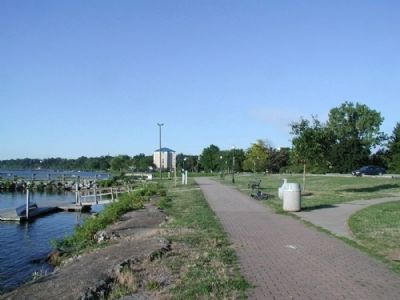
By Yugoboy, August 8, 2012
Cayuga-Seneca Canal Entrance Marker as seen facing south
201 ► New York, Ontario County, Geneva — Cayuga-Seneca Canal Entrance —  |
| Near Lake Front Drive (U.S. 20) just south of Lake Street. | |||
| 202 ► New York, Ontario County, Victor — Rochester Area — Historic New York — |
| On NYS Thruway - Seneca Rest Area. | |||
| 203 ► New York, Orleans County, Albion — Calamity Sept. 28, 1859 — |
| On South Main Street (New York State Route 98), on the left when traveling north. | |||
| 204 ► New York, Orleans County, Albion — Erie Canal 1825 — |
| On South Main Street (New York State Route 98), on the right when traveling north. | |||
| 205 ► New York, Orleans County, Albion — Erie Canal Spurs Albion's Growth and Prosperity — |
| On North Platt Street 0.1 miles north of East Bank Street, on the right when traveling north. | |||
| 206 ► New York, Orleans County, Albion — 29 — Lafayette's Tour — Mapping the Farewell Tour — The Lafayette Trail — |
| On North Platt Street 0.1 miles north of East Bank Street, on the right when traveling north. | |||
| 207 ► New York, Orleans County, Holley — 1823 Canal Bed — |
| On Geddes Street 0.1 miles east of Holley Square, on the right when traveling west. | |||
| 208 ► New York, Orleans County, Holley — The Holley Loop — The Canalway Trail — |
| On East Avenue, on the right when traveling east. | |||
| 209 ► New York, Orleans County, Kendall — Norway Colony — |
| On Norway Road at Bald Eagle Drive, on the left when traveling north on Norway Road. | |||
| 210 ► New York, Orleans County, Medina — Erie Canal — |
| Near Mill Street (Manilla Place on Google) east of Main Street ( Route 63), on the left when traveling east. | |||
| 211 ► New York, Orleans County, Medina — Greater Medina Area — Towns of Ridgeway & Shelby, Village of Medina — |
| On Mill Street (Manilla Place on Google) east of Main Street ( Route 63), on the left when traveling east. | |||
| 212 ► New York, Orleans County, Medina — John Ryan 1801-96 / Medina Sandstone — |
| On North Gravel Road (New York State Route 63) at Ryan Street, on the left when traveling south on North Gravel Road. | |||
| 213 ► New York, Orleans County, Medina — Main Street Historic District — Area 2 — |
| On Main Street (New York State Route 63) north of West Center Street, on the left when traveling north. | |||
| 214 ► New York, Orleans County, Medina — Medina Aqueduct — |
| On Mill Street (Manilla Place on Google) east of Main Street ( Route 63), on the left when traveling east. | |||
| 215 ► New York, Orleans County, Ridgeway — 1833 Servoss-Hagood House — National Register of Historic Places — |
| On Fruit Avenue (County Route 41) at Dublin Road, on the left when traveling south on Fruit Avenue. | |||
| 216 ► New York, Orleans County, Ridgeway — The Culvert Road — |
| On Culvert Road (County Route 35) 0.2 miles south of Portage Road, on the right when traveling south. | |||
| 217 ► New York, Orleans County, Ridgeway — The Medina Culvert — |
| On Culvert Road (County Route 35) 0.2 miles south of Portage Road when traveling south. | |||
| 218 ► New York, Orleans County, Ridgeway — Unlock the Adventure — The Canalway Trail — An Agricultural Highway — |
| On Knowlesville Road (County Route 4) at Portage Road, on the right when traveling north on Knowlesville Road. | |||
| 219 ► New York, Queens County, Queens, Maspeth — Dewitt Clinton Home 1790-1828 — |
| On Maspeth Avenue at 58th Street, on the right when traveling west on Maspeth Avenue. | |||
| 220 ► New York, Rockland County, Stony Point — The Lighthouse at Stony Point — |
| On Stony Point Park Road, on the right when traveling east. | |||
| 221 ► New York, Saratoga County, Clifton Park — Clutes Dry Dock — |
| Near Riverview Road. | |||
| 222 ► New York, Saratoga County, Clifton Park — Erie Canal — |
| On Riverview Road, on the right when traveling east. | |||
| 223 ► New York, Saratoga County, Halfmoon — Crescent / Mohawk Towpath Byway / Halfmoon — |
| On Old Canal Road. | |||
| 224 ► New York, Saratoga County, Halfmoon — Crescent Aqueduct — |
| Near Terminal Road at U.S. 9. | |||
| 225 ► New York, Saratoga County, Rexford — Aqueduct, 1842 — |
| On Balltown Road (New York State Route 146), on the right when traveling north. | |||
| 226 ► New York, Saratoga County, Stillwater — Surviving Portion of Champlain Canal — |
| Near Park Tour Road, on the right when traveling west. | |||
| 227 ► New York, Saratoga County, Vischer Ferry — Cast Iron Whipple Truss Bridge, 1869 — |
| On Riverview Road close to Van Vranken Road, on the right when traveling east. | |||
| 228 ► New York, Saratoga County, Vischer Ferry — Clute’s Dry Dock — |
| On Riverview Road, on the right when traveling east on Riverview Road. | |||
| 229 ► New York, Saratoga County, Vischer Ferry — Hamlet of Vischer Ferry — |
| On Ferry Drive 0.1 miles south of Riverview Road when traveling south. | |||
| 230 ► New York, Saratoga County, Vischer Ferry — Lock 19 — |
| Near Ferry Drive. | |||
| 231 ► New York, Saratoga County, Vischer Ferry — Vischer Ferry Nature and Historic Preserve — |
| On Riverview Road at Van Vranken Road, on the right when traveling east on Riverview Road. | |||
| 232 ► New York, Saratoga County, Vischer Ferry — Whipple Iron Truss Bridge — |
| On Riverview Road close to Van Vranken Road, on the right when traveling east. | |||
| 233 ► New York, Saratoga County, Waterford — Lock 2 Park — |
| Near Broad Street just south of 5th Street ( Route 32), on the right when traveling west. | |||
| 234 ► New York, Saratoga County, Waterford — White Homestead — |
| On Museum Lane, on the right when traveling south. | |||
| 235 ► New York, Schenectady County, Niskayuna — The Historic Rexford Aqueduct — A feature of the National Historic Landmark - New York State Canal System - The Erie Canal — |
| On New York State Route 146, on the right when traveling north. | |||
| 236 ► New York, Schenectady County, Rotterdam — Enlarged Erie Canal Lock 23 — Erie Canal Lock 23 — |
| Near Rice Road near Schermerhorn Road. Reported permanently removed. | |||
| 237 ► New York, Schenectady County, Rotterdam — Enlarged Lock 23 — |
| Near Rice Road. | |||
| 238 ► New York, Schenectady County, Rotterdam — Gateway Landing — Schenectady Harbor 1660 - 1820 — |
| On SCCC Loop, on the right when traveling north. | |||
| 239 ► New York, Schenectady County, Rotterdam Junction — Lock 25 — Rotterdam Junction, New York — |
| Near New York Empire State Trail south of Canal Street & Lock Street, on the left when traveling north. | |||
| 240 ► New York, Schenectady County, Rotterdam Junction — Plotter Kill Aqueduct — |
| On 5S, on the left. | |||
| 241 ► New York, Schenectady County, Schenectady — 10 — Canal Aqueduct — |
| On New York State Route 5S 0.1 miles west of Route 890, on the right when traveling north. | |||
| 242 ► New York, Schenectady County, Schenectady — Erie Canal Lock 8 — |
| On Empire State Trail 0.5 miles north of Schemerhorn Road, on the right when traveling north. | |||
| 243 ► New York, Schenectady County, Schenectady — Stockade Historic District — |
| On Erie Blvd at Union Street, on the right when traveling west on Erie Blvd. | |||
| 244 ► New York, Schenectady County, Schenectady — The Movable Dam at Lock 8 — Schenectady/ Erie Canalway Trail — |
| Near Rice Road. | |||
| 245 ► New York, Schuyler County, Burdett — Warehouse — |
| On New York State Route 414 0.2 miles south of Carpenter Road, on the right when traveling south. | |||
| 246 ► New York, Seneca County, Waterloo — The Finger Lakes — Historic New York — |
| Near NYS Thruway - Junius Ponds Rest Area. | |||
| 247 ► New York, Tompkins County, Ithaca — Cayuga Lake And The Erie Canal: — Ithaca’s Waterway To The World — |
| Near James L Gibbs Drive south of East Shore Drive, on the right when traveling south. | |||
| 248 ► New York, Wayne County, Arcadia — A Vast Enterprise — |
| On West Shore Boulevard at Whitbeck Road, on the right when traveling east on West Shore Boulevard. | |||
| 249 ► New York, Wayne County, Clyde — 861 — Canal Fight — |
| On Gansz Road, on the left when traveling north. | |||
| 250 ► New York, Wayne County, Clyde — Clyde Historical Highlights — |
| On Water Street, on the right when traveling west. | |||
| 251 ► New York, Wayne County, Clyde — Erie Canal — |
| On Water Street, on the right when traveling west. | |||
| 252 ► New York, Wayne County, Clyde — 15 — Iron Lift Bridge — |
| On Glasgow Street (New York State Route 414) south of Ford Street. | |||
| 253 ► New York, Wayne County, Clyde — Lock No. 64. — Empire State Trail — |
| Near Elm Street. | |||
| 254 ► New York, Wayne County, Clyde — The Erie Canal in Clyde — |
| On Water Street, on the right when traveling west. | |||
| 255 ► New York, Wayne County, Clyde — Towpath Trailhead — Empire State Trail — |
| Near New York 31, on the right when traveling east. | |||
| 256 ► New York, Wayne County, Lyons — 7 — Enlarged Erie Canal Lock 55 — H.G. Hotchkiss Peppermint Company — Rochester, Syracuse & Eastern Rail Road — |
| On Leach Road 0.1 miles south of Water Street, on the left when traveling north. | |||
| 257 ► New York, Wayne County, Lyons — It is 1880 and You are Riding on a Packet Boat — |
| On Geneva Street (New York State Route 14) at Montezuma Street, on the left when traveling north on Geneva Street. | |||
| 258 ► New York, Wayne County, Lyons — The Erie Canal — |
| On Peters Road, on the right when traveling west. | |||
| 259 ► New York, Wayne County, Lyons — The Lyons Drydock — |
| On Old Lyons Road 0.4 miles west of Gansz Road. | |||
| 260 ► New York, Wayne County, Macedon — Enlarged Erie Canal Lock 60 Historic Site — |
| Near Quaker Road 1 mile east of O'Neil Road. | |||
| 261 ► New York, Wayne County, Macedon — Erie Lock 60 — |
| On New York State Route 31 0.2 miles east of O'Neil Rd, on the left when traveling east. | |||
| 262 ► New York, Wayne County, Macedon — Have You Wondered — |
| On Canal Park 0.2 miles west of Railroad Avenue when traveling west. | |||
| 263 ► New York, Wayne County, Macedon — The 26 Erie Canal Laborers — |
| On Wayneport Road 0.1 miles south of Quaker Road, on the left when traveling north. | |||
| 264 ► New York, Wayne County, Macedon — Wayneport Historic Area — |
| On Wayneport Road at North Canal Road, on the right when traveling north on Wayneport Road. | |||
| 265 ► New York, Wayne County, Newark — 320 — Joseph Miller — |
| On West Miller Street at Main Street, on the left when traveling east on West Miller Street. | |||
| 266 ► New York, Wayne County, Newark — 323 — Lockville — |
| On Vienna Street at East Union Street ( Route 31), on the right when traveling north on Vienna Street. | |||
| 267 ► New York, Wayne County, Newark — The Lockville Locks in Newark — |
| On Van Buren Road at North Clinton Street, on the right when traveling east on Van Buren Road. | |||
| 268 ► New York, Wayne County, Palmyra — Towpath and Aqueduct / Father of the Iron Bridge — |
| Near West Main Street (New York State Route 31) 0.1 miles north of Creek Road. | |||
| 269 ► Pennsylvania, Crawford County, Conneautville — Erie Extension Canal — |
| On Main Street (Pennsylvania Route 18) at Old Depot Drive, on the right when traveling south on Main Street. | |||
| 270 ► Pennsylvania, Crawford County, Hartstown, West Fallowfield Township — Erie Extension Canal — |
| On Liberty Street (U.S. 322) 0.2 miles east of Center Street, on the right when traveling west. | |||
270 entries matched your criteria. Entries 201 through 270 are listed above. ⊲ Previous 100