575 entries match your criteria. Entries 401 through 500 are listed.⊲ Previous 100 — The final 75 ⊳
Entries Containing the Phrase «district of columbia»
This list will also include matches for inflectional* forms of the words. The following noise* word you entered was ignored: of. If this word is required for a successful search, go to the Advanced Searches page and use the Google Search from there.
On O Street Northwest at Prospect Street Northwest, on the right when traveling west on O Street Northwest.
Step across the cobblestone street and trolley tracks of a bygone era and look up at the façade of St. John's Church, Georgetown Parish, designed in the Federal style by William Thornton, architect of the Capitol. This Episcopal parish, . . . — — Map (db m112133) HM
On G Street Northwest at 14th Street Northwest, on the right when traveling west on G Street Northwest.
The chasm between the principles upon which the government was founded, in which it still professes to believe, and those which are daily practiced under the protection of the flag, yawns wide and deep
Mary Church . . . — — Map (db m141277) HM
On Chesapeake Street Northwest east of 40th Street Northwest, on the left when traveling east.
To your right is "Point Reno," the highest point in Washington — 409 feet above sea level, to be exact.
This unsurpassed vantage brought the Civil War (1861-1865) to Tenleytown. After the Union defeat at Bull Run in July 1861, northern . . . — — Map (db m130923) HM
On New Hampshire Avenue Northwest just south of V Street Northwest, on the right when traveling north.
The Northumberland
Apartments
Erected 1909 - 1910
Albert H. Beers, Architect
Harry Wardman, Builder
was listed in the District of Columbia
Inventory of Historic Sites and in
the National Register of Historic Places,
U.S. . . . — — Map (db m212704) HM
On Anacostia Drive Southeast north of South Capitol Street Southeast, on the right when traveling west.
The Frederick Douglass Memorial Bridge stands as a tribute to Anacostia's most famous resident, abolitionist Frederick Douglass. Douglass often traveled along the Anacostia's banks on his way to work as publisher of the newspaper New National . . . — — Map (db m297964) HM
On East Capitol Street Southeast just west of 22nd Street Southeast, on the right when traveling east.
The F-16 became the D.C. Air National Guard alert duty aircraft on Sept. 11, 2001. For twelve years, this capable fighter has responded to more than 4,000 individual alert missions over the District of Columbia. The U.S. Air Force has flown the . . . — — Map (db m213155) HM
On 9th Street Southeast near E Street Southeast, on the right when traveling south.
In 1866 the Navy completed the hospital you see across the street to treat injured and ailing seamen. With beds for 50, it included the carriage house/stable and cast-iron fence and (around the corner) the gazebo. Its front door originally . . . — — Map (db m130732) HM
On Martin Luther King Jr. Avenue Southeast at Redwood Street, on the right when traveling south on Martin Luther King Jr. Avenue Southeast.
Bringing a Landmark Back to Life
St. Elizabeths overs approximately 350 acres. The West Campus, on the other side of the historic wall in front of you, is comprised of 176 acres and is the oldest part of the historic campus. It is . . . — — Map (db m131529) HM
On North Center Street south of West Washington Street, on the left when traveling south.
Listed on the National Register of Historic Places 1983
The Dewenter's building has been the site of commercial and professional activity since 1856. Dewenter's, a men's clothing store, was in business here from 1870 to 1988. The building . . . — — Map (db m162819) HM
In April 1848, the Chesapeake Bay's stormy weather doomed a maritime dash to freedom by 77 slaves from Washington D.C.
Anti-slavery activist William L. Chapin had arranged for the schooner Pearl to spirit the 77 to New York and . . . — — Map (db m62551) HM
Near Birch Street west of Pearson Drive when traveling west.
Two notable Buncombe County brothers are buried here. Zebulon B. Vance (1830-1894) was North Carolina's Civil War governor and served as a U.S. senator from 1879 to 1894. His elder brother, Robert B. Vince (1828-1899), led the 29th North Carolina . . . — — Map (db m209950) HM
On State Street at Second Street, on the right when traveling east on State Street.
The soldiers and sailors of Harrisburg and Dauphin County who gave their lives during the Civil War were commemorated with the 1866 start-up of construction of the Obelisk in the center of the downtown intersection of N. Second and State Streets. . . . — — Map (db m6729) HM
This town, established in 1823, grew up around a store owned by Matthew Young (1803-1876), who was also postmaster 1831-43. It was first called Pressly's Station, for the post office opened in 1823 with David Pressly (1764-1834) as postmaster. The . . . — — Map (db m9397) HM
Near North Union Street east of Fayette Alley, on the right when traveling north. Reported missing.
13,000 years ago
The Paleoindian Period
A Native American hunter during the Paleoindian period discards a broken spear point, on a bluff overlooking a tributary to the Potomac River at the southern edge of present-day Alexandria. . . . — — Map (db m166409) HM
On The Strand south of King Street, on the left when traveling south.
In the early 1800s Alexandria was part of the District of Columbia and an important port with its own militia. In summer 1814, though, Alexandria’s militia had been sent to defend Maryland from the British invasion. So on August 28, four days . . . — — Map (db m81226) HM
Near Jones Point Drive east of South Royal Street, on the right when traveling east.
After the Revolutionary War, the new nation searched for a permanent seat of government. President George Washington favored a 10-mile square territory along the Potomac River that encompassed the economically important ports of Georgetown and . . . — — Map (db m141071) HM
Isaac Franklin and John Armfield leased this brick building with access to the wharves and docks in 1828 as a holding pen for enslaved people being shipped from Northern Virginia to Louisiana. They purchased the building and three lots in 1832. From . . . — — Map (db m72628) HM
Near 10th Road North at Patrick Henry Drive, on the right when traveling west.
This park is named for Merwin Ardeen Mace, a prolific developer in Northern Virginia who built some of Arlington's most recognizable communities from the 1930s to 1960s. Mace was born on 1899 in Minneapolis, Minnesota. By 1918, he had moved to . . . — — Map (db m163450) HM
On Roosevelt Drive at Grant Drive, on the right when traveling west on Roosevelt Drive.
Joint Resolution recognizing the outstanding service rendered to the United Nations by Field Marshal Sir John Dill
Whereas the Congress, having been informed of the death of Field Marshall Sir John Dill, in Washington, District of . . . — — Map (db m30690) HM WM
The 110th Field Artillery (FA), the Maryland National Guard's senior artillery organization, traces its origin to 28 December 1915, when Battery A, Maryland FA, was activated at Pikesville. Upon America's April 1917 entry into World War I, Battery A . . . — — Map (db m240656) HM WM
On Historic Sully Way at Air and Space Museum Parkway, on the right when traveling south on Historic Sully Way.
The history of the house built at Sully by Richard Bland Lee in 1794 intertwines closely with that of northern Virginia. Surrounded today by acres of grassy fields, the house and its various owners witnessed many changes during the centuries. . . . — — Map (db m129146) HM
On Old Cox Road 0.1 miles east of Meadows Road, on the left when traveling east.
In June 1864, to deny Gen. Robert E. Lee the use of the South Side R.R. and the Richmond and Danville R.R., Gen. Ulysses S. Grant sent Gen. James H. Wilson and Gen. August V. Kautz south of Petersburg on a cavalry raid to destroy track and rolling . . . — — Map (db m20170) HM
On Railroad Street NW at Vine Street NW, on the left when traveling north on Railroad Street NW.
The Old Decatur Historic District dates Back to the town's settlement in 1817; at that time it was called Rhodes Ferry Landing after Dr. Henry W. Rhodes, an early landowner who operated a ferry across the Tennessee River. In 1820, President . . . — — Map (db m103229) HM
On H Street Northwest at 22nd Street Northwest, on the right when traveling west on H Street Northwest.
Leonard A. Grimes, a Black man born free in Leesburg, Virginia, owned a residence on this corner from 1836 to 1846.
In the 1830s, he owned a successful coach business transporting passengers in and around Washington. He also carried slaves . . . — — Map (db m46970) HM
On South Bridge Street at Front Street, on the left when traveling north on South Bridge Street.
In memory of Italian immigrant families. Migration began in the late 1800’s. Descendents remained until displaced by the flood disaster of 1972, ending over 100 year history of Italian settlement. Family surnames that originated in this . . . — — Map (db m311598) HM
On North Church Street (U.S. 29) south of East North Street (South Carolina Highway 183), on the right when traveling north.
Started in 1820 as St. James' Mission, the first church built here in 1825 on land given by Vardry McBee, was consecrated in 1828 by Bishop Nathaniel Bowen as Christ Church. The present church was built 1852-54 with Rev. John D. McCollough as . . . — — Map (db m8506) HM
On 1st Street Northeast at Maryland Avenue Northeast, on the right when traveling south on 1st Street Northeast.
One of the icons of world architecture, the U.S. Capitol has been the meeting place of Congress since 1800. President George Washington laid the cornerstone on September 18, 1793. While under construction, the the building was damaged by British . . . — — Map (db m111467) HM
On Piney Branch Road Northwest at Georgia Avenue Northwest (U.S. 29), on the right when traveling west on Piney Branch Road Northwest.
On July 11 and 12, 1864, this intersection was the center of the only Civil War battle fought in the District of Columbia. Here, Union sharpshooters at Fort Stevens, supported by forces across the
northernmost of Washington's ring of . . . — — Map (db m123226) HM
The 1935 Colonial on the northwest corner of 33rd and Rittenhouse Streets was the home of Walter Tobriner (1902-1979), who served as DC's last appointed mayor.
Tobriner, a grandson of German-Jewish immigrants, attended Sidwell Friends . . . — — Map (db m296007) HM
On 16th Street Northwest at Sakharov Plaza, on the left when traveling south on 16th Street Northwest.
A Party for All
(Donkey)
Cory Lynn Caulfield
Grand Old Pachyderm
(Elephant)
Gary Jameson
On April 23, 2002, First Lady Laura Bush and Mayor of the District of Columbia, Anthony A. Williams, launched a DC . . . — — Map (db m294071) HM
On 15th Street Northwest north of Pennsylvania Avenue Northwest, on the right when traveling south.
Billions for the war
and a bunker
for the president
The grand, pillared United States Treasury building that stands before you was the financial command center for the Union during the Civil War. It was here between 1861 and 1865 . . . — — Map (db m130491) HM
On Pennsylvania Avenue Northwest west of 21st Street Northwest, on the right when traveling west.
The Honorable Walter E. Washington
(1915-2003)
In Tribute to the First Modern Mayor of the
District of Columbia
Appointed Commissioner-Mayor, 1967-73
Elected Mayor, 1974-79
A Good Friend of
The George Washington University
. . . — — Map (db m111547) HM
On Pennsylvania Avenue Northwest just west of 14th Street Northwest, in the median.
When "the Great War" ended in 1918, the United States did not have a tradition of national war memorials. Most memorials honored veterans from the local community, such as the District of Columbia War Memorial on the National Mall. An exception . . . — — Map (db m171292) HM
On M Street Northwest just west of Thomas Jefferson Street Northwest, on the right when traveling west. Reported damaged.
The scene before, beside, and behind you has changed a lot over time. Part of the stone structure on your left faced quiet, residential Bridge Street in a busy port city in Maryland when built in 1766. By the late 1800s, Bridge Street became M . . . — — Map (db m186612) HM
On T Street Northwest east of 4th Street Northwest. Reported permanently removed.
Save America's Treasures
This home was the residence of Mary Church Terrell, the first African American school board member in the United States, and Robert H. Terrell, the first African American municipal judge in the District of . . . — — Map (db m110498) HM
On Howard Place Northwest east of 6th Street Northwest, on the right when traveling east.
Founders Library houses wide-ranging collections, the university's museum, and the Moorland-Spingarn Research Center, one of the world's largest repositories dedicated to the culture and history of people of African descent. Dedicated in 1939, the . . . — — Map (db m116653) HM
On O Street Northwest at 23rd Street Northwest, on the right when traveling west on O Street Northwest. Reported damaged.
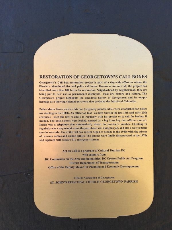
Police Call Boxes such as this one (originally painted blue) were installed in the District after the Civil War. Officers on foot patrol used this secure telegraph system to contact the station, accessing the box with a now highly collectible . . . — — Map (db m112627) HM
On N Street Northwest at 25th Street Northwest, on the left when traveling west on N Street Northwest.
Police Call Boxes such as this one (originally painted blue) were installed in the District after the Civil War. Officers on foot patrol used this secure telegraph system to contact the station, accessing the box with a now highly collectible . . . — — Map (db m112629) HM
On Anacostia Drive Southeast 0.5 miles north of Nicholson Street Southeast, on the right when traveling east.
Summer of 1968: in the wake of the assassination of Dr. Martin Luther King Jr., Americans struggled with fear, rage, and division. Riots in Washington, D.C. and killed 13 people.
As a step toward healing, the National Park Service (NPS), the . . . — — Map (db m297945) HM
Near Potomac Avenue Southeast at E Street Southeasr, on the right when traveling east.
Civil War Washington City
Over the course of the Civil War, the nation's capital was transformed. The dignified government city Pierre Charles L' Enfant laid out in 1791 was hardened into a sprawling military center. Encircled by strong . . . — — Map (db m139512) HM
On 1st Street SE north of Independence Avenue SE, on the left when traveling north.
One of the icons of world architecture, the U.S. Capitol has been the meeting place of Congress since 1800. President George Washington laid the cornerstone on September 18, 1793. While under construction, the the building was damaged by British . . . — — Map (db m282496) HM
On Martin Luther King, Jr. Avenue Southeast 0.1 miles north of South Capitol Street Southeast, on the right when traveling south.
Slave states and Confederate sympathizers surrounded the District of Columbia when the Civil War broke out. Every road, bridge, and waterway leading into the capital needed defending. Union troops built a 37-mile-long circle of forts and trenches . . . — — Map (db m295021) HM
On Independence Avenue Southwest east of West Basin Drive Southwest, on the right when traveling east. Reported permanently removed.
Admired by thousands each year, the Japanese Pagoda arrived in Washington, not as a gift from one nation to another, but as a gift from one man to another. In 1957, Ryozo Hiranuma, the Mayor of Yokohama and a visitor to Washington, DC four years . . . — — Map (db m309) HM
On West Main Street west of North Vermilion Street, on the right when traveling west.
Left Section
Danville was a destination for Abraham Lincoln for nearly twenty years. He first came to the village of a few hundred residents when he was a thirty-two-year-old attorney in 1841.
Elizabeth Harmon described the early . . . — — Map (db m29481) HM
On SE Monroe Street south of SE 15th Street, on the left when traveling south.
Across the field in front of you stands the former Monroe Elementary School. Parents of six students that attended this school in 1949 participated in the Brown v. Board of Education lawsuit. On May 17, 1954, the US Supreme Court issued a . . . — — Map (db m81395) HM
Near Main Street, on the right when traveling north.
The 40-et-8 box car was a standard European Box Car made in France and used during WWI and WWII. During both wars, the
boxcar was used to transport 40 soldiers or 8 mules or horses around Europe.
After WWII the French people donated one car to . . . — — Map (db m267120) HM
The Calhoun-Buchanan vault holds the remains of 29 members of two of Baltimore's leading Scots-Irish Presbyterian families spanning five or six generations. The neo-classical granite vault is probably the work of Robert Mills (1781-1855), the . . . — — Map (db m6637) HM
On Bay Avenue at 3rd Street, on the right when traveling north on Bay Avenue.
The Town of North Beach, Calvert County's northernmost municipality, was originally called "North Chesapeake Beach" when it was first developed for summer cottages in 1900. Before then, this view of the beach itself had changed relatively little . . . — — Map (db m138545) HM
Caleb Litton’s “Plantation”
The Headstones in this cemetery are what remain of a family graveyard begun by Caleb Litton and his descendants on a 472-acre farm. Litton was one of the very first settlers of what today is Rockville. For his . . . — — Map (db m135425) HM
In 1781, the American and French allies combined their armies at a pivotal turning point in the Revolutionary War. Under the command of General George Washington and French General Jean-Baptiste Donatien de Vimeur, comte de Rochambeau, the armies . . . — — Map (db m259486) HM
Washington-Rochambeau Revolutionary Route National Historic Trail
In 1781, the American and French allies combined their armies at a pivotal turning point in the Revolutionary War. Under the command of General George Washington and French . . . — — Map (db m165738) HM
On Freedman's Colony Road near U.S. 64/264, on the right when traveling west. Reported permanently removed.
and they made their lives
bitter with hard bondage
Exodus 1:14
For the millions of immigrants to this land, America has not been so much a destination as a promise: a promise of equality, a promise of . . . — — Map (db m9670) HM
On West Blue Ridge Drive (State Highway 253) at North Franklin Road, on the right when traveling east on West Blue Ridge Drive.
This early twentieth century suburb takes its name from Sans Souci, the nearby house and estate of Gov. Benjamin F. Perry (1805-1886). Perry, a prominent Unionist before the Civil War, was appointed provisional governor of S.C. by President . . . — — Map (db m15920) HM
Home of
George Gilpin 1740-1813
Member, Fairfax Committee of Safety
Colonel, Virginia Regiment Fairfax Militia,
Served with General George Washington
in New Jersey campaign and Battle of Germantown
Surveyor of the Town of . . . — — Map (db m115764) HM
On Mount Vernon Avenue south of East Uhler Avenue, on the right when traveling north.
English settlers built several plantations on the site in the 18th century. The land, much owned by the Swann and Daingerfield families, became part of Alexandria County, D.C. with the creation of the District of Columbia in 1791, and retroceded . . . — — Map (db m115145) HM
Constituted in May 1802 as the Columbian Brigade of the District of Columbia Militia, the 121st Engineers antecedents served with distinction as infantry in the War of 1812, Mexican War, Civil War, war with Spain, and World War 1, In January 1921, . . . — — Map (db m241862) WM
Fort Willard Park contains significant earthworks and archaeological remains of a fort built in 1862 by the Union Army. It was one of 63 forts that were built surrounding the District of Columbia during the Civil War as part of the Defenses of . . . — — Map (db m154524) HM
On Seneca Connector Trail just east of Seneca Road ( Route 602), on the left when traveling east.
George Washington walked, rode horseback, and boated through this region pursuing his dream of westward expansion—connecting the Atlantic Seaboard to the frontier West. His efforts to reengineer, dam, channelize, and straighten the Potomac River . . . — — Map (db m197946) HM
Evolution of a Landscape – Plantation, Prison, Park
It may be difficult to imagine all of the events, large and small, that took place on the surrounding landscape, but Laurel Hill Park has been influenced by thousands of years of . . . — — Map (db m22385) HM
On George Washington Memorial Parkway at Mt. Vernon Highway ( Route 235), on the right when traveling west on George Washington Memorial Parkway.
The George Washington Memorial Parkway opened in 1932 as the nation's first modern federal highway. Its construction honored the bicentennial of George Washington's birth as a patriotic pilgrimage between Washington, DC, and Mount Vernon. This . . . — — Map (db m182570) HM
Near Ball's Bluff Road, on the left when traveling east.
During the Federal retreat of Ball's Bluff, Lewis A. Bell, a free African American comp worker, may have been the first Black man to fire a gun in support of the Union Army.
According to the 1870 edition of History of Worcester in the War . . . — — Map (db m238588) HM
Near Dean Park Lane 0.4 miles west of Wellington Road, on the right when traveling west.
Watersheds are areas of land that drain into a particular body of water. Rain that falls within a watershed's boundaries flows to the lowest point. Eventually, all the rain water in the Chesapeake Bay watershed collects in the Bay.
On . . . — — Map (db m305510) HM
Dedicated To You, A Free Citizen In A Free Land
This reproduction of the Liberty Bell was presented to the people of
California
by direction of
The Honorable John W. Snyder
Secretary of Treasury
As the . . . — — Map (db m14837) HM
On 16th Street Northwest at Colorado Avenue Northwest, on the right when traveling north on 16th Street Northwest.
Fresh Water Springs in this pleasant high ground once drew European settlers. Farmers called the area "Crystal Spring." In 1859 the half-mile Crystal Spring Racetrack opened on land to your left. For 75 cents, Washingtonians hopped a . . . — — Map (db m109288) HM
On Sheridan Street Northwest east of 14th Street Northwest, on the right when traveling west.
We have Harry Wardman to thank for the rich variety of Sheridan Street rowhouses. Wardman, considered Washington's most prolific developer, built hundreds of offices, apartments, hotels, and comfortable rowhouses from 1899 to 1939. When he . . . — — Map (db m72823) HM
On Tuckerman Street Northwest at 13th Street Northwest, on the right when traveling east on Tuckerman Street Northwest.
In the 1930s as now, this area was a family friendly, "move-up" destination for hard-working government clerks and professionals. Like many DC neighborhoods, Brightwood had covenants prohibiting sales to certain white ethnics and African . . . — — Map (db m72777) HM
On K Street Northwest (U.S. 29) at 11th Street Northwest (U.S. 29), on the right when traveling east on K Street Northwest. Reported permanently removed.
"...watch yourselves closely
so that you do not forget the things
your eyes have seen...
...teach them
to your children
and to their children
and to their children after them."
Deuteronomy 4:9
Stories . . . — — Map (db m70316) HM
On I Street Northwest just east of 14th Street Northwest, on the right when traveling west.
Origins
Franklin Park was never supposed to exist. Unlike many other parks in Washington, DC, this land was not set aside for any special purpose. However, the natural springs that emerged from the ground here created a gathering place for . . . — — Map (db m240159) HM
On Massachusetts Avenue Northwest west of 17th Street Northwest, on the left when traveling west. Reported damaged.
Fire Fact, 1871
The District of Columbia Fire Department was established on September 23, 1871 and included six fire companies. The "all-paid" fire department replaced the volunteer fire companies that had protected the Districts.
. . . — — Map (db m112655) HM
On M Street Northwest at 34th Street Northwest, on the left when traveling west on M Street Northwest. Reported permanently removed.
The author of our National Anthem was a lawyer, patriot, community leader and poet. His home and law office stood approximately 100 yards west of here. Francis Scott Key lived there from 1803 to about 1833 with his wife, the former Mary Taylor Lloyd . . . — — Map (db m120) HM
On 5th Street Northwest just south of Q Street Northwest, on the left when traveling north.
Third Baptist Church
2008 Historic Landmark
Calvin Brent, Architect
has been placed on the
National Register
of Historic Places
by the United States
Department of the Interior — — Map (db m245018) HM
On 21st Street Northwest just west of L Street NW, on the right when traveling south.
“… a humble tribute of grateful remembrance to the late Thaddeus Stevens … the earnest champion of free and equal school privileges for all classes and conditions…” —the Board of Trustees of Colored Schools of Washington and Georgetown in honor . . . — — Map (db m282012) HM
On Martin Luther King Junior Avenue Southeast just north of U Street Southeast, on the right when traveling north.
Welcome to the Go-Go Museum & Café.
Go-Go is Washington, D.C.'s "Official Music" genre created by Chuck Brown in the 1970s.
This museum, like go-go music is rooted in Call & Response. Come inside. Meet our heroes. See our fashion. Taste . . . — — Map (db m266756) HM
On River Landing Road 0.3 miles south of U.S. 90, on the left when traveling west.
The 1795 Treaty of San Lorenzo defined the international border dividing Spanish Florida from the newly formed United States.
No one who signed the treaty had ever seen it, but the point of land formed by the confluence of the Chattahoochee and . . . — — Map (db m230733) HM
On MacArthur Circle east of Ridgewood Avenue (U.S. 1), on the right when traveling north.
Merci Box Car — Arrived in America in 1949 — A token of appreciation from the people of France to the people of America — Built between 1872 and 1885 — They were called 40 and 8's, carried either 40 men or 8 horses . . . — — Map (db m34796) HM
On Williams Road, on the right when traveling south.
[Front:]
[Insignia and motto of the 29th ID]: "29 Let's Go!"
Mobilized at Fort George G. Meade, February 1941; comprised of Army National Guard units from Maryland, Virginia, District of Columbia, and Pennsylvania. Trained vigorously . . . — — Map (db m17112) HM
This Property has Been Placed
on the
National Register
of
Historic Places
By the United States
Department of the Interior
This railroad station, erected in 1898-1899, is the original eastern terminus of the Chesapeake Beach Railway. . . . — — Map (db m109617) HM
The aquatic ecosystem of Chesapeake Bay supports a remarkable diversity of sea creatures.
From bottom-dwellers to swimmers to reef-clutching shellfish, the Bay environment produces more than $175 million in commercial harvests each year. . . . — — Map (db m69889) HM
On Brooke Road 0.1 miles west of Chandlee Mill Road, on the right when traveling west.
Nina Honemond Clarke Was a Master Teacher at the Sandy Spring Elementary School
She was born in Poolesville on November 13, 1917, grew up in Dickerson, graduated from Rockville Colored High School in 1934, and received her first . . . — — Map (db m188207) HM
On Brooke Road 0.1 miles west of Chandlee Mill Road, on the right when traveling west.
Tribute to Robert H. "Bob" Hill: Entrepreneur, Master Builder, and Community Leader
Robert H. Hill was born on a farm in Sandy Spring in 1904. His parent, Samuel T. and Mary Hill, were prosperous and raised not only 16 children, but hogs, . . . — — Map (db m188361) HM
On Rileys Lock Road south of River Road, on the right when traveling north.
As you enjoy the beautiful location where Seneca Creek empties into the Potomac River, know that you are part of a long tradition of folks seeking a respite from hard work at the “good time place” for outdoor fun!
Until the early 20th . . . — — Map (db m306052) HM
On Georgia Avenue (Maryland Route 97) at Sligo Avenue, on the right when traveling north on Georgia Avenue.
The Establishment of Silver Spring's first bank and Newspaper, traditional institutions required for a community to grow and prosper, occurred on this corner with the opening of the Silver Spring National Bank in 1910 and publication of The . . . — — Map (db m62165) HM
On Newell Street at Kennett Street, on the right when traveling north on Newell Street.
[Panel 1:] Blair Mansion: Silver Spring
Prior to the development of modern Silver Spring, this immediate area was a bucolic, rural landscape in a portion of Montgomery County then known as Sligo. The property was owned by Francis . . . — — Map (db m23488) HM
On Fern Street, on the right when traveling north.
Just east of this location was once the home for several generations of an influential African American family. In April 1894, Charles and Jane Webster bought an acre of land along the country road that became University Boulevard. in 1938, the . . . — — Map (db m245162) HM
Near Bladensburg Road (Maryland Route 450) 0.2 miles 38th Avenue, on the left when traveling west.
This is the site of the Battle of Bladensburg which took place in the War of 1812. Commodore Joshua Barney and his 500 Marines were greatly outnumbered by the British Expeditionary Force of 4,500 trained regulars. The battle raged for four hours . . . — — Map (db m70037) HM
On Bladensburg Road (Maryland Route 450) at 38th Avenue, on the left when traveling south on Bladensburg Road.
On this site, now part of Anacostia River Park, more than 50 duels were fought during the first half of the 19th century. Here, on what became known as "the dark and bloody grounds," gentlemen of Washington settled their political and personal . . . — — Map (db m3613) HM
Near Lewistown Road (Maryland Route 303) north of Norwich Creek Road, on the left when traveling south.
Empowered by a hunger for learning and a thirst for liberty, Frederick Douglass fled from slavery as a young adult in Baltimore and dedicated his life to ending the injustices of oppression. His work impacted the world, and the fire of his . . . — — Map (db m155652) HM
On the evening of Tuesday, Feb. 24, 1880 Frederick Bailey Douglass, one of the most influential American figures in history, graced the halls of the Wicomico County Courthouse. A former slave, famed abolitionist, writer, orator and at the time . . . — — Map (db m310225) HM
Near Pemberton Drive 0.1 miles west of Diamondback Drive, on the left when traveling west.
In the summer of 2007, eleven boys from West Salisbury Little League embarked on a spiritual journey that captured the hearts and minds of our town and surrounding communities. The journey began in June 2007, where they were assembled together . . . — — Map (db m43737) HM
On South Jefferson Street south of Morris Street, on the right when traveling south.
In 1964 a group of Jackson citizens and the
United Church of Christ challenged Lamar Life
Insurance Company's application for renewal of
their WLBT license, charging racial discrimination.
In 1971 the Federal Communications Commission
granted a . . . — — Map (db m178458) HM
Near East 143th Street east of Beekman Avenue, on the right when traveling west.
What was here before?
This site was once part of the estate of Jonas Bronck (1600-1643), for whom the Bronx is named. Later, the land was held by the family of Gouverneur Morris (1752-1816), an author of the U.S. Constitution. After 1857, . . . — — Map (db m275848) HM
On New York State Route 56 0.2 miles north of Sugarbush Lane, on the left when traveling west.
The hills begin here. So do the woods, the great South Woods, the Adirondacks.
The town of Colton straddles the northern boundary of the Adirondack Forrest Preserve. On end of the town touches on the neat homes of St. Lawrence County; the . . . — — Map (db m178681) HM
On West Washington Street at Mentor Avenue, on the right when traveling west on West Washington Street.
Early Life & Local Ties: 1852-1880s
Emma Millinda Gillett was born in Princeton, Wisconsin, but spent her school years in Girard, Pennsylvania following her father's passing. She attended Lake Erie College when it was Lake Erie Female . . . — — Map (db m300104) HM
[Main marker]:
In Memory of
81st Wildcat Division
which trained at Camp Sevier,
Apr to July 1918
Maj. Gen. Chas. J. Bailey,
commanding.
[Plaque at foot of marker]:
Camp Sevier
Camp Sevier, a WWI National . . . — — Map (db m8151) HM
On Corsair Avenue at Airdrome Avenue, on the right when traveling south on Corsair Avenue.
November 1956 saw the reactivation of the 356th as the "Green Demons" at Myrtle Beach Air Force Base, flying the F-100D Super Sabre. The 356th participated in numerous deployments to Europe during the late 1950s and early 1960s, and also deployed . . . — — Map (db m102101) WM
Thin black lines indicate changes in relevance. Between each pair of lines entries are ordered geographically but all have the same relevance.
* Inflectional forms of words are their plurals, singulars, and possessives as well as gramatical tenses and similar variations.
* A noise word is a word that has been deemed too common to index. “The,” “to,” and “then” are examples of noise words. You will find a full list on the Advanced Searches page, in the Rules and Options link of the Keyword Search.