This vast scene holds many intriguing stories. If the land could speak, it would tell of pioneers and wagons crossing the wide Ralf River Valley from Strevell Pass to Emigrant Canyon bound for California in 1843-1882. The land would speak of stage . . . — — Map (db m123956) HM
There are thousands of names here I registered on a large Rock. -- Richard Augustus Keen at City of Rocks, June 22, 1852
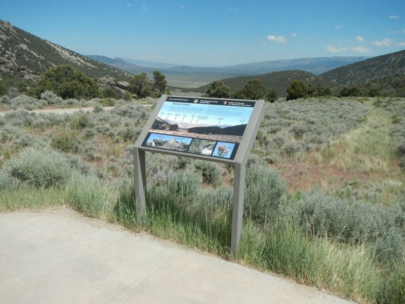
Throughout the West emigrants recorded their passing by writing their names -- often with axle grease -- at unique . . . — — Map (db m123960) HM
Dedicated to the Memory
Of those who lost their lives in a most
Horrible Indian Massacre 1861
Three hundred immigrants west bound
Only five escaped — — Map (db m119536) HM
At City of Rocks we were met with all kinds of Christmas greeting ... we sat down to a Christmas dinner that only youth and vigor could do justice to.... Jim has erected a Christmas tree, and decorated it with cranberries and pop corn, and on it . . . — — Map (db m124001) HM
After dinner a ride of 2 miles brought us to the outlet of this romantic vale, a very narrow pass, just wide enough for a wagon, and on either side very high, jagged. and thin walls of granite.... This is called the "Pinnacle Pass." -- J. . . . — — Map (db m123988) HM
That this journey...is perilous, the deaths of many testify...as I passed the fresh made graves, I have glanced at the side boards of the wagon, not knowing how soon it might serve as a coffin for some one of us. Lodisa Frizzell, 1852 . . . — — Map (db m123952) HM
They rise in a cone-like form from the bottom of the valley to a height of from 400 to 600 feet they are round and quite regular in form, tapering gradually to a point. -- Emigrant journal entry (Sawyer) describing the Twin Sisters, circa . . . — — Map (db m123994) HM
When completed in 1904, Milner Dam raised Snake River 38 feet to divert water into major north and south side canals.
A gravity system unmatched in size in national reclamation development, this project irrigates 360,000 acres of land. Twin . . . — — Map (db m31636) HM
In 1880, George Starrh, a Snake River placer miner, started a ferry across Snake River one mile north of here.
From 1880-2, freighters hauling supplies for a mining rush to Wood River used Starrh's ferry (powered by river current when stiff . . . — — Map (db m246253) HM
In the summer of 1880 George Starrh, a placer miner, established a ferry 4 miles west of the present city of Burley. Rich mineral mines had been discovered in the Wood River country and freight was hauled between the mines and Kelton, Utah, (the . . . — — Map (db m125404) HM
"The Oregon road take up the bluff and follows the course of the (Snake) river while we keep to the left and follow the creek (Raft River) nearly to its source. ... crossing the creek we followed up the bottom" -- Byron McKinstry, Aug 1, 1850 . . . — — Map (db m123844) HM
"Arrived at Raft River, crossed and nooned. ... traveled five miles up Raft River and camped after recrossing it. Grass in abundance and plenty of wood" -- Cyrus Loveland, Aug 3 1850
Guidebook Available
Trails West Inc. P.O. Box 12045, . . . — — Map (db m123846) HM
"We traveled up Raft River 16 miles. The road, water and grass, good. Entirely destitute of timber, except a little willow on the streams and the wild sage." -- Chester Ingersoll, Aug 13, 1847
Guidebook Available
Trails West Inc. P.O. . . . — — Map (db m123848) HM
After wheat crops flourished in the dry farm area, Idahome sprang up here in 1916 as a railroad terminal. Irrigation projects boosted its Economy.
When wheat farms disappeared and highway traffic replaced rail service here, Idahome became . . . — — Map (db m123849) HM
In 1811 the first white expedition to go through this area of the Snake River and the lower end of the Raft River Valley was the Wilson Price Hunt expedition from St. Louis to Astoria. However, the area was well known to the French and British . . . — — Map (db m123843) HM
"August 26, Sabbath."
"... We got a late start traveled directly across the valley before us, (Almo Valley) amidst the best scenery we have seen since we have been among these hills. South, a high range of mountains (Raft River Mountains) . . . — — Map (db m123884) HM
"After crossing (Cassia Creek) we crossed a swamp, which required considerable persevering to get through safely. Three miles farther we encamped on the side of a hill, between two ranges of mountains" -- Wakeman Bryarly, Jul 18, 1849
. . . — — Map (db m123883) HM
"By an easy ascent reached a summit and as gradually descended to a valley (Upper Raft River Valley) of sage and sand sloping to the south east. The streams running towards the (Great) Salt Lake." Byron N. McKinstry, Aug 3, 1850
Guidebook . . . — — Map (db m123886) HM
"We came onto the Subetts Cut Off road (Hudspeth Cutoff), or rather that cut off come onto our road which is the old and longest road." -- Henry Anable, Aug 7, 1852
Guidebook Available
Trails West Inc. P.O. Box 12045, Reno NV . . . — — Map (db m123882) HM
This shortcut to the California goldfields, followed by most of the 49'ers, came out of the hills to the east and joined the old California trail just about here. Opened by "Messrs. Hudspeth & Myers, of the Jackson County, Missouri, Company," who . . . — — Map (db m31638) HM
The Raft River Valley was used by Native Americans as a place to hunt and winter because the snow didn't lie in the valley and there was good water and plenty of grass for the animals. British and American trappers, Peter Skene Ogden, Milton . . . — — Map (db m123881) HM
"The moon just rising above the mountains, throwing mild light over the valley & opposite mountain, formed a beautiful scene of prairie mountain life." -- Hugh Brown Heiskell, Sep 3, 1849
Guidebook Available
Trails West Inc. P.O. Box . . . — — Map (db m124026) HM
Original Cassia County Jail cells where Diamondfield Jack was held in Albion from March 1897 to February 1899.
The jail was moved to Oakley after the jail here burned. — — Map (db m138483) HM
A vast display of towering granite rocks (16 miles southeast of here) attracted emigrants who were on their way to California. A gold rush visitor, July 14, 1849, reported that "you can imagine among these massive piles, church domes, spires, . . . — — Map (db m31637) HM
One day west of the City of Rocks: Never saw such dust! In some places it was actually to the top of the forewheels! Fine white dust; more like flour. Our men were a perfect fright, being literally covered. -- Emigrant journal entry, circa . . . — — Map (db m124025) HM
In April 1879 members of the Church of Jesus Christ of Latter-day Saints from Tooele, Utah, under direction of Wm. E. Martindale, arrived in Oakley where James Dayley and his two sons had staked claims and built cabins. On Sept. 24, 1882, the Saints . . . — — Map (db m246514) HM
( six panels are located beneath the interpretive site shelter:)
A Region Where History Was Made
The scenic routes shown on this map will take you to several historic and scenic landmarks in northeastern Idaho. You will . . . — — Map (db m124526) HM
When General O.O. Howard tried to get more than 600 Nez Perce Indians to settle on a North Idaho reservation in 1877, he ran into a lot of trouble here.
On their way to Yellowstone Park, Chief Joseph's Nez Perce people reached Hole in the . . . — — Map (db m124339) HM
After Montana's Gold Rushes began in 1862, thousands of miners came past here and a Beaver Canyon stage station was built here.
Freighters and travelers on stage lines from Salt Lake to Montana stopped at this station until Utah and . . . — — Map (db m124337) HM
This 717 foot high concrete structure is the highest straight axis gravity dam in North America. The dam backs up water from the North Fork of the Clearwater River forming a 54-mile lake at full pool. Flood control, power production, and recreation . . . — — Map (db m159495) HM
This rock, moved here from the river's edge, was used long ago by Indian fishermen as a water flow gauge. When the water level reached the upper mark carved on the side of the rock, they began building small dams of sticks and stones, called "fish . . . — — Map (db m159496) HM
You are nearing the junction of historic Highway 11, now designated as Gold Rush Historic Byway.
Winding its way through spectacular scenery, it passes through the traditional homeland of the Nez Perce Indians on the Weippe Prairie and the National . . . — — Map (db m109758) HM
Indians have lived here next to this good fishing hold for 10,000 years.
As long as 3,000 years ago, they had large oval houses, 28 feet long by 24 feet wide. To build these houses, they put a bark and mat covering over a frame of 50 or so . . . — — Map (db m121416) HM
In 1898, after rail service from Lewiston reached Lenore, a tramway was begun to ship grain from Camas Prairie (1600 feet above) to a new freight stop directly across the river.
Previously, grain wagons descended a long steep hill from the . . . — — Map (db m109760) HM
Founded by Seth S. Slater, May 6, 1861, Slaterville (permanent population, 50) had 5 edifices – built mainly of colored blankets – 2 stores, 2 houses, and a saloon.
When the Colonel Wright “snapped her tow-line on the Grand Rapids . . . — — Map (db m110703) HM
David Fraser, a young merchant, came to the area with a pack string headed for Pierce City, the gold rush area, to open a store in the Spring of 1863. Some people of the area encouraged Fraser to open the store here as a lot of the miners had moved . . . — — Map (db m121417) HM
This 10 acre park was a part of the original homestead of John Cattron, who homesteaded the 160 acres in 1890.
Lewis and Clark passed through the park on the old Nez Perce Indian trail that went through the park in 1805. Clark returned to the . . . — — Map (db m121437) HM
The brass monument nearby is provided by the Idaho Society of Professional Land Surveyors in cooperation with the National Geodetic Survey to commemorate the “Lewis and Clark” Corps of Discovery campsite at Canoe Camp, Idaho.
. . . — — Map (db m110468) HM
Lewis and Clark called this place Canoe Camp.
For 11 days in 1805 the Corps of Discovery camped here in the company of Nez Perce while building five canoes for the journey to the Pacific.
For thousands of years before that, this riverbank was . . . — — Map (db m110465) HM
Guided by Twisted Hair and several other Nez Perce, Capt. William Clark selected this as a camp site because of the many large ponderosa pines that grew here then. The canoe makers chopped out small portions of the pine logs, then used fire or . . . — — Map (db m109875) HM
Welcome to
Canoe Camp
One of 38 sites of Nez Perce National Historical Park
These grounds have been inhabited for thousands of years by the Nez Perce people, but are best known as the place where the Lewis and Clark . . . — — Map (db m109872) HM
Ever since the first cross-cut saws were heard in the remote forests of Clearwater County in the late 1800s, the Clearwater River played a major role in the timber industry of this area. The river served as a means of transportation and by the early . . . — — Map (db m159486) HM
After more than a month’s search, they finally had reached a westward river where they could use canoes.
From here they continued another 16 miles with their pack horses before they found a campsite with trees suitable for making canoes.
But at . . . — — Map (db m109757) HM
When the Lewis and Clark Corps of Discovery entered this area in September 1805, they were not only hungry, but still anxious to locate a water route to the Pacific Ocean.
Under the direction of a Nez Perce headman, Twisted Hair, the explorers . . . — — Map (db m159484) HM
Orofino is situated on the north and south banks of the Clearwater River.
The area’s mild climate and convenient location made it a thriving Nez Perce village site long before Lewis and Clark stopped here in 1805.
Lumberjack Days
. . . — — Map (db m109888) HM
Low mounds and depression in the ground here give only the faintest impression of villages that stood on both banks of the river. These are the remains of pit houses, built 1,500 to 2,000 years ago. Imagine the scene then: people spearing fish, . . . — — Map (db m109876) HM
...then crossed the River at a shole place the water to the horses bellies." - Sgt. John Ordway, Sept. 26, 1805
Clearwater Crossings
Long before we had highways and bridges, people crossed the river at this location. What . . . — — Map (db m159488) HM
Routes Through History
Travel through the rugged Clearwater River region has not always been on smooth, paved highways. Routes on land began as game trails, then foot paths which grew into horse paths. Many of these historic routes paid . . . — — Map (db m159490) HM
Canoe Camp is part of the Nez Perce National Historical Park and a key site along the Northwest Passage Scenic Byway
An Interesting Drive
The 202-mile Northwest Passage Scenic Byway stretches from Lewiston to Lolo Pass on US Highway . . . — — Map (db m109886) HM
During the gold rush boom, the population exceeded 6,000. At that time Pierce was actually located in Washington Territory. In 1861, Pierce became the first established gold rush town in Idaho, and the county seat of Shoshone County. In 1862, the . . . — — Map (db m121513) HM
The fabulous Gold Rush days of Idaho began on September 30, 1860, when W.F. Bassett struck gold just about here.
E.D. Pierce, who knew the country, had led twelve prospectors, including Bassett, out from Walla Walla in August. After news of . . . — — Map (db m121518) HM
This is the site of the graves of the Chinese who died in Pierce. All bodies have been returned to their homeland. Chinese artifcts (sic) broken tools and rotting cabins are still found in the nearby hills. — — Map (db m141099) HM
Charged with hacking a prominent local merchant to pieces, five Chinese were hanged here by vigilantes Sept. 18, 1885.
They were just setting out on a long, hard 240 mile trip from Pierce to face trial at the county seat in Murray when the . . . — — Map (db m121442) HM
Hearing rumors of gold in the hills, Captain Elias Davidson Pierce started his first journey from Walla Walla to this area on August 12, 1860, with a crew of ten. The crew included: Benthnel Farrell (18), Horace Dodge (22), Joseph L. Davis (37), . . . — — Map (db m121490) HM
One summer's night in 1885, it is alleged that five Chinese men gained entrance to the Fraser General Store, while their fellow countrymen set-off fireworks up and down Main Street. It was a stormy night and the fireworks supposedly helped drive-off . . . — — Map (db m121515) HM
Commercial center of Idaho's earliest mining district in the great days of 1861. It flourished here for more than a year.
Pierce City was only 2 miles away but another town sprang up near some rich gold strikes. In its first few weeks, Oro . . . — — Map (db m121517) HM
When the courthouse was built in 1862, Pierce was a boomtown. Gold discovered in the nearby hills was attracting thousands of miners. There was one catch: they were all trespassing on Nez Perce land.
The government solution was to draw up a new . . . — — Map (db m121579) HM
Shoshone County's original courthouse -- and Idaho's earliest public building -- still stands in Pierce., where it was built in 1862.
Although Pierce gained a large population for a year after gold was discovered here in 1860, most of the . . . — — Map (db m121520) HM
A few weeks later, a larger group of men and horses made a second journey to Pierce. The group passed near several Nez Perce Indian encampments, which had not seen many white men since Lewis and Clark passed through almost fifty years prior. The . . . — — Map (db m121512) HM
After the hardships of the mountain passage, the Weippe Prairie was a place of relief for the Corps of Discovery. The Nez Perce befriended them and renewed their hope of reaching the Pacific Ocean.
"the pleasure I now felt in having tryumphed . . . — — Map (db m121438) HM
The brass monument nearby is provided by the Idaho Society of Professional Land Surveyors to commemorated the "Lewis and Clark" Corps of Discovery campsite near Weippe Prairie, Idaho.
Datum NAD 83 and NAVD88
Latitude N 46º21' 00" Latitude . . . — — Map (db m121581) HM
I Set out early and proceeded ... to a Small Plain in which I found maney Indian lodges ... I met 3 Indian boys, when they saw me they ran and hid themselves. -- Capt. William Clark, September 20, 1805
After Lewis and Clark's Corps of . . . — — Map (db m121582) HM
In late September of 1805, three young Nez Perce spied several men dressed in strange clothes and hats coming from the ridge to the southeast. The boys hid, but the men discovered two of them in the area behind this sign. The boys led these men to . . . — — Map (db m232854) HM
Journeying toward the Clearwater, 6 men under Clark met the Nez Perce Indians not far from here, September 20, 1805.
Clark first saw 3 frightened Indian boys who hid in the grass. Finding two, he reassured them with small presents and "Sent . . . — — Map (db m121439) HM
This marker was dedicated
1957
to commemorate the arrival of the Lewis and Clark Expedition at Weippe Prairie, Idaho, Sept. 23, 1805. Also to honor the memory of Dr. J.T. Moser who pioneered here in the 1890's and to honor the memory of his . . . — — Map (db m121440) HM
Welcome to Weippe Prairie
This has always been a traditional gathering place for the Nez Perce people where camas bulbs are harvested and baked each year. The blue flower of the camas lily grow so thick here in the spring time that from . . . — — Map (db m121610) HM
You now stand among the remains of Bonanza City, laid out in 1877 and the Yankee Fork's first mining camp. Pack trails linking Ketchum, Stanley, Loon Creek, and Challis converged in Bonanza. At its peak, Bonanza had over 600 residents, a rectangular . . . — — Map (db m109990) HM
Near here, the initial pond of the Yankee Fork Gold Dredge was constructed to allow the assembly of the massive four-story floating machine. It was a major operation to transport the equipment and pieces needed to build the dredge. Some pieces were . . . — — Map (db m110005) HM
Thoughts of dredging the Yankee Fork began in 1899 when business groups bought up placer claims along the creek and were revived up again in 1904 when the Boston & Boise Dredge Company drilled test holes. Rising gold prices stimulated interest again . . . — — Map (db m109989) HM
Workers on the dredge included the winch men, stern and bow oilers, and the gold man. A ground crew cleared the area ahead of the digging and helped set the "deadmen." The dredge master oversaw the entire operation, deciding were to dig, when to . . . — — Map (db m109988) HM
The first prospectors on the Yankee Fork searched for small particles of gold known as "placer gold." Eroded from exposed ore veins in surrounding hillsides, placer gold washed down valley walls and collected in stream channels. Prospectors used . . . — — Map (db m109987) HM
The large piles of rock and gravel around you were left over from dredge mining operations that took place in the 1940s and early 1950s.
The 4-level Yankee Fork dredge floated in water as it dug its way upstream, extracting gold and silver . . . — — Map (db m109991) HM
The dredge operated 24 hours a day, 365 days a year, using only 3 men per shift. The winch man (1) was in charge, controling (sic) the dredge from his vantage point four stories above the deck. From there he could raise and lower, and vary the speed . . . — — Map (db m109948) HM
Starting in 1872, the valley bottom along the Yankee Fork, was hand placered in the search for free gold. Later, the Snake River Mining Company tested the ground along the stream and found gold still remained in the deep gravels. After obtain the . . . — — Map (db m109949) HM
Lack of development and limited government services in the western territories created opportunities for entrepreneurs like Alex Toponce. Arriving from France at age seven, Toponce traveled west and by age 18 had worked as a bullwhacker. By 1860 he . . . — — Map (db m109783) HM
Before settlers came to Idaho in 1860, Buffalo used to roam through this valley. Most of them had left here by 1840.
After they acquired Spanish horses, eighteenth century Shoshone buffalo hunters could drive a small herd over a cliff to make . . . — — Map (db m109766) HM
Founded in 1878, Challis provided a vital link to the outside world for the remote mining camps of the Yankee Fork and Bayhorse Mining Districts. Supply wagons arrived in Challis from Corinne, Utah and later Blackfoot, Idaho, with goods for delivery . . . — — Map (db m109702) HM
Travel on the Toll Road remained difficult due to the road's roughness. Pulling heavy loads over the road's two summits often fell upon oxen, The crack of the bullwhacker's whip and snort of laboring beasts were common sounds. You may still see . . . — — Map (db m109779) HM
By 1880 improvements to the Toll Road allowed the establishment of a stage line from Bonanza City to Challis. Along the Toll Road several stations provided services for drivers, and passengers. Eleven Mile Barn provided drivers an opportunity to . . . — — Map (db m109785) HM
Overlooked by many heading west, Idaho experienced little settlement until the 1860s when the discovery of gold brought a reverse migration from Oregon, Washington and California. Mining camps immediately sprang to life and the busy noises of pick . . . — — Map (db m109680) HM
This Valley was discovered in 1822 by an expedition of Hudson's Bay Company trappers led by Michel Bourdon. Bourdon had come to the Northwest with David Thompson, who had started the Idaho fur trade in 1808-9. Trappers searched everywhere for . . . — — Map (db m59949) HM
Two maker panels are located at this kiosk
The Keystone Road splits from the Toll Road near here. Teamsters and supplies headed for Bayhorse Mining District followed the Keystone Road to Bayhorse, Crystal and Clayton. In 1889, the . . . — — Map (db m109768) HM
Completion of the Toll Road in 1879 brought a period of prosperity to the Yankee Fork. Now heavy equipment needed to construct a mill could be transported in and large quantities of gold bullion shipped out to market. It also allowed goods and . . . — — Map (db m109781) HM
Lead-silver mineral discoveries 12 miles north of here on Bayhorse Creek in 1864 and 1872 led Joel E. Clayton to locate a large smelter here in 1880.
Doubled in size in 1888, Clayton's smelter has enough variety of ores from local mines to . . . — — Map (db m110016) HM
Crushing ore played a major role in the gold refining process. Different types of crushing methods were employed and changed with the times. Arrastras used a circular floor of tightly laid blocks of stone as a grinding surface. Ore was spread thinly . . . — — Map (db m109836) HM
The text of this marker is unreadable because of the reflection of the sun, but from the "Custer: A walking guide" brochure; "This building was built during the 1930's when many unemployed men and their families occupied the deserted town and . . . — — Map (db m109833) HM
The difficult work of mining required the use of many rugged and reliable tools that could stand up to the physical demands of day-to-day use. It was also a necessity to have equipment that was simple enough to be repaired and maintained on site. . . . — — Map (db m109868) HM
Custer boasted many different types of businesses including a brewery, carpenter shop, butcher shop, dentist, lawyer, barbershop, post office, general stores, hotels , boarding houses and saloons. The west end of town served as the business district . . . — — Map (db m109905) HM
The vibrating jig liberated the heavy minerals from most of the lighter waste material as water was forced upward through a screen with a shot bed consisting of lead shot or old nuts and bolts. Pulsating action combined with water caused the lighter . . . — — Map (db m109867) HM
Businesses in Chinatown included laundry services, a harness and shoe shop and a Chinese place of worship known as a joss house. A few residents made a living by growing vegetable gardens or raising pigs and chickens and then selling them to miners, . . . — — Map (db m109945) HM
Social gathering places for women were less available than for men at Custer. It was not acceptable for nice women to enter saloons or gaming establishments. Most of the socializing for women took place at socials held in homes, at the post office, . . . — — Map (db m109941) HM
Yankee Fork residents found few comforts and many hardships due to their remote location. Snow slides, work-related accidents, and disease combined with the lack of medical services created a difficult lifestyle. Evidence of this location is the . . . — — Map (db m109786) HM
Searching a hillside across the Yankee Fork in August of 1876, James Baxter, Eldon Dodge and Morgan McKim stumbled upon a rich vein of ore, exposed by a snow slide, that became the most famous mine on the Yankee Fork. Named after the popular . . . — — Map (db m109946) HM
The jail at Custer seldom housed a criminal and was unique in its construction. The walls were 2" x 6" lumber laid flat on top of each other similar to log buildings. The floor and ceiling had the same size boards laid on edge. One small barred . . . — — Map (db m109869) HM
" Jennie Smith, Mae Dellen, Lida Pfeitter, Stella Mavity, and Emma Mallm, think their selves smart they put them little kids up to that, and If that Sade Smith bothers me I will pound the stuffing out of her also Gladys, Annie and Josie." (sic) . . . — — Map (db m109830) HM
After a hard day of work, many townspeople sought rest, refreshment and entertainment. There was no shortage of drinking establishments in Custer and, at times, no shortage of consumers. At least five saloons were in operation at one time. The . . . — — Map (db m109870) HM
Snow slides were common during the winter months but none so tragic as on February 2, 1890. At 8pm the steam whistle on the Custer Mill shrieked the alarm, alerting the town of treacherous slides. One slide crashed down Bald Mountain and flooded the . . . — — Map (db m109831) HM
First mention of a livery stable appeared in R.L. Polk's 1902 Business Directory, listing Kenneth McKenzie as owner. To keep a horse cost $1.50 per day. Feed bought in over the 24-mile "hay trail" from Stanley Basin contributed to the high . . . — — Map (db m109898) HM
In 1879, Col. William Birelie Hyde and William Grayson of San Francisco purchased the Custer Mining Company and constructed of a twenty stamp mill began. All of the heavy equipment for the mill was brought over the newly established Toll Road by . . . — — Map (db m109834) HM
1101 entries matched your criteria. Entries 401 through 500 are listed above. ⊲ Previous 100 — Next 100 ⊳