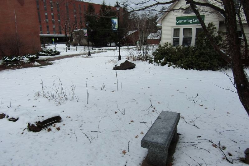
Historical site of the PSU Counseling and Human Relations Center founded by Professor Michael L. Fischler in 1974 and inspired by the lessons he taught during his 50 years of teaching. The Center stood devoted to reducing human suffering; providing . . . — — Map (db m245601) HM
The magnificent American chestnut tree (Castanea dentata) once covered approximately 180 million acres of the eastern United States.
The tree, being an excellent source of straight-grained, rot resistant, durable lumber, was known as . . . — — Map (db m245602) HM
General John Stark captured this cannon from British troops commanded by General John Burgoyne, on Aug. 16, 1777, at the Battle of Bennington. General Stark's victory was a turning point the Revolutionary War.
The barrel of cannon bears the . . . — — Map (db m243947) HM
Honored American poet, lived at this site during 1911-12 when he served as an instructor on the staff of Plymouth Normal School. — — Map (db m245600) HM
Named for local farmer Jacob Smith, the first bridge at this site was begun before 1786 and completed with the aid of a lottery authorized in that year. In 1850, contractor Harmon Marcy of Littleton, N.H. built a new bridge at a cost of about $2,700 . . . — — Map (db m74575) HM
The poetry of Robert Lee Frost is a cornerstone of American literature as it celebrates history, landscape and the human spirit.
Frost's year of teaching at Plymouth Normal School while living here (1911-12) was one of deep introspection. He . . . — — Map (db m243316) HM
Constructed by the Plymouth Rotary as a gift to the community, this space is intended as a celebration of our natural beauty and as a place for the enjoyment of good times together. — — Map (db m65880) HM
This is the site of the longest continuous stream gaging in New Hampshire. Daily measurement of the level of the Pemigewasset River was begun here in 1886 by the Locks and Canals Company of Lowell, Massachusetts, which controlled flowage in the . . . — — Map (db m74576) HM
In 1892 voters established this Park and voted to improve and ornament it. In 1905 the town built a bandstand designed by FW Bulfinch for use by the John Keniston Band. At G. Clarks urging, in 1932 the Pemigewasset Women’s Club created a Boy Scout . . . — — Map (db m65881) HM
Known to Indians as Asquamchumauke, the nearby river was renamed for Lt. Thomas Baker (1682-1753) whose company of 34 scouts from Northampton, Mass. passed down this valley in 1712. A few miles south his men destroyed a Pemigewasset Indian village. . . . — — Map (db m97232) HM
Nearly five billion years ago a great ball of cosmic gasses began to cool and condense forming our solar system. This cooling process continued for 3½ billion years solidifying our planet, Earth, and eventually forming the first continental . . . — — Map (db m97246) HM
Polar Caves Park was discovered by a group of local teenagers playing in the boulders beneath Mt. Haycock in the year 1900. Twenty-two years later Edwin Collishaw, seeing the potential, opened the caves to the public. He chose the name Polar Caves . . . — — Map (db m97245) HM
Granite is an Igneous rock and is known for being extremely durable and hard. In the early 1900's this site was used to harvet granite for the main lodge's foundation and entrance signs for the Polar Caves. You can see examples of where the granite . . . — — Map (db m97247) HM
The gift of Henry H. Crapo
and other philanthropic citizens
—————————————
Re-Dedicated July 16, 2000
Sugar Hill Town Offices
Richardson Memorial Library
Sugar Hill Improvement Association — — Map (db m280571) HM
In 1929, on the slopes of the hill to the east, Austrian-born Sig Buchmayr established the first organized ski school in the United States. Sponsored by Peckett's-on-Sugar Hill, one of the earliest resorts to promote the joys of winter vacationing . . . — — Map (db m77666) HM
In 1973 Norris Cotton celebrated 50 years of elected public service, having served in both the state legislature and Congress. Born in Warren in 1900, Cotton worked his way through Phillips Exeter Academy and Wesleyan University before being elected . . . — — Map (db m88006) HM
Three-year-old Sarah Whitcher became lost in
these woods in June 1783 while gathering flowers.
During a four-day search, Sarah's footprints were
found near Berry Brook alongside bear prints.
A local man joined the search after dreaming
three . . . — — Map (db m312869) HM
Generations of visitors have followed this trail
According to local historians, Native Americans once traveled a path through the area to hunt and fish.
During the nineteenth century, writers and artists, moved by the splendor of the . . . — — Map (db m125094) HM
The legend of Sabbaday Falls
Legend has it that one Saturday night, with winter rapidly approaching, workmen building a road from Albany Intervale to Waterville decided it was time to call it quits. They hid their tools, planning to return . . . — — Map (db m125188) HM
Adams, Douglas A.
• Aldrich, Arthur H.
• Albee. Richard C.
• Altenbern, Robert A.
• Altenbern, Thomas C. (Charles)
• Anderson, John E. (Edward)
• Andrews, Herbert O.
• Applebee, Willis A.
• Aremburg. Earl W.
• **Aremburg, . . . — — Map (db m280426) WM
About five miles north of
Amherst is the birthplace of
Horace Greeley (1811-1872),
founder of the New York
Tribune, member of Congress,
and candidate for
President in 1872. — — Map (db m301702) HM
The second used by the County in Amherst standing originally not far from the newer courthouse. Here Daniel Webster made his maiden plea. — — Map (db m301703) HM
This is considered to be the site of Colonel John Goffe's log dwelling. In 1744 Goffe build a gristmill on Bowman's Brook, later run by his son, Major John Goffe (1727–1813), and his grandson, Theodore Atkinson Goffe (1769–1860). The . . . — — Map (db m88052) HM
To remember and honor all those who served in our nation's armed forces.
World War II
Bercovitz, Z. Taylor · Bigwood, Ray · Bissonette, Armond O. · Bissonette, Florian A.
Bradbury, Lionel · Cloutier, Leo · Cooper, Bessie E. · . . . — — Map (db m230473) WM
This monument rededicated
to those courageous men and women
who served their country during times of strife
and to those who made the ultimate sacrifice — — Map (db m230472) WM
Deering Boys
in the World War
——————————
Perley E. Bosley • Herbert E. Dutton • Howard R. Mann
★Arthur T. Trotter [Died in Service] — — Map (db m230470) WM
Born in Francestown, this ardent Jacksonian rose to hold some of the nation's highest offices. After serving his state as legislator, judge, and Governor, he became
U. S. Senator, Secretary of Navy, Secretary of Treasury, and U.S. Supreme Court . . . — — Map (db m225997) HM
B&M Railroad Covered Bridge
Built in 1901
Destroyed by fire 1976
Gone but never forgotten
Remembered August 16, 2016
The Goffstown Historical Society — — Map (db m308710) HM
This building was the second Congregational Church to stand on this spot. The first (pictured) had been constructed in 1816 but was sold and moved to Nashua in 1845. Later that same year, this second church was built to accommodate the growing . . . — — Map (db m230496) HM
Built in 1889, the Grasmere Town Hall was
designed by noted Manchester architect
William W. Ireland, who created it in the
Queen Anne style popular at the time.
It was built not only as a meeting hall but
also a school (Schoolhouse #9). For . . . — — Map (db m162622) HM
In Memory of
Michael J. Kos
– #29 –
February 28, 1955 – August 2, 2007
Who served the Town of Goffstown faithfully for 23 years as a truck driver for the Department of Public Works as well as the Teamsters Local 633 as . . . — — Map (db m162623) HM
A Goffstown tradition since the 1930s, the popcorn stand was introduced to the town by Louis Prince, who originally operated the cart from the corner of South Mast Street and Wallace Road. In 1944, the popcorn stand was taken over by "Popcorn . . . — — Map (db m315733) HM
Built in 1909, Memorial Library cost $14,000 to construct on land donated by prominent citizen Frank A. Parker. An ancient tavern (pictured) was moved down Elm St. to make way for the new library. The building gets its name from the memorial . . . — — Map (db m230500) HM
Episcopalians first worshiped in Goffstown in 1758 but had no building until 1867. Rodney Johnson donated land and parishioners including William H. H. Hart gave for the construction of this carpenter gothic building. The 1869 organ is on the . . . — — Map (db m314559) HM
The choice land and pastures in this area were used from 1849-1867 and again from 1895-1938 by the County as a poor farm to house and care for impoverished residents. A hospital was also added to care for persons regarded as mentally ill. Starting . . . — — Map (db m314558) HM
Built in 1804 by Benjamin Pierce
Officer in the Revolutionary War
and Governor of New Hampshire in 1827-1829
Birthplace of his son Franklin Pierce
Fourteenth President of the United States
Restored and given to the
State of New . . . — — Map (db m230451) HM
In 1769, Col. John Hill, a Masonian proprietor. "granted forever" a tract of land in and around this triangle plot to the first settled minister, Rev. Johnathan Barnes, providing locations for the church, meetinghouse, minister's homestead, school, . . . — — Map (db m263648) HM
Hillsborough dedicates this memorial in recognition of the service rendered by its citizens in the wars of our country 1775 • 1812 • 1846 • 1861 • 1898 • 1917 — — Map (db m152125) WM
General Orders, No. 11. Headquarters Grand Army of the Republic, Washington, D.C., May 5, 1868. I. The 30th day of May, 1868, is designated for the purpose of strewing with flowers or otherwise decorating the graves of comrades who died in . . . — — Map (db m152129) HM
The Pierce Homestead was built in 1804 by Benjamin Pierce, a general in the American Revolution, twice governor of New Hampshire (1827-28, 1829-30), and father of Franklin Pierce, the 14th President of the United States (1853-57). Franklin Pierce . . . — — Map (db m83659) HM
Beginning in the 1830's, a few arched granite highway bridges were built in southern New Hampshire under the supervision of engineers from major manufacturing centers. By the 1850's, rural stonemasons had mastered the art of building such bridges . . . — — Map (db m97139) HM
Ash Street School
1897
has been placed on the
National Register
of Historic Places
by the United States
Department of the Interior — — Map (db m125011) HM
This monument erected by the city of Manchester to her sons who on land and sea defended the nation's honor in the war with Spain, the insurrection in the Philippines and the China Relief Expedition 1898-1902 Dedicated July 4, 1929. — — Map (db m101429) WM
The Currier Museum of Art originally opened in 1929, in a building designed by Edward Tilton of the New York architectural firm Tilton and Githens. Major expansions to the 1929 building were added to the north of the original building in 1982 . . . — — Map (db m125009) HM
Samuel Blodgett began a canal to bypass the steep falls in 1793, with money provided by a lottery. The canal was finished in 1807. Mills then sprang up on both sides of the river below the falls. The world renowned Amoskeag Manufacturing Company . . . — — Map (db m64872) HM
The Battlefield Cross is a symbolic representation of a cross for a soldier who has been killed in battle. This tradition originated during World War I and has continued in every conflict since. The crosses are erected by comrades in arms to show . . . — — Map (db m307189) HM WM
"There they are boys!
We beat them today
Or Molly Stark sleeps
A widow tonight!
Design by John Rogers - 1889
Sculpture by Robert Shure
Gift of John Brooks Threfall - 1999 — — Map (db m117677) WM
In honor of the men of Manchester who gave their services in the War which saved the Union and secured equal rights for all under the Constitution. This monument built by a grateful city 1878
Et Decorium est pro Patria . . . — — Map (db m96014) WM
Main inscription Brigadier General Kasimir Pulaski Born 1748 Died 1779 Marshall General of Poland
Front Charleston • Savannah • Germantown Side Script Father of American Cavalry • Chief of Dragoons • Continental Army • . . . — — Map (db m96025) HM
Plaque 1 In honor of Rene Gagnon and all those from Manchester who answered their countries call.
PFC Rene A. Gagnon 2nd Bn. 28th Reg. 5th Marine Div.
"Don't glorify war... there is no glory in it" Rene A. Gagnon "On Iwo Jima . . . — — Map (db m96023) HM WM
In memory of the Manchester Men who died in the Great War that made the world safe for Democracy... In a righteous cause they have won immortal glory and have nobly served their nation in serving mankind — — Map (db m96024) WM
Veterans Memorial Park
In honor of the men and women of Manchester who answered their nation's call in World War I, World War II, Korea and Viet Nam to preserve the principles of Freedom. We as a grateful and proud city dedicate these markers . . . — — Map (db m96016) WM
This is an 8 sided octagonal memorial. There is also a smaller memorial with a lengthy inscription. Beneath each side are rows and rows of inscripted names, with stars indicating those who made the supreme sacrifice with their lives.
On the 8 . . . — — Map (db m96013) WM
From the mid-1800s through the early 1900s, workers at the Amoskeag Manufacturing Company processed raw cotton in a three-story picker house originally at this site. Most of the cotton used to produce cloth here was grown on southern plantations . . . — — Map (db m307188) HM
Look up! Manchester's first "green roof"
now sits on top of City Hall's Connector building.
This UNH Cooperative Extension Initiative combines new technology with plants to deliver many benefits to the building below and to our overall . . . — — Map (db m117680) HM
Obverse March 8th, 1922 - December 6th, 2014
Early Life
Ralph Henry Baer was born March 8, 1922 in Pirmasens, Germany into a Jewish family. As a teenager, Ralph and his family fled to America to avoid the coming Holocaust. After . . . — — Map (db m135473) HM
She stands here, for thousands
of 19th century working women:
Industrial revolutionaries who broke
with the past to earn their living,
making history and creating the future.
In 1880 one third of Manchester's population,
3385 women, . . . — — Map (db m117686) HM
In abiding
memory of
Christos Kalivas
who was the
first Greek
American to
sacrifice his
life for our
country in
World War I
This memorial made possible
through the untiring efforts of
Chris J. Agrafiotis
· . . . — — Map (db m117728) WM
Established in 1841
Designed in the Rural Cemetery style
Built on land deeded to the City of Manchester
by the Amoskeag Manufacturing Company.
Resting place of Manchester laborers, civic leaders, industrialists and children.
Listed on . . . — — Map (db m117718) HM
In the spring of 1777 the outcome of the American Revolution was very much in question. A huge British army in Canada began to move south along the New York side of Lake Champlain as part of a plan to cut off New England from the rest of the . . . — — Map (db m307190) HM
This marker commemorates the
men and women who achieved
American independence.
These Patriots, believing in the
noble cause of liberty, fought
valiantly to found a new nation.
1775-1783
Presented by
Molly Stark Chapter, New . . . — — Map (db m312866) WM
This 30 acre tract along the Merrimack River was the family farm of Revolutionary War hero General John Stark and his wife Molly. When soldiers were stricken with smallpox at Ticonderoga, the General sent them here to his farm to recover. General . . . — — Map (db m307162) HM
[Notre Dame Bridge relief]
—————————————
[Markers formerly on the bridge]
Notre Dame Bridge
Federal
Emergency Administration
of Public Works . . . — — Map (db m117730) HM
This Box Car was a restoration project of the Grand Voiture du N.H. of the Forty and Eight. This Box Car is one of the 49 Freedom cars sent by the French Government to each one of the 48 states and one to be shared by District of Columbia and . . . — — Map (db m19825) HM
Marker Front: The first credit union in the U.S. was founded here in 1908, the inspiration of Monsignor Pierre Hevey, the pastor of Sainte-Marie Parish. Monsignor Hevey sought to improve the economic stability of the French-speaking mill . . . — — Map (db m65149) HM
Nearby stands the boyhood home of Samuel Wilson (1766 to 1854) who was generally known as “Uncle Sam.” He supplied beef to the Army in 1812. The brand on his barrel was “U.S.” The transition from U.S. to Uncle Sam followed and became the popular . . . — — Map (db m75238) HM
One of three New Hampshiremen to sign the Declaration of Independence, Matthew Thornton, physician, soldier, patriot, agitated against the Stamp Act of 1765, presided over the Provincial Congress in 1775, served in the State Senate and as an . . . — — Map (db m74577) HM
Was the original town, chartered by Massachusetts Bay Colony in 1673, which embraced parts of New Hampshire and Massachusetts. The New Hampshire portion of this area, following determination of the province boundary in 1741, was subsequently . . . — — Map (db m88053) HM
In memory of the
men and women
who served in the
Armed Forces of the
United States of America
————————————————
Merrimack's Honored War Dead
Revolutionary War
Reuben Cummings
Civil War
Horace B. . . . — — Map (db m230535) WM
Erected by the
Town of Merrimack, May 1892,
in memory of her
Soldiers and Sailors.
[Revolutionary] War 1776.
Isaac C. Alld · Wm. Alld, Jr. · Wm. Arbuckle · Sam'l Ayers · Sam'l Barron · Wm. Barron
Benj. Bowers · Augustus Blanchard . . . — — Map (db m230879) WM
These two Revolutionary soldiers were settlers near here in the town of Monson (afterward Amherst, now Milford). Captain Crosby served with distinction at Bunker Hill and marched in defense of Ticonderoga in 1777 and of Rhode Island in 1778. He . . . — — Map (db m161187) HM
After the Citizens Committee condemned the 1843 City Hall in 1926, there was a call for a new City Hall, championed by Mayor MacMaster who died before it could be realized. Several sites were proposed until the former site of Holy Name Society, . . . — — Map (db m230604) HM
Built in 1803-1804, the Abbot-Spalding House exemplifies the Federal and Colonial Revival styles of architecture in Nashua, with the interior featuring fine woodwork and cabinetry. Daniel Abbot, the "Father of Nashua," and his family were the . . . — — Map (db m244269) HM
In 1863 Isaac Eaton, Chief Engineer of the Nashua Fire Department purchased this fire alarm bell for the original City Hall at 106-130 Main Street. At 2,414 pounds strong with a 55" diameter, it was hung on September 24, 1863 and quickly became . . . — — Map (db m230590) HM
The 452 Amherst Street (Route 101A) property housed a 40-acre farm containing two of the last early nineteenth and late eighteenth century homes remaining in northwest Nashua. The area was always bustling with commerce as various connecting roads . . . — — Map (db m230588) HM
This Greek Revival Style house was built in 1835 for Joseph Greeley II and his wife, Charlotte Pollard Greeley. He acquired the lot from Samuel R. Baker for $450 on March 28, 1835, after Baker purchased it from Nashua Manufacturing Co. in 1834. . . . — — Map (db m244920) HM
"Le Parc de Notre Renaissance Française" was named in July 1999 after being selected as the site for the bronze monument commemorating the Franco-American immigrants. The Franco-American community, led by Georgi Laurin Hippauf, co-chair . . . — — Map (db m245441) HM
The former site of a two story wooden house and skating location was acquired by Leonard W. Noyes in 1829 before being purchased by the Masonic Building Association in 1889. The Rising Sun Lodge #39 was instituted on June 13, 1822 in Dunstable . . . — — Map (db m230664) HM
The Nashua Manufacturing Co., listed on the National Register of Historic Places, was important for the textile industry and early economic development of Nashua. In 1823, a charter was granted to Daniel Abbot, Moses Tyler, and Joseph Greeley to . . . — — Map (db m244316) HM
During the 1800s, the "Young Ladies' Soldiers Aid Society" advocated for a public library. Their efforts, with assistance and 1,300 volumes from the Union Athenaeum, a private reading club of 90 members from Nashville and Nashua, resulted in the . . . — — Map (db m243087) HM
The Nashua River, formed over 15,000 years ago by a glacial flow, is responsible for Nashua's rich industrial history, and is vital to Nashua's transportation, leisure, and community. It served as the town skating rink and annual July 4 Tub Race . . . — — Map (db m243819) HM
[Front]
A tribute to the
men of Nashua
who served their country
on land or sea during
the War of the
Rebellion, and aided in
preserving the integrity
of the
Federal union.
A.D. 1861-1865.
Erected by the
City of Nashua, . . . — — Map (db m197553) WM
This bell was located in the tower of No 1 Mill from 1881 to 1963. During that time it served as an unofficial timepiece for the citizens of Nashua when it announced each hour of the day.
It is dedicated to the memory of the thousands of men, . . . — — Map (db m243385) HM
On January 25, 1960 this City Hall Plaza
was John F. Kennedy's first campaign stop
in the nation for the Presidency of
the United States of America
—————————————
"Let the word go forth from this time and place,
to friend and foe . . . — — Map (db m230594) HM
975 entries matched your criteria. Entries 401 through 500 are listed above. ⊲ Previous 100 — Next 100 ⊳