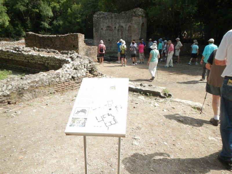
The texts on this marker are written in Albanian (shqip) (upper left) and English (upper right). Only the English text has been transcribed. To read the Albanian (shqip) text, enlarge the marker image by clicking on it.
English:
A . . . — — Map (db m126943) HM
The texts on this marker are written in Albanian (shqip) (top left) and English (top right). Only the English text has been transcribed. To read the Albanian (shqip) text, enlarge the marker image by clicking on it.
English:
Butrint . . . — — Map (db m126891) HM
The texts on this marker are written in Albanian (shqip) (upper left) and English (upper right). Only the English text has been transcribed. To read the Albanian (shqip) text, enlarge the marker image by clicking on it.
English:
The . . . — — Map (db m126921) HM
The texts on this marker are written in Albanian (shqip) bottom left, top) and English (bottom left, bottom). Only the English text has been transcribed. To read the Albanian (shqip) text, enlarge the marker image by clicking on it.
English: . . . — — Map (db m126888) HM
The texts on this marker are written in Albanian (shqip) (top left) and English (top right). Only the English text has been transcribed. To read the Albanian (shqip) text, enlarge the marker image by clicking on it.
English:
The . . . — — Map (db m126944) HM
The texts on this marker are written in Albanian (shqip) (top left) and English (top right). Only the English text has been transcribed. To read the Albanian (shqip), text enlarge the marker image by clicking on it.
English:
By the . . . — — Map (db m126918) HM
The texts on this marker are written in Albanian (shqip) (top left) and English (top right). Only the English text has been transcribed. To read the Albanian (shqip) text, enlarge the marker image by clicking on it.
English: . . . — — Map (db m126949) HM
The texts on this marker are written in Albanian (shqip) (top left) and English (bottom left). Only the English text has been transcribed. To read the Albanian (shqip) text, enlarge the marker image by clicking on it.
English:
The . . . — — Map (db m126951) HM
The texts on this marker are written in Albanian (shqip) (upper left) and English (upper right). Only the English text has been transcribed. To read the Albanian (shqip) text, enlarge the marker image by clicking on it.
English: . . . — — Map (db m126919) HM
The texts on this marker are written in Albanian (shqip) (top left) and English (top right). Only the English text has been transcribed. To read the Albanian (shqip) text, enlarge the marker image by clicking on it.
English:
The . . . — — Map (db m126913) HM
The texts on this marker are written in Albanian (shqip) (top left) and English (center left). Only the English text has been transcribed. To read the Albanian (shqip) text, enlarge the marker image by clicking on it.
English:
The . . . — — Map (db m126914) HM
The texts on this marker are written in Albanian (shqip) (top left) and English (bottom left). Only the English text has been transcribed. To read the Albanian (shqip) text, enlarge the marker image by clicking on it.
English:
The . . . — — Map (db m126884) HM
Miltidk Marjani • Selim Myftari • Astrit Toto • Sadik Rusto • Niko Stefani
DESHMOREVE QERANE KETU NEPERPJEKJE ME FORCAT NAZISTE ME 2.10.1943
English translation:
This is a very rough translation based on only a few words . . . — — Map (db m126783) HM WM
The texts on this marker are written in Albanian (shqip) (center) and English (right). Only the English text has been transcribed. To read the Albanian (shqip), text, enlarge the marker image by clicking on it.
English:
It's . . . — — Map (db m126795) HM
The texts on this marker are written in Romanian? (top), Albanian (shqip) (center) and English (bottom). Only the English text has been transcribed. To read the Romanian and Albanian (shqip), text, enlarge the marker image by clicking on it. . . . — — Map (db m126792) HM
The texts on this marker are written in Albanian (shqip) (center) and English (right). Only the English text has been transcribed. To read the Albanian (shqip), text, enlarge the marker image by clicking on it.
English:
Sinagogue - . . . — — Map (db m126803) HM
Only the English text (bottom) has been transcribed. To view the Croatian text (top), click on the marker image to enlarge and display it.
The first Arsenal was built between 1292 and 1331 and it was used as a shipyard for galleys. New . . . — — Map (db m127191) HM
Only the English text (bottom) has been transcribed. To view the Croatian text (top), click on the marker image to enlarge and display it.
The Benedictine Convent has been located here since 1664, originally the residential complex of . . . — — Map (db m127150) HM
Only the English text (bottom) has been transcribed. To view the Croatian text (top), click on the marker image to enlarge and display it.
The Gothic-Renaissance church was first mentioned in the 14th cent. It had a very important role . . . — — Map (db m127194) HM
Only the English text (bottom) has been transcribed. To view the Croatian text (top), click on the marker image to enlarge and display it.
The late Gothic Church of the Holy Spirit was built at the end of the 15th cent. by the . . . — — Map (db m127247) HM
Only the English text (bottom) has been transcribed. To view the Croatian text (top), click on the marker image to enlarge and display it.
City walls enclose the northern part of the city and they are connected with the Fortica fortress. . . . — — Map (db m127244) HM
Only the English text (bottom) has been transcribed. To view the Croatian text (top), click on the marker image to enlarge and display it.
Building of medieval City Walls started after the decision of the Venetian authorities in 1278. . . . — — Map (db m127147) HM
Only the English text (bottom) has been transcribed. To view the Croatian text (top), click on the marker image to enlarge and display it.
Building of medieval City Walls started after the decision of the Venetian authorities in 1278. . . . — — Map (db m127151) HM
Only the English text (bottom) has been transcribed. To view the Croatian text (top), click on the marker image to enlarge and display it.
Originally in the defensive system of the city walls, Clock Tower used to belong the Duke's . . . — — Map (db m127195) HM
Only the English text (bottom) has been transcribed. To view the Croatian text (top), click on the marker image to enlarge and display it.
Gothic Jakša palace wast built at the end of the 15th cent. next to the southern city walls. The . . . — — Map (db m127149) HM
Only the English text (bottom) has been transcribed. To view the Croatian text (top), click on the marker image to enlarge and display it.
The lower Paladini Palace was built by the galley commander and knight Nikiola Paladinić in . . . — — Map (db m127240) HM
Only the English text (bottom) has been transcribed. To view the Croatian text (top), click on the marker image to enlarge and display it.
City walls enclose the northern part of the city and they are connected with the Frotica . . . — — Map (db m127186) HM
Only the English text (bottom) has been transcribed. To view the Croatian text (top), click on the marker image to enlarge and display it.
City walls enclose the northern part of the city and they are connected with the Frotica . . . — — Map (db m127146) HM
Only the English text (bottom) has been transcribed. To view the Croatian text (top), click on the marker image to enlarge and display it.
Central square in the city of Hvar or Piazza is the largest square in Dalmatia. Originally it was . . . — — Map (db m127241) HM
Only the English text (bottom) has been transcribed. To view the Croatian text (top), click on the marker image to enlarge and display it.
Palace Užižić, earlier known as the Hektorović Palace incorrectly, was built about . . . — — Map (db m127188) HM
Only the English text (bottom) has been transcribed. To view the Croatian text (top), click on the marker image to enlarge and display it.
Vapnenica is one of several local words denoting a limekiln, When burnt, the piled stone burns . . . — — Map (db m127145) HM
The text of this marker appear at the bottom in five languages; Croatian, Italian, English, German and French. Only the English text (center) has been transcribed. To view the text in another language, click on the marker image to enlarge and . . . — — Map (db m128401) HM
The text of this marker appear at the bottom in five languages; Croatian, Italian, English, German and French. Only the English text (center) has been transcribed. To view the text in another language, click on the marker image to enlarge and . . . — — Map (db m128443) HM
The text of this marker appear at the bottom in five languages; Croatian, Italian, English, German and French. Only the English text (center) has been transcribed. To view the text in another language, click on the marker image to enlarge and . . . — — Map (db m128423) HM
The text of this marker appear at the bottom in five languages; Croatian, Italian, English, German and French. Only the English text (center) has been transcribed. To view the text in another language, click on the marker image to enlarge and . . . — — Map (db m128392) HM
The text of this marker appear at the bottom in five languages; Croatian, Italian, English, German and French. Only the English text (center) has been transcribed. To view the text in another language , click on the marker image to enlarge and . . . — — Map (db m128387) HM
Only the English text (right) has been transcribed. To view the Croatian text (left), click on the marker image to enlarge and display it.
The little church built in the 6th century in the sentries' walkway above the Iron Gate of . . . — — Map (db m128108) HM
Only the English text (right) has been transcribed. To view the Croatian text (left), click on the marker image to enlarge and display it.
The mausoleum of the Emperor Diocletian was built at the beginning of the 4th century, as one of . . . — — Map (db m127356) HM
The text of this marker appear at the bottom in five languages; Croatian, Italian, English, German and French. Only the English text (center) has been transcribed. To view the text in another language , click on the marker image to enlarge and . . . — — Map (db m128230) HM
The text of this marker appear at the bottom in five languages; Croatian, Italian, English, German and French. Only the English text (right) has been transcribed. To view the text in another language , click on the marker image to enlarge and . . . — — Map (db m128213) HM
Julius Nepos (C. 430-480) was a western emperor (474-480) during the last stage of the western Roman Empire he reigned. At first, over Italy and adjoining areas yet held by the western empire. As of 475, he had influence only over Dalmatia, having . . . — — Map (db m127597) HM
The Temple of Jupiter (Croatian: Jupiterov hram) is a temple dedicated to the Jupiter, Ancient Roman God of sky and thunder and king of the Gods. Temple is located in the western part of the Diocletian's palace near the Peristyle, the central square . . . — — Map (db m127358) HM
The text of this marker appear at the bottom in five languages; Croatian, Italian, English, German and French. Only the English text (right) has been transcribed. To view the text in another language , click on the marker image to enlarge and . . . — — Map (db m128215) HM
Croatian: U ovoj se kući (prema predaji) 18. VII. 1450. rodio
Marko Marulić
prozom i u "versih harvacki slažući
po običaju naših začinjavc"
začetke udari hrvatskoj umjetničkoj . . . — — Map (db m127596) HM
The text of this marker appear at the bottom in five languages; Croatian, Italian, English, German and French. Only the English text (center) has been transcribed. To view the text in another language, click on the marker image to enlarge and . . . — — Map (db m128390) HM
The text of this marker appear at the bottom in five languages; Croatian, Italian, English, German and French. Only the English text (right) has been transcribed. To view the text in another language , click on the marker image to enlarge and . . . — — Map (db m128216) HM
Only the English text (right) has been transcribed. To view the Croatian text (left), click on the marker image to enlarge and display it.
The three-storey building in Classicist style was designed for the building of the Classics High . . . — — Map (db m128104) HM
Only the English text (right) has been transcribed. To view the Croatian text (left), click on the marker image to enlarge and display it.
A Late Gothic palace of the wealthy merchant, later ennobled, Giovanni Battista De Gubbio of the . . . — — Map (db m127599) HM
Only the English text (right) has been transcribed. To view the Croatian text (left), click on the marker image to enlarge and display it.
The Gothic palace of the old Split patrician family of Cambi was built in the first half of the . . . — — Map (db m127414) HM
Only the English text (right) has been transcribed. To view the Croatian text (left), click on the marker image to enlarge and display it.
One of the first little churches in Diocletian's Palace, it was built in the 5th-6th century in . . . — — Map (db m127415) HM
Only the English text (right) has been transcribed. To view the Croatian text (left), click on the marker image to enlarge and display it.
The Church of St Roche with its Renaissance façade was created in 1516 through the conversion of . . . — — Map (db m128101) HM
Only the English text (right) has been transcribed. To view the Croatian text (left), click on the marker image to enlarge and display it.
The palace was built in 1394 for the Split nobleman Cipriano de Ciprianis (C. Žaninić . . . — — Map (db m127320) HM
Only the English text (right) has been transcribed. To view the Croatian text (left), click on the marker image to enlarge and display it.
This is an originally Romanesque house of the 13th century, with Gothic and Renaissance . . . — — Map (db m127417) HM
Only the English text (right) has been transcribed. To view the Croatian text (left), click on the marker image to enlarge and display it.
A Late Gothic palace of the second half of the 15th century, the design and execution of which . . . — — Map (db m127416) HM
Only the English text (right) has been transcribed. To view the Croatian text (left), click on the marker image to enlarge and display it.
The medieval house of the old Split patrician family of Grisogono was constructed on the corner . . . — — Map (db m128106) HM
Only the English text (right) has been transcribed. To view the Croatian text (left), click on the marker image to enlarge and display it.
The remains of this Late Gothic palace of the mid-15th century, which suffered numerous . . . — — Map (db m128112) HM
Only the English text (right) has been transcribed. To view the Croatian text (left), click on the marker image to enlarge and display it.
The Renaissance palace of the patrician family of Karepić, which moved from Trogir to . . . — — Map (db m127361) HM
Only the English text (right) has been transcribed. To view the Croatian text (left), click on the marker image to enlarge and display it.
The Late Gothic palace that was put up in the mid-15th century by the patrician Split . . . — — Map (db m127590) HM
Only the English text (right) has been transcribed. To view the Croatian text (left), click on the marker image to enlarge and display it.
A Late Gothic palace of the second half of the 15th century in which, according to tradition, . . . — — Map (db m127591) HM
Only the English text (right) has been transcribed. To view the Croatian text (left), click on the marker image to enlarge and display it.
This palace in the Baroque style with the characteristic sequence of round openings for shops on . . . — — Map (db m127374) HM
Only the English text (right) has been transcribed. To view the Croatian text (left), click on the marker image to enlarge and display it.
A complex on the site of the one-time triclinium and the residential sector of Diocletian's . . . — — Map (db m127322) HM
Only the English text (right) has been transcribed. To view the Croatian text (left), click on the marker image to enlarge and display it.
The Renaissance palace of an old Split patrician family of the 16th century. It was extended in . . . — — Map (db m127413) HM
Only the English text (right) has been transcribed. To view the Croatian text (left), click on the marker image to enlarge and display it.
This building of 1903 designed by Kamilo Tončić is an important specimen, with its . . . — — Map (db m127321) HM
Only the English text (right) has been transcribed. To view the Croatian text (left), click on the marker image to enlarge and display it.
The old Gothic town hall is the only remaining building complex that was knocked down in 1825 . . . — — Map (db m127371) HM
English Text:
A. The Propylaia
The Propylaia, the monumental entrance of the sanctuary of the Acropolis, was built at the west edge of the hill in the frame of the building programme of Perikles. The building's . . . — — Map (db m85103) HM
English Text:
A. The sanctuary of Artemis Brauronia
After passing through the Propylaia, the sanctuary of Artemis Brauronia, the so-called Brauronion, lies to the right of the processional way of the Acropolis. It was . . . — — Map (db m85203) HM
[Left columns - text in Greek]
[Right columns - text in English]
The Areopagus, a rocky outcrop approximately 115 m. high is situated between three other hills, the Acropolis, the Pnyx, and the Kolonos Agoraios. Its name . . . — — Map (db m47716) HM
A Doric peripteral temple, with pronaos (fore-temple), cella (inner shrine), and opisthonaos (rear wing), the best preserved of its type in the Greek world. The facade of the pronaos and opisthonaos, to the east and west, . . . — — Map (db m126052) HM
The large Archaic temple to the south of the Erechtheion, which today preserves only its foundations, was called the "Old Temple" according to epigraphic evidence. Dedicated to Athena Polias, the patron deity of the city, it housed the . . . — — Map (db m85232) HM
[Marker text printed in both Greek and English scripts:]
The Acropolis and its monuments, universal symbols of the classical spirit and culture, form the greatest architectural and artistic whole that Greek Antiquity has bequeathed to . . . — — Map (db m43648) HM
English Text:
The elegant building of the Ionic order is called, according to later literary sources, Erechtheion from the name of Erechtheus, the mythical king of Athens. The construction started before the outbreak of the . . . — — Map (db m85173) HM
English Text
The Parthenon was a temple dedicated to Athena Parthenos (Virgin). It is built in the Doric order and made of white Pentelic marble with a width of 30.86 meters, a length of 69.51 meters and a height of 15 meters. It has an . . . — — Map (db m85214) HM
English Text:
The colossal bronze statue of Athena, known as Athena Promachos, dominated in the area between the Propylaia and the Erechtheion, to the left of the visitor walking along the processional way of the Acropolis. It was made . . . — — Map (db m85182) HM
This monumental water clock was constructed at the end of the 4th cent. B.C. in a prominent location at the southwest corner of there Agora square, on the street leading from the Agora up to the Pnyx. Water was drawn by a stone drain. The device was . . . — — Map (db m126058) HM
Η αρχαιολογική αναδκαφή
(Text in Greek above. To read it enlarge the marker image.) English:
The remains of a neighborhood . . . — — Map (db m126107) HM
ΣΤΟΑ ΤΟΥ ΑΤΤΑΛΟΥ (156-138 π.X.)
(Text in Greek on the left side) English:
The Stoa, on the east side of the Ancient Agora, was the gift of Attalos . . . — — Map (db m126105) HM
The house at 22 Panos Street is a two-storey house, with a simple, traditional architecture, built at the beginning of the 19th century. The building has a ground (entrance) floor and an upper storey. It was restored by the Ministry of Culture, in . . . — — Map (db m126065) HM
U SPOMEN BROJNIM HRABRIM POMORCIMA BOKE POGINULIM U BICI KOD LEPANTA 7. X 1571 GODINE NA GALIJI "SAN TRIFONE DI CATTARO" POD ZAPOVJEDNIŠTVOM JERONIMA BISANTIJA I PERAŠKIM ČUVARIMA DŽAVNE ZASTAVE KOJI SU SVOJIM ŽIVOTIMA DOPINJELI . . . — — Map (db m126766) HM WM
English: The 57th Infantry Regiment was formed during the Balkan War in 1912. On 1 February 1915, it was reconstituted under the command of the 19th Infantry Division as part of the Turkish Fifth Army.
The regiment showed outstanding . . . — — Map (db m85113) HM
These ten panels, mounted upon a wall facing the sea, describes the conflict between Allied and Turkish forces on the Gallipoli Peninsula in 1915.
Panel #1
English:
The Dardanelles
A good army of . . . — — Map (db m85295) HM WM
English:
This beach, 600 metres long by 20 metres wide was the life line to the Allied soldiers within the Anzac perimeter. Because of Turkish shellfire, supplies could only be landed at night and carried by men and mules along tortuous . . . — — Map (db m85219) HM
English:
By early l9l5, the Western Front in France and Flanders had reached a stalemate. The British War Council sanctioned a plan to attack the Ottoman Empire, which was fighting alongside the Central Powers, led by Germany. By . . . — — Map (db m85184) HM WM
English:
At 0430 hours on 25 April, 36 rowing boats landed the first Australian soldiers around this point and at Anzac Cove. Immediately they climbed the 100 metre hill behind you (Plugge's Plateau) and by 1000 hrs. secured a front line . . . — — Map (db m85183) HM
"Those heroes that shed their blood and lost their lives... you are now living in the soil of a friendly country. Therefore rest in peace. There is no difference between the Johnnies and the Mehmets to us where they lie side by side here in this . . . — — Map (db m85220) WM
English:
During the Gallipoli campaign, this area was known as 'Hell Spit'. To the north is the beach which became known as Anzac Cove, where some 27,000 Australian and New Zealand, British and Indian troops came ashore between 25 April . . . — — Map (db m85241) HM
150 entries matched your criteria. The first 100 are listed above. The final 50 ⊳