The primary purpose of Fort Williams may have been for coastal defense, yet many men, women, and children also called it home. This self-sustaining community featured many of the buildings and services typical of an American town of the time . . . — — Map (db m25389) HM
This building was constructed in 1914 by the Quartermaster Corps for use as the Artillery Engineer Storehouse of Fort Williams. The structure housed the tools, equipments, and supplies used by the artillery engineer in maintianing and repairing the . . . — — Map (db m186112) HM
This building was constructed in 1914 by the Quartermaster Corps for use as the Artillery Engineer Storehouse of Fort Williams. The structure housed the tools, equipments, and supplies used by the artillery engineer in maintianing and repairing the . . . — — Map (db m186113) HM
This building was completed in 1909 for use by unmarried officers of the Coast Artillery Corps stationed at Fort Williams. Visiting officers or married officers without their families might also reside in the quarters. The structure was built to . . . — — Map (db m186117) HM
THis building was completed in 1909 for use by unmarried officers of the Coast Artillery Corps stationed at Fort Williams. Visiting officers or married officers without their families might also reside in the quarters. The structure was built to . . . — — Map (db m186116) HM
At the outbreak of World War II in Europe, the US Army authorized four new gum batteries for Portland Harbor. Two were located on Peaks Island and one each on Jewell Island and here at Two Lights.
This battery was designated as Battery 201 (the . . . — — Map (db m259675) HM
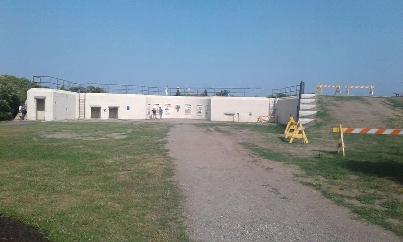
Battery Blair was completed in 1903. It was named for Francis P. Blair, Jr., a veteran of the Mexican and Civil Wars who rose to the rank of major general and later represented Missouri in the U.S. Senate. The battery consisted of two twelve-inch . . . — — Map (db m25378) HM
You are standing at the site of the
largest of six gun batteries built at
Fort Williams. Named for Francis P.
Blair, Jr., a veteran of the Mexican
and Civil wars, Battery Blair was
manned during World War I and the
early years of World War II. . . . — — Map (db m161815) HM
Battery Erasmus Keyes was completed In 1905 and named for Erasmus D. Keyes, a Maine resident and graduate of the U.S. Military Academy who rose to the rank of major general during the Civil War. The battery mounted two three-inch, rapid fire guns to . . . — — Map (db m161825) HM
Battery Hobart was built in 1898 and named for Lieutenant Henry A. Hobart, one
of the first Maine graduates of the U.S. Military Academy, who was killed in action
during the War of 1812. The battery mounted one British-built six-inch gun, . . . — — Map (db m161822) HM
One of Franklin Delano Roosevelt's New Deal programs, the Civilian Conservation Corps hired unemployed young men during the Great Depression. The CCC provided training to men between the ages of 18 and 25 for work on conservation projects including . . . — — Map (db m25390) HM
This building was completed in 1905 as the central powerhouse for Fort Williams by the Quartermaster Corps. The structure was built of reinforced concrete and sited in this sheltered spot to protect it from the fire of hostile vessels. Inside, . . . — — Map (db m186101) HM
This plaque was dedicated by Chapter 111 Alumni by former members of the Civilian Conservation Corps in memory of Franklin Delano Roosevelt and the members, who served at this post and other C.C.C. camps in Maine and throughout the United States . . . — — Map (db m50361) HM
In this bicentennial year, 1765-1965, of Cape Elizabeth, Maine, the town dedicates this plaque in honor of the United States Coast Guard on the 175th anniversary of its founding and the commissioning of the light by the President of the United . . . — — Map (db m161818) HM WM
After World War I, Fort Williams
was placed on caretaker status as a
coast artillery post, and became
home to the 5th Infantry Regiment
upon its return from occupation
duty in Germany in 1922. The 5th
remained at the fort until 1939,
longer . . . — — Map (db m161812) HM
This building was completed in 1911 under the direction of the Quartermaster Corps of the U.S. Army for use by a field officer (colonel, lieutenant colonel, or majro) of the Coast Artillery Corps and his family stationed at Fort Williams. It was . . . — — Map (db m186114) HM
This building was completed in 1911 under the direction of the Quartermaster Corps of the U.S. Army for use by a field officer (colonel, lieutenant colonel, or majro) of the Coast Artillery Corps and his family stationed at Fort Williams. It was . . . — — Map (db m186115) HM
This building was completed in 1911 by the U. S. Army Quartermaster Corps as a fire station for Fort Williams at a cost of $3,586. It was constructed of brick on a concrete foundation and the roof and tower, used for drying hoses, are slated. The . . . — — Map (db m205625) HM
This former military installation, begun in 1873 and known as The Battery at Portland Head, was a sub-post of Fort Preble until 1898 when it became a separate independent fort. It was designated Fort Williams in honor of Brevet Major General Seth . . . — — Map (db m23389) HM
From the 1750s, Portland Harbor was of economic importance as the closest American harbor to Europe and of strategic importance as a protected anchorage for the navy. As part of an upgrading of the harbor defenses in 1873, construction began on a . . . — — Map (db m25385) HM
This former military installation, begun in 1873 and known as The Battery at Portland Head, was a sub-post of Fort Preble until 1898 when it became a separate independent fort.
It was designated Fort Williams in honor of Brevet Major General . . . — — Map (db m247501) HM
The Goddard Manson was completed in 1858 for John Goddard (1811-1870) to an Italianate villa design prepared by Portland architect Charles Alexander, who planned other prominent buildings in the area. It was built of native stone and was one of the . . . — — Map (db m161828) HM
In the mid 1800’s, Cape Elizabeth became a haven for vacationers seeking warm sunshine, cool summer breezes, rocky coasts, fresh produce, and shore dinners. It was then (1853) that John Goddard purchased 25 acres which included the Grand Cape . . . — — Map (db m304105) HM
This building was completed in 1934 for the 240th Coast Artillery Regiment of the Maine National Guard by the Quartermaster Corps. The shed was used to house two of the regiment's four mobile 155mm guns and the large Holt crawler tractor used to . . . — — Map (db m186105) HM
This building was completed in 1934 for the 240th Coast Artillery Regiment of the Maine National Guard by the Quartermaster Corps. The shed was used to house two of the regiment's four mobile 155mm guns and the large Holt crawler tractor used to . . . — — Map (db m186106) HM
Henry Wadsworth Longfellow often
walked from Portland to visit this
Lighthouse. The Keepers were his
friends and it is believed he sat
here for inspiration for his poem
"The Lighthouse"
"Sail on; Sail on ye stately ships;
And with your . . . — — Map (db m161820) HM
John Goddard made his fortune in the lumber and timber trade in Orono, Maine. In 1853, Goddard purchased the Cape Cottage Horel and the surrounding 23 acres for $12,000 (about $500,000 in 2925 dollars). Originally opened in 1836, the Cape Cottage . . . — — Map (db m304236) HM
"Keepers of the Light"
1791 John K. Greenleaf •
1796 Dave Duncan •
1976 Barzillai Delano •
1820 Joshua Freeman •
1840 Richard Lee •
1849 John F. Watts •
1853 John W. Coolidge •
1854 James S. Williams •
1854 James Delano • . . . — — Map (db m186104) HM WM
[Header Information]
Population: 65,000
Surrounding Population: 250,000
Number of Languages Spoken in the Portland Public Schools: 40
Visitors Per Year: 3,750,000
Average Summer Temperature: 82°
Miles from Boston: 100
Amount of office . . . — — Map (db m50362) HM
Hannaford Bros. Co.: The supermarket chain was founded in 1883 to sell the vegetables and fruits grown on a farm in Cape Elizabeth.
Farming: Cape Elizabeth-grown cabbage was considered the best in the state, bringing . . . — — Map (db m50384) HM
The Militia Storehouse was built in 1915 by the Quartermaster Corps and was assigned to the Maine National Guard. The concrete building was used by the 240th Coast Artillery Regiment for storage of tents, bunks, and other equipment required during . . . — — Map (db m186107) HM
The Militia Storehouse was built in 1915 by the Quartermaster Corps and was assigned to the Maine National Guard. The concrete building was used by the 240th Coast Artillery Regiment for storage of tents, bunks, and other equipment required during . . . — — Map (db m186111) HM
This Mining Casemate was constructed in 1891, but it was rebuilt in 1903, enlarged in 1907, and modernized during World War II. The function of the casemate was to control the minefield in the main channel, which was laid during the Spanish-American . . . — — Map (db m186118) HM
The 240th Coast Artillery Regiment
of the Maine National Guard was
created to assist the 8th Coast
Artillery Regiment in time of war.
In 1930, a formal National Guard
camp was laid out at the fort with
mess halls and concrete slabs for
tents. . . . — — Map (db m161816) HM
After the World Wars and the decline of its relevant military capabilities, Fort Williams fell into disrepair before it was finally closed in 1962. The Town of Cape Elizabeth brought the 100-adre property for $200,000 in 1964. John Goddard’s ornate . . . — — Map (db m304346) HM
Since its commission by George Washington in 1790, Portland Head Light remains an enduring symbol of the rugged, solid characteristics of a magnificent coastline and proud people weathering the challenges of nature and time.
In observance of . . . — — Map (db m41841) HM
American
Society of
Civil
Engineers
1852
Portland Head Light
Portland Head Light was the first lighthouse completed and put into
service by the Federal Government under the Lighthouse Act of 1789
Completed 1791
Designated 2002 — — Map (db m161819) HM
Portland Head Light was the first lighthouse completed and put into service by the Federal government under the Lighthouse Act of 1789.
Completed 1791
Designated 2002 — — Map (db m259677) HM
In 1873, the U.S. Army began acquiring land (at $200 per acre) between the Portland Head Light and the Goddard Mansion to protect the vibrant trade and strategic harbor of Portland, Maine. The threat of war with Spain prompted the military to . . . — — Map (db m303905) HM
Officers Killed in Action
Lt. James G. Early (Commander) • Lt. John R. Laubach • Lt. Ambrose O. Vanderheiden • Ens. Seth E. Chapin • Ens. Roy F. Swan
Enlisted Crew Killed in Action
John J. Alexander F2c •
James O. Brown CGM • . . . — — Map (db m186103) WM
In memory of the officers and crewmen of the U.S. Navy's Eagle Class Sub-Chaser U.S.S. Eagle-56 (PE-56) torpedoed and sunk by the German U-boat U-853 approximately nine miles southeast of this location on Monday, 23 April 1945 with the loss of . . . — — Map (db m50332) WM
The Freedom Tree
with the vision of universal freedom
for all mankind
this tree is dedicated to
Capt. Henry Barrows
and all
Prisoners of War
and Missing in Action
1973
— — Map (db m186458) WM
This arch is all that remains of a Scarborough landmark business called The Danish Village. It was a first-class motel and restaurant built by Portland businessman Henry Rines. The 100-unit complex was probably the finest set of buildings ever . . . — — Map (db m186450) HM
In memory of Jim Durant founding member of Scarborough Police Volunteers in Police Services who died December 2006 from injuries sustained while directing traffic at an accident scene — — Map (db m186449) HM
The Freedom Tree
with the vision of universal freedom
for all mankind
this tree is dedicated to
Maj. Charles Greene, Jr.
and all
Prisoners of War
and Missing in Action
1973
— — Map (db m186457) WM
The Freedom Tree
with the vision of universal freedom
for all mankind
this tree is dedicated to
Maj. Robert Biss
and all
Prisoners of War
and Missing in Action
1973
— — Map (db m186456) WM
To the sons of Scarborough who died in the service of their country
★ World War I ★
Lucien T. Libby NG. •
Millard L. Gower NG. •
Rolland W. Seavey NG. •
John F. McKay •
Oega Wolters
★ World War II . . . — — Map (db m186455) WM
These sought not glory but their country's good
Carl ET Ahlquist •
Rudolph E Ahlquist •
Peter C Anderson •
Euchariste Archambault •
Clifton R Bryant •
Carl H Carter •
Raymond E Collins •
Irging D Corneally •
Guy A Cunningham . . . — — Map (db m186452) WM
Bug Light was erected in 1875 at the end of a 1,990-foot-long breakwater which protected Portland's inner harbor from ocean storms. The area around the breakwater has since been filled in and is now Bug Light Park.
Inspired by the fourth-century . . . — — Map (db m309066) HM
In honor of
those who served
in the
War for the Union
1861 - 1865
"Yours has the suffering been
the memory shall be ours."
"Your silent tents of green
we deck with fragrant flowers." — — Map (db m107072) WM
This plaque was dedicated by Chapter 111 Alumni by former members of the Civilian Conservation Corps in memory of Franklin Delano Roosevelt and the members, who served at this post and other C.C.C. camps in Maine and throughout the United States . . . — — Map (db m55601) HM
Dedicated to the
men and women of
the Coast Artillery Corps
who defended Portland Harbor
at Fort Preble in five wars
from 1808 through 1945 — — Map (db m55602) WM
Dedicated to the men and women of the Coast Artillery Corps who defended Portland Harbor at Fort Preble in five wars from 1808 through 1945. — — Map (db m186123) HM WM
The largest 17th century settlement in Cape Elizabeth - which included South Portland and Cape Elizabeth prior to 1895 - was established in 1658 near Spring Point. However, the onset of the French and Indian Wars in 1675 necessitated frequent . . . — — Map (db m55673) HM
In December, 1940, William Newell, president of Todd-Bath Iron, won a British contract to construct a seven-berth shipyard at Cushing Point and to build thirty 10,000-ton cargo vessels. On the mudflat site, Newell had constructed a cofferdam to . . . — — Map (db m186132) HM
Near this hallowed ground our earliest settlers erected in 1722 a garrison-meeting house for worship and protection. This was the beginning of the First Congregational Church of South Portland, which was established on November 10, 1734. . . . — — Map (db m55603) HM
Built on Hog Island Ledge, Fort Gorges was named after Sir Ferdinando Gorges, colonial proprietor of the Province of Maine. The fort's site allowed it to provide supplemental fire to both Forts Preble and Scammel. Its location at the head of the . . . — — Map (db m55627) HM
This area is the site of Fort Preble, also known as Fort Hancock during the Revolutionary War, a temporary fort. Fort Preble was begun in 1808 during the administration of Pres. Jefferson and completed before the War of 1812. It was named for . . . — — Map (db m55568) HM
This scenic point of land overlooking Portland Harbor, where Bug Light Park stands today, was once home to a sprawling World War II Shipyard that covered 140 acres of land, including over 60 buildings, and had the capacity to build up to 13 ships . . . — — Map (db m50474) HM
In memory
Morris P. Cates
Deputy Commissioner of Education
through whose untiring efforts
- Maine -
Vocational-Technical Institute
was established
in 1946
— — Map (db m55599) HM
Shipbuilding has been an important part of South Portland’s economy since colonial times. Small vessels built prior to the Revolutionary War were used for fishing and the coasting trade which ranged from the Kennebec River to Virginia. During the . . . — — Map (db m55678) HM
A major revival of shipbuilding took place here in the four years just prior to and during World War II. Cargo ships, the British Ocean series and the United States Liberty ships, were produced by the Todd-Bath Iron Shipbuilding . . . — — Map (db m186129) HM
In the mid-1800s, when South Portland was still a part of Cape Elizabeth, its waterfront appeared to be a continuous line of bustling yards building and repairing ships. From Butler on Turner's Island to Knight and Blanchard in Knightville to . . . — — Map (db m50413) HM
Todd-Bath Iron Shipbuilding Corp., 1940-1942
South Portland Shipbuilding Corp., 1941-1943
New England Shipbuilding Corp., 1943-1945
This is a complete list of the ships built by the emergency shipyards at South Portland, Maine, between . . . — — Map (db m50396) HM
When Rear Admiral Land, U.S. Maritime Commission Chairman showed President Roosevelt the Liberty ship plans, he remarked, "She'll carry a good load. She isn't much to look at though? A real ugly duckling." However, these simple but seaworthy ships . . . — — Map (db m50508) HM
This park memorial is dedicated to all families whose homes and heritages were destroyed in 1942 so a shipyard could be built during World War II
This area, known as Cushing’s Point at Ferry Village, consisted of many homes, some built by their . . . — — Map (db m84835) HM WM
We welcome you to our yard. You are now a member of our army of 25,000 men and women building the ships so urgently needed to carry war supplies to the fighting front.
New England Shipbuilding Corporation, Employee Handbook
With the . . . — — Map (db m55925) HM
We were all working there for one purpose: to get this country out of trouble. Everyone had one thing in mind: to produce and to win.
Bill Walton
Worker at New England Shipbuilding Corp.
Before there could be any British Ocean class or . . . — — Map (db m55737) HM
Each new ship strikes a blow at the menace to the Nation and for the Liberty of the Free People of the World…
President Franklin Delano Roosevelt
September 27, 1941
At the launching of the first Liberty ship, Patrick Henry from . . . — — Map (db m55922) HM
The U.S. Maritime Commission in the spring of 1941, called for the emergency construction of shipyards. William Newell received an order to develop another shipyard to the west of Cushing Point. Known as the West Yard, this facility had six . . . — — Map (db m186130) HM
During the war we all did our part to contribute. At first I worked at the shipyard as a welder. Then I served on board the Francis Retka, a Liberty ship we launched from the East Yard.
Frank Emery
Welder, 1941-1944, New England . . . — — Map (db m55765) HM
The construction of Alfred Street was ordered by the County Court in 1828. It was intended to pass through the center of valuable mill sites and connect directly to Main Street, Saco. Protests and petitions over this originated in . . . — — Map (db m186157) HM
Biddeford became a city in 1855. The city government met in the Somes Building on Washington and Main Streets. When the Central Block burned down in 1858, it had been thel largest wooden building north of Boston. It contained . . . — — Map (db m186176) HM
Biddeford Veterans Memorial Park Dedicated in 1993 to those who made the supreme sacrifice.
There are 5 slabs printed on both sides listing Biddeford residents who died during the Revolutionary War, the War of 1812, Korean war, Vietnam war, 2 . . . — — Map (db m96423) WM
Welcome to Biddeford
An early Industrial Revolution site, Biddeford was settledin 1630 by proprietors John Oldham and Richard Vines. They received their land grant as payment for services to the Plymouth Company in 1629. John . . . — — Map (db m186151) HM
Welcome to Biddeford
An early Industrial Revolution site, Biddeford was settledin 1630 by proprietors John Oldham and Richard Vines. They received their land grant as payment for services to the Plymouth Company in 1629. John . . . — — Map (db m186168) HM
Alfred Bonneau started publishing La Justice, a weekly French-language newspaper, in 1893. It was published until 1950. Joseph C. Bolduc was the last editor. Alfred Bonneau was a prominent citizen and one of the foremost . . . — — Map (db m186160) HM
Our
Dead Heroes.
"On fame's eternal
camping ground
their silent tents
are spread,
and glory guards with
solemn round
the bivuac of our
dead."
Maine
admitted
into the Union
1820.
Sumter.
1861. . . . — — Map (db m186175) HM WM
The Indians burned the township of Saco in 1688. Fort Saco was built on the future site of the Laconia Mills to protect the settlers in 1693. The fort served as stables during the construction of the Laconia mills in 1841. Yo Cat Gully . . . — — Map (db m55718) HM
In recognition of his selfless service as a Founder of Winterfest and for bringing laughter and smiles to Biddeford's children during the cold days of winter. — — Map (db m186173) HM
The Biddeford Daily Journal as a weekly abolitionist paper. Saco publishers Cowen and Noyes purchased the Eastern Journal which became the Union Journal in 1858, then the Biddeford Daily Journal in 1858, . . . — — Map (db m186172) HM
On June 24, 1825, General Lafayette spent the night here at Spring's Tavern on his way
to Portland. He stopped again on June 26 traveling south. — — Map (db m204927) HM
Frederick Douglas was denied the pulpit of the Second Parish Congregational Church in Biddeford. Abolitionist members of the church were disappointed and met in a pavilion tent erected for the 1855 Maine Republican Party . . . — — Map (db m186181) HM
The parade highlighting Painchaud's Band, in the lower photo, is going down Adams Street. The occasion is a flag raising on April 14, 1917 supporting World War I. In the background is the Nickel Theater, an early motion picture . . . — — Map (db m186170) HM
"Squire" Samuel Peirson's House was located on the site of Phillip's garrison house destroyed by the Indians in 1675 during King Phillip's War. The house shown here was erected in 1767 by Jeremiah Hill who died in 1820. Samuel . . . — — Map (db m186155) HM
Bishop Heley and Father Pierre-Emmanuel Dupont of St. Joseph's Church decided that a second church for Franco-Americans was needed. In 1899, they called upon Rev. Louis Bergeron, pastor in Fairfield, Maine, to organize St. André's . . . — — Map (db m186187) HM
219 entries matched your criteria. The first 100 are listed above. Next 100 ⊳