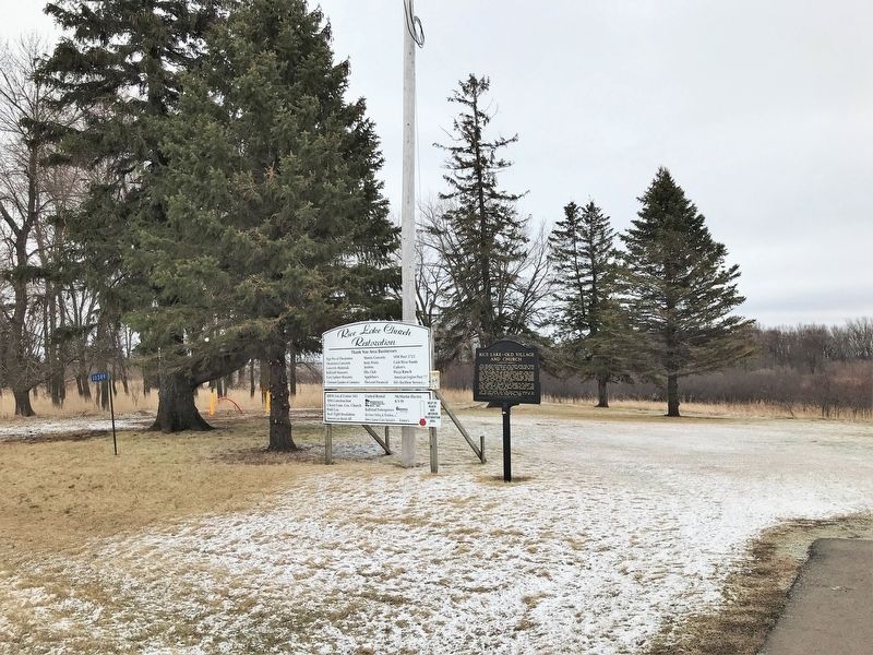
Rice Lake and its surrounding area were popular among early Indians for the abundance of good hunting and the wild rice that grew in the shallow lake waters. Women of the Winnebago tribe harvested the rice even after the first white settlers . . . — — Map (db m196833) HM
The First National Soil Conservation District Field Day and Plow Matches were held here on September 6, 1952. Over 125,000 spectators saw demonstrations of new methods and new techniques for soil conservation during the event. The presidential . . . — — Map (db m114960) HM
Dedicated to all Veterans who have honorably served past present and future Dear Veterans, Those of us who have not served will never fully understand the sacrifices you’ve made both in times of peace and of war. We will never fully . . . — — Map (db m306818) WM
Recognized as a local landmark since its construction, the Kasson Water Tower looks over the community. In 1895, 25 residents petitioned the Village of Kasson to erect a waterworks system inside the village limits. In June of that year, the council . . . — — Map (db m235300) HM
The 1st Freedom Rock® in Minnesota rolled into Kasson on July 4th, 2018. The 17 ton rock, donated by Brooks Excavating, found a home next to the Kasson American Legion Post #333. With artwork created by 'Ray Bubba' Sorensen II, this is the 5th Rock . . . — — Map (db m232540) HM
Dedicated to those who served
This memorial presented by the Dodge County Council of the American Legion, the Veterans of Foreign Wars and Auxiliaries
Dedicated November 11, 1992 — — Map (db m289493) WM
A tribute to Gold Star Families and Relatives who sacrificed a Loved One for our Freedom.
This monument honors, recognizes, and serves Gold Star Families and the legacy of their Loved Ones who have paid the ultimate sacrifice while serving . . . — — Map (db m289141) WM
This building was built in 1856 as a hotel by John B. Hubbell who was one of the founders of Mantorville.
It replaced the original log Hubbell House built in 1854, the year Mantorville was incorporated.
Erected 1998 by the Hubbell . . . — — Map (db m295143) HM
Cabin or House? In the frontier of the mid-1800s, a three-story log structure like this would have been considered quite luxurious. To our twenty-first century eyes, it is a cramped and uncomfortable little cabin. Given the size of the . . . — — Map (db m293002) HM
John Hischi founded the Dodge County Brewery in May of 1857. This establishment was located on Fifth Street West near the 1918 Opera House, making this business the oldest microbrewery in Minnesota. One year later, Hirschi sold the business to . . . — — Map (db m297579) HM
Mantorville schools began teacher training or normal training in 1913. Young women, having completed at least three years of high school, could prepare for teaching in rural schools through this type of program. Often Normal Schools evolved into . . . — — Map (db m288211) HM
The Restoration House was purchased by the Mantorville Restoration Association (MRA) in 1963 from the Wytaske Estate for $1700.00. It was in serious need of restoration and repair. MRA members volunteered their time and talent to restore it in . . . — — Map (db m294160) HM
Changing the Land Changes the River
Over the past 150 years we have changed the landscape to create cities and farms. These changes increased how much water runs off the land. More runoff means more erosion, pollution, . . . — — Map (db m299879) HM
Bill Patterson sitting on the porch. He owned the Doig House from 1963 to 1986.
In the early days of building Wasioja, town founder Curtis Moses recruited Andrew and Alexander Doig, Scottish immigrant brothers and . . . — — Map (db m285951) HM
This small limestone building was built in 1855. It is most well known as the last remaining Civil War recruiting station in Minnesota. The Wasioja Grange and Old Settlers Society were instrumental in its preservation in the 1960s. A . . . — — Map (db m287744) HM
The Wasioja Baptist Church, erected in 1858, was built by pledges and barters during a nationwide economic recession.
In Wasioja's earliest days, its first ten families organized a congregation for themselves. In the summer . . . — — Map (db m286434) HM
When the Civil War began in 1861, Minnesota was the first state to offer and send troops to aid the Union cause. In April 1861, this building was converted to use as a recruiting station. Recruits from the Wasioja station, numbering over 200, . . . — — Map (db m114961) HM
First, second and third grades, 1896
Wasioja's ambitious pioneer citizens established its first school in 1856 in a small wood frame building. But within two years, town leaders recognized the need for a permanent school. . . . — — Map (db m287263) HM
The role of buildings in the development of a community and their significance in history is amply pointed out by the history of this structure. Anxious to promote the growth of the newly formed town, the citizens agreed to provide the Free Will . . . — — Map (db m115028) HM
Settled in 1863 and platted in 1854, this town from June, 1856 to November, 1861, was the Government Land Office for the southern area. The St. Paul-Dubuque stage route, opened in 1854, following the Territorial Road from Hastings, roughly the . . . — — Map (db m207537) HM
It took almost 100 years and even more musicians for Chatfield to become known as Bandtown USA. In 1882, the little town formed its first brass band. The group was greeted with such approval that just three years later, the town instituted a tax . . . — — Map (db m288726) HM
The building before you represented the state of the art in progressive school building design when it opened in 1916 as the Chatfield High School. It exhibits a number of important design features that show the influence of the evolving . . . — — Map (db m289510) HM
Chatfield's founders intended the town to be the seat of government for the newly created Fillmore County, established by act of the Territorial Legislature on March 5, 1853. At the time it was created, Fillmore County encompassed all of the . . . — — Map (db m289170) HM
In 1854, the site of the future town of Chatfield was surveyed and platted by Thomas B. Twiford, acting as the agent for a group of real estate speculators organized in 1853 as the Chatfield Land Company. The town plat covered 195.6 acres and . . . — — Map (db m286448) HM
The roots of Chatfield's library were planted during the 1850s when a small group of book lovers purchased a collection of works for private circulation under the auspices of the "Washington Irving Literary Society," an off-shoot of the . . . — — Map (db m287293) HM
"CHATFIELD BRASS BAND—The instruments for the organization have been ordered, and are daily expected to arrive. There will doubtless be a good deal of 'tooting' for a while, as all things have a beginning, but in due course of time we shall have . . . — — Map (db m287753) HM
The Chatfield Academy was a non-governmental institution of secondary education, what we would now call a preparatory school. The academy movement had its origins in New England (Boston Latin was the prototype) and migrated west into Minnesota . . . — — Map (db m293055) HM
"The Territory of Minnesota opened a road from Winona to Chatfield and further west and the stage line followed the road. A stagecoach business flourished for many years and Chatfield was the crossing of two major lines, the stage . . . — — Map (db m288213) HM
The auditorium-gymnasium addition to Chatfield High School was built in 1935-1936. It was one of many PWA public school building projects in Minnesota. The building was designed by Toltz, King & Day, Inc., a well-known Saint Paul architectural . . . — — Map (db m294205) HM
History of the Harmony McMichael Grain Elevator
• Built (circa 1879) for the A. & T. McMichael Grain Co. of McGregor, Iowa
• The company owned and operated several grain elevators and warehouses in Minnesota, Iowa, Wisconsin, and . . . — — Map (db m287316) HM
Water Tower on Historic Ground
An interesting fact connected with the history of Harmony was brought to light when the Village Council was required by the P.W.A. to procure all necessary titles and transfers to the plot of ground on which . . . — — Map (db m297728) HM
Before Our Time
The original hotel was the Harmony House (later Pulver Hotel), as it appeared in 1885, when it was owned by Charles A. Thompson. To the left is Mr. Thompson's Boot, Shoe and Harness Shop; the Pool Hall building before it . . . — — Map (db m300440) HM
Original Johnson Store
Sam and Peter Nelson, Lanesboro merchants and Samuel B. Johnson (S.B.), a clerk in the store, started a general store in the summer of 1889. Ben Larson was a partner in the store of Nelson Bros.
In 1889, Hans S. . . . — — Map (db m303116) HM
Bert Yates Hardware
Bert Yates had a hardware store located on north Main from 1938-1953.
The sign on the building just to the south indicates the Vadheim-Landry Drug Store.
Tallak Brokken Building
The south side of the . . . — — Map (db m304864) HM
Corner Store, Barber Shop, Clover Farm Store Wiped out by Early Morning Blaze
Four fire companies fight flames for more than two hours. Volunteers helped immensely—sparks blown for blocks by northwest wind.
A devastating fire, . . . — — Map (db m307560) HM
July 4th Celebration
At the July 4th celebration, you can see the cars beautifully decorated. Tollef Sanderson's car (center) was decorated, and his three daughters and son were in the car.
The roof line at the far right is as it . . . — — Map (db m309033) HM
Construction in Harmony
The new Village Town Hall was built in 1935, at a cost of $4,000, and was completed in late summer. The building housed the fire department equipment, a council chamber, library, public rest room, a commodious room . . . — — Map (db m310773) HM
Like immigrants from many European nations in the mid-19th century, Norwegians left their homeland to escape overpopulation, food shortages, and farm foreclosures. They began arriving in Minnesota in the 1850s, drawn by rich farmland and job . . . — — Map (db m31323) HM
Growing for the Mills
The historic grain elevator reminds us of Preston's early agricultural years
Settled in 1853, Preston is named for Luther Preston, the town's millwright and first postmaster. Located on the . . . — — Map (db m289517) HM
"In memory of
Jesse Potter Nehring M. D.
who practiced medicine in this area from August 10, 1930, to January 25, 1967. His devoted service to his patients and his notable contributions to the care of the sick and to this . . . — — Map (db m303266) HM
In 1937-1928, during America's Great Depression, the Preston Overlook was built as a project of the federal National Reemployment Service (NRS). The NRS operated an employment office in each county to certify manpower for the many . . . — — Map (db m286102) HM
"A library outranks any other one thing a community can do to benefit its people. It is a never failing spring in the desert." Andrew Carnegie
No well-regulated, progressive town can afford to be without . . . — — Map (db m300553) HM
The Start of the Historic Walking Tour of Preston
1.🙠Historic Elevator. You are at Preston's railroad center (see adjacent The Milwaukee Road in Preston exhibit dedicated in 2019)—all that is left is the 1902 . . . — — Map (db m295762) HM
Returning from Caledonia, train #641 is steaming westward at Mabel toward its home terminal in Preston with Class 8 G engine #1022 (last steam engine scrapped by Milwaukee Road in 1956).
August, 1953
Photo by Cecil Cook . . . — — Map (db m298381) HM
Grain Elevators
As the Blufflands were settled in the mid-1800s, harvests from local farms were brought to the grain mills and elevators in nearby towns—such as the Milwaukee Co. Grain Elevator in Preston. Grain was stored in . . . — — Map (db m293222) HM
Consider this your personal invitation to visit Preston, Minnesota, located along the Root River in scenic Historic Bluff Country!
Preston, also known as "Minnesota's Trout Capital," is a welcoming, family-fun destination offering a wide . . . — — Map (db m294348) HM
The second schoolhouse for children from Forestville and Carimona was built in 1857 out of locally made bricks.
The brick schoolhouse cost $500 ($18,000 today) to build. It replaced a log building located in south Forestville. Milton . . . — — Map (db m288800) HM
Local bridges helped tie the Forestville community together. Early Forestville roads crossed the rivers at shallow fords. However, these crossing points were somtimes [sic] impassable due to dangerous flash flooding, thin ice or deep . . . — — Map (db m298885) HM
Because Forestville spanned both sides of the Root River, reliable bridges were essential.
The first bridge was a wooden one built in 1856. It washed away in a flood. So did its replacement.
In 1899, the Gillette-Herzog . . . — — Map (db m289628) HM
One hundred years ago, people escaped to these cool, wooded valleys to picnic, fish and relax. For centuries, the rugged blufflands landscape has been home to a remarkable variety of plant and animal life. Forestville/Mystery Cave State park was . . . — — Map (db m307716) HM
Forestville, 1853–1868
Growing Town and Trade Center
Native people lived in this area for hundreds of years, attracted by its ample fresh water, rich black soil, plentiful wildlife, and hardwood forests. When . . . — — Map (db m300716) HM
Forestville's brickyard was in this area. The clay for the bricks was mined from the hillside directly behind you. The streambed in front of you once supplied water for the brickyard.
In 1855, John Gill moved to Forestville from Ohio. . . . — — Map (db m287844) HM
Soon after Forestville was incorporated in 1855, the distillery opened.
Felix Meighen and Ruben Odell established Forestville's distillery. Their main product was rye whiskey, which sold for 40 cents a gallon. The distillery . . . — — Map (db m304972) HM
Wheat was king in southeastern Minnesota in the 1850s. Most towns had active gristmills.
Forestville's gristmill ground wheat into flour. It operated from 1857 until the 1880s. When competition from Minneapolis mills . . . — — Map (db m303351) HM
In the early 1850s, demand for new houses in southeastern Minnesota created a need for sawmills.
Thomas Meighen and Herman Luedtke built a steam-powered sawmill near this spot in 1892. To run their mill, they bought a . . . — — Map (db m295865) HM
The Forestville Graded School (as it was called locally) was built in 1879. It drew children from Forestville and the neighboring town of Carimona.
The first class was held here on January 14, 1880. The school stayed in use until the . . . — — Map (db m287325) HM
Step into the story of a 19th-century farming town.
Two 1851 treaties ceded Dakota lands to the United States, opening southern Minnesota to settlement. European American immigrants rushed into the territory.
In the early 1850s, . . . — — Map (db m289209) HM
During warm seasons, icehouses kept fresh food cold.
In the winter, ice was harvested from a nearby stream. To keep ice blocks from melting, they were packed in sawdust and stored in the icehouse. In the warm months, people used giant . . . — — Map (db m293279) HM
Horse medicine, school slates, eyeglasses, flour - all might have been for sale or trade in the log cabin store opened in 1853 by Felix Meighen and Robert Foster, boyhood friends from Pennsylvania. As the only store in Fillmore County, it did a . . . — — Map (db m205151) HM
Robert Foster, the general store's cofounder, built a house atop this hill around 1861.
Robert Foster and his family lived in the house until 1876, when he gave up his share of the store. Farmhands and their families lived in the house . . . — — Map (db m288264) HM
The south branch of the Root River is one of the largest trout streams in SE Minnesota. Its upper branch begins just south of Grand Meadow and Spring Valley, where it is fed by additional spring water and cuts through bedrock on the way to . . . — — Map (db m294390) HM
From 1855 to 1899, more than 30 burials were performed at Zumbro Hill Cemetery
The cemetery, accessible by a nearby wagon road, was built on land donated by Major Foster. Of the original headstones, 19 are still legible.
The cemetery . . . — — Map (db m286480) HM
Placed on National Register of Historic Places by the United States Department of Interior
Built-1872
Rushford Wagon and Carriage Co., started in 1860 by John Albertson, built wagons, carriages and sleighs until 1939. Other . . . — — Map (db m288766) HM
The Wilder family, of Farmer Boy by Laura Ingalls Wilder, moved to Spring Valley in the 1870's: James and Angeline, children Laura, Royal, Eliza, Alice, Almanzo and Perley.
Construction of this Methodist Church began in 1876. The . . . — — Map (db m286449) HM
1856 • Court Square
Dedicated to Freeborn County by Ruble family
1886 • Richardson Romanesque Courthouse
Designed by architect C.A. Dunham of Burlington, IA
1888 • Courthouse construction completed
Alex McNeil Contractor . . . — — Map (db m127217) HM
Firemen's Hall and Masonic Lodge
147 North Broadway
Built in 1909-1910, the upper floor houses the Masonic Lodge. The rest of the building served at one time as the “Idle Hour Theatre” and was later used by various area youth groups, health . . . — — Map (db m127861) HM
Today more than one hundred parks, waysides, monuments, historic sites, and trails are operated by the State of Minnesota. They fulfill the plea of Newton H. Winchell, state geologist and archaeologist, who in 1889 stressed the value of a system . . . — — Map (db m185580) HM
Minnesota's Roads. "A perfect highway is a thing of beauty and joy forever," enthused a speaker at Minnesota's first "Good Roads" convention in 1893. "It blesses every home by which it passes."
Early in the 1890s, even before the automobile . . . — — Map (db m9911) HM
Erected by citizens of Freeborn County, Minn.
in memory of Union Soldiers and Sailors
of the War of 1861-65
Dedicated to
Robson Post No. 5. G.A.R. of Albert Lea, Minn.
Memorial Day May 30, 1914 — — Map (db m127215) WM
The Grand Army of the Republic (the GAR) was organized by Civil War veterans. The Cannon Falls George McKinley GAR Post #92 closed its minutes on February 1, 1897, with this note: "We Must Have a Gun." Its members . . . — — Map (db m46821) HM
William Colvill,
Col. 1st Regt. Minn. Vols.
Born April 5, 1830.
Died June 12, 1905.
In Memory Of
Colonel William Colvill and the 1st Reg. Minn. Vols. which he commanded at the Battle of Gettysburg on July . . . — — Map (db m46813) HM
Built to the Glory of God
1868
by Gen. Nathaniel C. McLean
and Consecrated October 27th
by Bishop Henry Whipple.
This church has been placed on the
National Register of Historic Places
by the United States
Department of the . . . — — Map (db m45602) HM
On the shore of Lake Pepin just north of here a French expedition commanded by LaPerriere and accompanied by two Jesuits in September 1727 built a substantial log fort and the mission of St. Michael the Archangel. The post was occupied periodically . . . — — Map (db m45242) HM
This scenic Mississippi River site provided Native Americans food, shelter, and transportation for over 9,000 years. Count Frontenac, the Governor of New France, sponsored the first European explorers to this area in 1680. James (Bully) Wells . . . — — Map (db m47158) HM
Lake Pepin's Shell Game
Celebrated today as a resort area, Lake Pepin had an earlier fame as a clamming center. In the late 1800s and early 1900s, more than 500 clammers worked the lake from their flat-bottomed johnboats, using giant . . . — — Map (db m51948) HM
In the 1857 town plat of Frontenac (then called Westervelt), Wakondiota Park was designated as two blocks long, one block wide, and located at what is now the Christ Episcopal Church site. When the town was renamed in 1859, the park was moved one . . . — — Map (db m47877) HM
The growth of vegetation, home, construction and landscaping makes it difficult for the visitor of today to envision that the surrounding area was once used for the mining of clay. The pottery industry, that had its founding with John Paul, was . . . — — Map (db m236136) HM
This walking trail leads to a historic facility that is now Minnesota's premier artist retreat–the Anderson Center at Tower View. This 330-acre parcel includes an outdoor sculpture garden, scenic trails, and historic buildings. You are welcome to . . . — — Map (db m224583) HM
"The most beautiful prospect that imagination can form," wrote 18th century explorer Jonathan Carver about the view from Barn Bluff. "Verdant plains, fruitful meadows, and numerous islands abound with the most varied trees.... But above all, . . . — — Map (db m24816) HM
The construction of this building began in 1904 following an agreement in which the city of Red Wing provided trackage concessions and the railroad agreed to construct this depot and donate money toward construction of Levee Park. This building was . . . — — Map (db m49097) HM
This diverse landscape has always attracted a wide range of inhabitants. At one time, mammoths and mastodons roamed this area. Birds such as the marbled godwit and chestnut collared longspur once lived in the prairie. And people have inhabited this . . . — — Map (db m224645) HM
During the great ice ages the landscape of Minnesota was profoundly altered by continental glaciers in four major epochs of glaciation. In this area, as elsewhere, the closing stage of each epoch was characterized by the release of floods of . . . — — Map (db m45869) HM
Dedicated to those who gave their lives in service to their country.
[outline of Goodhue County]
Goodhue County Veterans Memorial · May 21, 1988 — — Map (db m52985) HM
Citizens of Red Wing have long sought convenient access to the summit of Mt. La Grange (Barn Bluff) to enjoy the impressive view of the Mississippi valley.
In 1889 local civic leader C.C. Webster promoted the construction of a path up the . . . — — Map (db m24890) HM
The benches on either side of this section contain thirty five of the steps which were removed from the original Kiwanis stairway. One hundred fourteen steps still remain where they were placed initially on the upper west end of the bluff.
This . . . — — Map (db m224652) HM
Military Roads
Thousands of immigrants and adventurers traveled to Minnesota Territory in the 1840s. They traveled by steamboat and humble wagon roads. Journeys could be difficult due to seasonal river conditions and the rough dirt trails. . . . — — Map (db m224746) HM
This bold bluff was a landmark for French explorers who named it Mt. La Grange for its resemblance to a large barn.
Some 10,000 years ago meltwater from the glaciers carved a deep channel in this area. Barn Bluff became an island in the . . . — — Map (db m24982) HM
Launched from Red Wing, the National Newspaper Association has been the voice and vehicle of grassroots American journalism for 100 years.
NNA was founded as the National Editorial Assn. but was renamed in 1965. Today it embraces . . . — — Map (db m46972) HM
A simple effort to showcase Minnesota's native trees.
This is an ecologically rich landscape. In this area one can find native prairies, old oak forests, high bluffs, steep ravines, rugged rock outcroppings, wetlands, spring-fed . . . — — Map (db m239590) HM
In 1885, T. H. Lewis mapped a mound group on a bluff top overlooking the confluence of the Cannon and Mississippi Rivers. Unlike other mound groups in the region, this set contained a flat-topped, rectangular mound. These types of mounds . . . — — Map (db m225107) HM
302 entries matched your criteria. The first 100 are listed above. Next 100 ⊳