(Side 1)
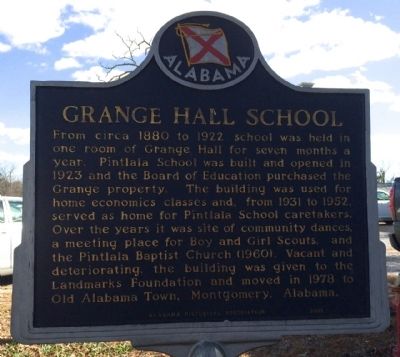
Pintlala Grange Hall
The National Grange of the Patrons of Husbandry was organized in 1867 to provide economic, social and cultural improvements for farmers and their families. Pintlala's Grange Hall was erected circa . . . — — Map (db m71433) HM
Michigan State Grange Organized in 1873, the Michigan State Grange of the Order of Patrons of Husbandry held its first annual meeting in January 1874 at Allen’s Hall, which once stood on this site. The Michigan Grange grew rapidly with over six . . . — — Map (db m190215) HM
One of the
Seven Founders of the National Grange
Patrons of Husbandry
Located near his burial place by
Steuben Co. Pomona Grange and
the New York State Grange — — Map (db m154149) HM
The National Grange of the Patrons of Husbandry was organized in Washington, D.C. in 1867. During the 1870's, it was the major voice of the American farmer and its social, educational, and fraternal activities brightened farm life. "Granger Laws", . . . — — Map (db m77761) HM
Pennsylvania's first Grange, officially organized March 4, 1871, two and a half years before organization of the Pennsylvania State Grange on Sept. 18, 1873. The National Grange (order of Patrons of Husbandry) had been established in 1867. . . . — — Map (db m43510) HM
Oliver Hudson Kelley organized National Grange, Patrons of Husbandry in Washington D.C., December 4, 1867. The Wisconsin State Grange was organized October 24, 1872 by National Deputy J. C. Abbott.
South Greenville Grange No. 225 was organized by . . . — — Map (db m3716) HM
Un patrimoine à conserver
Dans le langage courant du XIXe siècle, on l'appelait aussi « hangar à grains ». L'état actuel des recherches historiques ne permet pas d'établir avec précision le moment de la construction de la . . . — — Map (db m129008) HM
The New Home of the Hamilton-Grange.
Alexander Hamilton’s house, named “The Grange” after his family’s ancestral home in Scotland, was moved from its original site on W. 143rd Street to 287 Convent Avenue in 1889. Studies have been done to . . . — — Map (db m221430) HM
The Grange is believed to be the only home that Alexander Hamilton (1755-1804) ever owned. By the time he bought the land and built the Grange, he had already fought in the American Revolution, helped draft the Constitution and get it ratified . . . — — Map (db m209973) HM
In front of the Grange, Hamilton requested in his own words:
2. The Garden,er after making these out and making a beginning by way of example, will apply himself to planting of Raspberries in the orchard. He will go to Mr. Delafield for a . . . — — Map (db m209969) HM
One of the many impressive features of the Grange would have been the extensive gardens that surrounded it. Hamilton's gardens would have had many exotic plants that he had received from his close friend, Dr. Hosack, founder of the Elgin Botanic . . . — — Map (db m209970) HM
Along the western edge of what is now the Grange Insurance Audubon Center stands a string of old trees,
planted during the days of industrial use on the site. Long before the first spade of dirt was turned to build it,
the Center’s first . . . — — Map (db m209581) HM
[west side]
Minnehaha Grange No. 398 was organized on December 12, 1873. Its members came from Edina Mills, Richfield Mills, St. Louis Park and the surrounding area.
At first, the Grange met in the homes of its members. Then in . . . — — Map (db m55450) HM
Patterson
Grange No. 939
(Original Charter Patterson Grange No. 237)
1874
The country was on the brink of a depression, and the power of the railroads dominated the post Civil War economy when farmers from the Midwest and the . . . — — Map (db m24811) HM
This Park is located on the former site of the Clapp Family Barns. Note the remnants of the barn foundation around this sign. The barn complex, shown here, is in front of the old bridge whose abutment remains behind the Cenotaph.
Johnston Clapp . . . — — Map (db m110356) HM
Construite en 1882 par l'entrepreneur Alexander Solomon Walbridge, cette grange-étable est formée de douze murs pignons disposés autour d'un espace central. Le bâtiment comporte deux niveaux: un premier qui servait d'étable et un second, divisé en . . . — — Map (db m77846) HM
Français: En 1887, le sénateur Owens achète une bonne partie de la Seigneurie dont avait hérité la famille Bourassa lors du décès du seigneur Papineau. Owens, élu à trois reprises comme député conservateur du comté d'Argenteuil, . . . — — Map (db m151437) HM
Southover was one of the earliest suburbs of Lewes. The Priory was built here on low land between the River Ouse and the Winterbourne stream. King Henry VIII ordered the Priory to be destroyed in 1537-8. Some of the Caen Stone from the Priory . . . — — Map (db m129710) HM
The Danville Grange was a farmers' association and the hub of the community in the late 1800's and early 1900's. The Grange was instrumental in bringing many improvements to the valley over the years, such as San Ramon Valley High School, a public . . . — — Map (db m200171) HM
Original Marker - Missing
First Replacement Marker - See Photo #2
Pilot Hill Grange No.1, of 29 charter members: Master, F. D. Brown; Secretary, A. J. Bayley; was organized August 10, 1870. The Grange Hall, dedicated at this site . . . — — Map (db m11607) HM
Organized March 1874
Dedicated October 1882
Presented by Native Daughters of the Golden West
San Juan Parol #315
Rededicated 5-15-98 — — Map (db m2033) HM
The township of La Grange, French for "The Barn," was established in 1852 near the Tuolumne River. By 1853 French, Chinese, Mexicans, Spanish and Americans were here to mine gold, farm and ranch. About 5,000 people lived in the area. In 1854 . . . — — Map (db m94797) HM
This area has seen four phases of mining – placer, tunneling, hydraulic, and dredging. This bucket, one of a chain of 100, holds 12 c.f. and is from one of the worlds largest dredges. The Tuolumne Gold Dredging Co. started operation of the . . . — — Map (db m94799) HM
French settlers originally established the community of French Bar along the Tuolumne River in 1850. After the destructive floods of 1851-52, citizens of French Bar relocated one mile upstream above the flood plain. Renamed La Grange, the new town . . . — — Map (db m42578) HM
In this stand of eucalyptus trees lie the remains of the La Grange Gold Dredge Co. Camp. Here unmarried miners lived in a small community while they operated huge dredging machines near and on the Tuolumne River. The camp was abandoned in 1951 when . . . — — Map (db m46325) HM
The original saloon on this site burned on January 13, 1897 as a result of a fire in the adjacent Coulter Hotel. The saloon owner Louis Levaggi, erected the present building the same year for 13,000. It was known as the “Metropolitan”. . . . — — Map (db m42575) HM
This building, circa 1875, replaced the Branch District School that was built of rough lumber in 1855. Typical of the era, it is one room with handmade furnishings, porch and bell tower. A native of Iowa, C. C. Wright came here and began teaching in . . . — — Map (db m42562) HM
This mine was originally known as the Oregon Mountain group of claims, first operated about 1862. In 1892 the mine was purchased by the La Grange Hydraulic Gold Mining Company which brought water from Stuart's Fork through 29 miles of ditch tunnels . . . — — Map (db m32635) HM
The National Grange of the Order of the Patrons of Husbandry is a fraternal organization that encourages families to band together to promote the economic and political well-being of the community and agriculture and was founded in 1867. Loma Rica . . . — — Map (db m93917) HM
1941 1945
Honor Roll
Of Those Who Went From
Huntington
To Serve Their Country
Eli J. Baldwin • Robert L. Baldwin • Margarte E. Bassett • Royal O. Birdseye • Stanley R. Block • Howard R. Bonnell • James L. Burkle • George . . . — — Map (db m25376) HM
Constitutional Oak
Presented To
Francis M. Charter
Delegate From Ellington
At The 1902 Connecticut
Constitutional Convention
Erected By
Grange No. 46 P. of H.
1967 — — Map (db m111902) HM
Near this site The National Grange of the Patrons of Husbandry was organized on December 4, 1867 in the office of the Superintendent of the Propagating Gardens, Department of Agriculture. The founders of the Grange were:
Oliver H. Kelley, John . . . — — Map (db m47448) HM
Grangeville owes its origin to members of the Charity Grange #15, Patrons of Husbandry, organized in Mount Idaho in 1874. John M. Crooks, owner of a 600-acre ranch on Three Mile Creek, gave the Grangers land for a hall, an additional five acres, and . . . — — Map (db m141247) HM
This memorial stands here in commemoration of the many men and women from La Grange Park that have honorably served in the united states armed forces. These members of the military will never be forgotten for their courage, bravery, and interminable . . . — — Map (db m245388) HM
Memorial Park
Dedicated july 4, 1990
to honor all who
distinguished themselves
by serving in the armed
forces of the United
States of America — — Map (db m245390) HM
Built 1878 by the Grange. Used ever since for public meetings. Kentucky's first farm cooperative, the Church Hill Grange operated a livestock market here. Leading this pioneer cooperative were two Christian County farmers, Winston J. Davie, first . . . — — Map (db m158702) HM
Built circa 1868-70, this bridge is a single 86 ft. span and a good example of Theodore Burr’s truss employing multiple king posts. The yellow pine timbers have double-shouldered braces. Abutments are of “red stone”; corrugated sheet . . . — — Map (db m146743) HM
Buddy Pepper (1922-1993) a pianist, songwriter,
and actor during Hollywood's “Golden Age,” lived in
this house from his birth through 1932. He is best
remembered as a writer of the most popular song of
1953, “Vaya Con Dios,” which was recorded . . . — — Map (db m223377) HM
From its organization in 1900, through several decades, the social life in Jonesboro revolved around Grange meetings, public suppers and other types of Grange sponsored entertainment.
The custom of serving a public dinner on Town Meeting day was . . . — — Map (db m183787) HM
Internments dating from 1817 Plaque erected 1965 by Glade Valley Grange with cooperation of Methodist Church Walkersville, Maryland — — Map (db m8649) HM
Memorial
To those who served in the
World War
Presented to the Town of Brewster by
Brewster Grange 1919
Roland E Allen • Winthrop N Bassett • Ernest H Black • Allen S Bragg ☆ Herbert A Cahoon • Ernest E Chase • . . . — — Map (db m159811) WM
"And the leaves of the trees were for the healing of the nations" Rev. 22-2
This Grove is dedicated to the memory of the Timberland Grange pioneers of Eaton County.
To the boys who answered their country's call.
To the study of trees . . . — — Map (db m216459) WM
On this plot of ground was erected The First Schoolhouse in Vermontville in 1838.
It was used until a date in the early fifties, and was also occupied for church purposes from 1838 - 1844. — — Map (db m191599) HM
This memorial erected by Cherry Center Grange No. 1850 in honor of the boys and girls of Peninsula Town, who served in World Wars One and Two.
World War One – Frank Edgecomb
World War Two – Carl Brimmer
World War One, April 3 . . . — — Map (db m234756) WM
Dedicated to the memory of
Lenawee County men who gave their lives
for liberty and justice in the World War.
Claud T. Annis •
Harold Bachman •
Lloyd C. Bailey •
Ward B. Baughey •
Oliver M. Biggs •
Edward E. Biskupski •
Orvel V. . . . — — Map (db m182918) WM
(Obverse Side)
Hamilton Grange Hall
Local farmers organized Hamilton Grange No. 355 in 1874 and built this hall the following year. Lacking a town center, area residents congregated at the hall, which hosted elections and . . . — — Map (db m68413) HM
All Gave Some
Some Gave All
All veterans are honored and remembered by the
Windom Veterans of Foreign Wars Post #3844
Granite monument:
La Grange Post No. 79.
61 G.A.R. 65
Women's Relief Corps
61 No. 36. . . . — — Map (db m234289) WM
This bold bluff was a landmark for French explorers who named it Mt. La Grange for its resemblance to a large barn.
Some 10,000 years ago meltwater from the glaciers carved a deep channel in this area. Barn Bluff became an island in the . . . — — Map (db m24982) HM
The National Grange of the Order of Patrons of Husbandry was founded in Washington, D.C. on December 4, 1867. This date marks the birth of organized agriculture on American soil. Oliver Hudson Kelley first advanced the idea of a farm fraternity. As . . . — — Map (db m69902) HM
This well, 800 feet deep, was drilled in 1887 in search for fuel to fire large local steel rolling mill. Its bottled waters were famous in early 1900's, and shipped commercially pause to refresh.
"Know therefore this day, and . . . — — Map (db m150199) HM
English:
La Rue des Granges ("Barn Street" or Third Street), farthest from the river, formed the western boundary of the town. It had many small homes of tradesmen and laborers built along its east side, while the west side had . . . — — Map (db m151508) HM
This boulder stands near the site of the Great Indian Mound, leveled about 1870, which gave the city of St. Louis the name "Mound City" — — Map (db m139362) HM
Chartered June 30, 1896
Charter surrendered 1988
Original building built in 1898 on land owned by H.K. Wright. Grange founded for purpose of cooperative buying to lower costs for farmers. — — Map (db m47943) HM
Bethlehem Grange Hall 137
has been placed on the National Register of Historic Places by the United States Department of the Interior 1874 — — Map (db m245667) HM
Leon Grange has been placed on the National Register of Historic Places in 2014 by the United States Department of the Interior — — Map (db m133013) HM
Since and prior to its incorporation in 1788, Clermont has played a significant role in the history of America. Clermont’s history includes: home of Robert R. Livingston, negotiator of Louisiana Purchase and a drafter of the Declaration of . . . — — Map (db m136305) HM
Pawling Grange founded 1897. Hall built by Grange members in 1946 as meeting place and community center. Sold to Town of Pawling in 1962. — — Map (db m24658) HM
Tree With Bank Account Nichols Elm Stopping place for stage coaches, Indian trail and survey marker. Saved in 1928 when route 39 was built. Preserved through funds collected by citizens of Collins Center. On February 7, 1964, the 145 year . . . — — Map (db m104149) HM
Our Irondequoit melon was developed here on the Wm. Sutton farm. Its seed was first sold 1899. Very famous for its taste. Wiped out by blight 1940s. — — Map (db m90142) HM
1757 * A.B., A.M., L.L.D. * 1804
Statesman Soldier * Administrator * Lawyer
Captain Lt. Col. Staff of General Washington Major General Member of Congress Member of New York Legislature Delegate to the Constitutional Convention First Secretary of . . . — — Map (db m221900) HM
Site of first religious society
of Borodino Church c. 1833
Spafford Town Hall 1870
Borodino Grange #1272 1912-1997
Spafford Area Historical Society 1997 — — Map (db m108495) HM
Statue Inscription:
1776 1812 1861 1898
Front Plaque
In Honor And Memory of
the Boys Of Berlin Who Served
In World Wars I And II
World War I
Killed in Action
Crandall, Jerry •
Hull, Eugene •
Mosher, . . . — — Map (db m148282) WM
Home, Erected 1784
- Of -
William North
Born 1755 Died 1836
—————————
Soldier Throughout The
Revolution
Aide De Camp To Baron Steuben
Adjutant General Of The Provisional . . . — — Map (db m27494) HM
This 12-acre site was set aside by Islip Town in 1974 as a repository for 19th century structures that were threatened with demolition. Islip Town garnered the support of community groups to create a rural, pre-Civil War village with the structures . . . — — Map (db m123417) HM
Built mid 18th Century by
Higbie Family. Originally
named, the Higbie House.
Enlarged 19th Century. LI's
oldest continuing hostelry. — — Map (db m108704) HM
To honor those of the Town of Dryden who served their country in the 2nd World War with the Allied Nations for world freedom.
C.E. Mead · E.A. Chaffee · E.S. Youmans · R.J. McKeon · C.A. Root · R.H. Hoose · R.W. Martin · C.L. Royce · G. . . . — — Map (db m243214) WM
Council Oak Of the three things for which the site is historically important, only one survives - the famous Council Oak. Given the power of speech, the great tree could tell a stirring story of council meetings, torture of war prisoners, and . . . — — Map (db m100804) HM
This site(approximately 6 acres) contains 12 low mounds which each averaged 3 foot high and 35 feet wide. They contain adult, children, and animal remains and cremains, altars, and personal belongings of pre-historic mound building cultures from the . . . — — Map (db m101218) HM
Dedicated to the Honor and Sacrifice of our Men and Women Who served our Country in times of War
The erection of this monument made possible by the gifts of the citizens of the community, the assistance of the Huntington Grange, the efforts of . . . — — Map (db m38829) HM
In Memoriam
World War II
Lt. Herbert Gill
Navy Fighter Pilot
Died - Dec. 4, 1943
Sgt. Paul Bennett
486 QM REF. Co. M.
Died - Dec. 6, 1945
P.F.C. Fred Staedtler, Jr.
Co. M., 145 Inf., 37 Div.
Died - Mar. 6, 1945
Bert . . . — — Map (db m44883) WM
On December 17, 1887, Charles Crocker Drove The Golden Spike In The Rail Yard Just South Of This Point; Connecting The Oregon & California Tracks From The North With Those Of The California & Oregon, Now The Southern Pacific, From the South. This . . . — — Map (db m145727) HM
The Fort Rock Grange was organized in 1930 during the great
depression, a time of hardship, drought, and struggle for those living
in the Fort Rock Valley. There were 17 charter members, whose
names hang on the north wall of the main hall. . . . — — Map (db m189155) HM
Dedicated to Major General Nathanael Greene Brigadier General James Mirchell Varnum Colonel Christopher Greene Colonel Israel Angell and to other officers and men of 1st and 2nd Rhode Island Regiments encamped at Valley Forge in 1777-1778. - Let . . . — — Map (db m28897) HM
Erected - circa 1849
by
Providence Lodge No. 345 I.O.O.F. 1865
Warren Lodge No. 310 F.&A.M. 1865-1913
Keystone Grange No. 2 P. of H. 1913
Organized March 20, 1873
in
Upper-Providence Twp, Penna.
2nd Grange to be organized in . . . — — Map (db m21471) HM
Legendary football player, nicknamed " The Galloping Ghost," born in Forksville. Member, College Football Hall of Fame . Career began at Wheaton (Ill.) High School; scored 75 touchdowns. Played 1923-25 for the University of Illinois; an All - . . . — — Map (db m90013) HM
Veterans of Ginger Hill
☆ ☆ ☆
A community that honors its veterans is
a community committed to the preservation of a freedom won by the sacrifice of life itself.
This monument is dedicated to the valiant forces . . . — — Map (db m206655) WM
The Donalds Grange No. 497 is significant for both its architecture and its contribution to the social development of the community and Abbeville County. For these reasons, Donalds Grange No. 497, Patrons of Husbandry, was entered into the . . . — — Map (db m12112) HM
This old cemetery marks the site of the Bush River Meeting House. Settled by Quakers in the 1760s, it was a monthly meeting (1770-1822) and a quarterly meeting with jurisdiction over all meetings in South Carolina and Georgia from 1791 to 1808. . . . — — Map (db m13288) HM
Settled in 1819 on the site of an Indian trading post, it was named for General La Fayette's ancestral home in France. He visited La Grange in 1824 and called it the "Beautiful Village." Its location on a bluff made it a natural military post; . . . — — Map (db m62007) HM
This depot was completed in November 1897 by the M-K-T Railroad. It replaced the earlier depot that was on this site from 1887 until it burned in March 1897. The depot now houses the La Grange Depot Museum. — — Map (db m195093) HM
The Dawson Expedition
Under this historic oak on September 15, 1842, Capt. Nicholas Mosby Dawson organized his company of Fayette County mounted volunteers, who rushed to reinforce Col. Matthew Caldwell, after San Antonio was captured by . . . — — Map (db m53231) HM
Nolands River was an early Johnson County community, established in the late 1850s. A local club of the Grange, a farmers' fraternal organization, organized here in 1874, and built a two story meeting hall called "Grange Hall" that also housed a . . . — — Map (db m194382) HM
Built in 1822 by William Winfree, this Federal-style house was named for the large stand of magnolia trees in the front yard. It was originally surrounded by a 600-acre farm. A nearby tavern provided lodging for persons with business at the . . . — — Map (db m19487) HM
This building
was built about 1875
for a Grange Hall
It became the first federal
court north of Seattle, the
district court for Whatcom
County, and the first court
house for Skagit County.
Later it became at various
times...a school . . . — — Map (db m177795) HM
Commemorating the establishing
of Camp Washington
by Governor Isaac I. Stevens
on the site
in front of this monument
where he and Gen'l then
Captain George B McClellan
and their military
and engineering forces met
and camped from
October . . . — — Map (db m45328) HM
348 entries matched your criteria. The first 100 are listed above. Next 100 ⊳
* Inflectional forms of words are their plurals, singulars, and possessives as well as gramatical tenses and similar variations.