80 entries match your criteria.
Sons of Utah Pioneers Historical Markers
By Bill Kirchner, September 28, 2018
The Historic Dixie-Long Valley, Utah Pioneer Trail Marker
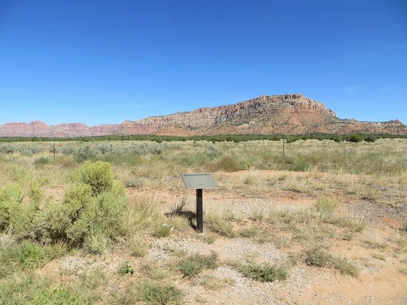
| 1 ► Arizona, Coconino County, Kaibab — 119 — The Historic Dixie-Long Valley, Utah Pioneer Trail — |
| On Arizona Route 389 at Cane Beds road, on the right when traveling north on State Route 389. | |||
| 2 ► Arizona, Maricopa County, Phoenix, Central City — First Latter-day Saint Chapel in Phoenix — |
| Near North 6th Street near East Monroe Street. | |||
| 3 ► California, San Bernardino County, Crestline — 96 — Mormon Lumber Road — |
| Near Rim of the World Highway (California Route 18) 0.3 miles west of Highway 138, on the right when traveling west. | |||
| 4 ► Idaho, Bingham County, Shelley — 128 — Covered Wagon — |
| Near East 1275 North. | |||
| 5 ► Idaho, Bingham County, Shelley — 152 — Pioneer Cabin — |
| Near East 1275 North. | |||
| 6 ► Idaho, Bingham County, Shelley — 162 — Pioneer School Bus Replica — |
| Near East 1275 North. | |||
| 7 ► Idaho, Bingham County, Shelley — 127 — Sheepcamp Wagon — |
| Near East 1275 North. | |||
| 8 ► Idaho, Bonneville County, Idaho Falls — 151 — Joseph Allen Taylor (1871-1945) & Chet Taylor (1893-1964) — Innovative Farmers — |
| On East 97th South near South 15th East, on the right when traveling west. | |||
| 9 ► Idaho, Bonneville County, Idaho Falls — 30 — The Idaho Falls LDS Hospital and School of Nursing — |
| On Riverside Drive at Memorial Drive, on the right when traveling south on Riverside Drive. | |||
| 10 ► Idaho, Madison County, Rexburg — 161 — Rexburg Public Square — |
| On West 2nd South near South 3rd West, on the right when traveling west. | |||
| 11 ► Idaho, Madison County, Rexburg — Rexburg Tabernacle Centennial — 1912-2012 — |
| On North Center Street. | |||
| 12 ► Nevada, Douglas County, Genoa — 36 — Mormon Station - Genoa — |
| Near Jacks Valley Road/Main Street (Nevada Route 206) near Genoa Lane. | |||
| 13 ► Utah, Box Elder County, Brigham City — 18 — Bushnell Hospital/Intermountain Indian School — Brigham City Historic Tour — |
| On East 700 South at S 400 E, on the right when traveling east on East 700 South. | |||
| 14 ► Utah, Box Elder County, Brigham City — 148 — Historic Brigham City Relief Society Granary — |
| On East 100 North at North 400 East, on the right when traveling east on East 100 North. | |||
| 15 ► Utah, Box Elder County, Brigham City — Lorenzo Snow Burial Site — |
| On East 300 South on East 300 South. | |||
| 16 ► Utah, Box Elder County, Brigham City — 25 — Pioneer Care Center — |
| On South 200 West, on the left when traveling south. | |||
| 17 ► Utah, Box Elder County, Brigham City — 1 — The Davis Fort-Built 1851 — Brigham City Historic Tour — |
| On 400 West 700 North at 400 W 700 N, on the right when traveling east on 400 West 700 North. | |||
| 18 ► Utah, Box Elder County, Collingston — Hampton's Bear River Crossing — |
| On Bigger Road near West 15200 North. | |||
| 19 ► Utah, Davis County, Bountiful — 31 — Original Gristmill Stones — |
| On Orchard Drive at Mill Street, on the right when traveling north on Orchard Drive. | |||
| 20 ► Utah, Iron County, Cedar City — Ellen (Nellie) Purcell Unthank — |
| On West 200 South, 0.1 miles west of South 300 West, on the right when traveling west. | |||
| 21 ► Utah, Iron County, Parowan — John C. Freemont Memorial — |
| On Main Street at 100 South, on the right when traveling north on Main Street. | |||
| 22 ► Utah, Iron County, Parowan — Parowan Adobe Fort — |
| On West 200 South at 200 West and 200 South, on the right when traveling north on West 200 South. | |||
| 23 ► Utah, Kane County, Kanab — 228 — Honeymoon Trail — |
| Near U.S. 89 at milepost 49. | |||
| 24 ► Utah, Kane County, Kanab — Israel and Charlotte Cox Heaton — |
| On South 100 East (U.S. 89) at East 300 South, on the left when traveling south on South 100 East. | |||
| 25 ► Utah, Kane County, Mount Carmel Junction — 120 — The Historic Dixie-Long Valley, Utah Pioneer Trail — |
| On U.S. 89, 0.6 miles south of Utah Route 9, on the left when traveling south. | |||
| 26 ► Utah, Salt Lake County, Magna — 28 — Early Magna Settlements — |
| On 8400 West (Utah Route 111) at 4100 South, on the right when traveling north on 8400 West. | |||
| 27 ► Utah, Salt Lake County, Murray — 1 — Murray Smelting — |
| Near 5300 South, on the right when traveling west. | |||
| 28 ► Utah, Salt Lake County, Riverton — 7 — Early Riverton and the Magnificent Dome Church — |
| On 1500 West, on the right when traveling north. | |||
| 29 ► Utah, Salt Lake County, Salt Lake City — 16 — Legacy of the Black Pioneer — |
| On Evergreen Avenue (3425 South), on the right when traveling east. | |||
| 30 ► Utah, Salt Lake County, Salt Lake City, Canyon Rim — 75 — Dudler's Inn — |
| 31 ► Utah, Salt Lake County, Salt Lake City, Canyon Rim — 80 — Dudler's Wine Cellar — |
| 32 ► Utah, Salt Lake County, Salt Lake City, Canyon Rim — 77 — Sandstone Wall & Aquaduct — |
| 33 ► Utah, Salt Lake County, Salt Lake City, Capitol Hill — Daniel Cowan Jackling — |
| Near Columbus Street. | |||
| 34 ► Utah, Salt Lake County, Salt Lake City, Rio Grande — Pioneer Telegraph Office — |
| On Main Street north of 100 South, on the right when traveling north. | |||
| 35 ► Utah, Salt Lake County, Salt Lake City, Rio Grande — The Pony Express — |
| Near South Main Street north of Local Road 200S, on the right when traveling north. | |||
| 36 ► Utah, Salt Lake County, Salt Lake City, Sugar House — 39 — Jordan & Salt Lake City Canal — |
| On E 2100 South, on the right when traveling east. | |||
| 37 ► Utah, Salt Lake County, Salt Lake City, University — Sesquicentennial Mormon Trail Wagontrain — |
| Near Sunnyside Avenue. | |||
| 38 ► Utah, Salt Lake County, South Salt Lake — 98 — Carlisle Family Historical Marker — |
| Near Carlisle Park Lane, on the right when traveling south. | |||
| 39 ► Utah, Salt Lake County, Taylorsville — 117 — Millrace — 1855 — |
| Near W 5400 S near Utah Route 173. | |||
| 40 ► Utah, Salt Lake County, Taylorsville — 9 — The Old School House — |
| On 6200 South, on the right when traveling west. | |||
| 41 ► Utah, Salt Lake County, West Jordan — 35 — Salt Lake and Utah Railroad — |
| On 1825 West (State Highway 48) 0.1 miles south of 7800 South (State Highway 48), on the right when traveling south. | |||
| 42 ► Utah, Salt Lake County, West Jordan — 12 — Utah Idaho Sugar Factory — West Jordan, Utah 1916-1970 — |
| On 1825 West, 0.1 miles south of 7800 South (Utah Highway 48), on the right when traveling south. | |||
| 43 ► Utah, San Juan County, Bluff — The San Juan Mission — |
| On Navajo Twins Drive west of U.S. 191, on the right when traveling west. | |||
| 44 ► Utah, Sanpete County, Birdseye — Birdseye Marble Quarry — Heartbeat of the Canyon — |
| On U.S. 89 at Birdseye Road (Route 89), on the right when traveling south on U.S. 89. | |||
| 45 ► Utah, Sevier County, Richfield — 125 — Old Lime Kiln — |
| On Utah Route 120 at Interstate 70, on the left when traveling north on State Route 120. | |||
| 46 ► Utah, Tooele County, Rush Valley — 98 — Rush Valley Station — Pony Express 1860-61 — |
| On Pony Express Trail Road, on the left when traveling east. | |||
| 47 ► Utah, Utah County, American Fork — 171 — First Flour Mill — Early Flour Milling — |
| On East 200 North, 0.1 miles east of North Center Street, on the left when traveling east. | |||
| 48 ► Utah, Utah County, American Fork — 189 — Log Cabin Grist Mill — First Flour Mill in American Fork — |
| Near South Center Street at East 300 South. | |||
| 49 ► Utah, Utah County, Lehi — 183 — John Austin Cabin — |
| On North Center Street, on the right when traveling south. | |||
| 50 ► Utah, Utah County, Lehi — Lehi Meeting House — |
| On South 200 West south of West 100 South, on the right when traveling south. | |||
| 51 ► Utah, Utah County, Lehi — 156 — Russon & Peck Immigration to Utah — |
| On East 900 North west of North 900 West, on the right when traveling west. | |||
| 52 ► Utah, Utah County, Lehi — The History of the Lehi Sugar Factory — |
| On Mill Pond Road at Pioneer Crossing, on the right when traveling south on Mill Pond Road. | |||
| 53 ► Utah, Utah County, Pleasant Grove — 246 — Civil War Skirmish at Pleasant Grove — 12 April 1863 — |
| On South 100 East, on the right when traveling north. | |||
| 54 ► Utah, Washington County, Harrisburg — 164 — Harrisburg Historic Pioneer Cemetery — |
| On Mountain View, on the right when traveling north. | |||
| 55 ► Utah, Washington County, Hurricane — 15 — Birth of Hurricane — |
| On 200 North, in the median. | |||
| 56 ► Utah, Washington County, Hurricane — Hurricane Canal — Utah Historic Site — |
| Near West State Street. | |||
| 57 ► Utah, Washington County, Hurricane — 23-C — Hurricane City — |
| Near State Street. | |||
| 58 ► Utah, Washington County, Hurricane — 134 — Southern Exploring Company - 1849 — Parley P. Pratt — Southern Utah Expedition — |
| On North Main Street, 1.3 miles north of Utah Route 9, on the right when traveling north. | |||
| 59 ► Utah, Washington County, Hurricane — 118 — The Historic Dixie-Long Valley, Utah Pioneer Trail — |
| Near Utah Route 59, 1.2 miles east of Main Street, on the left when traveling east. | |||
| 60 ► Utah, Washington County, Hurricane — 100A — The Historic Hurricane Canal — |
| On 200 North, in the median. | |||
| 61 ► Utah, Washington County, Hurricane — 101B — The Historic Hurricane Canal — |
| Near Utah Route 59, 1.2 miles east of Main Street, on the left when traveling east. | |||
| 62 ► Utah, Washington County, Hurricane — 166 — The Town Named After a Buggy Incident — |
| Near West State Street. | |||
| 63 ► Utah, Washington County, La Verkin — 135 — Southern Exploring Company – 1849 — Parley P. Pratt — Southern Utah Expedition — |
| On Center Street, 0.6 miles west of Utah Route 9, in the median. | |||
| 64 ► Utah, Washington County, New Harmony — 159 — Snowfield Monument — "Franciscan Fathers" — |
| On Interstate 15 at milepost 33, on the right when traveling north. | |||
| 65 ► Utah, Washington County, St. George — And the Desert Shall Blossom — |
| Near St. George Boulevard. | |||
| 66 ► Utah, Washington County, St. George — Brigham Young Home — |
| On North Main Street at St. George Boulevard, on the right when traveling north on North Main Street. | |||
| 67 ► Utah, Washington County, St. George — 174 — Brigham Young's Vision — |
| Near South Convention Center Drive. | |||
| 68 ► Utah, Washington County, St. George — Dixie Academy — |
| Near St. George Boulevard. | |||
| 69 ► Utah, Washington County, St. George — Erastus Snow's Big House — |
| On North Main Street at St. George Boulevard, on the right when traveling north on North Main Street. | |||
| 70 ► Utah, Washington County, St. George — Gardeners’ Club Hall — |
| Near St. George Boulevard. | |||
| 71 ► Utah, Washington County, St. George — 176 — Jedediah Strong Smith — |
| Near South Convention Center Drive. | |||
| 72 ► Utah, Washington County, St. George — Pioneer Courthouse — |
| Near St. George Boulevard. | |||
| 73 ► Utah, Washington County, St. George — St. George Social Hall “Opera House” — |
| On St. George Boulevard. | |||
| 74 ► Utah, Washington County, St. George — St. George Tabernacle — |
| Near St. George Boulevard. | |||
| 75 ► Utah, Washington County, St. George — St. George Temple — |
| Near St. George Boulevard. | |||
| 76 ► Utah, Washington County, St. George — 175 — The Southern Exploring Company — |
| Near South Convention Center Drive. | |||
| 77 ► Utah, Washington County, St. George — The Woodward School — |
| Near St. George Boulevard. | |||
| 78 ► Utah, Washington County, St. George — 173 — Tonaquint — |
| Near South Convention Center Drive. | |||
| 79 ► Utah, Washington County, St. George — 130 — Utah Is Rich in Aviation History — |
| Near West Sir Monte Drive. | |||
| 80 ► Wyoming, Goshen County, Fort Laramie — 49 — Mormon Pioneers at Fort Laramie — |
| On East Merriam Street (U.S. 26) at Lawton Avernue on East Merriam Street. | |||