Established May 31, 1923
Through effort of Stephen T. Mather and friends
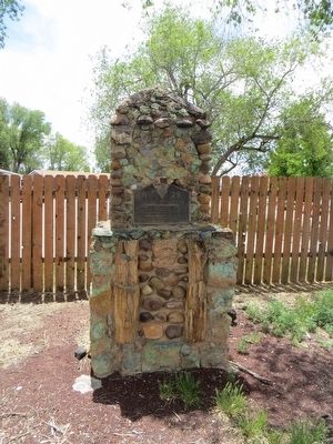
Pipe Springs
Occupied in 1863 by Dr. James M. Whitmore, who, with Robert McIntyre, was killed 4 miles S.E. Of here January 3, 1866 by Navajo and Piute . . . — — Map (db m131296) HM
March 24, 1876, Mormon colonization in Arizona began here with the establishment of Ballanger's Camp, later Brigham City, by Lot Smith, Jesse O. Ballanger, George Lake, William C. Allen and others sent from Utah by Brigham Young. They also . . . — — Map (db m96974) HM
The Mormon Battalion of the U.S. Army camped here enroute to California December 17, 1846. During the war with Mexico, on the longest infantry march of record, they were first to unfurl the flag of the United States in Tucson.
This marker . . . — — Map (db m92383) HM
Charles Jefferson Hunt served in the Mormon Battalion as Captain of Company “A” and as assistant executive officer. In its historic march from Council Bluffs, Iowa to San Diego, California, 1846 - 47. His service won the commendation of . . . — — Map (db m48986) HM
In honor of
Charles Coulson Rich
1809-1893
Pioneer builder of the west.
Major-General of the Nauvoo Legion
Alderman of the City of Nauvoo, in the time of Joseph Smith.
Pioneer of Utah, 1847.
Chairman of the first committee . . . — — Map (db m105849) HM
First habitation in this region was built by Nathaniel J. Wyeth on Snake River 14 miles west of this monument July 15, 1834 and named for Henry Hall, senior member of Wyeth's firm.
The original stockade, 80 feet square was purchased by Hudson's . . . — — Map (db m124481) HM
Honoring builders of bridges and trails and pioneers who passed this way in the development of the West.
The first wagon bridge over Snake River was erected here by James M. Taylor in 1865 replacing the ferry established on the . . . — — Map (db m152316) HM
The Battle of Bear River was fought in this vicinity January 29, 1863 Col. P.E. Connor, leading 300 California volunteers from Camp Douglas, Utah against Bannock and Shoshoni Indian guilty of hostile attacks on emigrants and settlers engaged about . . . — — Map (db m105787) HM
was built in the fall of 1810 by Captain Andrew Henry and his companions of the Missouri Fur Company, about five miles below here on the left bank of this stream (Henry's Fork of Snake River), first buildings erected by Americans in the present . . . — — Map (db m108980) HM
There are four plaques, one on each side, of this monument.)
The Indian Mission Call: Issued by Brigham Young to 27 elders of the Church of Jesus Christ of Latter-Day Saints (Mormon) at Salt Lake City, April 6 1855.
"Go into the . . . — — Map (db m123678) HM
Erected Sept. 28, 1935
In honor of the Rexburg Stake Pioneers
The founders of Rexburg, March 11, 1883
Thomas E. Ricks• Henry Flamm • Francis C. Gunnell • Fred Smith• William F. Rigby • Daniel Walters •
Thomas E. Ricks, Jr. • Lorenzo . . . — — Map (db m84344) HM
No. 70
August 21, 1937
In honor of
The Mormon Pioneers of Idaho
Builders of
North Fork Ferry
The first ferry on Henry’s Fork
of Snake River, was first operated
near this spot March 26, 1883. It
was constructed by Rexburg . . . — — Map (db m103903) HM
The Mormon Pioneer Trail from Nauvoo, Illinois to the Rocky Mountains passed here April 17, 1847. In this vicinity a military-type organization was formed with Brigham Young, Lieutenant General; Stephen Markham, Colonel; John Pack and Shadrach . . . — — Map (db m58566) HM
This Bridge is on the Mormon Pioneer Trail from Nauvoo, Illinois, to the Rocky Mountains. Driven from their homes by mobs, many of the dispossessed Mormon people crossed the Mississippi River on the ice in February, 1846. From these refugees five . . . — — Map (db m90469) HM
Mormon pioneers enroute from winter quarters, (Omaha) to the valley of the Great Salt Lake, under the leadership of Brigham Young, camped near here May 11, 1847. While in this vicinity William Clayton made a distance-measuring device which when . . . — — Map (db m180898) HM
Brigham Young and his company of Mormon Pioneers camped about 1,000 feet west of this point May 24, 1847. They were enroute from Nauvoo, Illinois and Winter Quarters, Nebraska to the Valley of the Great Salt Lake, which they reached July 24, 1847. . . . — — Map (db m79387) HM
The Mormon Battalion
Council Bluffs, July 16, 1846
Fort Leavenworth, Aug. 2, 1846
Santa Fe, Oct. 9, 1846
San Diego, Jan 29, 1847
Erected June 16, 1940
[ Map of Mormon Battalion Route ]
The Mormon Battalion, composed . . . — — Map (db m150860) HM
Established as the post of Beaver, May 15, 1872, by the 8th U.S. Infantry, Major John D. Wilkins, commanding. The military reservation, declared May 12, 1873, comprised two and two-thirds square miles. The name was changed July 1, 1874, to Fort . . . — — Map (db m75575) HM
Hostile Indians raided a small settlement in this vicinity Oct. 27, 1866, centering their attack on the house where Mr. and Mrs. J.P. Lee, their two daughters, and eight year old son, a young Miss Hall and Joseph Lillywhite were barricaded, fighting . . . — — Map (db m75616) HM
This monument marks the S.E. corner of fort built by Anson Call and associates in 1855 under direction of President Brigham Young as protection against Indians. The fort was the most northerly outpost in Utah. It was one hundred twenty feet . . . — — Map (db m152317) HM
In commemoration of the outstanding service he rendered the intermountain west as Patriot, Pioneer, Colonizer, Church leader, and Statesman on this plot of ground Aug 19th, 1877 he delivered his last public address when he organized the Box Elder . . . — — Map (db m152538) HM
To settle a wager among the trappers who were making their first winter rendezvous in Cache Valley, Bridger floated alone in a bull boat down Bear River to its outlet to determine the river's course in the late autumn or early winter of 1824, thus . . . — — Map (db m152315) HM
To commemorate an important episode in the early history of the west and to honor the scouts and explorers of earlier days, this monument was erected. In this vicinity in the winter of 1825-26 a cache containing 75 bales of furs, mostly beaver, . . . — — Map (db m149775) HM
Known to the Indians as Willow Valley was renamed by fur trappers and traders in the winter of 1825-1826. James Bridger led the first trappers to a winter encampment near here in 1824 towards December 1825. William L. Sublette, in charge of Gen . . . — — Map (db m44438) HM
Thirty feet east of this spot was built, in the winter of 1865-1866, under the leadership of Benget P. Woolfenstein, the first community center of the Logan Fifth Ward. Consisting of but one room, 16 by 20 feet. It served, nevertheless, as church . . . — — Map (db m154443) HM
The first settlers of Logan encamped near this spot on the bank of the Little Logan early in May 1859
Heads of Families: John R Blanchard, Abraham Caldwell, Griffith Charles, Israel J. Clark, Ann Davis, William Dees, James Demino, Sidney Dibble, . . . — — Map (db m44437) HM
This marker honors the first settlers of Providence, who camped near here early in May 1859, and those who followed in the years 1860,1861,1862. Included in the groups who pioneered this section are the following families: Alder, Bowen, . . . — — Map (db m44477) HM
On this spot stood the Layton Stage Coach Station on the Utah Idaho Montana (Virginia City) trail. It was established in 1857 by Ben Holladay, and carried mail and passengers between Salt Lake and points north and west. Isaac Brown was the keeper. . . . — — Map (db m154484) HM
Established 1868 by Ebenezer Hanks and others who organized the Great Western Iron Manufacturing Co., a cooperative enterprise. Officers were E. Hanks, President, Homer Duncan, Vice President, Seth M. Blair, Secretary. 800 pounds of iron of good . . . — — Map (db m150259) HM
Paragonah was founded in 1852. Indian trouble caused abandonment a year later until 1855 when the pioneer fort was built. The site was selected and dedicated by President Brigham Young.
The fort was 105 feet square with walls 3 feet thick at the . . . — — Map (db m59617) HM
Parowan was founded January 13, 1851 by settlers from northern communities under the leadership of George A. Smith. Among the early structures were a large liberty pole and a sundial.
This marker designates the site of the community sundial . . . — — Map (db m59612) HM
On June 14, 1870 Levi Stewart, who had been called from Salt Lake County by President Brigham Young to head a group of pioneers in settling this area, brought a party with seven wagons from Pipe Springs, where they had camped temporarily, to Fort . . . — — Map (db m41252) HM
The great Mormon frontiersman and Indian missionary settled in Tooele Valley, Utah in 1850 and began peaceful negotiations with the Red Men. He was so successful that the officials of the Church of Jesus Christ of Latter-Day Saints sent him to . . . — — Map (db m41254) HM
The Rocky Mountain Fur Company, headed by Milton G. Sublette, David E. Jackson and Jedediah S. Smith, conducted a fur trading rendezvous in this vicinity in June-July, 1827, taking 130 bales of beaver furs for shipment to St. Louis by pack train. . . . — — Map (db m66970) HM
About 1800 feet due west
prominent on the overland stage and
Pony Express route 1858 to 1868.
Kept by Orrin Porter Rockwell.
This monument was constructed of the stone from the old station. — — Map (db m150035) HM
Headed by Brigham Young, the company reaching here July 23d numbered 2,587 persons, with 464 carriages & wagons, 1,028 horses & mules, and 332 oxen & cows.
A program of addresses, six brass bands, singing, athletic events, drills by six . . . — — Map (db m153210) HM
Bingham Canyon was named for Erastus Bingham and sons, Sanford and Thomas, Utah Pioneers of 1847, who in 1848 took up grazing land in this vicinity, first for private herds and later as a community enterprise. They built a small cabin at the mouth . . . — — Map (db m35228) HM
445 feet west of this monument is the site of the pioneer flour mill erected in the spring of 1848 by John Neff, 1847 Pioneer, the burrs were bought by him at winter quarters from Brigham Young at whose request they were brought to Utah. The granite . . . — — Map (db m150269) HM
This monument marks the site of Fort Herriman built in 1855 by Thomas Butterfield, Henry Herriman, Samuel Egbert, Robert Petty, and John Stocking, as protection against the Indians.
The Fort was abandoned in 1858, under instructions from . . . — — Map (db m35032) HM
Early in 1849 the Pioneers of Union settled 1½ miles South-East of here, water, grass, wood and clay were abundant, Silas Richards first Bishop and school teacher arrived November 4, 1949. In 1853-54 Union Fort was built on ten acres donated by . . . — — Map (db m150037) HM
Was erected by Robert Gardner and his sons, Archibald, Robert and William, on Warm Springs Stream, in Salt Lake City, October, 1847, where three boards were sawed. The Mill was moved to this site in 1848, producing the first commercial lumber in . . . — — Map (db m150254) HM
On 19 July 1847, scouts Orson Pratt and John Brown climbed the mountain and became the first Latter-day Saints to see the Salt Lake Valley. Due to illness, the pioneer camp had divided into three small companies. On 23 July, the last party, led by . . . — — Map (db m150080) HM
Erected about 1852. Used as the executive offices of the Territory of Utah until 1855. Headquarters of Church of Jesus Christ of Latter-day Saints from the time it was finished until 1917 when the new church office building was complete.
For a . . . — — Map (db m172051) HM
July 26, 1847, two days after the Mormon pioneers entered this valley Brigham Young and party climbed to this point and with the aid of field glasses made a careful survey of the mountains, canyons and streams. In the group were Heber C. Kimball, . . . — — Map (db m150534) HM
Latitude 40°46'04" - Longitude 111°54'00" Altitude (sidewalk) 4327.27 Ft.Fixed by Orson Pratt assisted by Henry G. Sherwood, August 3, 1847, when beginning the original survey of “Great Salt Lake City,” around the . . . — — Map (db m35007) HM
Old Folks Day was inaugurated in Salt Lake City in 1875, by Charles R. Savage, assisted by Edward Hunter, presiding Bishop of the Church of Jesus Christ of Latter-Day Saints, and George Goddard, since which time all persons seventy or more years of . . . — — Map (db m34998) HM
Erected about 1852 by President Brigham Young as the official residence of the president of the Church of Jesus Christ of Latter-day Saints and occupied by him from the time it was completed until his death in 1877.
From 1852 to 1855 it also . . . — — Map (db m172047) HM
Built by President Brigham Young and used by him as a residence from about 1855 until his death in 1877. On the lower floor were the dining room and kitchens. On the next floor were the living rooms and large parlor; and on the top floor were the . . . — — Map (db m172050) HM
In June 1875 in answer to the appeal of the Rev. Lawrence Scanlan, two Sisters of the Holy Cross, Mother M. Augusta and Sister M. Raymond, came to Salt Lake City. In August they were joined by Sisters M. Pauline, Anna, Josepha, Holy Innocents, and . . . — — Map (db m149966) HM
The Donner Party led by George and Jacob Donner and James F. Reed passed here and crossed Jordan River nearby about September 2, 1846.
This party, consisting of 81 persons, 35 of them children, was delayed 2 weeks building a road via emigration . . . — — Map (db m152455) HM
This monument marks the site of the Great Salt Lake City station of the Pony Express, St. Joseph Mo. - Sacramento Cal., inaugurated April 3, 1860. — — Map (db m200663) HM
This monument marks the site of the "Old Fort" in which the Mormon Pioneers wintered in 1847-48 and in which some of the settlers resided for several years. Brigham Young laid the foundation stones on August 10, 1847, for 4 of the 17 houses . . . — — Map (db m161604) HM
This monument marks the site of the Social Hall, the first recreation center in the intermountain west. Built by the Church of Jesus Christ of Latter-day Saints under the direction of Brigham Young. Made of plastered adobe walls with native wood . . . — — Map (db m35756) HM
Built by Brigham Young for his own children stood on this corner lot 1860-1903 This early school was directed by Eli B. Kelsey, who in soliciting additional students announced in the Deseret News, December 12, 1860, as follows:
. . . — — Map (db m35005) HM
Born June 1, 1801, at Whitingham, Vermont
Died August 29, 1877, at Salt Lake City, Utah
Brigham Young, second President of the Church of Jesus Christ of Latter-day Saints succeeded Joseph Smith, founder of the Church, who was martyred at . . . — — Map (db m62788) HM
The granite used in the construction of the Mormon Temple in Salt Lake City was quarried from a large field of huge boulders covering this area broken by nature's forces from adjacent cliffs.
The quarrying of these boulders was begun about . . . — — Map (db m44176) HM
Was Made Here
June 14, 1873
This treaty led up to the final treaty at Cedar Grove in Grass Valley July 1, 1873, ending the Black Hawk Indian War in Southern Utah.
Present at the treaty council were:
Gen. Wm. B. Pace · George Evans · Byron . . . — — Map (db m138058) HM
Under the Leadership of Brigham Young
the "Mormon" Pioneers
Exploring Their Way to the Valley of
The Great Salt Lake
Passed here July 15 to 20, 1847. Orson Pratt's advance company reached here July 15, others following at . . . — — Map (db m150075) HM
Enclosing graves (West side) of two men and a child, emigrants of the early eighteen sixties.
Original Wall erected in 1888, by Mrs. Horace (Aunt Libby) Rockwell, to shelter graves of her beloved dogs. 1. Jenny Lind, 2. Josephine Bonaparte, . . . — — Map (db m150601) HM
St. Joseph, MO. - Sacramento, Cal.
Also Overland Stage & Freight Route
1858 - 1868
This Monument Constructed by
Enrollees of U.S. Grazing Division,
C. C. C. Camp G-154, Company 2517. — — Map (db m150600) HM
detachment of the U.S. Army, the first to enter the Rocky Mountain region, consisting of two companies of artillery, 85 dragoons, 130 teamsters, herders and hostlers from Fort Leavenworth, Kansas, under the command of Col. E.J. Steptoe, reach . . . — — Map (db m149985) HM
Upper Marker:
Fairfield - Camp Floyd - Fort Crittenden
In 1855 Fairfield was settled by John Carson, William Carson, David Carson, William Beardshall and John Clegg. A rock fort 4 rods square was erected in 1856-57, this monument . . . — — Map (db m149983) HM
The pioneers of Lehi settled in this vicinity in the fall of 1850. Thirteen families located at Sulphur Springs, later Snow’s Springs, forty rods east of here where a fort was begun. Another group formed the Lott Settlement, to the southeast. Others . . . — — Map (db m149977) HM
In 1853 because of Indian troubles, Brigham Young instructed the people to build forts for protection. A two foot six inch rock wall from three to five feet high, four city blocks square, was built here.
Private homes faced the center of the . . . — — Map (db m149513) HM
The first battle between Indians and the Utah Pioneers occurred in February 1849, two miles east of this monument, near the mouth of the canyon, between the Deseret Militia and the Indians. The stream and canyon were named “Battle Creek” . . . — — Map (db m149511) HM
Fray Francisco Silvestre Velez De Escalante and Fray Francisco Atanasio Dominguez, two Catholic Priests of the Franciscan Order accompanied by their attendants
Don Juan Pedro Cisneros - Lucrecio Muniz
Don Dernardo Miera Y Pacheco - Andres . . . — — Map (db m149097) HM
This monument stands 62 feet South, 2 feet East of the center of the fort built in 1862 by William M. Wall and the pioneers of Wallsburg. 20 families lived in the fort which was 400 feet square. This valley, known to the Indians as Little Warm . . . — — Map (db m149978) HM
Built and maintained by The Church of Jesus Christ of Latter-day Saints Out of respect for those who died and were buried here and in the surrounding area following the massacre of 1857. — — Map (db m152387) HM
Established May 9, 1854, by John D. Lee, Richard Woolsey, William R. Davis and others who had founded Harmony in 1852. County seat of Washington County until 1859. Headquarters of Mormon Mission to Lamanites 1853-1854.
The fort was finally . . . — — Map (db m59470) HM
Marker on Left:
Captain James Brown
Captain James Brown, Pioneer, Soldier and one of the founders of Ogden, enlisted in the Mormon Battalion of the U. S. Army in the Mexican War, July 16, 1846, at Council Bluffs, Iowa, and was made . . . — — Map (db m149971) HM
Outstanding explorer, Trapper, Trader and devout Christian. Came to Utah with Wm. H. Ashley's expedition in 1824.
Started first successful overland journey through Utah to the pacific coast from this vicinity August 22, 1826.
Substantially . . . — — Map (db m149967) HM
Marker on Left:
Lorin Farr
Lorin Farr, Utah Pioneer of 1847, one of the founders of Ogden, established Farr's Fort in 1850, assistant in laying out the city and organized its first government. In 1851, he became the first mayor, . . . — — Map (db m149969) HM
805 feet North of this site was located the toll gate established November 15, 1860 by Lorin Farr and Isaac Goodale, builders of the first road through Ogden Canyon. From 1865 to 1882 it was operated by the Ogden Canyon Road Company with the . . . — — Map (db m149973) HM
In 1854 Ogden pioneers built a rock and mud wall a mile square along 28th Street, Wall Avenue and 21st Street. Madison Avenue was not completed because the Indians became peaceful. The eight foot wall had a six foot base, a 31 inch top and four . . . — — Map (db m81035) HM
Father De Smet became well acquainted with the region of the Great Salt Lake, and gave much valuable information to Brigham Young and the Mormon Pioneers while they were at Winter Quarters, Nebraska, in November, 1846. — — Map (db m150039) HM
In honor of
The Mormon Colonists
of the Big Horn Basin
who, under the leadership of
Abraham O. Woodruff, first camped near this site in May 1900. These pioneers, under many difficulties, established towns, notably Byron, Cowley and . . . — — Map (db m91255) HM
Captain James G. Willie’s Handcart Company of Mormon emigrants on the way to Utah, greatly exhausted by the deep snow of an early winter and suffering form lack of food and clothing, had assembled here for reorganization by relief parties from Utah, . . . — — Map (db m80154) HM
Survivors of Captain Edward Martin's Handcart Company of Mormon emigrants from England to Utah were rescued here in perishing condition about Nov. 12, 1856. Delayed in starting and hampered by inferior carts it was overtaken by an early winter. . . . — — Map (db m95487) HM
First commercial ferry on the Platte River was established 1/2 mile south of here in June 1847 by “Mormon” pioneers on their way to the valley of the Great Salt Lake. Brigham Young directed nine men to remain to operate the ferry. They . . . — — Map (db m91916) HM
On Monday evening, June 28, 1847, Brigham Young and the Mormon pioneers met James Bridger and party near this place. Both companies encamped here over night and conferred at length regarding the route and the possibility of establishing and . . . — — Map (db m47138) HM
On August 3, 1855 the Church of Jesus Christ of Latter-day Saints concluded arrangements for the purchase of Fort Bridge from Louis Vasquez, partner of James Bridger, for $3,000. Final payment was made October 18, 1858. A cobblestone wall was . . . — — Map (db m90617) HM