185 entries match your criteria. Entries 101 through 185 are listed.⊲ Previous 100
Chesapeake and Ohio (C&O) Canal Historical Markers
By Allen C. Browne, April 26, 2017
Boats Passing by Marker
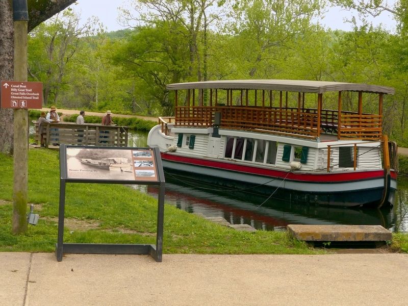
| 101 ► Maryland, Montgomery County, Potomac — Boats Passing By — Chesapeake and Ohio Canal Historical Park |
| Near MacArthur Blvd. Reported missing. | |||
| 102 ► Maryland, Montgomery County, Potomac — Creating a National Park — Chesapeake & Ohio Canal National Historical Park — National Park Service, U.S. Department of the Interior — |
| On Chesapeake and Ohio Canal Towpath south of Great Falls Road Climb. | |||
| 103 ► Maryland, Montgomery County, Potomac — Fighting Floods — |
| On Chesapeake and Ohio Canal Towpath, on the left when traveling north. | |||
| 104 ► Maryland, Montgomery County, Potomac — Great Falls of the Potomac — |
| On Falls Road at MacArthur Boulevard, on the right when traveling south on Falls Road. | |||
| 105 ► Maryland, Montgomery County, Potomac — Great Falls Tavern — Chesapeake and Ohio National Historical Park — National Park Service, U.S. Department of the Interior — |
| On C&O Canal Tow Path west of MacArthur Blvd./Great Falls Road Climb. | |||
| 106 ► Maryland, Montgomery County, Potomac — Great Falls Tavern — |
| Near Macarthur Boulevard, 1.3 miles west of Falls Road, on the left when traveling west. | |||
| 107 ► Maryland, Montgomery County, Potomac — Lockhouse 22 — Chesapeake and Ohio National Historical Park — National Park Service, U.S. Department of the Interior — |
| On Pennyfield Lock Road, on the right when traveling south. | |||
| 108 ► Maryland, Montgomery County, Potomac — Potomac River — — Chesapeake and Ohio Canal National Historical Park — — |
| Near Swains Lock Road. | |||
| 109 ► Maryland, Montgomery County, Potomac — Repairing the Breach at Anglers — |
| On Chesapeake and Ohio Canal Towpath at Angler's Footbridge, on the left when traveling west on Chesapeake and Ohio Canal Towpath. | |||
| 110 ► Maryland, Montgomery County, Potomac — Welcome to Great Falls — |
| On Macarthur Boulevard. | |||
| 111 ► Maryland, Montgomery County, Potomac, Carderock — Unexpected Benefits in the CCC — Chesapeake & Ohio National Historical Park — |
| Near Carderock, 0.3 miles south of Clara Barton Parkway, on the left when traveling west. | |||
| 112 ► Maryland, Montgomery County, Potomac, Carderock — Working Hard To Survive — CCC Creates Jobs for America's Unemployed — Chesapeake & Ohio Canal National Historical Park — |
| On Macarthur Boulevard, 0.3 miles south of Clara Barton Parkway, on the left when traveling west. | |||
| 113 ► Maryland, Montgomery County, Potomac, Great Falls — A Lift Lock — Chesapeake and Ohio Canal National Historical Park |
| On Macarthur Boulevard. Reported missing. | |||
| 114 ► Maryland, Montgomery County, Rockville — 12 — Rockville Baptist Church and Cemetery — Location: West Jefferson Street and West Montgomery Avenue — Explore Early Rockville Walking Tour — |
| On West Jefferson Street (Maryland Route 28) at South Van Buren Street, on the right when traveling west on West Jefferson Street. | |||
| 115 ► Maryland, Montgomery County, Seneca — Rowser’s Ford — 5,000 Confederate Cavalrymen Crossed — Gettysburg Campaign — |
| On Rileys Lock Road south of River Road, on the right when traveling south. | |||
| 116 ► Maryland, Montgomery County, Seneca — Seneca — Chesapeake and Ohio Canal National Historical Park — National Park Service, U.S. Department of the Interior — |
| On Riley's Lock Road. | |||
| 117 ► Maryland, Montgomery County, Seneca — Seneca Mill — |
| On Old River Road. | |||
| 118 ► Maryland, Montgomery County, Seneca — The Seneca Aqueduct |
| On Rileys Lock Road south of River Road. Reported missing. | |||
| 119 ► Maryland, Montgomery County, Seneca — Watering the Canal |
| Near Violette's Lock Road, on the right when traveling south. Reported missing. | |||
| 120 ► Maryland, Montgomery County, Silver Spring, Downtown Silver Spring — A Downtown is Born — Local Institutions — Silver Heritage Georgia Avenue — |
| On Georgia Avenue (Maryland Route 97) at Sligo Avenue, on the right when traveling north on Georgia Avenue. | |||
| 121 ► Maryland, Montgomery County, Silver Spring, Downtown Silver Spring — Finding a Niche — Early Family Businesses — Silver Heritage Georgia Avenue — |
| On Georgia Avenue (U.S. 29). | |||
| 122 ► Maryland, Montgomery County, Silver Spring, Downtown Silver Spring — Spirited Entertainment — West Side Development — Silver Spring Heritage - Georgia Avenue — |
| On Georgia Avenue (U.S. 29) south of Bonifant Street when traveling south. | |||
| 123 ► Maryland, Montgomery County, Silver Spring, Downtown Silver Spring — Springing Up — Masonic Temple — Silver Heritage Georgia Avenue — |
| On Georgia Avenue (Maryland Route 97) at Wayne Avenue on Georgia Avenue. | |||
| 124 ► Maryland, Washington County, Big Pool — Fort Frederick — A Witness to War — |
| On Fort Frederick Road south of Big Pool Road (Maryland Route 56), on the right when traveling south. | |||
| 125 ► Maryland, Washington County, Big Pool — Four Locks — Chesapeake and Ohio Canal National Historical Park — National Park Service, U.S. Department of the Interior — |
| On Four Locks Road, on the left when traveling west. | |||
| 126 ► Maryland, Washington County, Big Pool — Mule Power — Chesapeake and Ohio National Historical Park — National Park Service, U.S. Department of the Interior — |
| On Four Locks Road, on the left when traveling west. | |||
| 127 ► Maryland, Washington County, Big Spring — Four Locks — |
| 128 ► Maryland, Washington County, Clear Spring — Protecting Cultural Resources — Chesapeake and Ohio National Historical Park — National Park Service, U.S. Department of the Interior — |
| On Dam No. 5 Road, on the left when traveling west. | |||
| 129 ► Maryland, Washington County, Clear Spring — Stonewall Jackson at Dam 5 — Chesapeake and Ohio National Historical Park — National Park Service, U.S. Department of the Interior — |
| On Dam 5 Road, on the left when traveling west. | |||
| 130 ► Maryland, Washington County, Clear Spring — Vital Crossroads — Clear Spring in the Civil War — |
| On Cumberland Street (U.S. 40) at North Mill Street (Maryland Route 68), on the right when traveling west on Cumberland Street. | |||
| 131 ► Maryland, Washington County, Hagerstown — Bench Mark "A" — |
| On Summit Avenue, on the right when traveling north. | |||
| 132 ► Maryland, Washington County, Hagerstown — Our Journey Transports Us Through Time — |
| 133 ► Maryland, Washington County, Hancock — A panorama of the original Maryland-West Virginia river bridge / "The Light House" — |
| On East Church Street near West Main Street (Maryland Route 144), on the right when traveling south. | |||
| 134 ► Maryland, Washington County, Hancock — A Work of Art — Chesapeake and Ohio Canal National Historical Park — |
| Near East Main Street at Ford Drive, on the right when traveling east. | |||
| 135 ► Maryland, Washington County, Hancock — Discover the Trail — Western Maryland Rail Trail — |
| Near Canal Street east of Taney Street South, on the left when traveling east. | |||
| 136 ► Maryland, Washington County, Hancock — Hancock — Chesapeake and Ohio Canal National Historic Park — National Park Service, U.S. Department of the Interior — |
| Near Canal Street at South Pennsylvania Avenue, on the left when traveling west. | |||
| 137 ► Maryland, Washington County, Hancock — Hancock in the Canal Era — Chesapeake and Ohio Canal National Historical Park — |
| Near Canal Street at North Church Street. | |||
| 138 ► Maryland, Washington County, Hancock — Round Top Cement Mill — Chesapeake and Ohio Canal National Historic Park — |
| Near Canal Street, 3.1 miles west of South Pennsylvania Avenue. | |||
| 139 ► Maryland, Washington County, Hancock — Round Top Geology — Chesapeake and Ohio Canal National Historical Park — |
| Near Canal Street, 3.1 miles west of South Pennsylvania Avenue. | |||
| 140 ► Maryland, Washington County, Hancock — St. Thomas Episcopal Church — Unintended Target |
| On Church Street south of Main Street (Maryland Route 144), on the left when traveling south. Reported permanently removed. | |||
| 141 ► Maryland, Washington County, Hancock — The C&O Canal: Serving the Potomac Valley — Chesapeake and Ohio Canal National Historical Park — |
| Near Canal Street at North Church Street. | |||
| 142 ► Maryland, Washington County, Hancock — The Historic Bowles House — Hancock Visitor Center — Chesapeake and Ohio Canal National Historical Park — |
| Near East Main Street (Maryland Route 144) at Ford Drive, on the right when traveling east. | |||
| 143 ► Maryland, Washington County, Knoxville — Lock 34, Harpers Ferry — Chesapeake and Ohio Canal National Historical Park — National Park Service, U.S. Department of the Interior |
| On Harpers Ferry Road, on the right when traveling south. Reported permanently removed. | |||
| 144 ► Maryland, Washington County, Sandy Hook — Lift Lock 33 — Chesapeake and Ohio National Historical Park — National Park Service, U.S. Department of the Interior — |
| On Sandy Hook Road, on the right when traveling east. | |||
| 145 ► Maryland, Washington County, Sharpsburg — A View into the Past — |
| On Shepherdstown Pike (State Highway 34), on the right when traveling north. | |||
| 146 ► Maryland, Washington County, Sharpsburg — Ferry Hill — Farm, Ferry and Freedom — |
| On Shepherdstown Pike (Maryland Route 34). | |||
| 147 ► Maryland, Washington County, Sharpsburg — Ferry Hill Place — Chesapeake and Ohio Canal National Historical Park — National Park Service, U.S. Department of the Interior — |
| Near Shepherdstown Pike (Maryland Route 34) when traveling south. | |||
| 148 ► Maryland, Washington County, Sharpsburg — Packhorse Ford — |
| Near Canal Road, on the right when traveling east. | |||
| 149 ► Maryland, Washington County, Sharpsburg — Shepherdstown — A Town on the Crossroads of History — |
| On Canal Road, on the right when traveling south. | |||
| 150 ► Maryland, Washington County, Williamsport — At All Hours — Chesapeake and Ohio Canal National Historical Park — National Park Service, U.S. Department of the Interior — |
| Near Main Street south of Canal Street, on the left when traveling south. | |||
| 151 ► Maryland, Washington County, Williamsport — C & O Canal Aqueduct — Stonewall Changes Course — Antietam Campaign 1862 — |
| 152 ► Maryland, Washington County, Williamsport — Conococheague Creek Aqueduct — Chesapeake an Ohio Canal National Historical Park — National Park Service, U.S. Department of the Interior |
| On West Potomac Street. Reported missing. | |||
| 153 ► Maryland, Washington County, Williamsport — Creating a National Park — Chesapeake and Ohio Canal National Historical Park |
| On U.S. 11. Reported missing. | |||
| 154 ► Maryland, Washington County, Williamsport — Springfield Farm — (Circa 1755) — |
| On E. Potomac Street (U.S. 11) at Springfield Lane, on the right when traveling east on E. Potomac Street. | |||
| 155 ► Maryland, Washington County, Williamsport — Williamsport — A Town on the Edge of History — Chesapeake and Ohio Canal National Historical Park |
| On U.S. 11. Reported missing. | |||
| 156 ► New York, Onondaga County, Syracuse, Eastside — James Geddes — |
| 157 ► Virginia, Alexandria, Old Town North — Alexandria Canal (1843 - 1886) — Lock #3 — |
| On North Royal Street north of Montgomery Street, on the right when traveling north. | |||
| 158 ► Virginia, Alexandria, Old Town North — Alexandria Canal Turning Basin — (1843-1886) — Alexandria Heritage Trail, City of Alexandria, Virginia — |
| On Montgomery Street just west of North Pitt Street, on the right when traveling west. | |||
| 159 ► Virginia, Alexandria, Old Town North — Remnants of Lock #4 of the Alexandria Canal — |
| On North Pitt Street north of Montgomery Street, on the right when traveling north. | |||
| 160 ► Virginia, Arlington County, Arlington, North Rosslyn — Rosslyn — |
| On Langston Boulevard (U.S. 29) at North Fort Myer Drive, on the left when traveling east on Langston Boulevard. | |||
| 161 ► Virginia, Arlington County, Arlington, Woodmont — Fort C.F. Smith — Defending the Capital |
| Near 24th Street North. Reported permanently removed. | |||
| 162 ► Virginia, Arlington County, Arlington, Woodmont — Fort C.F. Smith — Mr. Lincoln’s Forts — Defenses of Washington, 1861-1865 |
| Near 24th Street North. Reported permanently removed. | |||
| 163 ► Virginia, Arlington County, Arlington, Woodmont — Fort C.F. Smith — Defending the Capital — Defenses of Washington, 1863-1865 — |
| Near 24th Street North, 0.1 miles east of 23rd Road North, on the left when traveling east. | |||
| 164 ► Virginia, Arlington County, Arlington, Woodmont — Fort C.F. Smith — Mr. Lincoln's Forts — Defenses of Washington, 1863-1865 — |
| On 24th Street North, 0.1 miles west of 23rd Road North, on the right when traveling west. | |||
| 165 ► Virginia, Clarke County, Berryville — King Wheat, Millwood & The Burwell-Morgan Mill — |
| On East Main Street (Virginia Route 7B) 0.1 miles west of Page Street, on the right when traveling west. | |||
| 166 ► Virginia, Loudoun County, Lansdowne — Elizabeth Mills Riverfront Park — |
| On Heron Way near Squirrel Ridge, on the right when traveling east. | |||
| 167 ► Virginia, Loudoun County, Leesburg — Additional Area Civil War Sites — |
| On Ball’s Bluff Road, on the right when traveling east. | |||
| 168 ► Virginia, Loudoun County, Leesburg — Edwards Ferry — An Eighty-Mile-Long Column — Gettysburg Campaign — |
| Near Riverpoint Drive, on the left when traveling east. | |||
| 169 ► Virginia, Loudoun County, Waterford — Mill to Market — |
| On Old Wheatland Road (Virginia Route 698) at Milltown Road (Virginia Route 681), on the right when traveling east on Old Wheatland Road. | |||
| 170 ► Virginia, Stafford County, Stafford — Government Island — Government Island Orientation — |
| Near Coal Landing Road (County Road 631). | |||
| 171 ► West Virginia, Hampshire County, Romney — Romney In The Civil War — Strategic Location on the Turnpike — |
| On East Main Street (U.S. 50) 0.1 miles south of Campus Drive. | |||
| 172 ► West Virginia, Jefferson County, Bolivar — Discover Harpers Ferry — Harpers Ferry National Historical Park — National Park Service, U.S. Department of the Interior — |
| Near Shoreline Drive, 0.2 miles south of Pointfield Drive, on the left when traveling south. | |||
| 173 ► West Virginia, Jefferson County, Charles Town — Rutherford House — “Go in!” — 1864 Valley Campaign — |
| On E Washington Street (U.S. 340 Bus) at S Seminary Street, on the right when traveling east on E Washington Street. | |||
| 174 ► West Virginia, Jefferson County, Harpers Ferry — Shenandoah Canal — |
| On Shenandoah Street (Business U.S. 340), on the right when traveling east. | |||
| 175 ► West Virginia, Jefferson County, Harpers Ferry — St. Peter's Roman Catholic Church — |
| On Church Street, on the right when traveling east. | |||
| 176 ► West Virginia, Jefferson County, Harpers Ferry — Tailrace — |
| Near Potomac Street, 0.1 miles north of Shenandoah Street, on the right when traveling north. | |||
| 177 ► West Virginia, Jefferson County, Harpers Ferry — The Iron Horse Wins — |
| Near South Potomac Street. | |||
| 178 ► West Virginia, Jefferson County, Harpers Ferry — The Mule Falters — |
| Near South Potomac Street. | |||
| 179 ► West Virginia, Jefferson County, Harpers Ferry — The Race to the Ohio — |
| Near South Potomac Street. | |||
| 180 ► West Virginia, Jefferson County, Shepherdstown — River Crossing — Chesapeake and Ohio National Historical Park — National Park Service, U.S. Department of the Interior — |
| On North Duke Street / Shepherdstown Pike (State Highway 480), on the right when traveling north. | |||
| 181 ► West Virginia, Jefferson County, Shepherdstown — Shepherdstown — Blending the past and the present.... — |
| On North King Street (Route 480) 0.3 miles east of Shepherd Grade Road, on the right when traveling east. | |||
| 182 ► West Virginia, Jefferson County, Shepherdstown — Waterfront Commerce and the Mecklenburg Warehouse — |
| On North Princess Street, 0.1 miles north of Bones Wright Street, on the right when traveling north. | |||
| 183 ► West Virginia, Morgan County, Berkeley Springs — Lovers' Leap — |
| On Hancock Road (Federal Route 522), on the right when traveling south. | |||
| 184 ► West Virginia, Morgan County, Berkeley Springs — Skirmish at Sir Johns Run — "We leveled our pieces and blazed away" — Jackson's Bath-Romney Campaign — |
| On Sir Johns Run Road (County Road 3) at Slonaker Lane (County Road 3/1), on the left when traveling north on Sir Johns Run Road. | |||
| 185 ► West Virginia, Morgan County, Great Cacapon — Panorama Overlook — Washington Heritage Trail — |
| On West Virginia Route 9, on the right when traveling west. | |||
185 entries matched your criteria. Entries 101 through 185 are listed above. ⊲ Previous 100