51 entries match your criteria.
Original Federal Boundary Stones Historical Markers
By F. Robby, January 28, 2008
Original Federal Boundary Stone East Marker
| 1 ► District of Columbia, Washington, Northeast Washington, East Corner — Original Federal Boundary Stone, District of Columbia, East Cornerstone — |
| On Eastern Avenue Northeast at Southern Avenue Northeast, on the left when traveling east on Eastern Avenue Northeast. | |||
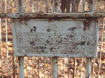
| 2 ► District of Columbia, Washington, Southwest Washington, Bellevue — Original Federal Boundary Stone, District of Columbia, Southeast 9 — |
| Near Kenilworth Avenue Freeway. | |||
| 3 ► Maryland, Montgomery County, Bethesda — NW5 — Original Federal Boundary Stone, District of Columbia, Northwest 5 — |
| Near Westwood Drive west of Wetherill Road, on the left when traveling west. | |||
| 4 ► Maryland, Montgomery County, Bethesda — The District of Columbia Boundary Stones — [Original Federal Boundary Stone, District of Columbia, Northwest 6] — |
| On Western Avenue east of Park Avenue, on the right when traveling west. | |||
| 5 ► Maryland, Montgomery County, Bethesda, Brookmont — Original Federal Boundary Stone, District of Columbia, Northwest 4 — |
| On Capital Cresent Trail, on the right when traveling north. | |||
| 6 ► Maryland, Montgomery County, Chevy Chase — Original Federal Boundary Stone, District of Columbia, Northwest 7 — |
| Near Western Avenue at Cedar Parkway. | |||
| 7 ► Maryland, Montgomery County, Chevy Chase — Original Federal Boundary Stone, District of Columbia, Northwest 8 — |
| On Pinehurst Circle, 0.1 miles north of Western Avenue when traveling west. | |||
| 8 ► Maryland, Montgomery County, Chevy Chase — Original Federal Boundary Stone, District of Columbia, Northwest 9 — |
| Near Daniel Road at Western Avenue. | |||
| 9 ► Maryland, Montgomery County, Silver Spring, Downtown Silver Spring — Original Federal Boundary Stone, District of Columbia, Northeast 1 — |
| On Eastern Avenue, 0 miles north of Georgia Avenue, on the right when traveling north. | |||
| 10 ► Maryland, Montgomery County, Silver Spring, Woodside — Original Federal Boundary Stone, District of Columbia, North Cornerstone — |
| Near East West Highway (Route 410) 0.3 miles west of 16th Street (Route 390), on the right when traveling east. | |||
| 11 ► Maryland, Montgomery County, Takoma Park — Original Federal Boundary Stone, District of Columbia, Northeast 2 — |
| On Maple Avenue just north of Carroll Street, NW, on the left when traveling north. | |||
| 12 ► Maryland, Prince George's County, Brentwood — Original Federal Boundary Stone, District of Columbia, Northeast 7 — |
| 13 ► Maryland, Prince George's County, Capitol Heights — Original Federal Boundary Stone, District of Columbia, Northeast 8 — |
| Near Kenilworth Avenue NE, 0.1 miles north of Kenilworth Avenue NE, on the right when traveling north. | |||
| 14 ► Maryland, Prince George's County, Capitol Heights — Original Federal Boundary Stone, District of Columbia, Southeast 1 — |
| On Thrift Road south of D Street Southeast, on the right when traveling north. | |||
| 15 ► Maryland, Prince George's County, Capitol Heights — Original Federal Boundary Stone, District of Columbia, Southeast 2 — |
| On Southern Avenue south of Rail Street, on the right when traveling north. | |||
| 16 ► Maryland, Prince George's County, Chillum — Original Federal Boundary Stone, District of Columbia, Northeast 3 — |
| On Eastern Avenue at New Hampshire Avenue Northeast, on the left when traveling south on Eastern Avenue. | |||
| 17 ► Maryland, Prince George's County, Chillum — Original Federal Boundary Stone, District of Columbia, Northeast 4 — |
| On Eastern Avenue north of Sargent Road, on the right when traveling north. | |||
| 18 ► Maryland, Prince George's County, Fairmount Heights — Original Federal Boundary Stone, District of Columbia, Northeast 9 — |
| On Eastern Avenue Northeast, 0 miles south of Sheriff Road Northeast, on the left when traveling south. | |||
| 19 ► Maryland, Prince George's County, Forest Heights — Original Federal Boundary Stone, District of Columbia, Southeast 8 — |
| 20 ► Maryland, Prince George's County, Forest Hills — Original Federal Boundary Stone, District of Columbia, Southeast 3 — |
| On Southern Avenue Southeast north of Suitland Terrace Southeast, on the right when traveling north. | |||
| 21 ► Maryland, Prince George's County, Glassmanor — Original Federal Boundary Stone, District of Columbia, Southeast 7 — |
| On Indian Head Highway (Maryland Route 210) at Southern Avenue when traveling north on Indian Head Highway. | |||
| 22 ► Maryland, Prince George's County, Mount Rainier — Original Federal Boundary Stone, District of Columbia, Northeast 5 — |
| On Eastern Avenue, 0.1 miles north of Varnum Street, on the right when traveling north. | |||
| 23 ► Maryland, Prince George's County, Mount Rainier — Original Federal Boundary Stone, District of Columbia, Northeast 6 — |
| On Eastern Avenue at 34th Street, on the right when traveling north on Eastern Avenue. | |||
| 24 ► Maryland, Prince George's County, Temple Hills — Original Federal Boundary Stone SE 6 |
| Near Southern Avenue south of Wheeler Road, on the right when traveling north. Reported missing. | |||
| 25 ► Maryland, Prince George's County, Temple Hills — Original Federal Boundary Stone, District of Columbia, Southeast 4 — |
| On Southern Avenue, 0.1 miles south of Naylor Road SE (State Route 637), on the right when traveling north. | |||
| 26 ► Maryland, Prince George's County, Temple Hills — SE5 — Original Federal Boundary Stone, District of Columbia, Southeast 5 — |
| On Southern Avenue south of 23rd Parkway, on the right when traveling north. | |||
| 27 ► Maryland, Prince George's County, Temple Hills — Original Federal Boundary Stone, District of Columbia, Southeast 6 — |
| On Southern Avenue south of Wheeler Road, on the right when traveling north. | |||
| 28 ► Virginia, Alexandria, Old Town — A Tale of Three Jurisdictions — |
| Near Capital Beltway (Interstate 95/495) 0.8 miles east of Richmond Highway (U.S. 1), on the left when traveling north. | |||
| 29 ► Virginia, Alexandria, Old Town — Alexandria, D.C. — City of Alexandria Est. 1749 — |
| On King Street (Virginia Route 7) at North West Street, on the right when traveling west on King Street. | |||
| 30 ► Virginia, Alexandria, Old Town — Alexandria, Virginia — Market Square — Alexandria Historic District — |
| On Cameron Street east of North Royal Street, on the right when traveling east. | |||
| 31 ► Virginia, Alexandria, Old Town — D.C.'s First Building Block — Jones Point Park — National Park Service, U.S. Department of the Interior — |
| Near Jones Point Drive east of South Royal Street, on the right when traveling east. | |||
| 32 ► Virginia, Alexandria, Old Town — Original Federal Boundary Stone, District of Columbia, South Cornerstone — District of Columbia |
| Near South Street near South Washington Street (Virginia Route 400). Reported permanently removed. | |||
| 33 ► Virginia, Alexandria, Old Town — The Federal District and Alexandria |
| On Wharf Street east of Ford's Landing Way, on the right when traveling west. Reported unreadable. | |||
| 34 ► Virginia, Alexandria, Old Town — The Nation's Capital Begins Here 1791-1793 — Jones Point Park — National Park Service, U.S. Department of the Interior — |
| Near Jones Point Drive east of South Royal Street, on the right when traveling east. | |||
| 35 ► Virginia, Alexandria, Old Town — Welcome to Jones Point Park — National Park Service — U.S. Department of the Interior — |
| On Jones Point Drive east of South Royal Street, on the right when traveling east. | |||
| 36 ► Virginia, Alexandria, Potomac West — Original Federal Boundary Stone, District of Columbia, Southwest 2 — |
| On Russell Road near King Street & Callahan Drive, on the right when traveling north. | |||
| 37 ► Virginia, Alexandria, Southwest Quadrant — Original Federal Boundary Stone, District of Columbia, Southwest 1 — |
| On Payne Street at Wilkes Street, on the right when traveling north on Payne Street. | |||
| 38 ► Virginia, Alexandria, Taylor Run — Original Federal Boundary Stone, District of Columbia, Southwest 3 — |
| On King Street (Virginia Route 7) near Scroggins Road, on the right when traveling south. | |||
| 39 ► Virginia, Arlington County, Arlington, Boulevard Manor — Original Federal Boundary Stone, District of Columbia, Southwest 8 — Southwest No. 8 Boundary Marker — |
| Near Wilson Boulevard at Patrick Henry Drive, on the left when traveling west. | |||
| 40 ► Virginia, Arlington County, Arlington, Claremont — Original Federal Boundary Stone, District of Columbia, Southwest 5 — |
| On South Walter Reed Drive, on the right when traveling west. | |||
| 41 ► Virginia, Arlington County, Arlington, Columbia Forest — Original Federal Boundary Stone, District of Columbia, Southwest 6 — Southwest No. 6 Boundary Marker — |
| On South Jefferson Street, 0.1 miles south of Columbia Pike (Virginia Route 244), in the median. | |||
| 42 ► Virginia, Arlington County, Arlington, East Falls Church — Benjamin Banneker Park Playground — Dream Big! Explore Your World! — |
| On 18th Street North east of North Underwood Street, on the right when traveling east. | |||
| 43 ► Virginia, Arlington County, Arlington, East Falls Church — Original Federal Boundary Stone, District of Columbia, Southwest 9 — |
| On North Van Buren Street at 18th Street North, on the left when traveling south on North Van Buren Street. | |||
| 44 ► Virginia, Arlington County, Arlington, East Falls Church — Original Federal Boundary Stone, District of Columbia, West Cornerstone — |
| On North Arizona Street when traveling north. | |||
| 45 ► Virginia, Arlington County, Arlington, Glencarlyn — Original Federal Boundary Stone, District of Columbia, Southwest 7 — Arlington County Virginia Bicentennial 1801-2001 — 200 Years of Community — |
| Near 5th Road South (Virginia Route 714) at Olds Drive. | |||
| 46 ► Virginia, Arlington County, Arlington, Shirlington — SW4 — Original Federal Boundary Stone, District of Columbia, Southwest 4 — |
| On King Street (Virginia Route 7) 0.1 miles west of South Wakefield Street, on the right when traveling west. | |||
| 47 ► Virginia, Arlington County, Arlington, Williamsburg — Original Federal Boundary Stone, District of Columbia, Northwest 1 — |
| Near North Powhatan Street, 0.2 miles north of North Rockingham Street, on the right when traveling north. | |||
| 48 ► Virginia, Fairfax County, Alexandria, Belle View — Historic Jones Point — Mount Vernon Trail — George Washington Memorial Parkway, National Park Service — |
| 49 ► Virginia, Fairfax County, McLean — NW2 — Original Federal Boundary Stone, District of Columbia, Northwest 2 — |
| Near 38th Street North, 0.2 miles west of 37th Road North. | |||
| 50 ► Virginia, Fairfax County, McLean — Original Federal Boundary Stone, District of Columbia, Northwest 3 — |
| Near North Tazewell Street north of 40th Street North, on the right when traveling north. | |||
| 51 ► Virginia, Falls Church — The Story of Falls Church / Settlement 1700 - 1815 — |
| On South Washington Street (U.S. 29) at Hillwood Avenue (Virginia Route 338), on the right when traveling north on South Washington Street. | |||