By Andrew Ruppenstein, November 8, 2009
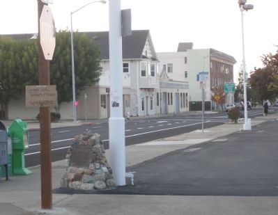
Birthplace of the Martini Marker. Looking along Alhambra Avenue
GEOGRAPHIC SORT Title Sort Marker Number Sort Marker Number Sort N Marker Number Sort T Publication Order Sort Publication Order Sort A Erected Year Sort Most Viewed Sort Most Recent-Interest Sort Most Recently Changed Sort SEE FAQ #33 FOR DESCRIPTIONS
On Alhambra Avenue at Masonic Street, on the right when traveling north on Alhambra Avenue.
On Escobar Street at Court Street, on the right when traveling south on Escobar Street.
Near Carquinez Scenic Drive near Talbart Street, on the right when traveling west.
On Carquinez Scenic Drive, 0.1 miles west of Talbart Street.
Near Carquinez Scenic Drive near Talbart Street, on the right when traveling west.
On Main Street near Castro Street, on the right when traveling east.
Near Carquinez Scenic Drive near Talbart Street, on the right when traveling west.
On Buckley Street near Talbart Street.
Near Marina Vista Avenue near Castro Street, on the right when traveling west.
On Joe DiMaggio Jr., Drive at Ferry Street, on the left when traveling east on Joe DiMaggio Jr., Drive.
Near Carquinez Scenic Drive near Talbart Street, on the right when traveling east.
On Brown Street, on the right when traveling west.
Near Alhambra Avenue, on the right when traveling south.
On Railroad Avenue at East 4th Street, on the right when traveling south on Railroad Avenue.
On East 5th Street at Marina Boulevard, on the right when traveling west on East 5th Street.
Paid Advertisement
On Railroad Avenue north of East 6th Street, on the right when traveling north.
On Cortsen Road, 0.4 miles south of Grayson Road, on the right when traveling east.
On Canyon Lake Drive, on the left when traveling north.
Near Nortonville Road near Somersville Road.
On Front Street at Stamps Way, on the left when traveling south on Front Street.
On Klamath Boulevard, 0.2 miles south of Ehlers Avenue, on the right when traveling north.
Near State Highway 49. Reported permanently removed.
On Pleasant Valley Road, on the right when traveling east.
On PG&E-Clarksville Sub-Station Road, on the right when traveling west.
On Orleans Street, on the right when traveling west.
On Lower Main Street (aka Wentworth Springs Road), on the right when traveling north.
On Lower Main Street (aka Wentworth Springs Road) north of Georgetown Road (California Highway 193), on the right when traveling south.
Paid Advertisement
On Lower Main Street (aka Wentworth Springs Road), on the right when traveling south.
On Wentworth Springs Road just south of Orleans Street, on the left when traveling south.
On Wentworth Springs Road north of Georgetown Road (California Highway 193), on the left when traveling north.
On Lower Main Street (aka Wentworth Springs Road), on the right when traveling south.
On Main Street at Placer Street, on the right when traveling west on Main Street.
On Wentworth Springs Road north of Georgetown Road (California Highway 193), on the left when traveling north.
On Georgetown Road (State Highway 193) at Lower Main Street, on the right when traveling east on Georgetown Road.
On Lower Main Street (aka Wentworth Springs Road) at Placer Street, on the right when traveling south on Lower Main Street (aka Wentworth Springs Road).
On U.S. 50 near Ice House Road, on the right when traveling west.
On South Shingle Road near Elvira Street, on the left when traveling east.
On US Highway 50 (U.S. 50) west of Pioneer Trail, on the left when traveling west.
On Main Street east of Bedford Avenue, on the right when traveling west.
On Main Street at Bradford Street, on the right when traveling west on Main Street.
On Main Street at Sacramento Street, on the right when traveling east on Main Street.
On Main Street, on the right when traveling west.
On Center Street at Center Street (U.S. 50), on the left when traveling north on Center Street.
Paid Advertisement
On Pony Express Trail east of Exit 57 (U.S. 50), on the right when traveling east.
On East Kings Canyon Road (State Highway 180) near South Rainbow Route, on the left when traveling east.
On Tollhouse Road (State Highway 168) 0.5 miles east of North Madsen Avenue, on the right when traveling east.
On South Clovis Avenue at 4th Street, on the right when traveling north on South Clovis Avenue.
Near South Clovis Avenue (State Highway 168) near Villa Avenue, on the left when traveling north. Reported missing.
On State Highway 180 at Forest Service Road 13S03, on the left when traveling north on State Highway 180.
Near Sans Baker Road, 0.2 miles north of Sand Creek Road, on the right when traveling north.
On South Elm Avenue at West Lincoln Avenue, on the right when traveling south on South Elm Avenue.
On Q Street at 15th Street, on the left when traveling south on Q Street.
On East Merced Street at South 7th Street, on the right when traveling north on East Merced Street.
On Kern Street at China Alley, on the right when traveling south on Kern Street.
On North Van Ness Boulevard, 0.2 miles east of Palm Avenue, on the right when traveling west.
Near North Millbrook Avenue/Fort Washington Road.
On Van Ness Avenue, 0.2 miles Tulare Street, on the right when traveling west.
On Huntington Boulevard near First Street, on the left when traveling east.
Near Mariposa Street just south of Fulton Street.
Paid Advertisement
Near West Kearney Boulevard, 0.3 miles west of South Bryan Avenue.
On F Street, 0.1 miles west of Kern Street, on the right when traveling west.
Near South Maple Avenue south of East Edgar Avenue, on the left when traveling south.
On North Doolittle Drive, 0.1 miles north of West Spaatz Avenue, on the right when traveling south.
On Fresno Street, 0.1 miles north of O Street, on the right when traveling north.
On Mariposa Street at F Street, on the left when traveling north on Mariposa Street. Reported missing.
On East Heaton Avenue at Los Angeles Street, on the left when traveling east on East Heaton Avenue.
On Hildreth Road, on the right when traveling south.
On Tollhouse Road at Pittman Hill Road, on the right when traveling east on Tollhouse Road.
On South Madera Avenue (State Highway 145) at West California Avenue, in the median on South Madera Avenue.
Near Madera Avenue (State Highway 145) 0.4 miles north of West Barstow Avenue. Reported missing.
On Pine Flat Road at Choinumni Park Road, on the right when traveling east on Pine Flat Road.
On Reed Avenue, 0.2 miles south of East Adams Avenue, on the right when traveling south.
On Reed Avenue at Olson Avenue, on the right when traveling south on Reed Avenue.
On Kings River Road, 0.1 miles south of Manning Avenue when traveling east.
Paid Advertisement
Near Pine Flat Road, 1.5 miles north of Elwood Road.
Near Hoag Avenue east of Jensen Street.
On Trimmer Springs Road near East Belmont Road, on the left when traveling east.
On Mill Street at South McCall Avenue, on the left when traveling east on Mill Street.
Near Art Gonzales Parkway, 0.2 miles Highland Avenue.
On East Front Street, 0.2 miles west of Park Street, on the left.
On West Front Street near 2nd Street, on the right.
On Highway 180 at National Forest Road 13S97, on the right when traveling west on Highway 180.
On Tollhouse Road, on the right when traveling east.
On E Street at Opera Alley, on the right when traveling north on E Street.
On Fort Avenue, on the right.
Near Redwood Highway (State Highway 101) at Hufford Road, on the right when traveling south.
On Mattole Road, on the right when traveling south. Reported missing.
On Lower Pacific Drive, on the left when traveling west.
On Edwards Street at Hector Street, on the left when traveling north on Edwards Street.
Paid Advertisement
On Heber Avenue at Fifth Street, on the right when traveling north on Heber Avenue.
On East 5th Street at Heber Avenue, on the right when traveling west on East 5th Street.
On East Fourth Street, on the right when traveling west.
On West Wahl Road at Nichols Road, on the right when traveling west on West Wahl Road.
On Interstate 8 at milepost 108, on the right when traveling east.
1754 entries matched your criteria. Entries 201 through 300 are listed above.
⊲ Previous 100 —
Next 100 ⊳