74 entries match your criteria.
Former U.S. Presidents: #06 John Quincy Adams Historical Markers
By Jason Armstrong, April 25, 2021
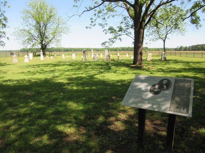
James Sevier Conway Marker
| 1 ► Arkansas, Lafayette County, Walnut Hill — James Sevier Conway — December 9, 1796 - March 3, 1855 — Surveyor • Politician • Planter — |
| Near County Road 9, 0.5 miles south of State Highway 160, in the median. | |||
| 2 ► Connecticut, New Haven County, New Haven, Downtown — “Make Us Free” — Amistad Memorial — |
| On Church Street at Court Street, on the right when traveling north on Church Street. | |||
| 3 ► Connecticut, New London County, New London — First Step to Freedom — |
| On Bank Street just east of Pearl Street. | |||
| 4 ► District of Columbia, Washington, Northwest Washington, Adams Morgan — 16 — Building a Better Neighborhood — Roads to Diversity — Adams Morgan Heritage Trail — |
| On 18th Street Northwest at California Street Northwest, on the right when traveling south on 18th Street Northwest. | |||
| 5 ► District of Columbia, Washington, Northwest Washington, Adams Morgan — 2 — Meridian Hill / Malcolm X Park — Roads to Diversity — Adams Morgan Heritage Trail — |
| On 16th Street Northwest south of Crescent Place Northwest, on the right when traveling south. | |||
| 6 ► District of Columbia, Washington, Northwest Washington, Adams Morgan — Resilience and Resistance — Hallowed Ground — Rock Creek Park, National Park Service, U.S. Department of the Interior — |
| On Calvert Street Northwest at 20th Street Northwest, on the right when traveling west on Calvert Street Northwest. | |||
| 7 ► District of Columbia, Washington, Northwest Washington, Adams Morgan — 11 — Walter Pierce Park — Roads to Diversity — Adams Morgan Heritage Trail — |
| Near Adams Mill Road Northwest south of Ontario Place Northwest, on the right when traveling north. | |||
| 8 ► District of Columbia, Washington, Northwest Washington, Downtown — White House Kitchen Garden — National Park Service, U.S. Department of the Interior — |
| On E Street Northwest west of 15th Street Northwest, on the right when traveling west. | |||
| 9 ► District of Columbia, Washington, Northwest Washington, Foggy Bottom — Marquis de Lafayette Hall — |
| On I Street Northwest west of 21st Street Northwest, on the right when traveling east. | |||
| 10 ► District of Columbia, Washington, Northwest Washington, Judiciary Square — e.1 — Senator Daniel Webster — Civil War to Civil Rights — Downtown Heritage Trail |
| On D Street Northwest west of 5th Street Northwest, on the right. Reported permanently removed. | |||
| 11 ► District of Columbia, Washington, Northwest Washington, Rock Creek Park — Adams Mill — |
| 12 ► District of Columbia, Washington, Northwest Washington, The National Mall — John Quincy Adams — [Founding of the Smithsonian Institution] — |
| On Madison Drive Northwest east of 14th Street Northwest (U.S. 1), on the right when traveling west. | |||
| 13 ► District of Columbia, Washington, Southeast Washington, Capitol Hill — 12 — Christ Church and Its Parishioners — Tour of Duty — Barracks Row Heritage Trail — |
| On G Street Southeast at F Street Terrace Southeast, on the right when traveling east on G Street Southeast. | |||
| 14 ► Florida, Leon County, Tallahassee — F-226 — Southern Boundary of Lafayette Land Grant — S.W. Corner 1.4 mi. West S.E. Corner 4.6 mi East |
| On Apalachee Parkway (U.S. 27) at Old St. Augustine Road, in the median on Apalachee Parkway. Reported missing. | |||
| 15 ► Florida, Leon County, Tallahassee, Killearn Estates — F-225 — Northern Boundary of Lafayette Land Grant — N.W. Corner 2.3 mi. West N.E. Corner 3.7 mi. East |
| On Thomasville Road (U.S. 319) at Radford Farm Road, on the right when traveling south on Thomasville Road. Reported missing. | |||
| 16 ► Florida, Leon County, Tallahassee, The Vineyards — F-224 — Eastern Boundary of Lafayette Land Grant — N.E. Corner 3 mi. North S.E. Corner 3 mi. South |
| On Mahan Drive (U.S. 90) 0.1 miles east of Arendell Way, on the right when traveling west. Reported missing. | |||
| 17 ► Florida, Nassau County, Fernandina Beach — Shipwreck, Slavery and Survival — The Saga of the Slave Ship Guerrero — Fernandina Plaza Historic State Park — |
| On Estrada Street at White Street, on the right when traveling south on Estrada Street. | |||
| 18 ► Florida, Santa Rosa County, Gulf Breeze — First Federal Tree Farm — Gulf Islands National Seashore — National Park Service, U.S. Department of the Interior — |
| Near Gulf Breeze Parkway (U.S. 98) 2.4 miles east of Pensacola Beach Boulevard (County Road 399). | |||
| 19 ► Georgia, Laurens County, Dudley — Vallombrosa Plantation of Governor George Michael Troup — |
| On U.S. 80, 0 miles east of Troup Lane, on the right when traveling west. | |||
| 20 ► Georgia, McDuffie County, Thomson — 094-7 — The Birthplace of George McDuffie — |
| On George McDuffie Road, 0.5 miles south of Augusta Road (U.S. 278), on the left when traveling south. | |||
| 21 ► Georgia, Walker County, Fort Oglethorpe — Mark Thrash — |
| On Dyer Road east of Chickamauga-Vittatoe Road, on the left when traveling east. | |||
| 22 ► Illinois, Adams County, Quincy — Quincy — |
| On Indian Mounds Park, 0.1 miles west of South 5th Street, on the left when traveling east. | |||
| 23 ► Indiana, Wabash County, Wabash — Quarters of Major General John Tipton — Indian Agent — |
| Near E. Market Street, 0.2 miles east of S. Allen Street. | |||
| 24 ► Iowa, Winneshiek County, Decorah — Vesterheim — Heritage Park, Vesterheim Norwegian-American Museum — |
| Near West Water Street just east of North Mill Street, on the left when traveling east. | |||
| 25 ► Kentucky, Fayette County, Lexington — Henry Clay — |
| Near West Main Street (U.S. 421) 0.1 miles north of Newtown Pike / Oliver Lewis Highway (Kentucky Route 922). | |||
| 26 ► Kentucky, Nelson County, Bardstown — The Harrison-Smith House — Circa 1795 & 1815 — |
| On South Third Street (U.S. 31E/150), on the right when traveling north. | |||
| 27 ► Kentucky, Trimble County, Bedford — 765 — County Named, 1836 — |
| On Main Street (U.S. 42) at U.S. 421, on the right when traveling south on Main Street. | |||
| 28 ► Maryland, Allegany County, Cumberland — Cumberland — Town Map and Directory — |
| On Canal Street just north of West Harrison Street, on the left when traveling north. | |||
| 29 ► Maryland, Calvert County, St. Leonard — John Stuart Skinner — Witness to Fort’s Bombardment — |
| On Jefferson Patterson Park Road. | |||
| 30 ► Maryland, Calvert County, St. Leonard — The Garden of Remembrance — |
| On St. Leonard Road (Maryland Route 765) 0.1 miles south of Calvert Beach Road, on the right when traveling south. | |||
| 31 ► Maryland, Prince George's County, Fort Washington — 40 Members of the Col. John Addison Family — |
| Near Livingston Road. | |||
| 32 ► Maryland, Washington County, Hagerstown — Hagerstonians In The Civil War — Congressman James Dixon Roman 1809-1867 — |
| On West Washington Street (Maryland Route 40), on the left when traveling east. | |||
| 33 ► Massachusetts, Hampden County, Springfield — Old First Church — First Church of Christ, Congregational — Founded in 1637 — |
| Near Elm Street just south of Main Street. | |||
| 34 ► Massachusetts, Norfolk County, Quincy — Abigail Adams — Adams National Historic Park — |
| On Hancock Street at Washington Street, on the left when traveling south on Hancock Street. | |||
| 35 ► Massachusetts, Norfolk County, Quincy — Abigail Adams Cairn — |
| On Viden Road at Franklin Street, on the right when traveling north on Viden Road. | |||
| 36 ► Massachusetts, Norfolk County, Quincy — Adams National Historical Park — |
| On Franklin Street, on the right when traveling south. | |||
| 37 ► Massachusetts, Norfolk County, Quincy — Three Adams Brothers — |
| 38 ► Massachusetts, Norfolk County, Quincy — United First Parish Church — |
| On Hancock Street at Washington Street, on the left when traveling south on Hancock Street. | |||
| 39 ► Massachusetts, Plymouth County, Mattapoisett — Ned's Point Light — Historically Speaking ... — |
| On Ned's Point Road south of Holly Lane, on the right when traveling south. | |||
| 40 ► Massachusetts, Suffolk County, Boston, Boston Theater District — John Quincy Adams — |
| On Boylston Street, on the right when traveling east. | |||
| 41 ► Massachusetts, Suffolk County, Boston, Waterfront — Sugar for Rope — Trade with Russia — Atlantic Wharf — |
| On Harborwalk north of Congress Street, on the right when traveling north. | |||
| 42 ► Michigan, St. Clair County, Marine City — L0546 — Holy Cross Parish — |
| On South Water Street south of Bridge Street, on the right when traveling south. | |||
| 43 ► Michigan, Washtenaw County, Ypsilanti — YC-48 — Town Hall School — |
| On West Circle Drive, 0.2 miles west of Oakwood Street, on the right when traveling east. | |||
| 44 ► Missouri, St. Louis, Downtown — Action and Reaction — Jefferson National Expansion Memorial — National Park Service, U.S. Department of the Interior — |
| On Gateway Arch Trail, on the right when traveling south. | |||
| 45 ► New York, Erie County, Buffalo, Downtown — "...With Liberty and Justice for All." — Buffalo History and Architecture — Niagara Square East — |
| Near Niagara Square at Court Street, in the median. | |||
| 46 ► New York, Orleans County, Holley — First Norwegian Immigrants Landed in Holley, 1825 — |
| Near East Avenue, 0.2 miles south of Perry Street, on the left when traveling south. | |||
| 47 ► New York, Suffolk County, Montauk Point — Amistad Memorial — |
| On Montauk Highway (New York State Route 27), on the right when traveling east. | |||
| 48 ► Ohio, Butler County, Fairfield — Historic Stones — |
| On Dixie Highway (Ohio Route 4) west of Holden Boulevard, on the right when traveling west. | |||
| 49 ► Ohio, Hamilton County, Cincinnati, Hyde Park — 23-31 — The Cincinnati Observatory — "Lighthouse of the Sky" — |
| 50 ► Ohio, Hamilton County, Cincinnati, Mount Adams — Mt. Adams — |
| On Celestial Street at Ida Street on Celestial Street. | |||
| 51 ► Ohio, Hamilton County, North Bend — Life At North Bend / President Harrison — William Henry Harrison Memorial Trail — |
| On Cliff Road, 0.1 miles north of Bower Road, on the right when traveling north. | |||
| 52 ► Oregon, Clackamas County, Oregon City — Oregon — America's Manifest Destiny — |
| Near Washington Street near Abernethy Road, on the right when traveling north. | |||
| 53 ► Pennsylvania, Franklin County, Cove Gap, Peters Township — President James Buchanan — |
| On Stoney Batter Road, on the left when traveling north. | |||
| 54 ► Pennsylvania, Philadelphia County, Philadelphia, William Penn Annex East — The House & the People Who Worked & Lived In It — |
| On Market Street at South Independence Mall West (6th Street), on the right when traveling east on Market Street. | |||
| 55 ► Pennsylvania, Washington County, Claysville — Claysville — Historic National Road — |
| On Main Street (U.S. 40) near Green Street, on the right when traveling west. | |||
| 56 ► Rhode Island, Newport County, Newport — The Elms & Its Neighbors: The Battle for Historic Preservation — |
| On Bellevue Avenue. | |||
| 57 ► South Carolina, Lexington County, Lexington — Lexington County Veterans Monument — |
| On South Lake Drive (State Highway 6), on the right when traveling south. | |||
| 58 ► South Carolina, Pickens County, Clemson — Fort Hill Plantation Office — |
| On Fort Hill Street. | |||
| 59 ► Utah, Washington County, Zion National Park — Westward Expansion — |
| 60 ► Vermont, Addison County, Cornwall, Bread Loaf — William Slade / The Gag Rule — 1786–1857 / 1836–1844 — |
| 61 ► Vermont, Windsor County, Woodstock, Village of Woodstock — Hiram Powers — |
| On Church Hill Road, 0.1 miles south of Shurtleff Lane, on the left when traveling south. | |||
| 62 ► Virginia, Alexandria, Old Town — The Alexandria Lyceum — City of Alexandria Est. 1749 — |
| On King Street (Virginia Route 7) at North Washington Street (Virginia Route 400), on the right when traveling east on King Street. | |||
| 63 ► Virginia, Alexandria, Old Town — The Lyceum — The Jean E. Keith Memorial — |
| On South Washington Street (Virginia Route 400) south of Prince Street, on the right when traveling south. | |||
| 64 ► Virginia, Fredericksburg — Hostages |
| On Princess Anne Street at Amelia Street, on the right when traveling south on Princess Anne Street. Reported permanently removed. | |||
| 65 ► Virginia, Loudoun County, Leesburg — F-28 — Loudoun County Courthouse — |
| On East Market Street (Business Virginia Route 7) at North King Street (Business U.S. 15), on the right when traveling west on East Market Street. | |||
| 66 ► Virginia, Loudoun County, Leesburg — Temple Hall |
| On Temple Hall Lane, 0.1 miles north of Limestone School Road (County Route 661), on the left when traveling north. Reported missing. | |||
| 67 ► Virginia, Loudoun County, Leesburg — This Is Temple Hall! — |
| On Temple Hall Lane, 0.3 miles north of Limestone School Road (Virginia Route 661), on the left when traveling north. | |||
| 68 ► Virginia, Norfolk, Downtown — Moses Myers House, 1792 — |
| On Bank Street. | |||
| 69 ► Virginia, Orange County, Montpelier Station — 24 — The Madison Family Cemetery — Discovering Madison — |
| On West Gate Road, on the right when traveling west. | |||
| 70 ► Virginia, Portsmouth, Hope Village — Norfolk Naval Shipyard — “Dry Dock 1” — Path of History Portsmouth, VA — |
| Near Lincoln Street east of 3rd Street, on the left when traveling east. | |||
| 71 ► Virginia, Westmoreland County, Colonial Beach — 8 — James Monroe's Legacy — |
| Near James Monroe Highway (Virginia Route 205) 0.3 miles north of Old Road, on the right when traveling north. | |||
| 72 ► Washington, Clallam County, Forks — Fort Ross, California - Sitka Castle, Alaska - Fort Elisabeth, Kaua’i, Hawai’i — |
| Near Upper Hoh Road, 0.1 miles east of Linder Creek Lane, on the left when traveling east. | |||
| 73 ► West Virginia, Jefferson County, Harpers Ferry — The Race to the Ohio — |
| Near South Potomac Street. | |||
| 74 ► Belgium, Vlaams Gewest, Oost-Vlaanderen, Ghent — Verdras van Gent / Treaty of Ghent — 1814 - 1964 — |
| On Veldstraat, on the right when traveling north. | |||