By Mark Hilton, August 26, 2013
Albert J. Pickett Marker
| On Alabama Route 14 at County Road 133, on the right when traveling west on State Route 14. |
| On South Autauga Street at Academy Street, on the right when traveling south on South Autauga Street. |
| Near County Road 63, 0.3 miles south of County Road 530, on the right when traveling south. |
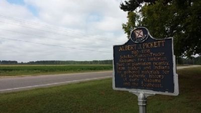
| Near County Road 63, 0.3 miles south of County Road 530, on the right when traveling south. |
| On County Road 99 north of County Road 68W, on the right when traveling north. |
| Near County Road 63, 0.2 miles south of County Road 530, on the right when traveling south. |
| Near County Road 63, 0.3 miles south of County Road 530, on the right when traveling south. |
| Near County Road 63, 0.2 miles south of County Road 530, on the right when traveling south. |
| On Autauga County Road 1, on the right when traveling north. |
| On Alabama Route 14, 0.4 miles west of County Road 9, on the right when traveling west. |
| On East 4th Street west of North Court Street, on the right when traveling west. |
| On West 4th Street (Alabama Route 206) at North Court Street, on the right when traveling west on West 4th Street. |
| On West 4th Street (Alabama Route 206) at North Court Street, on the right when traveling west on West 4th Street. |
| On North Court Street at West 4th Street (Alabama Route 206), on the right when traveling north on North Court Street. |
| Near West Main Street, 0.1 miles west of South Chestnut Street, on the right when traveling east. |
| On County Road 4, 0.1 miles west of Buena Vista Boulevard, on the right when traveling west. |
| On East 4th Street at South Chestnut Street, on the right when traveling east on East 4th Street. |
| On Doster Road at Mobile Drive, on the right when traveling south on Doster Road. |
| On East 3rd Street at South Chestnut Street, on the right when traveling east on East 3rd Street. |
| On East Sixth Street, 0.4 miles east of North Northington Street, on the right when traveling west. |
| On South Court Street at West Main Street, on the right when traveling south on South Court Street. |
| On Dosterville Road, 1.5 miles west of South Memorial Drive (U.S. 31), on the left when traveling west. |
| On County Road 57 just north of County Road 6, on the right when traveling north. |
| On Main Steet at South Chestnut Sreet, on the right when traveling east on Main Steet. |
| On South Court Street at West 3rd Street, on the left when traveling south on South Court Street. |
| On County Road 21, 0.1 miles south of County Road 40, on the left when traveling south. |
| On Maple Street at Pletcher Street, on the right when traveling west on Maple Street. |
| On East Main Street at South Memorial Drive (U.S. 31), on the right when traveling east on East Main Street. |
| On Bridge Street at Gin Shop Hill Road, on the right when traveling west on Bridge Street. |
| On South Washington Street at East 4th Street, on the right when traveling north on South Washington Street. |
| On Rocky Mount Road, 1.1 miles north of Cobbs Ford Road (U.S. 82), on the right when traveling north. |
| On East 4th Street at South Washington Street, on the right when traveling east on East 4th Street. |
| Near Wetumpka Street at South Washington Street, on the right when traveling east. |
| On Wetumpka Street (County Route 2) at South Washington Street, on the right when traveling east on Wetumpka Street. |
| Near South Washington Street at East 4th Street, on the left when traveling south. |
| On South Chestnut Street at 1st Street, on the right when traveling south on South Chestnut Street. |
| On County Road 21 south of County Road 20, on the right when traveling south. |
| On County Road 3, 0.7 miles east of Greeno Road (U.S. 98), on the right when traveling east. |
| On Courthouse Square (U.S. 31) at Hand Avenue, on the left when traveling east on Courthouse Square. |
| On Courthouse Square (U.S. 31) at D'Olive Street, on the left when traveling east on Courthouse Square. |
| On Hall Avenue (U.S. 31) at D'Olive Street on Hall Avenue. |
| On West 2nd Street east of McMillan Avenue, on the right when traveling east. |
| On Courthouse Square (U.S. 31) at Hand Avenue, on the left when traveling east on Courthouse Square. |
| On Courthouse Square (U.S. 31) at Hand Avenue, on the left when traveling west on Courthouse Square. |
| On Courthouse Square at U.S. 31, on the left when traveling north on Courthouse Square. |
| On Shedrick Hardy Parkway, 0.1 miles south of Rain Drive, on the right when traveling south. |
| On Washington Avenue south of Old Blakeley Road, on the right when traveling south. |
| On Washington Avenue south of Old Blakeley Road, on the right when traveling south. |
| Near Battlefield Road, 0.3 miles east of Green Street, on the right when traveling east. |
| On Old Blakeley Road, on the right when traveling south. |
| On Franklin Street, on the right when traveling north. Reported permanently removed. |
| On Franklin Street north of Washington Avenue, on the right when traveling north. |
| On Franklin Street, 0.4 miles north of Washington Avenue, on the right when traveling west. |
| On Battlefield Road, 0.3 miles east of Green Street. |
| On Battlefield Road, 0.8 miles east of Green Street, on the right when traveling north. |
| On Franklin Street, 0.4 miles north of Washington Avenue, on the right when traveling west. |
| On Battlefield Road, on the left when traveling east. |
| On Franklin Street, 0.1 miles north of Washington Avenue, on the left when traveling north. |
| On Battlefield Road, on the left when traveling east. |
| On Union Trail Loop west of Old Blakeley Road, on the left. |
| On County Road 49 at Swift Coles Lane, on the left when traveling south on County Road 49. |
| On River Road, 0.2 miles west of Bon Secour Highway, on the left when traveling west. |
| On Main Street south of Bayfront Park Drive, on the right when traveling south. |
| On Main Street at Manci Avenue, on the right when traveling south on Main Street. |
| On Daphne Road (County Road 64) near State Route 181, on the right when traveling west. |
| On Patrician Drive W, 0.1 miles north of Patrician Drive S, in the median. |
| On Main Street (County Road 98) at Magnolia Avenue, on the right when traveling north on Main Street. |
| Near U.S. 98 at Whispering Pines Road. |
| On Scenic Highway 98 (Alternate U.S. 98) near Zundel Road, on the right when traveling south. |
| On Pine Grove Drive near Confederate Rest Road, on the right when traveling west. |
| On 24 N Section Street at Fairhope Avenue, on the right when traveling north on 24 N Section Street. |
| On Alabama Route 59, on the left when traveling south. |
| Near Fort Morgan Road (Alabama Route 180) 2 miles west of Dune Drive, on the left when traveling west. |
| Near Fort Morgan Road (Alabama Route 180) 2 miles west of Dune Drive, on the right when traveling west. |
| On Fort Morgan Road (Alabama Route 180) 2 miles west of Dune Drive, on the right when traveling west. |
| Near Dixie Graves Parkway (State Highway 180) when traveling west. |
| On Fort Morgan Road (Alabama Route 180) 2 miles west of Dune Drive, on the left when traveling west. |
| Near Fort Morgan Road (Alabama Route 180) 2 miles west of Dune Drive, on the right when traveling west. |
| On Dixie Graves Parkway near Alabama Route 180 W. |
| On Fort Morgan Road (Alabama Route 180) 1.2 miles west of Dune Road, on the right when traveling west. |
| Near Fort Morgan Road, 1.4 miles Dune Road, on the left when traveling west. |
| Near Fort Morgan Road (Alabama Route 180) 1.6 miles west of Dune Road, on the right when traveling west. |
| On Fort Morgan Road (Road 180) 1.7 miles west of Dune Drive, on the right when traveling west. |
| Near Fort Morgan Road (State Road 180) 1 mile west of Dune Drive, on the left when traveling west. |
| On Fort Morgan Road (State Road 180) 1.7 miles west of Dune Drive, on the right when traveling west. |
| Near Fort Morgan Road (State Road 180) 1.7 miles west of Dune Drive. |
| Near West Fort Morgan Road (Alabama Route 180) at Island Club Drive, on the right when traveling west. |
| Near Fort Morgan Road (Alabama Route 180) 1.7 miles west of Dune Drive when traveling west. |
| On Dixie Graves Highway, on the right when traveling south. |
| On Sutton Place at Gulf Place, on the right when traveling south on Sutton Place. |
3962 entries matched your criteria. The first 100 are listed above.
Next 100 ⊳