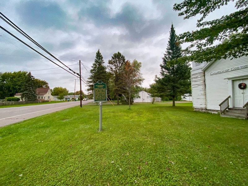
Established in 1847, the Ogaukawning Indian Mission, the first church in present-day Bay County, served Chippewa Indians at the nearby Kawkawlin settlement. First ministered by Methodist missionaries, it soon came under Indian trusteeship and still . . . — — Map (db m182297) HM
This boulder is erected
to the memory of
O-Ge-Ma Ke-Ga-To
Chief Speaker of the Chippewas
Born about 1794,; elected chief, 1815;
spoke at treaty, 1819; spoke before
Congress, 1837; died, 1840
First buried on property now known . . . — — Map (db m180642) HM
Henry W. Sage (1814-1897) founded the village of Wenona (later West Bay City) in 1863. A merchant and philanthropist, he was also a founder of the Sage, McGraw and Company sawmill. In 1881 he donated property, building funds and $10,000 for books to . . . — — Map (db m163167) HM
This bay derives its name from the Sauk Indians who once dwelt by its shores. Adrien Jolliet, on his voyage down Lake Huron’s western shore in 1669, first made it known to the white man. In the late 1800's an immense lumber industry flourished in . . . — — Map (db m182360) HM
St. Joseph was the first Catholic parish in the Saginaw Valley when it was founded in 1850-51 by missionary Joseph Kindekens. Dedicated on March 19, 1911, this building is the third to serve St. Joseph. During the late nineteenth century St. Joseph . . . — — Map (db m162342) HM
St. Stanislaus Kostka Roman Catholic Church
In the second half of the nineteenth century, Polish refugees who escaped Prussian domination settled in Bay City. In 1874 they formed a society under the patronage of Saint Stanislaus Kostka of . . . — — Map (db m161004) HM
During the 1870s, Swedish immigrants arrived in Bay County. By 1880 many Swedes had settled in West Bay City. In October of that year, fifty people organized the Swedish Evangelical Lutheran Sion Church, affiliated with the Augustana Synod. A year . . . — — Map (db m163096) HM
Historic photographs show two traffic control shacks located on Center Avenue east and west of the railroad tracks that ran down what is now Jefferson Avenue. These hexagon-shaped buildings housed guardsmen when trains left or arrived at the F & PM . . . — — Map (db m182352) HM
Trinity Church
Trinity Church grew from a small group of settlers served by Episcopal missionaries beginning around 1842. Church records credit William and Ann Fitzhugh with founding the church. On March 4, 1854, fourteen people, led by the . . . — — Map (db m33912) HM
This 13-inch mortar cannon is a true replica of those in place at Battery Park from the early 1900s to 1942.
The originals were thought to be part of the Confederate arsenal at Fort Sumter, which is recognized as the official beginning of the . . . — — Map (db m182353) HM
St. John Evangelical Lutheran German missionary Pastor Ferdinand Sievers organized St. John Church in June 1852 to serve a colony of German migrants, some fleeing the turmoil that followed the European revolutions of 1848. Initially, the church . . . — — Map (db m180379) HM
In 1894 William Jennison, a yachtsman for fifty years, founded the Bay City Boating and Fishing Club. The first clubhouse, located on the Saginaw River, was moved across the ice to this site around 1902. A larger, stylish building was soon erected. . . . — — Map (db m163334) HM
The first successful beet sugar factory in Michigan was built in 1898 by the Michigan Sugar Company on Woodside Avenue in Essexville. A year later the Bay City Sugar Company built a competing factory across the street. The two plants merged in 1903 . . . — — Map (db m163255) HM
In 1858, in what was then a remote wilderness, the Rev. Charles E. Bailey and four families from his Ohio Congregational parish founded Benzonia colony. It was to be an "educational Christian colony" modeled after the earlier Congregational . . . — — Map (db m97478) HM
Historian, author, editor, Bruce Catton (1899-1978) is best known for his two Civil War trilogies -- The Army of the Potomac and The Centennial History of the Civil War. Born in Petoskey, Catton spent most of his childhood in Benzonia, . . . — — Map (db m97480) HM
This building was a girls dormitory erected in 1909 for the Benzonia Academy. Named Mills Cottage in honor of the Reverend Harlow S. Mills, pastor of Benzonia Congregational Church from 1896 to 1916, it became property of that church when the . . . — — Map (db m97479) HM
Dedicated to the memory of the pioneers, who, in 1858, came to this region, then an unbroken forest, to establish a Christian community and college. Here they founded the earliest institution of higher learning in northern Michigan which was a . . . — — Map (db m228944) HM
William Davis. the son of
a plantation owner and a
slave woman, came here
with his wife. Mildred
Brand, and their children
in 1863. They were among
the area's first black
landowners. Upon the
death of his daughter in
1870, William Davis . . . — — Map (db m192394) HM
In 1873 an ambitious but ill-advised project was put through in an effort to connect Crystal Lake and Lake Michigan with a navigable channel. The original level of Crystal Lake was, at that time, much higher than its present level. The project was a . . . — — Map (db m97481) HM
On January 26, 1868, twenty-three early Frankfort residents founded First Congregational Church of Frankfort. They received guidance from an established Congregational Church in Benzonia, Michigan. In accordance with the practices of . . . — — Map (db m168222) HM
On December 12, 1891, the Lighthouse Board issued a "Notice to Mariners" informing them that a long sought steam-powered fog signal, featuring two 10-inch whistles similar to those then used on locomotives, had been installed at Point Betsie. . . . — — Map (db m98327) HM
Yes, we have a gravestone at Point Betsie but alas no grave. Edward Wheaton, Keeper 1934 to 1946, made this gravestone to honor his mother, Martha Madsen Wheaton, 1857 to 1941. She died in Cheboygan.
Keeper Edward Wheaton could not lift the . . . — — Map (db m98323) HM
On May 18, 1675, Father Jacques Marquette, the great Jesuit missionary and explorer, died and was buried by two French companions somewhere along the Lake Michigan shore of the lower peninsula. Marquette had been returning to his mission at St. . . . — — Map (db m97466) HM
Prior to 1892, large quantities of kerosene that fueled Point Betsie's beacon and apartment lamps, etc., was kept at the base of the lighthouses tower. As at other light stations, a separate building was erected here in 1892 to provide safer . . . — — Map (db m98330) HM
Thompsonville Junction
Constructed in 1889, Thompsonville Junction’s diamond crossing formed the intersection of the Chicago and Western Michigan Railroad (eventually the Chesapeake and Ohio) and the Frankfort and Southeastern Railroad . . . — — Map (db m228950) HM
Relocated and constructed on this site 1967-1968 by authority of Benton Harbor City Commission, as of June 20, 1968.
This agricultural marketing facility was originally created by the city of Benton Harbor in 1870 at its original location at . . . — — Map (db m85364) HM
(Obverse Side)
Israelite House of David
Based on the teachings of the Christian Israelite tradition begun by Joanna Southcott in England in 1792. Benjamin and Mary Purnell founded the House of David communal religious community in . . . — — Map (db m64809) HM
On April 13, 1836 Eleazar Morton (1786-1864) purchased land here for $1,000. Before long, he set aside a family cemetery plot. Other families asked to purchase adjacent plots. The cemetery grew, and in 1884, Eleazar’s son Henry C. and surveyor Ross . . . — — Map (db m184096) HM
Because of Lake Michigan's moderating effect, a narrow coastal strip from Indiana to Grand Traverse Bay, 300 miles north, is blessed by a climate uniquely suited to fruit growing. This fact was observed by the 1840's when peaches already were being . . . — — Map (db m64812) HM
Officially beginning on 14 March, 1930, Mary Purnell’s reorganization of the Israelite House of David began in a very humble fashion on newly acquired properties along Britain and Eastman Avenues. With four agricultural properties, an unfinished and . . . — — Map (db m81805) HM
This house built in 1849, by Eleazar Morton and his son Henry, was occupied until 1936 by four generations of Mortons. The oak-framed barn was built in 1840. Members of the Morton family, pioneers in this area, were prominent in Benton Harbor's . . . — — Map (db m43844) HM
A Unique Jail
Gilbert B. Avery, architect of the 1839 Courthouse next door, also designed the 1870 Berrien County Jail and Sheriff's Residence. The brick jail appeared from the outside as a conventional square structure with a ventilator . . . — — Map (db m64919) HM
This, the oldest Seventh-day Adventist college and the pioneer in a world-wide system of Christian education, was chartered in 1874 at Battle Creek as Battle Creek College. It was moved to Berrien Springs in 1901 where its name was changed to . . . — — Map (db m64917) HM
The county courthouse is an iconic symbol of the American legal system. Its importance in Michigan is established in the Michigan Constitution of 1835, which authorized county courts and the laws that followed, requiring counties to provide . . . — — Map (db m69920) HM
This building, a fine example of the Greek Revival style, was designed by Gilbert B. Avery in 1838. James Lewis, the contractor, agreed to complete the building by April, 1839. Built almost entirely of whitewood, the courthouse has hand-hewn . . . — — Map (db m64918) HM
Built in 1829 by Francis Murdock, the two story log cabin is the oldest home in Berrien County and of the five oldest homes still in existence in the state of Michigan. Murdock, a lawyer, was one of the first to argue a case in the new county . . . — — Map (db m226581) HM
In 1857 Protestants of different denominations established a church and cemetery on property purchased from Zera and Eliza Wright. They dedicated the Greek Revival-style Union Church on July 4, 1858. The denominations held services on alternating . . . — — Map (db m64939) HM
Nearby French and English trading posts were known as parc aux vaches or “cowpens” for the wild buffalo once found here. Joseph Bertrand, an early trader, married the daughter of a Potawatomi chief and through her acquired land in . . . — — Map (db m1604) HM
Known as Parc aux Vaches, or “cow pasture,” this area was named by the French for the wild buffalo that once grazed here. Two major Indian trails crossed here: the Sauk Trail, also called the old Chicago Trail, which linked Detroit and . . . — — Map (db m64552) HM
Here, in 1837, in the then flourishing settlement of Bertrand, a fine brick church, dedicated to St. Joseph, was built to serve the Catholics of this area. In this church, on September 8, 1844, the habit of the Sisters of the Holy Cross was given . . . — — Map (db m64931) HM
Commerce and Industry have characterized the Buchanan Downtown Historic District since mill owner Charles Cowles settled here in the 1830s. McCoy's Creek supplied millraces for fifteen mills. The circa 1840 Day and Hamilton Race supported William . . . — — Map (db m155293) HM
This historic district dates to
1842, when mill owner John
Hamilton platted Buchanan.
Many early residents worked
in milling. Late 19th and 20th
century industries, including
Zinc Collar Pad, furniture
factories, Electro-Voice and
Clark . . . — — Map (db m246673) HM
Downtown Buchanan National Register Historic District.
This Historic District has served as the city's commercial, civic and cultural center since Buchanan's 1830s founding, and includes properties from as early as the 1840s.
In 1862, a . . . — — Map (db m155294) HM
(Side 1)
Persuaded by reports of good land from the Reverend John Seybert, Bishop of the Ohio Conference, the Jacob and David Rough families came to Portage Prairie from Pennsylvania in the spring of 1849. In 1851 they organized the Zion . . . — — Map (db m64835) HM
People have lived on the terrace between Moccasin Bluff and the St. Joseph River for eight thousand years. The first inhabitants stayed in small temporary camps as early as 6300 B.C. The residents of A.D. 500 traded with groups in Indiana and . . . — — Map (db m217846) HM
Dr. William A. Baker, 19th century physician and teacher, a lifetime civic leader and community builder, purchased this land and presented it to Coloma in 1885 for a public park. — — Map (db m64892) HM
Built in 1910 by the Benton Harbor-St. Joe Railway and Light Company, this station served passengers and freight until 1928.
The station’s transformer provided Coloma’s first source of electricity. The electrified interurban rail line originally . . . — — Map (db m184099) HM
Carl Sandburg
In 1926. author and poet Carl
Sandburg (1878 -1967) and his family
rented a summer home on Lake
Michigan, near the town of Sawyer.
Two years later, Sandburg purchased
several lots in Harbert. His wife Lilian
(1883-1977), . . . — — Map (db m165338) HM
Edward K. Warren
Philanthropist and industrialist Edward
Kirk Warren (1847-1919) began his
career as a dry goods merchant in Three
Oaks. In 1882 he invented featherbone,
a cheaper, more flexible material than
the whalebone used as stays . . . — — Map (db m246674) HM
Known as Ames Grove, this property served as a picnic ground and recreation area beginning in the 1880s. John Aylesworth purchased the property in 1901 and opened the Lakeside Inn in this building as early as 1915. The hotel once had its own zoo and . . . — — Map (db m64830) HM
Five hijackers crashed American Airlines Flight 11
into the World Trade Centers North Tower.
The tower collapsed at 10:28 a.m.
after burning for 102 minutes.
When the tower collapsed, debris fell
on the nearby 7 World Trade Center . . . — — Map (db m165340) HM WM
Five hijackers crashed United Airlines Flight 175
into the World Trade Center's South Tower.
The tower collapsed at 9:59 a.m. after burning
for 56 minutes.
After impact one stairwell remained intact,
allowing 18 people to escape from above
the . . . — — Map (db m165339) HM WM
Logo text:
"Pokégnek Bodéwadmik" (Pokagon Band of Potawatomi)
New Buffalo was founded during an era of Indian removal from the region. Historically, the Potawatomi lands included millions of acres in Southern . . . — — Map (db m202624) HM
During the presidency (1953–1961) of Dwight D. Eisenhower, the 34th President of the United States, the National System of Interstate and Defense highways was finalized and signed into law. Gaining support for the Interstate Highway System . . . — — Map (db m1668) HM
The nation’s first Highway Travel Information center opened on May 4, 1935, on US-12 at New Buffalo, not far from here. Other states followed Michigan’s lead, and by 1985 there were 251 travel information centers across the nation. The New Buffalo . . . — — Map (db m1593) HM
The victims included 246 on the four planes,
plus the 19 hijackers, 2,606 died in New York City in the tower
and on the ground, and 125 at the Pentagon.
40 died on United Airlines Flight 93 that crashed into a field
near Shanksville Pennsylvania . . . — — Map (db m165341) HM
The Iron Brigade
The Iron Brigade became one of the most celebrated military units on the American Civil War (1861–1865). Wearing distinctive black hats, they were easily recognised by friend and foe alike. The five volunteer regiments in . . . — — Map (db m4117) HM
(side 1)
At the turn of the twentieth century, deep ruts and sand made West Michigan roads nearly impassable. In 1911 the West Michigan Lakeshore Highway Association was founded to promote the construction of the first improved highway . . . — — Map (db m60839) HM
This Veterans Memorial Park is named in honor of Donavon F. Smith, Lt. General, USAF. General Smith graduated from Niles High School in 1940. After flight training, he was assigned to the 56th Fighter Group in England where he flew 123 combat . . . — — Map (db m68534) HM
Dedicated to all veterans by the people of the greater Niles area
"Our country is free only because it is the Home of the Brave" — — Map (db m68533) WM
To the memory of
Father Claude Jean Allouez S. J.
Whose intrepid courage won the admiration of the Indians and whose apostolic zeal earned for him the title of the Francis Xavier of the American Missions. Father Allouez was born at St. . . . — — Map (db m68554) HM
Constructed in 1867 at a cost of nearly $3,000, the Ferry Street School opened in January, 1868 as Niles’s school for “colored children.” In 1870 the Niles school system was integrated, and this facility closed. It reopened as an integrated school . . . — — Map (db m1635) HM
The French fort built here in 1691 controlled southern Michigan’s principal Indian trade routes. Missionaries and fur traders were here already. The fort became a British outpost in 1761. Two years later it was one of the forts seized by Indians . . . — — Map (db m1628) HM
The Four Flags Hotel opened with much fanfare on July 6, 1926. The newly formed Niles Hotel Corporation had raised $350,000 to build a hotel on the site of the Pike House hostelry. Chicago architect Charles W. Nicol designed the hotel, which was . . . — — Map (db m1629) HM
John and Horace Dodge.
Auto barons John (1864–1920) and Horace (1868–1920) Dodge were born and raised in Niles. During the 1830s, their grandfather, Ezekiel, had migrated from Massachusetts to Niles, where he ran a steam engine . . . — — Map (db m1707) HM
John Johnson Sr. donated property for this cemetery in 1838. His son Samuel had been buried on the land in 1835. John Johnson Jr. was among the township's first white settlers. The Johnsons and many pioneers are buried here. All but 20 of the 211 . . . — — Map (db m64953) HM
(Obverse Side)
Michigan Central Railroad Depot
This Richardsonian Romanesque-style depot was constructed in 1892 by the Michigan Central Railroad Company. Seeking to create a lasting impression of Michigan for passengers . . . — — Map (db m68480) HM
The local Methodist Episcopal Society, the oldest Methodist society in Berrien Township, was organized in 1840. In 1846 it voted to name its church in honor of Bishop Thomas A. Morris, then the head of the Methodist Episcopal Church in Michigan. . . . — — Map (db m64952) HM
The St. Joseph River and the Sauk Trail (now U.S. 12) were major transportation routes for Indians, French voyagers, missionaries, military and early settlers through Niles. Nile's first railroad, the Michigan Central Railroad arrived October 1, . . . — — Map (db m68537) HM
(South Face of Memorial)
You a veteran of this
Old town or pilgrim
From far away looking
For some tranquility...
Here you may become
Silent in honor of those
Who have served...
No one is a stranger at
This revered place . . . — — Map (db m68541) WM
Nearly 12,000 memorial cannons were donated by the U.S. Government, between 1872 and 1916, to local Posts of the Grand Army of the Republic (G.A.R.) and other civic and patriotic groups for the purpose of display as a veterans' war memorial. They . . . — — Map (db m67883) HM WM
Sportswriter, humorist, sardonic observer of the American scene, Ring Lardner was born in the house across the street on March 6, 1885. Possibly the best-known American author in the 1920s, he began his career writing sketches of sporting events for . . . — — Map (db m1632) HM
The Roman Catholic Church in Niles traces its origin to the Indian Mission established at nearby Fort St. Joseph in the late 1600’s. Reestablished at Bertrand, three miles south of Niles, in the 1830s, the mission moved into town in 1849 and was . . . — — Map (db m1606) HM
In 1851 the Reverends J.W. Hackley and D.G. Lett organized the Second Baptist Church under the Anti-Slavery Baptist Association. The first of four churches—a log building—was erected on the southeast corner of Sixth and Ferry streets. In . . . — — Map (db m1607) HM
The Chapin House.
This Queen Anne style house, completed in 1884, was the Henry A. Chapin family home until 1902. In 1932, when the City of Niles bought the property at auction for $300, the Chapin children stipulated that it be used only for . . . — — Map (db m1706) HM
This is the oldest existing church structure in Niles, located in the oldest Episcopal parish in the Diocese of Western Michigan. The first Episcopal service in Niles was conducted by Bishop Philander Chase in 1832. The parish was organized in 1834. . . . — — Map (db m1634) HM
In Memoriam
U.S.S. Maine
Destroyed in Havana Harbor
February 15th 1898
This tablet is cast from metal recovered from the U.S.S. Maine — — Map (db m68477) WM
In 1839 circuit riders from Ohio began preaching in Niles, using the barroom of a local hotel. In 1832 nine worshipers formed the Methodist class that grew to be the Wesley United Methodist Church. They dedicated their first house of worship in . . . — — Map (db m1605) HM
For more than 85 years, this limestone block helped support the Fifth Street Viaduct in Niles as its cornerstone. Built in 1891 by the Michigan Central Railroad, the viaduct was a steel truss bridge that served the public faithfully until it was . . . — — Map (db m227469) HM
In 1854 Robert Hogue (1846-1905) migrated from Pennsylvania to Pipestone Township with his family. At age seventeen, he began teaching in a local school. He attended Adrian College, later graduating from the University of Michigan before he resumed . . . — — Map (db m64868) HM
St. Joseph and Benton Harbor once ranked among the nation's leading boatbuilding centers. From 1892 to 1955, waterfront facilities of the Truscott Boat Manufacturing Company, Dachel-Carter Shipbuilding Corporation, and Robinson Marine Construction . . . — — Map (db m68202) HM
William Burnett, an American patriot from New Jersey, established a trading post on the bank of the St. Joseph River immediately east of this point between 1775 and 1782. He was the first permanent white resident of this area. He married Kakima, . . . — — Map (db m64855) HM
Commercial fishing was one of St. Joseph's earliest maritime trades. Native Americans and the settlers who followed found the river and lake full of trout, whitefish, sturgeon, and perch. By the 1900s, family-run fisheries became major contributors . . . — — Map (db m68224) HM
Schooners rigged for sailing and steam-driven freighters were once common sights at St. Joseph and Benton Harbor. Fruit, lumber, and manufactured goods made up much of the port's early trade. By the 1870s, vessels were regularly carrying thousands . . . — — Map (db m68217) HM
The meeting of river and lake provided a natural setting for a harbor at St. Joseph. Human engineering would ultimately develop the port into one of the busiest on Lake Michigan.
In the 1830s, at the urging of local merchants, the U.S. Corps of . . . — — Map (db m68195) HM
On July 5, 1897 with great pride and effort the A.W. Chapman Post of the Grand Army of the Republic dedicated this gun and grounds to the memories of those who fought in the Civil War in defense of the flag. This 11 inch bore Dahlgren was built in . . . — — Map (db m64869) HM WM
Here in November 1679, on the Miami River, as the St. Joseph was then called, La Salle, the French explorer built a fort as a base for his western explorations. Here he awaited the Griffin, the upper lakes' first ship. When the ill-fated . . . — — Map (db m64837) HM
This Glacial Boulder found in the bed of the St. Joseph River was erected in 1902 by the Algonquin Chapter Daughters - American Revolution to commemorate the landing of Rene Robert Cavelier Sieur de La Salle and the building on this point. Fort . . . — — Map (db m43962) HM
The Great Lakes region is one of the nation's most important centers of maritime commerce. Lighthouses helped mariners navigate these vast inland seas. In 1832, the U.S. Government built the first lights on Lake Michigan at two of its busiest . . . — — Map (db m68176) HM
The north pier lighthouses, built in 1907, guide ships to this port. The inner light replaced a smaller, wooden lighthouse in use since 1847. The north pier was then extended and the outer light tower was added, allowing mariners to find the harbor . . . — — Map (db m68152) HM
During the late nineteenth and early twentieth centuries, local river captains, mill owners, merchants and other professionals built homes in this neighborhood. Over one hundred of their homes remain. They exemplify popular architectural styles . . . — — Map (db m64856) HM
Whether paddling a canoe, riding a riverboat, or sailing a yacht, pleasure boating has always been a favorite St. Joseph activity. Recreational boating has remained popular due to well-stocked fishing grounds and accessible private and city marinas. . . . — — Map (db m68216) HM
With a ready supply of lumber and a thriving port, St. Joseph and Benton Harbor offered a natural setting for shipbuilding. As early as the 1830s, sailing and steam-powered vessels were built here for lake and river navigation.
Shipbuilders . . . — — Map (db m68204) HM
5131 entries matched your criteria. Entries 201 through 300 are listed above. ⊲ Previous 100 — Next 100 ⊳