On Main Street (State Highway 89), on the right when traveling south.
Just north of town are remnants of the Cherry Coal Mine, where 259 miners lost their lives in one of the worst mine disasters in United States history.
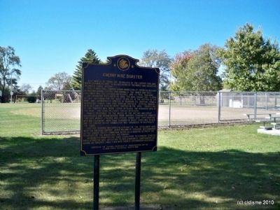
The St. Paul Coal Company began mining coal at Cherry in 1905 and by 1909 was mining 300,000 . . . — — Map (db m36734) HM
On West Dakota Street (U.S. 6) just east of North Strong Avenue, on the right when traveling east.
Pioneer resident of Spring Valley. Achieved national prominence in the settlement of the Pennsylvania Anthracite Miners Strike in 1902 with the co-operation of President Theodore Roosevelt.
President of United Mine Workers, 1889-1908. Author . . . — — Map (db m164894) HM
On South Spaulding Street at East Caroline Street, on the right when traveling north on South Spaulding Street.
Pioneer resident of Spring Valley. Achieved national prominence in the settlement of the Pennsylvania anthracite miners strike in 1902 with the co-operation of President Theodore Roosevelt. President of United Mine Workers, 1889-1908. Author of two . . . — — Map (db m185083) HM
On West Exchange Avenue east of South Peoria Street, on the left when traveling west.
In memory of Leslie F. Orear (1911-2014), co-founder and first president of the Illinois Labor History Society (1969-2005).
Les walked through this gate along with thousands of stockyard workers. He helped to secure their rights through . . . — — Map (db m244161) HM
On West Exchange Avenue east of South Peoria Street, on the left when traveling east.
[Front of the marker:]
The Union Stock Yard and Transit Company, Chicago's legendary livestock market and slaughterhouse, opened at this site on Christmas Day, 1865. Here, 320 acres of swampland lying between Pershing Avenue, Halsted Street, 47th . . . — — Map (db m244189) HM
On 25th Street at Karlov Avenue, on the left when traveling west on 25th Street.
Rudy Lozano's short life was characterized by passionate community activism. He strove to empower workers and forge coalitions among Latinos, African Americans, and other minorities.
Lozano's activism began at a young age. While a student at . . . — — Map (db m237840) HM
George Pullman established his reputation in Chicago in 1859 by inventing a way to raise buildings to the new street level required for installation of a sewer system.
In 1863, he began converting railroad passenger cars into luxury sleeping . . . — — Map (db m99944) HM
On 35th Street near Shields Avenue, on the right when traveling east.
This magnificent ball park was built all union under an historic project labor agreement and stands in tribute to the vision and unprecedented cooperation of those who crafted the agreement and to the many tradesmen and tradeswomen whose skill . . . — — Map (db m235429) HM
On North Desplaines Street at West Couch Place, on the left when traveling south on North Desplaines Street.
(plaque 1)
On the evening of May 4th, 1886, a tragedy of international significance unfolded on this site in Chicago’s Haymarket produce district. An outdoor meeting had been hastily organized by anarchist activists to protest the violent . . . — — Map (db m47728) HM
Has been designated a
National Historic Landmark
This monument represents the labor movements
struggle for workers rights and possesses National
significance in commemoration the history of
The United States of America
1997 . . . — — Map (db m115585) HM
This tablet was dedicated September 12, 1920 by Chicago Typographical Union No. 16 in honor of the following members of the organization who made the supreme sacrifice for their country in the World War, 1917-1919
Roy J. Broderson • Frank . . . — — Map (db m245875) WM
On East Division Street / Johnson Road (Illinois Route 113) 1 mile west of Interstate 55, on the right when traveling west.
The Diamond Mine of the Wilmington Coal Mining and Manufacturing Company, located near Braidwood on the Grundy-Will County line, was the site of a major mine disaster in Illinois.
The mine was on a marshy tract of land that had no natural . . . — — Map (db m6868) HM
Near Main Street (County Highway 15) at Mill Street, on the right when traveling north.
On July 19, 1932, unemployed workers marched toward the Marseilles
Dam, which was using out-of-state workers for a major project. As the
local workers reached the site, gunfire exploded from the dam site. 21
protesting workers were wounded and . . . — — Map (db m239352) HM
On Main Street (County Highway 15) at Mill Street, on the right when traveling north on Main Street.
In 1932 the national economic crisis of the Great Depression was still
growing. Workers had no legal right to organize unions, and had little
power individually to prevent lowering standards of living, but an
unemployed movement had formed. Near . . . — — Map (db m239351) HM
Near East Main Street east of West Street, on the right when traveling west.
One hundred years ago near this location, T.J. Wright and fellow Illinois Central Railroad conductors founded Division No. 1 Conductors Brotherhood later to become The Order of Railway Conductors and Brakemen, the second oldest railway labor . . . — — Map (db m209422) HM
On Montgomery Street at East Chestnut Street, on the right when traveling north on Montgomery Street.
Coal miners were the vanguard of the American Labor Movement and Illinois played a major role. In the 1890s tens of thousands of Illinois miners joined the United Mine Workers Union. But in succeeding decades the leadership of UMW President John L. . . . — — Map (db m184782) HM
On South Macoupin Street at East Pine Street, on the left when traveling south on South Macoupin Street.
Waves of European immigrants poured into
Gillespie in the 1880s to work its coal mines.
In the early 1900s, the Chicago and North Western Railroad opened four mines to fuel its locomotives. Locals knew each town by its mine number: . . . — — Map (db m185468) HM
On Mt. Olive Road at Old Reservoir Road, on the right when traveling south on Mt. Olive Road.
The Union Miners Cemetery in Mt. Olive, Illinois, is the only labor union-established and union-owned cemetery in the United States. It is the result of the Battle of Virden fought in Virden on October 12, 1898, when the Chicago-Virden Coal Company . . . — — Map (db m184803) HM
On North Dye Street at East Jackson Street, on the right when traveling south on North Dye Street.
Battle of Virden Monument State of Illinois Coal Office
UMWA District 12
Illinois AFL-CIO
City of Virden • John E Hein • John & Sondra Narmont • Wayne & Liz Joplin • John & Jeannie Alexander
In memory of Stephen & Luriel Narmont by . . . — — Map (db m195832) HM
On East Jackson Street at North Springfield Street (Illinois Route 4), on the right when traveling east on East Jackson Street.
Miserable wages and working conditions in coal mines made conflict between miners and coal companies inevitable in the 1890s. The battle that erupted here immortalized Virden in the history of labor rights. On October 12, 1898, eight miners, four . . . — — Map (db m149885) HM
Coal Mine #4 opened in 1893 with a shaft that was 180 feet deep. The mine ceased operation in 1914.
In March of 1906 the United Mine Workers of America organized a national strike. Newspapers reported that half a million workmen and their . . . — — Map (db m196834) HM
On Cass Street at Johnson, on the left when traveling west on Cass Street.
The 1894 Pullman Strike and boycott of Pullman railcars led by the American Railway Union involved 250,000 workers in 27 states. It paralyzed much of the nation’s rail system and directly led to the establishment that year of a national Labor Day. . . . — — Map (db m118847) HM
Bloomington Fire Fighters organized as an original number of the International Association Fire Fighters on February 28th, 1918 as Local #49
• In 1921 Local #49 was disbanded due to the depression era antilabor sentiments in city governments . . . — — Map (db m163421) HM
Mary Harris was born in Cork, Ireland in 1837. Her family fled to Toronto during the famine. She moved to Memphis in 1860, married George Jones, an iron molder and proud union man. They had four children together.
Mary Jones moved to Chicago, . . . — — Map (db m156812) HM
On Interstate 55 at milepost 65,, 10.8 miles south of Main Street (County Road 17).
Beneath us lies one of the nation's richest coal seams, formed 300 million years ago and covering two-thirds of Illinois. Coal made this state an industrial and economic powerhouse by the 1880s - it drove the machinery, heated the homes, smelted . . . — — Map (db m149886) HM
On Dr. M R Lemons Boulevard at Bond Avenue, on the left when traveling west on Dr. M R Lemons Boulevard.
Dr. Leroy Bundy lived here. He was a community leader in 1917. He stood trial and was found guilty of causing the riot. He was sentenced to life in prison. He was later exonerated by the Illinois Supreme Court. — — Map (db m142225) HM
On South Main Street at East Keys Street, on the right when traveling south on South Main Street.
Dedicated to Coal Miners of Southern Illinois, August 12 1990.
Papa dug coal from deep in the hearth to earn a living. He dressed for work when everyone else went to bed. He wore faded denims and steel-toe shoes and he walked a mile to his job . . . — — Map (db m170688) HM
On North Hazel Street south of Cherry Street, on the right when traveling south.
Mourn for Fight for
the Dead the Living
Remember Vermilion County Workers
Killed on the Job
Left Column of Names
David Farnsworth - Danville PBPA •
Charles Deck - UAW # 579 •
David . . . — — Map (db m10556) HM
On North State Street at East Moses Avenue, on the right when traveling north on North State Street.
They made this community the melting pot of nations and proved that men of all nationalities and creeds can work and live together.
"To the men who went to work below allowing the top to build and grow giving their labors in brawn and sweat . . . — — Map (db m11393) HM
On Kankakee Road at Illinois Route 53, on the right when traveling north on Kankakee Road.
In 1864, farmer Thomas Byron dug a well and struck "black diamonds" - coal. The next year, Scottish miner James Braidwood sank the first shaft. Towns like Braidwood, Coal City, Carbon Hill, Diamond, and Godley sprang up. These villages were home . . . — — Map (db m157068) HM
(front:)
In recognition of the men who lost their lives in the conflict of June 21 & 22, 1922. A time of labor unrest and lawlessness which still stands as the largest loss of life due to a labor dispute in the country. A tragedy known as . . . — — Map (db m216308) HM
On Forest Avenue (Indiana Route 59) at East National Avenue (U.S. 40), on the right when traveling north on Forest Avenue.
Jimmy Hoffa was born in Brazil, Indiana in 1913. His family struggled with poverty, inspiring him to become an organized labor leader during the Great Depression. He became active in the International Brotherhood of Teamsters in the 1930s and served . . . — — Map (db m238479) HM
On North Main Street (Indiana Route 167) at Highland Avenue, on the right when traveling north on North Main Street.
This memorial erected by the American Flint Class Workers' Union of North America, and Local Union No.107 of Dunkirk, Indiana, to commemorate the life work of their First Secretary Benjamin E. Rubrecht, who remained an active member from the . . . — — Map (db m215081) HM
On West Washington Street just west of Meridian Street, on the right when traveling west.
Side A:Bowen-Merrill FireOn March 17, 1890 the Bowen-Merrill Company stationery and book store at 16-18 West Washington Street caught fire. Eighty-six firemen fought the blaze. The wood framed roof and floors collapsed, dropping many . . . — — Map (db m41185) HM
1906 - - - - - 1992
President, Brotherhood of Railroad Trainmen
1963 - 1969
President, United Transportation Union
1969 - 1972
Contributing six decades to the Rail Labor Movement, Charles Luna began working as a Yard . . . — — Map (db m58537) HM
On North 8th Street south of Spruce Street, on the left when traveling south.
Debs (1855-1926) was leading pioneer in industrial unionism, social reformer, and peace advocate.
Founded American Railway Union, 1893; cofounded American Socialist Party, 1900; and ran five times for United States Presidency.
Home built in . . . — — Map (db m8928) HM
1919 - - - - - 1981
President, the American Federation of State,
County and Municipal Employees (AFSCME),
1964 - 1981
As president of AFSCME, Jerry Wurf was responsible for the union’s growth from 240,000 to one million . . . — — Map (db m58579) HM
President
Communications Workers of America
1938 - 1974
Joseph Beirne helped found the CWA in 1938, and served as President until 1974, helping develop CWA into the largest communications union in the Nation.
In 1949, when . . . — — Map (db m58536) HM
1905 - - - - - 1966
Co-Founder and First International President of
Transport Workers Union of America, AFL-CIO
(1934–1966)
1934 - - - Elected President of Transport Workers.
Organizing Subway, Bus and other Transit . . . — — Map (db m58581) HM
Field Organizer, United Mine Workers of America
“The most dangerous woman in America”
A teacher and seamstress, Mary Harris “Mother” Jones began her crusade for workers’ rights with the Knights of Labor in the 1870's. . . . — — Map (db m58469) HM
1849 - - - - - 1893
President
United Association of Journeyman and
Apprentices of the Plumbing and
Pipefitting Industry of the
United States and Canada
1889 - 1892
A plumber born in Boston, Massachusetts, Patrick J. . . . — — Map (db m58540) HM
1852 – 1906
Founder and General Secretary
United Brotherhood of Carpenters
and Joiners of America
1881 – 1901
Father of Labor Day
Peter J. McGuire was founder of the United Brotherhood of Carpenters . . . — — Map (db m58495) HM
1886 - - - - - 1952
President
United Steelworkers of America
1936 - 1952
Congress of Industrial Organization
1940 - 1952
Philip Murray went into the coal mines as a boy of 16. By 1916 he had risen through the ranks of . . . — — Map (db m58560) HM
1850 - - - - - 1924
Born in London, Jan. 27, 1850. Apprentice Shoemaker, 1860. U. S. Immigrant and member Cigarmakers Local 144, New York City, 1863. President, Local 144, 1876. Leader in convening Federation of Trades and Labor Unions, . . . — — Map (db m58468) HM
1907 - - - - - 1970
“- - - - Whose memory is enshrined in the hearts of all of us.”
Born at Wheeling, W. Va. Sept. 1, 1907, the son of Valentine and Anna Reuther. One of four brothers, the oldest Theodore and two younger . . . — — Map (db m58538) HM
1869 - - - - - 1928
Co-Founder and General Secretary-Treasurer,
International Workers of the World, 1905-1921
Secretary-Treasurer,
Western Federation of Miners, 1901-1906
Haywood’s visionary leadership as . . . — — Map (db m58488) HM
1828 - - - - - 1869
Born - Armagh, Pa. November 26, 1828
Died - Philadelphia, Pa. July 27, 1869
America’s First National Labor Leader.
Founder, National Union of Iron Moulders,
July 5, 1859
Founder, . . . — — Map (db m58496) HM
On Van Buren Street east of Chauncey Street, on the right when traveling east.
Columbia City attorney and banker, Gates (1893-1978) was elected State Commander of American Legion, 1931. In 1944, he led Republican Party to control of state offices and Indiana General Assembly. As Governor (1945-1949), he created state . . . — — Map (db m67886) HM
Near Johnson Street at South Water Street, on the left when traveling south.
Keokuk Union Depot
1891
Burnham and Root Architects, Chicago has been placed on the National Register of Historic Places by the United States Department of Interior — — Map (db m191186) HM
On Division Street north of U.S. 34, on the left when traveling north.
Lewis, the foremost National Labor leader of his time, was born near Lucas, Iowa, son of a Welsh immigrant miner. At age 16, he began work in the coal mines, and by 1906 was elected the United Mine Workers’ delegate from Lucas. Lewis rose quickly . . . — — Map (db m224576) HM
On High Avenue West west of Market Street (U.S. 63), on the right when traveling west.
Trolley Map!
Oskaloosa & Buxton Electric Car #14
circa November 1906
High Avenue West and B Avenue
Oskaloosa & Buxton Electric Car #14
circa November 1906
This was the biggest trolley to run on this line to Beacon! . . . — — Map (db m237685) HM
On Front Street (Old U.S. 66) 0.3 miles east of Joplin Street, on the right when traveling west.
This 1.2-mile section of roadbed is the most intact section of the original U.S. Highway 66 (Route 66) in Kansas. It was first paved around the turn of the century using macadam made from the waste products of the nearby mines. Prior to its federal . . . — — Map (db m170666) HM
On 2nd Street near Pine Street, on the right when traveling west.
Among the many significant European immigrants in Kansas history is Alexander Howat, President of District 14 of the United Mine Workers of America. He was chiefly responsible for the organization of a powerful and militant union membership in the . . . — — Map (db m35668) HM
On West 2nd Street at Walnut Street, on the right when traveling west on West 2nd Street.
Phase One: Pioneer Mining
The coal fields of Cherokee and Crawford Counties covered over 300 square miles of land, making it a prime area for coal mining. When early settlers first moved into the area in the 1800's, they were amazed to see . . . — — Map (db m35571) HM
On 2nd Street at Pine Street, on the right when traveling west on 2nd Street.
The women’s march of 1921 epitomizes the spirit of the Kansas Balkans, an area known for its rich cultural heritage and turbulent strike-ridden history. On December 12 of that year, 3,000 (by some reports up to 6,000) women—wives and other . . . — — Map (db m35692) HM
On 2nd Street at Walnut Street, on the right when traveling west on 2nd Street.
With the discovery of coal in Cherokee and Crawford Counties in the late 1860's, thousands came to work the mines. Some came from American towns and cities but most were immigrants from Europe. Over fifty nationalities settled in this area. Many . . . — — Map (db m35522) HM
On Main Street north of 8th Street, on the right when traveling north.
This building was completed in 1891 to serve as home for the Eudora branch of the Ancient Order of United Workers (Lodge #112). The Eudora branch of the Ancient Free and Accepted Masons (Doric Lodge #83) started to meet at this location in the . . . — — Map (db m76470) HM
Near Riverboat Row, on the left when traveling south.
By the mid-19th Century Newport emerged as a center of Kentucky's thriving iron and steel industry. In 1850 the Licking Rolling Mill employed 120 workers and annually transformed over 3,000 tons of pig iron into finished product.
In 1891 Joseph . . . — — Map (db m174797) HM
On North Main Street at Washington Street, on the right when traveling north on North Main Street.
Mourn for the dead,
fight for the living.
An injury
to one
is an injury
to all.
Dedicated on April 29.2006
to the women and men who
have lost their
lives on the job. — — Map (db m89392) HM
On Dixie Highway (U.S. 60) at Depot Lane, on the right when traveling north on Dixie Highway.
Company town of Kentucky’s only Portland cement manufacturer. Philadelphia industrialist Samuel Horner Jr. developed housing for white and black workers of his Kosmos Portland Cement Co. in rural Jefferson County. A rail station, post office, . . . — — Map (db m161670) HM
On Elm Street (Kentucky Route 8) east of Locust Street when traveling west.
(By Dave Schroeder.) Ludlow became a railroad town and grew prosperous. The economic depression of 1893, however, brought much if this prosperity to a halt. Two of Ludlow’s biggest employers were the Southern Railroad and the Pullman Car Repair . . . — — Map (db m180727) HM
On South Water Street south of Kentucky Avenue, on the left when traveling south.
Union labor helped build Paducah, including the flood wall on which this mural appears. Unions in construction, business, industry and government helped create a large middle class in Western KY especially after World War II. The region's earliest . . . — — Map (db m48502) HM
(Side One)
Farmers throughout Western Ky. and northern Tn. gathered in Guthrie on Sept. 24, 1904, in response to the tobacco growers' economic hardship. Five thousand farmers participated in the formation of a cooperative to pool their crops in . . . — — Map (db m103550) HM
On Grabow Road, 0.7 miles west of State Road 3099, on the right when traveling west.
At this site, on July 7, 1912, a violent confrontation occurred between the Galloway Lumber Company and the Brotherhood of Timber Workers. The riot left 4 men dead and an estimated 50 men wounded. It was the defining event in the attempt to . . . — — Map (db m125227) HM
The gun battle known as the Grabow (or Graybow) Riot marked the violent culmination of the growing animosity between the Brotherhood of Timber Workers (BTW) and the Southern Lumber Operators'
Association (SLOA). News of the shootout spread . . . — — Map (db m229092) HM
On Delaronde Street east of Lavergne Street, on the right when traveling east.
Norman Brownlee (1896-1967), pianist, bandleader, instrument salesman, & Musicians’ Union official, lived here at 407 Delaronde Street from 1912 until 1922. He led his own Brownlee’s Orchestra from 1920 to 1930, which included Emmet Hardy, Arthur . . . — — Map (db m162898) HM
On Main Street (Maine Route 9), on the left when traveling south.
Sarah Fairfield Hamilton was a founder of the local chapter of the Women's Educational and Industrial Union, and led that organization to create Saco's first kindergarten, a nursery for mill workers' children, summer park programs and other . . . — — Map (db m55721) HM
Ship owner Isaac McKim built a house here in 1808. St. Vincent de Paul Roman Catholic Church bought the property in 1879 and built a large social hall beside the house, naming the complex Carroll Hall. Parish societies used the hall, but high rental . . . — — Map (db m102326) HM
Near West Pratt Street east of South Schroeder Street, on the right when traveling east. Reported permanently removed.
African Americans played an integral role in American railroading from its inception. Slaves, and later freedmen, helped construct many of America's early southern railroads. By 1859, Baltimore had one of the highest populations of free African . . . — — Map (db m135950) HM
Near Howard Street south of West Camden Street, on the right when traveling south.
The first national strike began July 16, 1877, with Baltimore and Ohio Railroad workers in Martinsburg, West Virginia, and Baltimore Maryland. It spread across the nation halting rail traffic and closing factories in reaction to widespread worker . . . — — Map (db m63862) HM
On Pine Avenue west of Dundalk Avenue, on the right when traveling west.
In tribute to the members of Local 2609 U.S.W.A. that proudly served in the Armed Forces of our country in time of peace and war — — Map (db m212910) WM
On Maryland Highway (Maryland Route 135) east of Shady Acre Lane, on the right when traveling east.
On April 7, 1970, 139 employees of the Garrett County Roads Department went on strike asking the Garrett County Commissioners to recognize their affiliation with the American Federation of State, County and Municipal Employees (AFSCME). After months . . . — — Map (db m235204) HM
As a labor organizer, civic leader, political activist, and small business owner, Gene led a life dedicated to family, community, and public service. He served in many roles working to promote positive community change, including Montgomery County’s . . . — — Map (db m225758) HM
On Powder Mill Road (Maryland Route 212) 0.1 miles Riggs Road (Maryland Route 212).
Mary Harris “Mother” Jones, the legendary labor organizer, spent a life fighting for unions and the rights of workers. She died at the Burgess Farm near here on November 30, 1930, aged 100 years. — — Map (db m61188) HM
On Front Street near Union Street, on the right when traveling north.
On this site in 1936, Cape Verdean and Portuguese dockworkers formed Locals 1413 and 1465 of the International Longshoremen’s Association (ILA). Prior to organizing, these dockworkers were chosen daily, based only on their physical ability, and had . . . — — Map (db m1614) HM
This sculpture is a tribute to Lowell's nineteenth century "mill girls". The intertwined figures also represent the struggles and aspirations of all women throughout time — — Map (db m66208) HM
Irish laborers were vital in digging and maintaining the canals. The mills required a smooth and even flow of water to ensure efficiency and profit.
Before 1850, Yankee mill managers considered Irishmen fit to dig canals and construct mills, . . . — — Map (db m66056) HM
On Kirk Street near French Street, on the right when traveling north.
In 1821 Hugh Commisky led a band of laborers on a trek from Charlestown to Lowell. With muscle and sweat they dredged canals in the soil of rugged farmland. As others joined in their toil a complex waterpower system evolved, creating a new era of . . . — — Map (db m1620) HM
On Southern Artery (Massachusetts Route 3A) north of Greenleaf Street, on the right when traveling north.
The International
H. C. B. and C.
Laborer's Union
of America
to
D. D'Alessandro
[Bronze bas-relief panels]
Domenico D’Alessandro
International H. C. B. and C.
Laborer's Union of America [seal]
Labor omnia vincit ["Work conquers . . . — — Map (db m119230) HM
When Bay City's sawmills opened in 1885, mill owners notified workers that wages would be 12 to 25 percent lower than in 1884. On July 6, 1885, Bay City millhands began to walk off the job. Their slogan, "Ten Hours or No Sawdust," represented . . . — — Map (db m162453) HM
On East Michigan Avenue, on the right when traveling west.
W.D. Robinson •
J. C. (Yankee) Thompson •
Sam Keith •
Linus Keith •
Tommy Nixon •
Sam Amlar •
Tom Faulkner •
John Brown •
Henry Larthrop •
Henry Hall •
John McCurdy •
Uriah Stevens
History of The Brotherhood of Locomotive . . . — — Map (db m216517) HM
On West Hanover Street at South Linden Street, on the right when traveling east on West Hanover Street.
In April 1863 a meeting held here at the home of Jared C. Thompson led directly to the organization of the Brotherhood of the Footboard. Under the leadership of Marshall’s William D. Robinson, founder and first Grand Chief Engineer, 54 locals were . . . — — Map (db m177181) HM
On North Huron Avenue near Ducharme Street, on the right when traveling west.
The Village of Mackinaw City, Michigan dedicates this monument to Ironworkers of North America and the men that built the Mackinac Bridge. The Ironworker profession is an honorable and proud group of craftsmen that have "Built the World" with their . . . — — Map (db m214024) HM
On North Chevrolet Avenue near Hasselbring Street, on the left when traveling north.
They didn't know what would happen.
Workers' wives, girlfriends, and mothers supported the strikers during the Flint Sit-Down Strike. The Women's Emergency Brigade was formed after a street dance December 31, 1936 in front of the Fisher Body . . . — — Map (db m180539) HM
On North Chevrolet Avenue near Hasselbring Street, on the left when traveling north.
Flint Industry From 1910 through the 1980s, automobile and parts manufacturing dominated Flint industry. Like the saw and flour mills that preceded them, the factories were centered west of downtown in the Flint River valley. Industry began . . . — — Map (db m180537) HM
On Executive Plaza Drive at Penbrook Lane, on the right when traveling east on Executive Plaza Drive.
Parsons, a labor organizer known as a powerful writer and
speaker, focused on class struggles. She said the strike
of the future is not to strike, go out and starve, but remain in
and take possession of the property of production. This
tactic . . . — — Map (db m218746) HM
On Executive Plaza Drive at Penbrook Lane, on the right when traveling east on Executive Plaza Drive.
In January of 1987 Director Stan Marshall, Assistant Direction Ruben Burks and Secretary Bettye Cunningham began preparations for the 50th anniversary celebration of the Flint Sitdown Stoke. With the goal of recording their memories of the event, . . . — — Map (db m218719) HM
On North Chevrolet Avenue near Hasselbring Street, on the left when traveling north.
It is a pivotal event in American labor history. On December 30, 1936, workers sat down on assembly lines in Flint, including the Chevrolet and Fisher Body plants here across Chevrolet Avenue. Their strike was intended to improve working . . . — — Map (db m180549) HM
On Executive Plaza Drive at Penbrook Lane, on the left when traveling west on Executive Plaza Drive.
On February 1, 1937, the wave of sit-down strikes against General Motors broadened as Chevrolet Plant No. 4 was seized. The United Auto Workers’ strategy was a diversionary strike at the nearby Plant No. 9 to draw company personnel to that point . . . — — Map (db m180550) HM
On Saginaw Street at Whitman Street, on the right when traveling south on Saginaw Street.
Starting December 30, 1936, this building was occupied for forty-four days by striking members of the United Auto Workers. The strikers, acting in concert with other plants that were closed or to be closed by sit-downs, asked for recognition of the . . . — — Map (db m178335) HM
On Executive Plaza Drive at Penbrook Lane, on the right when traveling east on Executive Plaza Drive.
Labor history was made when the UAW won recognition from General Motors on
February 11, 1937 Recognition did not come easily. The 44 day Sitdown Strike took
place during a bitterly cold Flint winter. At one point, heat was turned off in . . . — — Map (db m218750) HM
On Seventh Street at Elm Street, on the right when traveling south on Seventh Street.
Side A
The Italian Hall
The building that stood on this site was called the Italian Hall, and was home to the Societa Mutua Beneficenza Italiana, which aided immigrants and others in need. Built in 1908, the hall housed a saloon . . . — — Map (db m76300) HM
On W. Michigan Avenue at Capitol Avenue, on the right when traveling west on W. Michigan Avenue.
Side A As the labor movement spread across Michigan in the 1930s, workers in Lansing organized. After a successful strike at REO Motor Car Company ended in April 1937, the Amalgamated United Auto Workers Local 182 began recruiting new . . . — — Map (db m104288) HM
On East Michigan Avenue at N. Grand Avenue, on the right when traveling west on East Michigan Avenue.
Following Flint's example, Lansing Amalgamated United Auto Workers Local 182 concluded a successful sit-down strike at Reo in April 1937. A subsequent effort to organize Capital City Wrecking Company resulted in the firing of workers, picket lines . . . — — Map (db m104154) HM
Walter Reuther was a skilled die maker in Ford auto plants. Following a family heritage of labor and political activism, he joined the young United Auto Workers (UAW) in 1936 and quickly emerged as a leader. He gained national attention in May 1937 . . . — — Map (db m103708) HM
Before the existence of Kensington Metropark, Detroit journalist, poet and labor leader Jo Labadie chose this site to get away from the "noise and hurry-up of the big town." He and his wife built a house, barn, printshop, and henhouse. Because of . . . — — Map (db m185009) HM
629 entries matched your criteria. Entries 101 through 200 are listed above. ⊲ Previous 100 — Next 100 ⊳