On July 5th, 1836, Andrew Hixon and wife, Ann, conveyed by Warranty Deed to the "Town of Liberty" Trustees for $30, one acre, "for the purpose of a public burying ground". Used as such before the 1825 settlement of Liberty. "The Old Graveyard", . . . — — Map (db m68263) HM
Built by Daniel Bell in 1858, an impressive ante-bellum mansion, restored by present owner, Donald Pharis, who also re-erected an early day log cabin here from nearby Richmond. — — Map (db m80964) HM
[Front]
"Come, drink, all who thirst for freedom: The water fountain will no longer separate us as a people."
During the Civil War era, one of every four Clay County residents was of African descent. Although sold in slave auctions and . . . — — Map (db m68207) HM
Originally John Owens' log tavern near Liberty Spring. Used for court sessions until 1831, when the permanent court house was built on the square.
Bicentennial 1976 — — Map (db m68310) HM
In 1803, President Thomas Jefferson buys the Louisiana Purchase from France for $15 million. It remains one of the greatest acquisitions in American history. In 1804, Jefferson sent Meriwether Lewis and William Clark to explore and map the . . . — — Map (db m68373) HM
"Steamboat Gothic" design, circa 1870's. Owned by Manheim Goldman, the first permanent Jewish settler in the metropolitan area who operated a store in Liberty. Twice Mayor of Liberty, a founder and chief benefactor of the Odd Fellows Home. . . . — — Map (db m68239) HM
Built in 1858, only ante-bellum building remaining on the square. Originally housed a branch of the Farmer's Bank. Scene of first daylight robbery in 1866, supposedly by James-Younger gang. Restored to original appearance by Jack Wymore. . . . — — Map (db m68210) HM
John Dougherty, a wealthy landowner and Indian agent, stands before his Little Dixie plantation, Multnomah. Dougherty witnessed the area's early history unfold between his birth in 1791 and his death in 1860. As depicted in these ceramic murals, . . . — — Map (db m68269) HM
Col. John Thornton, Elisha Cameron and James Gilmore served as the county's first administrative judges. They met at Owen's Tavern until a brick courthouse was built and later burns. In 1869, a second courthouse was constructed. A wooden statue . . . — — Map (db m68275) HM
Early border town, prominent trading and outfitting center, and one of the farthest northwest of U. S. towns to be based on southern culture and economy. Settled about 1820, mainly by southern pioneers, the town became the seat of justice for . . . — — Map (db m81749) HM
February 3, 1903, Chicago meat packers Armour & Company and Swift & Company founded the North Kansas City Development Company. It purchased from Willard E. Winner several thousand acres of Clay County property immediately north of the Missouri . . . — — Map (db m73534) HM
Placed here on March 17, 1981 by Frank McQuinn, John Pete O'Connell, and Jim O'Connor in celebration of the 1st Annual St. Patrick's Day Parade as a symbol dedicated to honor the Irish families that helped settle this area of Missouri. — — Map (db m67374) HM
Once forming part of Missouri's western boundary, Clinton County was organized in 1833 and named for N.Y. Governor DeWitt Clinton. It lost its boundary status in 1837 when the Indian Platte Purchase territory extended the State border to the . . . — — Map (db m198965) HM
Cole County
November 16, 1820
State Capital
October 1, 1826
State of Missouri
August 10, 1821
This Bicentennial Monument, erected in 2020 by the Cole County Bicentennial Committee, is dedicated to the people of Cole . . . — — Map (db m169388) HM
Front
The capital of Missouri, officially named the City of Jefferson in honor of the third U.S. President, is built on a site chosen by the First General Assembly, 1821, for a seat of government. St. Charles, until 1826, was the temporary . . . — — Map (db m62394) HM
On February 20, 1823, the U.S. government granted the land on which this building stands to the State of Missouri "for the purpose of fixing their seat of government thereon." The land was subsequently divided into 40 town lots, the first sale of . . . — — Map (db m62386) HM
The Missouri American
Jewish Tercentenary Service
commemorating the three
hundredth anniversary of
the first Jewish settlement
in the United States was
held here on September 19, 1954.
Missouri State Capitol
Historic District . . . — — Map (db m62260) HM
History
When Missouri became a state in 1821, the temporary seat of government was in St. Charles, Missouri. The Constitutional Convention was charged with the duty of selecting a permanent set of government and after much discussion and . . . — — Map (db m169360) HM
The Osage Indians thought so much of the French Explorer, Pierre Chouteau, as a fur trader, that on March 19, 1792 they gave him land along the Lamine River including what is now Blackwater township, Pilot Grove township and of course, the once . . . — — Map (db m44103) HM
Historic Boonville's first settlers were pioneer Mother Hannah Allison Cole and her 9 children who located on the Missouri River bluffs where St. Joseph Hospital now stands, 1810. Hannah, whose husband William T. Cole was killed by Indians, ran . . . — — Map (db m46067) HM
David Barton was born December 14, 1783, near Greeneville, North Carolina (now Tennessee). He came to the then-Louisiana Territory in 1809. Though Barton had some legal training, his first job was teaching in St. Charles. When the Missouri . . . — — Map (db m46019) HM
Hannah Cole was one of the earliest settlers of the present site of Boonville. She was born in Virginia about 1762. In 1789 she married William Temple Cole. They moved to Kentucky about 1805 and then to what would soon become Missouri Territory in . . . — — Map (db m45905) HM
In 1810 Hannah Cole and her nine children crossed the Missouri River and built a cabin on the site of Boonville, thus becomig the first white settlers south of the river.
After repeated Indian trouble in 1814 it was deemed necessary to build a . . . — — Map (db m46052) HM
Side A:
Early noted for its rich banks of iron ore, Crawford County was organized 1829, and named for Georgia Sen. W.H. Crawford. In territory ceded by Osage tribes 1808, the county was roamed by the Delaware and Shawnee into the period of . . . — — Map (db m55636) HM
[Side A]
Encompassing 504 sq. miles of the west slope of Missouri's Ozarks, Dade County was organized in 1841 and named for Maj. Francis L. Dade killed in Florida War with Seminoles in 1835. In territory ceded by Osage tribes in 1808, the . . . — — Map (db m79788) HM
[Front]
Dallas County, organized 1841, was first called Niangua for the river flowing within its borders, but the name proved difficult and it was changed to Dallas in 1844 for U.S. Vice Pres. George M. Dallas. Settled in the early 1830's . . . — — Map (db m62544) HM
[Front]
This Grand River town, platted in 1837 as the seat of Daviess County, is named in honor of Albert Gallatin, Secretary of the Treasury, 1801-1813. Settlers were in the area as early as 1830 and in 1836 the county was formed. . . . — — Map (db m67339) HM
Built by Jesse and Polly Embry Harris four miles East of Jamesport between 1830 and 1836. They arrived with ten children and one slave. Reconstructed by the Harris family in 1985. The last Harris owners were Dr. George Dowe Harris, a Jamesport . . . — — Map (db m67337) HM
[Side A]
DeKalb County, 270,720 acres of rolling prairie land, is one of 19 Missouri counties organized in February, 1845. The name is for German-born Johann Kalb, member of the French army and general in the American Revolution, known as . . . — — Map (db m88146) HM
Salem, an Ozark plateau town, 1,180 feet above sea level, was laid out, 1851, as the seat of newly organized Dent County. The town was named by early settler David R. Henderson for Salem, North Carolina, and the county name honors local pioneer and . . . — — Map (db m99638) HM
Here in the heartland of the Missouri Ozarks, Douglas County was organized in 1857 and named for statesman Stephen A. Douglas. Southern pioneers, attracted by forested hills, abundant game, spring-fed streams, fertile valleys, were first settlers in . . . — — Map (db m189740) HM
Here in the Southeast Lowland Region of Missouri on a Delaware and Shawnee Indian village site, Kennett was laid out as the seat of Dunklin County, 1846. The town was first called Chilletecaux for a Delaware Indian living here at the time. Later . . . — — Map (db m17477) HM
Originally a wood yard and steamboat stop along the Missouri River called Miller's Landing, the City of New Haven was first platted in 1856. Today, New Haven is home to over 2,000 residents, an award-winning school, artist community, and thriving . . . — — Map (db m132880) HM
Early prominent Missouri River port, New Haven was settled about 1805 and was first named Miller’s Landing for pioneer Philip Miller.
The Pacific R.R. (MO. PAC.) reached here in 1855 and the town was laid out and renamed the next year.
John . . . — — Map (db m121231) HM
Private John Colter was among the first members to be recruited by Captain Meriwether Lewis for the Lewis and Clark Expedition. Colter was a skillful hunter, scout, and translator and he quickly became a valuable member of the party.
After almost . . . — — Map (db m121296) HM
His (John Colter's) veracity was never questioned among us and his character was that of a true American backwoodsman. He was about thirty-five years of age, five feet ten inches in height and wore an open, ingenious, and pleasing . . . — — Map (db m169282) HM
Historic site of early Christian church and public school. Named to honor pioneer family whose members organized the first congregation in 1856. — — Map (db m169283) HM
Within this block, known since 1959 as Krog Park, lie the bodies of many early settlers of Washington. The town of Bassora was founded October 8, 1836 and this block was set aside for the city's cemetery. In 1847 this cemetery received the . . . — — Map (db m124423) HM
Permanent settlers began arriving in the area of present-day Washington, Missouri, in the 1790s. After former United States President George Washington died at his Virginia estate in 1799, numerous cities, counties and a state were named in his . . . — — Map (db m124397) HM
William Owens realized the potential for a town at the site of "Washington Landing" on the Missouri River. He purchased property including the landing and began to sell city lots as early as 1829.
Owens' murder in 1834 led to his estate being . . . — — Map (db m124413) HM
Historic
Log House
built
on this site
c. 1835
by George Gottfied Beyreis
Rehabilitated 1994-1997
by
Downtown Washington, Inc. Volunteers — — Map (db m124401) HM
Washington began in the area of Front and Lafayette Streets. The John Clayton Inn was located near the natural river landing site used in early times. Erected by John Clayton, this inn/boardinghouse is one of Washington's oldest surviving . . . — — Map (db m124366) HM
Built by Louis Kohmueller, a son of Frederick who had emigrated from Osnabruck, Germany in 1843 and purchased what once was an 80 acre farmstead. Clay was mined extensively here for brick manufacturing purposes. — — Map (db m169278) HM
Kentucky natives William G. and Lucinda Owens came to Missouri in 1818. William soon became the leading politician of newly created Franklin County. In 1827 he purchased a farm and ferry boat at Washington Landing. On July 4, 1829, he began to sell . . . — — Map (db m124370) HM
Built by the Kahmann family, records indicate that ownership of this structure passed to and from the Mense family several times. Different members of that family conducted a general store here for over fifteen years. — — Map (db m169267) HM
This marker commemorates Robert Frazer, a member of the Corps of Discovery, on the occasion of the bicentennial of the Lewis and Clark Expedition.
Listed as a witness in the trial of United States vs. Robert Westcott, Frazer wrote to President . . . — — Map (db m61608) HM
The parish dates back to 1834 when founded by twelve immigrant German families. This third church structure was constructed between January 1866 and March 1869 under the leadership of Father Martin Seisl, S.J. — — Map (db m124391) HM
The John B. Busch Washington Brewery And Malt House
In about 1854 John Baptiste Busch together with his older brother, Henry Busch, and a friend, Fred Gersie, started the Washington Brewery and Malt House at Jefferson and Eighth Street. John . . . — — Map (db m125024) HM
Ethnic Heritage: Located in the strongest area of German settlement in Missouri, Washington by the 1850s was a predominantly German town and remained so until the post World War I years. With a German newspaper, church and parochial schools, . . . — — Map (db m124360) HM
Characterized by old world charm of its German heritage, Washington was founded by William G. Owens who bought acreage here 1828, at the Missouri River ferry then called Washington Landing, Lucinda Young Owens, his widow, filed the town plat, . . . — — Map (db m61607) HM
East-facing:
Home of Lucinda Owens, official founder of Washington.
November 20, 1909 - November 20, 1984
This monument
dedicated to
the citizens of Washington, Missouri
by Franklin County Mercantile Bank
in . . . — — Map (db m124394) HM
This house was purchased by Zachariah and Amelia Foss in 1848. Zachariah was a cabinetmaker and Amelia was a teacher of English-speaking children. The house served as a school and is Washington's oldest surviving frame structure. The cellar was . . . — — Map (db m124369) HM
In memory of the early pioneers who perished in the explosion of the steamboat "Big Hatchie" at the wharf at Hermann in 1842, the thirty-five dead that lie buried here in unmarked graves and the many whose bodies were never recovered from the waters . . . — — Map (db m63484) HM
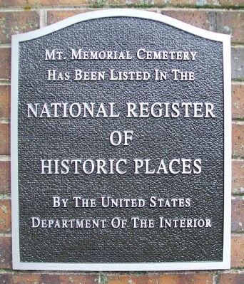
Dr. August Nasse - 1848
Home and Office
has been placed
on the
National Register
of
Historic Places
by the United States Department
of the Interior — — Map (db m169347) HM
Drusch-Koeller
Building
304 Schiller Street
has been placed on the
National Register
of Historic Places
by the United States
Department of the Interior
1885
— — Map (db m58716) HM
In Memory Of
My Beloved Husband
George F. Bayer
Born: Sept. 27, 1800
Died: March 18, 1839
And Our Son
Charles H.
Born: May 16, 1837
Died: Jan. 29, 1839
Wife and children I must leave you
Leave my home and all my woe . . . — — Map (db m63485) HM
Incorporated in 1849 by the state legislature, the German School had classes conducted in both the German and English languages.
This structure was the only privately owned public school building in the state when it was deeded to Historic . . . — — Map (db m58610) HM
Gustav Wohlt House
Built 1889
has been placed on the
National Register of
Historic Places
by the United States
Department of the Interior — — Map (db m63196) HM
Often called "Little Germany," Hermann was founded by the German Settlement Society of Philadelphia, 1836, as a colony where German customs and language could be preserved amid the benefits of America. Named for the national Germanic hero, the . . . — — Map (db m43695) HM
On April 15, 1870, Otto Monnig purchased this building on the corner of East Front and Guttenberg Streets and relocated his established hardware and cutlery store to this site. Over time, he expanded his inventory, adding a full line of clothing, . . . — — Map (db m63205) HM
This is an American Revolution Bicentennial Memorial marking the juncture of three famous pioneer trails here.
They are the Lewis and Clark Trail 1804-1806, the Ozark Frontier Trail mid-1800's and the Old Iron Road which linked the Meramec . . . — — Map (db m63207) HM
Strehly House
This house combines the European half-timber construction with the local brick tradition. It is representative of the less affluent Germans who emigrated to Missouri in the early 19th century, survived frontier hardships, and . . . — — Map (db m63260) HM
Catherine Oelschaeger Gentner bought the house in 1882 for $1,500. She and her husband, G. Heinrich, had been a part of the first group who arrived in December 1837 to begin the town of Hermann. Unlike the Pommers, the Gentners started with very . . . — — Map (db m63251) HM
This house is associated with two early Hermann families. Both the Pommer and Gentner families were among the initial members of the Deutsche Ansiedlungs-Gesellschaft zu Philadelphia (German Settlement Society of Philadelphia). Organized in 1836, . . . — — Map (db m169329) HM
In 1830 an early settlement was formed around the junction of "Old Iron Road" and the "St Louis to Springfield Road" (now Springfield & Peters Streets). Seventeen years later, two friends named this settlement after playing a horseshoe game to . . . — — Map (db m139777) HM
Through genealogical searches many families of Owensville have found their German heritage links them to Altena in Westphalia Germany as ancestors immigrated and located in this area in the mid 1800's. In 2004, the German American Club named Altena . . . — — Map (db m139783) HM
The Heartland Quilt Guild Carries on the stitching tradition of Owensville's Founding Fathers who sewed in the shoe factory to support their families and the founding mothers who sewed to clothe their families and cover their beds with warmth. — — Map (db m139780) HM
[Front]
Gentry County, first formed in 1841, and fully organized in 1845, is named for Mo. Militia Maj. Gen. Richard Gentry, Colonel of Volunteers in the Florida War, hero of the Battle of Lake Okeechobee, 1837, in which he was killed. A . . . — — Map (db m66516) HM
According to tradition, the city of Stanberry derived its name from that of John Jefferson Stansbury
City of Stanberry
Founded Sept. 25, 1879 — — Map (db m66514) HM
(Front): Queen City of the Ozarks, settled in 1830 by Tennessee pioneers on what had been a Kickapoo, Osage, and Delaware Indian camping ground. Springfield was first called Campbell and Fulbright Springs after its first settlers. Rivalry . . . — — Map (db m35247) HM
Site of Gen. Nicholas Smith's tavern on Boonville Road, earliest outlet of Springfield, also station of Butterfield Stage Route carrying first overland mail from St. Louis to Pacific Coast. Government subsidy $600,000 yearly. First mail left St. . . . — — Map (db m43089) HM
Near this spot was located the first post office in Springfield, in a one story, hewed log cabin, occupied by John Polk Campbell, who was appointed postmaster, Jan. 3, 1834. Mail was brought on horseback twice a month from Harrison's Store, on . . . — — Map (db m43120) HM
Site of first store in southwest Greene County, a little log cabin, supplied with goods from Boonville, Missouri, 1831, and conducted by Junius T. Campbell, brother of John P. Campbell, founder of Springfield. Marker erected 1921 by Reps Dry Goods . . . — — Map (db m43088) HM
First service in this building was June 26, 1904. Expansion program was completed in 1923. Exterior features are Ionic columns, stained glass windows, and dome. History of congregation dates from 1831. It once occupied historic structure at Walnut . . . — — Map (db m43123) HM
These mounds mark the site of pre-historic Indian homes. They are believed to represent the remains of thatch-roofed circular adobe huts, similar to those now built by the Mandan Indians. Thousands of similar mounds are widely scattered in groups . . . — — Map (db m79805) HM
585 feet southwest first church, Methodist Episcopal, in southwest Missouri was located in 1833. Size 18 x 20 feet, built of logs, puncheon floor and seats. Cost 18 dollars. Rev. Jas. H. Slavens, M.D., first pastor over White River and St. Francis . . . — — Map (db m43150) HM
About February, 1830, William Fulbright erected, near this spot, the first cabin built on the site of the present city of Springfield. At the same time, A. J. Burnett built a pole cabin near the natural well, and John Fulbright another near Jones' . . . — — Map (db m43086) HM
225 feet south of this spot the first school-house in Greene County was built by pioneers 1831. Small cabin, logs cut out for window and door openings. No shutter, door or chimney. Dirt floor. Three-legged benches. First teacher, Joseph Rountree. . . . — — Map (db m43064) HM
[side 1] Trenton, Settled in 1834, became the seat of Grundy County in 1841, when James S. Lomax gave 80 acres for a townsite. The county is named for Felix Grundy, United States Attorney General 1838-1839. The town name is . . . — — Map (db m179714) HM
Commemorates Trenton’s founding and the significance of “Five Points” in Trenton’s development. The original pole was erected in 1872. The fourth pole was erected in 2012. — — Map (db m216937) HM
[Front]
Here in the undulating glacial plains of north central Missouri, Harrison is one of 9 counties forming the State's border with Iowa. Twenty-sixth in size of Missouri's 114 counties, and second largest on the border, it was . . . — — Map (db m66588) HM
705 entries matched your criteria. Entries 101 through 200 are listed above. ⊲ Previous 100 — Next 100 ⊳