Near East Spring Street (Ohio Route 29/66) east of Miami and Erie Canal Trail, on the right when traveling east.
The headwaters of the St. Marys River be just southeast of the City of St. Marys. The ever flows generally northwest to Wayne, Indiana, where it meets with the St. Joseph River in downtown ft. Wayne to form the Maumee River. The Maumee then flows . . . — — Map (db m228266) HM
On East High Street, on the left when traveling east.
1845 - Miami & Erie Canal Opens
1847 The St. Marys flour mill built by Scott, Linzee and Co. was the first industry to use power from the Miami & Erie Canal water in St. Marys. 1860 to 1870 Robert B. Gordon, added three Grist . . . — — Map (db m228161) HM
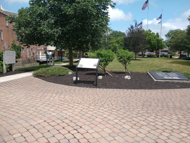
On Auglaize Street at Broadway, on the right when traveling east on Auglaize Street.
The Dayton and Michigan Railroad provided the single most important impetus to the growth and development of Wapakoneta. Although Wapakoneta had been platted in 1833, at the time of incorporation (1848), "the town was still without any material . . . — — Map (db m12406) HM
On West Auglaize Street (Ohio Route 67) 0.2 miles east of Presar Road (County Route 133), on the right when traveling east.
In 1967 Herold and Martha Dammeyer purchased acreage Saint Marys Township - section 30 and on this property was the original old log house and this old log smoke house; being typical of buildings in our early history.
In 1983 the old log . . . — — Map (db m244697) HM
On Santa Fe-New Knoxville Road (County Route 100) at Cemetery Rd (County Route 161), on the left when traveling east on Santa Fe-New Knoxville Road.
Saints Peter and Paul Church, Petersburg (1835), was the mother
church for St. Joseph, Wapakoneta; St. John the Evangelist, Fryburg;
St. Lawrence, Rhine; and Our Lady of the Immaculate Conception,
Botkins. All were founded by German-Catholic . . . — — Map (db m225370) HM
On Auglaize Street (Ohio Route 501) when traveling west.
Plaque # 1 The Shawnee Indians were driven from
the southern United States in the late 17th
and early 18th centuries by white settlers
and Catawba, Cherokee and Chickasaw
Nations. the Shawnee were given permission
by the Miamis and . . . — — Map (db m86526) HM
On Main Street (U.S. 40) at Lincoln Avenue (Ohio Route 7), on the right when traveling west on Main Street.
Colonel Ebenezer Zane, one of the founders of Wheeling, laid out the village that became Bridgeport in 1806 on the site of Fort Kirkwood (1789). Originally named Canton, it acquired its present name after the bridge to Wheeling Island was built. The . . . — — Map (db m515) HM
On National Road (County Route 807), on the right when traveling east.
The village of Hendrysburg was laid out by Charles Hendry in 1828, shortly after the National Road was completed through this area. Mr. Hendry had erected a steam flouring mill which attracted many people to the area, giving rise to the laying out . . . — — Map (db m246566) HM
The Walnut Grove Cemetery is the burial place of members of the Zane and Martin families. Their graves lie within the brick enclosure. The cemetery is also the resting-place of many early Martins Ferry residents, including veterans of the . . . — — Map (db m28444) HM
Near Mellot Street, 0.1 miles south of Main Street.
First surveyed in 1849, Powhatan Point was laid out by Franklin Knox. The "point" is the confluence of Captina Creek and the Ohio River. The small but thriving river and farming community served York Township and the rich Captina Valley as a . . . — — Map (db m78499) HM
On West Main Street, on the right when traveling east.
Ground was broken for the National Road in Ohio in front of the Belmont County Courthouse in St. Clairsville on July 4, 1825.
St. Clairsville was originally platted as Newellstown in 1803, the same year Ohio became a state. As the seat of Belmont . . . — — Map (db m209538) HM
On West Main Street (U.S. 40) at South Market Street, on the left when traveling east on West Main Street.
Belmont County. On September 7, 1801, Belmont County became the ninth county in what became the State of Ohio. On April 1, 1803, the state’s first General Assembly appointed a commission to determine if it was necessary to move the county . . . — — Map (db m214486) HM
On Main Street (Ohio Route 125) at Eagle Street (County Route 102), on the right when traveling east on Main Street.
Historic Decatur. Originally called St. Clairsville and platted in 1801, Decatur was named for early 19th century naval hero Stephen Decatur. It is among the oldest villages in Brown County, which before 1817 was a part of Adams County. Among . . . — — Map (db m121885) HM
This house originally stood at Logan’s Gap, Union Township. By tradition, it was constructed in 1783 by Indian scouts William Dixon and Cornelius Washburn who became residents of Brown County. Dixon lived in this house until 1800. — — Map (db m135937) HM
On Wahlsburg East Road (County Route 81) east of South High Street (U.S. 68), on the right when traveling east.
Through the terms of his will,
absentee British
landowner Samuel Gist
freed his 350 slaves in Virginia.
Gist (c.1723-1815)
intended
that these freed people would
remain on
the land and
receive
instruction in Christianity and that schools . . . — — Map (db m136037) HM
Constructed in 1793 by William Dixon and Cornelius Washburn, Indian scouts who helped to clear for settlement the area that became Brown County. — — Map (db m135967) HM
(west-facing tablet) The men who wrought for Liberty were the forerunners of the Abolition Movement culminating in the Civil War. • They were the intermediaries between the anti-slavery men of the American Revolution and the anti-slavery . . . — — Map (db m135396) HM
On North Front Street north of Main Street, on the left when traveling north.
A part of the Virginia Military District, Ripley was founded in 1812 by Colonel James Poage, a veteran of the Revolutionary War. Originally named Staunton, after Poage’s home town in Virginia, the village comprised 1,000 acres along the Ohio river. . . . — — Map (db m135427) HM
On Columbus Street (U.S. 62) near Main Street (Ohio Route 125), on the right when traveling south.
Ohio
Revolutionary
Memorial
Trail
$50 Fine
or
10 days
imprison-
ment or
both for
defacing
this
marker
Ohio State
General Code
Section 12489 — — Map (db m137356) HM
On Anderson State Road, 0.4 miles east of Ohio Route 251, on the right when traveling east.
In July of 1845 eleven Ursuline Nuns arrived in Saint Martin, a village of French and Irish settlers at the northern tip of Brown County. John Baptist Purcell, Bishop of Cincinnati, had urged these Ursulines to establish a school for young . . . — — Map (db m246386) HM
Elisha Morgan purchased 48.6 acres in Fairfield Township, part of the Symmes Purchase, in 1817. The Farm Mansion was built shortly after he settled the land. The house incorporates two prevalent architectural styles in southwest Ohio in the . . . — — Map (db m224980) HM
On Dixie Highway (Ohio Route 4) west of Holden Boulevard, on the right when traveling west.
For generations everyone from prince to pauper arrived in Cincinnati at the "public landing" along the banks of the Ohio River. "The Landing" as the local population knew it, greeted the new arrivals to the young city and still serves as a social . . . — — Map (db m201219) HM
On River Road at Lakeside Drive, on the right when traveling north on River Road.
Miami Chapel Cemetery. Around 1843, local Methodists organized a new Methodist Episcopal church at Fair Play and later erected a brick chapel. The congregation was short-lived, however, and fell into decline after one of its leading members, . . . — — Map (db m158422) HM
On Dayton Street, on the left when traveling east.
On this site stood a square two-story brick farmhouse occupied by
Wiiliam Bebb and built in 1835.
After he was elected nineteenth Governor of Ohio, William Bebb
sold his house in 1848 to William Beckett, founder of Beckett Paper
Company, who . . . — — Map (db m116670) HM
On Reily Millville Rd (County Route 29), on the left when traveling west.
Bunker Hill The Millville, Reilly and Milton Turnpike brought prosperity to the
village now renamed Bunker Hill. School House No. 10 stood nearby
from 1849-1857. By 1860 clothing manufacturing was the major
business here. A Post Office was . . . — — Map (db m107801) HM
On Hancock Avenue north of Bender Avenue, on the right when traveling north.
Crawford Woods was the country estate of the Crawford family for nearly 125 years and a popular location for family picnics and Sunday School outings for East Hamilton residents for decades before it became a multiple-use Hamilton park.
The 10-room . . . — — Map (db m201354) HM
On High Street (Ohio Route 129/177) west of Monument Street, on the right when traveling east.
Mills were essential in the settlers' struggle to convert their land from a debt to an asset. Financial survival depended on access to grist mills, saw mills and carding mills - the trading complexes and community centers on the Ohio frontier. . . . — — Map (db m73595) HM
On High Street (Ohio Route 129/177) west of Monument Street, on the right when traveling east.
Because water was the most efficient way to transport goods, most early Ohio roads led to a navigable stream, such as the Great Miami River. Through the 1820s, much of Butler County's abundant agriculture output found its way to market on . . . — — Map (db m73593) HM
On High Street (Ohio Route 129/177) west of Monument Street, on the right when traveling east.
March 25, 1913, a record Great Miami River flood hit Hamilton, claiming more than 200 lives, leaving about 10,000 homeless and causing more than $10 million in property damage. Local survivors helped create the Miami Conservancy District - a . . . — — Map (db m73594) HM
On High Street (Ohio Route 129/177) west of Monument Street, on the left when traveling east.
The privately developed Hamilton Hydraulic opened Jan. 27, 1845, providing cheap, reliable water power and starting Hamilton's era of industrial growth and diversification. Water was diverted into the hydraulic canal system from the Great Miami . . . — — Map (db m73598) HM
On Third Street, on the right when traveling north.
Side A
Clark Lane built this library in 1866 and donated it to the people of Hamilton two years later. The 1913 Great Miami River flood catastrophe damaged much of the building and many of its books and records. The refurbished library . . . — — Map (db m122413) HM
On Reily Millville Road at Cochran Road, on the right when traveling west on Reily Millville Road.
Lewis-Sample Farmstead. The farmstead shares the name of the Lewis and Sample families, two owners since European-descended settlers began moving into the Ohio County in the late 1700s. Andrew (1762-1847) and Martha Lewis (1774-1852) acquired . . . — — Map (db m157034) HM
On South Monument Avenue, on the right when traveling south.
This log building, which was erected while this part of the country was still a wilderness, is a silent tribute to the courageous and hardy Americans who preceded you who read this. This tribute symbolizes the strength and character of which we . . . — — Map (db m30660) HM
On Ross Avenue at B Street, on the right when traveling south on Ross Avenue.
Rossville was settled in April 1801 shortly after the U.S. Government initiated land sales west of the Great Miami River. Its original proprietors--John Sutherland, Henry Brown, Jacob Burnet, James Smith and William Ruffin--named the town in honor . . . — — Map (db m28790) HM
On High Street (Ohio Route 129/177) west of Monument Street, on the left when traveling east.
Fort Hamilton was completed Sept. 30, 1791, and occupied by the U. S. Army commanded by Gen. Arthur St. Clair. The supply base was the first in a chain of outposts north of Cincinnati (Fort Washington) in the Northwest Territory. The log . . . — — Map (db m73600) HM
On South Third Street near Charles Str, on the left when traveling south.
- “I declare the earth is hollow and habitable within,” said John Cleves Symmes in summarizing his “Theory of Concentric Spheres and Solar Voids” to a doubting scientific world in the early 1820’s. His theory is commemorated . . . — — Map (db m116622) HM
On Central Avenue (Ohio Route 122) at N. Verity Parkway (Ohio Route 73), on the right when traveling west on Central Avenue.
Canals were built in Ohio to provide a better way to transport goods to the eastern markets. Two major canals were built connecting the Ohio River to Lake Erie - the Ohio Erie & [sic Ohio & Erie] Canal running from Portsmouth to Cleveland and the . . . — — Map (db m30375) HM
On Verity Parkway (Ohio Route 4 / 73) at Main Street, on the right when traveling north on Verity Parkway.
Verity Pkw. once Miami-Erie Canal
an Underground Railroad route
1830 - 1860
Those traveling along Underground
Railroad found safe stations
in N. Main St. homes of
African-Americans
listed on other side
Rice • Hawkins • Colston . . . — — Map (db m29667) HM
On Elk Creek Road at Howe Road, on the right when traveling north on Elk Creek Road.
In c1795 Bambo Harris a freed black slave built and operated the first Water Driven gristmill in the area on Elk Creek. For fifty years his Millstones ground wheat and corn. A member of the Prairie Baptist Church, he was highly respected in the . . . — — Map (db m28779) HM
On Elk Creek Road at Howe Road, on the right when traveling north on Elk Creek Road.
The village of Miltonville, located along the banks of Elk Creek, was platted in 1816 by George Bennett, Theophilus Eaglesfield, and Richard V. V. Crane. The creek served two grist mills, one built around 1804 and operated by a free black, Bambo . . . — — Map (db m28776) HM
On East Elm Street at Cincinnati Dayton Road, on the right when traveling west on East Elm Street.
City of Monroe Monroe. Nathanial Sackett (1768-1854) and John H. Piatt (1781-1820) platted Monroe in 1817, naming it for President James Monroe. Monroe was a stagecoach stop between Cincinnati and Dayton and grew to be a rural village . . . — — Map (db m206448) HM
On Okeana-Drewersburg Road, 0.1 miles west of Cincinnati-Brookville Road (Ohio Route 126), on the right when traveling west.
Side A:
1858 Morgan Township House
On April 20, 1857, the trustees of Morgan Township met in Okeana to obtain a lot for the township house. From a quarter mill tax levy, $850 was budgeted for a house and lot. Money expended on the project . . . — — Map (db m24000) HM
Edward Bebb, father of William Bebb and first Welshman to settle in Paddy's Run, Morgan Township, Butler County purchased this cabin in 1801. Originally the cabin stood four miles southeast of this site on the Dry Fork of the Whitewater River. It . . . — — Map (db m24001) HM
On Reily-Millville Road (County Route 29) 0.2 miles west of Bunker Hill Woods Road, on the right when traveling east.
(side A)
Bunker Hill Universalist Church
The Bunker Hill Society was organized about 1845 and fellowshipped in 1854. A frame meeting house, capable of seating 300, was dedicated in 1855. Thirty people united with the church . . . — — Map (db m107789) HM
On Indian Creek Road (County Route 37), on the left when traveling east.
The Indian Creek Regular Baptist Church was established in 1810 as an arm of the Little Cedar Creek Church of Brookville, Indiana. The congregation purchased three acres of land for a burial ground and church and built a log structure here in . . . — — Map (db m120291) HM
On Patterson Avenue (U.S. 27), on the left when traveling south.
Side A: Langstroth Cottage Reverend Lorenzo Langstroth, renowned as "The Father of American Beekeeping," lived in this simple two-story, eight-room house with his wife, Anne, and their three children from 1858 to 1887. Unchanged externally, the . . . — — Map (db m24009) HM
Near Oxford Millville Road (U.S. 27) 0.3 miles north of Stillwell Beckett Road, on the right when traveling north.
side A
A cemetery was established on the site in 1811 and became the final resting place for many of the area's early pioneer families. The Hanover Township Trustees obtained title to the land in 1823 from John and Anna Farnsworth, and it . . . — — Map (db m97814) HM
(bust of Washington)
The Act of 1794
In the name of the United States of America: It is hereby declared that
one complete township or tract of land, of six miles square, to be located
with the approbation of the governor, for the . . . — — Map (db m116659) HM
Side A: The DeWitt Family
Zachariah Price DeWitt was born of a Dutch family in New Jersey in 1768. With brothers Jacob and Peter, he migrated to Kentucky where, in 1790, he married Elizabeth Teets, who was born in Pennsylvania in 1774. By . . . — — Map (db m24064) HM
On Brown Road at Doty Road, on the right when traveling north on Brown Road.
Side A: The Doty Settlement
As Oxford Township was developing in the mid-1800s, a cluster of farmsteads near its northern border was designated the "Doty Settlement." As was the custom, the community took its name from a prominent family in . . . — — Map (db m24015) HM
This original dug well relates to one of the several fascinating legends of Zachariah and Elizabeth DeWitt. As reported by Ralph McGinnis in The History of Oxford, Ohio, from the Earliest Days to the Present, Zachariah heard Elizabeth's . . . — — Map (db m24072) HM
On Brown Road, 0.2 miles south of Doty Road, on the right when traveling south.
Side A: The Restoration Movement
In the early years of the nineteenth century, a religious unrest known as the Second Great Awakening spread across much of the American frontier. Among the most influential of the evolving religious . . . — — Map (db m24051) HM
On Cincinnati-Brookville Road (Ohio Route 126), on the right when traveling east.
The foundation for the first Welsh settlement in Ohio was laid on June 29, 1801, when William and Morgan Gwilym purchased land in what is now Morgan Township at the Cincinnati Land Office. The Welsh, who settled in Pennsylvania beginning in the late . . . — — Map (db m23991) HM
On State Street (Ohio Route 73) at Miami Street / Hamilton Road, on the left when traveling west on State Street.
Site of the home of Trenton's founder, Michael Pearce, and his wife, Phebe Squier Pearce. The family migrated from New Jersey in 1801, purchased 1,500 acres, and settled in this location. Michael Pearce and David Enyeart platted the village of 33 . . . — — Map (db m29681) HM
On State Street (Ohio Route 73) at Miami Street / Hamilton Road, on the left when traveling west on State Street.
Side A: The Village of Trenton
Platted 1816. Incorporated as Village 1895. Became a city 1971
Trenton's founder, Michael Pearce, came to the area in 1801. The original village of 33 lots was named Bloomfield. When the post office was . . . — — Map (db m28792) HM
On Woodsdale Road (County Route 150), on the right when traveling west.
This farm, Chrisholm (German for home farm of Christian Augspurger), was established in 1830 by Christian Augspurger (1782-1848), leader of the Amish Mennonite settlement in Butler County. The Amish selected this area because of rich, fertile . . . — — Map (db m122421) HM
On Woodsdale Road (County Route 150), on the left when traveling east.
This hamlet, located one mile southwest from here, was never platted, but was named after William Woods, president of the three-story brick Woodsdale paper mill constructed in 1867. Flanking the mill were the company office and store and several . . . — — Map (db m122420) HM
On Scio Road (Ohio Route 332) at Autumn Rd SW (County Road 19), on the left when traveling south on Scio Road.
The Algonquin Mill
was named for an Indian camp site near the settlement which is now Petersburg. This structure, built about 1826, replaced an earlier mill. Originally operated by water power from Little McQuire Creek, it drove two sets of burrs. . . . — — Map (db m159707) HM
On Bachelor Road (County Road 23) at Barks Road Northwest (County Road 26), on the right when traveling east on Bachelor Road.
Platted by Samuel Oswalt and John Wagoner in 1831. Worley’s Hotel, built in 1820, was the first stage coast stop between Bolivar-Canton and Steubenville. The road followed the first white man’s trail, established by Bezaleel Wells who founded Canton . . . — — Map (db m159693) HM
On Deacon Road Southwest (County Road 115) at Autumn Road Southwest (County Road 19), on the right when traveling east on Deacon Road Southwest.
The New Hagerstown Academy, built on this site in 1837, operated as a fully qualified educational institution until the turn of the century. It offered a well rounded curriculum and some of the most eminent physicians, lawyers, educators and . . . — — Map (db m159760) HM
On Alliance Road Northwest (Ohio Route 183) at Linden Road Northwest (County Road 229), in the median on Alliance Road Northwest.
The Great Indian Trail between Ft. Pitt and Chillicothe followed this route. In 1764 Col. Henry Bouquet and his expedition followed this trail to Coshocton to free 200 captives held by the Seneca, Delawares, and Shawnee Tribes. The resulting treaty . . . — — Map (db m159651) HM
On Lodge Road Southwest (Ohio Route 542) at Fargo Road, on the left when traveling east on Lodge Road Southwest.
Atwood Village originally stood at this intersection.
Although the plat never was recorded, baptismal records from the United Presbyterian Church, dated 1834, indicate that ATWOOD was a thriving village at that time.
It . . . — — Map (db m159766) HM
This memorial is in memory of Jacob
and Martha Boggs Johnson, and marks
the spot where the Indian cabin stood
Into which they moved April 1. 1805. With
other pioneers they came as the Indians
departed and worthily bore their part
in subduing . . . — — Map (db m127297) HM
On Ohio Route 245, 0.2 miles south of Mt. Tabor Road (Ohio Route 507), on the right when traveling north.
Mt. Tabor Church. The first Mt. Tabor Church, a log meetinghouse, was erected on this site in 1816. It stood on land originally selected by Griffith and Martha Evans for a graveyard at the death of their daughter circa 1812. Deeds show the . . . — — Map (db m198029) HM
On Ohio Route 29 at Ohio Route 560, on the left when traveling west on State Route 29.
(bronze plaque)
Richard Stanhope
(Stanup)
Free black man and landowner
Settler in Madison County, Ohio
on Virginia Military land
resident of Concord Township
Champaign County, Ohio
Died September 1862
Buried in Concord . . . — — Map (db m106683) HM
On Main Street (Ohio Route 29) at Race Street, on the right when traveling north on Main Street.
The Mechanicsburg United Methodist congregation was founded in the early nineteenth century and met first in open-air camp meetings before moving into a small log school building. In 1820 the congregation built a wood framed church on East Sandusky . . . — — Map (db m13730) HM
On Sandusky Street (Ohio Route 4), on the right when traveling east.
Side A:
This site has long served the religious, education, and public interests of the residents of Mechanicsburg. A local Methodist congregation built its first church here in 1820, and the townspeople also used the structure as its . . . — — Map (db m13731) HM
On Main Street (U.S. 68), on the left when traveling north.
A group of Freemasons, inspired by the concepts of a new country, of Freedom with Responsibility, Brotherly Love, and Truth, formed Harmony Lodge near this site in 1809, the first Masonic lodge in western Ohio. Meetings were held in the log court . . . — — Map (db m13820) HM
On Patrik Avenue (Ohio Route 54) 0.1 miles south of Jefferson Avenue, on the left when traveling south.
Simon Kenton who is buried here. During the Revolutionary War he frequently served as scout under George Rogers Clark and later praised Clark for his role in saving the Kentucky settlements. Kenton's Indian captivity of 1778-79 acquainted him with . . . — — Map (db m34088) HM
On High Street at College Street, on the right when traveling south on High Street.
Side A: John Anderson Ward Farmstead
John Anderson Ward had this Federal style house constructed from 1823-1825 on land inherited from his father, Urbana's founder Colonel William Ward. The Colonel's will stipulated that a local mason . . . — — Map (db m13822) HM
On KentonStreet at Ward Street, on the right when traveling north on KentonStreet.
War Council of 1812. To confirm that the Treaty of Greenville would be upheld, Ohio Governor Return J. Meigs called a council with Native Americans June 6-9, 1812. He sought approval to cross native land when marching to Canada and to ensure . . . — — Map (db m81636) HM
On Upper Valley Pike (Ohio Route 560), on the right when traveling south.
Virginia native William Owen, 1769-1821, is credited with being the
first American to settle in Mad River Township, Champaign County
sometime between 1797-1799. He and his family built a cabin in the
northeast quarter of Section 15 directly west . . . — — Map (db m86157) HM
On William Street just north of West Jamestown Street, on the right when traveling south.
South Charleston Historic District has been placed on The National Register Of Historic Places in 1978 by The United States Department Of The Interior — — Map (db m221944) HM
On Old National Road (U.S. 40) at Buena Vista road (County Route 92), on the right when traveling west on Old National Road.
Built in 1836, the Buena Vista Tavern operated as an inn from 1849 to
1856, when it became a private residence. In 1930, it returned to
public life as a tourist camp with cabins or cottages located behind the
old inn. The Buena Vista Tavern is . . . — — Map (db m86729) HM
In memory of the men
buried in Clark County
who fought in the
American Revolution
1775 - 1783
Lt. John Bancroft • Jacob Ellsworth
William McIntire • Frederick Brown
Samuel Lippincott Sr. • James Kelly
Corneilus Toland • Isaac . . . — — Map (db m28796) HM
Since 1826, the Esplanade has been the traditional center of Springfield and Clark County. The National Road passed within one block of “Market Square” as it was then called. Three city halls, several hotels, train stations, and numerous . . . — — Map (db m13316) HM
On E Main Street (U.S. 40) at S Spring Street (Ohio Route 72), on the left when traveling west on E Main Street.
This Marks the Site of
The First Tavern in Springfield
Near Which
In 1808 A Permanent Peace Treaty
Was Made By
Simon Kenton and Others
With the Indians — — Map (db m217174) HM
Near West Columbia Street (U.S. 40) just east of North Wittenberg Avenue, on the left when traveling east.
James Demint, a Virginian by birth, came to this area from Cincinnati with his family in 1799. Prior to his arrival, he purchased 640 acres from John Cleves Symmes, owner of a large amount of land located between the Great and Little Miami . . . — — Map (db m224414) HM
On East College Avenue, on the right when traveling east.
One hundred feet south of this
spot, James Demint, the founder of
Springfield, built the first cabin
in the city. In 1803 he completed
the first plat of the city. — — Map (db m83855) HM
Springfield's "first inventor", born in Virginia, brings a genius previously unparalleled in the history of our community. His passion for the use of the abundant water supply in the area accelerates Springfield into the early beginnings of the . . . — — Map (db m81932) HM
Jeremiah and his wife Ann, wealthy Quakers from Philadelphia, arrive in Springfield in 1830 to claim extensive acreage inherited from his late father’s estate. That same year, he purchases from the estate the village of Lagonda consisting of . . . — — Map (db m81890) HM
Affectionately called by some, “The Father of Ferncliff Cemetery”, John Ludlow is a member of an early pioneer family in Clark County, eventually becoming a well-known pharmacist. In 1851, he is elected as a director of the Springfield . . . — — Map (db m81896) HM
1361 entries matched your criteria. Entries 101 through 200 are listed above. ⊲ Previous 100 — Next 100 ⊳