After filtering for Tennessee, 356 entries match your criteria. The first 100 are listed. ⊳
Native Americans Topic
By Darren Jefferson Clay, April 18, 2021
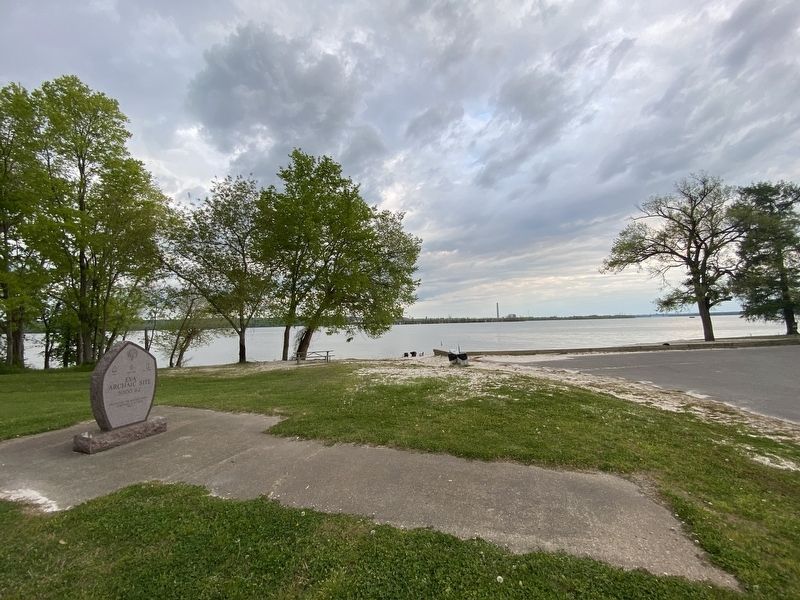
Eva Archaic Site Marker
| 1 ► Tennessee, Benton County, Eva — Eva Archaic Site — 5000 B.C. — |
| On Eva Beach Drive, 0.2 miles east of Lucas Road, on the right when traveling east. | |||
| 2 ► Tennessee, Blount County, Maryville — 1E 14 — Chilhowee — |
| On U.S. 129, 0.5 miles east of Happy Valley Road, on the left when traveling east. | |||
| 3 ► Tennessee, Blount County, Maryville — 1E 5 — Houston's Station — |
| On Calderwood Highway (U.S. 129) 0.1 miles south of Hutton Ridge Road, on the left when traveling south. | |||
| 4 ► Tennessee, Blount County, Maryville — 1 E 100 — John Craig's Fort — |
| On South Washington Street (State Highway 35) at Sevierville Road, on the right when traveling south on South Washington Street. | |||
| 5 ► Tennessee, Blount County, Maryville — Near the Site of Henry Fort — |
| On U.S. 411 at Henry Lane, on the right when traveling north on U.S. 411. | |||
| 6 ► Tennessee, Blount County, Seymour — Campbell Family Massacre — |
| Near Barbra Estates Drive, 0.1 miles east of Boling Road, on the right when traveling east. | |||
| 7 ► Tennessee, Blount County, Sixmile — 1E-125 — Montvale Springs — |
| On Montvale Road, 0.3 miles south of Deer Run Drive, on the right when traveling south. | |||
| 8 ► Tennessee, Blount County, Townsend — 1E 15 — Tuckaleechee Villages — |
| On US Hwy 321, 0.1 miles east of Old Tuckaleechee Road, on the right when traveling north. | |||
| 9 ► Tennessee, Bradley County, Charleston — A New Home — |
| Near Market Street NE north of Hiwassee Street (U.S. 11), on the left when traveling north. | |||
| 10 ► Tennessee, Bradley County, Charleston — A New Home — |
| Near Market Street NE north of Hiwassee Street (U.S. 11), on the left when traveling north. | |||
| 11 ► Tennessee, Bradley County, Charleston — A Warning and a Protest — |
| On Market Street NE, 0.1 miles north of Hiwassee Street (U.S. 11), on the left when traveling north. | |||
| 12 ► Tennessee, Bradley County, Charleston — A Warning and a Protest — |
| On Market Street NE, 0.1 miles north of Hiwassee Street (U.S. 11), on the left when traveling north. | |||
| 13 ► Tennessee, Bradley County, Charleston — Anticipation Grows — |
| On Market Street NE, 0.1 miles north of Hiwassee Street (U.S. 11), on the left when traveling north. | |||
| 14 ► Tennessee, Bradley County, Charleston — Anticipation Grows — |
| On Market Street NE, 0.1 miles north of Hiwassee Street (U.S. 11), on the left when traveling north. | |||
| 15 ► Tennessee, Bradley County, Charleston — Preparing for Removal — |
| On Market Street NE north of Hiwassee Street (U.S. 11), on the left when traveling north. | |||
| 16 ► Tennessee, Bradley County, Charleston — Preparing for Removal — |
| On Market Street NE north of Hiwassee Street (U.S. 11), on the left when traveling north. | |||
| 17 ► Tennessee, Bradley County, Charleston — Prisoners — |
| On Market Street NE north of Hiwassee Street (U.S. 11), on the left when traveling north. | |||
| 18 ► Tennessee, Bradley County, Charleston — Prisoners — |
| On Market Street NE, 0.1 miles north of Hiwassee Street (U.S. 11), on the left when traveling north. | |||
| 19 ► Tennessee, Bradley County, Charleston — Sickness in the Camps — |
| Near Market Street NE north of Hiwassee Street (U.S. 11), on the left when traveling north. | |||
| 20 ► Tennessee, Bradley County, Charleston — Sickness in the Camps — |
| Near Market Street NE north of Hiwassee Street (U.S. 11), on the left when traveling north. | |||
| 21 ► Tennessee, Bradley County, Charleston — Spare Our People — |
| On Market Street NE, 0.1 miles north of Hiwassee Street (U.S. 11), on the left when traveling north. | |||
| 22 ► Tennessee, Bradley County, Charleston — Spare Our People — |
| On Market Street NE, 0.1 miles north of Hiwassee Street (U.S. 11), on the left when traveling north. | |||
| 23 ► Tennessee, Bradley County, Charleston — Voices from the Past — |
| Near Hiwassee Street (U.S. 11) north of Market Street NE, on the right when traveling north. | |||
| 24 ► Tennessee, Bradley County, Charleston — Voices from the Past — |
| Near Worth Street NE west of Market Street NE, on the left when traveling west. | |||
| 25 ► Tennessee, Bradley County, Cleveland — 2A 71 — "Chief Jack" Walker — |
| On Keith Street Northwest (U.S. 11) at Stuart Road, on the right when traveling north on Keith Street Northwest. | |||
| 26 ► Tennessee, Bradley County, Cleveland — 2A 92 — Cooper Cemetery — |
| Near Blythewood Road Southwest at Harris Creek Road Southwest, on the right when traveling north. | |||
| 27 ► Tennessee, Bradley County, Cleveland — 2A 44 — Red Clay Council Ground — |
| On Dalton Pike (State Highway 60). | |||
| 28 ► Tennessee, Bradley County, McDonald — 2A 8 — De Soto's Route — |
| On South Lee Highway (U.S. 64) at South McDonald Road, on the right when traveling east on South Lee Highway. | |||
| 29 ► Tennessee, Campbell County, Caryville — Indian Mounds — |
| Near Veterans Memorial Highway (Alternate Interstate 75) south of Lake Access Road, on the right when traveling south. | |||
| 30 ► Tennessee, Cannon County, Woodbury — 2E 22 — The Trail of Tears — |
| On McMinnville Highway (U.S. 70S) west of Gassaway Road. | |||
| 31 ► Tennessee, Carter County, Elizabethton — Buffalo Creek — |
| Near West G Street (Tennessee Route 67) at West Elk Avenue (U.S. 321), on the right when traveling west. | |||
| 32 ► Tennessee, Carter County, Elizabethton — Sycamore Shoals of the Watauga — |
| On West Elk Avenue (U.S. 321) 0.1 miles south of Williams Avenue, on the right when traveling north. | |||
| 33 ► Tennessee, Carter County, Elizabethton — 1A 52 — Transylvania Purchase — |
| On West Elk Avenue (U.S. 321) west of Franklin Club Drive, on the right when traveling west. | |||
| 34 ► Tennessee, Carter County, Elizabethton — Uncovering the Past — Sabine Hill State Historic Site — |
| Near West G Street (Tennessee Route 67) 0.1 miles west of Sabine Street, on the left when traveling west. | |||
| 35 ► Tennessee, Carter County, Elizabethton — Valentine Sevier, "The Immigrant" — 1712-1803 — |
| On Franklin Club Drive, 0.2 miles West Elk Avenue (U.S. 321), on the left when traveling west. | |||
| 36 ► Tennessee, Carter County, Elizabethton — 1A 53 — Watauga Purchase — |
| On West Elk Avenue (U.S. 321) west of Franklin Club Drive, on the right when traveling west. | |||
| 37 ► Tennessee, Cheatham County, Kingston Springs — 3C 58 — Mound Bottom — |
| On Cedar Hill Road, 0.4 miles south of Mound Creek Road, on the right when traveling south. | |||
| 38 ► Tennessee, Claiborne County, Speedwell — 1D 19 — Yoakum Station — |
| On State Highway 63 at Ausmus Road, on the right when traveling north on State Highway 63. | |||
| 39 ► Tennessee, Cocke County, Newport — 1C 66 — The War Ford |
| On North Street (U.S. 321) at Northcutt Street, on the right when traveling north on North Street. Reported missing. | |||
| 40 ► Tennessee, Cocke County, Newport — The Warford — |
| On River Street, on the left when traveling east. | |||
| 41 ► Tennessee, Cocke County, Newport — 1C 19 — Whitson’s Fort — |
| On Wilton Springs Road (U.S. 321) at Cosby Hwy., on the left when traveling south on Wilton Springs Road. | |||
| 42 ► Tennessee, Coffee County, Manchester — 2E 5 — Old Stone Fort — |
| On Murfreesboro Hwy (U.S. 41), on the left when traveling north. | |||
| 43 ► Tennessee, Coffee County, Manchester — 2E 5 — Old Stone Fort — |
| On Murfreesboro Highway (U.S. 41) at Stone Fort Drive, on the right when traveling south on Murfreesboro Highway. | |||
| 44 ► Tennessee, Davidson County, Goodlettsville — 3B 23 — Casper Mansker — 1746–1820 — |
| On South Main Street (U.S. 31W) near Memorial Drive, on the left when traveling north. | |||
| 45 ► Tennessee, Davidson County, Hermitage — Ginning and Pressing "King Cotton" — Wealth Created by Enslaved Hands — |
| On Field Quarter Trail. | |||
| 46 ► Tennessee, Davidson County, Hermitage — Land Conservation at The Hermitage — Native Warm Season Grasses Plan — |
| Near Rachels Lane. | |||
| 47 ► Tennessee, Davidson County, Nashville — Early History — Tennessee Agricultural Museum — |
| Near Hogan Road. | |||
| 48 ► Tennessee, Davidson County, Nashville, Antioch — 244 — Alice Thompson Collinsworth — 1777-1828 — |
| On Crossings Boulevard west of Mt. View Road, on the right when traveling west. | |||
| 49 ► Tennessee, Davidson County, Nashville, Downtown — Colonel Richard Henderson — Founder and Promoter of the noted "Transylvania Land Company" — |
| Near 1st Avenue North, 0.1 miles south of Church Street, on the right when traveling north. | |||
| 50 ► Tennessee, Davidson County, Nashville, Downtown — 3A 32 — Demonbreum's Cave — |
| Near 1st Avenue South, on the right when traveling north. | |||
| 51 ► Tennessee, Davidson County, Nashville, Downtown — Native American Plaza — |
| On 1st Avenue North, 0.1 miles north of Broadway (U.S. 70), on the right when traveling north. | |||
| 52 ► Tennessee, Davidson County, Nashville, Downtown — The First Peoples — |
| On 1st Avenue North, 0.1 miles north of Broadway (U.S. 70), on the right when traveling north. | |||
| 53 ► Tennessee, Davidson County, Nashville, East Nashville — More Than Survival — |
| Near Shelby Bottoms Greenway east of Through the Woods, on the right when traveling south. | |||
| 54 ► Tennessee, Davidson County, Nashville, East Nashville — Shelby Bottoms — First Peoples — |
| On Shelby Bottoms Greenway east of Through the Woods, on the right when traveling south. | |||
| 55 ► Tennessee, Davidson County, Nashville, Green Hills — 18 — Johnson's Station — |
| On Harding Pike (U.S. 70S) at Vine Court, on the right when traveling west on Harding Pike. | |||
| 56 ► Tennessee, Davidson County, Nashville, Midtown — Natchez Trace — |
| On 27th Avenue North at West End Avenue (U.S. 70S), on the right when traveling north on 27th Avenue North. | |||
| 57 ► Tennessee, Davidson County, Nashville, North Capitol — A Major Treaty with the Chickasaw — |
| On 7th Avenue North, on the left when traveling south. | |||
| 58 ► Tennessee, Davidson County, Nashville, North Capitol — Agricultural state, permanent capital, education and Cherokee forced removal — |
| On 7th Avenue North, on the left when traveling south. | |||
| 59 ► Tennessee, Davidson County, Nashville, North Capitol — Andrew Jackson and the Treaty of New Echota — |
| On 7th Avenue North, on the left when traveling south. | |||
| 60 ► Tennessee, Davidson County, Nashville, North Capitol — Archaic-period Indians in Tennessee — |
| On 7th Avenue, on the left when traveling south. | |||
| 61 ► Tennessee, Davidson County, Nashville, North Capitol — Attacks in the East Tennessee settlements — |
| On 7th Avenue, on the left when traveling south. | |||
| 62 ► Tennessee, Davidson County, Nashville, North Capitol — Buried City — Prehistory — |
| Near 4th Avenue North, 0.1 miles north of Harrison Street, on the right when traveling north. | |||
| 63 ► Tennessee, Davidson County, Nashville, North Capitol — Chattanooga — |
| On 7th Avenue North, on the left when traveling south. | |||
| 64 ► Tennessee, Davidson County, Nashville, North Capitol — Cherokee deaths on Trail of Tears — |
| On 7th Avenue North, on the left when traveling south. | |||
| 65 ► Tennessee, Davidson County, Nashville, North Capitol — Cherokee in the 1820s — |
| On 7th Avenue North, on the left when traveling south. | |||
| 66 ► Tennessee, Davidson County, Nashville, North Capitol — Cherokee seizure of Fort Loudoun — |
| On 7th Avenue, on the left when traveling south. | |||
| 67 ► Tennessee, Davidson County, Nashville, North Capitol — Contact between Native American and Europeans — |
| On 7th Avenue, on the left when traveling south. | |||
| 68 ► Tennessee, Davidson County, Nashville, North Capitol — Defeat of Native Americans diminished warfare — |
| On 7th Avenue North, on the left when traveling south. | |||
| 69 ► Tennessee, Davidson County, Nashville, North Capitol — Disappearance of the Mississippian culture from Middle Tennessee — |
| On 7th Avenue, on the left when traveling south. | |||
| 70 ► Tennessee, Davidson County, Nashville, North Capitol — Eastern and Western Cherokee Council's reunited at Red Clay State Historic Area — |
| On 7th Avenue North, on the left when traveling south. | |||
| 71 ► Tennessee, Davidson County, Nashville, North Capitol — First English-speaking men into future Tennessee — |
| On 7th Avenue, on the left when traveling south. | |||
| 72 ► Tennessee, Davidson County, Nashville, North Capitol — French Lick Creek — French Lick Creek Greenway — |
| On 6th Avenue North, on the right when traveling north. | |||
| 73 ► Tennessee, Davidson County, Nashville, North Capitol — Ice Age Elephant — Prehistory — |
| Near 4th Avenue North, 0.1 miles north of Harrison Street, on the right when traveling north. | |||
| 74 ► Tennessee, Davidson County, Nashville, North Capitol — John Donelson's 1771 Survey — |
| On 7th Avenue, on the left when traveling south. | |||
| 75 ► Tennessee, Davidson County, Nashville, North Capitol — John Hague and the third cotton textile mill in the U.S. — |
| On 7th Avenue North, on the left when traveling south. | |||
| 76 ► Tennessee, Davidson County, Nashville, North Capitol — Journey West: Forced Removal of the Cherokee — 1823 Nashville Toll Bridge — |
| On Gay Street Connector, 0.1 miles south of 1st Avenue North, on the left when traveling south. | |||
| 77 ► Tennessee, Davidson County, Nashville, North Capitol — Middle Tennessee Settlements during American Revolution — |
| On 7th Avenue, on the left when traveling south. | |||
| 78 ► Tennessee, Davidson County, Nashville, North Capitol — Mineral Water — Prehistory — |
| Near 4th Avenue North, 0.1 miles north of Harrison Street, on the right when traveling north. | |||
| 79 ► Tennessee, Davidson County, Nashville, North Capitol — Mississippian era in Tennessee — |
| On 7th Avenue, on the left when traveling south. | |||
| 80 ► Tennessee, Davidson County, Nashville, North Capitol — Native Americans and disease — |
| On 7th Avenue, on the left when traveling south. | |||
| 81 ► Tennessee, Davidson County, Nashville, North Capitol — Overhill Cherokee — |
| On 7th Avenue, on the left when traveling south. | |||
| 82 ► Tennessee, Davidson County, Nashville, North Capitol — Peace between English and Cherokee — |
| On 7th Avenue, on the left when traveling south. | |||
| 83 ► Tennessee, Davidson County, Nashville, North Capitol — Pioneer Settlements in East Tennessee — |
| On 7th Avenue, on the left when traveling south. | |||
| 84 ► Tennessee, Davidson County, Nashville, North Capitol — Platform Mound — Prehistory — |
| Near 4th Avenue North, 0.1 miles north of Harrison Street, on the right when traveling north. | |||
| 85 ► Tennessee, Davidson County, Nashville, North Capitol — Prosperous Cherokee — |
| On 7th Avenue North, on the left when traveling south. | |||
| 86 ► Tennessee, Davidson County, Nashville, North Capitol — Salt Industry — Prehistory — |
| Near 4th Avenue North, 0.1 miles north of Harrison Street, on the right when traveling north. | |||
| 87 ► Tennessee, Davidson County, Nashville, North Capitol — Sequoyah — |
| On 7th Avenue North, on the left when traveling south. | |||
| 88 ► Tennessee, Davidson County, Nashville, North Capitol — Tellico Dam and destruction of Overhill Cherokee village sites — |
| On 7th Avenue North, on the left when traveling south. | |||
| 89 ► Tennessee, Davidson County, Nashville, North Capitol — Tennessee Boundaries — |
| On 7th Avenue North, on the left when traveling south. | |||
| 90 ► Tennessee, Davidson County, Nashville, North Capitol — Tennessee Trails Past and Present — |
| On 6th Avenue North north of U.S. 31/431, on the left when traveling north. | |||
| 91 ► Tennessee, Davidson County, Nashville, North Capitol — The First Tennesseans — |
| Near 6th Avenue North just north of U.S. 31/41, on the left when traveling north. | |||
| 92 ► Tennessee, Davidson County, Nashville, North Capitol — The Jackson Purchase — |
| On 7th Avenue North, on the left when traveling south. | |||
| 93 ► Tennessee, Davidson County, Nashville, North Capitol — The Treaty of Hard Labour — |
| On 7th Avenue, on the left when traveling south. | |||
| 94 ► Tennessee, Davidson County, Nashville, North Capitol — Three major Native-American nations living in future Tennessee — |
| On 7th Avenue, on the left when traveling south. | |||
| 95 ► Tennessee, Davidson County, Nashville, North Capitol — Transylvania Purchase — |
| On 7th Avenue, on the left when traveling south. | |||
| 96 ► Tennessee, Davidson County, Nashville, North Capitol — Treat of New Echota — |
| On 7th Avenue North, on the left when traveling south. | |||
| 97 ► Tennessee, Davidson County, Nashville, North Capitol — Warfare between Cherokee and settlers — |
| On 7th Avenue North, on the left when traveling south. | |||
| 98 ► Tennessee, Davidson County, Nashville, North Capitol — Woodland Indian culture in Tennessee — |
| On 7th Avenue, on the left when traveling south. | |||
| 99 ► Tennessee, Davidson County, Nashville, North Nashville — Jefferson Street's Rich History — Welcome to Kossie Gardner Sr. Park — |
| On Jefferson Street, on the left when traveling east. | |||
| 100 ► Tennessee, Davidson County, Nashville, Otter Creek — Bison Meadow — |
| On Hemingway Drive, on the left when traveling west. | |||
356 entries matched your criteria. The first 100 are listed above. Next 100 ⊳