By Duane and Tracy Marsteller, March 10, 2024
In Memory of Samuel Swayze Marker
GEOGRAPHIC SORT Title Sort Marker Number Sort Marker Number Sort N Marker Number Sort T Publication Order Sort Publication Order Sort A Erected Year Sort Most Viewed Sort Most Recent-Interest Sort Most Recently Changed Sort SEE FAQ #33 FOR DESCRIPTIONS
On Hutchins Landing Road, 0.2 miles east of Hillside Plantation Road, on the right when traveling east.
Near Hutchins Landing Road, 0.2 miles east of Hillside Plantation Road, on the right when traveling east.
On Trails End Road west of North Palestine Road, on the right when traveling south.
On South Union Street north of Main Street, on the right when traveling north.
On North Dr. Martin Luther King Street at St. Catherine Street, on the right on North Dr. Martin Luther King Street.
On Saint Catherine Street west of Orange Avenue, on the left when traveling west.
On St. Catherine Street at Orange Avenue, on the right when traveling west on St. Catherine Street.
Near South Union Street near Main Street, on the right.
On North Rankin Street at Jefferson Street, on the right when traveling south on North Rankin Street.
On Jefferson Street near North Union, on the right when traveling west.
On South Union Street at Main Street, on the left when traveling north on South Union Street.
On Franklin Street at North Pearl Street, on the left when traveling east on Franklin Street.
On South BroadwayStreet near Washington Street, on the right when traveling south.
On South Commerce Street at Washington Street, on the right when traveling south on South Commerce Street.
On Jefferson Street at North Union Street on Jefferson Street.
Paid Advertisement
On Co-Lin Circle west of Campus Drive, on the left when traveling west.
On Hutchins Landing Road, 0.3 miles east of Hillside Plantation Road, on the right when traveling east.
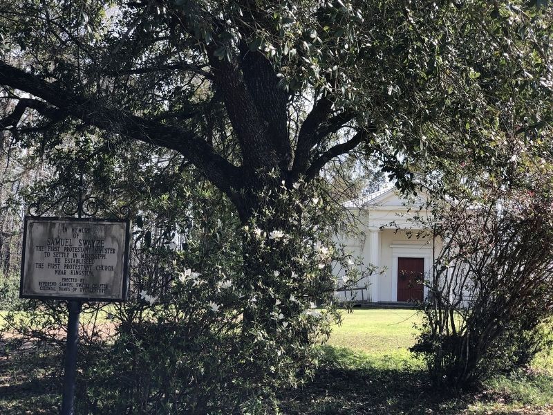
On U.S. 61 at Kingston Road, on the right when traveling north on U.S. 61.
On U.S. 61 at Kingston Road, on the right when traveling north on U.S. 61.
On Liberty Road at Stanley Davis Road, on the right when traveling west on Liberty Road.
On Madison Street east of North Union Street, on the left when traveling east.
On Franklin Street at Locust Street, on the right when traveling south on Franklin Street.
Near Aldrich Street near Old Devereaux St, on the left when traveling west.
On Morgantown Road at T Waring Bennett Jr. Road, on the left when traveling north on Morgantown Road.
On South Union Street near Main Street.
On South Commerce Street at Washington Street, on the left when traveling south on South Commerce Street.
On State Street at Pearl Street, on the left when traveling east on State Street.
On South Rankin Street at Orleans Street, on the left when traveling south on South Rankin Street.
On South Commerce south of Washington Street, on the left when traveling south.
On South Commerce Street south of Washington Street, on the left when traveling south.
On Jefferson Street near North Doctor Martin Luther King Jr. Street, on the left when traveling west.
Paid Advertisement
On North Martin Luther King Street at St. Catherine Street, on the right when traveling west on North Martin Luther King Street.
On Martin Luther King Junior Road (Mississippi Route 555) at Airport Road (Mississippi Route 554), on the right when traveling south on Martin Luther King Junior Road.
Near Emerald Mound Road, 1 mile west of Natchez Trace Parkway, on the right when traveling west.
Near Emerald Mound Road, 1 mile Natchez Trace Parkway, on the right when traveling west.
On Old U.S. 84, 0.3 miles east of Blues Highway (U.S. 61), on the left when traveling east.
On U.S. 61 at Morgantown Road, on the left when traveling west on U.S. 61.
On New Hope Road (County Road 513) 0.4 miles west of U.S. 45, on the right when traveling west.
On County Road 106 north of County Road 187, on the right when traveling north.
On Perry Road north of Ewell Road, on the left when traveling north.
On Walnut Drive at North Church Streeet, on the left when traveling north on Walnut Drive.
On North Greensburg Road at East Fork Roar, on the right when traveling south on North Greensburg Road.
On Natchez Trace Parkway (at milepost 176.3), 0.1 miles south of County Road 3122, on the right when traveling north.
On Mississippi Route 12 at Mississippi Route 429, on the right when traveling east on State Route 12.
On Ruby Street near Aloe Avenue, on the right when traveling east.
On East Sunflower Road (State Highway 8) 0.2 miles east of North Davis Avenue (U.S. 278), on the right when traveling east.
Paid Advertisement
On Main Street (State Highway 1) north of Vorhees Street, on the right when traveling north.
On George Street (Mississippi Route 17) south of McCain Street, on the right when traveling south.
On Front Street (U.S. 51) at East Herring/Greensboro Street (County Road 430), on the right when traveling north on Front Street.
On North Church Street (Mississippi Route 245) at Laster Drive, on the right when traveling south on North Church Street.
Near Lebannon Road, 0.2 miles north of South Union Road, on the right when traveling north.
On Mississippi Route 12, 1.4 miles west of Scott Road, on the right when traveling west.
On South Union Road, 0.1 miles Lebannon Road, on the right when traveling west.
On South Union Road, 0.1 miles west of Lebannon Road, on the right when traveling west.
On Concord-Bethsalem Road, 0.1 miles north of Highpoint-Weir Road.
On State Highway 552 at Russum Westside Road, on the left when traveling south on State Highway 552.
Near Grand Gulf Road at River Road.
Near Grand Gulf Road at River Road.
Near Natchez Trace Parkway (at milepost 54.8).
On Rodney Road, 4.2 miles west of Church Street (U.S. 61), on the right when traveling west.
On Farmer Street at Orange Street, on the right when traveling north on Farmer Street.
On Church Street (U.S. 61) at Walnut Street on Church Street.
Paid Advertisement
On Church Street (U.S. 61) at Walnut Street, on the right when traveling north on Church Street.
On Shaifer Road, 0.5 miles west of Bessie Weathers Road, on the left when traveling west.
Near Natchez Trace Parkway (at milepost 45.7), 4.2 miles north of Mississippi Highway 18. Reported missing.
On Church Street (U.S. 61) at Jackson Street, on the right when traveling north on Church Street.
On College Street near Chinquepin Street, on the right when traveling north.
On Church Street (U.S. 61) north of China Street, on the right when traveling north.
On Church Street (U.S. 61) at Carroll Street, on the right when traveling south on Church Street.
On Church Street (U.S. 61) north of Orange Street, on the right when traveling north.
On Church Street (U.S. 61) at Carroll Street, on the right when traveling south on Church Street.
On Martin Luther King Boulevard, 0.1 miles west of Yahoo Avenue, on the right when traveling west.
On Yazoo Avenue at Martin Luther King Boulevard, on the right when traveling north on Yazoo Avenue.
On Delta Avenue north of Sunflower Avenue, on the right when traveling north.
On Delta Avenue, 0.1 miles north of 1st Street, on the right when traveling south.
On 2nd Street at Church Street, on the left when traveling north on 2nd Street.
On Rozell Street east of Sheriff Ridge Avenue, on the right when traveling east.
On Chautauqua Drive, 0.5 miles west of U.S. 51, on the right when traveling west.
Paid Advertisement
On U.S. 49 at State Route 590, in the median on U.S. 49.
On Spencer Street at Milton Barnes Avenue, on the right when traveling north on Spencer Street.
On Eatonville Road, 0.5 miles west of J.C.Bryant Road, on the left when traveling west.
On East Fifth Street east of J D Randolph Street, on the right when traveling east.
On West Pearl Street at Water Street, on the left when traveling west on West Pearl Street.
On Main Street near Federal Street, on the right when traveling west.
On Sycamore Street at Blaize Avenue, on the right when traveling east on Sycamore Street.
On South Beach Boulevard near Union Street, on the right when traveling south.
On U.S. 90 at Seminary Drive, on the right when traveling east on U.S. 90.
On South Beach Boulevard, 0.2 miles south of Court Street, on the right when traveling south.
On South Beach Boulevard east of Union Street, on the right when traveling east.
On South Beach Boulevard south of Brown Road, on the right when traveling south.
On Howard Avenue, on the right when traveling west on Howard Avenue.
On Beach Boulevard (U.S. 90) at Bellman Street, on the right when traveling west on Beach Boulevard.
On Central Avenue, 0.1 miles south of Bay Shore Drive, on the right when traveling south.
On a frontage road on north side of East Beach Blvd, 0.2 miles west of 20th Avenue, on the right when traveling west.
Paid Advertisement
On East Pass Road at Bridge Street, on the right when traveling west on East Pass Road.
On Church Street west of Watkins Avenue, on the left when traveling west.
On East Beach Boulevard (U.S. 90) at Church Avenue, on the right when traveling west on East Beach Boulevard.
On 36th Avenue at 19th Street, on the right when traveling north on 36th Avenue.
On Pineville Road east of Beeline Road, on the left when traveling east.
335 entries matched your criteria. The first 100 are listed above.
Next 100 ⊳