"… we found a gap in the bluffs of Boise valley, where we turned down and succeeded in reaching the valley in safety, although our road was very steep and stony, and long…" -- P.V. Crawford, 1851
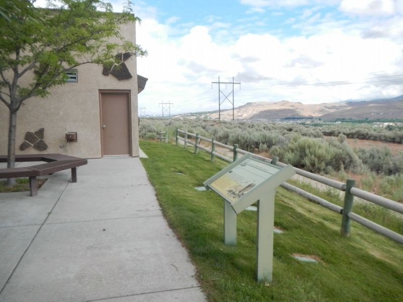
From the high ridge above the Boise River 5 miles southwest of here, westward-bound travelers got their first view of the Boise Valley. In 1811, Wilson Price Hunt and the Overland Astorians' party were the first white sojourners to enjoy the scene. . . . — — Map (db m119002) HM
In 1906, at the age of seventy-five, Ezra Meeker began a journey east from his home in Puyallup, Washington, to retrace the route of the Oregon Trail over which he originally traveled in 1852 with his wife and young son. He traveled the route with . . . — — Map (db m118993) HM
Westward-bound emigrants entered Idaho after crossing Thomas Fork Valley. They soon encountered the climb and descent of Big Hill, witnessed nature's curiosities at Soda Springs, and discovered willing traders at Fort Hall.
In 1843 wagons . . . — — Map (db m118992) HM
After the transcontinental railroad was completed on May 10, 1869, new stage and freight routes were established to connect southwester Idaho with newly established railheads.
Kelton, Utah, soon became the main shipping point for Boise, when John . . . — — Map (db m118996) HM
Along this historic trail, from 1841 to 1861, traveled the greatest land migration in history. Nearly half a million pioneers came to settle America's Northwest. One out of every eight would perish along the way. — — Map (db m125859) HM
Between 1843 and 1869 over 300,000 emigrants fulfilled Americas's Manifest Destiny by voluntarily relocating to Oregon and California. Their nearly 2,000 mile journey along game trails long used by the early Native Americans would become known as . . . — — Map (db m119239) HM
Placed here by Ezra Meeker on May 9, 1906
Pioneer • Preservationist • Visionary
Ezra Meeker was largely responsible for locating and preserving the Old Oregon Trail. To commemorate the centennial of this monument, a time capsule of . . . — — Map (db m128544) HM
Wednesday September 15th "Today we traveled up a long hill some 4 miles. Road good, ascent very gradual. When we arrived at the top we got a grand view of the Boise River Valley. It is all filled or covered with dry grass and a few trees . . . — — Map (db m125787) HM
"When we first came in sight of Boise City and valley we were upon a hill seven miles distant." -- Julius Caesar Merrill, 1864
Creaking, groaning wheels, the dust so thick that the hunch-back oxen ahead looked more like tawny . . . — — Map (db m125861) HM
In 1874 the Wells-Fargo stage line assigned Wm.A. Tillotson to operate a station in Marsh Valley. where the trail crossed Sage Creek (now Yago Creek). This route skirted the eastern side of the valley and extended from Franklin, Idaho to mining . . . — — Map (db m140075) HM
Most early Bear Lake settlers came from Britain. One was the first woman convert to the LDS church in Europe.
Born in Preston, England, Aug. 24, 1806. Ann Elizabeth Walmsley Palmer was baptized July 30, 1837. An invalid, she was carried into the . . . — — Map (db m99318) HM
To load their wagons with salt from the salt springs on Crow Creek, Mormon settlers of Bear Lake Valley followed the Native American Indian trail over this pass about 1865.
In 1868, The Church of Jesus Christ of Latter-day Saints Apostle Charles C . . . — — Map (db m105896) HM
"... the greatest impediment on the whole route from the United States to Fort Hall." - Theodore Talbot, 1843
Near the Wyoming/Idaho border the pioneers face Big Hill, on of the most challenging obstacles of their journey. The dusty . . . — — Map (db m90854) HM
On their way west to Oregon and California, emigrant wagons often crossed high ridges in order to avoid gullies and canyons.
When he came here in 1843, Theodore Talbot noted that he "had to cross a very high hill, which is said to be the . . . — — Map (db m90807) HM
"the steepest and longest ascent we have made on the route..." - James Wilkins
Looking east across the fields is Big Hill, one of the most difficult obstacles along the 2,000-mile Oregon/California Trail. The trail crosses the Thomas . . . — — Map (db m90851) HM
Within five years after Apostle Charles C Rich was called to establish a settlement in Bear Lake Valley, 1868, he looked at western Wyoming as a possible expansion of the Mormon community. By 1879 the Bear Lake Stake of the Church of Jesus Christ of . . . — — Map (db m105895) HM
The Crow Creek Road was the link between the Mormon settlements of Bear Lake and Star Valley for 50 years. The 100-mile round trip between Afton, WY and the railhead at Montpelier ID would take a team of horses from 3 to 7 days depending on the . . . — — Map (db m105897) HM
Beginning in Independence, Missouri, the Oregon/California Trail passes through present-day Missouri, Kansas, Wyoming, and Idaho. it ends in Oregon, California or Utah - depending on the destination of the pioneers.
While the . . . — — Map (db m90876) HM
Westward-bound emigrants entered Idaho after crossing Thomas Fork Valley. They soon encountered the climb and descent of Big Hill, witnessed nature's curiosities at Soda Springs, and discovered willing traders at Fort Hall.
In 1843 wagons first . . . — — Map (db m90852) HM
Coming west with Ezra Meeker in 1852, Thomas McAuley decided to build a road to let emigrants bypass Big Hill.
Worst of all Oregon Trail descents, Big Hill needed replacement. Eliza McAuley reported that her brother Tom "fished awhile, . . . — — Map (db m90808) HM
“I have always felt I was at a disadvantage in making a living for my self and family if I did not have a wagon and team.” – John Nield Diary
John and Sarah Broadbent Nield moved their family to Star Valley in 1888 over the . . . — — Map (db m105901) HM
"One continual stream of honest looking open harted people going west" - James Cayman, mountain man, captured this sentiment in his diary as he watched pioneers heading west in 1846.
Between 1841 and 1869 nearly 300,000 farmers, . . . — — Map (db m90853) HM
In 1848, Pegleg Smith established a trading post on the Oregon Trail at Big Timber somewhere near here on the river.
Some travelers called it "Fort Smith", though it had only four log cabins and some Indian lodges. Packing a plow and tools . . . — — Map (db m90805) HM
By 1881, just five years following the opening of the Crow Creek Freight Road, freighters had started calling this canyon by that name. Snowslides were frequent on snowy, windy days as drifts would build up on the shale ridge. Unable to hold the . . . — — Map (db m105894) HM
On April 7, 1852, seventeen-year-old Eliza Ann McAuley, with her older brother Thomas and sister Margaret, left Mount Pleasant, Iowa, to travel overland to California. For a time they were accompanied by the "Eddyville Company," led by William Buck . . . — — Map (db m90850) HM
A bad ford gave trouble to wagon trains crossing this stream on the trail to California and Oregon in 1849.
In that year, gold-seeking 49'ers developed a shortcut that crossed here. Then emigrants built two bridges here in 1850. But an . . . — — Map (db m90804) HM
Clinging to the white shale formation a mile east (on the Crow Creek Rd.) is the White Dugway. There was moisture in the shale and when frost had it in its grip the road was very slippery. Freighters learned to be cautious as a wagon or sleigh could . . . — — Map (db m105899) HM
Past travel and settlement across the rugged lands of the Bear Lake Valley were strongly influenced by the valley's hydrologic features. The shifting rivers, sloughs, and marshes presented natural barriers and were prone to flooding. This often . . . — — Map (db m140215) HM
The region comprising Bear Lake County has alway been an important juncture for overland travel. From the 1800s onward, migrants on the Oregon and California trails traversed the area, relying on knowledge garnered by Native Americans, early . . . — — Map (db m140213) HM
John Mullan was the Army officer who in 1859-1862 surveyed and built the Mullan Road
from Walla Walla, Washington to Fort Benton, Montana.
The road was to connect the Missouri and the Columbia, and Congress approved in 1855.
Indian . . . — — Map (db m110031) HM
Capt. John Mullan U.S. Army
Capt. John Mullan, US Army, Constructor and surveyor.
He was directed to mark a wagon and railroad route from Fort Benton, Montana to Walla Walla, Washington from 1853-1855.
He built the actual road . . . — — Map (db m110000) HM
Designed to connect the Missouri and the Columbia, this military wagon road was constructed past here in 1859.
Swamps in the St. Joe valley has to be corduroyed with logs, and 70 men spent a week digging out sidehills south of here and . . . — — Map (db m122114) HM
A log structure was erected one half mile north of this site in 1864, which served as a stage station. The Ben Holliday stages use it as a stopping place as did the freighters who passed this way. Mail was unofficially handled here for more than a . . . — — Map (db m124480) HM
This area was crossed by many trails used by the ancestors of the Shoshone and Bannock people. Some trails connected hunting and gathering grounds; others marked traditional ceremonial lands of the various Shoshone and Bannock bands. Among the . . . — — Map (db m108542) HM
(Three panels are mounted in a kiosk located near the Fort Hall Indian Reservation Museum)Panel 1:
Shoshone and Bannock Tribes
Before settlers came to this region, Shoshone and Bannock tribal members moved with . . . — — Map (db m108545) HM
(Five panels in the kiosk deal with the history of Goodale's Cutoff and the surrounding area)
Idaho's Emigrant Trails
Westward-bound emigrants entered Idaho after crossing Thomas Fork Valley. They soon encountered the climb . . . — — Map (db m110138) HM
An old emigrant road headed west across Camas Prairie and then descended to the valley below on its way to rejoin the Oregon Trail 28 miles west of here.
This route, discovered by Donald Mackenzie's fur trade party in 1820, came into use for . . . — — Map (db m125602) HM
Horace Lewis began the "Ketchum Fast Freight Line" soon after the town was founded on August 2, 1880. The first load of ore was carried from the Elkhorn mine to the railroad at Kelton, Utah. These monstrous wagons with six-foot wheels known as "The . . . — — Map (db m110104) HM
The Old Toll Road to Idaho City crossed the ridge from Boise through the lowest point you can see in the skyline across the valley.
Climbing the More's creek canyon wall, it crossed this highway about here and swung north. The road was built and . . . — — Map (db m22599) HM
(Three panels make up this marker:)
In the 1930s, Gallagher CCC widened and surfaced this road, built Scott Mountain Road, developed Hot Springs and Pine Flat Campgrounds, erected fences to control livestock grazing, fought fires, and . . . — — Map (db m119235) HM
Honoring builders of bridges and trails and pioneers who passed this way in the development of the West.
The first wagon bridge over Snake River was erected here by James M. Taylor in 1865 replacing the ferry established on the . . . — — Map (db m152316) HM
Thousands of eager miners came by here in an 1864-65 gold rush to Wild Horse, BC. Parts of their pack trail still can be seen.
An extension of North Idaho's earlier gold excitements, Wild Horse was served by a pack trains that hauled . . . — — Map (db m122176) HM
Beginning in the 1850s, armed skirmishes broke out between Shoshone Indians and emigrants traveling by wagon train to the west. Many pioneers tried new paths through Idaho that would avoid the Snake River, where they were most vulnerable to attack. . . . — — Map (db m140017) HM
Mormon pioneers settled this area along the Oregon Trail in the 1880s. The town was named Chesterfield because it reminded some of the countryside around Chesterfield, England, and to honor the settlement's founder, Chester Call.
A traditional . . . — — Map (db m124578) HM
In the summer of 1849, the California Gold Rush was diverted this way in search of a more direct route to the mines.
Stampeding 49'ers would try anything to save miles and time in their rush for California's gold: the regular Oregon and . . . — — Map (db m106774) HM
After the arrival of the first settlers of Chesterfield in 1875, covered wagon trains continued to use the Old Oregon Traill of 1846 which passed this point. Tired discouraged and ill, travelers arrived here from early spring to late autumn. Local . . . — — Map (db m124580) HM
The Oregon Trail was not blazed by the first wagon train of emigrants who set out on the journey in 1841. They were following pathways discovered and described by explorers, and mountain men in the early 1800s - pathways traveled for countless years . . . — — Map (db m124650) HM
The Bidwell-Bartleson Party
In 1841, John Bidwell and John Bartleson became the first Americans emigrants to undertake a wagon crossing from Missouri to California.
Although Oregon was the primary destination of early westward-bound . . . — — Map (db m140278) HM
Geological processes created the complex landscape of southeastern Idaho and eventually determined the routes covered wagons would take along the Oregon Trail. In their journals, trail emigrants often wrote something about the two volcanic cinder . . . — — Map (db m140253) HM
Floods of emigrants, gold seekers, and Mormon settlers entering the homeland of the Shoshone and Bannock people from the mid-1840s to early 1860s gave rise to conflict and often violent encounters. Despite Mormon effort to supply them with food, . . . — — Map (db m106723) HM
In 1958, Dr. Evan and Lois Kackley donated the Yellowstone Coach to the City of Soda Springs. According to Dr. Kackley's written letters to the city council he stated, "This particular coach was used to carry Pres. Theodore Roosevelt and the . . . — — Map (db m106694) HM
For over two decades (1834-1856), fur trappers and Oregon Trail wagon trains passed by the doors of this adobe fort. Nathaniel Wyeth, an ambitious Bostonian, built the post in 1834 but soon sold his holdings to the Hudson's Bay Company, whose staff . . . — — Map (db m106849) HM
Towering 1200 feet above the waters of Bear River is Sheep Rock, a prominent landmark described in emigrant diaries and journals as they traveled west on the Oregon and California trails. Trapper and mountain men, in the early 1830s, indicate that a . . . — — Map (db m106737) HM
The route of US 30 traces its origin to the early 1900s. Until that time, the current route was but a well-traveled wagon road parallel with the Oregon Short Line railroad. In the spring of 1903, Dr. Horatio Nelson Jackson became the first person . . . — — Map (db m106771) HM
Native Americans traveled and camped in the Soda Springs area for centuries before emigrants traveled the Oregon Trail.
Sheep Rock (Soda Point) marked the junction of the main route of the Oregon-California Trail and the Hudspeth Cutoff and was . . . — — Map (db m106850) HM
Westward-bound emigrants entered Idaho after crossing Thomas Fork Valley. They soon encountered the climb and decent of Big Hill, witnessed nature's curiosities at Soda Springs, and discovered willing traders at Fort Hall.
In 1843 wagons first . . . — — Map (db m106845) HM
As many as 350,000 people and tens of thousands of covered wagons traveled the Oregon Trail between 1840 and 1870. Countless feet, hooves, and iron-rimmed wheels cut and compacted the ground, leaving long-lasting traces still visible on many western . . . — — Map (db m124577) HM
When they left the main trail leading to Fort Hall, emigrants heading to California thought that Hudspeth's Cutoff would save them considerable time and miles in the race to the gold fields. To their surprise, they were still in Idaho's Raft River . . . — — Map (db m106772) HM
This is an east-west travel corridor of the earliest emigrant trails that continued even after the arrival of railroads and highways. Early explorers, such as John Fremont, Jedediah Smith, Osborne Russell, and missionary Narcissi Whitman were among . . . — — Map (db m106846) HM
The year was 1885 when Cassia County purchased an unfinished hovel for its first courthouse. Idaho was still a territory - a place where disagreements were at times decided by the business end of a gun. Sparked by disputes between cattle and . . . — — Map (db m124028) HM
Surrounded by high Rocky and very ragged looking mountains -- this valley we take the liberty to call Pleasant Valley, as it is a very good and pleasant for camping. -- Leander V. Loomis, circa 1850, describing the Circle Creek Basin. . . . — — Map (db m123961) HM
"At the entrance of the pass was a pleasant little spring & fine branch." - Wakeman Bryarly, Jul 20, 1849
Guidebook available
Trails West Inc, P.O. Box 12045 Reno NV 89510 — — Map (db m138456) HM
"We enter a gorge of the hills which in a short time brings us to a large ampitheatre surrounded with rock of every kind of fanciful character." -- Joseph Middleton Aug 26, 1849 Guidebook Available
Trails West Inc. P.O. Box 12045, Reno . . . — — Map (db m123955) HM
"A ride ... brought us to the outlet of this romantic vale, a very narrow pass - just wide enough for a wagon, and on either side very high, jagged and thin walls of granite ... called the 'Pinnacle Pass'" - J.G. Bruff, Aug 29, 1849
. . . — — Map (db m123990) HM
"The gray granit rocks stand in pyramid monument & dome forms., here & there towering aloft. The road winds along between them. Emigrants names are written ... on these curious structures" -- Augustus Ripley Burbank, Aug 4, 1849 Guidebook . . . — — Map (db m123987) HM
...with a wide plain at our left and high mountains at our right and being within sight of the...Salt Lake Route which road intersects our trail seven miles further on. - Emigrant journal entry (Lewis), circa 1850, describing their camp . . . — — Map (db m123953) HM
The flow of emigrant traffic through City of Rocks ebbed after 1852 and virtually ceased following the completion of the Transcontinental Union Pacific Railroad. The City of Rocks remained an important transportation center, serving as a relay . . . — — Map (db m240524) HM
This vast scene holds many intriguing stories. If the land could speak, it would tell of pioneers and wagons crossing the wide Ralf River Valley from Strevell Pass to Emigrant Canyon bound for California in 1843-1882. The land would speak of stage . . . — — Map (db m123956) HM
At City of Rocks we were met with all kinds of Christmas greeting ... we sat down to a Christmas dinner that only youth and vigor could do justice to.... Jim has erected a Christmas tree, and decorated it with cranberries and pop corn, and on it . . . — — Map (db m124001) HM
After dinner a ride of 2 miles brought us to the outlet of this romantic vale, a very narrow pass, just wide enough for a wagon, and on either side very high, jagged. and thin walls of granite.... This is called the "Pinnacle Pass." -- J. . . . — — Map (db m123988) HM
That this journey...is perilous, the deaths of many testify...as I passed the fresh made graves, I have glanced at the side boards of the wagon, not knowing how soon it might serve as a coffin for some one of us. Lodisa Frizzell, 1852 . . . — — Map (db m123952) HM
They rise in a cone-like form from the bottom of the valley to a height of from 400 to 600 feet they are round and quite regular in form, tapering gradually to a point. -- Emigrant journal entry (Sawyer) describing the Twin Sisters, circa . . . — — Map (db m123994) HM
In 1880, George Starrh, a Snake River placer miner, started a ferry across Snake River one mile north of here. From 1880-2, freighters hauling supplies for a mining rush to Wood River used Starrh's ferry (powered by river current when stiff winds . . . — — Map (db m31635) HM
"The Oregon road take up the bluff and follows the course of the (Snake) river while we keep to the left and follow the creek (Raft River) nearly to its source. ... crossing the creek we followed up the bottom" -- Byron McKinstry, Aug 1, 1850 . . . — — Map (db m123844) HM
"Arrived at Raft River, crossed and nooned. ... traveled five miles up Raft River and camped after recrossing it. Grass in abundance and plenty of wood" -- Cyrus Loveland, Aug 3 1850
Guidebook Available
Trails West Inc. P.O. Box 12045, . . . — — Map (db m123846) HM
"We traveled up Raft River 16 miles. The road, water and grass, good. Entirely destitute of timber, except a little willow on the streams and the wild sage." -- Chester Ingersoll, Aug 13, 1847
Guidebook Available
Trails West Inc. P.O. . . . — — Map (db m123848) HM
In 1811 the first white expedition to go through this area of the Snake River and the lower end of the Raft River Valley was the Wilson Price Hunt expedition from St. Louis to Astoria. However, the area was well known to the French and British . . . — — Map (db m123843) HM
"August 26, Sabbath."
"... We got a late start traveled directly across the valley before us, (Almo Valley) amidst the best scenery we have seen since we have been among these hills. South, a high range of mountains (Raft River Mountains) . . . — — Map (db m123884) HM
"After crossing (Cassia Creek) we crossed a swamp, which required considerable persevering to get through safely. Three miles farther we encamped on the side of a hill, between two ranges of mountains" -- Wakeman Bryarly, Jul 18, 1849
. . . — — Map (db m123883) HM
"By an easy ascent reached a summit and as gradually descended to a valley (Upper Raft River Valley) of sage and sand sloping to the south east. The streams running towards the (Great) Salt Lake." Byron N. McKinstry, Aug 3, 1850
Guidebook . . . — — Map (db m123886) HM
"We came onto the Subetts Cut Off road (Hudspeth Cutoff), or rather that cut off come onto our road which is the old and longest road." -- Henry Anable, Aug 7, 1852
Guidebook Available
Trails West Inc. P.O. Box 12045, Reno NV . . . — — Map (db m123882) HM
The Raft River Valley was used by Native Americans as a place to hunt and winter because the snow didn't lie in the valley and there was good water and plenty of grass for the animals. British and American trappers, Peter Skene Ogden, Milton . . . — — Map (db m123881) HM
"The moon just rising above the mountains, throwing mild light over the valley & opposite mountain, formed a beautiful scene of prairie mountain life." -- Hugh Brown Heiskell, Sep 3, 1849
Guidebook Available
Trails West Inc. P.O. Box . . . — — Map (db m124026) HM
One day west of the City of Rocks: Never saw such dust! In some places it was actually to the top of the forewheels! Fine white dust; more like flour. Our men were a perfect fright, being literally covered. -- Emigrant journal entry, circa . . . — — Map (db m124025) HM
After Montana's Gold Rushes began in 1862, thousands of miners came past here and a Beaver Canyon stage station was built here.
Freighters and travelers on stage lines from Salt Lake to Montana stopped at this station until Utah and . . . — — Map (db m124337) HM
You are nearing the junction of historic Highway 11, now designated as Gold Rush Historic Byway.
Winding its way through spectacular scenery, it passes through the traditional homeland of the Nez Perce Indians on the Weippe Prairie and the National . . . — — Map (db m109758) HM
Routes Through History
Travel through the rugged Clearwater River region has not always been on smooth, paved highways. Routes on land began as game trails, then foot paths which grew into horse paths. Many of these historic routes paid . . . — — Map (db m159490) HM
Lack of development and limited government services in the western territories created opportunities for entrepreneurs like Alex Toponce. Arriving from France at age seven, Toponce traveled west and by age 18 had worked as a bullwhacker. By 1860 he . . . — — Map (db m109783) HM
Travel on the Toll Road remained difficult due to the road's roughness. Pulling heavy loads over the road's two summits often fell upon oxen, The crack of the bullwhacker's whip and snort of laboring beasts were common sounds. You may still see . . . — — Map (db m109779) HM
By 1880 improvements to the Toll Road allowed the establishment of a stage line from Bonanza City to Challis. Along the Toll Road several stations provided services for drivers, and passengers. Eleven Mile Barn provided drivers an opportunity to . . . — — Map (db m109785) HM
Two maker panels are located at this kiosk
The Keystone Road splits from the Toll Road near here. Teamsters and supplies headed for Bayhorse Mining District followed the Keystone Road to Bayhorse, Crystal and Clayton. In 1889, the . . . — — Map (db m109768) HM
157 entries matched your criteria. The first 100 are listed above. The final 57 ⊳