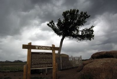
This small pine tree that seems to be growing out of solid rock has fascinated travelers since the first train rolled past on the Union Pacific Railroad. It is said that the builders of the original railroad diverted the tracks slightly to pass by . . . — — Map (db m62159) HM
On State Highway 230 near County Route 33, on the left when traveling west.
From 1849 through the end of the 19th century, thousands followed the Overland Trail into Wyoming, across the Laramie Plains, to a toll bridge near tree on the Laramie River. The historic crossing of the marshy plains consisted of a corduroy road . . . — — Map (db m89621) HM
On U.S. 287 at Cavalryman Ranch Road, on the right when traveling north on U.S. 287.
The emigrant trails across Wyoming were a vital link in the transcontinental migration of an estimated 250,000 Americans in the 19th century, and opened the area to settlers. The Indians resented this intrusion and threatened these . . . — — Map (db m67994) HM
Near Interstate 80 at Happy Jack Road (Wyoming Highway 210), on the right when traveling west.
"That there should be a Lincoln Highway across this country is the most important thing"
In memory of Henry B. Joy
The first president of the Lincoln Highway Association
Who saw realized the dream of a continuous improved highway from the . . . — — Map (db m84887) HM
This monument commemorates the Lincoln Highway, America's first transcontinental automobile road, and Henry Bourne Joy, the first president of the Lincoln Highway Association (1913). Joy, also president of the Packard Motor Car Company, is sometimes . . . — — Map (db m47145) HM
On Snowy Range Road (State Highway 130) near Cactus Hill Road, on the right when traveling west.
The route that later became the Overland Trail was followed in 1825 by William Ashley and members of the Rocky Mountain Fur Company, who entered the Laramie Valley from the south, forded the Medicine Bow River near Elk Mountain, and crossed the . . . — — Map (db m89623) HM
On Banzhaf Lane (County Route 67) at U.S. 30, on the left when traveling north on Banzhaf Lane.
In memory of those who
passed this way to win
and hold the West
on the Fort Halleck-
Fort Laramie Road
Frontier town of
Rock Creek 10 miles
north east — — Map (db m89658) HM
This stone marks the
place where
The Overland Stage Line
on its way to the West,
June 1862 - 1868
crossed the Colorado-Wyoming boundary line. — — Map (db m89620) HM
On Greybull Hwy (U.S. 20 / 16), on the left when traveling west.
This region is totally unfit for either rail or wagon roads and can only be traversed with the greatest of difficulty. - U.S. Army Lieutenant Henry Mayandier, while attempting to map a wagon route across the Big Horn Basin in . . . — — Map (db m86910) HM
On Alternate U.S. 14A at milepost 71 near Old U.S. Highway 14A, on the left when traveling east.
Reconstruction of 52 miles of US 14A between Big Horn Lake and Burgess Junction, began with a bridge and causeway at the lake in the mid-60s. The mountain project was described as "one of the most difficult" in the Department's history.
Then, . . . — — Map (db m91285) HM
On East Main Street (U.S. 310) near Montana Avenue, on the right when traveling east.
was developed for the U.S. Army during WWII by the Willys Motor Company. Its tough four-wheel drive made it the first all-terrain vehicle. By 1945 over 500,000 had been delivered to the Army and other branches of the armed forces. The Jeep was also . . . — — Map (db m91259) HM
On U.S. 14A at Old U.S. Highway 14A, on the left when traveling east on U.S. 14A.
For many years, the northern most road over Wyoming's Big Horn mountains was commonly referred to as the Dayton-Kane Road. It connected those two towns on opposite sides of the mountain, the latter now just a memory beneath the waters of Big Horn . . . — — Map (db m91284) HM
On Ranch Drive, 0.1 miles south of State Highway 387, on the left when traveling south.
Gross weight empty 223,276 lbs. Gross weight loaded 563,276 lbs. Engine 16V149 Detroit 1600 hp Life to date: 30,000 hrs. Fuel consumption 20-gal. hr. Tires avg. cost $9,000 Engine rebuild avg. cost $35,000 143 was moved from Butte to the Black . . . — — Map (db m242992) HM
On State Highway 387 at milepost 124 near Brown Road, on the left when traveling west.
As with other emigrant trails in the west, the Bozeman Trail followed a route previously used by traders, trappers, and Native Americans. John Bozeman, along with John Jacobs, officially opened the Bozeman Trail to emigrants in 1863. This 500-mile . . . — — Map (db m210594) HM
Near State Highway 387 at Ranch Drive, on the right when traveling west.
"In the beginning when Wright was first taking shape and becoming its own place it was the spring of 1949 when the Wyoming Highway Department began constructing the Reno Junction Maintenance Camp. It was located about two and a half miles south of . . . — — Map (db m242956) HM
Near Interstate 80 at Elk Mountain Arlington Road.
The area near the Wagonhound Rest Area has played an important role in western transportation since the earliest days of human activity in the Rock Mountain west. The area has provided Wyoming's earliest inhabitants, explorers, westbound settlers, . . . — — Map (db m47142) HM
On State Highway 220 near U.S. 287, on the right when traveling north.
Muddy Gap sits at a crossroads of many historic sites related to the Oregon and Mormon Trails. From Muddy Gap, Independence Rock is 18 miles northeast, Split Rock is 10 miles to the northwest; Devils Gate is 14 miles northeast, and Martin’s . . . — — Map (db m95472) HM
On County Route 347 near Interstate 80, on the right when traveling north.
The bridge tender's house was constructed by the Union Pacific Railroad to serve as an employee surveillance point. The bridge tender could respond quickly to locomotive-caused fires and could remove flood debris which might damage the bridge and . . . — — Map (db m89754) HM
Near County Route 347 near Interstate 80, on the right when traveling west.
Two stone foundations and chimneys remain of the five enlisted men's barracks once at Fort Fred Steele. The walls were constructed of logs and boards and battens while a shingled roof protected pine floor boards. Tar paper covered interior walls. . . . — — Map (db m89949) HM
On County Route 347 near Interstate 80, on the right when traveling west.
plus other lines of transportation and communication - train, telegraph and telephone - bisected America while linking its east and west coasts during one of our nation's most remarkable eras of development. Those lifelines also sustained the . . . — — Map (db m89924) HM
On State Highway 789 near Interstate 80, on the right when traveling south.
"From the Platte west to Fort Bridger... is one almost uninterrupted panorama of barren hills, sandy plains, ugly tortuous ravines, and blank desolation... All life and all living things, seem to be gone." (Overland Trail traveler Demas Barnes, . . . — — Map (db m89716) HM
On State Highway 93, on the right when traveling north.
From this point, the Bozeman Trail wound a long, twisting northwesterly route to the Montana goldfields. This view points out a portion of that difficult and dangerous road. The map shows the locations of forts, rivers and mountains along the trail. . . . — — Map (db m80089) HM
On Brownfield Road (County Route 61) near West Center Street (Business Interstate 25), on the left when traveling south.
This massive steam locomotive was donated to the people of the State of Wyoming by the Chicago, Burlington and Quincy Railroad Company. It was moved dead-in-train from Galesburg, Ill to Orin then via C&NW Railroad to Douglas in April of 1962. Title . . . — — Map (db m92162) HM
On Brownfield Road (County Route 61) near West Center Street (Business Interstate 25), on the left when traveling south.
This car was built by the Budd Company at Philadelphia, PA as a 48 seat Diner in March 1947. It was part of an order for new stainless steel passenger cars for system-wide service. It was named "Silver Salver" and was numbered #196, later Burlington . . . — — Map (db m92166) HM
On Brownfield Road (County Route 61) near West Center Street (Business Interstate 25), on the left when traveling south.
The "Good Roads Club" was incorporated in Douglas in 1910 with 119 members and capitalization of $50,000. It was a popular social club with a primary goal to establish a way to improve the road system to enjoy the new automobile.
In 1918, the . . . — — Map (db m92180) HM
On Cold Springs Road (State Highway 91) near Bedtick Road (County Route 8), on the right when traveling west.
This Monument
marks the junction
of the Oregon Trail
and road to Old Ft.
Fetterman nine
miles north of this
spot. Established
July 10, 1867. Abandoned
May 25, 1882. — — Map (db m92111) HM
Near Natural Bridge Road (County Road 13) 2.5 miles south of Spring Canyon Road (County Road 11).
The Oregon Trail crosses LaPrele Creek about one mile downstream from Natural Bridge. Before the modern road was built into the gorge, Natural Bridge was difficult to access, and it was only rarely visited by emigrants of the covered wagon era. From . . . — — Map (db m71495) HM
On Big Muddy Road near Cole Creek Road (County Route 22), on the left when traveling east.
Caleb and Nancy Magill with their six children were part of a wagon train traveling fro Brown County, Kansas, to Dallas, Oregon, in 1864. After leaving Fort Laramie their three-year-old daughter Ada was taken sick with dysentery. At Deer Creek . . . — — Map (db m92079) HM
On South 4th Street (Business Route 25), on the left when traveling south.
Deer Creek Station, which once stood on the site of present- day Glenrock near the confluence of Deer Creek and the North Platte River, became a familiar landmark along the Oregon-California-Mormon Trail between 1857 and 1866.
The station began . . . — — Map (db m92081) HM
On Interstate 25 at milepost 152 near Natural Bridge Road (County Route 13), on the right when traveling east.
Three men named Sharp,
Franklin, and Taylor, and
one unknown man were
killed by Indians July 12,
1864 where the Oregon
Trail crosses Little Box
Elder Creek 2 1/2 miles S.W.
of here. They were buried
4 miles S.W. by the grave . . . — — Map (db m92087) HM
On Deer Creek Road (County Highway 19) 1 mile south of I-25 (U.S. I-25), on the left when traveling south.
One of the first two stations built to supply the Mormon emigrants and mail station to accommodate the mail service by virtue of the mail contract awarded to Hyrum Kimball agent of the BYX.
Abandoned in 1858 due to the actions of the United . . . — — Map (db m151835) HM
Near Interstate 90 near U.S. 14, on the right when traveling west.
Along this trail passed herds of cattle from distant Texas to replace the fast vanishing buffalo and build a civilization on the north-western plains. — — Map (db m97984) HM
Near Union Pass Road (Forest Road 600) near Forest Road 534, on the right when traveling south.
A road, component of a cultural environment, is the most noticeable feature of this otherwise natural landscape. In present form it is not old, not a pioneer route hacked by frontiersmen. Based and graded to support rapid haulage o ponderous loads . . . — — Map (db m180419) HM
Westbound Astorians led by Wilson Price Hunt in September, 1811, passed through Dubois region, over Union Pass, and on to the mouth of the Columbia River to explore a line of communication and to locate sites for fur trading posts across the . . . — — Map (db m96244) HM
On U.S. 287 at Union Pass Road, on the left when traveling west on U.S. 287.
Union Pass, so named in 1860 by Captain William F. Raynolds during the Hayden Surveys of Wyoming, provides access across the Continental Divide in the Northern Wind River Mountains. Ancient peoples used this pass for centuries, with use by fur . . . — — Map (db m96313) HM
Near U.S. 287, 1 mile west of California Emigrant Road, on the right when traveling west.
The need was there
Competing with time, harsh climates, long distances, tough terrain and the hostility of numerous Indian bands, the Pony Express carried the mail 1600 miles across the West. From April 4, 1860 to October 24, 1861, . . . — — Map (db m69604) HM
Near U.S. 287, 1 mile west of California Emigrant Rd, on the right when traveling west.
Originally called the Emigrant Road, the Oregon Trail was the main route of westward expansion from 1812 to 1869. An estimated 500,000 people journeyed past here in search of new lands and new lives in the West.
Because of its unique shape, . . . — — Map (db m62092) HM
On U.S. 287, 2.5 miles west of California Emigrant Road, on the right when traveling west.
A famous natural landmark used by Indians, trappers, and emigrants on the Oregon Trail. Site of Split Rock Pony Express 1860-1861, stage and telegraph station is on the south side of the Sweetwater. Split Rock can be seen as a cleft on the . . . — — Map (db m67007) HM
Near U.S. 287, 1 mile west of California Emigrant Road, on the right when traveling west.
Split Rock was a relay station during the turbulent 18 month life of the Pony Express. The Express operated at a gallop, speeding mail across the West in only 10 days. However, because of the "talking wire," its days were numbered. The telegraph . . . — — Map (db m69603) HM
Near U.S. 287, 1 mile west of California Emigrant Road, on the right when traveling west.
Shoshone, Arapaho, Crow and Sioux Indians occupied this pleasant valley long before the Oregon Trail, which changed their cultures and life styles forever. This led to tragic warfare and the eventual loss of country they had called their own.
. . . — — Map (db m69602) HM
Near Wyoming 789 near Wyoming Highway 220, on the right when traveling west.
The Oregon Trail was American’s main street west. Building upon American Indians footpaths, emigrants bound for the Pacific Northwest used the trail. They were soon followed by Mormons fleeing persecution, gold seekers rushing to California and the . . . — — Map (db m95744) HM
Near U.S. 287, 12 miles east of Wyoming Highway 28.
Viewed from Beaver Rim, the Wind River Mountains, part of the Rocky Mountain chain, boast 53 granite peaks over 13,000 feet high. The Continental Divide runs the length of the Wind River Range. Water on the east side of the Continental Divide flows . . . — — Map (db m67012) HM
On Oregon Buttes Road at Emigrant Trail, on the left when traveling south on Oregon Buttes Road.
To the south stand the Oregon Buttes, a major trail landmark. The name is significant because the Buttes were roughly the beginning of the Oregon Territory and also helped keep emigrants encouraged, even though there were still hundreds of miles of . . . — — Map (db m80499) HM
On Dickinson Avenue (State Highway 28) at Red Canyon Road, on the right when traveling west on Dickinson Avenue.
Red Canyon is cooperatively managed by the Wyoming Game and Fish Department, the State of Wyoming, the Bureau of Land Management and private landowners.
The spectacular orange and red sandstone formations you see here have been exposed through . . . — — Map (db m80132) HM
On Oregon Trail, on the right when traveling west.
At 7000 feet above sea level, Rocky Ridge is the highest point on the Mormon and Oregon Trails. This elevation, lack of water, and rugged landscape presented a challenge to early pioneers. The trail over Rocky Ridge is approximately two miles long . . . — — Map (db m96621) HM
Near State Highway 28, 0.8 miles north of Lander Cutoff Road.
The South Pass, in which you are now located, is perhaps the most significant transportation-gateway through the Rocky Mountains. Indians, mountain men, Oregon Trail emigrants, Pony Express riders, and miners all recognized the value of this . . . — — Map (db m67016) HM
Near State Highway 28, 0.7 miles south of Lander-Pinedale Stage Road.
From where you're standing South Pass doesn't look all that remarkable. But compared to the rugged Wind River Mountains, it can easily be recognized as a type of gateway.
Nevertheless, crossing the Continental Divide into "Oregon Country" was a . . . — — Map (db m67020) HM
Near State Highway 28, 0.7 miles south of Lander-Pinedale Stage Road.
Even after the discovery of South Pass in 1824, it was years before the route was used extensively. Fur trapper/trader William Sublette brought a small caravan of wagons to South Pass in 1828. While his party did not take wagons over the pass, they . . . — — Map (db m67021) HM
South Pass was discovered in 1812 by a small band of Astorians led by Robert Stuart as they traveled east with dispatches for John Jacob Astor. It was “rediscovered” in 1824 by a party led by Jedediah Smith as they searched for a winter . . . — — Map (db m80501) HM
Near State Highway 28, 0.7 miles south of Lander-Pinedale Stage Road.
The trail over South Pass is a transportation corridor which served many purposes. In addition to being the route to Oregon and California, it was used by Mormon pioneers and by the Pony Express.
A great exodus to the Salt Lake Valley in 1847 . . . — — Map (db m67019) HM
Near State Highway 28, 0.7 miles south of Lander-Pinedale Stage Road.
The demand for beaver pelts in the early 1800s led to the exploration and eventual settlement of the American West. South Pass was part of a major thoroughfare through the Rockies and its discovery is significant to the era known as the fur trade. . . . — — Map (db m67022) HM
The Oregon Trail
In memory of those who passed this way to win and hold the West
Plaque placed by the Historical Landmark Commission of Wyoming
1950 — — Map (db m80504) HM
Near State Highway 28, 0.7 miles south of Lander-Pinedale Stage Road.
With South Pass behind them, Oregon and California-bound travelers faced the second half of their journey. The roughest travel was yet to come. From Missouri to South Pass, emigrants were able to follow rivers. But from South Pass to Oregon and . . . — — Map (db m67018) HM
On Wyoming Route 28, on the right when traveling north.
The Twin Mounds are a minor landmark along the Trail. These low hills on either side of the Trail helped keep emigrants headed in the right direction on the final climb to South Pass.
After the wagons passed between the Mounds, they fanned out . . . — — Map (db m237435) HM
On Oregon Trail, on the right when traveling west.
The James G. Willie Handcart Company was rescued on October 21, 1856 by a rescue party sent by Brigham Young. 21 members of the Willie Company perished in this valley due to a severe winter storm and lack of clothing and food. Captain Willie left in . . . — — Map (db m96622) HM
On U.S. 20, 0.4 miles north of Brannon Road, on the left when traveling north.
Boysen Dam, completed in 1951, marks the southern margin of the east-west trending Owl Creek Mountains and the Wind River Canyon. Drained by the north flowing Wind River, the canyon is 14 miles long, 1.3-2 miles wide and 2,400 feet deep where it . . . — — Map (db m70611) HM
On Dickinson Avenue (State Highway 28) near Lander Cut-Off Road, on the left when traveling south.
In 1858, this ancient path, which had been used by Indians, explorers and mountain men as a short cut to the Snake River country was developed by Frederick Lander in to an alternate route on the Oregon Trail. What is commonly called the Lander Trail . . . — — Map (db m80161) HM
On Dickinson Avenue (State Highway 28) near South Pass City Road / B Street, on the right when traveling west.
A region rich in history. A city rich in gold. From 1812 to 1868 this open country at the end of the Wind River Mountains provided a passage - the only passage - through the Rocky Mountain barrier of the Continental Divide for some 500,000 westering . . . — — Map (db m80160) HM
Near Lewiston Road near Oregon Trail, on the left when traveling east.
Captain James G. Willie’s Handcart Company of Mormon emigrants on the way to Utah, greatly exhausted by the deep snow of an early winter and suffering form lack of food and clothing, had assembled here for reorganization by relief parties from Utah, . . . — — Map (db m80154) HM
On Wyoming 789 (U.S. 287) at Wyoming Highway 135 on Wyoming 789.
The modern burg of Sweetwater Station is at the intersection of U.S. Highway 287 and State Route 135 in central Wyoming along the Sweetwater River. It is a place of scenic beauty and historic significance. Prehistoric groups camped along the . . . — — Map (db m95745) HM
Near Wyoming 789 (U.S. 287) at Sand Draw Road (Wyoming Highway 135), on the right when traveling west.
The Sweetwater Valley is the mid-section of the 2000 mile-long Oregon Trail. West of Casper, Wyoming, branches of that trail, meld into a single transportation corridor and here, paralleling the serpentine Sweetwater River, the trail approaches the . . . — — Map (db m95776) HM
On U.S. 26 near Otis Street, on the left when traveling north.
The epic story of America’s western expansion played out on a grand scale at Fort Laramie, where the North Platte and Laramie Rivers meet.
Fort Laramie was first established in 1834 as a private fur trading post. By the 1840’s, it served as an . . . — — Map (db m79778) HM
Near State Highway 160, on the left when traveling west.
We cannot afford to purchase wagons and teams as in times past. I am consequently thrown back upon my old plan – to make hand-carts, and let the emigration foot it . . . Brigham Young, 1855 Between 1856 and . . . — — Map (db m86981) HM
Near Road 92 (County Route 50) near Gray Rocks Road, on the right when traveling west.
Mary Elizabeth Homsley was born near Lexington, Kentucky, July 20, 1824. She move with her parents, Jacob and Sarah Oden, to Truxton, Missouri, where she was married to Benjamin Franklin Homsley in 1841. In April 1852, accompanied by Mary's parents . . . — — Map (db m98361) HM
On East Merriam Street (U.S. 26) at Lawton Avernue on East Merriam Street.
Between the years 1847 and 1868, most of the approximate 80,000 Mormon Pioneers passed through Fort Laramie. This was the first stop for the vanguard company after leaving Winter Quarters, (near Omaha) Nebraska.
In June, 1847, after following a . . . — — Map (db m79776) HM
passed near this point between 1876 and 1887. Built to supply the Dakota gold camps, the road was constructed in violation of the Ft. Laramie treaty of 1868 which reserved the Black Hills for Sioux Indians. Stagecoaches and wagons carrying . . . — — Map (db m79780) HM
On Road 92 near Gray Rocks Road, on the right when traveling west.
"We proceeded (westward from Fort Laramie) and encamped outside the boundaries of Uncle Sam." So wrote Dr. J.S. Shepard in 1851 as he began the second leg of his journey west. "To leave Fort Laramie was to cast off all ties with civilization. It was . . . — — Map (db m98360) HM
On State Highway 151 at 3rd Avenue, on the left when traveling west on State Highway 151.
In remembrance of the hardy pioneer stockmen and cowboys who drove their Texas herds across this spot into central and northern Wyoming — — Map (db m98347) HM
On U.S. 29/85 near Road 81, on the right when traveling west.
Many emigrants journals and diaries from the 1840s to 1860s mention experiences such as; “nooning,” camping for the night, crossing over, or burying a loved one on the banks of Rawhide Creek. Of these experiences, death and disease were . . . — — Map (db m79704) HM
On West 4th Steet (U.S. 26) near Main Street, on the right when traveling west.
1336 miles - Nauvoo, Illinois to the Salt Lake Valley (Second plaque below:)
"Whether I live or whether I die all is well, all is well"
Elizabeth Rutledge 1806 - 1852 — — Map (db m98358) HM
On 2nd Street at Main Street, on the right when traveling west on 2nd Street.
Over this trail, from distant Texas, passed the greatest migration of men and cattle in the history of America.
(second plaque at the base:)
In Memory
of the pioneer cattlemen who passed this way on the Old Texas Trail . . . — — Map (db m98349) HM
On U.S. 85 near Industrial Park Road, on the left when traveling north.
3/4 mile east from this point
Cold Springs was a popular camping ground on the Overland Trail to California, Oregon, Utah and other points in the far west. It was a stage station along the Overland Stage Route 1854-1862 and also a Pony Express . . . — — Map (db m79702) HM
On U.S. 20 near Gebo Oil Field Road, on the right when traveling north.
The Bridger Trail crossed the Bighorn River near this location in 1864. Passing over the Bridger Mountains to the southeast, the trail came down Kirby creek, crossed the river and proceeded north to the Yellowstone River, then west to the gold . . . — — Map (db m97784) HM
On Broadway Street near North 7th Street, on the right when traveling west.
“Make it a good street. Make it wide enough to turn this damn team of mules around in.” (Henry “Sixteen Mule Team” Johnson) Thermopolis was named for the nearby hot springs by combining the Greek words thermo . . . — — Map (db m97782) HM
Near Buffalo Sussex Cutoff Road near Irigaray Road, on the right when traveling north.
Travel along the Bozeman Trail began in 1863 as miners carrying their supplies on packhorses or in wagons, headed toward the gold fields. Compared to other available methods and road of travel, this route was a shortcut to Virginia City. . . . — — Map (db m91532) HM
On E Hart Street (U.S. 16) at Interstate 25, on the right when traveling east on E Hart Street.
Before you is the “eighteen wheeler” of the 1860’s. It could haul 2000 lbs. to 5000 lbs. of weight depending on the grades of the trail. This model of the wagon was powered by oxen. Anywhere from 3 yokes (a yoke being two oxen) . . . — — Map (db m87708) HM
On E. Fetterman Street at Main Street (Business Interstate 25), on the right when traveling west on E. Fetterman Street.
1869 - Occidental Hotel established as a tent in its present location alongside Clear Creek
1879 - First buildings constructed in what is now Buffalo
- Postal service established in Buffalo by President Hayes . . . — — Map (db m244120) HM
On North Main Street (Business Interstate 25) at Fort Street, on the right when traveling south on North Main Street.
Buffalo, Wyoming, the Johnson County seat, chartered March 3, 1884, started as a trading center for Fort McKinney, located two miles west of town, which was founded July 18, 1887 and is now the Veterans' Home of Wyoming.
The court house was . . . — — Map (db m91499) HM
Near Kennedy Road near Central Avenue, on the right when traveling east.
This stone marks that road of romance and adventure traveled by trappers, traders and troops to Fort Laramie, the most historic spot in the west.
1867 - 1887 — — Map (db m95230) HM
On Capitol Avenue near West 22nd Street, on the right when traveling north.
started from the corner of Capitol Ave. & 16th Street and ran 88 miles north to Ft. Laramie, the most historic Fort in the Rocky Mountain west. In 1876 it was extended to Deadwood and the Black Hills gold fields 266 miles from Cheyenne. Indians, . . . — — Map (db m95261) HM
On West Linclonway near Carey Avenue, on the right when traveling west.
The Lincoln Highway was America's first transcontinental highway, conceived in 1912 specifically with the automobile in mind. Although parts of the Lincoln Highway were first used in 1908 for the famous New York to Paris automobile "Great Race", it . . . — — Map (db m95580) HM
277 entries matched your criteria. The first 100 are listed above. Next 100 ⊳