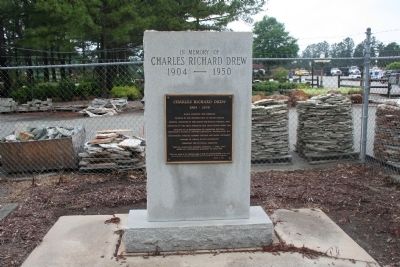
Charles Richard Drew
1904 - 1950
Black scientist and surgeon
Pioneer in the preservation of blood plasma
Medical director of the Blood-for-Britain Project, 1940
Director of the first American Red Cross Blood Bank, 1941 . . . — — Map (db m31142) HM
Was located 150 yards north-east of this marker. Built by community effort and without public funds. This school was dedicated to thoroughness in all subjects taught, and to the building of character as fundamental for the growth of the student. . . . — — Map (db m75810) HM
Side A Pleasant Grove High School was built on this site in 1922 to serve grades 8 - 10 from 5 small schools in the Pleasant Grove township and one from the Faucette township; Mahan, Sidney, King, Squires, and McCray. Brogden Tew was the . . . — — Map (db m31151) HM
One-room school built for Black children in 1915-16. In continuous operation until 1951 when four rural schoolhouses were consolidated into Pleasant Grove School. — — Map (db m224338) HM
The McCray School, built in 1915-16, is a rare example of early twentieth century one-room schools for Black children in rural Alamance County. Land for the school was donated by Albert Graham (1836-1916). Construction was completed by Andrew Nash, . . . — — Map (db m224339) HM
Early textile mill owners alleviated labor shortages by recruiting entire families for employment. Offering homes as well as jobs, owners created villages of workers from which the mills could draw. Children - sometimes as young as seven - filled . . . — — Map (db m222745) HM
When Glencoe Mill opened in 1880, founder James H. Holt was ahead of most of his contemporaries in requiring that village children attend school for several months a year to the sixth grade, before they could work in the factory. The company built . . . — — Map (db m222767) HM
In the village, every aspect of the workers’ lives revolved around the mill. In addition to their homes, the churches, schools, and stores all belonged or were tied to the mill owners. While these places provided much needed social time for mill . . . — — Map (db m222773) HM
Teacher in Piedmont area from 1819 to 1867; operated own school in Alamance County, 1851 - 67. Home is 1 mile, grave is 3½ miles northeast. — — Map (db m29244) HM
Side A Providence was a gathering spot for pioneers in the Haw River basin. Many families and denominations during the eighteenth century used this cemetery. Many early settlers including members of the Turrentine, Sellars, Holt, Harden, . . . — — Map (db m28277) HM
Educator, historian, civic leader, farmer, a teacher in the public schools of North Carolina for 32 years. 22 years in this community he motivated his students and the community, his home place stands 2 miles northwest. — — Map (db m30283) HM
In 1921 Principal E.P. Dixon started high school classes in nearby vacant cotton gin, naming school for the inventor Eli Whitney.
In 1923 high school classes relocated to building on this site. In 1928 a primary grade school building was . . . — — Map (db m33345) HM
Noted educator and minister. Founded York Collegiate Institute & numerous academies. Professor at Rutherford College. Grave 5mi. N. — — Map (db m156756) HM
President of National Farmers' Alliance, 1889-1892; began Progressive Farmer, 1886; a founder of NCSU and Meredith College. Was born here. — — Map (db m42356) HM
Anson County Training School
1920-1960
A facility for education
of children of color.
Woodlawn School
1960-1961
J.R. Faison School
1961-1985 — — Map (db m94987) HM
American botanist and Harvard professor. In July 1841, investigated the region's flora. Headquarters was in house that stood 50 yds. N. — — Map (db m95736) HM
Presbyterian. Founded in 1900 by Edgar Tufts. Named for teacher Elizabeth McRae & benefactor Mrs. S. P. Lees. Senior college since 1988. — — Map (db m98511) HM
Founded by Mary Martin Sloop, physician, 1913, to serve region's youth. Weaving Room, est. 1920, boosted revival of handicrafts. Campus ½ mi. W. — — Map (db m77493) HM
Nowhere is The Crossnore School's mission to provide hope and healing in a
homelike residential education setting for children from families in crisis more
lovingly portrayed than through Ben Long's rendering of Mark 10:14, “Suffer the . . . — — Map (db m229252) HM
Bath, originally the Indian town of
Pampticough, was settled by white men
about 1690 and incorporated in 1705.
It is the oldest town in North Carolina.
Its first commissioners were John Lawson,
Joel Martin, and Simon Alderson. Here was . . . — — Map (db m64799) HM
Bath, oldest town in North Carolina, was established in 1705. The first settlers were French Huguenots from Virginia. Among the early English inhabitants were John Lawson, author of the first history of Carolina (1709) and Christopher Gale, Chief . . . — — Map (db m67574) HM
Episcopal boys school founded in 1851 by The Rev. N.C. Hughes. Open off and on until 1908. Many students entered ministry. Stood here. — — Map (db m52835) HM
Organized prior to 1756. Present building constructed 1818—the third on site. First two buildings of logs. Was also used for secular education until 1848. Among early ministers: H. McAden, Jas. Hall, S. Stanford, C. Lindsay. — — Map (db m60483) HM
Organized prior to 1756 by Scottish settlers. Present building constructed 1818. Third building on site. First two building of logs. Was also used for secular education until 1848. Some early ministers: H. McAden — Jas. Hall — S. . . . — — Map (db m60485) HM
Asheville's first official school building for black children, built in 1892. Destroyed by fire in the great tragedy of 1917, seven students died. In 1922 the famous Stephen's Lee High School was erected in it's place, becoming a beacon for black . . . — — Map (db m209939) HM
Here, on this ground, community grew like a garden. Paving a way for economic freedom, newly emancipated Isaac and Delia Dickson (pictured at right w/ horse), worked, saved, & bought several tracts of land on Valley Street where they rented homes to . . . — — Map (db m209940) HM
After the end of the Civil War, Black people began establishing enterprises in Asheville. Isaac Dickson's investments sparked a thriving business district and neighborhood that stretched from Eagle and Market streets into the present-day East . . . — — Map (db m240092) HM
Established before 1793 as Union Hill Academy. Named for George Newton. Later site of a public school. Building stood 200 feet east. — — Map (db m2277) HM
The Religious of Christian Education, an
order of nuns originally from France,
established Hillside Convent School on
January 6, 1908. In 1910, the school was
moved to this site and renamed St.
Genevieve~of~the~Pines. For eight decades,
the . . . — — Map (db m57479) HM
Established 1927; became Asheville-Biltmore College 1936. Moved here in 1961. A campus of The University of North Carolina, 1969. — — Map (db m55545) HM
Est. 1892 as a center for social, moral, religious influence for blacks working at Biltmore. Businesses thrived in building 100 yards, S. — — Map (db m30151) HM
You Have Arrived
The Swannanoa River Valley was known as "Grey Eagle" in the time when the Cherokee and Catawba people lived here. By the late 1800s, surveyors had deemed the neighboring Black Mountains range the highest in the Eastern . . . — — Map (db m209919) HM
Woolly Adelgid Devastation The hemlock woolly adelgid is an invasive aphid-like species which was accidentally imported to Virginia on nursery stock around 1951. Adelgids insert long sucking mouthparts into the base of needles and . . . — — Map (db m237796) HM
Founded as Weaverville College, 1873; Methodist, coeducational. In 1934 merged with Rutherford to form Brevard College. Campus was one block W. — — Map (db m55842) HM
Black mothers led fight
for equality in education
Organized meetings and
demonstrations here, 1961.
Inspired nonviolent change. — — Map (db m240443) HM
Evolved from private school opened c. 1853 by R.L. Abernethy. Operated 1900-1933 by Methodist Church. Closed 1935. The original site 1.3 mi N. — — Map (db m20391) HM
Evolved from private school opened c. 1853 by R.L. Adernethy. Operated 1900-1933 by Methodist Church. Closed 1935. The original site 8/10 mi N. — — Map (db m20393) HM
Presbyterian. Est. 1867 by Luke Dorland to educate Negro women, Scotia Seminary merged in 1930 with Barber Memorial Institute. Coed since 1954. — — Map (db m43383) HM
Mr. Sandy Smith build his North Union Street residence around 1868 on what is now a parking lot at the southeast corner of Killarny Avenue and North Union Street. In 1918 the residence became a YMCA, to be later converted in 1940 to the Community . . . — — Map (db m175763) HM
Leader in founding of the Stonewall Jackson Training School, state senator, editor Concord “Standard” (1888-96) and “Uplift.” Home ½ block W. — — Map (db m43378) HM
The above images give tribute to Scotia Seminary, which was founded in 1867 on Depot Street for the education for young African American women. The first building at Scotia was the top image, a simple white siding structure. The lower images . . . — — Map (db m175760) HM
Men from Mount Pleasant met here in August, 1861 to organize a unit for service in the Confederate Army. Many of these men were students of the North Carolina College in Mount Pleasant. This unit would become Company H, Eighth North Carolina, . . . — — Map (db m246217) HM WM
Organized November 1869 in the chapel of North Carolina College (1859-1901) (First place of worship circa 1867-72) Edifice erected 1872directly west across South Main Street and facing Mont Amoena Female Seminary (1859-1927). . . . — — Map (db m245987) HM
For women; chartered 1859 by Methodist Episcopal Church, South; merged with Greensboro College, 1933. Two bldgs. stand 100 ft. S.W. — — Map (db m77566) HM
This location is the site of the original "McBride Colored School". The school was erected in 1926 during the era of segregation in the rural South for the education of African American children grades 1-12.
Julius Rosenwald and Booker T. . . . — — Map (db m211237) HM
The area around Beaufort and Morehead City long has been valued by marine biologists for its research potential. Army surgeons at Fort Macon in the 1870s published articles about marine life. In the 1880s The Johns Hopkins University for six summers . . . — — Map (db m77033) HM
In memory of
Millard Quentin Plumblee
1906 - 1987
Educator
Community Servant
Friend
Mr. Plumblee
Born December 26, 1906 in Greenville County, SC.
Graduated from University of North Carolina in 1931.
Became . . . — — Map (db m220869) HM
First president Greensboro College, 1846-47. Founder and master of the Somerville Female Institute, 1848-1892. Home stands 100 yds. N. — — Map (db m216374) HM
First built as Watkins Dry Goods Store where clothing could be purchased. There was also a school room and you could buy books. Bought by Walter Lea Thomas in 1910 and operated by him and his sons as a general merchandise store and a post office . . . — — Map (db m220873) HM
On this lot was a 3 story brick building where the Burch family lived. On the first floor was a five and dime store and a one room school. It was bought by Walter Lea Thomas of Leasburg, torn down and rebuilt between 1914 and 1916 out of the . . . — — Map (db m171783) HM
The plans for Cline Gymnasium,
originally scheduled to be built in
1922, were expanded to include a
third floor with enough dorm rooms
to house 48 male students. Because
of the changes, the project had to
be delayed for additional funding. The . . . — — Map (db m234834) HM
Since its founding by four Lutheran pastors
in 1891, Lenoir-Rhyne University has been a
co-educational, private liberal arts institution
based on Christian values. In addition to
academics and athletics, the university seeks
to liberate mind . . . — — Map (db m210393) HM
Constructed in 1935 to serve African-American students in Hickory. With desegregation of Hickory Schools, Ridgeview High School classes ceased in 1966; Ridgeview School closed in 1973. — — Map (db m235000) HM
First school established in Hickory Public School System 1903; North School 1914-1933 and Oakwood Elementary School 1933-present — — Map (db m234854) HM
Coeducational, liberal arts. Affiliated with Evangelical & Reformed Church. Opened ½ mi. N., 1851. Moved to Salisbury, 1925, & enlarged. — — Map (db m156713) HM
African-American high school grew out of an
1899 one-room schoolhouse. In 1924 the school
was enlarged and named Snow Hill Graded
School. Grades 8 & 9 were added in 1934, and
it became a full high school in 1936, renamed
Central High School. In . . . — — Map (db m240701) HM
Founded 1904. First graded
school in what is now City
of Newton. From 1914 to 1931
was site of Startown Farm Life
School, an innovative state-supported
high school integrating
agriculture and home economics
in curriculum. Continues as
an . . . — — Map (db m240666) HM
Place first known as Matthews Crossroads, a rural post office named Energy opened here in 1880. The coming of the railroad in 1884 stimulated the development of a town, first known as Siler Station. Population in 1890 was 254.
Above is the . . . — — Map (db m171996) HM
A Gothic Revival style church built by Hannibal Badham Jr. a member of the famous Edenton Badham family of carpenters. Notable contributors to Edenton's architectural heritage, revere such famous names as Joe Welcome (1774-1859) and three . . . — — Map (db m225361) HM